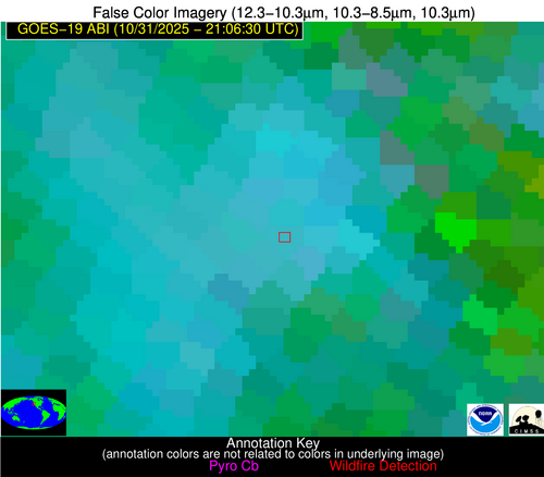
Wildfire Alert Report
| Date: | 2025-10-31 |
|---|---|
| Time: | 21:06:17 |
| Production Date and Time: | 2025-10-31 21:11:14 UTC |
| Primary Instrument: | GOES-19 ABI |
| Wmo Spacecraft Id: | 666 |
| Location/orbit: | GEO |
| L1 File: | OR_ABI-L1b-RadC-M6C14_G19_s20253042106174_e20253042108547_c20253042109015.nc |
| L1 File(s) - Temporal | OR_ABI-L1b-RadC-M6C14_G19_s20253042101174_e20253042103547_c20253042104025.nc |
| Number Of Thermal Anomaly Alerts: | 4 |
Possible Wildfire
| Basic Information | |
|---|---|
| State/Province(s) | WV |
| Country/Countries | United States |
| County/Locality(s) | Mason County, WV |
| NWS WFO | Charleston WV |
| Identification Method | Enhanced Contextual (Clear) |
| Mean Object Date/Time | 2025-10-31 21:06:52UTC |
| Radiative Center (Lat, Lon): | 38.952221°, -81.923889° |
| Nearby Counties (meeting alert criteria): |
|
| Total Radiative Power Anomaly | n/a |
| Total Radiative Power | 7.36 MW |
| Map: | |
| Additional Information | |
| Alert Status | New Feature |
| Type of Event | Coal-processing |
| Event Priority Ranking | 5 |
| Maximum Observed BT (3.9 um) | 286.77 K |
| Observed - Background BT (3.9 um) | 4.04 K |
| BT Anomaly (3.9 um) | 5.66 K |
| Maximum Observed - Clear RTM BT (3.9 um) | 8.72 K |
| Maximum Observed BTD (3.9-10/11/12 um) | 6.26 K |
| Observed - Background BTD (3.9-10/11/12 um) | 3.55 K |
| BTD Anomaly (3.9-10/11/12 um) | 4.37 K |
| Similar Pixel Count | 5 |
| BT Time Tendency (3.9 um) | 3.90 K |
| Image Interval | 5.00 minutes |
| Fraction of Surrounding LWIR Pixels that are Colder | 0.85 |
| Fraction of Surrounding Red Channel Pixels that are Brighter | 1.00 |
| Maximum Radiative Power | 7.36 MW |
| Maximum Radiative Power Uncertainty | 0.00 MW |
| Total Radiative Power Uncertainty | 0.00 MW |
| Mean Viewing Angle | 45.90° |
| Mean Solar Zenith Angle | 76.10° |
| Mean Glint Angle | 94.50° |
| Water Fraction | 0.00 |
| Total Pixel Area | 5.70 km2 |
| Latest Satellite Imagery: | |
| View all event imagery » | |
Possible Wildfire
| Basic Information | |
|---|---|
| State/Province(s) | CA |
| Country/Countries | United States |
| County/Locality(s) | Trinity County, CA |
| NWS WFO | Eureka CA |
| Identification Method | Enhanced Contextual (Clear) |
| Mean Object Date/Time | 2025-10-31 21:06:48UTC |
| Radiative Center (Lat, Lon): | 40.273056°, -123.506943° |
| Nearby Counties (meeting alert criteria): |
|
| Total Radiative Power Anomaly | n/a |
| Total Radiative Power | 25.54 MW |
| Map: | |
| Additional Information | |
| Alert Status | New Feature |
| Type of Event | Nominal Risk |
| Event Priority Ranking | 4 |
| Maximum Observed BT (3.9 um) | 292.55 K |
| Observed - Background BT (3.9 um) | 5.65 K |
| BT Anomaly (3.9 um) | 5.53 K |
| Maximum Observed - Clear RTM BT (3.9 um) | 10.38 K |
| Maximum Observed BTD (3.9-10/11/12 um) | 14.40 K |
| Observed - Background BTD (3.9-10/11/12 um) | 5.01 K |
| BTD Anomaly (3.9-10/11/12 um) | 7.07 K |
| Similar Pixel Count | 10 |
| BT Time Tendency (3.9 um) | 0.50 K |
| Image Interval | 5.00 minutes |
| Fraction of Surrounding LWIR Pixels that are Colder | 0.96 |
| Fraction of Surrounding Red Channel Pixels that are Brighter | 1.00 |
| Maximum Radiative Power | 25.54 MW |
| Maximum Radiative Power Uncertainty | 0.00 MW |
| Total Radiative Power Uncertainty | 0.00 MW |
| Mean Viewing Angle | 68.10° |
| Mean Solar Zenith Angle | 56.50° |
| Mean Glint Angle | 85.70° |
| Water Fraction | 0.00 |
| Total Pixel Area | 10.70 km2 |
| Latest Satellite Imagery: | |
| View all event imagery » | |
Possible Wildfire
| Basic Information | |
|---|---|
| State/Province(s) | LA |
| Country/Countries | United States |
| County/Locality(s) | Franklin Parish, LA |
| NWS WFO | Jackson MS |
| Identification Method | Enhanced Contextual (Cloud) |
| Mean Object Date/Time | 2025-10-31 21:07:20UTC |
| Radiative Center (Lat, Lon): | 32.148335°, -91.819443° |
| Nearby Counties (meeting alert criteria): |
|
| Total Radiative Power Anomaly | n/a |
| Total Radiative Power | 278.59 MW |
| Map: | |
| Additional Information | |
| Alert Status | New Feature |
| Type of Event | Nominal Risk |
| Event Priority Ranking | 4 |
| Maximum Observed BT (3.9 um) | 327.16 K |
| Observed - Background BT (3.9 um) | 33.71 K |
| BT Anomaly (3.9 um) | 58.19 K |
| Maximum Observed - Clear RTM BT (3.9 um) | 39.48 K |
| Maximum Observed BTD (3.9-10/11/12 um) | 35.07 K |
| Observed - Background BTD (3.9-10/11/12 um) | 31.74 K |
| BTD Anomaly (3.9-10/11/12 um) | 93.02 K |
| Similar Pixel Count | 0 |
| BT Time Tendency (3.9 um) | 26.50 K |
| Image Interval | 5.00 minutes |
| Fraction of Surrounding LWIR Pixels that are Colder | 1.00 |
| Fraction of Surrounding Red Channel Pixels that are Brighter | 0.09 |
| Maximum Radiative Power | 204.70 MW |
| Maximum Radiative Power Uncertainty | 0.00 MW |
| Total Radiative Power Uncertainty | 0.00 MW |
| Mean Viewing Angle | 41.70° |
| Mean Solar Zenith Angle | 65.60° |
| Mean Glint Angle | 76.60° |
| Water Fraction | 0.00 |
| Total Pixel Area | 16.10 km2 |
| Latest Satellite Imagery: | |
| View all event imagery » | |
Possible Wildfire
| Basic Information | |
|---|---|
| State/Province(s) | TX |
| Country/Countries | United States |
| County/Locality(s) | Shelby County, TX |
| NWS WFO | Shreveport LA |
| Identification Method | Enhanced Contextual (Clear) |
| Mean Object Date/Time | 2025-10-31 21:07:20UTC |
| Radiative Center (Lat, Lon): | 31.798611°, -94.279999° |
| Nearby Counties (meeting alert criteria): |
|
| Total Radiative Power Anomaly | n/a |
| Total Radiative Power | 4.61 MW |
| Map: | |
| Additional Information | |
| Alert Status | New Feature |
| Type of Event | Nominal Risk |
| Event Priority Ranking | 4 |
| Maximum Observed BT (3.9 um) | 295.24 K |
| Observed - Background BT (3.9 um) | 2.68 K |
| BT Anomaly (3.9 um) | 5.06 K |
| Maximum Observed - Clear RTM BT (3.9 um) | 6.99 K |
| Maximum Observed BTD (3.9-10/11/12 um) | 4.55 K |
| Observed - Background BTD (3.9-10/11/12 um) | 2.25 K |
| BTD Anomaly (3.9-10/11/12 um) | 7.65 K |
| Similar Pixel Count | 3 |
| BT Time Tendency (3.9 um) | 0.90 K |
| Image Interval | 5.00 minutes |
| Fraction of Surrounding LWIR Pixels that are Colder | 0.85 |
| Fraction of Surrounding Red Channel Pixels that are Brighter | 1.00 |
| Maximum Radiative Power | 4.61 MW |
| Maximum Radiative Power Uncertainty | 0.00 MW |
| Total Radiative Power Uncertainty | 0.00 MW |
| Mean Viewing Angle | 42.60° |
| Mean Solar Zenith Angle | 63.80° |
| Mean Glint Angle | 74.20° |
| Water Fraction | 0.00 |
| Total Pixel Area | 5.40 km2 |
| Latest Satellite Imagery: | |
| View all event imagery » | |


