Wildfire Alert Report
| Date: | 2025-10-09 |
|---|---|
| Time: | 16:16:17 |
| Production Date and Time: | 2025-10-09 16:21:31 UTC |
| Primary Instrument: | GOES-19 ABI |
| Wmo Spacecraft Id: | 666 |
| Location/orbit: | GEO |
| L1 File: | OR_ABI-L1b-RadC-M6C14_G19_s20252821616177_e20252821618550_c20252821619062.nc |
| L1 File(s) - Temporal | OR_ABI-L1b-RadC-M6C14_G19_s20252821611177_e20252821613550_c20252821613597.nc |
| Number Of Thermal Anomaly Alerts: | 3 |
Possible Wildfire
| Basic Information | |
|---|---|
| State/Province(s) | KS |
| Country/Countries | United States |
| County/Locality(s) | Sherman County, KS |
| NWS WFO | Goodland KS |
| Identification Method | Enhanced Contextual (Clear) |
| Mean Object Date/Time | 2025-10-09 16:16:50UTC |
| Radiative Center (Lat, Lon): | 39.467777°, -101.549446° |
| Nearby Counties (meeting alert criteria): |
|
| Total Radiative Power Anomaly | n/a |
| Total Radiative Power | 5.93 MW |
| Map: | |
| Additional Information | |
| Alert Status | New Feature |
| Type of Event | Nominal Risk |
| Event Priority Ranking | 4 |
| Maximum Observed BT (3.9 um) | 306.04 K |
| Observed - Background BT (3.9 um) | 2.54 K |
| BT Anomaly (3.9 um) | 2.34 K |
| Maximum Observed - Clear RTM BT (3.9 um) | 9.62 K |
| Maximum Observed BTD (3.9-10/11/12 um) | 13.50 K |
| Observed - Background BTD (3.9-10/11/12 um) | 2.01 K |
| BTD Anomaly (3.9-10/11/12 um) | 2.19 K |
| Similar Pixel Count | 25 |
| BT Time Tendency (3.9 um) | 1.10 K |
| Image Interval | 5.00 minutes |
| Fraction of Surrounding LWIR Pixels that are Colder | 0.78 |
| Fraction of Surrounding Red Channel Pixels that are Brighter | 0.92 |
| Maximum Radiative Power | 5.93 MW |
| Maximum Radiative Power Uncertainty | 0.00 MW |
| Total Radiative Power Uncertainty | 0.00 MW |
| Mean Viewing Angle | 53.50° |
| Mean Solar Zenith Angle | 55.50° |
| Mean Glint Angle | 108.80° |
| Water Fraction | 0.00 |
| Total Pixel Area | 6.70 km2 |
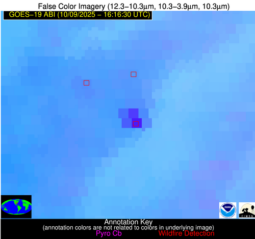
| Latest Satellite Imagery: | |
| View all event imagery » | |
Possible Wildfire
| Basic Information | |
|---|---|
| State/Province(s) | AR |
| Country/Countries | United States |
| County/Locality(s) | Greene County, AR |
| NWS WFO | Memphis TN |
| Identification Method | Enhanced Contextual (Cloud) |
| Mean Object Date/Time | 2025-10-09 16:17:21UTC |
| Radiative Center (Lat, Lon): | 36.059166°, -90.688332° |
| Nearby Counties (meeting alert criteria): |
|
| Total Radiative Power Anomaly | n/a |
| Total Radiative Power | 163.12 MW |
| Map: | |
| Additional Information | |
| Alert Status | New Feature |
| Type of Event | Nominal Risk |
| Event Priority Ranking | 4 |
| Maximum Observed BT (3.9 um) | 325.23 K |
| Observed - Background BT (3.9 um) | 20.59 K |
| BT Anomaly (3.9 um) | 9.56 K |
| Maximum Observed - Clear RTM BT (3.9 um) | 34.24 K |
| Maximum Observed BTD (3.9-10/11/12 um) | 29.65 K |
| Observed - Background BTD (3.9-10/11/12 um) | 19.35 K |
| BTD Anomaly (3.9-10/11/12 um) | 11.34 K |
| Similar Pixel Count | 0 |
| BT Time Tendency (3.9 um) | 18.70 K |
| Image Interval | 5.00 minutes |
| Fraction of Surrounding LWIR Pixels that are Colder | 0.99 |
| Fraction of Surrounding Red Channel Pixels that are Brighter | 0.62 |
| Maximum Radiative Power | 97.80 MW |
| Maximum Radiative Power Uncertainty | 0.00 MW |
| Total Radiative Power Uncertainty | 0.00 MW |
| Mean Viewing Angle | 45.20° |
| Mean Solar Zenith Angle | 47.50° |
| Mean Glint Angle | 92.50° |
| Water Fraction | 0.00 |
| Total Pixel Area | 11.40 km2 |
| Latest Satellite Imagery: | |
| View all event imagery » | |
Possible Wildfire
| Basic Information | |
|---|---|
| State/Province(s) | TX |
| Country/Countries | United States |
| County/Locality(s) | Bowie County, TX |
| NWS WFO | Shreveport LA |
| Identification Method | Enhanced Contextual (Clear) |
| Mean Object Date/Time | 2025-10-09 16:17:20UTC |
| Radiative Center (Lat, Lon): | 33.296391°, -94.384720° |
| Nearby Counties (meeting alert criteria): |
|
| Total Radiative Power Anomaly | n/a |
| Total Radiative Power | 10.25 MW |
| Map: | |
| Additional Information | |
| Alert Status | New Feature |
| Type of Event | Nominal Risk |
| Event Priority Ranking | 4 |
| Maximum Observed BT (3.9 um) | 304.07 K |
| Observed - Background BT (3.9 um) | 3.03 K |
| BT Anomaly (3.9 um) | 1.42 K |
| Maximum Observed - Clear RTM BT (3.9 um) | 7.58 K |
| Maximum Observed BTD (3.9-10/11/12 um) | 13.13 K |
| Observed - Background BTD (3.9-10/11/12 um) | 2.44 K |
| BTD Anomaly (3.9-10/11/12 um) | 1.70 K |
| Similar Pixel Count | 18 |
| BT Time Tendency (3.9 um) | 1.00 K |
| Image Interval | 5.00 minutes |
| Fraction of Surrounding LWIR Pixels that are Colder | 0.41 |
| Fraction of Surrounding Red Channel Pixels that are Brighter | 0.76 |
| Maximum Radiative Power | 10.25 MW |
| Maximum Radiative Power Uncertainty | 0.00 MW |
| Total Radiative Power Uncertainty | 0.00 MW |
| Mean Viewing Angle | 44.10° |
| Mean Solar Zenith Angle | 47.00° |
| Mean Glint Angle | 91.00° |
| Water Fraction | 0.00 |
| Total Pixel Area | 5.60 km2 |
| Latest Satellite Imagery: | |
| View all event imagery » | |


