Jan 2026: Due to an ongoing data center cooling system construction project, NGFS data outages may occur with little or no notice. Bitterly cold air in Madison Jan 22-24 increases risk of outages.
Wildfire Alert Report
| Date: | 2025-10-01 |
|---|---|
| Time: | 20:41:17 |
| Production Date and Time: | 2025-10-01 20:46:24 UTC |
| Primary Instrument: | GOES-19 ABI |
| Wmo Spacecraft Id: | 666 |
| Location/orbit: | GEO |
| L1 File: | OR_ABI-L1b-RadC-M6C14_G19_s20252742041171_e20252742043544_c20252742043588.nc |
| L1 File(s) - Temporal | OR_ABI-L1b-RadC-M6C14_G19_s20252742036171_e20252742038544_c20252742039043.nc |
| Number Of Thermal Anomaly Alerts: | 4 |
Possible Wildfire
| Basic Information | |
|---|---|
| State/Province(s) | AR |
| Country/Countries | United States |
| County/Locality(s) | Mississippi County, AR |
| NWS WFO | Memphis TN |
| Identification Method | Enhanced Contextual (Clear) |
| Mean Object Date/Time | 2025-10-01 20:42:21UTC |
| Radiative Center (Lat, Lon): | 35.618057°, -90.197502° |
| Nearby Counties (meeting alert criteria): |
|
| Total Radiative Power Anomaly | n/a |
| Total Radiative Power | 28.39 MW |
| Map: | |
| Additional Information | |
| Alert Status | New Feature |
| Type of Event | Nominal Risk |
| Event Priority Ranking | 4 |
| Maximum Observed BT (3.9 um) | 312.67 K |
| Observed - Background BT (3.9 um) | 7.58 K |
| BT Anomaly (3.9 um) | 4.75 K |
| Maximum Observed - Clear RTM BT (3.9 um) | 14.16 K |
| Maximum Observed BTD (3.9-10/11/12 um) | 19.69 K |
| Observed - Background BTD (3.9-10/11/12 um) | 7.47 K |
| BTD Anomaly (3.9-10/11/12 um) | 5.66 K |
| Similar Pixel Count | 19 |
| BT Time Tendency (3.9 um) | 5.80 K |
| Image Interval | 5.00 minutes |
| Fraction of Surrounding LWIR Pixels that are Colder | 0.67 |
| Fraction of Surrounding Red Channel Pixels that are Brighter | 0.99 |
| Maximum Radiative Power | 28.39 MW |
| Maximum Radiative Power Uncertainty | 0.00 MW |
| Total Radiative Power Uncertainty | 0.00 MW |
| Mean Viewing Angle | 44.50° |
| Mean Solar Zenith Angle | 55.50° |
| Mean Glint Angle | 72.40° |
| Water Fraction | 0.00 |
| Total Pixel Area | 5.60 km2 |
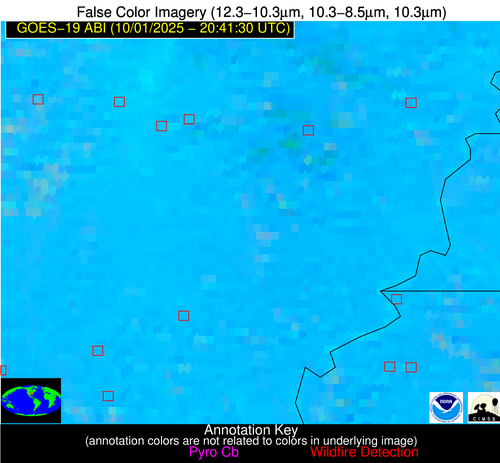
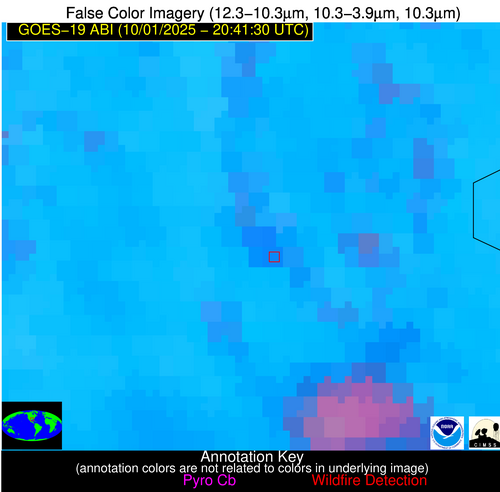
| Latest Satellite Imagery: | |
| View all event imagery » | |
Possible Wildfire
| Basic Information | |
|---|---|
| State/Province(s) | AR |
| Country/Countries | United States |
| County/Locality(s) | Monroe County, AR |
| NWS WFO | Little Rock AR |
| Identification Method | Enhanced Contextual (Clear) |
| Mean Object Date/Time | 2025-10-01 20:42:21UTC |
| Radiative Center (Lat, Lon): | 34.803890°, -91.240837° |
| Nearby Counties (meeting alert criteria): |
|
| Total Radiative Power Anomaly | n/a |
| Total Radiative Power | 66.38 MW |
| Map: | |
| Additional Information | |
| Alert Status | New Feature |
| Type of Event | Nominal Risk |
| Event Priority Ranking | 4 |
| Maximum Observed BT (3.9 um) | 313.68 K |
| Observed - Background BT (3.9 um) | 9.72 K |
| BT Anomaly (3.9 um) | 5.32 K |
| Maximum Observed - Clear RTM BT (3.9 um) | 14.03 K |
| Maximum Observed BTD (3.9-10/11/12 um) | 19.97 K |
| Observed - Background BTD (3.9-10/11/12 um) | 8.63 K |
| BTD Anomaly (3.9-10/11/12 um) | 5.46 K |
| Similar Pixel Count | 11 |
| BT Time Tendency (3.9 um) | 4.90 K |
| Image Interval | 5.00 minutes |
| Fraction of Surrounding LWIR Pixels that are Colder | 0.96 |
| Fraction of Surrounding Red Channel Pixels that are Brighter | 0.56 |
| Maximum Radiative Power | 36.05 MW |
| Maximum Radiative Power Uncertainty | 0.00 MW |
| Total Radiative Power Uncertainty | 0.00 MW |
| Mean Viewing Angle | 44.10° |
| Mean Solar Zenith Angle | 54.40° |
| Mean Glint Angle | 70.40° |
| Water Fraction | 0.00 |
| Total Pixel Area | 11.10 km2 |
| Latest Satellite Imagery: | |
| View all event imagery » | |
Possible Wildfire
| Basic Information | |
|---|---|
| State/Province(s) | LA |
| Country/Countries | United States |
| County/Locality(s) | Pointe Coupee Parish, LA |
| NWS WFO | New Orleans LA |
| Identification Method | Enhanced Contextual (Clear) |
| Mean Object Date/Time | 2025-10-01 20:42:20UTC |
| Radiative Center (Lat, Lon): | 30.888056°, -91.732224° |
| Nearby Counties (meeting alert criteria): |
|
| Total Radiative Power Anomaly | n/a |
| Total Radiative Power | 119.36 MW |
| Map: | |
| Additional Information | |
| Alert Status | New Feature |
| Type of Event | Nominal Risk |
| Event Priority Ranking | 4 |
| Maximum Observed BT (3.9 um) | 317.04 K |
| Observed - Background BT (3.9 um) | 13.05 K |
| BT Anomaly (3.9 um) | 5.68 K |
| Maximum Observed - Clear RTM BT (3.9 um) | 16.15 K |
| Maximum Observed BTD (3.9-10/11/12 um) | 23.55 K |
| Observed - Background BTD (3.9-10/11/12 um) | 12.21 K |
| BTD Anomaly (3.9-10/11/12 um) | 7.29 K |
| Similar Pixel Count | 4 |
| BT Time Tendency (3.9 um) | 9.50 K |
| Image Interval | 5.00 minutes |
| Fraction of Surrounding LWIR Pixels that are Colder | 0.87 |
| Fraction of Surrounding Red Channel Pixels that are Brighter | 0.56 |
| Maximum Radiative Power | 50.93 MW |
| Maximum Radiative Power Uncertainty | 0.00 MW |
| Total Radiative Power Uncertainty | 0.00 MW |
| Mean Viewing Angle | 40.40° |
| Mean Solar Zenith Angle | 51.80° |
| Mean Glint Angle | 63.80° |
| Water Fraction | 0.00 |
| Total Pixel Area | 15.80 km2 |
| Latest Satellite Imagery: | |
| View all event imagery » | |
Possible Wildfire
| Basic Information | |
|---|---|
| State/Province(s) | TX |
| Country/Countries | United States |
| County/Locality(s) | Jasper County, TX |
| NWS WFO | Lake Charles LA |
| Identification Method | Enhanced Contextual (Clear) |
| Mean Object Date/Time | 2025-10-01 20:42:20UTC |
| Radiative Center (Lat, Lon): | 30.309444°, -94.008888° |
| Nearby Counties (meeting alert criteria): |
|
| Total Radiative Power Anomaly | n/a |
| Total Radiative Power | 41.51 MW |
| Map: | |
| Additional Information | |
| Alert Status | New Feature |
| Type of Event | Nominal Risk |
| Event Priority Ranking | 4 |
| Maximum Observed BT (3.9 um) | 308.02 K |
| Observed - Background BT (3.9 um) | 5.88 K |
| BT Anomaly (3.9 um) | 5.75 K |
| Maximum Observed - Clear RTM BT (3.9 um) | 7.15 K |
| Maximum Observed BTD (3.9-10/11/12 um) | 15.86 K |
| Observed - Background BTD (3.9-10/11/12 um) | 6.51 K |
| BTD Anomaly (3.9-10/11/12 um) | 5.61 K |
| Similar Pixel Count | 12 |
| BT Time Tendency (3.9 um) | 1.00 K |
| Image Interval | 5.00 minutes |
| Fraction of Surrounding LWIR Pixels that are Colder | 0.41 |
| Fraction of Surrounding Red Channel Pixels that are Brighter | 0.47 |
| Maximum Radiative Power | 23.90 MW |
| Maximum Radiative Power Uncertainty | 0.00 MW |
| Total Radiative Power Uncertainty | 0.00 MW |
| Mean Viewing Angle | 41.10° |
| Mean Solar Zenith Angle | 49.90° |
| Mean Glint Angle | 61.40° |
| Water Fraction | 0.00 |
| Total Pixel Area | 10.60 km2 |
| Latest Satellite Imagery: | |
| View all event imagery » | |


