10 Jan 2026: Notice to users: ongoing data center construction may unexpectedly interrupt NGFS product generation.
Wildfire Alert Report
| Date: | 2025-09-28 |
|---|---|
| Time: | 18:41:16 |
| Production Date and Time: | 2025-09-28 18:46:21 UTC |
| Primary Instrument: | GOES-19 ABI |
| Wmo Spacecraft Id: | 666 |
| Location/orbit: | GEO |
| L1 File: | OR_ABI-L1b-RadC-M6C14_G19_s20252711841160_e20252711843533_c20252711844034.nc |
| L1 File(s) - Temporal | OR_ABI-L1b-RadC-M6C14_G19_s20252711836160_e20252711838533_c20252711839025.nc |
| Number Of Thermal Anomaly Alerts: | 7 |
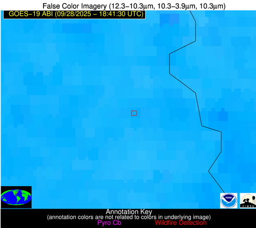
Possible Wildfire
| Basic Information | |
|---|---|
| State/Province(s) | Manitoba |
| Country/Countries | Canada |
| County/Locality(s) | Division No. 17, Manitoba |
| NWS WFO | N/A |
| Identification Method | Enhanced Contextual (Clear) |
| Mean Object Date/Time | 2025-09-28 18:41:19UTC |
| Radiative Center (Lat, Lon): | 51.467499°, -100.035835° |
| Nearby Counties (meeting alert criteria): |
|
| Total Radiative Power Anomaly | n/a |
| Total Radiative Power | 58.07 MW |
| Map: | |
| Additional Information | |
| Alert Status | New Feature |
| Type of Event | Nominal Risk |
| Event Priority Ranking | 4 |
| Maximum Observed BT (3.9 um) | 306.93 K |
| Observed - Background BT (3.9 um) | 7.02 K |
| BT Anomaly (3.9 um) | 3.91 K |
| Maximum Observed - Clear RTM BT (3.9 um) | 13.13 K |
| Maximum Observed BTD (3.9-10/11/12 um) | 15.89 K |
| Observed - Background BTD (3.9-10/11/12 um) | 6.05 K |
| BTD Anomaly (3.9-10/11/12 um) | 5.17 K |
| Similar Pixel Count | 14 |
| BT Time Tendency (3.9 um) | 2.00 K |
| Image Interval | 5.00 minutes |
| Fraction of Surrounding LWIR Pixels that are Colder | 0.93 |
| Fraction of Surrounding Red Channel Pixels that are Brighter | 0.22 |
| Maximum Radiative Power | 29.57 MW |
| Maximum Radiative Power Uncertainty | 0.00 MW |
| Total Radiative Power Uncertainty | 0.00 MW |
| Mean Viewing Angle | 63.80° |
| Mean Solar Zenith Angle | 53.30° |
| Mean Glint Angle | 109.50° |
| Water Fraction | 0.00 |
| Total Pixel Area | 18.10 km2 |
| Latest Satellite Imagery: | |
| View all event imagery » | |
Possible Wildfire
| Basic Information | |
|---|---|
| State/Province(s) | IL |
| Country/Countries | United States |
| County/Locality(s) | Crawford County, IL |
| NWS WFO | Lincoln IL |
| Identification Method | Enhanced Contextual (Clear) |
| Mean Object Date/Time | 2025-09-28 18:41:50UTC |
| Radiative Center (Lat, Lon): | 39.015278°, -87.741112° |
| Nearby Counties (meeting alert criteria): |
|
| Total Radiative Power Anomaly | n/a |
| Total Radiative Power | 3.17 MW |
| Map: | |
| Additional Information | |
| Alert Status | New Feature |
| Type of Event | Likely an Urban Source |
| Event Priority Ranking | 4 |
| Maximum Observed BT (3.9 um) | 308.17 K |
| Observed - Background BT (3.9 um) | 1.83 K |
| BT Anomaly (3.9 um) | 1.35 K |
| Maximum Observed - Clear RTM BT (3.9 um) | 7.09 K |
| Maximum Observed BTD (3.9-10/11/12 um) | 10.86 K |
| Observed - Background BTD (3.9-10/11/12 um) | 1.50 K |
| BTD Anomaly (3.9-10/11/12 um) | 1.80 K |
| Similar Pixel Count | 25 |
| BT Time Tendency (3.9 um) | 0.60 K |
| Image Interval | 5.00 minutes |
| Fraction of Surrounding LWIR Pixels that are Colder | 0.65 |
| Fraction of Surrounding Red Channel Pixels that are Brighter | 0.90 |
| Maximum Radiative Power | 3.17 MW |
| Maximum Radiative Power Uncertainty | 0.00 MW |
| Total Radiative Power Uncertainty | 0.00 MW |
| Mean Viewing Angle | 47.20° |
| Mean Solar Zenith Angle | 43.10° |
| Mean Glint Angle | 83.00° |
| Water Fraction | 0.00 |
| Total Pixel Area | 5.90 km2 |
| Latest Satellite Imagery: | |
| View all event imagery » | |
Possible Wildfire
| Basic Information | |
|---|---|
| State/Province(s) | TN |
| Country/Countries | United States |
| County/Locality(s) | Henry County, TN |
| NWS WFO | Memphis TN |
| Identification Method | Enhanced Contextual (Clear) |
| Mean Object Date/Time | 2025-09-28 18:41:50UTC |
| Radiative Center (Lat, Lon): | 36.173611°, -88.433052° |
| Nearby Counties (meeting alert criteria): |
|
| Total Radiative Power Anomaly | n/a |
| Total Radiative Power | 94.24 MW |
| Map: | |
| Additional Information | |
| Alert Status | New Feature |
| Type of Event | Nominal Risk |
| Event Priority Ranking | 4 |
| Maximum Observed BT (3.9 um) | 312.81 K |
| Observed - Background BT (3.9 um) | 7.65 K |
| BT Anomaly (3.9 um) | 5.31 K |
| Maximum Observed - Clear RTM BT (3.9 um) | 13.86 K |
| Maximum Observed BTD (3.9-10/11/12 um) | 15.19 K |
| Observed - Background BTD (3.9-10/11/12 um) | 6.97 K |
| BTD Anomaly (3.9-10/11/12 um) | 8.58 K |
| Similar Pixel Count | 4 |
| BT Time Tendency (3.9 um) | 1.80 K |
| Image Interval | 5.00 minutes |
| Fraction of Surrounding LWIR Pixels that are Colder | 0.80 |
| Fraction of Surrounding Red Channel Pixels that are Brighter | 0.13 |
| Maximum Radiative Power | 28.48 MW |
| Maximum Radiative Power Uncertainty | 0.00 MW |
| Total Radiative Power Uncertainty | 0.00 MW |
| Mean Viewing Angle | 44.40° |
| Mean Solar Zenith Angle | 40.20° |
| Mean Glint Angle | 77.30° |
| Water Fraction | 0.00 |
| Total Pixel Area | 22.40 km2 |
| Latest Satellite Imagery: | |
| View all event imagery » | |
Possible Wildfire
| Basic Information | |
|---|---|
| State/Province(s) | OK |
| Country/Countries | United States |
| County/Locality(s) | Garfield County, OK |
| NWS WFO | Norman OK |
| Identification Method | Enhanced Contextual (Cloud) |
| Mean Object Date/Time | 2025-09-28 18:42:19UTC |
| Radiative Center (Lat, Lon): | 36.240555°, -97.945274° |
| Nearby Counties (meeting alert criteria): |
|
| Total Radiative Power Anomaly | n/a |
| Total Radiative Power | 184.80 MW |
| Map: | |
| Additional Information | |
| Alert Status | New Feature |
| Type of Event | Nominal Risk |
| Event Priority Ranking | 4 |
| Maximum Observed BT (3.9 um) | 319.33 K |
| Observed - Background BT (3.9 um) | 14.85 K |
| BT Anomaly (3.9 um) | 8.96 K |
| Maximum Observed - Clear RTM BT (3.9 um) | 17.13 K |
| Maximum Observed BTD (3.9-10/11/12 um) | 36.98 K |
| Observed - Background BTD (3.9-10/11/12 um) | 14.98 K |
| BTD Anomaly (3.9-10/11/12 um) | 6.63 K |
| Similar Pixel Count | 0 |
| BT Time Tendency (3.9 um) | 6.60 K |
| Image Interval | 5.00 minutes |
| Fraction of Surrounding LWIR Pixels that are Colder | 0.08 |
| Fraction of Surrounding Red Channel Pixels that are Brighter | 0.92 |
| Maximum Radiative Power | 95.98 MW |
| Maximum Radiative Power Uncertainty | 0.00 MW |
| Total Radiative Power Uncertainty | 0.00 MW |
| Mean Viewing Angle | 48.70° |
| Mean Solar Zenith Angle | 38.30° |
| Mean Glint Angle | 79.70° |
| Water Fraction | 0.00 |
| Total Pixel Area | 12.10 km2 |
| Latest Satellite Imagery: | |
| View all event imagery » | |
Possible Wildfire
| Basic Information | |
|---|---|
| State/Province(s) | MS |
| Country/Countries | United States |
| County/Locality(s) | Harrison County, MS |
| NWS WFO | New Orleans LA |
| Identification Method | Enhanced Contextual (Clear) |
| Mean Object Date/Time | 2025-09-28 18:42:20UTC |
| Radiative Center (Lat, Lon): | 30.574722°, -89.305557° |
| Nearby Counties (meeting alert criteria): |
|
| Total Radiative Power Anomaly | n/a |
| Total Radiative Power | 24.68 MW |
| Map: | |
| Additional Information | |
| Alert Status | New Feature |
| Type of Event | Nominal Risk |
| Event Priority Ranking | 4 |
| Maximum Observed BT (3.9 um) | 311.29 K |
| Observed - Background BT (3.9 um) | 6.33 K |
| BT Anomaly (3.9 um) | 6.08 K |
| Maximum Observed - Clear RTM BT (3.9 um) | 9.29 K |
| Maximum Observed BTD (3.9-10/11/12 um) | 17.83 K |
| Observed - Background BTD (3.9-10/11/12 um) | 5.75 K |
| BTD Anomaly (3.9-10/11/12 um) | 4.57 K |
| Similar Pixel Count | 20 |
| BT Time Tendency (3.9 um) | 8.30 K |
| Image Interval | 5.00 minutes |
| Fraction of Surrounding LWIR Pixels that are Colder | 0.86 |
| Fraction of Surrounding Red Channel Pixels that are Brighter | 0.76 |
| Maximum Radiative Power | 24.68 MW |
| Maximum Radiative Power Uncertainty | 0.00 MW |
| Total Radiative Power Uncertainty | 0.00 MW |
| Mean Viewing Angle | 39.00° |
| Mean Solar Zenith Angle | 34.80° |
| Mean Glint Angle | 65.90° |
| Water Fraction | 0.00 |
| Total Pixel Area | 5.10 km2 |
| Latest Satellite Imagery: | |
| View all event imagery » | |
Possible Wildfire
| Basic Information | |
|---|---|
| State/Province(s) | Unknown |
| Country/Countries | Cuba |
| County/Locality(s) | Unknown, Unknown |
| NWS WFO | N/A |
| Identification Method | Enhanced Contextual (Clear) |
| Mean Object Date/Time | 2025-09-28 18:43:21UTC |
| Radiative Center (Lat, Lon): | 22.491667°, -79.547226° |
| Nearby Counties (meeting alert criteria): |
|
| Total Radiative Power Anomaly | n/a |
| Total Radiative Power | 20.71 MW |
| Map: | |
| Additional Information | |
| Alert Status | New Feature |
| Type of Event | Nominal Risk |
| Event Priority Ranking | 4 |
| Maximum Observed BT (3.9 um) | 304.71 K |
| Observed - Background BT (3.9 um) | 3.12 K |
| BT Anomaly (3.9 um) | 2.60 K |
| Maximum Observed - Clear RTM BT (3.9 um) | 5.67 K |
| Maximum Observed BTD (3.9-10/11/12 um) | 16.56 K |
| Observed - Background BTD (3.9-10/11/12 um) | 3.49 K |
| BTD Anomaly (3.9-10/11/12 um) | 2.82 K |
| Similar Pixel Count | 25 |
| BT Time Tendency (3.9 um) | 0.70 K |
| Image Interval | 5.00 minutes |
| Fraction of Surrounding LWIR Pixels that are Colder | 0.53 |
| Fraction of Surrounding Red Channel Pixels that are Brighter | 0.72 |
| Maximum Radiative Power | 11.79 MW |
| Maximum Radiative Power Uncertainty | 0.00 MW |
| Total Radiative Power Uncertainty | 0.00 MW |
| Mean Viewing Angle | 26.90° |
| Mean Solar Zenith Angle | 33.20° |
| Mean Glint Angle | 52.30° |
| Water Fraction | 0.00 |
| Total Pixel Area | 9.00 km2 |
| Latest Satellite Imagery: | |
| View all event imagery » | |
Possible Wildfire
| Basic Information | |
|---|---|
| State/Province(s) | Unknown |
| Country/Countries | Dominican Republic |
| County/Locality(s) | Unknown, Unknown |
| NWS WFO | N/A |
| Identification Method | Enhanced Contextual (Clear) |
| Mean Object Date/Time | 2025-09-28 18:43:52UTC |
| Radiative Center (Lat, Lon): | 18.849445°, -70.116943° |
| Nearby Counties (meeting alert criteria): |
|
| Total Radiative Power Anomaly | n/a |
| Total Radiative Power | 7.02 MW |
| Map: | |
| Additional Information | |
| Alert Status | New Feature |
| Type of Event | Nominal Risk |
| Event Priority Ranking | 4 |
| Maximum Observed BT (3.9 um) | 306.21 K |
| Observed - Background BT (3.9 um) | 1.81 K |
| BT Anomaly (3.9 um) | 1.66 K |
| Maximum Observed - Clear RTM BT (3.9 um) | 5.51 K |
| Maximum Observed BTD (3.9-10/11/12 um) | 13.67 K |
| Observed - Background BTD (3.9-10/11/12 um) | 1.67 K |
| BTD Anomaly (3.9-10/11/12 um) | 1.17 K |
| Similar Pixel Count | 25 |
| BT Time Tendency (3.9 um) | 1.50 K |
| Image Interval | 5.00 minutes |
| Fraction of Surrounding LWIR Pixels that are Colder | 0.60 |
| Fraction of Surrounding Red Channel Pixels that are Brighter | 1.00 |
| Maximum Radiative Power | 7.02 MW |
| Maximum Radiative Power Uncertainty | 0.00 MW |
| Total Radiative Power Uncertainty | 0.00 MW |
| Mean Viewing Angle | 23.00° |
| Mean Solar Zenith Angle | 38.10° |
| Mean Glint Angle | 56.30° |
| Water Fraction | 0.00 |
| Total Pixel Area | 4.30 km2 |
| Latest Satellite Imagery: | |
| View all event imagery » | |


