Jan 2026: Due to an ongoing data center cooling system construction project, NGFS data outages may occur with little or no notice. Bitterly cold air in Madison Jan 22-24 increases risk of outages.
Wildfire Alert Report
| Date: | 2025-09-23 |
|---|---|
| Time: | 23:41:18 |
| Production Date and Time: | 2025-09-23 23:46:11 UTC |
| Primary Instrument: | GOES-18 ABI |
| Wmo Spacecraft Id: | 665 |
| Location/orbit: | GEO |
| L1 File: | OR_ABI-L1b-RadC-M6C14_G18_s20252662341182_e20252662343556_c20252662344067.nc |
| L1 File(s) - Temporal | OR_ABI-L1b-RadC-M6C14_G18_s20252662336182_e20252662338556_c20252662339047.nc |
| Number Of Thermal Anomaly Alerts: | 2 |
Possible Wildfire
| Basic Information | |
|---|---|
| State/Province(s) | SD |
| Country/Countries | United States |
| County/Locality(s) | Corson County, SD |
| NWS WFO | Aberdeen SD |
| Identification Method | Enhanced Contextual (Clear) |
| Mean Object Date/Time | 2025-09-23 23:41:25UTC |
| Radiative Center (Lat, Lon): | 45.680279°, -101.750557° |
| Nearby Counties (meeting alert criteria): |
|
| Total Radiative Power Anomaly | n/a |
| Total Radiative Power | 19.12 MW |
| Map: | |
| Additional Information | |
| Alert Status | New Feature |
| Type of Event | Nominal Risk |
| Event Priority Ranking | 4 |
| Maximum Observed BT (3.9 um) | 295.59 K |
| Observed - Background BT (3.9 um) | 4.89 K |
| BT Anomaly (3.9 um) | 11.50 K |
| Maximum Observed - Clear RTM BT (3.9 um) | 6.94 K |
| Maximum Observed BTD (3.9-10/11/12 um) | 8.99 K |
| Observed - Background BTD (3.9-10/11/12 um) | 4.63 K |
| BTD Anomaly (3.9-10/11/12 um) | 15.83 K |
| Similar Pixel Count | 2 |
| BT Time Tendency (3.9 um) | 4.00 K |
| Image Interval | 5.00 minutes |
| Fraction of Surrounding LWIR Pixels that are Colder | 0.90 |
| Fraction of Surrounding Red Channel Pixels that are Brighter | 1.00 |
| Maximum Radiative Power | 19.12 MW |
| Maximum Radiative Power Uncertainty | 0.00 MW |
| Total Radiative Power Uncertainty | 0.00 MW |
| Mean Viewing Angle | 63.30° |
| Mean Solar Zenith Angle | 79.80° |
| Mean Glint Angle | 129.90° |
| Water Fraction | 0.00 |
| Total Pixel Area | 8.90 km2 |
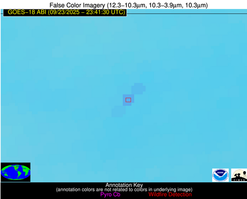
| Latest Satellite Imagery: | |
| View all event imagery » | |
Possible Wildfire
| Basic Information | |
|---|---|
| State/Province(s) | HI |
| Country/Countries | United States |
| County/Locality(s) | Maui County, HI |
| NWS WFO | Honolulu HI |
| Identification Method | Enhanced Contextual (Cloud) |
| Mean Object Date/Time | 2025-09-23 23:43:19UTC |
| Radiative Center (Lat, Lon): | 20.897778°, -156.349716° |
| Nearby Counties (meeting alert criteria): |
|
| Total Radiative Power Anomaly | n/a |
| Total Radiative Power | 41.76 MW |
| Map: | |
| Additional Information | |
| Alert Status | New Feature |
| Type of Event | Nominal Risk |
| Event Priority Ranking | 4 |
| Maximum Observed BT (3.9 um) | 322.05 K |
| Observed - Background BT (3.9 um) | 9.54 K |
| BT Anomaly (3.9 um) | 4.93 K |
| Maximum Observed - Clear RTM BT (3.9 um) | 26.04 K |
| Maximum Observed BTD (3.9-10/11/12 um) | 27.28 K |
| Observed - Background BTD (3.9-10/11/12 um) | 8.69 K |
| BTD Anomaly (3.9-10/11/12 um) | 6.21 K |
| Similar Pixel Count | 0 |
| BT Time Tendency (3.9 um) | 5.00 K |
| Image Interval | 5.00 minutes |
| Fraction of Surrounding LWIR Pixels that are Colder | 0.99 |
| Fraction of Surrounding Red Channel Pixels that are Brighter | 0.55 |
| Maximum Radiative Power | 41.76 MW |
| Maximum Radiative Power Uncertainty | 0.00 MW |
| Total Radiative Power Uncertainty | 0.00 MW |
| Mean Viewing Angle | 33.00° |
| Mean Solar Zenith Angle | 29.10° |
| Mean Glint Angle | 42.20° |
| Water Fraction | 0.00 |
| Total Pixel Area | 4.80 km2 |
| Latest Satellite Imagery: | |
| View all event imagery » | |


