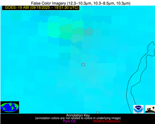
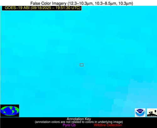
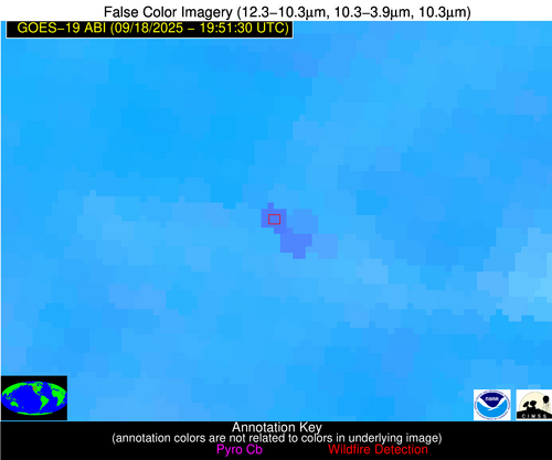
Jan 2026: Due to an ongoing data center cooling system construction project, NGFS data outages may occur with little or no notice. Bitterly cold air in Madison Jan 22-24 increases risk of outages.
Wildfire Alert Report
| Date: | 2025-09-18 |
|---|---|
| Time: | 19:51:17 |
| Production Date and Time: | 2025-09-18 19:56:44 UTC |
| Primary Instrument: | GOES-19 ABI |
| Wmo Spacecraft Id: | 666 |
| Location/orbit: | GEO |
| L1 File: | OR_ABI-L1b-RadC-M6C14_G19_s20252611951171_e20252611953545_c20252611954028.nc |
| L1 File(s) - Temporal | OR_ABI-L1b-RadC-M6C14_G19_s20252611946171_e20252611948545_c20252611949048.nc |
| Number Of Thermal Anomaly Alerts: | 8 |
Possible Wildfire
| Basic Information | |
|---|---|
| State/Province(s) | WA |
| Country/Countries | United States |
| County/Locality(s) | Ferry County, WA |
| NWS WFO | Spokane WA |
| Identification Method | Enhanced Contextual (Clear) |
| Mean Object Date/Time | 2025-09-18 19:51:19UTC |
| Radiative Center (Lat, Lon): | 48.565834°, -118.447777° |
| Nearby Counties (meeting alert criteria): |
|
| Total Radiative Power Anomaly | n/a |
| Total Radiative Power | 148.76 MW |
| Map: | |
| Additional Information | |
| Alert Status | New Feature |
| Type of Event | Nominal Risk, Known Incident: SNOW PEAK (HIGH, tdiff=2.10597 days, Point) |
| Event Priority Ranking | 4 |
| Maximum Observed BT (3.9 um) | 306.11 K |
| Observed - Background BT (3.9 um) | 8.84 K |
| BT Anomaly (3.9 um) | 5.79 K |
| Maximum Observed - Clear RTM BT (3.9 um) | 14.74 K |
| Maximum Observed BTD (3.9-10/11/12 um) | 19.51 K |
| Observed - Background BTD (3.9-10/11/12 um) | 9.57 K |
| BTD Anomaly (3.9-10/11/12 um) | 6.07 K |
| Similar Pixel Count | 5 |
| BT Time Tendency (3.9 um) | 4.20 K |
| Image Interval | 5.00 minutes |
| Fraction of Surrounding LWIR Pixels that are Colder | 0.20 |
| Fraction of Surrounding Red Channel Pixels that are Brighter | 0.54 |
| Maximum Radiative Power | 78.88 MW |
| Maximum Radiative Power Uncertainty | 0.00 MW |
| Total Radiative Power Uncertainty | 0.00 MW |
| Mean Viewing Angle | 69.90° |
| Mean Solar Zenith Angle | 46.40° |
| Mean Glint Angle | 100.20° |
| Water Fraction | 0.00 |
| Total Pixel Area | 23.30 km2 |
| Latest Satellite Imagery: | |
| View all event imagery » | |
Possible Wildfire
| Basic Information | |
|---|---|
| State/Province(s) | OR |
| Country/Countries | United States |
| County/Locality(s) | Jefferson County, OR |
| NWS WFO | Pendleton OR |
| Identification Method | Enhanced Contextual (Clear) |
| Mean Object Date/Time | 2025-09-18 19:51:48UTC |
| Radiative Center (Lat, Lon): | 44.697498°, -121.045555° |
| Nearby Counties (meeting alert criteria): |
|
| Total Radiative Power Anomaly | n/a |
| Total Radiative Power | 59.99 MW |
| Map: | |
| Additional Information | |
| Alert Status | New Feature |
| Type of Event | Nominal Risk |
| Event Priority Ranking | 4 |
| Maximum Observed BT (3.9 um) | 315.79 K |
| Observed - Background BT (3.9 um) | 5.80 K |
| BT Anomaly (3.9 um) | 3.53 K |
| Maximum Observed - Clear RTM BT (3.9 um) | 16.77 K |
| Maximum Observed BTD (3.9-10/11/12 um) | 18.48 K |
| Observed - Background BTD (3.9-10/11/12 um) | 5.48 K |
| BTD Anomaly (3.9-10/11/12 um) | 5.44 K |
| Similar Pixel Count | 18 |
| BT Time Tendency (3.9 um) | 5.80 K |
| Image Interval | 5.00 minutes |
| Fraction of Surrounding LWIR Pixels that are Colder | 0.79 |
| Fraction of Surrounding Red Channel Pixels that are Brighter | 0.57 |
| Maximum Radiative Power | 59.99 MW |
| Maximum Radiative Power Uncertainty | 0.00 MW |
| Total Radiative Power Uncertainty | 0.00 MW |
| Mean Viewing Angle | 68.90° |
| Mean Solar Zenith Angle | 42.60° |
| Mean Glint Angle | 96.60° |
| Water Fraction | 0.00 |
| Total Pixel Area | 11.10 km2 |
| Latest Satellite Imagery: | |
| View all event imagery » | |
Possible Wildfire
| Basic Information | |
|---|---|
| State/Province(s) | ID |
| Country/Countries | United States |
| County/Locality(s) | Jefferson County, ID |
| NWS WFO | Pocatello ID |
| Identification Method | Enhanced Contextual (Clear) |
| Mean Object Date/Time | 2025-09-18 19:51:49UTC |
| Radiative Center (Lat, Lon): | 43.754444°, -111.925835° |
| Nearby Counties (meeting alert criteria): |
|
| Total Radiative Power Anomaly | n/a |
| Total Radiative Power | 94.09 MW |
| Map: | |
| Additional Information | |
| Alert Status | New Feature |
| Type of Event | Nominal Risk |
| Event Priority Ranking | 4 |
| Maximum Observed BT (3.9 um) | 312.26 K |
| Observed - Background BT (3.9 um) | 5.70 K |
| BT Anomaly (3.9 um) | 4.06 K |
| Maximum Observed - Clear RTM BT (3.9 um) | 14.23 K |
| Maximum Observed BTD (3.9-10/11/12 um) | 16.06 K |
| Observed - Background BTD (3.9-10/11/12 um) | 7.05 K |
| BTD Anomaly (3.9-10/11/12 um) | 8.83 K |
| Similar Pixel Count | 3 |
| BT Time Tendency (3.9 um) | 6.40 K |
| Image Interval | 5.00 minutes |
| Fraction of Surrounding LWIR Pixels that are Colder | 0.04 |
| Fraction of Surrounding Red Channel Pixels that are Brighter | 1.00 |
| Maximum Radiative Power | 52.55 MW |
| Maximum Radiative Power Uncertainty | 0.00 MW |
| Total Radiative Power Uncertainty | 0.00 MW |
| Mean Viewing Angle | 62.70° |
| Mean Solar Zenith Angle | 42.10° |
| Mean Glint Angle | 88.50° |
| Water Fraction | 0.00 |
| Total Pixel Area | 17.40 km2 |
| Latest Satellite Imagery: | |
| View all event imagery » | |
Possible Wildfire
| Basic Information | |
|---|---|
| State/Province(s) | IN |
| Country/Countries | United States |
| County/Locality(s) | Bartholomew County, IN |
| NWS WFO | Indianapolis IN |
| Identification Method | Enhanced Contextual (Clear) |
| Mean Object Date/Time | 2025-09-18 19:51:51UTC |
| Radiative Center (Lat, Lon): | 39.051945°, -85.926666° |
| Nearby Counties (meeting alert criteria): |
|
| Total Radiative Power Anomaly | n/a |
| Total Radiative Power | 15.11 MW |
| Map: | |
| Additional Information | |
| Alert Status | New Feature |
| Type of Event | Nominal Risk |
| Event Priority Ranking | 4 |
| Maximum Observed BT (3.9 um) | 306.83 K |
| Observed - Background BT (3.9 um) | 2.52 K |
| BT Anomaly (3.9 um) | 1.59 K |
| Maximum Observed - Clear RTM BT (3.9 um) | 5.16 K |
| Maximum Observed BTD (3.9-10/11/12 um) | 10.76 K |
| Observed - Background BTD (3.9-10/11/12 um) | 2.83 K |
| BTD Anomaly (3.9-10/11/12 um) | 2.94 K |
| Similar Pixel Count | 19 |
| BT Time Tendency (3.9 um) | 3.30 K |
| Image Interval | 5.00 minutes |
| Fraction of Surrounding LWIR Pixels that are Colder | 0.38 |
| Fraction of Surrounding Red Channel Pixels that are Brighter | 1.00 |
| Maximum Radiative Power | 15.11 MW |
| Maximum Radiative Power Uncertainty | 0.00 MW |
| Total Radiative Power Uncertainty | 0.00 MW |
| Mean Viewing Angle | 46.80° |
| Mean Solar Zenith Angle | 47.80° |
| Mean Glint Angle | 76.80° |
| Water Fraction | 0.00 |
| Total Pixel Area | 5.80 km2 |
| Latest Satellite Imagery: | |
| View all event imagery » | |
Possible Wildfire
| Basic Information | |
|---|---|
| State/Province(s) | AR |
| Country/Countries | United States |
| County/Locality(s) | Clay County, AR |
| NWS WFO | Memphis TN |
| Identification Method | Enhanced Contextual (Cloud) |
| Mean Object Date/Time | 2025-09-18 19:51:51UTC |
| Radiative Center (Lat, Lon): | 36.297501°, -90.182220° |
| Nearby Counties (meeting alert criteria): |
|
| Total Radiative Power Anomaly | n/a |
| Total Radiative Power | 244.58 MW |
| Map: | |
| Additional Information | |
| Alert Status | New Feature |
| Type of Event | Nominal Risk |
| Event Priority Ranking | 4 |
| Maximum Observed BT (3.9 um) | 330.76 K |
| Observed - Background BT (3.9 um) | 20.63 K |
| BT Anomaly (3.9 um) | 11.29 K |
| Maximum Observed - Clear RTM BT (3.9 um) | 23.45 K |
| Maximum Observed BTD (3.9-10/11/12 um) | 34.50 K |
| Observed - Background BTD (3.9-10/11/12 um) | 19.82 K |
| BTD Anomaly (3.9-10/11/12 um) | 13.19 K |
| Similar Pixel Count | 0 |
| BT Time Tendency (3.9 um) | 16.00 K |
| Image Interval | 5.00 minutes |
| Fraction of Surrounding LWIR Pixels that are Colder | 0.88 |
| Fraction of Surrounding Red Channel Pixels that are Brighter | 0.96 |
| Maximum Radiative Power | 123.86 MW |
| Maximum Radiative Power Uncertainty | 0.00 MW |
| Total Radiative Power Uncertainty | 0.00 MW |
| Mean Viewing Angle | 45.20° |
| Mean Solar Zenith Angle | 43.50° |
| Mean Glint Angle | 70.20° |
| Water Fraction | 0.00 |
| Total Pixel Area | 11.40 km2 |
| Latest Satellite Imagery: | |
| View all event imagery » | |
Possible Wildfire
| Basic Information | |
|---|---|
| State/Province(s) | AR |
| Country/Countries | United States |
| County/Locality(s) | Mississippi County, AR |
| NWS WFO | Memphis TN |
| Identification Method | Enhanced Contextual (Cloud) |
| Mean Object Date/Time | 2025-09-18 19:52:21UTC |
| Radiative Center (Lat, Lon): | 35.719723°, -90.244720° |
| Nearby Counties (meeting alert criteria): |
|
| Total Radiative Power Anomaly | n/a |
| Total Radiative Power | 428.87 MW |
| Map: | |
| Additional Information | |
| Alert Status | New Feature |
| Type of Event | Nominal Risk |
| Event Priority Ranking | 4 |
| Maximum Observed BT (3.9 um) | 341.68 K |
| Observed - Background BT (3.9 um) | 29.35 K |
| BT Anomaly (3.9 um) | 8.74 K |
| Maximum Observed - Clear RTM BT (3.9 um) | 34.13 K |
| Maximum Observed BTD (3.9-10/11/12 um) | 43.94 K |
| Observed - Background BTD (3.9-10/11/12 um) | 28.43 K |
| BTD Anomaly (3.9-10/11/12 um) | 8.81 K |
| Similar Pixel Count | 0 |
| BT Time Tendency (3.9 um) | 27.10 K |
| Image Interval | 5.00 minutes |
| Fraction of Surrounding LWIR Pixels that are Colder | 0.95 |
| Fraction of Surrounding Red Channel Pixels that are Brighter | 0.84 |
| Maximum Radiative Power | 217.76 MW |
| Maximum Radiative Power Uncertainty | 0.00 MW |
| Total Radiative Power Uncertainty | 0.00 MW |
| Mean Viewing Angle | 44.60° |
| Mean Solar Zenith Angle | 43.00° |
| Mean Glint Angle | 69.10° |
| Water Fraction | 0.00 |
| Total Pixel Area | 11.20 km2 |
| Latest Satellite Imagery: | |
| View all event imagery » | |
Possible Wildfire
| Basic Information | |
|---|---|
| State/Province(s) | AR |
| Country/Countries | United States |
| County/Locality(s) | Poinsett County, AR |
| NWS WFO | Memphis TN |
| Identification Method | Enhanced Contextual (Cloud) |
| Mean Object Date/Time | 2025-09-18 19:52:21UTC |
| Radiative Center (Lat, Lon): | 35.571945°, -90.332222° |
| Nearby Counties (meeting alert criteria): |
|
| Total Radiative Power Anomaly | n/a |
| Total Radiative Power | 570.54 MW |
| Map: | |
| Additional Information | |
| Alert Status | New Feature |
| Type of Event | Nominal Risk |
| Event Priority Ranking | 4 |
| Maximum Observed BT (3.9 um) | 342.42 K |
| Observed - Background BT (3.9 um) | 29.96 K |
| BT Anomaly (3.9 um) | 9.01 K |
| Maximum Observed - Clear RTM BT (3.9 um) | 34.35 K |
| Maximum Observed BTD (3.9-10/11/12 um) | 44.99 K |
| Observed - Background BTD (3.9-10/11/12 um) | 29.71 K |
| BTD Anomaly (3.9-10/11/12 um) | 8.35 K |
| Similar Pixel Count | 0 |
| BT Time Tendency (3.9 um) | 24.50 K |
| Image Interval | 5.00 minutes |
| Fraction of Surrounding LWIR Pixels that are Colder | 0.78 |
| Fraction of Surrounding Red Channel Pixels that are Brighter | 0.62 |
| Maximum Radiative Power | 225.55 MW |
| Maximum Radiative Power Uncertainty | 0.00 MW |
| Total Radiative Power Uncertainty | 0.00 MW |
| Mean Viewing Angle | 44.50° |
| Mean Solar Zenith Angle | 42.80° |
| Mean Glint Angle | 68.80° |
| Water Fraction | 0.00 |
| Total Pixel Area | 22.40 km2 |
| Latest Satellite Imagery: | |
| View all event imagery » | |
Possible Wildfire
| Basic Information | |
|---|---|
| State/Province(s) | MS |
| Country/Countries | United States |
| County/Locality(s) | Sunflower County, MS |
| NWS WFO | Jackson MS |
| Identification Method | Enhanced Contextual (Clear) |
| Mean Object Date/Time | 2025-09-18 19:52:21UTC |
| Radiative Center (Lat, Lon): | 33.592499°, -90.633614° |
| Nearby Counties (meeting alert criteria): |
|
| Total Radiative Power Anomaly | n/a |
| Total Radiative Power | 40.97 MW |
| Map: | |
| Additional Information | |
| Alert Status | New Feature |
| Type of Event | Nominal Risk |
| Event Priority Ranking | 4 |
| Maximum Observed BT (3.9 um) | 318.45 K |
| Observed - Background BT (3.9 um) | 6.77 K |
| BT Anomaly (3.9 um) | 3.64 K |
| Maximum Observed - Clear RTM BT (3.9 um) | 11.07 K |
| Maximum Observed BTD (3.9-10/11/12 um) | 23.12 K |
| Observed - Background BTD (3.9-10/11/12 um) | 7.01 K |
| BTD Anomaly (3.9-10/11/12 um) | 4.29 K |
| Similar Pixel Count | 12 |
| BT Time Tendency (3.9 um) | 4.20 K |
| Image Interval | 5.00 minutes |
| Fraction of Surrounding LWIR Pixels that are Colder | 0.43 |
| Fraction of Surrounding Red Channel Pixels that are Brighter | 0.29 |
| Maximum Radiative Power | 40.97 MW |
| Maximum Radiative Power Uncertainty | 0.00 MW |
| Total Radiative Power Uncertainty | 0.00 MW |
| Mean Viewing Angle | 42.60° |
| Mean Solar Zenith Angle | 41.30° |
| Mean Glint Angle | 65.00° |
| Water Fraction | 0.00 |
| Total Pixel Area | 5.40 km2 |
| Latest Satellite Imagery: | |
| View all event imagery » | |


