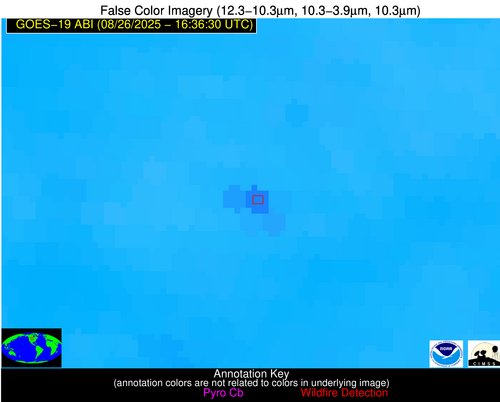
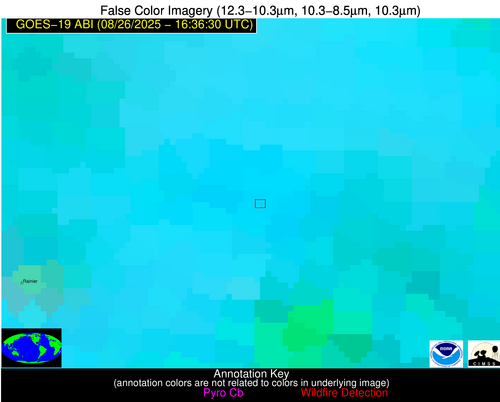
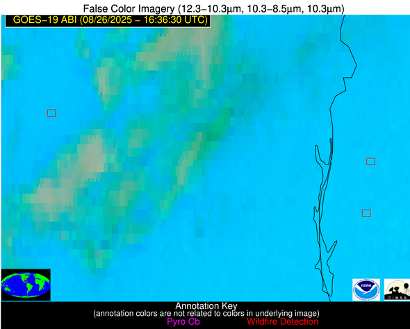
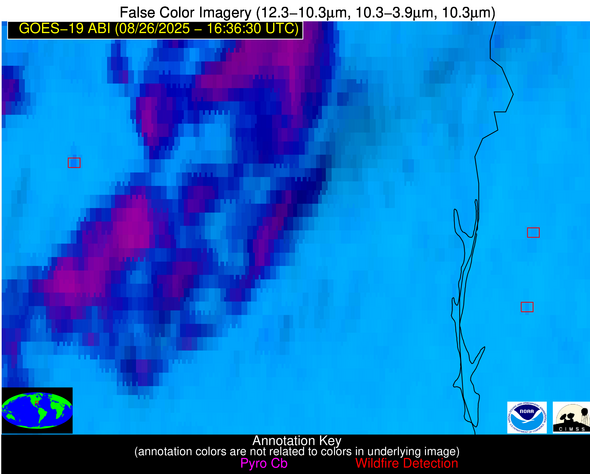
Jan 2026: Due to an ongoing data center cooling system construction project, NGFS data outages may occur with little or no notice. Bitterly cold air in Madison Jan 22-24 increases risk of outages.
Wildfire Alert Report
| Date: | 2025-08-26 |
|---|---|
| Time: | 16:36:17 |
| Production Date and Time: | 2025-08-26 16:41:22 UTC |
| Primary Instrument: | GOES-19 ABI |
| Wmo Spacecraft Id: | 666 |
| Location/orbit: | GEO |
| L1 File: | OR_ABI-L1b-RadC-M6C14_G19_s20252381636177_e20252381638550_c20252381639034.nc |
| L1 File(s) - Temporal | OR_ABI-L1b-RadC-M6C14_G19_s20252381631177_e20252381633550_c20252381634045.nc |
| Number Of Thermal Anomaly Alerts: | 6 |
Possible Wildfire
| Basic Information | |
|---|---|
| State/Province(s) | ND |
| Country/Countries | United States |
| County/Locality(s) | Grant County, ND |
| NWS WFO | Bismarck ND |
| Identification Method | Enhanced Contextual (Cloud) |
| Mean Object Date/Time | 2025-08-26 16:36:20UTC |
| Radiative Center (Lat, Lon): | 46.363335°, -101.292221° |
| Nearby Counties (meeting alert criteria): |
|
| Total Radiative Power Anomaly | n/a |
| Total Radiative Power | 37.79 MW |
| Map: | |
| Additional Information | |
| Alert Status | New Feature |
| Type of Event | Nominal Risk |
| Event Priority Ranking | 4 |
| Maximum Observed BT (3.9 um) | 307.89 K |
| Observed - Background BT (3.9 um) | 7.08 K |
| BT Anomaly (3.9 um) | 6.45 K |
| Maximum Observed - Clear RTM BT (3.9 um) | 13.98 K |
| Maximum Observed BTD (3.9-10/11/12 um) | 16.21 K |
| Observed - Background BTD (3.9-10/11/12 um) | 6.95 K |
| BTD Anomaly (3.9-10/11/12 um) | 11.85 K |
| Similar Pixel Count | 0 |
| BT Time Tendency (3.9 um) | 6.40 K |
| Image Interval | 5.00 minutes |
| Fraction of Surrounding LWIR Pixels that are Colder | 0.57 |
| Fraction of Surrounding Red Channel Pixels that are Brighter | 1.00 |
| Maximum Radiative Power | 37.79 MW |
| Maximum Radiative Power Uncertainty | 0.00 MW |
| Total Radiative Power Uncertainty | 0.00 MW |
| Mean Viewing Angle | 59.50° |
| Mean Solar Zenith Angle | 45.00° |
| Mean Glint Angle | 103.40° |
| Water Fraction | 0.00 |
| Total Pixel Area | 7.90 km2 |
| Latest Satellite Imagery: | |
| View all event imagery » | |
Possible Wildfire
| Basic Information | |
|---|---|
| State/Province(s) | WA |
| Country/Countries | United States |
| County/Locality(s) | Yakima County, WA |
| NWS WFO | Pendleton OR |
| Identification Method | Enhanced Contextual (Clear) |
| Mean Object Date/Time | 2025-08-26 16:36:18UTC |
| Radiative Center (Lat, Lon): | 46.967777°, -121.406113° |
| Nearby Counties (meeting alert criteria): |
|
| Total Radiative Power Anomaly | n/a |
| Total Radiative Power | 51.28 MW |
| Map: | |
| Additional Information | |
| Alert Status | New Feature |
| Type of Event | Nominal Risk |
| Event Priority Ranking | 4 |
| Maximum Observed BT (3.9 um) | 303.42 K |
| Observed - Background BT (3.9 um) | 6.90 K |
| BT Anomaly (3.9 um) | 6.40 K |
| Maximum Observed - Clear RTM BT (3.9 um) | 12.18 K |
| Maximum Observed BTD (3.9-10/11/12 um) | 15.24 K |
| Observed - Background BTD (3.9-10/11/12 um) | 6.49 K |
| BTD Anomaly (3.9-10/11/12 um) | 5.57 K |
| Similar Pixel Count | 23 |
| BT Time Tendency (3.9 um) | -0.20 K |
| Image Interval | 5.00 minutes |
| Fraction of Surrounding LWIR Pixels that are Colder | 0.89 |
| Fraction of Surrounding Red Channel Pixels that are Brighter | 0.75 |
| Maximum Radiative Power | 51.28 MW |
| Maximum Radiative Power Uncertainty | 0.00 MW |
| Total Radiative Power Uncertainty | 0.00 MW |
| Mean Viewing Angle | 70.60° |
| Mean Solar Zenith Angle | 57.20° |
| Mean Glint Angle | 126.10° |
| Water Fraction | 0.00 |
| Total Pixel Area | 12.00 km2 |
| Latest Satellite Imagery: | |
| View all event imagery » | |
Possible Wildfire
| Basic Information | |
|---|---|
| State/Province(s) | MO |
| Country/Countries | United States |
| County/Locality(s) | Lawrence County, MO |
| NWS WFO | Springfield MO |
| Identification Method | Enhanced Contextual (Clear) |
| Mean Object Date/Time | 2025-08-26 16:36:50UTC |
| Radiative Center (Lat, Lon): | 37.183056°, -93.929726° |
| Nearby Counties (meeting alert criteria): |
|
| Total Radiative Power Anomaly | n/a |
| Total Radiative Power | 30.88 MW |
| Map: | |
| Additional Information | |
| Alert Status | New Feature |
| Type of Event | Nominal Risk |
| Event Priority Ranking | 4 |
| Maximum Observed BT (3.9 um) | 311.35 K |
| Observed - Background BT (3.9 um) | 6.07 K |
| BT Anomaly (3.9 um) | 3.17 K |
| Maximum Observed - Clear RTM BT (3.9 um) | 14.72 K |
| Maximum Observed BTD (3.9-10/11/12 um) | 15.36 K |
| Observed - Background BTD (3.9-10/11/12 um) | 6.67 K |
| BTD Anomaly (3.9-10/11/12 um) | 6.91 K |
| Similar Pixel Count | 3 |
| BT Time Tendency (3.9 um) | 7.80 K |
| Image Interval | 5.00 minutes |
| Fraction of Surrounding LWIR Pixels that are Colder | 0.28 |
| Fraction of Surrounding Red Channel Pixels that are Brighter | 1.00 |
| Maximum Radiative Power | 30.88 MW |
| Maximum Radiative Power Uncertainty | 0.00 MW |
| Total Radiative Power Uncertainty | 0.00 MW |
| Mean Viewing Angle | 47.60° |
| Mean Solar Zenith Angle | 34.80° |
| Mean Glint Angle | 81.20° |
| Water Fraction | 0.00 |
| Total Pixel Area | 5.90 km2 |
| Latest Satellite Imagery: | |
| View all event imagery » | |
Possible Wildfire
| Basic Information | |
|---|---|
| State/Province(s) | AL |
| Country/Countries | United States |
| County/Locality(s) | Lowndes County, AL |
| NWS WFO | Birmingham AL |
| Identification Method | Enhanced Contextual (Clear) |
| Mean Object Date/Time | 2025-08-26 16:37:21UTC |
| Radiative Center (Lat, Lon): | 32.121666°, -86.808609° |
| Nearby Counties (meeting alert criteria): |
|
| Total Radiative Power Anomaly | n/a |
| Total Radiative Power | 21.39 MW |
| Map: | |
| Additional Information | |
| Alert Status | New Feature |
| Type of Event | Nominal Risk |
| Event Priority Ranking | 4 |
| Maximum Observed BT (3.9 um) | 308.11 K |
| Observed - Background BT (3.9 um) | 7.07 K |
| BT Anomaly (3.9 um) | 5.81 K |
| Maximum Observed - Clear RTM BT (3.9 um) | 9.05 K |
| Maximum Observed BTD (3.9-10/11/12 um) | 19.14 K |
| Observed - Background BTD (3.9-10/11/12 um) | 6.13 K |
| BTD Anomaly (3.9-10/11/12 um) | 6.33 K |
| Similar Pixel Count | 7 |
| BT Time Tendency (3.9 um) | 2.00 K |
| Image Interval | 5.00 minutes |
| Fraction of Surrounding LWIR Pixels that are Colder | 0.94 |
| Fraction of Surrounding Red Channel Pixels that are Brighter | 1.00 |
| Maximum Radiative Power | 21.39 MW |
| Maximum Radiative Power Uncertainty | 0.00 MW |
| Total Radiative Power Uncertainty | 0.00 MW |
| Mean Viewing Angle | 39.60° |
| Mean Solar Zenith Angle | 27.10° |
| Mean Glint Angle | 65.50° |
| Water Fraction | 0.00 |
| Total Pixel Area | 5.20 km2 |
| Latest Satellite Imagery: | |
| View all event imagery » | |
Possible Wildfire
| Basic Information | |
|---|---|
| State/Province(s) | GA |
| Country/Countries | United States |
| County/Locality(s) | Randolph County, GA |
| NWS WFO | Tallahassee FL |
| Identification Method | Enhanced Contextual (Clear) |
| Mean Object Date/Time | 2025-08-26 16:37:21UTC |
| Radiative Center (Lat, Lon): | 31.851389°, -84.839722° |
| Nearby Counties (meeting alert criteria): |
|
| Total Radiative Power Anomaly | n/a |
| Total Radiative Power | 7.92 MW |
| Map: | |
| Additional Information | |
| Alert Status | New Feature |
| Type of Event | Nominal Risk |
| Event Priority Ranking | 4 |
| Maximum Observed BT (3.9 um) | 304.67 K |
| Observed - Background BT (3.9 um) | 3.20 K |
| BT Anomaly (3.9 um) | 2.99 K |
| Maximum Observed - Clear RTM BT (3.9 um) | 6.14 K |
| Maximum Observed BTD (3.9-10/11/12 um) | 14.05 K |
| Observed - Background BTD (3.9-10/11/12 um) | 2.68 K |
| BTD Anomaly (3.9-10/11/12 um) | 3.63 K |
| Similar Pixel Count | 25 |
| BT Time Tendency (3.9 um) | 2.60 K |
| Image Interval | 5.00 minutes |
| Fraction of Surrounding LWIR Pixels that are Colder | 0.81 |
| Fraction of Surrounding Red Channel Pixels that are Brighter | 1.00 |
| Maximum Radiative Power | 7.92 MW |
| Maximum Radiative Power Uncertainty | 0.00 MW |
| Total Radiative Power Uncertainty | 0.00 MW |
| Mean Viewing Angle | 38.70° |
| Mean Solar Zenith Angle | 25.80° |
| Mean Glint Angle | 63.30° |
| Water Fraction | 0.00 |
| Total Pixel Area | 5.10 km2 |
| Latest Satellite Imagery: | |
| View all event imagery » | |
Possible Wildfire
| Basic Information | |
|---|---|
| State/Province(s) | LA |
| Country/Countries | United States |
| County/Locality(s) | De Soto Parish, LA |
| NWS WFO | Shreveport LA |
| Identification Method | Enhanced Contextual (Clear) |
| Mean Object Date/Time | 2025-08-26 16:37:20UTC |
| Radiative Center (Lat, Lon): | 31.965555°, -93.610558° |
| Nearby Counties (meeting alert criteria): |
|
| Total Radiative Power Anomaly | n/a |
| Total Radiative Power | 27.98 MW |
| Map: | |
| Additional Information | |
| Alert Status | New Feature |
| Type of Event | Nominal Risk |
| Event Priority Ranking | 4 |
| Maximum Observed BT (3.9 um) | 309.70 K |
| Observed - Background BT (3.9 um) | 8.09 K |
| BT Anomaly (3.9 um) | 9.16 K |
| Maximum Observed - Clear RTM BT (3.9 um) | 12.45 K |
| Maximum Observed BTD (3.9-10/11/12 um) | 20.92 K |
| Observed - Background BTD (3.9-10/11/12 um) | 7.29 K |
| BTD Anomaly (3.9-10/11/12 um) | 6.94 K |
| Similar Pixel Count | 14 |
| BT Time Tendency (3.9 um) | 1.10 K |
| Image Interval | 5.00 minutes |
| Fraction of Surrounding LWIR Pixels that are Colder | 0.97 |
| Fraction of Surrounding Red Channel Pixels that are Brighter | 0.39 |
| Maximum Radiative Power | 27.98 MW |
| Maximum Radiative Power Uncertainty | 0.00 MW |
| Total Radiative Power Uncertainty | 0.00 MW |
| Mean Viewing Angle | 42.40° |
| Mean Solar Zenith Angle | 31.30° |
| Mean Glint Angle | 72.30° |
| Water Fraction | 0.00 |
| Total Pixel Area | 5.40 km2 |
| Latest Satellite Imagery: | |
| View all event imagery » | |


