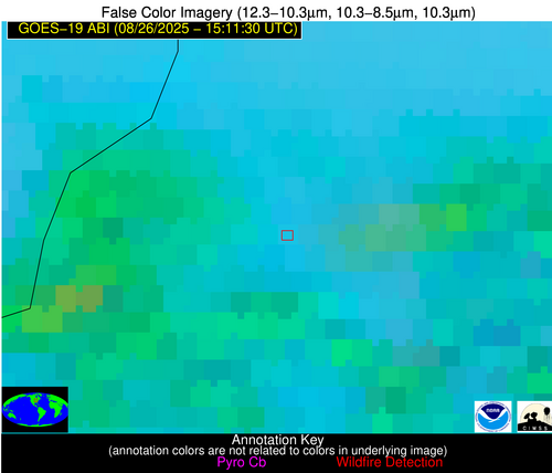
Jan 2026: Due to an ongoing data center cooling system construction project, NGFS data outages may occur with little or no notice.
Wildfire Alert Report
| Date: | 2025-08-26 |
|---|---|
| Time: | 15:11:17 |
| Production Date and Time: | 2025-08-26 15:16:21 UTC |
| Primary Instrument: | GOES-19 ABI |
| Wmo Spacecraft Id: | 666 |
| Location/orbit: | GEO |
| L1 File: | OR_ABI-L1b-RadC-M6C14_G19_s20252381511177_e20252381513550_c20252381514050.nc |
| L1 File(s) - Temporal | OR_ABI-L1b-RadC-M6C14_G19_s20252381506177_e20252381508550_c20252381508596.nc |
| Number Of Thermal Anomaly Alerts: | 4 |
Possible Wildfire
| Basic Information | |
|---|---|
| State/Province(s) | IL |
| Country/Countries | United States |
| County/Locality(s) | Whiteside County, IL |
| NWS WFO | Quad Cities IL |
| Identification Method | Enhanced Contextual (Clear) |
| Mean Object Date/Time | 2025-08-26 15:11:51UTC |
| Radiative Center (Lat, Lon): | 41.673054°, -90.031670° |
| Nearby Counties (meeting alert criteria): |
|
| Total Radiative Power Anomaly | n/a |
| Total Radiative Power | 24.65 MW |
| Map: | |
| Additional Information | |
| Alert Status | New Feature |
| Type of Event | Nominal Risk |
| Event Priority Ranking | 4 |
| Maximum Observed BT (3.9 um) | 299.99 K |
| Observed - Background BT (3.9 um) | 7.82 K |
| BT Anomaly (3.9 um) | 6.88 K |
| Maximum Observed - Clear RTM BT (3.9 um) | 15.22 K |
| Maximum Observed BTD (3.9-10/11/12 um) | 16.24 K |
| Observed - Background BTD (3.9-10/11/12 um) | 7.77 K |
| BTD Anomaly (3.9-10/11/12 um) | 6.40 K |
| Similar Pixel Count | 13 |
| BT Time Tendency (3.9 um) | 4.00 K |
| Image Interval | 5.00 minutes |
| Fraction of Surrounding LWIR Pixels that are Colder | 0.82 |
| Fraction of Surrounding Red Channel Pixels that are Brighter | 1.00 |
| Maximum Radiative Power | 24.65 MW |
| Maximum Radiative Power Uncertainty | 0.00 MW |
| Total Radiative Power Uncertainty | 0.00 MW |
| Mean Viewing Angle | 50.70° |
| Mean Solar Zenith Angle | 48.40° |
| Mean Glint Angle | 90.80° |
| Water Fraction | 0.00 |
| Total Pixel Area | 6.30 km2 |
| Latest Satellite Imagery: | |
| View all event imagery » | |
Possible Wildfire
| Basic Information | |
|---|---|
| State/Province(s) | MO |
| Country/Countries | United States |
| County/Locality(s) | Cooper County, MO |
| NWS WFO | Kansas City/Pleasant Hill MO |
| Identification Method | Enhanced Contextual (Clear) |
| Mean Object Date/Time | 2025-08-26 15:11:50UTC |
| Radiative Center (Lat, Lon): | 38.853054°, -92.891945° |
| Nearby Counties (meeting alert criteria): |
|
| Total Radiative Power Anomaly | n/a |
| Total Radiative Power | 4.37 MW |
| Map: | |
| Additional Information | |
| Alert Status | New Feature |
| Type of Event | Nominal Risk |
| Event Priority Ranking | 4 |
| Maximum Observed BT (3.9 um) | 298.39 K |
| Observed - Background BT (3.9 um) | 2.13 K |
| BT Anomaly (3.9 um) | 1.97 K |
| Maximum Observed - Clear RTM BT (3.9 um) | 8.32 K |
| Maximum Observed BTD (3.9-10/11/12 um) | 6.57 K |
| Observed - Background BTD (3.9-10/11/12 um) | 1.67 K |
| BTD Anomaly (3.9-10/11/12 um) | 3.80 K |
| Similar Pixel Count | 25 |
| BT Time Tendency (3.9 um) | 0.80 K |
| Image Interval | 5.00 minutes |
| Fraction of Surrounding LWIR Pixels that are Colder | 0.68 |
| Fraction of Surrounding Red Channel Pixels that are Brighter | 1.00 |
| Maximum Radiative Power | 4.37 MW |
| Maximum Radiative Power Uncertainty | 0.00 MW |
| Total Radiative Power Uncertainty | 0.00 MW |
| Mean Viewing Angle | 48.90° |
| Mean Solar Zenith Angle | 49.20° |
| Mean Glint Angle | 90.00° |
| Water Fraction | 0.00 |
| Total Pixel Area | 6.10 km2 |
| Latest Satellite Imagery: | |
| View all event imagery » | |
Possible Wildfire
| Basic Information | |
|---|---|
| State/Province(s) | AL |
| Country/Countries | United States |
| County/Locality(s) | Escambia County, AL |
| NWS WFO | Mobile AL |
| Identification Method | Enhanced Contextual (Cloud) |
| Mean Object Date/Time | 2025-08-26 15:12:21UTC |
| Radiative Center (Lat, Lon): | 31.191944°, -86.938057° |
| Nearby Counties (meeting alert criteria): |
|
| Total Radiative Power Anomaly | n/a |
| Total Radiative Power | 26.76 MW |
| Map: | |
| Additional Information | |
| Alert Status | New Feature |
| Type of Event | Nominal Risk |
| Event Priority Ranking | 4 |
| Maximum Observed BT (3.9 um) | 306.31 K |
| Observed - Background BT (3.9 um) | 8.37 K |
| BT Anomaly (3.9 um) | 11.43 K |
| Maximum Observed - Clear RTM BT (3.9 um) | 9.95 K |
| Maximum Observed BTD (3.9-10/11/12 um) | 17.14 K |
| Observed - Background BTD (3.9-10/11/12 um) | 8.18 K |
| BTD Anomaly (3.9-10/11/12 um) | 10.89 K |
| Similar Pixel Count | 0 |
| BT Time Tendency (3.9 um) | 8.70 K |
| Image Interval | 5.00 minutes |
| Fraction of Surrounding LWIR Pixels that are Colder | 0.65 |
| Fraction of Surrounding Red Channel Pixels that are Brighter | 1.00 |
| Maximum Radiative Power | 26.76 MW |
| Maximum Radiative Power Uncertainty | 0.00 MW |
| Total Radiative Power Uncertainty | 0.00 MW |
| Mean Viewing Angle | 38.70° |
| Mean Solar Zenith Angle | 41.80° |
| Mean Glint Angle | 72.40° |
| Water Fraction | 0.00 |
| Total Pixel Area | 5.10 km2 |
| Latest Satellite Imagery: | |
| View all event imagery » | |
Possible Wildfire
| Basic Information | |
|---|---|
| State/Province(s) | MS |
| Country/Countries | United States |
| County/Locality(s) | Amite County, MS |
| NWS WFO | New Orleans LA |
| Identification Method | Enhanced Contextual (Clear) |
| Mean Object Date/Time | 2025-08-26 15:12:21UTC |
| Radiative Center (Lat, Lon): | 31.088888°, -90.603615° |
| Nearby Counties (meeting alert criteria): |
|
| Total Radiative Power Anomaly | n/a |
| Total Radiative Power | 9.77 MW |
| Map: | |
| Additional Information | |
| Alert Status | New Feature |
| Type of Event | Nominal Risk |
| Event Priority Ranking | 4 |
| Maximum Observed BT (3.9 um) | 301.11 K |
| Observed - Background BT (3.9 um) | 2.87 K |
| BT Anomaly (3.9 um) | 4.83 K |
| Maximum Observed - Clear RTM BT (3.9 um) | 3.74 K |
| Maximum Observed BTD (3.9-10/11/12 um) | 14.88 K |
| Observed - Background BTD (3.9-10/11/12 um) | 3.20 K |
| BTD Anomaly (3.9-10/11/12 um) | 2.57 K |
| Similar Pixel Count | 22 |
| BT Time Tendency (3.9 um) | 0.60 K |
| Image Interval | 5.00 minutes |
| Fraction of Surrounding LWIR Pixels that are Colder | 0.35 |
| Fraction of Surrounding Red Channel Pixels that are Brighter | 1.00 |
| Maximum Radiative Power | 9.77 MW |
| Maximum Radiative Power Uncertainty | 0.00 MW |
| Total Radiative Power Uncertainty | 0.00 MW |
| Mean Viewing Angle | 40.10° |
| Mean Solar Zenith Angle | 44.80° |
| Mean Glint Angle | 77.20° |
| Water Fraction | 0.00 |
| Total Pixel Area | 5.20 km2 |
| Latest Satellite Imagery: | |
| View all event imagery » | |


