Wildfire Alert Report
| Date: | 2025-07-10 |
|---|---|
| Time: | 19:10:21 |
| Production Date and Time: | 2025-07-10 19:21:47 UTC |
| Primary Instrument: | GOES-18 ABI |
| Wmo Spacecraft Id: | 665 |
| Location/orbit: | GEO |
| L1 File: | OR_ABI-L1b-RadF-M6C14_G18_s20251911910212_e20251911919520_c20251911919584.nc |
| L1 File(s) - Temporal | OR_ABI-L1b-RadF-M6C14_G18_s20251911900212_e20251911909520_c20251911909587.nc |
| Number Of Thermal Anomaly Alerts: | 3 |
Possible Wildfire
| Basic Information | |
|---|---|
| State/Province(s) | AK |
| Country/Countries | United States |
| County/Locality(s) | Yukon-Koyukuk Census Area, AK |
| NWS WFO | Unknown |
| Identification Method | Enhanced Contextual (Cloud) |
| Mean Object Date/Time | 2025-07-10 19:10:24UTC |
| Radiative Center (Lat, Lon): | 66.796387°, -154.057495° |
| Nearby Counties (meeting alert criteria): |
|
| Total Radiative Power Anomaly | n/a |
| Total Radiative Power | 124.28 MW |
| Map: | |
| Additional Information | |
| Alert Status | New Feature |
| Type of Event | Nominal Risk |
| Event Priority Ranking | 4 |
| Maximum Observed BT (3.9 um) | 296.34 K |
| Observed - Background BT (3.9 um) | 10.50 K |
| BT Anomaly (3.9 um) | 5.32 K |
| Maximum Observed - Clear RTM BT (3.9 um) | 17.35 K |
| Maximum Observed BTD (3.9-10/11/12 um) | 23.88 K |
| Observed - Background BTD (3.9-10/11/12 um) | 10.56 K |
| BTD Anomaly (3.9-10/11/12 um) | 3.57 K |
| Similar Pixel Count | 0 |
| BT Time Tendency (3.9 um) | 5.60 K |
| Image Interval | 10.00 minutes |
| Fraction of Surrounding LWIR Pixels that are Colder | 0.75 |
| Fraction of Surrounding Red Channel Pixels that are Brighter | 0.75 |
| Maximum Radiative Power | 124.28 MW |
| Maximum Radiative Power Uncertainty | 0.00 MW |
| Total Radiative Power Uncertainty | 0.00 MW |
| Mean Viewing Angle | 77.10° |
| Mean Solar Zenith Angle | 53.40° |
| Mean Glint Angle | 117.90° |
| Water Fraction | 0.00 |
| Total Pixel Area | 17.90 km2 |
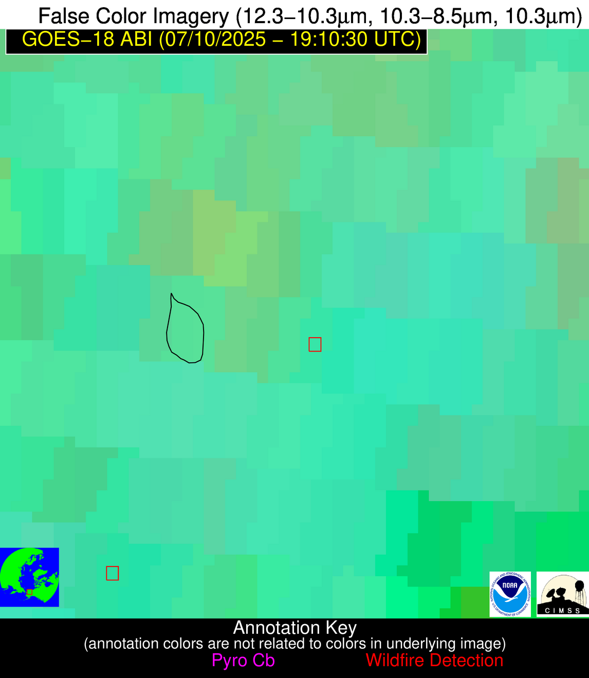
| Latest Satellite Imagery: | |
| View all event imagery » | |
Possible Wildfire
| Basic Information | |
|---|---|
| State/Province(s) | British Columbia |
| Country/Countries | Canada |
| County/Locality(s) | Bulkley-Nechako, British Columbia |
| NWS WFO | N/A |
| Identification Method | Enhanced Contextual (Clear) |
| Mean Object Date/Time | 2025-07-10 19:10:40UTC |
| Radiative Center (Lat, Lon): | 53.597221°, -125.860558° |
| Nearby Counties (meeting alert criteria): |
|
| Total Radiative Power Anomaly | n/a |
| Total Radiative Power | 22.36 MW |
| Map: | |
| Additional Information | |
| Alert Status | New Feature |
| Type of Event | Nominal Risk |
| Event Priority Ranking | 4 |
| Maximum Observed BT (3.9 um) | 299.69 K |
| Observed - Background BT (3.9 um) | 6.40 K |
| BT Anomaly (3.9 um) | 2.43 K |
| Maximum Observed - Clear RTM BT (3.9 um) | 12.03 K |
| Maximum Observed BTD (3.9-10/11/12 um) | 18.28 K |
| Observed - Background BTD (3.9-10/11/12 um) | 6.52 K |
| BTD Anomaly (3.9-10/11/12 um) | 2.55 K |
| Similar Pixel Count | 19 |
| BT Time Tendency (3.9 um) | 0.30 K |
| Image Interval | 10.00 minutes |
| Fraction of Surrounding LWIR Pixels that are Colder | 0.55 |
| Fraction of Surrounding Red Channel Pixels that are Brighter | 1.00 |
| Maximum Radiative Power | 22.36 MW |
| Maximum Radiative Power Uncertainty | 0.00 MW |
| Total Radiative Power Uncertainty | 0.00 MW |
| Mean Viewing Angle | 62.50° |
| Mean Solar Zenith Angle | 34.50° |
| Mean Glint Angle | 87.90° |
| Water Fraction | 0.00 |
| Total Pixel Area | 8.70 km2 |
| Latest Satellite Imagery: | |
| View all event imagery » | |
Possible Wildfire
| Basic Information | |
|---|---|
| State/Province(s) | British Columbia |
| Country/Countries | Canada |
| County/Locality(s) | Cariboo, British Columbia |
| NWS WFO | N/A |
| Identification Method | Enhanced Contextual (Clear) |
| Mean Object Date/Time | 2025-07-10 19:10:41UTC |
| Radiative Center (Lat, Lon): | 52.889721°, -123.446945° |
| Nearby Counties (meeting alert criteria): |
|
| Total Radiative Power Anomaly | n/a |
| Total Radiative Power | 20.85 MW |
| Map: | |
| Additional Information | |
| Alert Status | New Feature |
| Type of Event | Nominal Risk |
| Event Priority Ranking | 4 |
| Maximum Observed BT (3.9 um) | 296.85 K |
| Observed - Background BT (3.9 um) | 4.51 K |
| BT Anomaly (3.9 um) | 1.66 K |
| Maximum Observed - Clear RTM BT (3.9 um) | 7.44 K |
| Maximum Observed BTD (3.9-10/11/12 um) | 10.76 K |
| Observed - Background BTD (3.9-10/11/12 um) | 4.25 K |
| BTD Anomaly (3.9-10/11/12 um) | 2.15 K |
| Similar Pixel Count | 8 |
| BT Time Tendency (3.9 um) | 5.30 K |
| Image Interval | 10.00 minutes |
| Fraction of Surrounding LWIR Pixels that are Colder | 0.57 |
| Fraction of Surrounding Red Channel Pixels that are Brighter | 1.00 |
| Maximum Radiative Power | 20.85 MW |
| Maximum Radiative Power Uncertainty | 0.00 MW |
| Total Radiative Power Uncertainty | 0.00 MW |
| Mean Viewing Angle | 62.10° |
| Mean Solar Zenith Angle | 33.10° |
| Mean Glint Angle | 86.60° |
| Water Fraction | 0.00 |
| Total Pixel Area | 8.60 km2 |
| Latest Satellite Imagery: | |
| View all event imagery » | |


