Wildfire Alert Report
| Date: | 2025-07-03 |
|---|---|
| Time: | 21:36:17 |
| Production Date and Time: | 2025-07-03 21:41:15 UTC |
| Primary Instrument: | GOES-19 ABI |
| Wmo Spacecraft Id: | 666 |
| Location/orbit: | GEO |
| L1 File: | OR_ABI-L1b-RadC-M6C14_G19_s20251842136179_e20251842138552_c20251842139048.nc |
| L1 File(s) - Temporal | OR_ABI-L1b-RadC-M6C14_G19_s20251842131179_e20251842133552_c20251842134061.nc |
| Number Of Thermal Anomaly Alerts: | 2 |
Possible Wildfire
| Basic Information | |
|---|---|
| State/Province(s) | KS |
| Country/Countries | United States |
| County/Locality(s) | Comanche County, KS |
| NWS WFO | Dodge City KS |
| Identification Method | Enhanced Contextual (Clear) |
| Mean Object Date/Time | 2025-07-03 21:36:50UTC |
| Radiative Center (Lat, Lon): | 37.097221°, -99.435280° |
| Nearby Counties (meeting alert criteria): |
|
| Total Radiative Power Anomaly | n/a |
| Total Radiative Power | 3.02 MW |
| Map: | |
| Additional Information | |
| Alert Status | New Feature |
| Type of Event | Nominal Risk |
| Event Priority Ranking | 4 |
| Maximum Observed BT (3.9 um) | 306.64 K |
| Observed - Background BT (3.9 um) | 2.51 K |
| BT Anomaly (3.9 um) | 1.26 K |
| Maximum Observed - Clear RTM BT (3.9 um) | 7.35 K |
| Maximum Observed BTD (3.9-10/11/12 um) | 20.80 K |
| Observed - Background BTD (3.9-10/11/12 um) | 3.03 K |
| BTD Anomaly (3.9-10/11/12 um) | 1.73 K |
| Similar Pixel Count | 25 |
| BT Time Tendency (3.9 um) | 2.40 K |
| Image Interval | 5.00 minutes |
| Fraction of Surrounding LWIR Pixels that are Colder | 0.61 |
| Fraction of Surrounding Red Channel Pixels that are Brighter | 0.75 |
| Maximum Radiative Power | 3.02 MW |
| Maximum Radiative Power Uncertainty | 0.00 MW |
| Total Radiative Power Uncertainty | 0.00 MW |
| Mean Viewing Angle | 50.20° |
| Mean Solar Zenith Angle | 40.00° |
| Mean Glint Angle | 43.20° |
| Water Fraction | 0.00 |
| Total Pixel Area | 6.30 km2 |
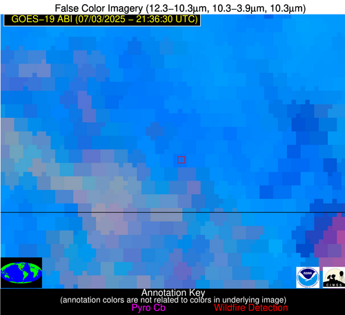
| Latest Satellite Imagery: | |
| View all event imagery » | |
Possible Wildfire
| Basic Information | |
|---|---|
| State/Province(s) | TN |
| Country/Countries | United States |
| County/Locality(s) | Obion County, TN |
| NWS WFO | Memphis TN |
| Identification Method | Enhanced Contextual (Clear) |
| Mean Object Date/Time | 2025-07-03 21:36:51UTC |
| Radiative Center (Lat, Lon): | 36.394444°, -89.108055° |
| Nearby Counties (meeting alert criteria): |
|
| Total Radiative Power Anomaly | n/a |
| Total Radiative Power | 11.46 MW |
| Map: | |
| Additional Information | |
| Alert Status | New Feature |
| Type of Event | Nominal Risk |
| Event Priority Ranking | 4 |
| Maximum Observed BT (3.9 um) | 305.64 K |
| Observed - Background BT (3.9 um) | 3.08 K |
| BT Anomaly (3.9 um) | 2.88 K |
| Maximum Observed - Clear RTM BT (3.9 um) | 7.50 K |
| Maximum Observed BTD (3.9-10/11/12 um) | 11.93 K |
| Observed - Background BTD (3.9-10/11/12 um) | 3.03 K |
| BTD Anomaly (3.9-10/11/12 um) | 3.25 K |
| Similar Pixel Count | 22 |
| BT Time Tendency (3.9 um) | 0.90 K |
| Image Interval | 5.00 minutes |
| Fraction of Surrounding LWIR Pixels that are Colder | 0.55 |
| Fraction of Surrounding Red Channel Pixels that are Brighter | 1.00 |
| Maximum Radiative Power | 11.46 MW |
| Maximum Radiative Power Uncertainty | 0.00 MW |
| Total Radiative Power Uncertainty | 0.00 MW |
| Mean Viewing Angle | 44.90° |
| Mean Solar Zenith Angle | 48.20° |
| Mean Glint Angle | 47.80° |
| Water Fraction | 0.00 |
| Total Pixel Area | 5.70 km2 |
| Latest Satellite Imagery: | |
| View all event imagery » | |


