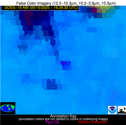
Wildfire Alert Report
| Date: | 2025-05-15 |
|---|---|
| Time: | 16:26:17 |
| Production Date and Time: | 2025-05-15 16:31:15 UTC |
| Primary Instrument: | GOES-19 ABI |
| Wmo Spacecraft Id: | 666 |
| Location/orbit: | GEO |
| L1 File: | OR_ABI-L1b-RadC-M6C14_G19_s20251351626179_e20251351628552_c20251351629041.nc |
| L1 File(s) - Temporal | OR_ABI-L1b-RadC-M6C14_G19_s20251351621179_e20251351623552_c20251351624051.nc |
| Number Of Thermal Anomaly Alerts: | 2 |
Possible Wildfire
| Basic Information | |
|---|---|
| State/Province(s) | MO |
| Country/Countries | United States |
| County/Locality(s) | Linn County, MO |
| NWS WFO | Kansas City/Pleasant Hill MO |
| Identification Method | Enhanced Contextual (Clear) |
| Mean Object Date/Time | 2025-05-15 16:26:50UTC |
| Radiative Center (Lat, Lon): | 39.972221°, -93.211113° |
| Nearby Counties (meeting alert criteria): |
|
| Total Radiative Power Anomaly | n/a |
| Total Radiative Power | 3.44 MW |
| Map: | |
| Additional Information | |
| Alert Status | New Feature |
| Type of Event | Nominal Risk |
| Event Priority Ranking | 4 |
| Maximum Observed BT (3.9 um) | 307.92 K |
| Observed - Background BT (3.9 um) | 2.58 K |
| BT Anomaly (3.9 um) | 1.53 K |
| Maximum Observed - Clear RTM BT (3.9 um) | 15.45 K |
| Maximum Observed BTD (3.9-10/11/12 um) | 11.13 K |
| Observed - Background BTD (3.9-10/11/12 um) | 1.51 K |
| BTD Anomaly (3.9-10/11/12 um) | 1.75 K |
| Similar Pixel Count | 25 |
| BT Time Tendency (3.9 um) | 0.50 K |
| Image Interval | 5.00 minutes |
| Fraction of Surrounding LWIR Pixels that are Colder | 0.86 |
| Fraction of Surrounding Red Channel Pixels that are Brighter | 0.94 |
| Maximum Radiative Power | 3.44 MW |
| Maximum Radiative Power Uncertainty | 0.00 MW |
| Total Radiative Power Uncertainty | 0.00 MW |
| Mean Viewing Angle | 50.10° |
| Mean Solar Zenith Angle | 30.60° |
| Mean Glint Angle | 78.30° |
| Water Fraction | 0.00 |
| Total Pixel Area | 6.20 km2 |
| Latest Satellite Imagery: | |
| View all event imagery » | |
Possible Wildfire
| Basic Information | |
|---|---|
| State/Province(s) | TX |
| Country/Countries | United States |
| County/Locality(s) | Colorado County, TX |
| NWS WFO | Houston/Galveston TX |
| Identification Method | Enhanced Contextual (Cloud) |
| Mean Object Date/Time | 2025-05-15 16:27:50UTC |
| Radiative Center (Lat, Lon): | 29.629444°, -96.323891° |
| Nearby Counties (meeting alert criteria): |
|
| Total Radiative Power Anomaly | n/a |
| Total Radiative Power | 164.61 MW |
| Map: | |
| Additional Information | |
| Alert Status | New Feature |
| Type of Event | Nominal Risk |
| Event Priority Ranking | 4 |
| Maximum Observed BT (3.9 um) | 325.14 K |
| Observed - Background BT (3.9 um) | 17.32 K |
| BT Anomaly (3.9 um) | 15.00 K |
| Maximum Observed - Clear RTM BT (3.9 um) | 23.38 K |
| Maximum Observed BTD (3.9-10/11/12 um) | 33.94 K |
| Observed - Background BTD (3.9-10/11/12 um) | 18.10 K |
| BTD Anomaly (3.9-10/11/12 um) | 15.72 K |
| Similar Pixel Count | 0 |
| BT Time Tendency (3.9 um) | 10.60 K |
| Image Interval | 5.00 minutes |
| Fraction of Surrounding LWIR Pixels that are Colder | 0.43 |
| Fraction of Surrounding Red Channel Pixels that are Brighter | 0.41 |
| Maximum Radiative Power | 97.33 MW |
| Maximum Radiative Power Uncertainty | 0.00 MW |
| Total Radiative Power Uncertainty | 0.00 MW |
| Mean Viewing Angle | 41.70° |
| Mean Solar Zenith Angle | 28.30° |
| Mean Glint Angle | 66.40° |
| Water Fraction | 0.00 |
| Total Pixel Area | 10.70 km2 |
| Latest Satellite Imagery: | |
| View all event imagery » | |


