Wildfire Alert Report
| Date: | 2025-05-01 |
|---|---|
| Time: | 21:46:17 |
| Production Date and Time: | 2025-05-01 21:51:16 UTC |
| Primary Instrument: | GOES-19 ABI |
| Wmo Spacecraft Id: | 666 |
| Location/orbit: | GEO |
| L1 File: | OR_ABI-L1b-RadC-M6C14_G19_s20251212146176_e20251212148549_c20251212149046.nc |
| L1 File(s) - Temporal | OR_ABI-L1b-RadC-M6C14_G19_s20251212141176_e20251212143549_c20251212144050.nc |
| Number Of Thermal Anomaly Alerts: | 4 |
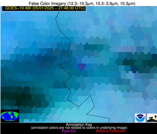
Possible Wildfire
| Basic Information | |
|---|---|
| State/Province(s) | IA |
| Country/Countries | United States |
| County/Locality(s) | Harrison County, IA |
| NWS WFO | Omaha/Valley NE |
| Identification Method | Enhanced Contextual (Cloud) |
| Mean Object Date/Time | 2025-05-01 21:46:50UTC |
| Radiative Center (Lat, Lon): | 41.675278°, -96.038330° |
| Nearby Counties (meeting alert criteria): |
|
| Total Radiative Power Anomaly | n/a |
| Total Radiative Power | 31.19 MW |
| Map: | |
| Additional Information | |
| Alert Status | New Feature |
| Type of Event | Nominal Risk |
| Event Priority Ranking | 4 |
| Maximum Observed BT (3.9 um) | 297.33 K |
| Observed - Background BT (3.9 um) | 8.49 K |
| BT Anomaly (3.9 um) | 6.79 K |
| Maximum Observed - Clear RTM BT (3.9 um) | 12.64 K |
| Maximum Observed BTD (3.9-10/11/12 um) | 23.97 K |
| Observed - Background BTD (3.9-10/11/12 um) | 8.26 K |
| BTD Anomaly (3.9-10/11/12 um) | 6.96 K |
| Similar Pixel Count | 0 |
| BT Time Tendency (3.9 um) | 4.60 K |
| Image Interval | 5.00 minutes |
| Fraction of Surrounding LWIR Pixels that are Colder | 0.32 |
| Fraction of Surrounding Red Channel Pixels that are Brighter | 0.90 |
| Maximum Radiative Power | 31.19 MW |
| Maximum Radiative Power Uncertainty | 0.00 MW |
| Total Radiative Power Uncertainty | 0.00 MW |
| Mean Viewing Angle | 52.90° |
| Mean Solar Zenith Angle | 51.60° |
| Mean Glint Angle | 58.10° |
| Water Fraction | 0.00 |
| Total Pixel Area | 6.60 km2 |
| Latest Satellite Imagery: | |
| View all event imagery » | |
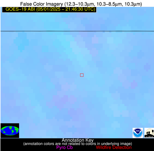
Possible Wildfire
| Basic Information | |
|---|---|
| State/Province(s) | Sonora |
| Country/Countries | Mexico |
| County/Locality(s) | Santa Cruz, Sonora |
| NWS WFO | N/A |
| Identification Method | Enhanced Contextual (Clear) |
| Mean Object Date/Time | 2025-05-01 21:47:18UTC |
| Radiative Center (Lat, Lon): | 31.163055°, -110.718330° |
| Nearby Counties (meeting alert criteria): |
|
| Total Radiative Power Anomaly | n/a |
| Total Radiative Power | 11.53 MW |
| Map: | |
| Additional Information | |
| Alert Status | New Feature |
| Type of Event | Nominal Risk |
| Event Priority Ranking | 4 |
| Maximum Observed BT (3.9 um) | 317.25 K |
| Observed - Background BT (3.9 um) | 2.48 K |
| BT Anomaly (3.9 um) | 1.81 K |
| Maximum Observed - Clear RTM BT (3.9 um) | 14.35 K |
| Maximum Observed BTD (3.9-10/11/12 um) | 7.60 K |
| Observed - Background BTD (3.9-10/11/12 um) | 1.78 K |
| BTD Anomaly (3.9-10/11/12 um) | 4.73 K |
| Similar Pixel Count | 21 |
| BT Time Tendency (3.9 um) | 0.70 K |
| Image Interval | 5.00 minutes |
| Fraction of Surrounding LWIR Pixels that are Colder | 0.83 |
| Fraction of Surrounding Red Channel Pixels that are Brighter | 0.72 |
| Maximum Radiative Power | 11.53 MW |
| Maximum Radiative Power Uncertainty | 0.00 MW |
| Total Radiative Power Uncertainty | 0.00 MW |
| Mean Viewing Angle | 53.10° |
| Mean Solar Zenith Angle | 37.20° |
| Mean Glint Angle | 40.00° |
| Water Fraction | 0.00 |
| Total Pixel Area | 6.70 km2 |
| Latest Satellite Imagery: | |
| View all event imagery » | |
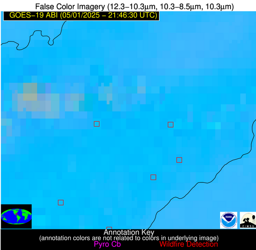
Possible Wildfire
| Basic Information | |
|---|---|
| State/Province(s) | Unknown |
| Country/Countries | Cuba |
| County/Locality(s) | Unknown, Unknown |
| NWS WFO | N/A |
| Identification Method | Enhanced Contextual (Clear) |
| Mean Object Date/Time | 2025-05-01 21:48:21UTC |
| Radiative Center (Lat, Lon): | 22.684166°, -83.256668° |
| Nearby Counties (meeting alert criteria): |
|
| Total Radiative Power Anomaly | n/a |
| Total Radiative Power | 18.52 MW |
| Map: | |
| Additional Information | |
| Alert Status | New Feature |
| Type of Event | Nominal Risk |
| Event Priority Ranking | 4 |
| Maximum Observed BT (3.9 um) | 306.51 K |
| Observed - Background BT (3.9 um) | 6.90 K |
| BT Anomaly (3.9 um) | 4.85 K |
| Maximum Observed - Clear RTM BT (3.9 um) | 8.52 K |
| Maximum Observed BTD (3.9-10/11/12 um) | 16.63 K |
| Observed - Background BTD (3.9-10/11/12 um) | 7.58 K |
| BTD Anomaly (3.9-10/11/12 um) | 5.65 K |
| Similar Pixel Count | 13 |
| BT Time Tendency (3.9 um) | 1.90 K |
| Image Interval | 5.00 minutes |
| Fraction of Surrounding LWIR Pixels that are Colder | 0.23 |
| Fraction of Surrounding Red Channel Pixels that are Brighter | 0.55 |
| Maximum Radiative Power | 18.52 MW |
| Maximum Radiative Power Uncertainty | 0.00 MW |
| Total Radiative Power Uncertainty | 0.00 MW |
| Mean Viewing Angle | 28.20° |
| Mean Solar Zenith Angle | 60.80° |
| Mean Glint Angle | 52.80° |
| Water Fraction | 0.00 |
| Total Pixel Area | 4.50 km2 |
| Latest Satellite Imagery: | |
| View all event imagery » | |
Possible Wildfire
| Basic Information | |
|---|---|
| State/Province(s) | Unknown |
| Country/Countries | Cuba |
| County/Locality(s) | Unknown, Unknown |
| NWS WFO | N/A |
| Identification Method | Enhanced Contextual (Clear) |
| Mean Object Date/Time | 2025-05-01 21:48:21UTC |
| Radiative Center (Lat, Lon): | 22.682501°, -83.035278° |
| Nearby Counties (meeting alert criteria): |
|
| Total Radiative Power Anomaly | n/a |
| Total Radiative Power | 21.79 MW |
| Map: | |
| Additional Information | |
| Alert Status | New Feature |
| Type of Event | Nominal Risk |
| Event Priority Ranking | 4 |
| Maximum Observed BT (3.9 um) | 310.89 K |
| Observed - Background BT (3.9 um) | 8.35 K |
| BT Anomaly (3.9 um) | 3.14 K |
| Maximum Observed - Clear RTM BT (3.9 um) | 13.29 K |
| Maximum Observed BTD (3.9-10/11/12 um) | 17.72 K |
| Observed - Background BTD (3.9-10/11/12 um) | 8.85 K |
| BTD Anomaly (3.9-10/11/12 um) | 4.53 K |
| Similar Pixel Count | 5 |
| BT Time Tendency (3.9 um) | 4.20 K |
| Image Interval | 5.00 minutes |
| Fraction of Surrounding LWIR Pixels that are Colder | 0.41 |
| Fraction of Surrounding Red Channel Pixels that are Brighter | 0.99 |
| Maximum Radiative Power | 21.79 MW |
| Maximum Radiative Power Uncertainty | 0.00 MW |
| Total Radiative Power Uncertainty | 0.00 MW |
| Mean Viewing Angle | 28.10° |
| Mean Solar Zenith Angle | 61.00° |
| Mean Glint Angle | 53.20° |
| Water Fraction | 0.00 |
| Total Pixel Area | 4.50 km2 |
| Latest Satellite Imagery: | |
| View all event imagery » | |


