Wildfire Alert Report
| Date: | 2025-04-26 |
|---|---|
| Time: | 14:46:17 |
| Production Date and Time: | 2025-04-26 14:51:04 UTC |
| Primary Instrument: | GOES-19 ABI |
| Wmo Spacecraft Id: | 666 |
| Location/orbit: | GEO |
| L1 File: | OR_ABI-L1b-RadC-M6C14_G19_s20251161446171_e20251161448544_c20251161449045.nc |
| L1 File(s) - Temporal | OR_ABI-L1b-RadC-M6C14_G19_s20251161441171_e20251161443544_c20251161444058.nc |
| Number Of Thermal Anomaly Alerts: | 2 |
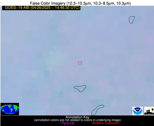
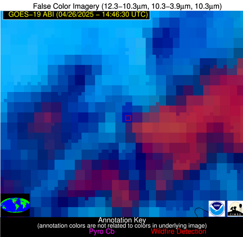
Possible Wildfire
| Basic Information | |
|---|---|
| State/Province(s) | MN |
| Country/Countries | United States |
| County/Locality(s) | Le Sueur County, MN |
| NWS WFO | Twin Cities/Chanhassen MN |
| Identification Method | Enhanced Contextual (Clear) |
| Mean Object Date/Time | 2025-04-26 14:46:21UTC |
| Radiative Center (Lat, Lon): | 44.394444°, -93.781387° |
| Nearby Counties (meeting alert criteria): |
|
| Total Radiative Power Anomaly | n/a |
| Total Radiative Power | 17.25 MW |
| Map: | |
| Additional Information | |
| Alert Status | New Feature |
| Type of Event | Nominal Risk |
| Event Priority Ranking | 4 |
| Maximum Observed BT (3.9 um) | 297.06 K |
| Observed - Background BT (3.9 um) | 6.71 K |
| BT Anomaly (3.9 um) | 6.11 K |
| Maximum Observed - Clear RTM BT (3.9 um) | 16.38 K |
| Maximum Observed BTD (3.9-10/11/12 um) | 12.71 K |
| Observed - Background BTD (3.9-10/11/12 um) | 6.15 K |
| BTD Anomaly (3.9-10/11/12 um) | 10.23 K |
| Similar Pixel Count | 2 |
| BT Time Tendency (3.9 um) | 5.30 K |
| Image Interval | 5.00 minutes |
| Fraction of Surrounding LWIR Pixels that are Colder | 0.83 |
| Fraction of Surrounding Red Channel Pixels that are Brighter | 1.00 |
| Maximum Radiative Power | 17.25 MW |
| Maximum Radiative Power Uncertainty | 0.00 MW |
| Total Radiative Power Uncertainty | 0.00 MW |
| Mean Viewing Angle | 54.70° |
| Mean Solar Zenith Angle | 53.70° |
| Mean Glint Angle | 96.80° |
| Water Fraction | 0.00 |
| Total Pixel Area | 6.90 km2 |
| Latest Satellite Imagery: | |
| View all event imagery » | |
Possible Wildfire
| Basic Information | |
|---|---|
| State/Province(s) | GA |
| Country/Countries | United States |
| County/Locality(s) | Bryan County, GA |
| NWS WFO | Charleston SC |
| Identification Method | Enhanced Contextual (Clear) |
| Mean Object Date/Time | 2025-04-26 14:47:22UTC |
| Radiative Center (Lat, Lon): | 31.992500°, -81.438332° |
| Nearby Counties (meeting alert criteria): |
|
| Total Radiative Power Anomaly | n/a |
| Total Radiative Power | 35.86 MW |
| Map: | |
| Additional Information | |
| Alert Status | New Feature |
| Type of Event | Nominal Risk |
| Event Priority Ranking | 4 |
| Maximum Observed BT (3.9 um) | 303.89 K |
| Observed - Background BT (3.9 um) | 7.61 K |
| BT Anomaly (3.9 um) | 4.02 K |
| Maximum Observed - Clear RTM BT (3.9 um) | 8.32 K |
| Maximum Observed BTD (3.9-10/11/12 um) | 33.35 K |
| Observed - Background BTD (3.9-10/11/12 um) | 7.74 K |
| BTD Anomaly (3.9-10/11/12 um) | 3.24 K |
| Similar Pixel Count | 17 |
| BT Time Tendency (3.9 um) | 18.60 K |
| Image Interval | 5.00 minutes |
| Fraction of Surrounding LWIR Pixels that are Colder | 0.64 |
| Fraction of Surrounding Red Channel Pixels that are Brighter | 0.83 |
| Maximum Radiative Power | 35.86 MW |
| Maximum Radiative Power Uncertainty | 0.00 MW |
| Total Radiative Power Uncertainty | 0.00 MW |
| Mean Viewing Angle | 38.00° |
| Mean Solar Zenith Angle | 40.50° |
| Mean Glint Angle | 66.50° |
| Water Fraction | 0.00 |
| Total Pixel Area | 5.10 km2 |
| Latest Satellite Imagery: | |
| View all event imagery » | |


