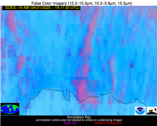
Wildfire Alert Report
| Date: | 2025-04-21 |
|---|---|
| Time: | 19:11:17 |
| Production Date and Time: | 2025-04-21 19:16:24 UTC |
| Primary Instrument: | GOES-19 ABI |
| Wmo Spacecraft Id: | 666 |
| Location/orbit: | GEO |
| L1 File: | OR_ABI-L1b-RadC-M6C14_G19_s20251111911176_e20251111913549_c20251111914048.nc |
| L1 File(s) - Temporal | OR_ABI-L1b-RadC-M6C14_G19_s20251111906176_e20251111908549_c20251111909050.nc |
| Number Of Thermal Anomaly Alerts: | 15 |
Possible Wildfire
| Basic Information | |
|---|---|
| State/Province(s) | IA |
| Country/Countries | United States |
| County/Locality(s) | Adair County, IA |
| NWS WFO | Des Moines IA |
| Identification Method | Enhanced Contextual (Clear) |
| Mean Object Date/Time | 2025-04-21 19:11:50UTC |
| Radiative Center (Lat, Lon): | 41.165001°, -94.687775° |
| Nearby Counties (meeting alert criteria): |
|
| Total Radiative Power Anomaly | n/a |
| Total Radiative Power | 9.90 MW |
| Map: | |
| Additional Information | |
| Alert Status | New Feature |
| Type of Event | Nominal Risk |
| Event Priority Ranking | 4 |
| Maximum Observed BT (3.9 um) | 305.50 K |
| Observed - Background BT (3.9 um) | 3.47 K |
| BT Anomaly (3.9 um) | 2.66 K |
| Maximum Observed - Clear RTM BT (3.9 um) | 16.00 K |
| Maximum Observed BTD (3.9-10/11/12 um) | 12.24 K |
| Observed - Background BTD (3.9-10/11/12 um) | 2.84 K |
| BTD Anomaly (3.9-10/11/12 um) | 4.20 K |
| Similar Pixel Count | 25 |
| BT Time Tendency (3.9 um) | 0.50 K |
| Image Interval | 5.00 minutes |
| Fraction of Surrounding LWIR Pixels that are Colder | 0.80 |
| Fraction of Surrounding Red Channel Pixels that are Brighter | 1.00 |
| Maximum Radiative Power | 9.90 MW |
| Maximum Radiative Power Uncertainty | 0.00 MW |
| Total Radiative Power Uncertainty | 0.00 MW |
| Mean Viewing Angle | 51.90° |
| Mean Solar Zenith Angle | 31.90° |
| Mean Glint Angle | 73.80° |
| Water Fraction | 0.00 |
| Total Pixel Area | 6.50 km2 |
| Latest Satellite Imagery: | |
| View all event imagery » | |
Possible Wildfire
| Basic Information | |
|---|---|
| State/Province(s) | MO |
| Country/Countries | United States |
| County/Locality(s) | Gentry County, MO |
| NWS WFO | Kansas City/Pleasant Hill MO |
| Identification Method | Enhanced Contextual (Clear) |
| Mean Object Date/Time | 2025-04-21 19:11:50UTC |
| Radiative Center (Lat, Lon): | 40.287777°, -94.299446° |
| Nearby Counties (meeting alert criteria): |
|
| Total Radiative Power Anomaly | n/a |
| Total Radiative Power | 8.09 MW |
| Map: | |
| Additional Information | |
| Alert Status | New Feature |
| Type of Event | Nominal Risk |
| Event Priority Ranking | 4 |
| Maximum Observed BT (3.9 um) | 302.54 K |
| Observed - Background BT (3.9 um) | 2.33 K |
| BT Anomaly (3.9 um) | 2.22 K |
| Maximum Observed - Clear RTM BT (3.9 um) | 12.84 K |
| Maximum Observed BTD (3.9-10/11/12 um) | 9.99 K |
| Observed - Background BTD (3.9-10/11/12 um) | 2.00 K |
| BTD Anomaly (3.9-10/11/12 um) | 3.76 K |
| Similar Pixel Count | 25 |
| BT Time Tendency (3.9 um) | 1.50 K |
| Image Interval | 5.00 minutes |
| Fraction of Surrounding LWIR Pixels that are Colder | 0.33 |
| Fraction of Surrounding Red Channel Pixels that are Brighter | 1.00 |
| Maximum Radiative Power | 8.09 MW |
| Maximum Radiative Power Uncertainty | 0.00 MW |
| Total Radiative Power Uncertainty | 0.00 MW |
| Mean Viewing Angle | 50.80° |
| Mean Solar Zenith Angle | 31.20° |
| Mean Glint Angle | 71.90° |
| Water Fraction | 0.00 |
| Total Pixel Area | 6.30 km2 |
| Latest Satellite Imagery: | |
| View all event imagery » | |
Possible Wildfire
| Basic Information | |
|---|---|
| State/Province(s) | KS |
| Country/Countries | United States |
| County/Locality(s) | Lyon County, KS |
| NWS WFO | Topeka KS |
| Identification Method | Enhanced Contextual (Clear) |
| Mean Object Date/Time | 2025-04-21 19:11:50UTC |
| Radiative Center (Lat, Lon): | 38.441944°, -96.053886° |
| Nearby Counties (meeting alert criteria): |
|
| Total Radiative Power Anomaly | n/a |
| Total Radiative Power | 8.90 MW |
| Map: | |
| Additional Information | |
| Alert Status | New Feature |
| Type of Event | Nominal Risk |
| Event Priority Ranking | 4 |
| Maximum Observed BT (3.9 um) | 302.27 K |
| Observed - Background BT (3.9 um) | 2.22 K |
| BT Anomaly (3.9 um) | 0.95 K |
| Maximum Observed - Clear RTM BT (3.9 um) | 10.03 K |
| Maximum Observed BTD (3.9-10/11/12 um) | 10.40 K |
| Observed - Background BTD (3.9-10/11/12 um) | 2.24 K |
| BTD Anomaly (3.9-10/11/12 um) | 1.05 K |
| Similar Pixel Count | 25 |
| BT Time Tendency (3.9 um) | 2.60 K |
| Image Interval | 5.00 minutes |
| Fraction of Surrounding LWIR Pixels that are Colder | 0.52 |
| Fraction of Surrounding Red Channel Pixels that are Brighter | 0.96 |
| Maximum Radiative Power | 8.90 MW |
| Maximum Radiative Power Uncertainty | 0.00 MW |
| Total Radiative Power Uncertainty | 0.00 MW |
| Mean Viewing Angle | 49.80° |
| Mean Solar Zenith Angle | 29.00° |
| Mean Glint Angle | 68.80° |
| Water Fraction | 0.00 |
| Total Pixel Area | 6.20 km2 |
| Latest Satellite Imagery: | |
| View all event imagery » | |
Possible Wildfire
| Basic Information | |
|---|---|
| State/Province(s) | KS |
| Country/Countries | United States |
| County/Locality(s) | Franklin County, KS |
| NWS WFO | Topeka KS |
| Identification Method | Enhanced Contextual (Clear) |
| Mean Object Date/Time | 2025-04-21 19:11:50UTC |
| Radiative Center (Lat, Lon): | 38.405556°, -95.146111° |
| Nearby Counties (meeting alert criteria): |
|
| Total Radiative Power Anomaly | n/a |
| Total Radiative Power | 15.78 MW |
| Map: | |
| Additional Information | |
| Alert Status | New Feature |
| Type of Event | Nominal Risk |
| Event Priority Ranking | 4 |
| Maximum Observed BT (3.9 um) | 302.54 K |
| Observed - Background BT (3.9 um) | 5.22 K |
| BT Anomaly (3.9 um) | 11.96 K |
| Maximum Observed - Clear RTM BT (3.9 um) | 12.65 K |
| Maximum Observed BTD (3.9-10/11/12 um) | 11.24 K |
| Observed - Background BTD (3.9-10/11/12 um) | 4.66 K |
| BTD Anomaly (3.9-10/11/12 um) | 12.98 K |
| Similar Pixel Count | 4 |
| BT Time Tendency (3.9 um) | 3.60 K |
| Image Interval | 5.00 minutes |
| Fraction of Surrounding LWIR Pixels that are Colder | 0.93 |
| Fraction of Surrounding Red Channel Pixels that are Brighter | 1.00 |
| Maximum Radiative Power | 15.78 MW |
| Maximum Radiative Power Uncertainty | 0.00 MW |
| Total Radiative Power Uncertainty | 0.00 MW |
| Mean Viewing Angle | 49.40° |
| Mean Solar Zenith Angle | 29.30° |
| Mean Glint Angle | 68.50° |
| Water Fraction | 0.00 |
| Total Pixel Area | 6.10 km2 |
| Latest Satellite Imagery: | |
| View all event imagery » | |
Possible Wildfire
| Basic Information | |
|---|---|
| State/Province(s) | KS |
| Country/Countries | United States |
| County/Locality(s) | Marion County, KS |
| NWS WFO | Wichita KS |
| Identification Method | Enhanced Contextual (Clear) |
| Mean Object Date/Time | 2025-04-21 19:11:50UTC |
| Radiative Center (Lat, Lon): | 38.375557°, -97.012497° |
| Nearby Counties (meeting alert criteria): |
|
| Total Radiative Power Anomaly | n/a |
| Total Radiative Power | 17.20 MW |
| Map: | |
| Additional Information | |
| Alert Status | New Feature |
| Type of Event | Nominal Risk |
| Event Priority Ranking | 4 |
| Maximum Observed BT (3.9 um) | 305.43 K |
| Observed - Background BT (3.9 um) | 4.44 K |
| BT Anomaly (3.9 um) | 5.15 K |
| Maximum Observed - Clear RTM BT (3.9 um) | 13.45 K |
| Maximum Observed BTD (3.9-10/11/12 um) | 12.45 K |
| Observed - Background BTD (3.9-10/11/12 um) | 4.55 K |
| BTD Anomaly (3.9-10/11/12 um) | 9.95 K |
| Similar Pixel Count | 7 |
| BT Time Tendency (3.9 um) | 4.40 K |
| Image Interval | 5.00 minutes |
| Fraction of Surrounding LWIR Pixels that are Colder | 0.38 |
| Fraction of Surrounding Red Channel Pixels that are Brighter | 1.00 |
| Maximum Radiative Power | 17.20 MW |
| Maximum Radiative Power Uncertainty | 0.00 MW |
| Total Radiative Power Uncertainty | 0.00 MW |
| Mean Viewing Angle | 50.20° |
| Mean Solar Zenith Angle | 28.60° |
| Mean Glint Angle | 69.10° |
| Water Fraction | 0.00 |
| Total Pixel Area | 6.20 km2 |
| Latest Satellite Imagery: | |
| View all event imagery » | |
Possible Wildfire
| Basic Information | |
|---|---|
| State/Province(s) | KS |
| Country/Countries | United States |
| County/Locality(s) | Butler County, KS |
| NWS WFO | Wichita KS |
| Identification Method | Enhanced Contextual (Cloud) |
| Mean Object Date/Time | 2025-04-21 19:11:50UTC |
| Radiative Center (Lat, Lon): | 37.546112°, -96.632500° |
| Nearby Counties (meeting alert criteria): |
|
| Total Radiative Power Anomaly | n/a |
| Total Radiative Power | 42.95 MW |
| Map: | |
| Additional Information | |
| Alert Status | New Feature |
| Type of Event | Nominal Risk |
| Event Priority Ranking | 4 |
| Maximum Observed BT (3.9 um) | 310.31 K |
| Observed - Background BT (3.9 um) | 10.79 K |
| BT Anomaly (3.9 um) | 19.77 K |
| Maximum Observed - Clear RTM BT (3.9 um) | 18.69 K |
| Maximum Observed BTD (3.9-10/11/12 um) | 23.51 K |
| Observed - Background BTD (3.9-10/11/12 um) | 11.05 K |
| BTD Anomaly (3.9-10/11/12 um) | 10.90 K |
| Similar Pixel Count | 0 |
| BT Time Tendency (3.9 um) | 8.30 K |
| Image Interval | 5.00 minutes |
| Fraction of Surrounding LWIR Pixels that are Colder | 0.21 |
| Fraction of Surrounding Red Channel Pixels that are Brighter | 1.00 |
| Maximum Radiative Power | 42.95 MW |
| Maximum Radiative Power Uncertainty | 0.00 MW |
| Total Radiative Power Uncertainty | 0.00 MW |
| Mean Viewing Angle | 49.20° |
| Mean Solar Zenith Angle | 28.00° |
| Mean Glint Angle | 67.30° |
| Water Fraction | 0.00 |
| Total Pixel Area | 6.10 km2 |
| Latest Satellite Imagery: | |
| View all event imagery » | |
Possible Wildfire
| Basic Information | |
|---|---|
| State/Province(s) | OK |
| Country/Countries | United States |
| County/Locality(s) | Garvin County, OK |
| NWS WFO | Norman OK |
| Identification Method | Enhanced Contextual (Clear) |
| Mean Object Date/Time | 2025-04-21 19:12:20UTC |
| Radiative Center (Lat, Lon): | 34.618332°, -97.357498° |
| Nearby Counties (meeting alert criteria): |
|
| Total Radiative Power Anomaly | n/a |
| Total Radiative Power | 9.95 MW |
| Map: | |
| Additional Information | |
| Alert Status | New Feature |
| Type of Event | Nominal Risk |
| Event Priority Ranking | 4 |
| Maximum Observed BT (3.9 um) | 306.74 K |
| Observed - Background BT (3.9 um) | 3.88 K |
| BT Anomaly (3.9 um) | 3.26 K |
| Maximum Observed - Clear RTM BT (3.9 um) | 13.28 K |
| Maximum Observed BTD (3.9-10/11/12 um) | 9.73 K |
| Observed - Background BTD (3.9-10/11/12 um) | 2.86 K |
| BTD Anomaly (3.9-10/11/12 um) | 5.11 K |
| Similar Pixel Count | 25 |
| BT Time Tendency (3.9 um) | 0.50 K |
| Image Interval | 5.00 minutes |
| Fraction of Surrounding LWIR Pixels that are Colder | 0.93 |
| Fraction of Surrounding Red Channel Pixels that are Brighter | 1.00 |
| Maximum Radiative Power | 9.95 MW |
| Maximum Radiative Power Uncertainty | 0.00 MW |
| Total Radiative Power Uncertainty | 0.00 MW |
| Mean Viewing Angle | 46.90° |
| Mean Solar Zenith Angle | 25.10° |
| Mean Glint Angle | 61.90° |
| Water Fraction | 0.00 |
| Total Pixel Area | 5.90 km2 |
| Latest Satellite Imagery: | |
| View all event imagery » | |
Possible Wildfire
| Basic Information | |
|---|---|
| State/Province(s) | FL |
| Country/Countries | United States |
| County/Locality(s) | Leon County, FL |
| NWS WFO | Tallahassee FL |
| Identification Method | Enhanced Contextual (Cloud) |
| Mean Object Date/Time | 2025-04-21 19:12:21UTC |
| Radiative Center (Lat, Lon): | 30.661388°, -84.211945° |
| Nearby Counties (meeting alert criteria): |
|
| Total Radiative Power Anomaly | n/a |
| Total Radiative Power | 26.22 MW |
| Map: | |
| Additional Information | |
| Alert Status | New Feature |
| Type of Event | Nominal Risk |
| Event Priority Ranking | 4 |
| Maximum Observed BT (3.9 um) | 308.61 K |
| Observed - Background BT (3.9 um) | 6.73 K |
| BT Anomaly (3.9 um) | 5.62 K |
| Maximum Observed - Clear RTM BT (3.9 um) | 10.30 K |
| Maximum Observed BTD (3.9-10/11/12 um) | 20.95 K |
| Observed - Background BTD (3.9-10/11/12 um) | 6.62 K |
| BTD Anomaly (3.9-10/11/12 um) | 3.56 K |
| Similar Pixel Count | 0 |
| BT Time Tendency (3.9 um) | 3.10 K |
| Image Interval | 5.00 minutes |
| Fraction of Surrounding LWIR Pixels that are Colder | 0.83 |
| Fraction of Surrounding Red Channel Pixels that are Brighter | 0.99 |
| Maximum Radiative Power | 26.22 MW |
| Maximum Radiative Power Uncertainty | 0.00 MW |
| Total Radiative Power Uncertainty | 0.00 MW |
| Mean Viewing Angle | 37.20° |
| Mean Solar Zenith Angle | 29.30° |
| Mean Glint Angle | 53.00° |
| Water Fraction | 0.00 |
| Total Pixel Area | 5.00 km2 |
| Latest Satellite Imagery: | |
| View all event imagery » | |
Possible Wildfire
| Basic Information | |
|---|---|
| State/Province(s) | Unknown |
| Country/Countries | Cuba |
| County/Locality(s) | Unknown, Unknown |
| NWS WFO | N/A |
| Identification Method | Enhanced Contextual (Clear) |
| Mean Object Date/Time | 2025-04-21 19:13:21UTC |
| Radiative Center (Lat, Lon): | 22.479723°, -83.302498° |
| Nearby Counties (meeting alert criteria): |
|
| Total Radiative Power Anomaly | n/a |
| Total Radiative Power | 17.20 MW |
| Map: | |
| Additional Information | |
| Alert Status | New Feature |
| Type of Event | Nominal Risk |
| Event Priority Ranking | 4 |
| Maximum Observed BT (3.9 um) | 315.19 K |
| Observed - Background BT (3.9 um) | 3.31 K |
| BT Anomaly (3.9 um) | 1.35 K |
| Maximum Observed - Clear RTM BT (3.9 um) | 9.39 K |
| Maximum Observed BTD (3.9-10/11/12 um) | 13.71 K |
| Observed - Background BTD (3.9-10/11/12 um) | 3.29 K |
| BTD Anomaly (3.9-10/11/12 um) | 2.00 K |
| Similar Pixel Count | 23 |
| BT Time Tendency (3.9 um) | 3.30 K |
| Image Interval | 5.00 minutes |
| Fraction of Surrounding LWIR Pixels that are Colder | 0.51 |
| Fraction of Surrounding Red Channel Pixels that are Brighter | 1.00 |
| Maximum Radiative Power | 17.20 MW |
| Maximum Radiative Power Uncertainty | 0.00 MW |
| Total Radiative Power Uncertainty | 0.00 MW |
| Mean Viewing Angle | 28.00° |
| Mean Solar Zenith Angle | 26.10° |
| Mean Glint Angle | 37.60° |
| Water Fraction | 0.00 |
| Total Pixel Area | 4.50 km2 |
| Latest Satellite Imagery: | |
| View all event imagery » | |
Possible Wildfire
| Basic Information | |
|---|---|
| State/Province(s) | Unknown |
| Country/Countries | Cuba |
| County/Locality(s) | Unknown, Unknown |
| NWS WFO | N/A |
| Identification Method | Enhanced Contextual (Cloud) |
| Mean Object Date/Time | 2025-04-21 19:13:22UTC |
| Radiative Center (Lat, Lon): | 22.078056°, -78.660553° |
| Nearby Counties (meeting alert criteria): |
|
| Total Radiative Power Anomaly | n/a |
| Total Radiative Power | 252.63 MW |
| Map: | |
| Additional Information | |
| Alert Status | New Feature |
| Type of Event | Nominal Risk |
| Event Priority Ranking | 4 |
| Maximum Observed BT (3.9 um) | 327.76 K |
| Observed - Background BT (3.9 um) | 17.69 K |
| BT Anomaly (3.9 um) | 6.85 K |
| Maximum Observed - Clear RTM BT (3.9 um) | 22.10 K |
| Maximum Observed BTD (3.9-10/11/12 um) | 30.23 K |
| Observed - Background BTD (3.9-10/11/12 um) | 17.78 K |
| BTD Anomaly (3.9-10/11/12 um) | 7.86 K |
| Similar Pixel Count | 0 |
| BT Time Tendency (3.9 um) | 11.00 K |
| Image Interval | 5.00 minutes |
| Fraction of Surrounding LWIR Pixels that are Colder | 0.61 |
| Fraction of Surrounding Red Channel Pixels that are Brighter | 0.39 |
| Maximum Radiative Power | 73.51 MW |
| Maximum Radiative Power Uncertainty | 0.00 MW |
| Total Radiative Power Uncertainty | 0.00 MW |
| Mean Viewing Angle | 26.30° |
| Mean Solar Zenith Angle | 30.10° |
| Mean Glint Angle | 41.30° |
| Water Fraction | 0.00 |
| Total Pixel Area | 17.80 km2 |
| Latest Satellite Imagery: | |
| View all event imagery » | |
Possible Wildfire
| Basic Information | |
|---|---|
| State/Province(s) | Unknown |
| Country/Countries | Cuba |
| County/Locality(s) | Unknown, Unknown |
| NWS WFO | N/A |
| Identification Method | Enhanced Contextual (Clear) |
| Mean Object Date/Time | 2025-04-21 19:13:22UTC |
| Radiative Center (Lat, Lon): | 22.043056°, -80.104164° |
| Nearby Counties (meeting alert criteria): |
|
| Total Radiative Power Anomaly | n/a |
| Total Radiative Power | 8.76 MW |
| Map: | |
| Additional Information | |
| Alert Status | New Feature |
| Type of Event | Nominal Risk |
| Event Priority Ranking | 4 |
| Maximum Observed BT (3.9 um) | 305.13 K |
| Observed - Background BT (3.9 um) | 2.70 K |
| BT Anomaly (3.9 um) | 1.29 K |
| Maximum Observed - Clear RTM BT (3.9 um) | 2.72 K |
| Maximum Observed BTD (3.9-10/11/12 um) | 8.21 K |
| Observed - Background BTD (3.9-10/11/12 um) | 2.91 K |
| BTD Anomaly (3.9-10/11/12 um) | 2.48 K |
| Similar Pixel Count | 11 |
| BT Time Tendency (3.9 um) | 2.90 K |
| Image Interval | 5.00 minutes |
| Fraction of Surrounding LWIR Pixels that are Colder | 0.25 |
| Fraction of Surrounding Red Channel Pixels that are Brighter | 1.00 |
| Maximum Radiative Power | 8.76 MW |
| Maximum Radiative Power Uncertainty | 0.00 MW |
| Total Radiative Power Uncertainty | 0.00 MW |
| Mean Viewing Angle | 26.50° |
| Mean Solar Zenith Angle | 28.80° |
| Mean Glint Angle | 39.70° |
| Water Fraction | 0.00 |
| Total Pixel Area | 4.50 km2 |
| Latest Satellite Imagery: | |
| View all event imagery » | |
Possible Wildfire
| Basic Information | |
|---|---|
| State/Province(s) | Unknown |
| Country/Countries | Cuba |
| County/Locality(s) | Unknown, Unknown |
| NWS WFO | N/A |
| Identification Method | Enhanced Contextual (Clear) |
| Mean Object Date/Time | 2025-04-21 19:13:21UTC |
| Radiative Center (Lat, Lon): | 21.718611°, -82.830002° |
| Nearby Counties (meeting alert criteria): |
|
| Total Radiative Power Anomaly | n/a |
| Total Radiative Power | 44.83 MW |
| Map: | |
| Additional Information | |
| Alert Status | New Feature |
| Type of Event | Nominal Risk |
| Event Priority Ranking | 4 |
| Maximum Observed BT (3.9 um) | 319.74 K |
| Observed - Background BT (3.9 um) | 10.65 K |
| BT Anomaly (3.9 um) | 4.74 K |
| Maximum Observed - Clear RTM BT (3.9 um) | 18.38 K |
| Maximum Observed BTD (3.9-10/11/12 um) | 20.67 K |
| Observed - Background BTD (3.9-10/11/12 um) | 10.84 K |
| BTD Anomaly (3.9-10/11/12 um) | 5.66 K |
| Similar Pixel Count | 3 |
| BT Time Tendency (3.9 um) | 9.80 K |
| Image Interval | 5.00 minutes |
| Fraction of Surrounding LWIR Pixels that are Colder | 0.56 |
| Fraction of Surrounding Red Channel Pixels that are Brighter | 0.47 |
| Maximum Radiative Power | 44.83 MW |
| Maximum Radiative Power Uncertainty | 0.00 MW |
| Total Radiative Power Uncertainty | 0.00 MW |
| Mean Viewing Angle | 27.00° |
| Mean Solar Zenith Angle | 26.30° |
| Mean Glint Angle | 36.50° |
| Water Fraction | 0.00 |
| Total Pixel Area | 4.50 km2 |
| Latest Satellite Imagery: | |
| View all event imagery » | |
Possible Wildfire
| Basic Information | |
|---|---|
| State/Province(s) | Unknown |
| Country/Countries | Cuba |
| County/Locality(s) | Unknown, Unknown |
| NWS WFO | N/A |
| Identification Method | Enhanced Contextual (Clear) |
| Mean Object Date/Time | 2025-04-21 19:13:22UTC |
| Radiative Center (Lat, Lon): | 21.608612°, -78.429726° |
| Nearby Counties (meeting alert criteria): |
|
| Total Radiative Power Anomaly | n/a |
| Total Radiative Power | 28.13 MW |
| Map: | |
| Additional Information | |
| Alert Status | New Feature |
| Type of Event | Nominal Risk |
| Event Priority Ranking | 4 |
| Maximum Observed BT (3.9 um) | 317.25 K |
| Observed - Background BT (3.9 um) | 5.11 K |
| BT Anomaly (3.9 um) | 2.07 K |
| Maximum Observed - Clear RTM BT (3.9 um) | 10.34 K |
| Maximum Observed BTD (3.9-10/11/12 um) | 16.64 K |
| Observed - Background BTD (3.9-10/11/12 um) | 4.32 K |
| BTD Anomaly (3.9-10/11/12 um) | 1.99 K |
| Similar Pixel Count | 19 |
| BT Time Tendency (3.9 um) | 3.60 K |
| Image Interval | 5.00 minutes |
| Fraction of Surrounding LWIR Pixels that are Colder | 0.87 |
| Fraction of Surrounding Red Channel Pixels that are Brighter | 0.89 |
| Maximum Radiative Power | 16.01 MW |
| Maximum Radiative Power Uncertainty | 0.00 MW |
| Total Radiative Power Uncertainty | 0.00 MW |
| Mean Viewing Angle | 25.70° |
| Mean Solar Zenith Angle | 30.20° |
| Mean Glint Angle | 40.80° |
| Water Fraction | 0.00 |
| Total Pixel Area | 8.90 km2 |
| Latest Satellite Imagery: | |
| View all event imagery » | |
Possible Wildfire
| Basic Information | |
|---|---|
| State/Province(s) | Unknown |
| Country/Countries | Dominican Republic |
| County/Locality(s) | Unknown, Unknown |
| NWS WFO | N/A |
| Identification Method | Enhanced Contextual (Clear) |
| Mean Object Date/Time | 2025-04-21 19:13:53UTC |
| Radiative Center (Lat, Lon): | 18.614166°, -70.028336° |
| Nearby Counties (meeting alert criteria): |
|
| Total Radiative Power Anomaly | n/a |
| Total Radiative Power | 11.79 MW |
| Map: | |
| Additional Information | |
| Alert Status | New Feature |
| Type of Event | Nominal Risk |
| Event Priority Ranking | 4 |
| Maximum Observed BT (3.9 um) | 307.25 K |
| Observed - Background BT (3.9 um) | 3.08 K |
| BT Anomaly (3.9 um) | 1.52 K |
| Maximum Observed - Clear RTM BT (3.9 um) | 6.27 K |
| Maximum Observed BTD (3.9-10/11/12 um) | 13.45 K |
| Observed - Background BTD (3.9-10/11/12 um) | 3.10 K |
| BTD Anomaly (3.9-10/11/12 um) | 1.46 K |
| Similar Pixel Count | 20 |
| BT Time Tendency (3.9 um) | 5.90 K |
| Image Interval | 5.00 minutes |
| Fraction of Surrounding LWIR Pixels that are Colder | 0.67 |
| Fraction of Surrounding Red Channel Pixels that are Brighter | 0.86 |
| Maximum Radiative Power | 11.79 MW |
| Maximum Radiative Power Uncertainty | 0.00 MW |
| Total Radiative Power Uncertainty | 0.00 MW |
| Mean Viewing Angle | 22.70° |
| Mean Solar Zenith Angle | 37.40° |
| Mean Glint Angle | 49.60° |
| Water Fraction | 0.00 |
| Total Pixel Area | 4.30 km2 |
| Latest Satellite Imagery: | |
| View all event imagery » | |
Possible Wildfire
| Basic Information | |
|---|---|
| State/Province(s) | Unknown |
| Country/Countries | Dominican Republic |
| County/Locality(s) | Unknown, Unknown |
| NWS WFO | N/A |
| Identification Method | Enhanced Contextual (Clear) |
| Mean Object Date/Time | 2025-04-21 19:13:53UTC |
| Radiative Center (Lat, Lon): | 18.580278°, -69.004997° |
| Nearby Counties (meeting alert criteria): |
|
| Total Radiative Power Anomaly | n/a |
| Total Radiative Power | 34.64 MW |
| Map: | |
| Additional Information | |
| Alert Status | New Feature |
| Type of Event | Nominal Risk |
| Event Priority Ranking | 4 |
| Maximum Observed BT (3.9 um) | 315.94 K |
| Observed - Background BT (3.9 um) | 9.99 K |
| BT Anomaly (3.9 um) | 6.17 K |
| Maximum Observed - Clear RTM BT (3.9 um) | 15.75 K |
| Maximum Observed BTD (3.9-10/11/12 um) | 19.61 K |
| Observed - Background BTD (3.9-10/11/12 um) | 9.70 K |
| BTD Anomaly (3.9-10/11/12 um) | 8.86 K |
| Similar Pixel Count | 4 |
| BT Time Tendency (3.9 um) | 8.50 K |
| Image Interval | 5.00 minutes |
| Fraction of Surrounding LWIR Pixels that are Colder | 0.69 |
| Fraction of Surrounding Red Channel Pixels that are Brighter | 0.76 |
| Maximum Radiative Power | 34.64 MW |
| Maximum Radiative Power Uncertainty | 0.00 MW |
| Total Radiative Power Uncertainty | 0.00 MW |
| Mean Viewing Angle | 23.00° |
| Mean Solar Zenith Angle | 38.40° |
| Mean Glint Angle | 51.40° |
| Water Fraction | 0.00 |
| Total Pixel Area | 4.30 km2 |
| Latest Satellite Imagery: | |
| View all event imagery » | |
