Wildfire Alert Report
| Date: | 2025-04-19 |
|---|---|
| Time: | 18:11:17 |
| Production Date and Time: | 2025-04-19 18:16:00 UTC |
| Primary Instrument: | GOES-18 ABI |
| Wmo Spacecraft Id: | 665 |
| Location/orbit: | GEO |
| L1 File: | OR_ABI-L1b-RadC-M6C14_G18_s20251091811170_e20251091813543_c20251091814048.nc |
| L1 File(s) - Temporal | OR_ABI-L1b-RadC-M6C14_G18_s20251091806170_e20251091808543_c20251091809035.nc |
| Number Of Thermal Anomaly Alerts: | 2 |
Possible Wildfire
| Basic Information | |
|---|---|
| State/Province(s) | WA |
| Country/Countries | United States |
| County/Locality(s) | Stevens County, WA |
| NWS WFO | Spokane WA |
| Identification Method | Enhanced Contextual (Cloud) |
| Mean Object Date/Time | 2025-04-19 18:11:23UTC |
| Radiative Center (Lat, Lon): | 48.303612°, -117.912224° |
| Nearby Counties (meeting alert criteria): |
|
| Total Radiative Power Anomaly | n/a |
| Total Radiative Power | 44.04 MW |
| Map: | |
| Additional Information | |
| Alert Status | New Feature |
| Type of Event | Nominal Risk |
| Event Priority Ranking | 4 |
| Maximum Observed BT (3.9 um) | 295.01 K |
| Observed - Background BT (3.9 um) | 12.11 K |
| BT Anomaly (3.9 um) | 3.86 K |
| Maximum Observed - Clear RTM BT (3.9 um) | 14.93 K |
| Maximum Observed BTD (3.9-10/11/12 um) | 27.31 K |
| Observed - Background BTD (3.9-10/11/12 um) | 11.93 K |
| BTD Anomaly (3.9-10/11/12 um) | 3.87 K |
| Similar Pixel Count | 0 |
| BT Time Tendency (3.9 um) | 3.70 K |
| Image Interval | 5.00 minutes |
| Fraction of Surrounding LWIR Pixels that are Colder | 0.86 |
| Fraction of Surrounding Red Channel Pixels that are Brighter | 0.41 |
| Maximum Radiative Power | 44.04 MW |
| Maximum Radiative Power Uncertainty | 0.00 MW |
| Total Radiative Power Uncertainty | 0.00 MW |
| Mean Viewing Angle | 58.80° |
| Mean Solar Zenith Angle | 42.80° |
| Mean Glint Angle | 83.70° |
| Water Fraction | 0.00 |
| Total Pixel Area | 7.70 km2 |
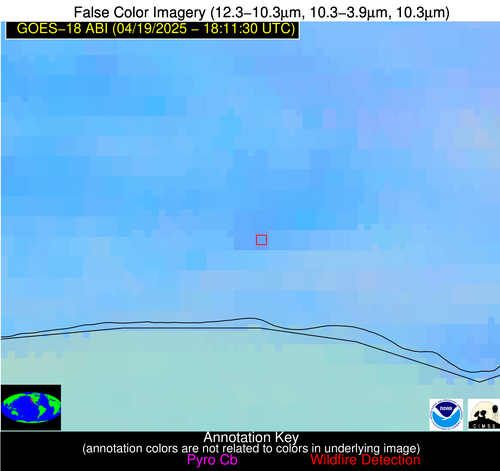
| Latest Satellite Imagery: | |
| View all event imagery » | |
Possible Wildfire
| Basic Information | |
|---|---|
| State/Province(s) | CA |
| Country/Countries | United States |
| County/Locality(s) | Santa Barbara County, CA |
| NWS WFO | Los Angeles/Oxnard CA |
| Identification Method | Enhanced Contextual (Clear) |
| Mean Object Date/Time | 2025-04-19 18:12:23UTC |
| Radiative Center (Lat, Lon): | 34.576111°, -120.114998° |
| Nearby Counties (meeting alert criteria): |
|
| Total Radiative Power Anomaly | n/a |
| Total Radiative Power | 10.67 MW |
| Map: | |
| Additional Information | |
| Alert Status | New Feature |
| Type of Event | Nominal Risk |
| Event Priority Ranking | 4 |
| Maximum Observed BT (3.9 um) | 304.96 K |
| Observed - Background BT (3.9 um) | 4.02 K |
| BT Anomaly (3.9 um) | 2.27 K |
| Maximum Observed - Clear RTM BT (3.9 um) | 10.70 K |
| Maximum Observed BTD (3.9-10/11/12 um) | 9.45 K |
| Observed - Background BTD (3.9-10/11/12 um) | 3.18 K |
| BTD Anomaly (3.9-10/11/12 um) | 4.77 K |
| Similar Pixel Count | 14 |
| BT Time Tendency (3.9 um) | 1.30 K |
| Image Interval | 5.00 minutes |
| Fraction of Surrounding LWIR Pixels that are Colder | 0.68 |
| Fraction of Surrounding Red Channel Pixels that are Brighter | 0.81 |
| Maximum Radiative Power | 10.67 MW |
| Maximum Radiative Power Uncertainty | 0.00 MW |
| Total Radiative Power Uncertainty | 0.00 MW |
| Mean Viewing Angle | 44.30° |
| Mean Solar Zenith Angle | 34.20° |
| Mean Glint Angle | 58.00° |
| Water Fraction | 0.00 |
| Total Pixel Area | 5.60 km2 |
| Latest Satellite Imagery: | |
| View all event imagery » | |


