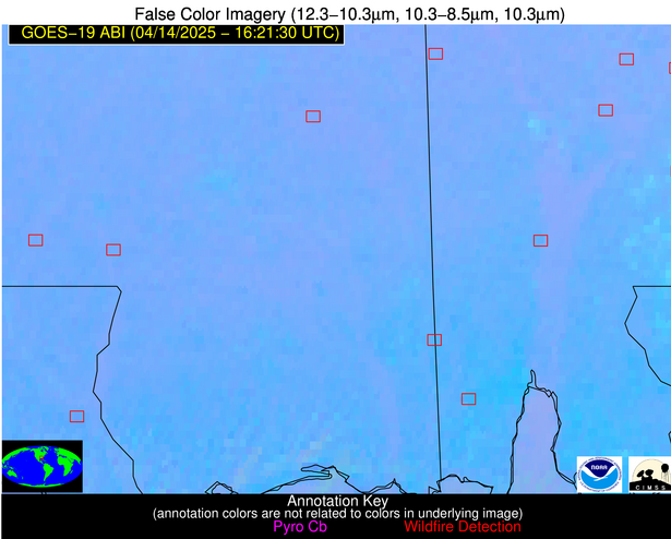
Wildfire Alert Report
| Date: | 2025-04-14 |
|---|---|
| Time: | 16:21:18 |
| Production Date and Time: | 2025-04-14 16:26:16 UTC |
| Primary Instrument: | GOES-19 ABI |
| Wmo Spacecraft Id: | 666 |
| Location/orbit: | GEO |
| L1 File: | OR_ABI-L1b-RadC-M6C14_G19_s20251041621180_e20251041623553_c20251041624046.nc |
| L1 File(s) - Temporal | OR_ABI-L1b-RadC-M6C14_G19_s20251041616180_e20251041618553_c20251041619035.nc |
| Number Of Thermal Anomaly Alerts: | 11 |
Possible Wildfire
| Basic Information | |
|---|---|
| State/Province(s) | MO |
| Country/Countries | United States |
| County/Locality(s) | Dade County, MO |
| NWS WFO | Springfield MO |
| Identification Method | Enhanced Contextual (Clear) |
| Mean Object Date/Time | 2025-04-14 16:21:51UTC |
| Radiative Center (Lat, Lon): | 37.445557°, -94.009720° |
| Nearby Counties (meeting alert criteria): |
|
| Total Radiative Power Anomaly | n/a |
| Total Radiative Power | 11.60 MW |
| Map: | |
| Additional Information | |
| Alert Status | New Feature |
| Type of Event | Nominal Risk |
| Event Priority Ranking | 4 |
| Maximum Observed BT (3.9 um) | 304.15 K |
| Observed - Background BT (3.9 um) | 3.84 K |
| BT Anomaly (3.9 um) | 4.60 K |
| Maximum Observed - Clear RTM BT (3.9 um) | 18.88 K |
| Maximum Observed BTD (3.9-10/11/12 um) | 13.56 K |
| Observed - Background BTD (3.9-10/11/12 um) | 3.55 K |
| BTD Anomaly (3.9-10/11/12 um) | 4.18 K |
| Similar Pixel Count | 23 |
| BT Time Tendency (3.9 um) | 1.80 K |
| Image Interval | 5.00 minutes |
| Fraction of Surrounding LWIR Pixels that are Colder | 0.80 |
| Fraction of Surrounding Red Channel Pixels that are Brighter | 0.98 |
| Maximum Radiative Power | 11.60 MW |
| Maximum Radiative Power Uncertainty | 0.00 MW |
| Total Radiative Power Uncertainty | 0.00 MW |
| Mean Viewing Angle | 47.90° |
| Mean Solar Zenith Angle | 38.50° |
| Mean Glint Angle | 84.70° |
| Water Fraction | 0.00 |
| Total Pixel Area | 6.00 km2 |
| Latest Satellite Imagery: | |
| View all event imagery » | |
Possible Wildfire
| Basic Information | |
|---|---|
| State/Province(s) | LA |
| Country/Countries | United States |
| County/Locality(s) | Lincoln Parish, LA |
| NWS WFO | Shreveport LA |
| Identification Method | Enhanced Contextual (Clear) |
| Mean Object Date/Time | 2025-04-14 16:22:21UTC |
| Radiative Center (Lat, Lon): | 32.575001°, -92.693611° |
| Nearby Counties (meeting alert criteria): |
|
| Total Radiative Power Anomaly | n/a |
| Total Radiative Power | 23.46 MW |
| Map: | |
| Additional Information | |
| Alert Status | New Feature |
| Type of Event | Nominal Risk |
| Event Priority Ranking | 4 |
| Maximum Observed BT (3.9 um) | 307.76 K |
| Observed - Background BT (3.9 um) | 6.27 K |
| BT Anomaly (3.9 um) | 6.22 K |
| Maximum Observed - Clear RTM BT (3.9 um) | 12.59 K |
| Maximum Observed BTD (3.9-10/11/12 um) | 18.18 K |
| Observed - Background BTD (3.9-10/11/12 um) | 6.42 K |
| BTD Anomaly (3.9-10/11/12 um) | 3.67 K |
| Similar Pixel Count | 19 |
| BT Time Tendency (3.9 um) | 3.50 K |
| Image Interval | 5.00 minutes |
| Fraction of Surrounding LWIR Pixels that are Colder | 0.34 |
| Fraction of Surrounding Red Channel Pixels that are Brighter | 0.52 |
| Maximum Radiative Power | 23.46 MW |
| Maximum Radiative Power Uncertainty | 0.00 MW |
| Total Radiative Power Uncertainty | 0.00 MW |
| Mean Viewing Angle | 42.60° |
| Mean Solar Zenith Angle | 34.60° |
| Mean Glint Angle | 75.40° |
| Water Fraction | 0.00 |
| Total Pixel Area | 5.40 km2 |
| Latest Satellite Imagery: | |
| View all event imagery » | |
Possible Wildfire
| Basic Information | |
|---|---|
| State/Province(s) | GA |
| Country/Countries | United States |
| County/Locality(s) | Dougherty County, GA |
| NWS WFO | Tallahassee FL |
| Identification Method | Enhanced Contextual (Clear) |
| Mean Object Date/Time | 2025-04-14 16:22:22UTC |
| Radiative Center (Lat, Lon): | 31.611111°, -84.387779° |
| Nearby Counties (meeting alert criteria): |
|
| Total Radiative Power Anomaly | n/a |
| Total Radiative Power | 11.33 MW |
| Map: | |
| Additional Information | |
| Alert Status | New Feature |
| Type of Event | Nominal Risk |
| Event Priority Ranking | 4 |
| Maximum Observed BT (3.9 um) | 306.70 K |
| Observed - Background BT (3.9 um) | 2.60 K |
| BT Anomaly (3.9 um) | 1.27 K |
| Maximum Observed - Clear RTM BT (3.9 um) | 13.35 K |
| Maximum Observed BTD (3.9-10/11/12 um) | 9.61 K |
| Observed - Background BTD (3.9-10/11/12 um) | 3.19 K |
| BTD Anomaly (3.9-10/11/12 um) | 2.99 K |
| Similar Pixel Count | 4 |
| BT Time Tendency (3.9 um) | 1.40 K |
| Image Interval | 5.00 minutes |
| Fraction of Surrounding LWIR Pixels that are Colder | 0.26 |
| Fraction of Surrounding Red Channel Pixels that are Brighter | 1.00 |
| Maximum Radiative Power | 11.33 MW |
| Maximum Radiative Power Uncertainty | 0.00 MW |
| Total Radiative Power Uncertainty | 0.00 MW |
| Mean Viewing Angle | 38.30° |
| Mean Solar Zenith Angle | 28.70° |
| Mean Glint Angle | 65.30° |
| Water Fraction | 0.00 |
| Total Pixel Area | 5.10 km2 |
| Latest Satellite Imagery: | |
| View all event imagery » | |
Possible Wildfire
| Basic Information | |
|---|---|
| State/Province(s) | AL |
| Country/Countries | United States |
| County/Locality(s) | Clarke County, AL |
| NWS WFO | Mobile AL |
| Identification Method | Enhanced Contextual (Clear) |
| Mean Object Date/Time | 2025-04-14 16:22:22UTC |
| Radiative Center (Lat, Lon): | 31.555834°, -87.713333° |
| Nearby Counties (meeting alert criteria): |
|
| Total Radiative Power Anomaly | n/a |
| Total Radiative Power | 9.74 MW |
| Map: | |
| Additional Information | |
| Alert Status | New Feature |
| Type of Event | Nominal Risk |
| Event Priority Ranking | 4 |
| Maximum Observed BT (3.9 um) | 302.35 K |
| Observed - Background BT (3.9 um) | 2.23 K |
| BT Anomaly (3.9 um) | 1.55 K |
| Maximum Observed - Clear RTM BT (3.9 um) | 7.95 K |
| Maximum Observed BTD (3.9-10/11/12 um) | 7.61 K |
| Observed - Background BTD (3.9-10/11/12 um) | 2.85 K |
| BTD Anomaly (3.9-10/11/12 um) | 3.45 K |
| Similar Pixel Count | 3 |
| BT Time Tendency (3.9 um) | 2.10 K |
| Image Interval | 5.00 minutes |
| Fraction of Surrounding LWIR Pixels that are Colder | 0.17 |
| Fraction of Surrounding Red Channel Pixels that are Brighter | 1.00 |
| Maximum Radiative Power | 9.74 MW |
| Maximum Radiative Power Uncertainty | 0.00 MW |
| Total Radiative Power Uncertainty | 0.00 MW |
| Mean Viewing Angle | 39.40° |
| Mean Solar Zenith Angle | 30.70° |
| Mean Glint Angle | 68.20° |
| Water Fraction | 0.00 |
| Total Pixel Area | 5.20 km2 |
| Latest Satellite Imagery: | |
| View all event imagery » | |
Possible Wildfire
| Basic Information | |
|---|---|
| State/Province(s) | MS |
| Country/Countries | United States |
| County/Locality(s) | Wayne County, MS |
| NWS WFO | Mobile AL |
| Identification Method | Enhanced Contextual (Clear) |
| Mean Object Date/Time | 2025-04-14 16:22:22UTC |
| Radiative Center (Lat, Lon): | 31.536112°, -88.932777° |
| Nearby Counties (meeting alert criteria): |
|
| Total Radiative Power Anomaly | n/a |
| Total Radiative Power | 7.62 MW |
| Map: | |
| Additional Information | |
| Alert Status | New Feature |
| Type of Event | Nominal Risk |
| Event Priority Ranking | 4 |
| Maximum Observed BT (3.9 um) | 302.57 K |
| Observed - Background BT (3.9 um) | 2.45 K |
| BT Anomaly (3.9 um) | 2.40 K |
| Maximum Observed - Clear RTM BT (3.9 um) | 8.24 K |
| Maximum Observed BTD (3.9-10/11/12 um) | 7.12 K |
| Observed - Background BTD (3.9-10/11/12 um) | 2.44 K |
| BTD Anomaly (3.9-10/11/12 um) | 4.57 K |
| Similar Pixel Count | 5 |
| BT Time Tendency (3.9 um) | 1.90 K |
| Image Interval | 5.00 minutes |
| Fraction of Surrounding LWIR Pixels that are Colder | 0.47 |
| Fraction of Surrounding Red Channel Pixels that are Brighter | 1.00 |
| Maximum Radiative Power | 7.62 MW |
| Maximum Radiative Power Uncertainty | 0.00 MW |
| Total Radiative Power Uncertainty | 0.00 MW |
| Mean Viewing Angle | 39.80° |
| Mean Solar Zenith Angle | 31.40° |
| Mean Glint Angle | 69.50° |
| Water Fraction | 0.00 |
| Total Pixel Area | 5.20 km2 |
| Latest Satellite Imagery: | |
| View all event imagery » | |
Possible Wildfire
| Basic Information | |
|---|---|
| State/Province(s) | MS |
| Country/Countries | United States |
| County/Locality(s) | Marion County, MS |
| NWS WFO | Jackson MS |
| Identification Method | Enhanced Contextual (Clear) |
| Mean Object Date/Time | 2025-04-14 16:22:22UTC |
| Radiative Center (Lat, Lon): | 31.115000°, -89.765274° |
| Nearby Counties (meeting alert criteria): |
|
| Total Radiative Power Anomaly | n/a |
| Total Radiative Power | 12.96 MW |
| Map: | |
| Additional Information | |
| Alert Status | New Feature |
| Type of Event | Nominal Risk |
| Event Priority Ranking | 4 |
| Maximum Observed BT (3.9 um) | 302.84 K |
| Observed - Background BT (3.9 um) | 2.63 K |
| BT Anomaly (3.9 um) | 2.67 K |
| Maximum Observed - Clear RTM BT (3.9 um) | 9.35 K |
| Maximum Observed BTD (3.9-10/11/12 um) | 7.45 K |
| Observed - Background BTD (3.9-10/11/12 um) | 2.23 K |
| BTD Anomaly (3.9-10/11/12 um) | 4.33 K |
| Similar Pixel Count | 12 |
| BT Time Tendency (3.9 um) | 2.00 K |
| Image Interval | 5.00 minutes |
| Fraction of Surrounding LWIR Pixels that are Colder | 0.66 |
| Fraction of Surrounding Red Channel Pixels that are Brighter | 1.00 |
| Maximum Radiative Power | 6.57 MW |
| Maximum Radiative Power Uncertainty | 0.00 MW |
| Total Radiative Power Uncertainty | 0.00 MW |
| Mean Viewing Angle | 39.80° |
| Mean Solar Zenith Angle | 31.70° |
| Mean Glint Angle | 69.70° |
| Water Fraction | 0.00 |
| Total Pixel Area | 10.40 km2 |
| Latest Satellite Imagery: | |
| View all event imagery » | |
Possible Wildfire
| Basic Information | |
|---|---|
| State/Province(s) | LA |
| Country/Countries | United States |
| County/Locality(s) | St. Tammany Parish, LA |
| NWS WFO | New Orleans LA |
| Identification Method | Enhanced Contextual (Clear) |
| Mean Object Date/Time | 2025-04-14 16:22:22UTC |
| Radiative Center (Lat, Lon): | 30.588888°, -89.917503° |
| Nearby Counties (meeting alert criteria): |
|
| Total Radiative Power Anomaly | n/a |
| Total Radiative Power | 35.96 MW |
| Map: | |
| Additional Information | |
| Alert Status | New Feature |
| Type of Event | Nominal Risk |
| Event Priority Ranking | 4 |
| Maximum Observed BT (3.9 um) | 310.86 K |
| Observed - Background BT (3.9 um) | 10.79 K |
| BT Anomaly (3.9 um) | 7.46 K |
| Maximum Observed - Clear RTM BT (3.9 um) | 16.82 K |
| Maximum Observed BTD (3.9-10/11/12 um) | 16.43 K |
| Observed - Background BTD (3.9-10/11/12 um) | 10.09 K |
| BTD Anomaly (3.9-10/11/12 um) | 6.64 K |
| Similar Pixel Count | 1 |
| BT Time Tendency (3.9 um) | 7.70 K |
| Image Interval | 5.00 minutes |
| Fraction of Surrounding LWIR Pixels that are Colder | 0.85 |
| Fraction of Surrounding Red Channel Pixels that are Brighter | 0.62 |
| Maximum Radiative Power | 35.96 MW |
| Maximum Radiative Power Uncertainty | 0.00 MW |
| Total Radiative Power Uncertainty | 0.00 MW |
| Mean Viewing Angle | 39.30° |
| Mean Solar Zenith Angle | 31.50° |
| Mean Glint Angle | 68.90° |
| Water Fraction | 0.00 |
| Total Pixel Area | 5.20 km2 |
| Latest Satellite Imagery: | |
| View all event imagery » | |
Possible Wildfire
| Basic Information | |
|---|---|
| State/Province(s) | FL |
| Country/Countries | United States |
| County/Locality(s) | Jefferson County, FL |
| NWS WFO | Tallahassee FL |
| Identification Method | Enhanced Contextual (Clear) |
| Mean Object Date/Time | 2025-04-14 16:22:22UTC |
| Radiative Center (Lat, Lon): | 30.359444°, -83.872780° |
| Nearby Counties (meeting alert criteria): |
|
| Total Radiative Power Anomaly | n/a |
| Total Radiative Power | 9.16 MW |
| Map: | |
| Additional Information | |
| Alert Status | New Feature |
| Type of Event | Nominal Risk |
| Event Priority Ranking | 4 |
| Maximum Observed BT (3.9 um) | 305.16 K |
| Observed - Background BT (3.9 um) | 4.28 K |
| BT Anomaly (3.9 um) | 2.44 K |
| Maximum Observed - Clear RTM BT (3.9 um) | 11.06 K |
| Maximum Observed BTD (3.9-10/11/12 um) | 8.31 K |
| Observed - Background BTD (3.9-10/11/12 um) | 3.27 K |
| BTD Anomaly (3.9-10/11/12 um) | 4.68 K |
| Similar Pixel Count | 16 |
| BT Time Tendency (3.9 um) | 0.50 K |
| Image Interval | 5.00 minutes |
| Fraction of Surrounding LWIR Pixels that are Colder | 0.75 |
| Fraction of Surrounding Red Channel Pixels that are Brighter | 1.00 |
| Maximum Radiative Power | 9.16 MW |
| Maximum Radiative Power Uncertainty | 0.00 MW |
| Total Radiative Power Uncertainty | 0.00 MW |
| Mean Viewing Angle | 36.80° |
| Mean Solar Zenith Angle | 27.50° |
| Mean Glint Angle | 62.50° |
| Water Fraction | 0.00 |
| Total Pixel Area | 5.00 km2 |
| Latest Satellite Imagery: | |
| View all event imagery » | |
Possible Wildfire
| Basic Information | |
|---|---|
| State/Province(s) | TX |
| Country/Countries | United States |
| County/Locality(s) | Caldwell County, TX |
| NWS WFO | Austin/San Antonio TX |
| Identification Method | Enhanced Contextual (Clear) |
| Mean Object Date/Time | 2025-04-14 16:22:51UTC |
| Radiative Center (Lat, Lon): | 29.791111°, -97.772499° |
| Nearby Counties (meeting alert criteria): |
|
| Total Radiative Power Anomaly | n/a |
| Total Radiative Power | 5.70 MW |
| Map: | |
| Additional Information | |
| Alert Status | New Feature |
| Type of Event | Nominal Risk |
| Event Priority Ranking | 4 |
| Maximum Observed BT (3.9 um) | 310.57 K |
| Observed - Background BT (3.9 um) | 2.03 K |
| BT Anomaly (3.9 um) | 1.43 K |
| Maximum Observed - Clear RTM BT (3.9 um) | 12.21 K |
| Maximum Observed BTD (3.9-10/11/12 um) | 10.59 K |
| Observed - Background BTD (3.9-10/11/12 um) | 1.68 K |
| BTD Anomaly (3.9-10/11/12 um) | 2.39 K |
| Similar Pixel Count | 25 |
| BT Time Tendency (3.9 um) | 1.60 K |
| Image Interval | 5.00 minutes |
| Fraction of Surrounding LWIR Pixels that are Colder | 0.65 |
| Fraction of Surrounding Red Channel Pixels that are Brighter | 1.00 |
| Maximum Radiative Power | 5.70 MW |
| Maximum Radiative Power Uncertainty | 0.00 MW |
| Total Radiative Power Uncertainty | 0.00 MW |
| Mean Viewing Angle | 42.80° |
| Mean Solar Zenith Angle | 36.80° |
| Mean Glint Angle | 77.80° |
| Water Fraction | 0.00 |
| Total Pixel Area | 5.50 km2 |
| Latest Satellite Imagery: | |
| View all event imagery » | |
Possible Wildfire
| Basic Information | |
|---|---|
| State/Province(s) | Tamaulipas |
| Country/Countries | Mexico |
| County/Locality(s) | González, Tamaulipas |
| NWS WFO | N/A |
| Identification Method | Enhanced Contextual (Clear) |
| Mean Object Date/Time | 2025-04-14 16:23:20UTC |
| Radiative Center (Lat, Lon): | 22.687500°, -98.686943° |
| Nearby Counties (meeting alert criteria): |
|
| Total Radiative Power Anomaly | n/a |
| Total Radiative Power | 33.06 MW |
| Map: | |
| Additional Information | |
| Alert Status | New Feature |
| Type of Event | Nominal Risk |
| Event Priority Ranking | 4 |
| Maximum Observed BT (3.9 um) | 315.07 K |
| Observed - Background BT (3.9 um) | 2.43 K |
| BT Anomaly (3.9 um) | 1.56 K |
| Maximum Observed - Clear RTM BT (3.9 um) | 10.46 K |
| Maximum Observed BTD (3.9-10/11/12 um) | 14.81 K |
| Observed - Background BTD (3.9-10/11/12 um) | 3.35 K |
| BTD Anomaly (3.9-10/11/12 um) | 3.80 K |
| Similar Pixel Count | 22 |
| BT Time Tendency (3.9 um) | 3.70 K |
| Image Interval | 5.00 minutes |
| Fraction of Surrounding LWIR Pixels that are Colder | 0.15 |
| Fraction of Surrounding Red Channel Pixels that are Brighter | 0.97 |
| Maximum Radiative Power | 16.86 MW |
| Maximum Radiative Power Uncertainty | 0.00 MW |
| Total Radiative Power Uncertainty | 0.00 MW |
| Mean Viewing Angle | 37.70° |
| Mean Solar Zenith Angle | 34.80° |
| Mean Glint Angle | 70.60° |
| Water Fraction | 0.00 |
| Total Pixel Area | 10.10 km2 |
| Latest Satellite Imagery: | |
| View all event imagery » | |
Possible Wildfire
| Basic Information | |
|---|---|
| State/Province(s) | Tamaulipas |
| Country/Countries | Mexico |
| County/Locality(s) | González, Tamaulipas |
| NWS WFO | N/A |
| Identification Method | Enhanced Contextual (Clear) |
| Mean Object Date/Time | 2025-04-14 16:23:20UTC |
| Radiative Center (Lat, Lon): | 22.496111°, -98.509720° |
| Nearby Counties (meeting alert criteria): |
|
| Total Radiative Power Anomaly | n/a |
| Total Radiative Power | 5.87 MW |
| Map: | |
| Additional Information | |
| Alert Status | New Feature |
| Type of Event | Nominal Risk |
| Event Priority Ranking | 4 |
| Maximum Observed BT (3.9 um) | 314.25 K |
| Observed - Background BT (3.9 um) | 1.70 K |
| BT Anomaly (3.9 um) | 1.07 K |
| Maximum Observed - Clear RTM BT (3.9 um) | 8.26 K |
| Maximum Observed BTD (3.9-10/11/12 um) | 13.16 K |
| Observed - Background BTD (3.9-10/11/12 um) | 1.73 K |
| BTD Anomaly (3.9-10/11/12 um) | 2.06 K |
| Similar Pixel Count | 25 |
| BT Time Tendency (3.9 um) | 1.00 K |
| Image Interval | 5.00 minutes |
| Fraction of Surrounding LWIR Pixels that are Colder | 0.57 |
| Fraction of Surrounding Red Channel Pixels that are Brighter | 0.83 |
| Maximum Radiative Power | 5.87 MW |
| Maximum Radiative Power Uncertainty | 0.00 MW |
| Total Radiative Power Uncertainty | 0.00 MW |
| Mean Viewing Angle | 37.40° |
| Mean Solar Zenith Angle | 34.60° |
| Mean Glint Angle | 70.20° |
| Water Fraction | 0.00 |
| Total Pixel Area | 5.00 km2 |
| Latest Satellite Imagery: | |
| View all event imagery » | |
