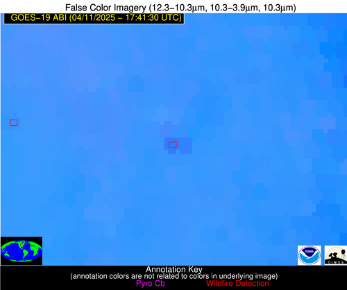
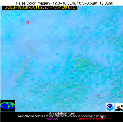
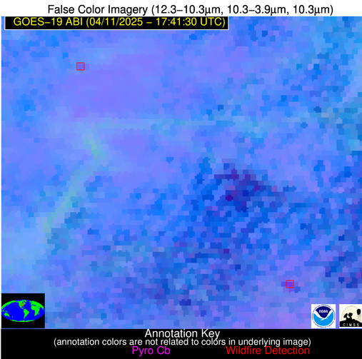
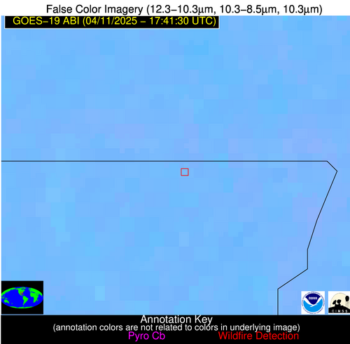
Wildfire Alert Report
| Date: | 2025-04-11 |
|---|---|
| Time: | 17:41:17 |
| Production Date and Time: | 2025-04-11 17:46:22 UTC |
| Primary Instrument: | GOES-19 ABI |
| Wmo Spacecraft Id: | 666 |
| Location/orbit: | GEO |
| L1 File: | OR_ABI-L1b-RadC-M6C14_G19_s20251011741177_e20251011743550_c20251011744045.nc |
| L1 File(s) - Temporal | OR_ABI-L1b-RadC-M6C14_G19_s20251011736177_e20251011738550_c20251011739034.nc |
| Number Of Thermal Anomaly Alerts: | 11 |
Possible Wildfire
| Basic Information | |
|---|---|
| State/Province(s) | IA |
| Country/Countries | United States |
| County/Locality(s) | Sioux County, IA |
| NWS WFO | Sioux Falls SD |
| Identification Method | Enhanced Contextual (Clear) |
| Mean Object Date/Time | 2025-04-11 17:41:50UTC |
| Radiative Center (Lat, Lon): | 42.941944°, -96.010277° |
| Nearby Counties (meeting alert criteria): |
|
| Total Radiative Power Anomaly | n/a |
| Total Radiative Power | 36.77 MW |
| Map: | |
| Additional Information | |
| Alert Status | New Feature |
| Type of Event | Nominal Risk |
| Event Priority Ranking | 4 |
| Maximum Observed BT (3.9 um) | 315.17 K |
| Observed - Background BT (3.9 um) | 3.33 K |
| BT Anomaly (3.9 um) | 4.94 K |
| Maximum Observed - Clear RTM BT (3.9 um) | 19.86 K |
| Maximum Observed BTD (3.9-10/11/12 um) | 16.73 K |
| Observed - Background BTD (3.9-10/11/12 um) | 3.88 K |
| BTD Anomaly (3.9-10/11/12 um) | 11.03 K |
| Similar Pixel Count | 25 |
| BT Time Tendency (3.9 um) | 2.00 K |
| Image Interval | 5.00 minutes |
| Fraction of Surrounding LWIR Pixels that are Colder | 0.22 |
| Fraction of Surrounding Red Channel Pixels that are Brighter | 1.00 |
| Maximum Radiative Power | 21.38 MW |
| Maximum Radiative Power Uncertainty | 0.00 MW |
| Total Radiative Power Uncertainty | 0.00 MW |
| Mean Viewing Angle | 54.10° |
| Mean Solar Zenith Angle | 36.30° |
| Mean Glint Angle | 89.90° |
| Water Fraction | 0.00 |
| Total Pixel Area | 13.60 km2 |
| Latest Satellite Imagery: | |
| View all event imagery » | |
Possible Wildfire
| Basic Information | |
|---|---|
| State/Province(s) | IL |
| Country/Countries | United States |
| County/Locality(s) | Lee County, IL |
| NWS WFO | Chicago IL |
| Identification Method | Enhanced Contextual (Clear) |
| Mean Object Date/Time | 2025-04-11 17:41:51UTC |
| Radiative Center (Lat, Lon): | 41.624168°, -89.408607° |
| Nearby Counties (meeting alert criteria): |
|
| Total Radiative Power Anomaly | n/a |
| Total Radiative Power | 18.08 MW |
| Map: | |
| Additional Information | |
| Alert Status | New Feature |
| Type of Event | Nominal Risk, Known Incident: Maytown PHA RX (HIGH, tdiff=0.03316 days, Point) |
| Event Priority Ranking | 4 |
| Maximum Observed BT (3.9 um) | 310.11 K |
| Observed - Background BT (3.9 um) | 3.35 K |
| BT Anomaly (3.9 um) | 2.12 K |
| Maximum Observed - Clear RTM BT (3.9 um) | 24.49 K |
| Maximum Observed BTD (3.9-10/11/12 um) | 18.02 K |
| Observed - Background BTD (3.9-10/11/12 um) | 3.84 K |
| BTD Anomaly (3.9-10/11/12 um) | 3.68 K |
| Similar Pixel Count | 23 |
| BT Time Tendency (3.9 um) | 4.80 K |
| Image Interval | 5.00 minutes |
| Fraction of Surrounding LWIR Pixels that are Colder | 0.34 |
| Fraction of Surrounding Red Channel Pixels that are Brighter | 1.00 |
| Maximum Radiative Power | 18.08 MW |
| Maximum Radiative Power Uncertainty | 0.00 MW |
| Total Radiative Power Uncertainty | 0.00 MW |
| Mean Viewing Angle | 50.50° |
| Mean Solar Zenith Angle | 33.90° |
| Mean Glint Angle | 83.70° |
| Water Fraction | 0.00 |
| Total Pixel Area | 6.30 km2 |
| Latest Satellite Imagery: | |
| View all event imagery » | |
Possible Wildfire
| Basic Information | |
|---|---|
| State/Province(s) | IL |
| Country/Countries | United States |
| County/Locality(s) | McLean County, IL |
| NWS WFO | Lincoln IL |
| Identification Method | Enhanced Contextual (Cloud) |
| Mean Object Date/Time | 2025-04-11 17:41:51UTC |
| Radiative Center (Lat, Lon): | 40.476665°, -88.498055° |
| Nearby Counties (meeting alert criteria): |
|
| Total Radiative Power Anomaly | n/a |
| Total Radiative Power | 46.42 MW |
| Map: | |
| Additional Information | |
| Alert Status | New Feature |
| Type of Event | Nominal Risk, Known Incident: Saybrook PHA RX (HIGH, tdiff=0.17725 days, Point) |
| Event Priority Ranking | 4 |
| Maximum Observed BT (3.9 um) | 313.50 K |
| Observed - Background BT (3.9 um) | 9.93 K |
| BT Anomaly (3.9 um) | 6.05 K |
| Maximum Observed - Clear RTM BT (3.9 um) | 27.30 K |
| Maximum Observed BTD (3.9-10/11/12 um) | 24.96 K |
| Observed - Background BTD (3.9-10/11/12 um) | 9.67 K |
| BTD Anomaly (3.9-10/11/12 um) | 7.27 K |
| Similar Pixel Count | 0 |
| BT Time Tendency (3.9 um) | 8.60 K |
| Image Interval | 5.00 minutes |
| Fraction of Surrounding LWIR Pixels that are Colder | 0.70 |
| Fraction of Surrounding Red Channel Pixels that are Brighter | 1.00 |
| Maximum Radiative Power | 46.42 MW |
| Maximum Radiative Power Uncertainty | 0.00 MW |
| Total Radiative Power Uncertainty | 0.00 MW |
| Mean Viewing Angle | 49.00° |
| Mean Solar Zenith Angle | 32.70° |
| Mean Glint Angle | 81.00° |
| Water Fraction | 0.00 |
| Total Pixel Area | 6.10 km2 |
| Latest Satellite Imagery: | |
| View all event imagery » | |
Possible Wildfire
| Basic Information | |
|---|---|
| State/Province(s) | NE |
| Country/Countries | United States |
| County/Locality(s) | Richardson County, NE |
| NWS WFO | Omaha/Valley NE |
| Identification Method | Enhanced Contextual (Cloud) |
| Mean Object Date/Time | 2025-04-11 17:41:50UTC |
| Radiative Center (Lat, Lon): | 40.009445°, -95.546669° |
| Nearby Counties (meeting alert criteria): |
|
| Total Radiative Power Anomaly | n/a |
| Total Radiative Power | 137.15 MW |
| Map: | |
| Additional Information | |
| Alert Status | New Feature |
| Type of Event | Nominal Risk |
| Event Priority Ranking | 4 |
| Maximum Observed BT (3.9 um) | 330.65 K |
| Observed - Background BT (3.9 um) | 21.51 K |
| BT Anomaly (3.9 um) | 19.82 K |
| Maximum Observed - Clear RTM BT (3.9 um) | 40.05 K |
| Maximum Observed BTD (3.9-10/11/12 um) | 31.75 K |
| Observed - Background BTD (3.9-10/11/12 um) | 20.41 K |
| BTD Anomaly (3.9-10/11/12 um) | 28.37 K |
| Similar Pixel Count | 0 |
| BT Time Tendency (3.9 um) | 20.90 K |
| Image Interval | 5.00 minutes |
| Fraction of Surrounding LWIR Pixels that are Colder | 0.93 |
| Fraction of Surrounding Red Channel Pixels that are Brighter | 1.00 |
| Maximum Radiative Power | 137.15 MW |
| Maximum Radiative Power Uncertainty | 0.00 MW |
| Total Radiative Power Uncertainty | 0.00 MW |
| Mean Viewing Angle | 51.10° |
| Mean Solar Zenith Angle | 33.40° |
| Mean Glint Angle | 84.10° |
| Water Fraction | 0.00 |
| Total Pixel Area | 6.40 km2 |
| Latest Satellite Imagery: | |
| View all event imagery » | |
Possible Wildfire
| Basic Information | |
|---|---|
| State/Province(s) | KS |
| Country/Countries | United States |
| County/Locality(s) | Osage County, KS |
| NWS WFO | Topeka KS |
| Identification Method | Enhanced Contextual (Cloud) |
| Mean Object Date/Time | 2025-04-11 17:41:50UTC |
| Radiative Center (Lat, Lon): | 38.667778°, -95.736664° |
| Nearby Counties (meeting alert criteria): |
|
| Total Radiative Power Anomaly | n/a |
| Total Radiative Power | 32.23 MW |
| Map: | |
| Additional Information | |
| Alert Status | New Feature |
| Type of Event | Nominal Risk |
| Event Priority Ranking | 4 |
| Maximum Observed BT (3.9 um) | 312.10 K |
| Observed - Background BT (3.9 um) | 7.09 K |
| BT Anomaly (3.9 um) | 4.91 K |
| Maximum Observed - Clear RTM BT (3.9 um) | 20.75 K |
| Maximum Observed BTD (3.9-10/11/12 um) | 15.74 K |
| Observed - Background BTD (3.9-10/11/12 um) | 7.15 K |
| BTD Anomaly (3.9-10/11/12 um) | 8.76 K |
| Similar Pixel Count | 0 |
| BT Time Tendency (3.9 um) | 4.50 K |
| Image Interval | 5.00 minutes |
| Fraction of Surrounding LWIR Pixels that are Colder | 0.50 |
| Fraction of Surrounding Red Channel Pixels that are Brighter | 1.00 |
| Maximum Radiative Power | 32.23 MW |
| Maximum Radiative Power Uncertainty | 0.00 MW |
| Total Radiative Power Uncertainty | 0.00 MW |
| Mean Viewing Angle | 49.90° |
| Mean Solar Zenith Angle | 32.20° |
| Mean Glint Angle | 81.70° |
| Water Fraction | 0.00 |
| Total Pixel Area | 6.20 km2 |
| Latest Satellite Imagery: | |
| View all event imagery » | |
Possible Wildfire
| Basic Information | |
|---|---|
| State/Province(s) | KS |
| Country/Countries | United States |
| County/Locality(s) | Lyon County, KS |
| NWS WFO | Topeka KS |
| Identification Method | Enhanced Contextual (Clear) |
| Mean Object Date/Time | 2025-04-11 17:41:50UTC |
| Radiative Center (Lat, Lon): | 38.453609°, -96.349442° |
| Nearby Counties (meeting alert criteria): |
|
| Total Radiative Power Anomaly | n/a |
| Total Radiative Power | 8.94 MW |
| Map: | |
| Additional Information | |
| Alert Status | New Feature |
| Type of Event | Nominal Risk |
| Event Priority Ranking | 4 |
| Maximum Observed BT (3.9 um) | 309.16 K |
| Observed - Background BT (3.9 um) | 1.23 K |
| BT Anomaly (3.9 um) | 0.99 K |
| Maximum Observed - Clear RTM BT (3.9 um) | 15.47 K |
| Maximum Observed BTD (3.9-10/11/12 um) | 11.17 K |
| Observed - Background BTD (3.9-10/11/12 um) | 1.97 K |
| BTD Anomaly (3.9-10/11/12 um) | 3.07 K |
| Similar Pixel Count | 25 |
| BT Time Tendency (3.9 um) | 2.40 K |
| Image Interval | 5.00 minutes |
| Fraction of Surrounding LWIR Pixels that are Colder | 0.19 |
| Fraction of Surrounding Red Channel Pixels that are Brighter | 0.98 |
| Maximum Radiative Power | 8.94 MW |
| Maximum Radiative Power Uncertainty | 0.00 MW |
| Total Radiative Power Uncertainty | 0.00 MW |
| Mean Viewing Angle | 50.00° |
| Mean Solar Zenith Angle | 32.20° |
| Mean Glint Angle | 81.70° |
| Water Fraction | 0.00 |
| Total Pixel Area | 6.20 km2 |
| Latest Satellite Imagery: | |
| View all event imagery » | |
Possible Wildfire
| Basic Information | |
|---|---|
| State/Province(s) | OK |
| Country/Countries | United States |
| County/Locality(s) | Alfalfa County, OK |
| NWS WFO | Norman OK |
| Identification Method | Enhanced Contextual (Clear) |
| Mean Object Date/Time | 2025-04-11 17:41:50UTC |
| Radiative Center (Lat, Lon): | 36.785831°, -98.171669° |
| Nearby Counties (meeting alert criteria): |
|
| Total Radiative Power Anomaly | n/a |
| Total Radiative Power | 12.98 MW |
| Map: | |
| Additional Information | |
| Alert Status | New Feature |
| Type of Event | Nominal Risk |
| Event Priority Ranking | 4 |
| Maximum Observed BT (3.9 um) | 311.74 K |
| Observed - Background BT (3.9 um) | 3.40 K |
| BT Anomaly (3.9 um) | 2.22 K |
| Maximum Observed - Clear RTM BT (3.9 um) | 16.97 K |
| Maximum Observed BTD (3.9-10/11/12 um) | 12.48 K |
| Observed - Background BTD (3.9-10/11/12 um) | 3.12 K |
| BTD Anomaly (3.9-10/11/12 um) | 4.93 K |
| Similar Pixel Count | 22 |
| BT Time Tendency (3.9 um) | 0.50 K |
| Image Interval | 5.00 minutes |
| Fraction of Surrounding LWIR Pixels that are Colder | 0.65 |
| Fraction of Surrounding Red Channel Pixels that are Brighter | 0.98 |
| Maximum Radiative Power | 12.98 MW |
| Maximum Radiative Power Uncertainty | 0.00 MW |
| Total Radiative Power Uncertainty | 0.00 MW |
| Mean Viewing Angle | 49.30° |
| Mean Solar Zenith Angle | 31.20° |
| Mean Glint Angle | 80.20° |
| Water Fraction | 0.00 |
| Total Pixel Area | 6.10 km2 |
| Latest Satellite Imagery: | |
| View all event imagery » | |
Possible Wildfire
| Basic Information | |
|---|---|
| State/Province(s) | OK |
| Country/Countries | United States |
| County/Locality(s) | Garvin County, OK |
| NWS WFO | Norman OK |
| Identification Method | Enhanced Contextual (Clear) |
| Mean Object Date/Time | 2025-04-11 17:42:20UTC |
| Radiative Center (Lat, Lon): | 34.618332°, -97.357498° |
| Nearby Counties (meeting alert criteria): |
|
| Total Radiative Power Anomaly | n/a |
| Total Radiative Power | 7.90 MW |
| Map: | |
| Additional Information | |
| Alert Status | New Feature |
| Type of Event | Nominal Risk |
| Event Priority Ranking | 4 |
| Maximum Observed BT (3.9 um) | 308.79 K |
| Observed - Background BT (3.9 um) | 2.72 K |
| BT Anomaly (3.9 um) | 2.41 K |
| Maximum Observed - Clear RTM BT (3.9 um) | 15.51 K |
| Maximum Observed BTD (3.9-10/11/12 um) | 9.99 K |
| Observed - Background BTD (3.9-10/11/12 um) | 2.13 K |
| BTD Anomaly (3.9-10/11/12 um) | 4.59 K |
| Similar Pixel Count | 25 |
| BT Time Tendency (3.9 um) | 0.70 K |
| Image Interval | 5.00 minutes |
| Fraction of Surrounding LWIR Pixels that are Colder | 0.74 |
| Fraction of Surrounding Red Channel Pixels that are Brighter | 1.00 |
| Maximum Radiative Power | 7.90 MW |
| Maximum Radiative Power Uncertainty | 0.00 MW |
| Total Radiative Power Uncertainty | 0.00 MW |
| Mean Viewing Angle | 46.90° |
| Mean Solar Zenith Angle | 29.00° |
| Mean Glint Angle | 75.50° |
| Water Fraction | 0.00 |
| Total Pixel Area | 5.90 km2 |
| Latest Satellite Imagery: | |
| View all event imagery » | |
Possible Wildfire
| Basic Information | |
|---|---|
| State/Province(s) | LA |
| Country/Countries | United States |
| County/Locality(s) | Washington Parish, LA |
| NWS WFO | New Orleans LA |
| Identification Method | Enhanced Contextual (Clear) |
| Mean Object Date/Time | 2025-04-11 17:42:21UTC |
| Radiative Center (Lat, Lon): | 30.981388°, -89.990280° |
| Nearby Counties (meeting alert criteria): |
|
| Total Radiative Power Anomaly | n/a |
| Total Radiative Power | 8.74 MW |
| Map: | |
| Additional Information | |
| Alert Status | New Feature |
| Type of Event | Nominal Risk |
| Event Priority Ranking | 4 |
| Maximum Observed BT (3.9 um) | 303.86 K |
| Observed - Background BT (3.9 um) | 2.74 K |
| BT Anomaly (3.9 um) | 2.88 K |
| Maximum Observed - Clear RTM BT (3.9 um) | 10.81 K |
| Maximum Observed BTD (3.9-10/11/12 um) | 8.00 K |
| Observed - Background BTD (3.9-10/11/12 um) | 2.72 K |
| BTD Anomaly (3.9-10/11/12 um) | 6.42 K |
| Similar Pixel Count | 17 |
| BT Time Tendency (3.9 um) | 1.90 K |
| Image Interval | 5.00 minutes |
| Fraction of Surrounding LWIR Pixels that are Colder | 0.53 |
| Fraction of Surrounding Red Channel Pixels that are Brighter | 0.91 |
| Maximum Radiative Power | 8.74 MW |
| Maximum Radiative Power Uncertainty | 0.00 MW |
| Total Radiative Power Uncertainty | 0.00 MW |
| Mean Viewing Angle | 39.70° |
| Mean Solar Zenith Angle | 23.50° |
| Mean Glint Angle | 62.70° |
| Water Fraction | 0.00 |
| Total Pixel Area | 5.20 km2 |
| Latest Satellite Imagery: | |
| View all event imagery » | |
Possible Wildfire
| Basic Information | |
|---|---|
| State/Province(s) | TX |
| Country/Countries | United States |
| County/Locality(s) | Williamson County, TX |
| NWS WFO | Austin/San Antonio TX |
| Identification Method | Enhanced Contextual (Clear) |
| Mean Object Date/Time | 2025-04-11 17:42:20UTC |
| Radiative Center (Lat, Lon): | 30.503056°, -97.205276° |
| Nearby Counties (meeting alert criteria): |
|
| Total Radiative Power Anomaly | n/a |
| Total Radiative Power | 10.55 MW |
| Map: | |
| Additional Information | |
| Alert Status | New Feature |
| Type of Event | Nominal Risk |
| Event Priority Ranking | 4 |
| Maximum Observed BT (3.9 um) | 313.89 K |
| Observed - Background BT (3.9 um) | 2.26 K |
| BT Anomaly (3.9 um) | 1.34 K |
| Maximum Observed - Clear RTM BT (3.9 um) | 14.27 K |
| Maximum Observed BTD (3.9-10/11/12 um) | 12.05 K |
| Observed - Background BTD (3.9-10/11/12 um) | 2.25 K |
| BTD Anomaly (3.9-10/11/12 um) | 3.87 K |
| Similar Pixel Count | 25 |
| BT Time Tendency (3.9 um) | 0.60 K |
| Image Interval | 5.00 minutes |
| Fraction of Surrounding LWIR Pixels that are Colder | 0.57 |
| Fraction of Surrounding Red Channel Pixels that are Brighter | 1.00 |
| Maximum Radiative Power | 10.55 MW |
| Maximum Radiative Power Uncertainty | 0.00 MW |
| Total Radiative Power Uncertainty | 0.00 MW |
| Mean Viewing Angle | 43.10° |
| Mean Solar Zenith Angle | 25.30° |
| Mean Glint Angle | 68.10° |
| Water Fraction | 0.00 |
| Total Pixel Area | 5.50 km2 |
| Latest Satellite Imagery: | |
| View all event imagery » | |
Possible Wildfire
| Basic Information | |
|---|---|
| State/Province(s) | Unknown |
| Country/Countries | Bahamas |
| County/Locality(s) | Unknown, Unknown |
| NWS WFO | N/A |
| Identification Method | Enhanced Contextual (Clear) |
| Mean Object Date/Time | 2025-04-11 17:42:52UTC |
| Radiative Center (Lat, Lon): | 26.818333°, -77.463608° |
| Nearby Counties (meeting alert criteria): |
|
| Total Radiative Power Anomaly | n/a |
| Total Radiative Power | 19.86 MW |
| Map: | |
| Additional Information | |
| Alert Status | New Feature |
| Type of Event | Nominal Risk |
| Event Priority Ranking | 4 |
| Maximum Observed BT (3.9 um) | 308.85 K |
| Observed - Background BT (3.9 um) | 7.62 K |
| BT Anomaly (3.9 um) | 2.40 K |
| Maximum Observed - Clear RTM BT (3.9 um) | 14.67 K |
| Maximum Observed BTD (3.9-10/11/12 um) | 12.99 K |
| Observed - Background BTD (3.9-10/11/12 um) | 7.07 K |
| BTD Anomaly (3.9-10/11/12 um) | 3.94 K |
| Similar Pixel Count | 1 |
| BT Time Tendency (3.9 um) | 1.70 K |
| Image Interval | 5.00 minutes |
| Fraction of Surrounding LWIR Pixels that are Colder | 0.89 |
| Fraction of Surrounding Red Channel Pixels that are Brighter | 0.36 |
| Maximum Radiative Power | 19.86 MW |
| Maximum Radiative Power Uncertainty | 0.00 MW |
| Total Radiative Power Uncertainty | 0.00 MW |
| Mean Viewing Angle | 31.60° |
| Mean Solar Zenith Angle | 20.20° |
| Mean Glint Angle | 50.30° |
| Water Fraction | 0.00 |
| Total Pixel Area | 4.70 km2 |
| Latest Satellite Imagery: | |
| View all event imagery » | |

