Wildfire Alert Report
| Date: | 2025-04-10 |
|---|---|
| Time: | 19:00:28 |
| Production Date and Time: | 2025-04-10 19:01:43 UTC |
| Primary Instrument: | GOES-19 ABI |
| Wmo Spacecraft Id: | 666 |
| Location/orbit: | GEO |
| L1 File: | OR_ABI-L1b-RadM1-M6C14_G19_s20251001900284_e20251001900341_c20251001900400.nc |
| L1 File(s) - Temporal | OR_ABI-L1b-RadM1-M6C14_G19_s20251001859255_e20251001859313_c20251001859366.nc |
| Number Of Thermal Anomaly Alerts: | 2 |
Possible Wildfire
| Basic Information | |
|---|---|
| State/Province(s) | IA |
| Country/Countries | United States |
| County/Locality(s) | Henry County, IA |
| NWS WFO | Quad Cities IL |
| Identification Method | Enhanced Contextual (Cloud) |
| Mean Object Date/Time | 2025-04-10 19:00:29UTC |
| Radiative Center (Lat, Lon): | 40.994167°, -91.644165° |
| Nearby Counties (meeting alert criteria): |
|
| Total Radiative Power Anomaly | n/a |
| Total Radiative Power | 868.39 MW |
| Map: | |
| Additional Information | |
| Alert Status | New Feature |
| Type of Event | Nominal Risk |
| Event Priority Ranking | 4 |
| Maximum Observed BT (3.9 um) | 324.16 K |
| Observed - Background BT (3.9 um) | 32.83 K |
| BT Anomaly (3.9 um) | 8.05 K |
| Maximum Observed - Clear RTM BT (3.9 um) | 36.45 K |
| Maximum Observed BTD (3.9-10/11/12 um) | 51.02 K |
| Observed - Background BTD (3.9-10/11/12 um) | 32.12 K |
| BTD Anomaly (3.9-10/11/12 um) | 8.07 K |
| Similar Pixel Count | 0 |
| BT Time Tendency (3.9 um) | 15.30 K |
| Image Interval | 1.00 minutes |
| Fraction of Surrounding LWIR Pixels that are Colder | 0.95 |
| Fraction of Surrounding Red Channel Pixels that are Brighter | 0.96 |
| Maximum Radiative Power | 409.69 MW |
| Maximum Radiative Power Uncertainty | 0.00 MW |
| Total Radiative Power Uncertainty | 0.00 MW |
| Mean Viewing Angle | 50.60° |
| Mean Solar Zenith Angle | 35.40° |
| Mean Glint Angle | 77.70° |
| Water Fraction | 0.00 |
| Total Pixel Area | 18.90 km2 |
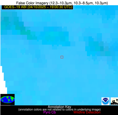
| Latest Satellite Imagery: | |
| View all event imagery » | |
Possible Wildfire
| Basic Information | |
|---|---|
| State/Province(s) | LA |
| Country/Countries | United States |
| County/Locality(s) | Grant Parish, LA |
| NWS WFO | Shreveport LA |
| Identification Method | Enhanced Contextual (Clear) |
| Mean Object Date/Time | 2025-04-10 19:00:32UTC |
| Radiative Center (Lat, Lon): | 31.723612°, -92.565277° |
| Nearby Counties (meeting alert criteria): |
|
| Total Radiative Power Anomaly | n/a |
| Total Radiative Power | 7.28 MW |
| Map: | |
| Additional Information | |
| Alert Status | New Feature |
| Type of Event | Nominal Risk, Known Incident: RX CAT C-13-14 (HIGH, tdiff=0.21304 days, Point) |
| Event Priority Ranking | 4 |
| Maximum Observed BT (3.9 um) | 302.65 K |
| Observed - Background BT (3.9 um) | 2.21 K |
| BT Anomaly (3.9 um) | 2.78 K |
| Maximum Observed - Clear RTM BT (3.9 um) | 6.46 K |
| Maximum Observed BTD (3.9-10/11/12 um) | 8.85 K |
| Observed - Background BTD (3.9-10/11/12 um) | 1.87 K |
| BTD Anomaly (3.9-10/11/12 um) | 3.34 K |
| Similar Pixel Count | 25 |
| BT Time Tendency (3.9 um) | 0.60 K |
| Image Interval | 1.00 minutes |
| Fraction of Surrounding LWIR Pixels that are Colder | 0.67 |
| Fraction of Surrounding Red Channel Pixels that are Brighter | 1.00 |
| Maximum Radiative Power | 7.28 MW |
| Maximum Radiative Power Uncertainty | 0.00 MW |
| Total Radiative Power Uncertainty | 0.00 MW |
| Mean Viewing Angle | 41.70° |
| Mean Solar Zenith Angle | 26.70° |
| Mean Glint Angle | 59.20° |
| Water Fraction | 0.00 |
| Total Pixel Area | 5.40 km2 |
| Latest Satellite Imagery: | |
| View all event imagery » | |


