Wildfire Alert Report
| Date: | 2025-04-08 |
|---|---|
| Time: | 22:36:17 |
| Production Date and Time: | 2025-04-08 22:41:18 UTC |
| Primary Instrument: | GOES-19 ABI |
| Wmo Spacecraft Id: | 666 |
| Location/orbit: | GEO |
| L1 File: | OR_ABI-L1b-RadC-M6C14_G19_s20250982236175_e20250982238548_c20250982239028.nc |
| L1 File(s) - Temporal | OR_ABI-L1b-RadC-M6C14_G19_s20250982231175_e20250982233548_c20250982234041.nc |
| Number Of Thermal Anomaly Alerts: | 9 |
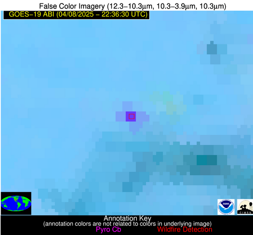
Possible Wildfire
| Basic Information | |
|---|---|
| State/Province(s) | MN |
| Country/Countries | United States |
| County/Locality(s) | Goodhue County, MN |
| NWS WFO | Twin Cities/Chanhassen MN |
| Identification Method | Enhanced Contextual (Clear) |
| Mean Object Date/Time | 2025-04-08 22:36:21UTC |
| Radiative Center (Lat, Lon): | 44.441944°, -92.740555° |
| Nearby Counties (meeting alert criteria): |
|
| Total Radiative Power Anomaly | n/a |
| Total Radiative Power | 50.13 MW |
| Map: | |
| Additional Information | |
| Alert Status | New Feature |
| Type of Event | Nominal Risk |
| Event Priority Ranking | 4 |
| Maximum Observed BT (3.9 um) | 295.62 K |
| Observed - Background BT (3.9 um) | 10.69 K |
| BT Anomaly (3.9 um) | 9.71 K |
| Maximum Observed - Clear RTM BT (3.9 um) | 19.67 K |
| Maximum Observed BTD (3.9-10/11/12 um) | 16.73 K |
| Observed - Background BTD (3.9-10/11/12 um) | 11.04 K |
| BTD Anomaly (3.9-10/11/12 um) | 23.89 K |
| Similar Pixel Count | 3 |
| BT Time Tendency (3.9 um) | 9.00 K |
| Image Interval | 5.00 minutes |
| Fraction of Surrounding LWIR Pixels that are Colder | 0.38 |
| Fraction of Surrounding Red Channel Pixels that are Brighter | 1.00 |
| Maximum Radiative Power | 29.60 MW |
| Maximum Radiative Power Uncertainty | 0.00 MW |
| Total Radiative Power Uncertainty | 0.00 MW |
| Mean Viewing Angle | 54.40° |
| Mean Solar Zenith Angle | 68.10° |
| Mean Glint Angle | 68.10° |
| Water Fraction | 0.00 |
| Total Pixel Area | 13.80 km2 |
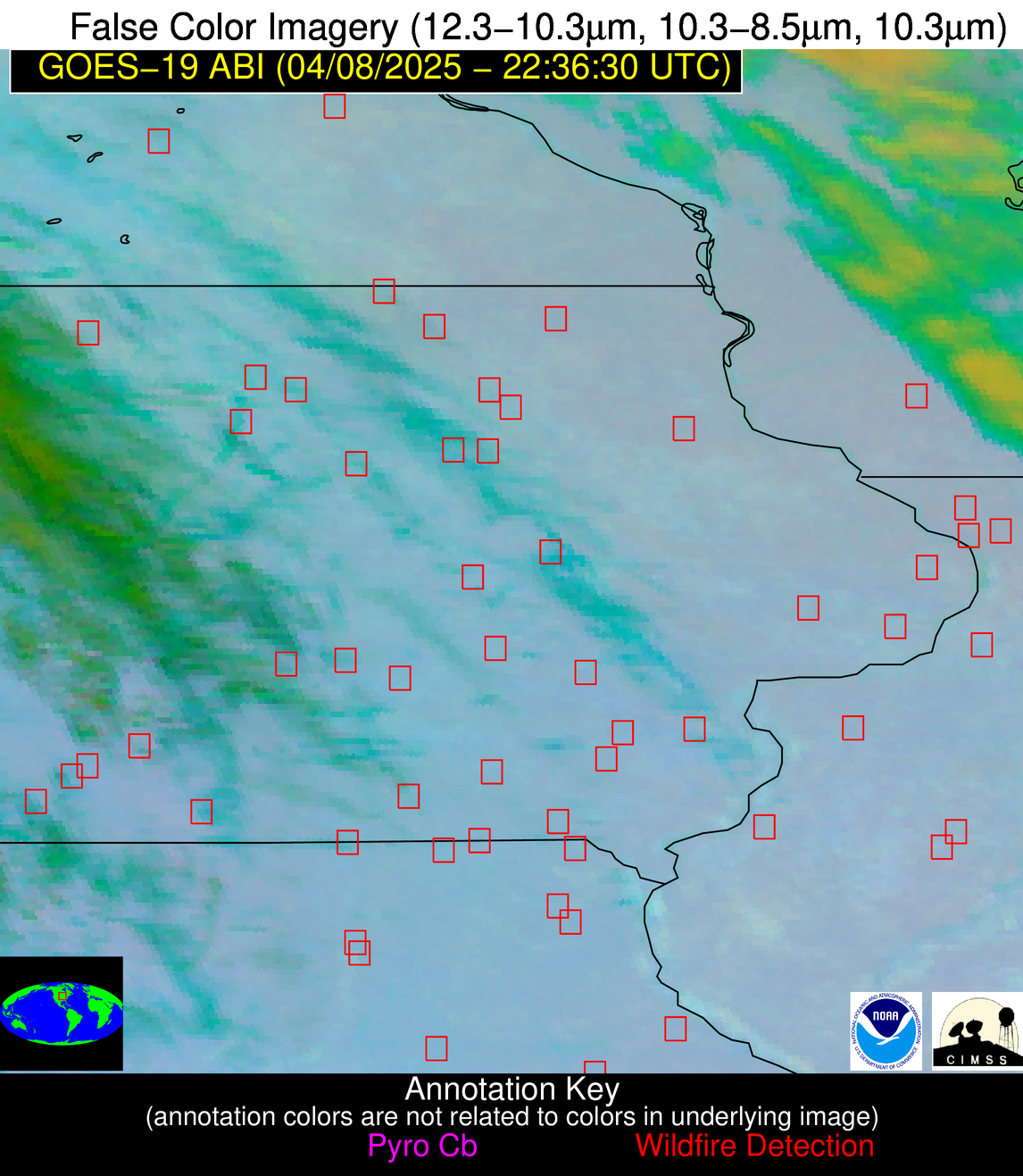
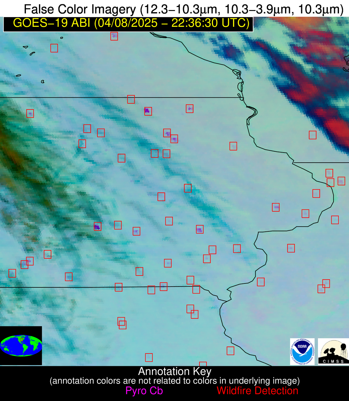
| Latest Satellite Imagery: | |
| View all event imagery » | |
Possible Wildfire
| Basic Information | |
|---|---|
| State/Province(s) | IA |
| Country/Countries | United States |
| County/Locality(s) | Hancock County, IA |
| NWS WFO | Des Moines IA |
| Identification Method | Enhanced Contextual (Cloud) |
| Mean Object Date/Time | 2025-04-08 22:36:21UTC |
| Radiative Center (Lat, Lon): | 43.254444°, -93.726944° |
| Nearby Counties (meeting alert criteria): |
|
| Total Radiative Power Anomaly | n/a |
| Total Radiative Power | 33.66 MW |
| Map: | |
| Additional Information | |
| Alert Status | New Feature |
| Type of Event | Nominal Risk |
| Event Priority Ranking | 4 |
| Maximum Observed BT (3.9 um) | 296.14 K |
| Observed - Background BT (3.9 um) | 12.16 K |
| BT Anomaly (3.9 um) | 10.24 K |
| Maximum Observed - Clear RTM BT (3.9 um) | 17.51 K |
| Maximum Observed BTD (3.9-10/11/12 um) | 17.95 K |
| Observed - Background BTD (3.9-10/11/12 um) | 12.07 K |
| BTD Anomaly (3.9-10/11/12 um) | 10.21 K |
| Similar Pixel Count | 0 |
| BT Time Tendency (3.9 um) | 11.60 K |
| Image Interval | 5.00 minutes |
| Fraction of Surrounding LWIR Pixels that are Colder | 0.71 |
| Fraction of Surrounding Red Channel Pixels that are Brighter | 1.00 |
| Maximum Radiative Power | 33.66 MW |
| Maximum Radiative Power Uncertainty | 0.00 MW |
| Total Radiative Power Uncertainty | 0.00 MW |
| Mean Viewing Angle | 53.60° |
| Mean Solar Zenith Angle | 67.10° |
| Mean Glint Angle | 66.30° |
| Water Fraction | 0.00 |
| Total Pixel Area | 6.70 km2 |
| Latest Satellite Imagery: | |
| View all event imagery » | |
Possible Wildfire
| Basic Information | |
|---|---|
| State/Province(s) | IA |
| Country/Countries | United States |
| County/Locality(s) | Clinton County, IA |
| NWS WFO | Quad Cities IL |
| Identification Method | Enhanced Contextual (Clear) |
| Mean Object Date/Time | 2025-04-08 22:36:51UTC |
| Radiative Center (Lat, Lon): | 42.025833°, -90.369720° |
| Nearby Counties (meeting alert criteria): |
|
| Total Radiative Power Anomaly | n/a |
| Total Radiative Power | 5.33 MW |
| Map: | |
| Additional Information | |
| Alert Status | New Feature |
| Type of Event | Nominal Risk |
| Event Priority Ranking | 4 |
| Maximum Observed BT (3.9 um) | 287.36 K |
| Observed - Background BT (3.9 um) | 3.02 K |
| BT Anomaly (3.9 um) | 2.38 K |
| Maximum Observed - Clear RTM BT (3.9 um) | 11.68 K |
| Maximum Observed BTD (3.9-10/11/12 um) | 7.55 K |
| Observed - Background BTD (3.9-10/11/12 um) | 2.71 K |
| BTD Anomaly (3.9-10/11/12 um) | 4.40 K |
| Similar Pixel Count | 22 |
| BT Time Tendency (3.9 um) | 1.90 K |
| Image Interval | 5.00 minutes |
| Fraction of Surrounding LWIR Pixels that are Colder | 0.70 |
| Fraction of Surrounding Red Channel Pixels that are Brighter | 0.96 |
| Maximum Radiative Power | 5.33 MW |
| Maximum Radiative Power Uncertainty | 0.00 MW |
| Total Radiative Power Uncertainty | 0.00 MW |
| Mean Viewing Angle | 51.20° |
| Mean Solar Zenith Angle | 69.30° |
| Mean Glint Angle | 67.90° |
| Water Fraction | 0.00 |
| Total Pixel Area | 6.40 km2 |
| Latest Satellite Imagery: | |
| View all event imagery » | |
Possible Wildfire
| Basic Information | |
|---|---|
| State/Province(s) | IA |
| Country/Countries | United States |
| County/Locality(s) | Clinton County, IA |
| NWS WFO | Quad Cities IL |
| Identification Method | Enhanced Contextual (Clear) |
| Mean Object Date/Time | 2025-04-08 22:36:51UTC |
| Radiative Center (Lat, Lon): | 41.813332°, -90.844719° |
| Nearby Counties (meeting alert criteria): |
|
| Total Radiative Power Anomaly | n/a |
| Total Radiative Power | 49.17 MW |
| Map: | |
| Additional Information | |
| Alert Status | New Feature |
| Type of Event | Nominal Risk |
| Event Priority Ranking | 4 |
| Maximum Observed BT (3.9 um) | 295.67 K |
| Observed - Background BT (3.9 um) | 9.09 K |
| BT Anomaly (3.9 um) | 12.16 K |
| Maximum Observed - Clear RTM BT (3.9 um) | 19.31 K |
| Maximum Observed BTD (3.9-10/11/12 um) | 15.81 K |
| Observed - Background BTD (3.9-10/11/12 um) | 10.04 K |
| BTD Anomaly (3.9-10/11/12 um) | 31.68 K |
| Similar Pixel Count | 2 |
| BT Time Tendency (3.9 um) | 5.90 K |
| Image Interval | 5.00 minutes |
| Fraction of Surrounding LWIR Pixels that are Colder | 0.48 |
| Fraction of Surrounding Red Channel Pixels that are Brighter | 1.00 |
| Maximum Radiative Power | 26.19 MW |
| Maximum Radiative Power Uncertainty | 0.00 MW |
| Total Radiative Power Uncertainty | 0.00 MW |
| Mean Viewing Angle | 51.10° |
| Mean Solar Zenith Angle | 68.90° |
| Mean Glint Angle | 67.30° |
| Water Fraction | 0.00 |
| Total Pixel Area | 12.70 km2 |
| Latest Satellite Imagery: | |
| View all event imagery » | |
Possible Wildfire
| Basic Information | |
|---|---|
| State/Province(s) | IL |
| Country/Countries | United States |
| County/Locality(s) | Fulton County, IL |
| NWS WFO | Lincoln IL |
| Identification Method | Enhanced Contextual (Clear) |
| Mean Object Date/Time | 2025-04-08 22:36:51UTC |
| Radiative Center (Lat, Lon): | 40.560276°, -90.309998° |
| Nearby Counties (meeting alert criteria): |
|
| Total Radiative Power Anomaly | n/a |
| Total Radiative Power | 17.38 MW |
| Map: | |
| Additional Information | |
| Alert Status | New Feature |
| Type of Event | Nominal Risk |
| Event Priority Ranking | 4 |
| Maximum Observed BT (3.9 um) | 290.63 K |
| Observed - Background BT (3.9 um) | 4.54 K |
| BT Anomaly (3.9 um) | 3.83 K |
| Maximum Observed - Clear RTM BT (3.9 um) | 12.55 K |
| Maximum Observed BTD (3.9-10/11/12 um) | 7.97 K |
| Observed - Background BTD (3.9-10/11/12 um) | 3.43 K |
| BTD Anomaly (3.9-10/11/12 um) | 5.28 K |
| Similar Pixel Count | 4 |
| BT Time Tendency (3.9 um) | 1.80 K |
| Image Interval | 5.00 minutes |
| Fraction of Surrounding LWIR Pixels that are Colder | 0.92 |
| Fraction of Surrounding Red Channel Pixels that are Brighter | 1.00 |
| Maximum Radiative Power | 10.44 MW |
| Maximum Radiative Power Uncertainty | 0.00 MW |
| Total Radiative Power Uncertainty | 0.00 MW |
| Mean Viewing Angle | 49.70° |
| Mean Solar Zenith Angle | 69.10° |
| Mean Glint Angle | 66.70° |
| Water Fraction | 0.00 |
| Total Pixel Area | 18.50 km2 |
| Latest Satellite Imagery: | |
| View all event imagery » | |
Possible Wildfire
| Basic Information | |
|---|---|
| State/Province(s) | MO |
| Country/Countries | United States |
| County/Locality(s) | Ralls County, MO |
| NWS WFO | St Louis MO |
| Identification Method | Enhanced Contextual (Clear) |
| Mean Object Date/Time | 2025-04-08 22:36:51UTC |
| Radiative Center (Lat, Lon): | 39.608334°, -91.375832° |
| Nearby Counties (meeting alert criteria): |
|
| Total Radiative Power Anomaly | n/a |
| Total Radiative Power | 4.03 MW |
| Map: | |
| Additional Information | |
| Alert Status | New Feature |
| Type of Event | Nominal Risk |
| Event Priority Ranking | 4 |
| Maximum Observed BT (3.9 um) | 287.55 K |
| Observed - Background BT (3.9 um) | 1.73 K |
| BT Anomaly (3.9 um) | 1.66 K |
| Maximum Observed - Clear RTM BT (3.9 um) | 9.06 K |
| Maximum Observed BTD (3.9-10/11/12 um) | 5.72 K |
| Observed - Background BTD (3.9-10/11/12 um) | 1.84 K |
| BTD Anomaly (3.9-10/11/12 um) | 3.11 K |
| Similar Pixel Count | 8 |
| BT Time Tendency (3.9 um) | 1.20 K |
| Image Interval | 5.00 minutes |
| Fraction of Surrounding LWIR Pixels that are Colder | 0.49 |
| Fraction of Surrounding Red Channel Pixels that are Brighter | 0.96 |
| Maximum Radiative Power | 4.03 MW |
| Maximum Radiative Power Uncertainty | 0.00 MW |
| Total Radiative Power Uncertainty | 0.00 MW |
| Mean Viewing Angle | 49.10° |
| Mean Solar Zenith Angle | 68.20° |
| Mean Glint Angle | 64.90° |
| Water Fraction | 0.00 |
| Total Pixel Area | 6.10 km2 |
| Latest Satellite Imagery: | |
| View all event imagery » | |
Possible Wildfire
| Basic Information | |
|---|---|
| State/Province(s) | KY |
| Country/Countries | United States |
| County/Locality(s) | Garrard County, KY |
| NWS WFO | Louisville KY |
| Identification Method | Enhanced Contextual (Clear) |
| Mean Object Date/Time | 2025-04-08 22:36:51UTC |
| Radiative Center (Lat, Lon): | 37.569721°, -84.412498° |
| Nearby Counties (meeting alert criteria): |
|
| Total Radiative Power Anomaly | n/a |
| Total Radiative Power | 2.77 MW |
| Map: | |
| Additional Information | |
| Alert Status | New Feature |
| Type of Event | Nominal Risk |
| Event Priority Ranking | 4 |
| Maximum Observed BT (3.9 um) | 282.80 K |
| Observed - Background BT (3.9 um) | 2.24 K |
| BT Anomaly (3.9 um) | 3.45 K |
| Maximum Observed - Clear RTM BT (3.9 um) | 9.18 K |
| Maximum Observed BTD (3.9-10/11/12 um) | 3.66 K |
| Observed - Background BTD (3.9-10/11/12 um) | 1.88 K |
| BTD Anomaly (3.9-10/11/12 um) | 7.92 K |
| Similar Pixel Count | 2 |
| BT Time Tendency (3.9 um) | 0.90 K |
| Image Interval | 5.00 minutes |
| Fraction of Surrounding LWIR Pixels that are Colder | 0.81 |
| Fraction of Surrounding Red Channel Pixels that are Brighter | 1.00 |
| Maximum Radiative Power | 2.77 MW |
| Maximum Radiative Power Uncertainty | 0.00 MW |
| Total Radiative Power Uncertainty | 0.00 MW |
| Mean Viewing Angle | 44.80° |
| Mean Solar Zenith Angle | 73.30° |
| Mean Glint Angle | 70.80° |
| Water Fraction | 0.00 |
| Total Pixel Area | 5.60 km2 |
| Latest Satellite Imagery: | |
| View all event imagery » | |
Possible Wildfire
| Basic Information | |
|---|---|
| State/Province(s) | OK |
| Country/Countries | United States |
| County/Locality(s) | Dewey County, OK |
| NWS WFO | Norman OK |
| Identification Method | Enhanced Contextual (Cloud) |
| Mean Object Date/Time | 2025-04-08 22:37:20UTC |
| Radiative Center (Lat, Lon): | 36.094166°, -98.702225° |
| Nearby Counties (meeting alert criteria): |
|
| Total Radiative Power Anomaly | n/a |
| Total Radiative Power | 77.18 MW |
| Map: | |
| Additional Information | |
| Alert Status | New Feature |
| Type of Event | Nominal Risk |
| Event Priority Ranking | 4 |
| Maximum Observed BT (3.9 um) | 314.31 K |
| Observed - Background BT (3.9 um) | 19.25 K |
| BT Anomaly (3.9 um) | 23.39 K |
| Maximum Observed - Clear RTM BT (3.9 um) | 26.54 K |
| Maximum Observed BTD (3.9-10/11/12 um) | 24.49 K |
| Observed - Background BTD (3.9-10/11/12 um) | 19.77 K |
| BTD Anomaly (3.9-10/11/12 um) | 37.62 K |
| Similar Pixel Count | 0 |
| BT Time Tendency (3.9 um) | 14.00 K |
| Image Interval | 5.00 minutes |
| Fraction of Surrounding LWIR Pixels that are Colder | 0.50 |
| Fraction of Surrounding Red Channel Pixels that are Brighter | 1.00 |
| Maximum Radiative Power | 77.18 MW |
| Maximum Radiative Power Uncertainty | 0.00 MW |
| Total Radiative Power Uncertainty | 0.00 MW |
| Mean Viewing Angle | 49.00° |
| Mean Solar Zenith Angle | 61.80° |
| Mean Glint Angle | 54.90° |
| Water Fraction | 0.00 |
| Total Pixel Area | 6.10 km2 |
| Latest Satellite Imagery: | |
| View all event imagery » | |
Possible Wildfire
| Basic Information | |
|---|---|
| State/Province(s) | TX |
| Country/Countries | United States |
| County/Locality(s) | Jackson County, TX |
| NWS WFO | Houston/Galveston TX |
| Identification Method | Enhanced Contextual (Clear) |
| Mean Object Date/Time | 2025-04-08 22:37:50UTC |
| Radiative Center (Lat, Lon): | 29.093056°, -96.490837° |
| Nearby Counties (meeting alert criteria): |
|
| Total Radiative Power Anomaly | n/a |
| Total Radiative Power | 6.48 MW |
| Map: | |
| Additional Information | |
| Alert Status | New Feature |
| Type of Event | Nominal Risk |
| Event Priority Ranking | 4 |
| Maximum Observed BT (3.9 um) | 301.00 K |
| Observed - Background BT (3.9 um) | 2.03 K |
| BT Anomaly (3.9 um) | 1.37 K |
| Maximum Observed - Clear RTM BT (3.9 um) | 9.64 K |
| Maximum Observed BTD (3.9-10/11/12 um) | 6.10 K |
| Observed - Background BTD (3.9-10/11/12 um) | 2.31 K |
| BTD Anomaly (3.9-10/11/12 um) | 5.06 K |
| Similar Pixel Count | 7 |
| BT Time Tendency (3.9 um) | 1.80 K |
| Image Interval | 5.00 minutes |
| Fraction of Surrounding LWIR Pixels that are Colder | 0.43 |
| Fraction of Surrounding Red Channel Pixels that are Brighter | 0.99 |
| Maximum Radiative Power | 6.48 MW |
| Maximum Radiative Power Uncertainty | 0.00 MW |
| Total Radiative Power Uncertainty | 0.00 MW |
| Mean Viewing Angle | 41.40° |
| Mean Solar Zenith Angle | 62.40° |
| Mean Glint Angle | 49.60° |
| Water Fraction | 0.00 |
| Total Pixel Area | 5.30 km2 |
| Latest Satellite Imagery: | |
| View all event imagery » | |
