Wildfire Alert Report
| Date: | 2025-04-06 |
|---|---|
| Time: | 20:26:17 |
| Production Date and Time: | 2025-04-06 20:31:25 UTC |
| Primary Instrument: | GOES-16 ABI |
| Wmo Spacecraft Id: | 152 |
| Location/orbit: | GEO |
| L1 File: | OR_ABI-L1b-RadC-M6C14_G16_s20250962026174_e20250962028547_c20250962029034.nc |
| L1 File(s) - Temporal | OR_ABI-L1b-RadC-M6C14_G16_s20250962021174_e20250962023547_c20250962024044.nc |
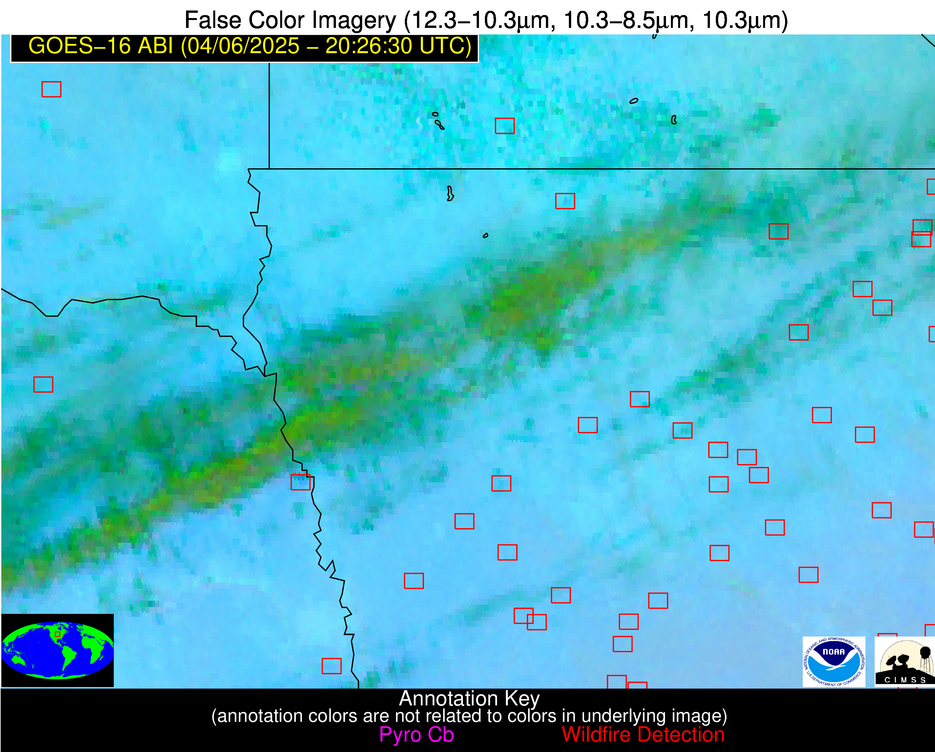
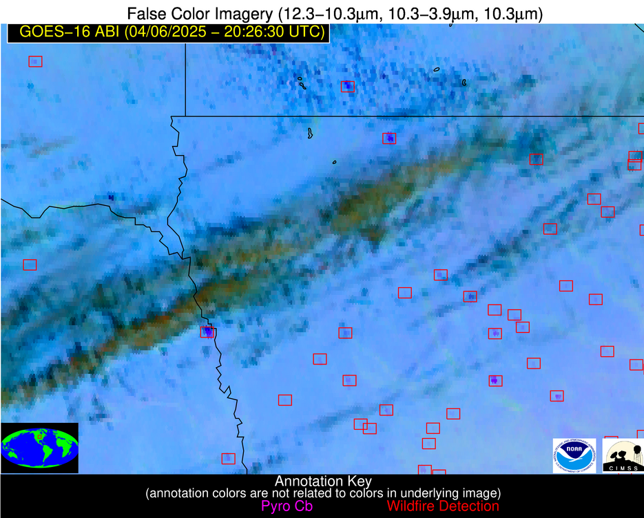
| Number Of Thermal Anomaly Alerts: | 12 |
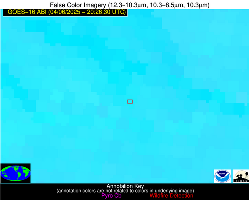
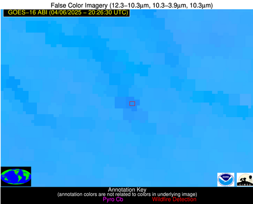
Possible Wildfire
| Basic Information | |
|---|---|
| State/Province(s) | MT |
| Country/Countries | United States |
| County/Locality(s) | Roosevelt County, MT |
| NWS WFO | Glasgow MT |
| Identification Method | Enhanced Contextual (Clear) |
| Mean Object Date/Time | 2025-04-06 20:26:20UTC |
| Radiative Center (Lat, Lon): | 48.116943°, -105.162498° |
| Nearby Counties (meeting alert criteria): |
|
| Total Radiative Power Anomaly | n/a |
| Total Radiative Power | 24.30 MW |
| Map: | |
| Additional Information | |
| Alert Status | New Feature |
| Type of Event | Nominal Risk |
| Event Priority Ranking | 4 |
| Maximum Observed BT (3.9 um) | 307.14 K |
| Observed - Background BT (3.9 um) | 3.57 K |
| BT Anomaly (3.9 um) | 5.14 K |
| Maximum Observed - Clear RTM BT (3.9 um) | 20.50 K |
| Maximum Observed BTD (3.9-10/11/12 um) | 14.50 K |
| Observed - Background BTD (3.9-10/11/12 um) | 4.55 K |
| BTD Anomaly (3.9-10/11/12 um) | 5.28 K |
| Similar Pixel Count | 23 |
| BT Time Tendency (3.9 um) | 2.40 K |
| Image Interval | 5.00 minutes |
| Fraction of Surrounding LWIR Pixels that are Colder | 0.20 |
| Fraction of Surrounding Red Channel Pixels that are Brighter | 1.00 |
| Maximum Radiative Power | 24.30 MW |
| Maximum Radiative Power Uncertainty | 0.00 MW |
| Total Radiative Power Uncertainty | 0.00 MW |
| Mean Viewing Angle | 62.60° |
| Mean Solar Zenith Angle | 45.60° |
| Mean Glint Angle | 85.80° |
| Water Fraction | 0.00 |
| Total Pixel Area | 8.70 km2 |
| Latest Satellite Imagery: | |
| View all event imagery » | |
Possible Wildfire
| Basic Information | |
|---|---|
| State/Province(s) | SD |
| Country/Countries | United States |
| County/Locality(s) | Sanborn County, SD |
| NWS WFO | Sioux Falls SD |
| Identification Method | Enhanced Contextual (Cloud) |
| Mean Object Date/Time | 2025-04-06 20:26:20UTC |
| Radiative Center (Lat, Lon): | 43.896389°, -97.994446° |
| Nearby Counties (meeting alert criteria): |
|
| Total Radiative Power Anomaly | n/a |
| Total Radiative Power | 25.36 MW |
| Map: | |
| Additional Information | |
| Alert Status | New Feature |
| Type of Event | Nominal Risk |
| Event Priority Ranking | 4 |
| Maximum Observed BT (3.9 um) | 304.90 K |
| Observed - Background BT (3.9 um) | 6.51 K |
| BT Anomaly (3.9 um) | 7.82 K |
| Maximum Observed - Clear RTM BT (3.9 um) | 21.48 K |
| Maximum Observed BTD (3.9-10/11/12 um) | 15.76 K |
| Observed - Background BTD (3.9-10/11/12 um) | 6.28 K |
| BTD Anomaly (3.9-10/11/12 um) | 9.87 K |
| Similar Pixel Count | 0 |
| BT Time Tendency (3.9 um) | 5.50 K |
| Image Interval | 5.00 minutes |
| Fraction of Surrounding LWIR Pixels that are Colder | 0.68 |
| Fraction of Surrounding Red Channel Pixels that are Brighter | 1.00 |
| Maximum Radiative Power | 25.36 MW |
| Maximum Radiative Power Uncertainty | 0.00 MW |
| Total Radiative Power Uncertainty | 0.00 MW |
| Mean Viewing Angle | 55.70° |
| Mean Solar Zenith Angle | 45.10° |
| Mean Glint Angle | 77.40° |
| Water Fraction | 0.00 |
| Total Pixel Area | 7.10 km2 |
| Latest Satellite Imagery: | |
| View all event imagery » | |
Possible Wildfire
| Basic Information | |
|---|---|
| State/Province(s) | MN |
| Country/Countries | United States |
| County/Locality(s) | Martin County, MN |
| NWS WFO | Twin Cities/Chanhassen MN |
| Identification Method | Enhanced Contextual (Cloud) |
| Mean Object Date/Time | 2025-04-06 20:26:20UTC |
| Radiative Center (Lat, Lon): | 43.714443°, -94.778893° |
| Nearby Counties (meeting alert criteria): |
|
| Total Radiative Power Anomaly | n/a |
| Total Radiative Power | 204.24 MW |
| Map: | |
| Additional Information | |
| Alert Status | New Feature |
| Type of Event | Nominal Risk |
| Event Priority Ranking | 4 |
| Maximum Observed BT (3.9 um) | 321.83 K |
| Observed - Background BT (3.9 um) | 19.86 K |
| BT Anomaly (3.9 um) | 14.33 K |
| Maximum Observed - Clear RTM BT (3.9 um) | 38.43 K |
| Maximum Observed BTD (3.9-10/11/12 um) | 33.93 K |
| Observed - Background BTD (3.9-10/11/12 um) | 20.26 K |
| BTD Anomaly (3.9-10/11/12 um) | 12.26 K |
| Similar Pixel Count | 0 |
| BT Time Tendency (3.9 um) | 19.20 K |
| Image Interval | 5.00 minutes |
| Fraction of Surrounding LWIR Pixels that are Colder | 0.33 |
| Fraction of Surrounding Red Channel Pixels that are Brighter | 0.79 |
| Maximum Radiative Power | 103.49 MW |
| Maximum Radiative Power Uncertainty | 0.00 MW |
| Total Radiative Power Uncertainty | 0.00 MW |
| Mean Viewing Angle | 54.30° |
| Mean Solar Zenith Angle | 46.50° |
| Mean Glint Angle | 77.30° |
| Water Fraction | 0.00 |
| Total Pixel Area | 13.70 km2 |
| Latest Satellite Imagery: | |
| View all event imagery » | |
Possible Wildfire
| Basic Information | |
|---|---|
| State/Province(s) | IA |
| Country/Countries | United States |
| County/Locality(s) | Hamilton County, IA |
| NWS WFO | Des Moines IA |
| Identification Method | Enhanced Contextual (Cloud) |
| Mean Object Date/Time | 2025-04-06 20:26:51UTC |
| Radiative Center (Lat, Lon): | 42.353889°, -93.821114° |
| Nearby Counties (meeting alert criteria): |
|
| Total Radiative Power Anomaly | n/a |
| Total Radiative Power | 25.02 MW |
| Map: | |
| Additional Information | |
| Alert Status | New Feature |
| Type of Event | Nominal Risk |
| Event Priority Ranking | 4 |
| Maximum Observed BT (3.9 um) | 305.82 K |
| Observed - Background BT (3.9 um) | 6.23 K |
| BT Anomaly (3.9 um) | 5.52 K |
| Maximum Observed - Clear RTM BT (3.9 um) | 22.82 K |
| Maximum Observed BTD (3.9-10/11/12 um) | 17.30 K |
| Observed - Background BTD (3.9-10/11/12 um) | 5.98 K |
| BTD Anomaly (3.9-10/11/12 um) | 5.74 K |
| Similar Pixel Count | 0 |
| BT Time Tendency (3.9 um) | 7.50 K |
| Image Interval | 5.00 minutes |
| Fraction of Surrounding LWIR Pixels that are Colder | 0.67 |
| Fraction of Surrounding Red Channel Pixels that are Brighter | 1.00 |
| Maximum Radiative Power | 25.02 MW |
| Maximum Radiative Power Uncertainty | 0.00 MW |
| Total Radiative Power Uncertainty | 0.00 MW |
| Mean Viewing Angle | 52.60° |
| Mean Solar Zenith Angle | 46.10° |
| Mean Glint Angle | 75.10° |
| Water Fraction | 0.00 |
| Total Pixel Area | 6.60 km2 |
| Latest Satellite Imagery: | |
| View all event imagery » | |
Possible Wildfire
| Basic Information | |
|---|---|
| State/Province(s) | IA |
| Country/Countries | United States |
| County/Locality(s) | Story County, IA |
| NWS WFO | Des Moines IA |
| Identification Method | Enhanced Contextual (Clear) |
| Mean Object Date/Time | 2025-04-06 20:26:51UTC |
| Radiative Center (Lat, Lon): | 42.197777°, -93.518059° |
| Nearby Counties (meeting alert criteria): |
|
| Total Radiative Power Anomaly | n/a |
| Total Radiative Power | 45.02 MW |
| Map: | |
| Additional Information | |
| Alert Status | New Feature |
| Type of Event | Nominal Risk |
| Event Priority Ranking | 4 |
| Maximum Observed BT (3.9 um) | 305.40 K |
| Observed - Background BT (3.9 um) | 7.78 K |
| BT Anomaly (3.9 um) | 9.30 K |
| Maximum Observed - Clear RTM BT (3.9 um) | 22.44 K |
| Maximum Observed BTD (3.9-10/11/12 um) | 23.56 K |
| Observed - Background BTD (3.9-10/11/12 um) | 7.95 K |
| BTD Anomaly (3.9-10/11/12 um) | 6.65 K |
| Similar Pixel Count | 4 |
| BT Time Tendency (3.9 um) | 5.00 K |
| Image Interval | 5.00 minutes |
| Fraction of Surrounding LWIR Pixels that are Colder | 0.13 |
| Fraction of Surrounding Red Channel Pixels that are Brighter | 0.96 |
| Maximum Radiative Power | 27.63 MW |
| Maximum Radiative Power Uncertainty | 0.00 MW |
| Total Radiative Power Uncertainty | 0.00 MW |
| Mean Viewing Angle | 52.30° |
| Mean Solar Zenith Angle | 46.20° |
| Mean Glint Angle | 74.80° |
| Water Fraction | 0.00 |
| Total Pixel Area | 13.10 km2 |
| Latest Satellite Imagery: | |
| View all event imagery » | |
Possible Wildfire
| Basic Information | |
|---|---|
| State/Province(s) | IA |
| Country/Countries | United States |
| County/Locality(s) | Adair County, IA |
| NWS WFO | Des Moines IA |
| Identification Method | Enhanced Contextual (Clear) |
| Mean Object Date/Time | 2025-04-06 20:26:50UTC |
| Radiative Center (Lat, Lon): | 41.243610°, -94.551941° |
| Nearby Counties (meeting alert criteria): |
|
| Total Radiative Power Anomaly | n/a |
| Total Radiative Power | 7.55 MW |
| Map: | |
| Additional Information | |
| Alert Status | New Feature |
| Type of Event | Nominal Risk |
| Event Priority Ranking | 4 |
| Maximum Observed BT (3.9 um) | 303.80 K |
| Observed - Background BT (3.9 um) | 3.60 K |
| BT Anomaly (3.9 um) | 3.17 K |
| Maximum Observed - Clear RTM BT (3.9 um) | 20.54 K |
| Maximum Observed BTD (3.9-10/11/12 um) | 12.34 K |
| Observed - Background BTD (3.9-10/11/12 um) | 3.16 K |
| BTD Anomaly (3.9-10/11/12 um) | 4.70 K |
| Similar Pixel Count | 25 |
| BT Time Tendency (3.9 um) | 2.40 K |
| Image Interval | 5.00 minutes |
| Fraction of Surrounding LWIR Pixels that are Colder | 0.74 |
| Fraction of Surrounding Red Channel Pixels that are Brighter | 1.00 |
| Maximum Radiative Power | 7.55 MW |
| Maximum Radiative Power Uncertainty | 0.00 MW |
| Total Radiative Power Uncertainty | 0.00 MW |
| Mean Viewing Angle | 51.80° |
| Mean Solar Zenith Angle | 44.90° |
| Mean Glint Angle | 73.00° |
| Water Fraction | 0.00 |
| Total Pixel Area | 6.50 km2 |
| Latest Satellite Imagery: | |
| View all event imagery » | |
Possible Wildfire
| Basic Information | |
|---|---|
| State/Province(s) | IA |
| Country/Countries | United States |
| County/Locality(s) | Jefferson County, IA |
| NWS WFO | Quad Cities IL |
| Identification Method | Enhanced Contextual (Clear) |
| Mean Object Date/Time | 2025-04-06 20:26:51UTC |
| Radiative Center (Lat, Lon): | 41.148888°, -92.063889° |
| Nearby Counties (meeting alert criteria): |
|
| Total Radiative Power Anomaly | n/a |
| Total Radiative Power | 38.16 MW |
| Map: | |
| Additional Information | |
| Alert Status | New Feature |
| Type of Event | Nominal Risk |
| Event Priority Ranking | 4 |
| Maximum Observed BT (3.9 um) | 304.39 K |
| Observed - Background BT (3.9 um) | 6.97 K |
| BT Anomaly (3.9 um) | 5.11 K |
| Maximum Observed - Clear RTM BT (3.9 um) | 22.11 K |
| Maximum Observed BTD (3.9-10/11/12 um) | 14.51 K |
| Observed - Background BTD (3.9-10/11/12 um) | 6.07 K |
| BTD Anomaly (3.9-10/11/12 um) | 10.32 K |
| Similar Pixel Count | 4 |
| BT Time Tendency (3.9 um) | 4.90 K |
| Image Interval | 5.00 minutes |
| Fraction of Surrounding LWIR Pixels that are Colder | 0.89 |
| Fraction of Surrounding Red Channel Pixels that are Brighter | 1.00 |
| Maximum Radiative Power | 19.77 MW |
| Maximum Radiative Power Uncertainty | 0.00 MW |
| Total Radiative Power Uncertainty | 0.00 MW |
| Mean Viewing Angle | 50.80° |
| Mean Solar Zenith Angle | 46.30° |
| Mean Glint Angle | 73.30° |
| Water Fraction | 0.00 |
| Total Pixel Area | 12.60 km2 |
| Latest Satellite Imagery: | |
| View all event imagery » | |
Possible Wildfire
| Basic Information | |
|---|---|
| State/Province(s) | KS |
| Country/Countries | United States |
| County/Locality(s) | Coffey County, KS |
| NWS WFO | Topeka KS |
| Identification Method | Enhanced Contextual (Cloud) |
| Mean Object Date/Time | 2025-04-06 20:26:50UTC |
| Radiative Center (Lat, Lon): | 38.223888°, -95.898056° |
| Nearby Counties (meeting alert criteria): |
|
| Total Radiative Power Anomaly | n/a |
| Total Radiative Power | 306.83 MW |
| Map: | |
| Additional Information | |
| Alert Status | New Feature |
| Type of Event | Nominal Risk |
| Event Priority Ranking | 4 |
| Maximum Observed BT (3.9 um) | 325.75 K |
| Observed - Background BT (3.9 um) | 29.55 K |
| BT Anomaly (3.9 um) | 22.83 K |
| Maximum Observed - Clear RTM BT (3.9 um) | 43.62 K |
| Maximum Observed BTD (3.9-10/11/12 um) | 36.61 K |
| Observed - Background BTD (3.9-10/11/12 um) | 29.24 K |
| BTD Anomaly (3.9-10/11/12 um) | 37.29 K |
| Similar Pixel Count | 0 |
| BT Time Tendency (3.9 um) | 29.70 K |
| Image Interval | 5.00 minutes |
| Fraction of Surrounding LWIR Pixels that are Colder | 0.67 |
| Fraction of Surrounding Red Channel Pixels that are Brighter | 1.00 |
| Maximum Radiative Power | 189.65 MW |
| Maximum Radiative Power Uncertainty | 0.00 MW |
| Total Radiative Power Uncertainty | 0.00 MW |
| Mean Viewing Angle | 49.40° |
| Mean Solar Zenith Angle | 42.10° |
| Mean Glint Angle | 67.40° |
| Water Fraction | 0.00 |
| Total Pixel Area | 24.60 km2 |
| Latest Satellite Imagery: | |
| View all event imagery » | |
Possible Wildfire
| Basic Information | |
|---|---|
| State/Province(s) | KS |
| Country/Countries | United States |
| County/Locality(s) | Reno County, KS |
| NWS WFO | Wichita KS |
| Identification Method | Enhanced Contextual (Clear) |
| Mean Object Date/Time | 2025-04-06 20:26:50UTC |
| Radiative Center (Lat, Lon): | 37.985554°, -98.363052° |
| Nearby Counties (meeting alert criteria): |
|
| Total Radiative Power Anomaly | n/a |
| Total Radiative Power | 6.30 MW |
| Map: | |
| Additional Information | |
| Alert Status | New Feature |
| Type of Event | Nominal Risk |
| Event Priority Ranking | 4 |
| Maximum Observed BT (3.9 um) | 300.13 K |
| Observed - Background BT (3.9 um) | 2.16 K |
| BT Anomaly (3.9 um) | 1.80 K |
| Maximum Observed - Clear RTM BT (3.9 um) | 15.99 K |
| Maximum Observed BTD (3.9-10/11/12 um) | 8.99 K |
| Observed - Background BTD (3.9-10/11/12 um) | 2.02 K |
| BTD Anomaly (3.9-10/11/12 um) | 3.85 K |
| Similar Pixel Count | 25 |
| BT Time Tendency (3.9 um) | 0.10 K |
| Image Interval | 5.00 minutes |
| Fraction of Surrounding LWIR Pixels that are Colder | 0.55 |
| Fraction of Surrounding Red Channel Pixels that are Brighter | 1.00 |
| Maximum Radiative Power | 6.30 MW |
| Maximum Radiative Power Uncertainty | 0.00 MW |
| Total Radiative Power Uncertainty | 0.00 MW |
| Mean Viewing Angle | 50.40° |
| Mean Solar Zenith Angle | 40.60° |
| Mean Glint Angle | 66.80° |
| Water Fraction | 0.00 |
| Total Pixel Area | 6.30 km2 |
| Latest Satellite Imagery: | |
| View all event imagery » | |
Possible Wildfire
| Basic Information | |
|---|---|
| State/Province(s) | Unknown |
| Country/Countries | Cuba |
| County/Locality(s) | Unknown, Unknown |
| NWS WFO | N/A |
| Identification Method | Enhanced Contextual (Clear) |
| Mean Object Date/Time | 2025-04-06 20:28:22UTC |
| Radiative Center (Lat, Lon): | 22.786667°, -80.736115° |
| Nearby Counties (meeting alert criteria): |
|
| Total Radiative Power Anomaly | n/a |
| Total Radiative Power | 44.66 MW |
| Map: | |
| Additional Information | |
| Alert Status | New Feature |
| Type of Event | Nominal Risk |
| Event Priority Ranking | 4 |
| Maximum Observed BT (3.9 um) | 316.41 K |
| Observed - Background BT (3.9 um) | 11.24 K |
| BT Anomaly (3.9 um) | 5.44 K |
| Maximum Observed - Clear RTM BT (3.9 um) | 11.44 K |
| Maximum Observed BTD (3.9-10/11/12 um) | 23.01 K |
| Observed - Background BTD (3.9-10/11/12 um) | 11.99 K |
| BTD Anomaly (3.9-10/11/12 um) | 5.51 K |
| Similar Pixel Count | 11 |
| BT Time Tendency (3.9 um) | 6.30 K |
| Image Interval | 5.00 minutes |
| Fraction of Surrounding LWIR Pixels that are Colder | 0.44 |
| Fraction of Surrounding Red Channel Pixels that are Brighter | 1.00 |
| Maximum Radiative Power | 44.66 MW |
| Maximum Radiative Power Uncertainty | 0.00 MW |
| Total Radiative Power Uncertainty | 0.00 MW |
| Mean Viewing Angle | 27.50° |
| Mean Solar Zenith Angle | 46.60° |
| Mean Glint Angle | 52.60° |
| Water Fraction | 0.00 |
| Total Pixel Area | 4.50 km2 |
| Latest Satellite Imagery: | |
| View all event imagery » | |
Possible Wildfire
| Basic Information | |
|---|---|
| State/Province(s) | Unknown |
| Country/Countries | Cuba |
| County/Locality(s) | Unknown, Unknown |
| NWS WFO | N/A |
| Identification Method | Enhanced Contextual (Clear) |
| Mean Object Date/Time | 2025-04-06 20:28:22UTC |
| Radiative Center (Lat, Lon): | 22.304445°, -79.024170° |
| Nearby Counties (meeting alert criteria): |
|
| Total Radiative Power Anomaly | n/a |
| Total Radiative Power | 9.38 MW |
| Map: | |
| Additional Information | |
| Alert Status | New Feature |
| Type of Event | Nominal Risk |
| Event Priority Ranking | 4 |
| Maximum Observed BT (3.9 um) | 310.96 K |
| Observed - Background BT (3.9 um) | 3.85 K |
| BT Anomaly (3.9 um) | 2.60 K |
| Maximum Observed - Clear RTM BT (3.9 um) | 6.50 K |
| Maximum Observed BTD (3.9-10/11/12 um) | 12.33 K |
| Observed - Background BTD (3.9-10/11/12 um) | 3.10 K |
| BTD Anomaly (3.9-10/11/12 um) | 3.65 K |
| Similar Pixel Count | 25 |
| BT Time Tendency (3.9 um) | 1.80 K |
| Image Interval | 5.00 minutes |
| Fraction of Surrounding LWIR Pixels that are Colder | 0.85 |
| Fraction of Surrounding Red Channel Pixels that are Brighter | 1.00 |
| Maximum Radiative Power | 9.38 MW |
| Maximum Radiative Power Uncertainty | 0.00 MW |
| Total Radiative Power Uncertainty | 0.00 MW |
| Mean Viewing Angle | 26.50° |
| Mean Solar Zenith Angle | 48.10° |
| Mean Glint Angle | 54.60° |
| Water Fraction | 0.00 |
| Total Pixel Area | 4.50 km2 |
| Latest Satellite Imagery: | |
| View all event imagery » | |
Possible Wildfire
| Basic Information | |
|---|---|
| State/Province(s) | Unknown |
| Country/Countries | Cuba |
| County/Locality(s) | Unknown, Unknown |
| NWS WFO | N/A |
| Identification Method | Enhanced Contextual (Clear) |
| Mean Object Date/Time | 2025-04-06 20:28:22UTC |
| Radiative Center (Lat, Lon): | 21.875000°, -78.910835° |
| Nearby Counties (meeting alert criteria): |
|
| Total Radiative Power Anomaly | n/a |
| Total Radiative Power | 44.58 MW |
| Map: | |
| Additional Information | |
| Alert Status | New Feature |
| Type of Event | Nominal Risk |
| Event Priority Ranking | 4 |
| Maximum Observed BT (3.9 um) | 314.96 K |
| Observed - Background BT (3.9 um) | 6.93 K |
| BT Anomaly (3.9 um) | 4.32 K |
| Maximum Observed - Clear RTM BT (3.9 um) | 10.06 K |
| Maximum Observed BTD (3.9-10/11/12 um) | 18.26 K |
| Observed - Background BTD (3.9-10/11/12 um) | 7.00 K |
| BTD Anomaly (3.9-10/11/12 um) | 3.68 K |
| Similar Pixel Count | 13 |
| BT Time Tendency (3.9 um) | 3.40 K |
| Image Interval | 5.00 minutes |
| Fraction of Surrounding LWIR Pixels that are Colder | 0.63 |
| Fraction of Surrounding Red Channel Pixels that are Brighter | 0.63 |
| Maximum Radiative Power | 24.06 MW |
| Maximum Radiative Power Uncertainty | 0.00 MW |
| Total Radiative Power Uncertainty | 0.00 MW |
| Mean Viewing Angle | 26.00° |
| Mean Solar Zenith Angle | 48.10° |
| Mean Glint Angle | 54.20° |
| Water Fraction | 0.00 |
| Total Pixel Area | 8.90 km2 |
| Latest Satellite Imagery: | |
| View all event imagery » | |
