10 Jan 2026: Notice to users: ongoing data center construction may unexpectedly interrupt NGFS product generation.
Wildfire Alert Report
| Date: | 2025-04-04 |
|---|---|
| Time: | 00:16:17 |
| Production Date and Time: | 2025-04-04 00:21:00 UTC |
| Primary Instrument: | GOES-16 ABI |
| Wmo Spacecraft Id: | 152 |
| Location/orbit: | GEO |
| L1 File: | OR_ABI-L1b-RadC-M6C14_G16_s20250940016172_e20250940018545_c20250940019046.nc |
| L1 File(s) - Temporal | OR_ABI-L1b-RadC-M6C14_G16_s20250940011172_e20250940013545_c20250940014040.nc |
| Number Of Thermal Anomaly Alerts: | 2 |
Possible Wildfire
| Basic Information | |
|---|---|
| State/Province(s) | IA |
| Country/Countries | United States |
| County/Locality(s) | Clayton County, IA |
| NWS WFO | La Crosse WI |
| Identification Method | Enhanced Contextual (Clear) |
| Mean Object Date/Time | 2025-04-04 00:16:51UTC |
| Radiative Center (Lat, Lon): | 42.904999°, -91.526947° |
| Nearby Counties (meeting alert criteria): |
|
| Total Radiative Power Anomaly | n/a |
| Total Radiative Power | 67.67 MW |
| Map: | |
| Additional Information | |
| Alert Status | New Feature |
| Type of Event | Nominal Risk |
| Event Priority Ranking | 4 |
| Maximum Observed BT (3.9 um) | 287.10 K |
| Observed - Background BT (3.9 um) | 13.93 K |
| BT Anomaly (3.9 um) | 18.33 K |
| Maximum Observed - Clear RTM BT (3.9 um) | 10.86 K |
| Maximum Observed BTD (3.9-10/11/12 um) | 15.22 K |
| Observed - Background BTD (3.9-10/11/12 um) | 13.52 K |
| BTD Anomaly (3.9-10/11/12 um) | 16.11 K |
| Similar Pixel Count | 3 |
| BT Time Tendency (3.9 um) | 11.70 K |
| Image Interval | 5.00 minutes |
| Fraction of Surrounding LWIR Pixels that are Colder | 0.85 |
| Fraction of Surrounding Red Channel Pixels that are Brighter | 0.98 |
| Maximum Radiative Power | 28.44 MW |
| Maximum Radiative Power Uncertainty | 0.00 MW |
| Total Radiative Power Uncertainty | 0.00 MW |
| Mean Viewing Angle | 52.40° |
| Mean Solar Zenith Angle | 87.70° |
| Mean Glint Angle | 66.70° |
| Water Fraction | 0.00 |
| Total Pixel Area | 19.70 km2 |
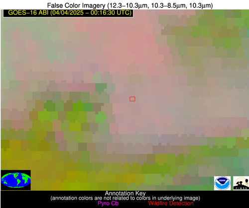
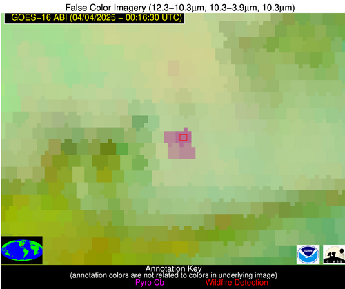
| Latest Satellite Imagery: | |
| View all event imagery » | |
Possible Wildfire
| Basic Information | |
|---|---|
| State/Province(s) | Unknown |
| Country/Countries | Cuba |
| County/Locality(s) | Unknown, Unknown |
| NWS WFO | N/A |
| Identification Method | Enhanced Contextual (Clear) |
| Mean Object Date/Time | 2025-04-04 00:18:21UTC |
| Radiative Center (Lat, Lon): | 22.441111°, -83.561111° |
| Nearby Counties (meeting alert criteria): |
|
| Total Radiative Power Anomaly | n/a |
| Total Radiative Power | 3.99 MW |
| Map: | |
| Additional Information | |
| Alert Status | New Feature |
| Type of Event | Nominal Risk |
| Event Priority Ranking | 4 |
| Maximum Observed BT (3.9 um) | 297.02 K |
| Observed - Background BT (3.9 um) | 2.04 K |
| BT Anomaly (3.9 um) | 4.23 K |
| Maximum Observed - Clear RTM BT (3.9 um) | 2.48 K |
| Maximum Observed BTD (3.9-10/11/12 um) | 3.72 K |
| Observed - Background BTD (3.9-10/11/12 um) | 1.63 K |
| BTD Anomaly (3.9-10/11/12 um) | 4.10 K |
| Similar Pixel Count | 1 |
| BT Time Tendency (3.9 um) | 0.80 K |
| Image Interval | 5.00 minutes |
| Fraction of Surrounding LWIR Pixels that are Colder | 0.89 |
| Fraction of Surrounding Red Channel Pixels that are Brighter | 1.00 |
| Maximum Radiative Power | 3.99 MW |
| Maximum Radiative Power Uncertainty | 0.00 MW |
| Total Radiative Power Uncertainty | 0.00 MW |
| Mean Viewing Angle | 27.90° |
| Mean Solar Zenith Angle | 96.90° |
| Mean Glint Angle | 83.10° |
| Water Fraction | 0.00 |
| Total Pixel Area | 4.50 km2 |
| Latest Satellite Imagery: | |
| View all event imagery » | |


