Wildfire Alert Report
| Date: | 2025-03-26 |
|---|---|
| Time: | 19:31:18 |
| Production Date and Time: | 2025-03-26 19:36:13 UTC |
| Primary Instrument: | GOES-18 ABI |
| Wmo Spacecraft Id: | 665 |
| Location/orbit: | GEO |
| L1 File: | OR_ABI-L1b-RadC-M6C14_G18_s20250851931184_e20250851933557_c20250851934053.nc |
| L1 File(s) - Temporal | OR_ABI-L1b-RadC-M6C14_G18_s20250851926184_e20250851928557_c20250851929011.nc |
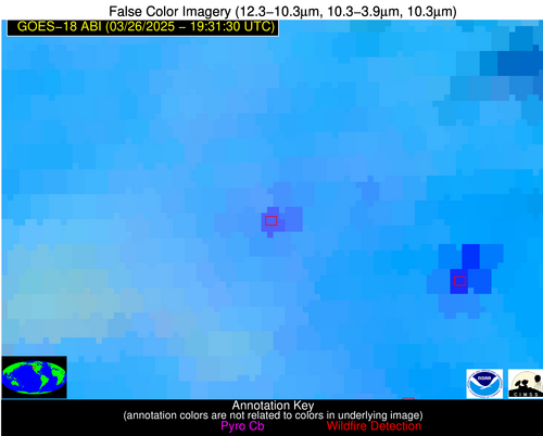
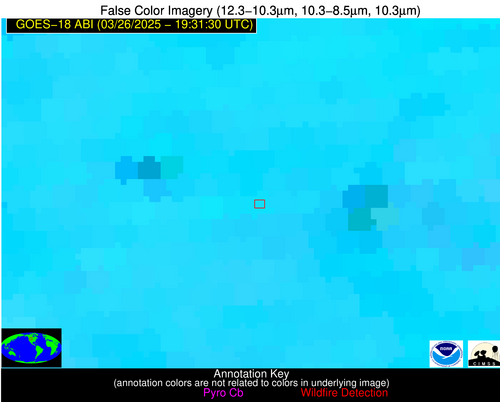
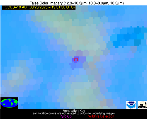
| Number Of Thermal Anomaly Alerts: | 3 |
Possible Wildfire
| Basic Information | |
|---|---|
| State/Province(s) | ID |
| Country/Countries | United States |
| County/Locality(s) | Lewis County, ID |
| NWS WFO | Spokane WA |
| Identification Method | Enhanced Contextual (Cloud) |
| Mean Object Date/Time | 2025-03-26 19:31:24UTC |
| Radiative Center (Lat, Lon): | 46.237778°, -116.434448° |
| Nearby Counties (meeting alert criteria): |
|
| Total Radiative Power Anomaly | n/a |
| Total Radiative Power | 82.34 MW |
| Map: | |
| Additional Information | |
| Alert Status | New Feature |
| Type of Event | Nominal Risk |
| Event Priority Ranking | 4 |
| Maximum Observed BT (3.9 um) | 311.06 K |
| Observed - Background BT (3.9 um) | 10.62 K |
| BT Anomaly (3.9 um) | 4.82 K |
| Maximum Observed - Clear RTM BT (3.9 um) | 23.69 K |
| Maximum Observed BTD (3.9-10/11/12 um) | 19.71 K |
| Observed - Background BTD (3.9-10/11/12 um) | 10.24 K |
| BTD Anomaly (3.9-10/11/12 um) | 7.01 K |
| Similar Pixel Count | 0 |
| BT Time Tendency (3.9 um) | 8.80 K |
| Image Interval | 5.00 minutes |
| Fraction of Surrounding LWIR Pixels that are Colder | 0.64 |
| Fraction of Surrounding Red Channel Pixels that are Brighter | 1.00 |
| Maximum Radiative Power | 82.34 MW |
| Maximum Radiative Power Uncertainty | 0.00 MW |
| Total Radiative Power Uncertainty | 0.00 MW |
| Mean Viewing Angle | 57.20° |
| Mean Solar Zenith Angle | 44.70° |
| Mean Glint Angle | 95.90° |
| Water Fraction | 0.00 |
| Total Pixel Area | 14.80 km2 |
| Latest Satellite Imagery: | |
| View all event imagery » | |
Possible Wildfire
| Basic Information | |
|---|---|
| State/Province(s) | MT |
| Country/Countries | United States |
| County/Locality(s) | Yellowstone County, MT |
| NWS WFO | Billings MT |
| Identification Method | Enhanced Contextual (Cloud) |
| Mean Object Date/Time | 2025-03-26 19:31:25UTC |
| Radiative Center (Lat, Lon): | 45.947224°, -108.174721° |
| Nearby Counties (meeting alert criteria): |
|
| Total Radiative Power Anomaly | n/a |
| Total Radiative Power | 40.50 MW |
| Map: | |
| Additional Information | |
| Alert Status | New Feature |
| Type of Event | Nominal Risk |
| Event Priority Ranking | 4 |
| Maximum Observed BT (3.9 um) | 313.48 K |
| Observed - Background BT (3.9 um) | 6.82 K |
| BT Anomaly (3.9 um) | 8.11 K |
| Maximum Observed - Clear RTM BT (3.9 um) | 21.85 K |
| Maximum Observed BTD (3.9-10/11/12 um) | 17.56 K |
| Observed - Background BTD (3.9-10/11/12 um) | 6.36 K |
| BTD Anomaly (3.9-10/11/12 um) | 8.55 K |
| Similar Pixel Count | 0 |
| BT Time Tendency (3.9 um) | 7.20 K |
| Image Interval | 5.00 minutes |
| Fraction of Surrounding LWIR Pixels that are Colder | 0.75 |
| Fraction of Surrounding Red Channel Pixels that are Brighter | 1.00 |
| Maximum Radiative Power | 40.50 MW |
| Maximum Radiative Power Uncertainty | 0.00 MW |
| Total Radiative Power Uncertainty | 0.00 MW |
| Mean Viewing Angle | 60.40° |
| Mean Solar Zenith Angle | 44.30° |
| Mean Glint Angle | 98.90° |
| Water Fraction | 0.00 |
| Total Pixel Area | 8.10 km2 |
| Latest Satellite Imagery: | |
| View all event imagery » | |
Possible Wildfire
| Basic Information | |
|---|---|
| State/Province(s) | MT |
| Country/Countries | United States |
| County/Locality(s) | Madison County, MT |
| NWS WFO | Great Falls MT |
| Identification Method | Enhanced Contextual (Clear) |
| Mean Object Date/Time | 2025-03-26 19:31:24UTC |
| Radiative Center (Lat, Lon): | 45.360832°, -111.974998° |
| Nearby Counties (meeting alert criteria): |
|
| Total Radiative Power Anomaly | n/a |
| Total Radiative Power | 46.58 MW |
| Map: | |
| Additional Information | |
| Alert Status | New Feature |
| Type of Event | Nominal Risk |
| Event Priority Ranking | 4 |
| Maximum Observed BT (3.9 um) | 308.56 K |
| Observed - Background BT (3.9 um) | 9.53 K |
| BT Anomaly (3.9 um) | 4.03 K |
| Maximum Observed - Clear RTM BT (3.9 um) | 25.82 K |
| Maximum Observed BTD (3.9-10/11/12 um) | 19.11 K |
| Observed - Background BTD (3.9-10/11/12 um) | 9.90 K |
| BTD Anomaly (3.9-10/11/12 um) | 6.36 K |
| Similar Pixel Count | 3 |
| BT Time Tendency (3.9 um) | 8.50 K |
| Image Interval | 5.00 minutes |
| Fraction of Surrounding LWIR Pixels that are Colder | 0.52 |
| Fraction of Surrounding Red Channel Pixels that are Brighter | 0.46 |
| Maximum Radiative Power | 46.58 MW |
| Maximum Radiative Power Uncertainty | 0.00 MW |
| Total Radiative Power Uncertainty | 0.00 MW |
| Mean Viewing Angle | 58.20° |
| Mean Solar Zenith Angle | 43.60° |
| Mean Glint Angle | 95.90° |
| Water Fraction | 0.00 |
| Total Pixel Area | 7.60 km2 |
| Latest Satellite Imagery: | |
| View all event imagery » | |


