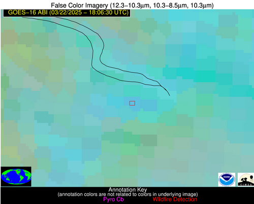
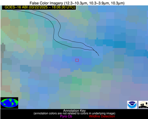
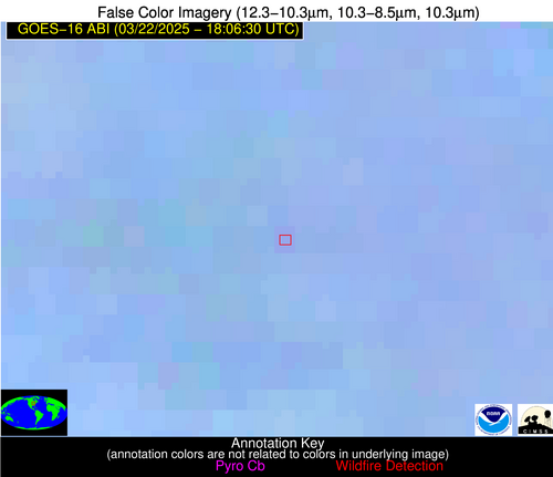
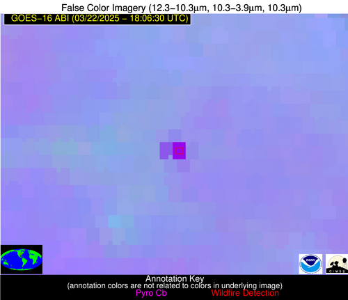
Wildfire Alert Report
| Date: | 2025-03-22 |
|---|---|
| Time: | 18:06:17 |
| Production Date and Time: | 2025-03-22 18:11:24 UTC |
| Primary Instrument: | GOES-16 ABI |
| Wmo Spacecraft Id: | 152 |
| Location/orbit: | GEO |
| L1 File: | OR_ABI-L1b-RadC-M6C14_G16_s20250811806172_e20250811808545_c20250811809037.nc |
| L1 File(s) - Temporal | OR_ABI-L1b-RadC-M6C14_G16_s20250811801172_e20250811803545_c20250811804035.nc |
| Number Of Thermal Anomaly Alerts: | 17 |
Possible Wildfire
| Basic Information | |
|---|---|
| State/Province(s) | WA |
| Country/Countries | United States |
| County/Locality(s) | Chelan County, WA |
| NWS WFO | Spokane WA |
| Identification Method | Enhanced Contextual (Clear) |
| Mean Object Date/Time | 2025-03-22 18:06:19UTC |
| Radiative Center (Lat, Lon): | 47.798054°, -120.082497° |
| Nearby Counties (meeting alert criteria): |
|
| Total Radiative Power Anomaly | n/a |
| Total Radiative Power | 17.31 MW |
| Map: | |
| Additional Information | |
| Alert Status | New Feature |
| Type of Event | Nominal Risk |
| Event Priority Ranking | 4 |
| Maximum Observed BT (3.9 um) | 297.81 K |
| Observed - Background BT (3.9 um) | 4.20 K |
| BT Anomaly (3.9 um) | 4.65 K |
| Maximum Observed - Clear RTM BT (3.9 um) | 19.14 K |
| Maximum Observed BTD (3.9-10/11/12 um) | 13.38 K |
| Observed - Background BTD (3.9-10/11/12 um) | 2.59 K |
| BTD Anomaly (3.9-10/11/12 um) | 5.68 K |
| Similar Pixel Count | 18 |
| BT Time Tendency (3.9 um) | 0.00 K |
| Image Interval | 5.00 minutes |
| Fraction of Surrounding LWIR Pixels that are Colder | 1.00 |
| Fraction of Surrounding Red Channel Pixels that are Brighter | 1.00 |
| Maximum Radiative Power | 17.31 MW |
| Maximum Radiative Power Uncertainty | 0.00 MW |
| Total Radiative Power Uncertainty | 0.00 MW |
| Mean Viewing Angle | 70.10° |
| Mean Solar Zenith Angle | 54.40° |
| Mean Glint Angle | 122.80° |
| Water Fraction | 0.00 |
| Total Pixel Area | 11.80 km2 |
| Latest Satellite Imagery: | |
| View all event imagery » | |
Possible Wildfire
| Basic Information | |
|---|---|
| State/Province(s) | IL |
| Country/Countries | United States |
| County/Locality(s) | Will County, IL |
| NWS WFO | Chicago IL |
| Identification Method | Enhanced Contextual (Cloud) |
| Mean Object Date/Time | 2025-03-22 18:06:51UTC |
| Radiative Center (Lat, Lon): | 41.359722°, -88.108330° |
| Nearby Counties (meeting alert criteria): |
|
| Total Radiative Power Anomaly | n/a |
| Total Radiative Power | 86.00 MW |
| Map: | |
| Additional Information | |
| Alert Status | New Feature |
| Type of Event | Nominal Risk, Known Incident: East Side - East Group RX (HIGH, tdiff=0.13059 days, Point) |
| Event Priority Ranking | 4 |
| Maximum Observed BT (3.9 um) | 318.10 K |
| Observed - Background BT (3.9 um) | 19.63 K |
| BT Anomaly (3.9 um) | 10.45 K |
| Maximum Observed - Clear RTM BT (3.9 um) | 35.28 K |
| Maximum Observed BTD (3.9-10/11/12 um) | 30.08 K |
| Observed - Background BTD (3.9-10/11/12 um) | 19.85 K |
| BTD Anomaly (3.9-10/11/12 um) | 16.71 K |
| Similar Pixel Count | 0 |
| BT Time Tendency (3.9 um) | 17.80 K |
| Image Interval | 5.00 minutes |
| Fraction of Surrounding LWIR Pixels that are Colder | 0.33 |
| Fraction of Surrounding Red Channel Pixels that are Brighter | 0.95 |
| Maximum Radiative Power | 86.00 MW |
| Maximum Radiative Power Uncertainty | 0.00 MW |
| Total Radiative Power Uncertainty | 0.00 MW |
| Mean Viewing Angle | 49.80° |
| Mean Solar Zenith Angle | 41.20° |
| Mean Glint Angle | 89.00° |
| Water Fraction | 0.00 |
| Total Pixel Area | 6.20 km2 |
| Latest Satellite Imagery: | |
| View all event imagery » | |
Possible Wildfire
| Basic Information | |
|---|---|
| State/Province(s) | IA |
| Country/Countries | United States |
| County/Locality(s) | Monroe County, IA |
| NWS WFO | Des Moines IA |
| Identification Method | Enhanced Contextual (Cloud) |
| Mean Object Date/Time | 2025-03-22 18:06:51UTC |
| Radiative Center (Lat, Lon): | 40.975834°, -92.705002° |
| Nearby Counties (meeting alert criteria): |
|
| Total Radiative Power Anomaly | n/a |
| Total Radiative Power | 83.43 MW |
| Map: | |
| Additional Information | |
| Alert Status | New Feature |
| Type of Event | Nominal Risk |
| Event Priority Ranking | 4 |
| Maximum Observed BT (3.9 um) | 298.26 K |
| Observed - Background BT (3.9 um) | 7.65 K |
| BT Anomaly (3.9 um) | 8.67 K |
| Maximum Observed - Clear RTM BT (3.9 um) | 11.46 K |
| Maximum Observed BTD (3.9-10/11/12 um) | 25.18 K |
| Observed - Background BTD (3.9-10/11/12 um) | 7.58 K |
| BTD Anomaly (3.9-10/11/12 um) | 6.05 K |
| Similar Pixel Count | 0 |
| BT Time Tendency (3.9 um) | 10.10 K |
| Image Interval | 5.00 minutes |
| Fraction of Surrounding LWIR Pixels that are Colder | 0.63 |
| Fraction of Surrounding Red Channel Pixels that are Brighter | 1.00 |
| Maximum Radiative Power | 29.87 MW |
| Maximum Radiative Power Uncertainty | 0.00 MW |
| Total Radiative Power Uncertainty | 0.00 MW |
| Mean Viewing Angle | 50.80° |
| Mean Solar Zenith Angle | 40.90° |
| Mean Glint Angle | 89.80° |
| Water Fraction | 0.00 |
| Total Pixel Area | 19.00 km2 |
| Latest Satellite Imagery: | |
| View all event imagery » | |
Possible Wildfire
| Basic Information | |
|---|---|
| State/Province(s) | MO |
| Country/Countries | United States |
| County/Locality(s) | Monroe County, MO |
| NWS WFO | St Louis MO |
| Identification Method | Enhanced Contextual (Clear) |
| Mean Object Date/Time | 2025-03-22 18:06:51UTC |
| Radiative Center (Lat, Lon): | 39.365555°, -92.213890° |
| Nearby Counties (meeting alert criteria): |
|
| Total Radiative Power Anomaly | n/a |
| Total Radiative Power | 20.41 MW |
| Map: | |
| Additional Information | |
| Alert Status | New Feature |
| Type of Event | Nominal Risk |
| Event Priority Ranking | 4 |
| Maximum Observed BT (3.9 um) | 308.06 K |
| Observed - Background BT (3.9 um) | 5.96 K |
| BT Anomaly (3.9 um) | 5.23 K |
| Maximum Observed - Clear RTM BT (3.9 um) | 19.77 K |
| Maximum Observed BTD (3.9-10/11/12 um) | 17.08 K |
| Observed - Background BTD (3.9-10/11/12 um) | 6.25 K |
| BTD Anomaly (3.9-10/11/12 um) | 8.13 K |
| Similar Pixel Count | 9 |
| BT Time Tendency (3.9 um) | 1.30 K |
| Image Interval | 5.00 minutes |
| Fraction of Surrounding LWIR Pixels that are Colder | 0.52 |
| Fraction of Surrounding Red Channel Pixels that are Brighter | 0.88 |
| Maximum Radiative Power | 20.41 MW |
| Maximum Radiative Power Uncertainty | 0.00 MW |
| Total Radiative Power Uncertainty | 0.00 MW |
| Mean Viewing Angle | 49.00° |
| Mean Solar Zenith Angle | 39.30° |
| Mean Glint Angle | 86.40° |
| Water Fraction | 0.00 |
| Total Pixel Area | 6.10 km2 |
| Latest Satellite Imagery: | |
| View all event imagery » | |
Possible Wildfire
| Basic Information | |
|---|---|
| State/Province(s) | MO |
| Country/Countries | United States |
| County/Locality(s) | Boone County, MO |
| NWS WFO | St Louis MO |
| Identification Method | Enhanced Contextual (Clear) |
| Mean Object Date/Time | 2025-03-22 18:06:51UTC |
| Radiative Center (Lat, Lon): | 38.755001°, -92.372498° |
| Nearby Counties (meeting alert criteria): |
|
| Total Radiative Power Anomaly | n/a |
| Total Radiative Power | 30.52 MW |
| Map: | |
| Additional Information | |
| Alert Status | New Feature |
| Type of Event | Nominal Risk |
| Event Priority Ranking | 4 |
| Maximum Observed BT (3.9 um) | 305.57 K |
| Observed - Background BT (3.9 um) | 4.95 K |
| BT Anomaly (3.9 um) | 7.90 K |
| Maximum Observed - Clear RTM BT (3.9 um) | 16.31 K |
| Maximum Observed BTD (3.9-10/11/12 um) | 15.36 K |
| Observed - Background BTD (3.9-10/11/12 um) | 3.82 K |
| BTD Anomaly (3.9-10/11/12 um) | 4.43 K |
| Similar Pixel Count | 18 |
| BT Time Tendency (3.9 um) | 2.40 K |
| Image Interval | 5.00 minutes |
| Fraction of Surrounding LWIR Pixels that are Colder | 0.96 |
| Fraction of Surrounding Red Channel Pixels that are Brighter | 0.99 |
| Maximum Radiative Power | 17.24 MW |
| Maximum Radiative Power Uncertainty | 0.00 MW |
| Total Radiative Power Uncertainty | 0.00 MW |
| Mean Viewing Angle | 48.50° |
| Mean Solar Zenith Angle | 38.70° |
| Mean Glint Angle | 85.20° |
| Water Fraction | 0.00 |
| Total Pixel Area | 12.10 km2 |
| Latest Satellite Imagery: | |
| View all event imagery » | |
Possible Wildfire
| Basic Information | |
|---|---|
| State/Province(s) | MO |
| Country/Countries | United States |
| County/Locality(s) | St. Charles County, MO |
| NWS WFO | St Louis MO |
| Identification Method | Enhanced Contextual (Clear) |
| Mean Object Date/Time | 2025-03-22 18:06:51UTC |
| Radiative Center (Lat, Lon): | 38.626667°, -90.929726° |
| Nearby Counties (meeting alert criteria): |
|
| Total Radiative Power Anomaly | n/a |
| Total Radiative Power | 26.80 MW |
| Map: | |
| Additional Information | |
| Alert Status | New Feature |
| Type of Event | Nominal Risk |
| Event Priority Ranking | 4 |
| Maximum Observed BT (3.9 um) | 307.34 K |
| Observed - Background BT (3.9 um) | 6.85 K |
| BT Anomaly (3.9 um) | 4.66 K |
| Maximum Observed - Clear RTM BT (3.9 um) | 18.70 K |
| Maximum Observed BTD (3.9-10/11/12 um) | 18.56 K |
| Observed - Background BTD (3.9-10/11/12 um) | 6.98 K |
| BTD Anomaly (3.9-10/11/12 um) | 5.14 K |
| Similar Pixel Count | 9 |
| BT Time Tendency (3.9 um) | 3.20 K |
| Image Interval | 5.00 minutes |
| Fraction of Surrounding LWIR Pixels that are Colder | 0.46 |
| Fraction of Surrounding Red Channel Pixels that are Brighter | 1.00 |
| Maximum Radiative Power | 26.80 MW |
| Maximum Radiative Power Uncertainty | 0.00 MW |
| Total Radiative Power Uncertainty | 0.00 MW |
| Mean Viewing Angle | 47.80° |
| Mean Solar Zenith Angle | 38.50° |
| Mean Glint Angle | 84.30° |
| Water Fraction | 0.00 |
| Total Pixel Area | 6.00 km2 |
| Latest Satellite Imagery: | |
| View all event imagery » | |
Possible Wildfire
| Basic Information | |
|---|---|
| State/Province(s) | IL |
| Country/Countries | United States |
| County/Locality(s) | Washington County, IL |
| NWS WFO | St Louis MO |
| Identification Method | Enhanced Contextual (Clear) |
| Mean Object Date/Time | 2025-03-22 18:06:51UTC |
| Radiative Center (Lat, Lon): | 38.367222°, -89.326385° |
| Nearby Counties (meeting alert criteria): |
|
| Total Radiative Power Anomaly | n/a |
| Total Radiative Power | 7.65 MW |
| Map: | |
| Additional Information | |
| Alert Status | New Feature |
| Type of Event | Nominal Risk |
| Event Priority Ranking | 4 |
| Maximum Observed BT (3.9 um) | 305.22 K |
| Observed - Background BT (3.9 um) | 2.62 K |
| BT Anomaly (3.9 um) | 2.02 K |
| Maximum Observed - Clear RTM BT (3.9 um) | 18.92 K |
| Maximum Observed BTD (3.9-10/11/12 um) | 12.80 K |
| Observed - Background BTD (3.9-10/11/12 um) | 2.39 K |
| BTD Anomaly (3.9-10/11/12 um) | 2.92 K |
| Similar Pixel Count | 25 |
| BT Time Tendency (3.9 um) | 2.00 K |
| Image Interval | 5.00 minutes |
| Fraction of Surrounding LWIR Pixels that are Colder | 0.69 |
| Fraction of Surrounding Red Channel Pixels that are Brighter | 1.00 |
| Maximum Radiative Power | 7.65 MW |
| Maximum Radiative Power Uncertainty | 0.00 MW |
| Total Radiative Power Uncertainty | 0.00 MW |
| Mean Viewing Angle | 47.00° |
| Mean Solar Zenith Angle | 38.20° |
| Mean Glint Angle | 83.20° |
| Water Fraction | 0.00 |
| Total Pixel Area | 5.90 km2 |
| Latest Satellite Imagery: | |
| View all event imagery » | |
Possible Wildfire
| Basic Information | |
|---|---|
| State/Province(s) | IL |
| Country/Countries | United States |
| County/Locality(s) | Williamson County, IL |
| NWS WFO | Paducah KY |
| Identification Method | Enhanced Contextual (Clear) |
| Mean Object Date/Time | 2025-03-22 18:06:51UTC |
| Radiative Center (Lat, Lon): | 37.678333°, -89.070000° |
| Nearby Counties (meeting alert criteria): |
|
| Total Radiative Power Anomaly | n/a |
| Total Radiative Power | 14.17 MW |
| Map: | |
| Additional Information | |
| Alert Status | New Feature |
| Type of Event | Nominal Risk |
| Event Priority Ranking | 4 |
| Maximum Observed BT (3.9 um) | 304.79 K |
| Observed - Background BT (3.9 um) | 3.61 K |
| BT Anomaly (3.9 um) | 2.72 K |
| Maximum Observed - Clear RTM BT (3.9 um) | 17.73 K |
| Maximum Observed BTD (3.9-10/11/12 um) | 12.25 K |
| Observed - Background BTD (3.9-10/11/12 um) | 4.06 K |
| BTD Anomaly (3.9-10/11/12 um) | 5.15 K |
| Similar Pixel Count | 6 |
| BT Time Tendency (3.9 um) | 2.00 K |
| Image Interval | 5.00 minutes |
| Fraction of Surrounding LWIR Pixels that are Colder | 0.21 |
| Fraction of Surrounding Red Channel Pixels that are Brighter | 1.00 |
| Maximum Radiative Power | 14.17 MW |
| Maximum Radiative Power Uncertainty | 0.00 MW |
| Total Radiative Power Uncertainty | 0.00 MW |
| Mean Viewing Angle | 46.20° |
| Mean Solar Zenith Angle | 37.50° |
| Mean Glint Angle | 81.70° |
| Water Fraction | 0.00 |
| Total Pixel Area | 5.80 km2 |
| Latest Satellite Imagery: | |
| View all event imagery » | |
Possible Wildfire
| Basic Information | |
|---|---|
| State/Province(s) | AR |
| Country/Countries | United States |
| County/Locality(s) | Lawrence County, AR |
| NWS WFO | Little Rock AR |
| Identification Method | Enhanced Contextual (Clear) |
| Mean Object Date/Time | 2025-03-22 18:07:21UTC |
| Radiative Center (Lat, Lon): | 36.118889°, -90.996109° |
| Nearby Counties (meeting alert criteria): |
|
| Total Radiative Power Anomaly | n/a |
| Total Radiative Power | 20.11 MW |
| Map: | |
| Additional Information | |
| Alert Status | New Feature |
| Type of Event | Elevated SPC Risk |
| Event Priority Ranking | 3 |
| Maximum Observed BT (3.9 um) | 318.59 K |
| Observed - Background BT (3.9 um) | 4.79 K |
| BT Anomaly (3.9 um) | 3.79 K |
| Maximum Observed - Clear RTM BT (3.9 um) | 23.99 K |
| Maximum Observed BTD (3.9-10/11/12 um) | 17.68 K |
| Observed - Background BTD (3.9-10/11/12 um) | 4.21 K |
| BTD Anomaly (3.9-10/11/12 um) | 5.18 K |
| Similar Pixel Count | 21 |
| BT Time Tendency (3.9 um) | 3.60 K |
| Image Interval | 5.00 minutes |
| Fraction of Surrounding LWIR Pixels that are Colder | 0.86 |
| Fraction of Surrounding Red Channel Pixels that are Brighter | 0.70 |
| Maximum Radiative Power | 20.11 MW |
| Maximum Radiative Power Uncertainty | 0.00 MW |
| Total Radiative Power Uncertainty | 0.00 MW |
| Mean Viewing Angle | 45.20° |
| Mean Solar Zenith Angle | 36.00° |
| Mean Glint Angle | 79.30° |
| Water Fraction | 0.00 |
| Total Pixel Area | 5.70 km2 |
| Latest Satellite Imagery: | |
| View all event imagery » | |
Possible Wildfire
| Basic Information | |
|---|---|
| State/Province(s) | AR |
| Country/Countries | United States |
| County/Locality(s) | White County, AR |
| NWS WFO | Little Rock AR |
| Identification Method | Enhanced Contextual (Clear) |
| Mean Object Date/Time | 2025-03-22 18:07:21UTC |
| Radiative Center (Lat, Lon): | 35.186943°, -91.647224° |
| Nearby Counties (meeting alert criteria): |
|
| Total Radiative Power Anomaly | n/a |
| Total Radiative Power | 17.76 MW |
| Map: | |
| Additional Information | |
| Alert Status | New Feature |
| Type of Event | Elevated SPC Risk |
| Event Priority Ranking | 3 |
| Maximum Observed BT (3.9 um) | 310.21 K |
| Observed - Background BT (3.9 um) | 5.97 K |
| BT Anomaly (3.9 um) | 3.71 K |
| Maximum Observed - Clear RTM BT (3.9 um) | 17.42 K |
| Maximum Observed BTD (3.9-10/11/12 um) | 14.94 K |
| Observed - Background BTD (3.9-10/11/12 um) | 5.24 K |
| BTD Anomaly (3.9-10/11/12 um) | 3.58 K |
| Similar Pixel Count | 16 |
| BT Time Tendency (3.9 um) | 0.60 K |
| Image Interval | 5.00 minutes |
| Fraction of Surrounding LWIR Pixels that are Colder | 0.88 |
| Fraction of Surrounding Red Channel Pixels that are Brighter | 0.47 |
| Maximum Radiative Power | 17.76 MW |
| Maximum Radiative Power Uncertainty | 0.00 MW |
| Total Radiative Power Uncertainty | 0.00 MW |
| Mean Viewing Angle | 44.60° |
| Mean Solar Zenith Angle | 35.10° |
| Mean Glint Angle | 77.70° |
| Water Fraction | 0.00 |
| Total Pixel Area | 5.60 km2 |
| Latest Satellite Imagery: | |
| View all event imagery » | |
Possible Wildfire
| Basic Information | |
|---|---|
| State/Province(s) | AL |
| Country/Countries | United States |
| County/Locality(s) | Blount County, AL |
| NWS WFO | Birmingham AL |
| Identification Method | Enhanced Contextual (Clear) |
| Mean Object Date/Time | 2025-03-22 18:07:21UTC |
| Radiative Center (Lat, Lon): | 34.071388°, -86.449165° |
| Nearby Counties (meeting alert criteria): |
|
| Total Radiative Power Anomaly | n/a |
| Total Radiative Power | 6.84 MW |
| Map: | |
| Additional Information | |
| Alert Status | New Feature |
| Type of Event | Elevated SPC Risk |
| Event Priority Ranking | 3 |
| Maximum Observed BT (3.9 um) | 303.77 K |
| Observed - Background BT (3.9 um) | 1.91 K |
| BT Anomaly (3.9 um) | 3.55 K |
| Maximum Observed - Clear RTM BT (3.9 um) | 13.64 K |
| Maximum Observed BTD (3.9-10/11/12 um) | 9.90 K |
| Observed - Background BTD (3.9-10/11/12 um) | 2.19 K |
| BTD Anomaly (3.9-10/11/12 um) | 8.98 K |
| Similar Pixel Count | 25 |
| BT Time Tendency (3.9 um) | 1.20 K |
| Image Interval | 5.00 minutes |
| Fraction of Surrounding LWIR Pixels that are Colder | 0.20 |
| Fraction of Surrounding Red Channel Pixels that are Brighter | 1.00 |
| Maximum Radiative Power | 6.84 MW |
| Maximum Radiative Power Uncertainty | 0.00 MW |
| Total Radiative Power Uncertainty | 0.00 MW |
| Mean Viewing Angle | 41.50° |
| Mean Solar Zenith Angle | 34.00° |
| Mean Glint Angle | 73.50° |
| Water Fraction | 0.00 |
| Total Pixel Area | 5.30 km2 |
| Latest Satellite Imagery: | |
| View all event imagery » | |
Possible Wildfire
| Basic Information | |
|---|---|
| State/Province(s) | AL |
| Country/Countries | United States |
| County/Locality(s) | Talladega County, AL |
| NWS WFO | Birmingham AL |
| Identification Method | Enhanced Contextual (Clear) |
| Mean Object Date/Time | 2025-03-22 18:07:21UTC |
| Radiative Center (Lat, Lon): | 33.554165°, -85.932220° |
| Nearby Counties (meeting alert criteria): |
|
| Total Radiative Power Anomaly | n/a |
| Total Radiative Power | 7.84 MW |
| Map: | |
| Additional Information | |
| Alert Status | New Feature |
| Type of Event | Nominal Risk |
| Event Priority Ranking | 4 |
| Maximum Observed BT (3.9 um) | 305.47 K |
| Observed - Background BT (3.9 um) | 2.07 K |
| BT Anomaly (3.9 um) | 1.70 K |
| Maximum Observed - Clear RTM BT (3.9 um) | 14.64 K |
| Maximum Observed BTD (3.9-10/11/12 um) | 10.16 K |
| Observed - Background BTD (3.9-10/11/12 um) | 2.16 K |
| BTD Anomaly (3.9-10/11/12 um) | 4.19 K |
| Similar Pixel Count | 25 |
| BT Time Tendency (3.9 um) | 1.90 K |
| Image Interval | 5.00 minutes |
| Fraction of Surrounding LWIR Pixels that are Colder | 0.44 |
| Fraction of Surrounding Red Channel Pixels that are Brighter | 1.00 |
| Maximum Radiative Power | 7.84 MW |
| Maximum Radiative Power Uncertainty | 0.00 MW |
| Total Radiative Power Uncertainty | 0.00 MW |
| Mean Viewing Angle | 40.80° |
| Mean Solar Zenith Angle | 33.60° |
| Mean Glint Angle | 72.30° |
| Water Fraction | 0.00 |
| Total Pixel Area | 5.30 km2 |
| Latest Satellite Imagery: | |
| View all event imagery » | |
Possible Wildfire
| Basic Information | |
|---|---|
| State/Province(s) | AL |
| Country/Countries | United States |
| County/Locality(s) | Montgomery County, AL |
| NWS WFO | Birmingham AL |
| Identification Method | Enhanced Contextual (Clear) |
| Mean Object Date/Time | 2025-03-22 18:07:21UTC |
| Radiative Center (Lat, Lon): | 32.112499°, -86.333336° |
| Nearby Counties (meeting alert criteria): |
|
| Total Radiative Power Anomaly | n/a |
| Total Radiative Power | 6.71 MW |
| Map: | |
| Additional Information | |
| Alert Status | New Feature |
| Type of Event | Nominal Risk |
| Event Priority Ranking | 4 |
| Maximum Observed BT (3.9 um) | 304.83 K |
| Observed - Background BT (3.9 um) | 2.13 K |
| BT Anomaly (3.9 um) | 2.39 K |
| Maximum Observed - Clear RTM BT (3.9 um) | 11.41 K |
| Maximum Observed BTD (3.9-10/11/12 um) | 10.61 K |
| Observed - Background BTD (3.9-10/11/12 um) | 2.83 K |
| BTD Anomaly (3.9-10/11/12 um) | 6.07 K |
| Similar Pixel Count | 25 |
| BT Time Tendency (3.9 um) | 1.90 K |
| Image Interval | 5.00 minutes |
| Fraction of Surrounding LWIR Pixels that are Colder | 0.10 |
| Fraction of Surrounding Red Channel Pixels that are Brighter | 1.00 |
| Maximum Radiative Power | 6.71 MW |
| Maximum Radiative Power Uncertainty | 0.00 MW |
| Total Radiative Power Uncertainty | 0.00 MW |
| Mean Viewing Angle | 39.40° |
| Mean Solar Zenith Angle | 32.10° |
| Mean Glint Angle | 69.30° |
| Water Fraction | 0.00 |
| Total Pixel Area | 5.20 km2 |
| Latest Satellite Imagery: | |
| View all event imagery » | |
Possible Wildfire
| Basic Information | |
|---|---|
| State/Province(s) | AL |
| Country/Countries | United States |
| County/Locality(s) | Pike County, AL |
| NWS WFO | Birmingham AL |
| Identification Method | Enhanced Contextual (Clear) |
| Mean Object Date/Time | 2025-03-22 18:07:21UTC |
| Radiative Center (Lat, Lon): | 31.945000°, -86.173889° |
| Nearby Counties (meeting alert criteria): |
|
| Total Radiative Power Anomaly | n/a |
| Total Radiative Power | 4.23 MW |
| Map: | |
| Additional Information | |
| Alert Status | New Feature |
| Type of Event | Nominal Risk |
| Event Priority Ranking | 4 |
| Maximum Observed BT (3.9 um) | 303.99 K |
| Observed - Background BT (3.9 um) | 1.52 K |
| BT Anomaly (3.9 um) | 1.64 K |
| Maximum Observed - Clear RTM BT (3.9 um) | 10.57 K |
| Maximum Observed BTD (3.9-10/11/12 um) | 9.02 K |
| Observed - Background BTD (3.9-10/11/12 um) | 1.45 K |
| BTD Anomaly (3.9-10/11/12 um) | 2.23 K |
| Similar Pixel Count | 25 |
| BT Time Tendency (3.9 um) | 0.70 K |
| Image Interval | 5.00 minutes |
| Fraction of Surrounding LWIR Pixels that are Colder | 0.56 |
| Fraction of Surrounding Red Channel Pixels that are Brighter | 1.00 |
| Maximum Radiative Power | 4.23 MW |
| Maximum Radiative Power Uncertainty | 0.00 MW |
| Total Radiative Power Uncertainty | 0.00 MW |
| Mean Viewing Angle | 39.10° |
| Mean Solar Zenith Angle | 32.00° |
| Mean Glint Angle | 69.00° |
| Water Fraction | 0.00 |
| Total Pixel Area | 5.20 km2 |
| Latest Satellite Imagery: | |
| View all event imagery » | |
Possible Wildfire
| Basic Information | |
|---|---|
| State/Province(s) | GA |
| Country/Countries | United States |
| County/Locality(s) | Cook County, GA |
| NWS WFO | Tallahassee FL |
| Identification Method | Enhanced Contextual (Clear) |
| Mean Object Date/Time | 2025-03-22 18:07:21UTC |
| Radiative Center (Lat, Lon): | 31.250000°, -83.506943° |
| Nearby Counties (meeting alert criteria): |
|
| Total Radiative Power Anomaly | n/a |
| Total Radiative Power | 8.64 MW |
| Map: | |
| Additional Information | |
| Alert Status | New Feature |
| Type of Event | Nominal Risk |
| Event Priority Ranking | 4 |
| Maximum Observed BT (3.9 um) | 305.57 K |
| Observed - Background BT (3.9 um) | 1.77 K |
| BT Anomaly (3.9 um) | 1.51 K |
| Maximum Observed - Clear RTM BT (3.9 um) | 12.38 K |
| Maximum Observed BTD (3.9-10/11/12 um) | 10.39 K |
| Observed - Background BTD (3.9-10/11/12 um) | 2.42 K |
| BTD Anomaly (3.9-10/11/12 um) | 3.52 K |
| Similar Pixel Count | 24 |
| BT Time Tendency (3.9 um) | 2.50 K |
| Image Interval | 5.00 minutes |
| Fraction of Surrounding LWIR Pixels that are Colder | 0.17 |
| Fraction of Surrounding Red Channel Pixels that are Brighter | 1.00 |
| Maximum Radiative Power | 8.64 MW |
| Maximum Radiative Power Uncertainty | 0.00 MW |
| Total Radiative Power Uncertainty | 0.00 MW |
| Mean Viewing Angle | 37.60° |
| Mean Solar Zenith Angle | 31.60° |
| Mean Glint Angle | 67.00° |
| Water Fraction | 0.00 |
| Total Pixel Area | 5.00 km2 |
| Latest Satellite Imagery: | |
| View all event imagery » | |
Possible Wildfire
| Basic Information | |
|---|---|
| State/Province(s) | GA |
| Country/Countries | United States |
| County/Locality(s) | Colquitt County, GA |
| NWS WFO | Tallahassee FL |
| Identification Method | Enhanced Contextual (Clear) |
| Mean Object Date/Time | 2025-03-22 18:07:21UTC |
| Radiative Center (Lat, Lon): | 31.135834°, -83.626945° |
| Nearby Counties (meeting alert criteria): |
|
| Total Radiative Power Anomaly | n/a |
| Total Radiative Power | 10.10 MW |
| Map: | |
| Additional Information | |
| Alert Status | New Feature |
| Type of Event | Nominal Risk |
| Event Priority Ranking | 4 |
| Maximum Observed BT (3.9 um) | 306.91 K |
| Observed - Background BT (3.9 um) | 3.06 K |
| BT Anomaly (3.9 um) | 2.21 K |
| Maximum Observed - Clear RTM BT (3.9 um) | 13.98 K |
| Maximum Observed BTD (3.9-10/11/12 um) | 10.98 K |
| Observed - Background BTD (3.9-10/11/12 um) | 3.10 K |
| BTD Anomaly (3.9-10/11/12 um) | 4.09 K |
| Similar Pixel Count | 22 |
| BT Time Tendency (3.9 um) | 0.70 K |
| Image Interval | 5.00 minutes |
| Fraction of Surrounding LWIR Pixels that are Colder | 0.45 |
| Fraction of Surrounding Red Channel Pixels that are Brighter | 0.83 |
| Maximum Radiative Power | 10.10 MW |
| Maximum Radiative Power Uncertainty | 0.00 MW |
| Total Radiative Power Uncertainty | 0.00 MW |
| Mean Viewing Angle | 37.50° |
| Mean Solar Zenith Angle | 31.50° |
| Mean Glint Angle | 66.80° |
| Water Fraction | 0.00 |
| Total Pixel Area | 5.00 km2 |
| Latest Satellite Imagery: | |
| View all event imagery » | |
Possible Wildfire
| Basic Information | |
|---|---|
| State/Province(s) | LA |
| Country/Countries | United States |
| County/Locality(s) | Pointe Coupee Parish, LA |
| NWS WFO | New Orleans LA |
| Identification Method | Enhanced Contextual (Clear) |
| Mean Object Date/Time | 2025-03-22 18:07:20UTC |
| Radiative Center (Lat, Lon): | 30.721666°, -91.536942° |
| Nearby Counties (meeting alert criteria): |
|
| Total Radiative Power Anomaly | n/a |
| Total Radiative Power | 35.52 MW |
| Map: | |
| Additional Information | |
| Alert Status | New Feature |
| Type of Event | Nominal Risk |
| Event Priority Ranking | 4 |
| Maximum Observed BT (3.9 um) | 315.43 K |
| Observed - Background BT (3.9 um) | 8.96 K |
| BT Anomaly (3.9 um) | 3.08 K |
| Maximum Observed - Clear RTM BT (3.9 um) | 19.61 K |
| Maximum Observed BTD (3.9-10/11/12 um) | 18.69 K |
| Observed - Background BTD (3.9-10/11/12 um) | 8.91 K |
| BTD Anomaly (3.9-10/11/12 um) | 4.96 K |
| Similar Pixel Count | 9 |
| BT Time Tendency (3.9 um) | 3.30 K |
| Image Interval | 5.00 minutes |
| Fraction of Surrounding LWIR Pixels that are Colder | 0.51 |
| Fraction of Surrounding Red Channel Pixels that are Brighter | 0.59 |
| Maximum Radiative Power | 35.52 MW |
| Maximum Radiative Power Uncertainty | 0.00 MW |
| Total Radiative Power Uncertainty | 0.00 MW |
| Mean Viewing Angle | 40.00° |
| Mean Solar Zenith Angle | 30.60° |
| Mean Glint Angle | 68.60° |
| Water Fraction | 0.00 |
| Total Pixel Area | 5.20 km2 |
| Latest Satellite Imagery: | |
| View all event imagery » | |
