Wildfire Alert Report
| Date: | 2025-03-18 |
|---|---|
| Time: | 16:06:17 |
| Production Date and Time: | 2025-03-18 16:11:07 UTC |
| Primary Instrument: | GOES-16 ABI |
| Wmo Spacecraft Id: | 152 |
| Location/orbit: | GEO |
| L1 File: | OR_ABI-L1b-RadC-M6C14_G16_s20250771606170_e20250771608543_c20250771609037.nc |
| L1 File(s) - Temporal | OR_ABI-L1b-RadC-M6C14_G16_s20250771601170_e20250771603543_c20250771604032.nc |
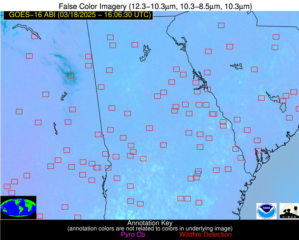
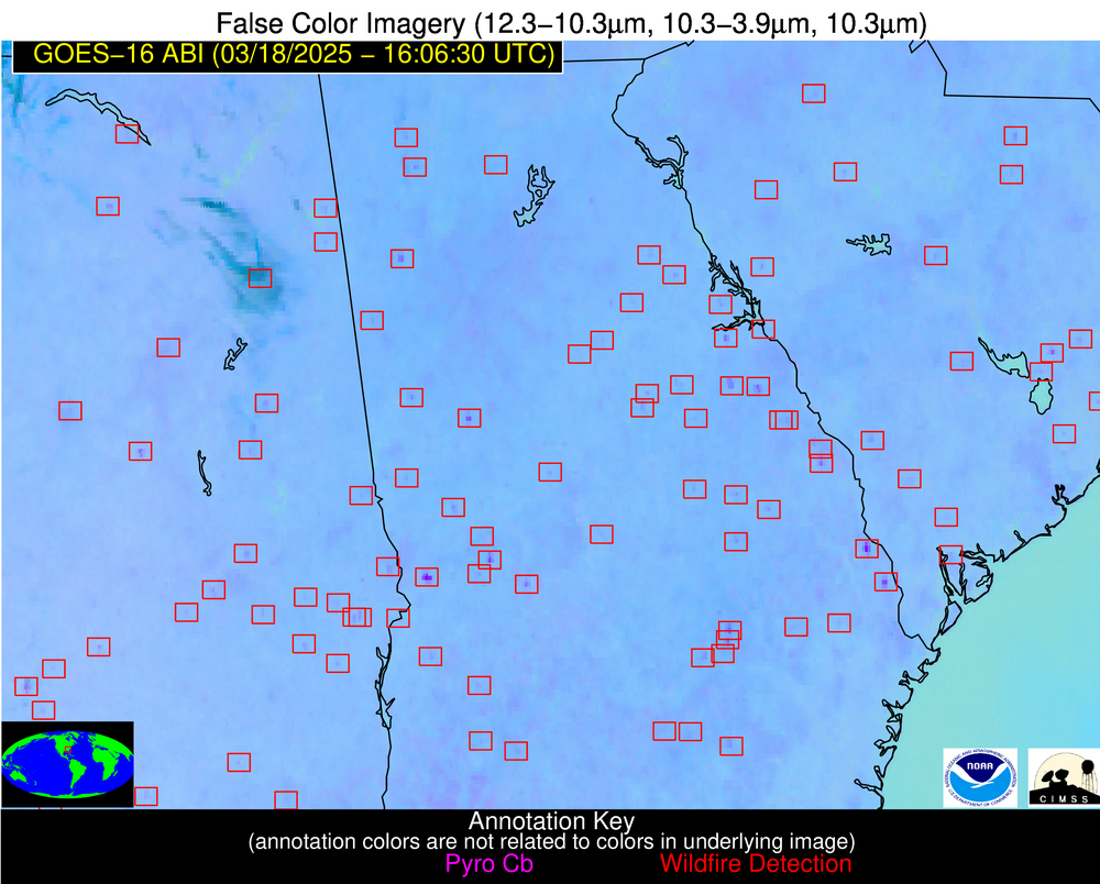
| Number Of Thermal Anomaly Alerts: | 22 |
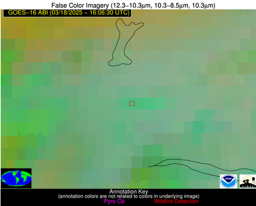
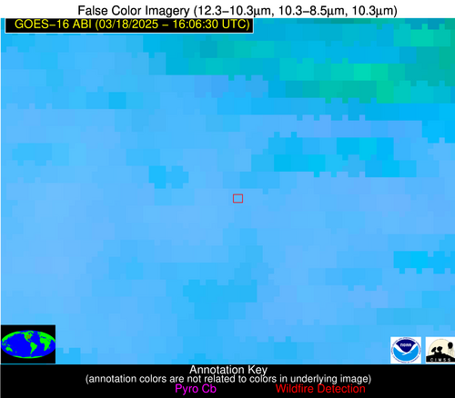
Possible Wildfire
| Basic Information | |
|---|---|
| State/Province(s) | Quebec |
| Country/Countries | Canada |
| County/Locality(s) | Le Saguenay-et-son-Fjord, Quebec |
| NWS WFO | N/A |
| Identification Method | Enhanced Contextual (Cloud) |
| Mean Object Date/Time | 2025-03-18 16:06:23UTC |
| Radiative Center (Lat, Lon): | 48.619720°, -71.118889° |
| Nearby Counties (meeting alert criteria): |
|
| Total Radiative Power Anomaly | n/a |
| Total Radiative Power | 19.24 MW |
| Map: | |
| Additional Information | |
| Alert Status | New Feature |
| Type of Event | Nominal Risk |
| Event Priority Ranking | 4 |
| Maximum Observed BT (3.9 um) | 288.03 K |
| Observed - Background BT (3.9 um) | 14.19 K |
| BT Anomaly (3.9 um) | 4.79 K |
| Maximum Observed - Clear RTM BT (3.9 um) | 21.16 K |
| Maximum Observed BTD (3.9-10/11/12 um) | 22.75 K |
| Observed - Background BTD (3.9-10/11/12 um) | 14.41 K |
| BTD Anomaly (3.9-10/11/12 um) | 4.99 K |
| Similar Pixel Count | 0 |
| BT Time Tendency (3.9 um) | 7.00 K |
| Image Interval | 5.00 minutes |
| Fraction of Surrounding LWIR Pixels that are Colder | 0.54 |
| Fraction of Surrounding Red Channel Pixels that are Brighter | 0.89 |
| Maximum Radiative Power | 19.24 MW |
| Maximum Radiative Power Uncertainty | 0.00 MW |
| Total Radiative Power Uncertainty | 0.00 MW |
| Mean Viewing Angle | 56.30° |
| Mean Solar Zenith Angle | 51.00° |
| Mean Glint Angle | 104.80° |
| Water Fraction | 0.00 |
| Total Pixel Area | 7.20 km2 |
| Latest Satellite Imagery: | |
| View all event imagery » | |
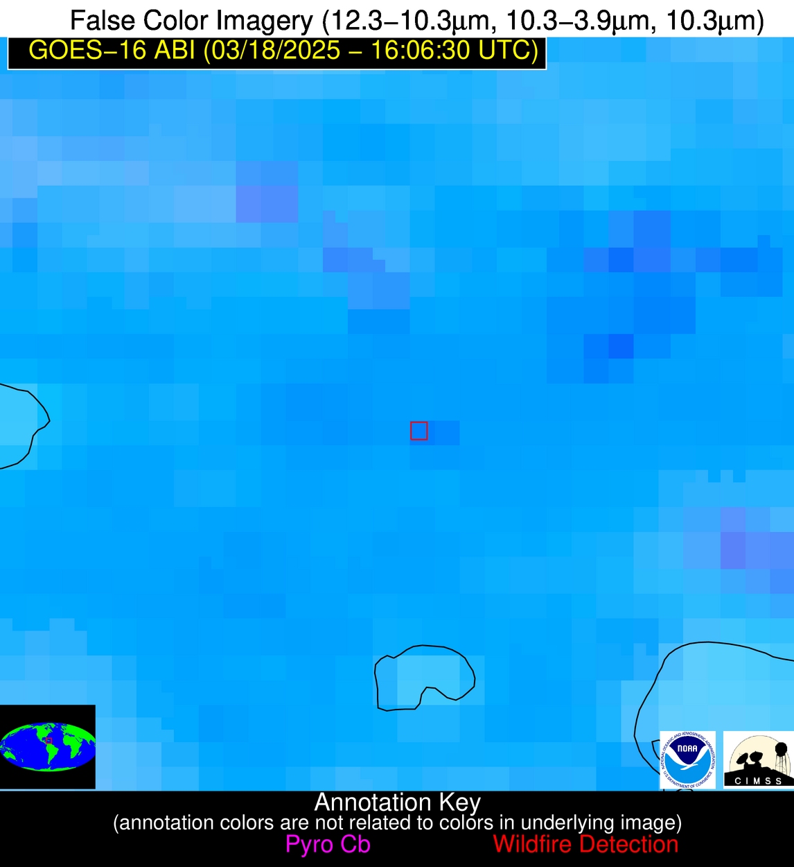
Possible Wildfire
| Basic Information | |
|---|---|
| State/Province(s) | MO |
| Country/Countries | United States |
| County/Locality(s) | Sullivan County, MO |
| NWS WFO | Kansas City/Pleasant Hill MO |
| Identification Method | Enhanced Contextual (Clear) |
| Mean Object Date/Time | 2025-03-18 16:06:51UTC |
| Radiative Center (Lat, Lon): | 40.132221°, -93.102776° |
| Nearby Counties (meeting alert criteria): |
|
| Total Radiative Power Anomaly | n/a |
| Total Radiative Power | 13.30 MW |
| Map: | |
| Additional Information | |
| Alert Status | New Feature |
| Type of Event | Elevated SPC Risk and Red Flag Warning |
| Event Priority Ranking | 1 |
| Maximum Observed BT (3.9 um) | 304.68 K |
| Observed - Background BT (3.9 um) | 3.76 K |
| BT Anomaly (3.9 um) | 7.42 K |
| Maximum Observed - Clear RTM BT (3.9 um) | 15.55 K |
| Maximum Observed BTD (3.9-10/11/12 um) | 13.89 K |
| Observed - Background BTD (3.9-10/11/12 um) | 3.15 K |
| BTD Anomaly (3.9-10/11/12 um) | 4.39 K |
| Similar Pixel Count | 23 |
| BT Time Tendency (3.9 um) | 2.80 K |
| Image Interval | 5.00 minutes |
| Fraction of Surrounding LWIR Pixels that are Colder | 0.76 |
| Fraction of Surrounding Red Channel Pixels that are Brighter | 1.00 |
| Maximum Radiative Power | 13.30 MW |
| Maximum Radiative Power Uncertainty | 0.00 MW |
| Total Radiative Power Uncertainty | 0.00 MW |
| Mean Viewing Angle | 50.10° |
| Mean Solar Zenith Angle | 51.60° |
| Mean Glint Angle | 100.00° |
| Water Fraction | 0.00 |
| Total Pixel Area | 6.20 km2 |
| Latest Satellite Imagery: | |
| View all event imagery » | |
Possible Wildfire
| Basic Information | |
|---|---|
| State/Province(s) | SC |
| Country/Countries | United States |
| County/Locality(s) | Spartanburg County, SC |
| NWS WFO | Greenville-Spartanburg SC |
| Identification Method | Enhanced Contextual (Clear) |
| Mean Object Date/Time | 2025-03-18 16:07:22UTC |
| Radiative Center (Lat, Lon): | 34.826668°, -81.802223° |
| Nearby Counties (meeting alert criteria): |
|
| Total Radiative Power Anomaly | n/a |
| Total Radiative Power | 7.16 MW |
| Map: | |
| Additional Information | |
| Alert Status | New Feature |
| Type of Event | Nominal Risk |
| Event Priority Ranking | 4 |
| Maximum Observed BT (3.9 um) | 300.84 K |
| Observed - Background BT (3.9 um) | 1.93 K |
| BT Anomaly (3.9 um) | 1.50 K |
| Maximum Observed - Clear RTM BT (3.9 um) | 14.84 K |
| Maximum Observed BTD (3.9-10/11/12 um) | 8.93 K |
| Observed - Background BTD (3.9-10/11/12 um) | 2.38 K |
| BTD Anomaly (3.9-10/11/12 um) | 4.14 K |
| Similar Pixel Count | 24 |
| BT Time Tendency (3.9 um) | 1.30 K |
| Image Interval | 5.00 minutes |
| Fraction of Surrounding LWIR Pixels that are Colder | 0.25 |
| Fraction of Surrounding Red Channel Pixels that are Brighter | 1.00 |
| Maximum Radiative Power | 7.16 MW |
| Maximum Radiative Power Uncertainty | 0.00 MW |
| Total Radiative Power Uncertainty | 0.00 MW |
| Mean Viewing Angle | 41.20° |
| Mean Solar Zenith Angle | 41.80° |
| Mean Glint Angle | 80.90° |
| Water Fraction | 0.00 |
| Total Pixel Area | 5.30 km2 |
| Latest Satellite Imagery: | |
| View all event imagery » | |
Possible Wildfire
| Basic Information | |
|---|---|
| State/Province(s) | SC |
| Country/Countries | United States |
| County/Locality(s) | Newberry County, SC |
| NWS WFO | Columbia SC |
| Identification Method | Enhanced Contextual (Clear) |
| Mean Object Date/Time | 2025-03-18 16:07:22UTC |
| Radiative Center (Lat, Lon): | 34.431946°, -81.559723° |
| Nearby Counties (meeting alert criteria): |
|
| Total Radiative Power Anomaly | n/a |
| Total Radiative Power | 8.48 MW |
| Map: | |
| Additional Information | |
| Alert Status | New Feature |
| Type of Event | Nominal Risk, Known Incident: C-126 Block 8 RX (HIGH, tdiff=0.09775 days, Point) |
| Event Priority Ranking | 4 |
| Maximum Observed BT (3.9 um) | 299.23 K |
| Observed - Background BT (3.9 um) | 2.86 K |
| BT Anomaly (3.9 um) | 2.45 K |
| Maximum Observed - Clear RTM BT (3.9 um) | 12.82 K |
| Maximum Observed BTD (3.9-10/11/12 um) | 8.70 K |
| Observed - Background BTD (3.9-10/11/12 um) | 3.16 K |
| BTD Anomaly (3.9-10/11/12 um) | 5.88 K |
| Similar Pixel Count | 5 |
| BT Time Tendency (3.9 um) | 2.30 K |
| Image Interval | 5.00 minutes |
| Fraction of Surrounding LWIR Pixels that are Colder | 0.35 |
| Fraction of Surrounding Red Channel Pixels that are Brighter | 1.00 |
| Maximum Radiative Power | 8.48 MW |
| Maximum Radiative Power Uncertainty | 0.00 MW |
| Total Radiative Power Uncertainty | 0.00 MW |
| Mean Viewing Angle | 40.70° |
| Mean Solar Zenith Angle | 41.40° |
| Mean Glint Angle | 80.00° |
| Water Fraction | 0.00 |
| Total Pixel Area | 5.30 km2 |
| Latest Satellite Imagery: | |
| View all event imagery » | |
Possible Wildfire
| Basic Information | |
|---|---|
| State/Province(s) | AL |
| Country/Countries | United States |
| County/Locality(s) | Cherokee County, AL |
| NWS WFO | Birmingham AL |
| Identification Method | Enhanced Contextual (Clear) |
| Mean Object Date/Time | 2025-03-18 16:07:21UTC |
| Radiative Center (Lat, Lon): | 34.248890°, -85.551666° |
| Nearby Counties (meeting alert criteria): |
|
| Total Radiative Power Anomaly | n/a |
| Total Radiative Power | 10.18 MW |
| Map: | |
| Additional Information | |
| Alert Status | New Feature |
| Type of Event | Nominal Risk |
| Event Priority Ranking | 4 |
| Maximum Observed BT (3.9 um) | 300.13 K |
| Observed - Background BT (3.9 um) | 2.57 K |
| BT Anomaly (3.9 um) | 2.22 K |
| Maximum Observed - Clear RTM BT (3.9 um) | 14.39 K |
| Maximum Observed BTD (3.9-10/11/12 um) | 9.57 K |
| Observed - Background BTD (3.9-10/11/12 um) | 3.40 K |
| BTD Anomaly (3.9-10/11/12 um) | 6.75 K |
| Similar Pixel Count | 4 |
| BT Time Tendency (3.9 um) | 1.80 K |
| Image Interval | 5.00 minutes |
| Fraction of Surrounding LWIR Pixels that are Colder | 0.17 |
| Fraction of Surrounding Red Channel Pixels that are Brighter | 1.00 |
| Maximum Radiative Power | 10.18 MW |
| Maximum Radiative Power Uncertainty | 0.00 MW |
| Total Radiative Power Uncertainty | 0.00 MW |
| Mean Viewing Angle | 41.50° |
| Mean Solar Zenith Angle | 43.20° |
| Mean Glint Angle | 82.80° |
| Water Fraction | 0.00 |
| Total Pixel Area | 5.30 km2 |
| Latest Satellite Imagery: | |
| View all event imagery » | |
Possible Wildfire
| Basic Information | |
|---|---|
| State/Province(s) | AL |
| Country/Countries | United States |
| County/Locality(s) | Cherokee County, AL |
| NWS WFO | Birmingham AL |
| Identification Method | Enhanced Contextual (Clear) |
| Mean Object Date/Time | 2025-03-18 16:07:21UTC |
| Radiative Center (Lat, Lon): | 34.078609°, -85.549721° |
| Nearby Counties (meeting alert criteria): |
|
| Total Radiative Power Anomaly | n/a |
| Total Radiative Power | 7.76 MW |
| Map: | |
| Additional Information | |
| Alert Status | New Feature |
| Type of Event | Nominal Risk |
| Event Priority Ranking | 4 |
| Maximum Observed BT (3.9 um) | 300.96 K |
| Observed - Background BT (3.9 um) | 2.91 K |
| BT Anomaly (3.9 um) | 2.50 K |
| Maximum Observed - Clear RTM BT (3.9 um) | 14.86 K |
| Maximum Observed BTD (3.9-10/11/12 um) | 8.64 K |
| Observed - Background BTD (3.9-10/11/12 um) | 2.63 K |
| BTD Anomaly (3.9-10/11/12 um) | 5.05 K |
| Similar Pixel Count | 16 |
| BT Time Tendency (3.9 um) | 2.20 K |
| Image Interval | 5.00 minutes |
| Fraction of Surrounding LWIR Pixels that are Colder | 0.57 |
| Fraction of Surrounding Red Channel Pixels that are Brighter | 1.00 |
| Maximum Radiative Power | 7.76 MW |
| Maximum Radiative Power Uncertainty | 0.00 MW |
| Total Radiative Power Uncertainty | 0.00 MW |
| Mean Viewing Angle | 41.30° |
| Mean Solar Zenith Angle | 43.10° |
| Mean Glint Angle | 82.40° |
| Water Fraction | 0.00 |
| Total Pixel Area | 5.30 km2 |
| Latest Satellite Imagery: | |
| View all event imagery » | |
Possible Wildfire
| Basic Information | |
|---|---|
| State/Province(s) | GA |
| Country/Countries | United States |
| County/Locality(s) | Morgan County, GA |
| NWS WFO | Peachtree City GA |
| Identification Method | Enhanced Contextual (Clear) |
| Mean Object Date/Time | 2025-03-18 16:07:21UTC |
| Radiative Center (Lat, Lon): | 33.583332°, -83.428055° |
| Nearby Counties (meeting alert criteria): |
|
| Total Radiative Power Anomaly | n/a |
| Total Radiative Power | 4.75 MW |
| Map: | |
| Additional Information | |
| Alert Status | New Feature |
| Type of Event | Nominal Risk |
| Event Priority Ranking | 4 |
| Maximum Observed BT (3.9 um) | 300.67 K |
| Observed - Background BT (3.9 um) | 2.68 K |
| BT Anomaly (3.9 um) | 2.74 K |
| Maximum Observed - Clear RTM BT (3.9 um) | 13.27 K |
| Maximum Observed BTD (3.9-10/11/12 um) | 8.00 K |
| Observed - Background BTD (3.9-10/11/12 um) | 2.12 K |
| BTD Anomaly (3.9-10/11/12 um) | 5.69 K |
| Similar Pixel Count | 25 |
| BT Time Tendency (3.9 um) | 1.50 K |
| Image Interval | 5.00 minutes |
| Fraction of Surrounding LWIR Pixels that are Colder | 0.75 |
| Fraction of Surrounding Red Channel Pixels that are Brighter | 1.00 |
| Maximum Radiative Power | 4.75 MW |
| Maximum Radiative Power Uncertainty | 0.00 MW |
| Total Radiative Power Uncertainty | 0.00 MW |
| Mean Viewing Angle | 40.20° |
| Mean Solar Zenith Angle | 41.60° |
| Mean Glint Angle | 79.80° |
| Water Fraction | 0.00 |
| Total Pixel Area | 5.20 km2 |
| Latest Satellite Imagery: | |
| View all event imagery » | |
Possible Wildfire
| Basic Information | |
|---|---|
| State/Province(s) | SC |
| Country/Countries | United States |
| County/Locality(s) | Berkeley County, SC |
| NWS WFO | Charleston SC |
| Identification Method | Enhanced Contextual (Clear) |
| Mean Object Date/Time | 2025-03-18 16:07:22UTC |
| Radiative Center (Lat, Lon): | 33.111668°, -79.878609° |
| Nearby Counties (meeting alert criteria): |
|
| Total Radiative Power Anomaly | n/a |
| Total Radiative Power | 7.73 MW |
| Map: | |
| Additional Information | |
| Alert Status | New Feature |
| Type of Event | Nominal Risk |
| Event Priority Ranking | 4 |
| Maximum Observed BT (3.9 um) | 298.53 K |
| Observed - Background BT (3.9 um) | 2.81 K |
| BT Anomaly (3.9 um) | 1.99 K |
| Maximum Observed - Clear RTM BT (3.9 um) | 10.85 K |
| Maximum Observed BTD (3.9-10/11/12 um) | 8.16 K |
| Observed - Background BTD (3.9-10/11/12 um) | 2.98 K |
| BTD Anomaly (3.9-10/11/12 um) | 4.53 K |
| Similar Pixel Count | 5 |
| BT Time Tendency (3.9 um) | 1.60 K |
| Image Interval | 5.00 minutes |
| Fraction of Surrounding LWIR Pixels that are Colder | 0.43 |
| Fraction of Surrounding Red Channel Pixels that are Brighter | 1.00 |
| Maximum Radiative Power | 7.73 MW |
| Maximum Radiative Power Uncertainty | 0.00 MW |
| Total Radiative Power Uncertainty | 0.00 MW |
| Mean Viewing Angle | 39.00° |
| Mean Solar Zenith Angle | 39.50° |
| Mean Glint Angle | 76.30° |
| Water Fraction | 0.00 |
| Total Pixel Area | 5.10 km2 |
| Latest Satellite Imagery: | |
| View all event imagery » | |
Possible Wildfire
| Basic Information | |
|---|---|
| State/Province(s) | AL |
| Country/Countries | United States |
| County/Locality(s) | Coosa County, AL |
| NWS WFO | Birmingham AL |
| Identification Method | Enhanced Contextual (Clear) |
| Mean Object Date/Time | 2025-03-18 16:07:21UTC |
| Radiative Center (Lat, Lon): | 33.030834°, -86.128609° |
| Nearby Counties (meeting alert criteria): |
|
| Total Radiative Power Anomaly | n/a |
| Total Radiative Power | 7.79 MW |
| Map: | |
| Additional Information | |
| Alert Status | New Feature |
| Type of Event | Nominal Risk |
| Event Priority Ranking | 4 |
| Maximum Observed BT (3.9 um) | 301.92 K |
| Observed - Background BT (3.9 um) | 2.54 K |
| BT Anomaly (3.9 um) | 3.14 K |
| Maximum Observed - Clear RTM BT (3.9 um) | 14.25 K |
| Maximum Observed BTD (3.9-10/11/12 um) | 8.84 K |
| Observed - Background BTD (3.9-10/11/12 um) | 2.69 K |
| BTD Anomaly (3.9-10/11/12 um) | 4.06 K |
| Similar Pixel Count | 19 |
| BT Time Tendency (3.9 um) | 3.00 K |
| Image Interval | 5.00 minutes |
| Fraction of Surrounding LWIR Pixels that are Colder | 0.37 |
| Fraction of Surrounding Red Channel Pixels that are Brighter | 1.00 |
| Maximum Radiative Power | 7.79 MW |
| Maximum Radiative Power Uncertainty | 0.00 MW |
| Total Radiative Power Uncertainty | 0.00 MW |
| Mean Viewing Angle | 40.30° |
| Mean Solar Zenith Angle | 42.60° |
| Mean Glint Angle | 81.10° |
| Water Fraction | 0.00 |
| Total Pixel Area | 5.20 km2 |
| Latest Satellite Imagery: | |
| View all event imagery » | |
Possible Wildfire
| Basic Information | |
|---|---|
| State/Province(s) | GA |
| Country/Countries | United States |
| County/Locality(s) | Troup County, GA |
| NWS WFO | Peachtree City GA |
| Identification Method | Enhanced Contextual (Clear) |
| Mean Object Date/Time | 2025-03-18 16:07:21UTC |
| Radiative Center (Lat, Lon): | 32.889168°, -84.928055° |
| Nearby Counties (meeting alert criteria): |
|
| Total Radiative Power Anomaly | n/a |
| Total Radiative Power | 7.39 MW |
| Map: | |
| Additional Information | |
| Alert Status | New Feature |
| Type of Event | Nominal Risk |
| Event Priority Ranking | 4 |
| Maximum Observed BT (3.9 um) | 301.96 K |
| Observed - Background BT (3.9 um) | 2.48 K |
| BT Anomaly (3.9 um) | 2.02 K |
| Maximum Observed - Clear RTM BT (3.9 um) | 13.88 K |
| Maximum Observed BTD (3.9-10/11/12 um) | 8.69 K |
| Observed - Background BTD (3.9-10/11/12 um) | 2.72 K |
| BTD Anomaly (3.9-10/11/12 um) | 4.74 K |
| Similar Pixel Count | 19 |
| BT Time Tendency (3.9 um) | 2.80 K |
| Image Interval | 5.00 minutes |
| Fraction of Surrounding LWIR Pixels that are Colder | 0.41 |
| Fraction of Surrounding Red Channel Pixels that are Brighter | 1.00 |
| Maximum Radiative Power | 7.39 MW |
| Maximum Radiative Power Uncertainty | 0.00 MW |
| Total Radiative Power Uncertainty | 0.00 MW |
| Mean Viewing Angle | 39.80° |
| Mean Solar Zenith Angle | 41.90° |
| Mean Glint Angle | 79.70° |
| Water Fraction | 0.00 |
| Total Pixel Area | 5.20 km2 |
| Latest Satellite Imagery: | |
| View all event imagery » | |
Possible Wildfire
| Basic Information | |
|---|---|
| State/Province(s) | AL |
| Country/Countries | United States |
| County/Locality(s) | Elmore County, AL |
| NWS WFO | Birmingham AL |
| Identification Method | Enhanced Contextual (Clear) |
| Mean Object Date/Time | 2025-03-18 16:07:21UTC |
| Radiative Center (Lat, Lon): | 32.509445°, -86.165276° |
| Nearby Counties (meeting alert criteria): |
|
| Total Radiative Power Anomaly | n/a |
| Total Radiative Power | 24.17 MW |
| Map: | |
| Additional Information | |
| Alert Status | New Feature |
| Type of Event | Nominal Risk |
| Event Priority Ranking | 4 |
| Maximum Observed BT (3.9 um) | 304.93 K |
| Observed - Background BT (3.9 um) | 5.37 K |
| BT Anomaly (3.9 um) | 4.28 K |
| Maximum Observed - Clear RTM BT (3.9 um) | 16.39 K |
| Maximum Observed BTD (3.9-10/11/12 um) | 10.47 K |
| Observed - Background BTD (3.9-10/11/12 um) | 4.67 K |
| BTD Anomaly (3.9-10/11/12 um) | 9.62 K |
| Similar Pixel Count | 4 |
| BT Time Tendency (3.9 um) | 3.80 K |
| Image Interval | 5.00 minutes |
| Fraction of Surrounding LWIR Pixels that are Colder | 0.71 |
| Fraction of Surrounding Red Channel Pixels that are Brighter | 1.00 |
| Maximum Radiative Power | 13.60 MW |
| Maximum Radiative Power Uncertainty | 0.00 MW |
| Total Radiative Power Uncertainty | 0.00 MW |
| Mean Viewing Angle | 39.80° |
| Mean Solar Zenith Angle | 42.30° |
| Mean Glint Angle | 80.10° |
| Water Fraction | 0.00 |
| Total Pixel Area | 10.40 km2 |
| Latest Satellite Imagery: | |
| View all event imagery » | |
Possible Wildfire
| Basic Information | |
|---|---|
| State/Province(s) | AL |
| Country/Countries | United States |
| County/Locality(s) | Montgomery County, AL |
| NWS WFO | Birmingham AL |
| Identification Method | Enhanced Contextual (Clear) |
| Mean Object Date/Time | 2025-03-18 16:07:21UTC |
| Radiative Center (Lat, Lon): | 32.200832°, -86.030281° |
| Nearby Counties (meeting alert criteria): |
|
| Total Radiative Power Anomaly | n/a |
| Total Radiative Power | 15.78 MW |
| Map: | |
| Additional Information | |
| Alert Status | New Feature |
| Type of Event | Nominal Risk |
| Event Priority Ranking | 4 |
| Maximum Observed BT (3.9 um) | 303.43 K |
| Observed - Background BT (3.9 um) | 3.20 K |
| BT Anomaly (3.9 um) | 2.64 K |
| Maximum Observed - Clear RTM BT (3.9 um) | 14.25 K |
| Maximum Observed BTD (3.9-10/11/12 um) | 8.56 K |
| Observed - Background BTD (3.9-10/11/12 um) | 2.91 K |
| BTD Anomaly (3.9-10/11/12 um) | 5.39 K |
| Similar Pixel Count | 10 |
| BT Time Tendency (3.9 um) | 1.90 K |
| Image Interval | 5.00 minutes |
| Fraction of Surrounding LWIR Pixels that are Colder | 0.69 |
| Fraction of Surrounding Red Channel Pixels that are Brighter | 1.00 |
| Maximum Radiative Power | 8.43 MW |
| Maximum Radiative Power Uncertainty | 0.00 MW |
| Total Radiative Power Uncertainty | 0.00 MW |
| Mean Viewing Angle | 39.40° |
| Mean Solar Zenith Angle | 42.00° |
| Mean Glint Angle | 79.50° |
| Water Fraction | 0.00 |
| Total Pixel Area | 10.40 km2 |
| Latest Satellite Imagery: | |
| View all event imagery » | |
Possible Wildfire
| Basic Information | |
|---|---|
| State/Province(s) | AL |
| Country/Countries | United States |
| County/Locality(s) | Barbour County, AL |
| NWS WFO | Birmingham AL |
| Identification Method | Enhanced Contextual (Clear) |
| Mean Object Date/Time | 2025-03-18 16:07:21UTC |
| Radiative Center (Lat, Lon): | 31.955278°, -85.456947° |
| Nearby Counties (meeting alert criteria): |
|
| Total Radiative Power Anomaly | n/a |
| Total Radiative Power | 10.78 MW |
| Map: | |
| Additional Information | |
| Alert Status | New Feature |
| Type of Event | Nominal Risk |
| Event Priority Ranking | 4 |
| Maximum Observed BT (3.9 um) | 303.35 K |
| Observed - Background BT (3.9 um) | 4.20 K |
| BT Anomaly (3.9 um) | 5.00 K |
| Maximum Observed - Clear RTM BT (3.9 um) | 12.79 K |
| Maximum Observed BTD (3.9-10/11/12 um) | 9.33 K |
| Observed - Background BTD (3.9-10/11/12 um) | 3.96 K |
| BTD Anomaly (3.9-10/11/12 um) | 11.52 K |
| Similar Pixel Count | 2 |
| BT Time Tendency (3.9 um) | 4.00 K |
| Image Interval | 5.00 minutes |
| Fraction of Surrounding LWIR Pixels that are Colder | 0.64 |
| Fraction of Surrounding Red Channel Pixels that are Brighter | 1.00 |
| Maximum Radiative Power | 10.78 MW |
| Maximum Radiative Power Uncertainty | 0.00 MW |
| Total Radiative Power Uncertainty | 0.00 MW |
| Mean Viewing Angle | 38.90° |
| Mean Solar Zenith Angle | 41.50° |
| Mean Glint Angle | 78.50° |
| Water Fraction | 0.00 |
| Total Pixel Area | 5.10 km2 |
| Latest Satellite Imagery: | |
| View all event imagery » | |
Possible Wildfire
| Basic Information | |
|---|---|
| State/Province(s) | AL |
| Country/Countries | United States |
| County/Locality(s) | Clarke County, AL |
| NWS WFO | Mobile AL |
| Identification Method | Enhanced Contextual (Clear) |
| Mean Object Date/Time | 2025-03-18 16:07:21UTC |
| Radiative Center (Lat, Lon): | 31.718611°, -87.716942° |
| Nearby Counties (meeting alert criteria): |
|
| Total Radiative Power Anomaly | n/a |
| Total Radiative Power | 7.60 MW |
| Map: | |
| Additional Information | |
| Alert Status | New Feature |
| Type of Event | Nominal Risk |
| Event Priority Ranking | 4 |
| Maximum Observed BT (3.9 um) | 302.71 K |
| Observed - Background BT (3.9 um) | 3.91 K |
| BT Anomaly (3.9 um) | 4.14 K |
| Maximum Observed - Clear RTM BT (3.9 um) | 13.33 K |
| Maximum Observed BTD (3.9-10/11/12 um) | 7.74 K |
| Observed - Background BTD (3.9-10/11/12 um) | 2.97 K |
| BTD Anomaly (3.9-10/11/12 um) | 4.73 K |
| Similar Pixel Count | 8 |
| BT Time Tendency (3.9 um) | 1.70 K |
| Image Interval | 5.00 minutes |
| Fraction of Surrounding LWIR Pixels that are Colder | 0.92 |
| Fraction of Surrounding Red Channel Pixels that are Brighter | 1.00 |
| Maximum Radiative Power | 7.60 MW |
| Maximum Radiative Power Uncertainty | 0.00 MW |
| Total Radiative Power Uncertainty | 0.00 MW |
| Mean Viewing Angle | 39.50° |
| Mean Solar Zenith Angle | 42.60° |
| Mean Glint Angle | 80.30° |
| Water Fraction | 0.00 |
| Total Pixel Area | 5.20 km2 |
| Latest Satellite Imagery: | |
| View all event imagery » | |
Possible Wildfire
| Basic Information | |
|---|---|
| State/Province(s) | GA |
| Country/Countries | United States |
| County/Locality(s) | Dougherty County, GA |
| NWS WFO | Tallahassee FL |
| Identification Method | Enhanced Contextual (Clear) |
| Mean Object Date/Time | 2025-03-18 16:07:21UTC |
| Radiative Center (Lat, Lon): | 31.564167°, -84.360001° |
| Nearby Counties (meeting alert criteria): |
|
| Total Radiative Power Anomaly | n/a |
| Total Radiative Power | 3.82 MW |
| Map: | |
| Additional Information | |
| Alert Status | New Feature |
| Type of Event | Nominal Risk |
| Event Priority Ranking | 4 |
| Maximum Observed BT (3.9 um) | 303.35 K |
| Observed - Background BT (3.9 um) | 1.92 K |
| BT Anomaly (3.9 um) | 1.49 K |
| Maximum Observed - Clear RTM BT (3.9 um) | 11.53 K |
| Maximum Observed BTD (3.9-10/11/12 um) | 8.23 K |
| Observed - Background BTD (3.9-10/11/12 um) | 1.45 K |
| BTD Anomaly (3.9-10/11/12 um) | 2.32 K |
| Similar Pixel Count | 25 |
| BT Time Tendency (3.9 um) | 1.40 K |
| Image Interval | 5.00 minutes |
| Fraction of Surrounding LWIR Pixels that are Colder | 0.73 |
| Fraction of Surrounding Red Channel Pixels that are Brighter | 1.00 |
| Maximum Radiative Power | 3.82 MW |
| Maximum Radiative Power Uncertainty | 0.00 MW |
| Total Radiative Power Uncertainty | 0.00 MW |
| Mean Viewing Angle | 38.20° |
| Mean Solar Zenith Angle | 40.50° |
| Mean Glint Angle | 76.80° |
| Water Fraction | 0.00 |
| Total Pixel Area | 5.10 km2 |
| Latest Satellite Imagery: | |
| View all event imagery » | |
Possible Wildfire
| Basic Information | |
|---|---|
| State/Province(s) | AL |
| Country/Countries | United States |
| County/Locality(s) | Crenshaw County, AL |
| NWS WFO | Mobile AL |
| Identification Method | Enhanced Contextual (Clear) |
| Mean Object Date/Time | 2025-03-18 16:07:21UTC |
| Radiative Center (Lat, Lon): | 31.456112°, -86.216110° |
| Nearby Counties (meeting alert criteria): |
|
| Total Radiative Power Anomaly | n/a |
| Total Radiative Power | 8.09 MW |
| Map: | |
| Additional Information | |
| Alert Status | New Feature |
| Type of Event | Nominal Risk |
| Event Priority Ranking | 4 |
| Maximum Observed BT (3.9 um) | 301.88 K |
| Observed - Background BT (3.9 um) | 2.49 K |
| BT Anomaly (3.9 um) | 2.28 K |
| Maximum Observed - Clear RTM BT (3.9 um) | 11.80 K |
| Maximum Observed BTD (3.9-10/11/12 um) | 7.92 K |
| Observed - Background BTD (3.9-10/11/12 um) | 2.77 K |
| BTD Anomaly (3.9-10/11/12 um) | 5.99 K |
| Similar Pixel Count | 10 |
| BT Time Tendency (3.9 um) | 1.10 K |
| Image Interval | 5.00 minutes |
| Fraction of Surrounding LWIR Pixels that are Colder | 0.37 |
| Fraction of Surrounding Red Channel Pixels that are Brighter | 1.00 |
| Maximum Radiative Power | 8.09 MW |
| Maximum Radiative Power Uncertainty | 0.00 MW |
| Total Radiative Power Uncertainty | 0.00 MW |
| Mean Viewing Angle | 38.70° |
| Mean Solar Zenith Angle | 41.50° |
| Mean Glint Angle | 78.30° |
| Water Fraction | 0.00 |
| Total Pixel Area | 5.10 km2 |
| Latest Satellite Imagery: | |
| View all event imagery » | |
Possible Wildfire
| Basic Information | |
|---|---|
| State/Province(s) | Nuevo León |
| Country/Countries | Mexico |
| County/Locality(s) | General Bravo, Nuevo León |
| NWS WFO | N/A |
| Identification Method | Enhanced Contextual (Clear) |
| Mean Object Date/Time | 2025-03-18 16:07:49UTC |
| Radiative Center (Lat, Lon): | 25.991667°, -98.735558° |
| Nearby Counties (meeting alert criteria): |
|
| Total Radiative Power Anomaly | n/a |
| Total Radiative Power | 6.10 MW |
| Map: | |
| Additional Information | |
| Alert Status | New Feature |
| Type of Event | Nominal Risk |
| Event Priority Ranking | 4 |
| Maximum Observed BT (3.9 um) | 310.15 K |
| Observed - Background BT (3.9 um) | 2.25 K |
| BT Anomaly (3.9 um) | 2.23 K |
| Maximum Observed - Clear RTM BT (3.9 um) | 9.79 K |
| Maximum Observed BTD (3.9-10/11/12 um) | 10.34 K |
| Observed - Background BTD (3.9-10/11/12 um) | 2.00 K |
| BTD Anomaly (3.9-10/11/12 um) | 3.50 K |
| Similar Pixel Count | 25 |
| BT Time Tendency (3.9 um) | 1.50 K |
| Image Interval | 5.00 minutes |
| Fraction of Surrounding LWIR Pixels that are Colder | 0.63 |
| Fraction of Surrounding Red Channel Pixels that are Brighter | 0.98 |
| Maximum Radiative Power | 6.10 MW |
| Maximum Radiative Power Uncertainty | 0.00 MW |
| Total Radiative Power Uncertainty | 0.00 MW |
| Mean Viewing Angle | 40.10° |
| Mean Solar Zenith Angle | 46.80° |
| Mean Glint Angle | 85.90° |
| Water Fraction | 0.00 |
| Total Pixel Area | 5.20 km2 |
| Latest Satellite Imagery: | |
| View all event imagery » | |
Possible Wildfire
| Basic Information | |
|---|---|
| State/Province(s) | Unknown |
| Country/Countries | Bahamas |
| County/Locality(s) | Unknown, Unknown |
| NWS WFO | N/A |
| Identification Method | Enhanced Contextual (Clear) |
| Mean Object Date/Time | 2025-03-18 16:07:52UTC |
| Radiative Center (Lat, Lon): | 24.855278°, -78.023331° |
| Nearby Counties (meeting alert criteria): |
|
| Total Radiative Power Anomaly | n/a |
| Total Radiative Power | 5.16 MW |
| Map: | |
| Additional Information | |
| Alert Status | New Feature |
| Type of Event | Nominal Risk |
| Event Priority Ranking | 4 |
| Maximum Observed BT (3.9 um) | 305.95 K |
| Observed - Background BT (3.9 um) | 2.60 K |
| BT Anomaly (3.9 um) | 1.72 K |
| Maximum Observed - Clear RTM BT (3.9 um) | 6.31 K |
| Maximum Observed BTD (3.9-10/11/12 um) | 8.42 K |
| Observed - Background BTD (3.9-10/11/12 um) | 1.97 K |
| BTD Anomaly (3.9-10/11/12 um) | 2.77 K |
| Similar Pixel Count | 20 |
| BT Time Tendency (3.9 um) | 1.30 K |
| Image Interval | 5.00 minutes |
| Fraction of Surrounding LWIR Pixels that are Colder | 0.81 |
| Fraction of Surrounding Red Channel Pixels that are Brighter | 0.86 |
| Maximum Radiative Power | 5.16 MW |
| Maximum Radiative Power Uncertainty | 0.00 MW |
| Total Radiative Power Uncertainty | 0.00 MW |
| Mean Viewing Angle | 29.30° |
| Mean Solar Zenith Angle | 31.80° |
| Mean Glint Angle | 58.70° |
| Water Fraction | 0.00 |
| Total Pixel Area | 4.60 km2 |
| Latest Satellite Imagery: | |
| View all event imagery » | |
Possible Wildfire
| Basic Information | |
|---|---|
| State/Province(s) | Unknown |
| Country/Countries | Cuba |
| County/Locality(s) | Unknown, Unknown |
| NWS WFO | N/A |
| Identification Method | Enhanced Contextual (Clear) |
| Mean Object Date/Time | 2025-03-18 16:08:22UTC |
| Radiative Center (Lat, Lon): | 22.906389°, -80.142502° |
| Nearby Counties (meeting alert criteria): |
|
| Total Radiative Power Anomaly | n/a |
| Total Radiative Power | 14.13 MW |
| Map: | |
| Additional Information | |
| Alert Status | New Feature |
| Type of Event | Nominal Risk |
| Event Priority Ranking | 4 |
| Maximum Observed BT (3.9 um) | 311.16 K |
| Observed - Background BT (3.9 um) | 3.82 K |
| BT Anomaly (3.9 um) | 2.29 K |
| Maximum Observed - Clear RTM BT (3.9 um) | 12.38 K |
| Maximum Observed BTD (3.9-10/11/12 um) | 14.71 K |
| Observed - Background BTD (3.9-10/11/12 um) | 3.30 K |
| BTD Anomaly (3.9-10/11/12 um) | 1.84 K |
| Similar Pixel Count | 17 |
| BT Time Tendency (3.9 um) | 4.90 K |
| Image Interval | 5.00 minutes |
| Fraction of Surrounding LWIR Pixels that are Colder | 0.86 |
| Fraction of Surrounding Red Channel Pixels that are Brighter | 0.74 |
| Maximum Radiative Power | 14.13 MW |
| Maximum Radiative Power Uncertainty | 0.00 MW |
| Total Radiative Power Uncertainty | 0.00 MW |
| Mean Viewing Angle | 27.50° |
| Mean Solar Zenith Angle | 31.60° |
| Mean Glint Angle | 56.80° |
| Water Fraction | 0.00 |
| Total Pixel Area | 4.50 km2 |
| Latest Satellite Imagery: | |
| View all event imagery » | |
Possible Wildfire
| Basic Information | |
|---|---|
| State/Province(s) | San Luis Potosí |
| Country/Countries | Mexico |
| County/Locality(s) | Tamuín, San Luis Potosí |
| NWS WFO | N/A |
| Identification Method | Enhanced Contextual (Clear) |
| Mean Object Date/Time | 2025-03-18 16:08:19UTC |
| Radiative Center (Lat, Lon): | 22.029444°, -98.838058° |
| Nearby Counties (meeting alert criteria): |
|
| Total Radiative Power Anomaly | n/a |
| Total Radiative Power | 10.33 MW |
| Map: | |
| Additional Information | |
| Alert Status | New Feature |
| Type of Event | Nominal Risk |
| Event Priority Ranking | 4 |
| Maximum Observed BT (3.9 um) | 311.16 K |
| Observed - Background BT (3.9 um) | 4.17 K |
| BT Anomaly (3.9 um) | 3.85 K |
| Maximum Observed - Clear RTM BT (3.9 um) | 12.31 K |
| Maximum Observed BTD (3.9-10/11/12 um) | 11.69 K |
| Observed - Background BTD (3.9-10/11/12 um) | 2.92 K |
| BTD Anomaly (3.9-10/11/12 um) | 4.93 K |
| Similar Pixel Count | 21 |
| BT Time Tendency (3.9 um) | 2.80 K |
| Image Interval | 5.00 minutes |
| Fraction of Surrounding LWIR Pixels that are Colder | 1.00 |
| Fraction of Surrounding Red Channel Pixels that are Brighter | 0.88 |
| Maximum Radiative Power | 10.33 MW |
| Maximum Radiative Power Uncertainty | 0.00 MW |
| Total Radiative Power Uncertainty | 0.00 MW |
| Mean Viewing Angle | 37.10° |
| Mean Solar Zenith Angle | 45.00° |
| Mean Glint Angle | 81.30° |
| Water Fraction | 0.00 |
| Total Pixel Area | 5.00 km2 |
| Latest Satellite Imagery: | |
| View all event imagery » | |
Possible Wildfire
| Basic Information | |
|---|---|
| State/Province(s) | Unknown |
| Country/Countries | Cuba |
| County/Locality(s) | Unknown, Unknown |
| NWS WFO | N/A |
| Identification Method | Enhanced Contextual (Clear) |
| Mean Object Date/Time | 2025-03-18 16:08:22UTC |
| Radiative Center (Lat, Lon): | 21.303888°, -78.303337° |
| Nearby Counties (meeting alert criteria): |
|
| Total Radiative Power Anomaly | n/a |
| Total Radiative Power | 31.95 MW |
| Map: | |
| Additional Information | |
| Alert Status | New Feature |
| Type of Event | Nominal Risk |
| Event Priority Ranking | 4 |
| Maximum Observed BT (3.9 um) | 319.62 K |
| Observed - Background BT (3.9 um) | 8.42 K |
| BT Anomaly (3.9 um) | 3.45 K |
| Maximum Observed - Clear RTM BT (3.9 um) | 18.01 K |
| Maximum Observed BTD (3.9-10/11/12 um) | 17.40 K |
| Observed - Background BTD (3.9-10/11/12 um) | 8.54 K |
| BTD Anomaly (3.9-10/11/12 um) | 5.87 K |
| Similar Pixel Count | 2 |
| BT Time Tendency (3.9 um) | 7.90 K |
| Image Interval | 5.00 minutes |
| Fraction of Surrounding LWIR Pixels that are Colder | 0.37 |
| Fraction of Surrounding Red Channel Pixels that are Brighter | 1.00 |
| Maximum Radiative Power | 31.95 MW |
| Maximum Radiative Power Uncertainty | 0.00 MW |
| Total Radiative Power Uncertainty | 0.00 MW |
| Mean Viewing Angle | 25.30° |
| Mean Solar Zenith Angle | 29.20° |
| Mean Glint Angle | 52.10° |
| Water Fraction | 0.00 |
| Total Pixel Area | 4.40 km2 |
| Latest Satellite Imagery: | |
| View all event imagery » | |
Possible Wildfire
| Basic Information | |
|---|---|
| State/Province(s) | Unknown |
| Country/Countries | Dominican Republic |
| County/Locality(s) | Unknown, Unknown |
| NWS WFO | N/A |
| Identification Method | Enhanced Contextual (Clear) |
| Mean Object Date/Time | 2025-03-18 16:08:53UTC |
| Radiative Center (Lat, Lon): | 18.451389°, -71.247223° |
| Nearby Counties (meeting alert criteria): |
|
| Total Radiative Power Anomaly | n/a |
| Total Radiative Power | 18.42 MW |
| Map: | |
| Additional Information | |
| Alert Status | New Feature |
| Type of Event | Nominal Risk |
| Event Priority Ranking | 4 |
| Maximum Observed BT (3.9 um) | 321.23 K |
| Observed - Background BT (3.9 um) | 5.05 K |
| BT Anomaly (3.9 um) | 2.93 K |
| Maximum Observed - Clear RTM BT (3.9 um) | 9.35 K |
| Maximum Observed BTD (3.9-10/11/12 um) | 18.03 K |
| Observed - Background BTD (3.9-10/11/12 um) | 5.58 K |
| BTD Anomaly (3.9-10/11/12 um) | 5.48 K |
| Similar Pixel Count | 22 |
| BT Time Tendency (3.9 um) | 4.00 K |
| Image Interval | 5.00 minutes |
| Fraction of Surrounding LWIR Pixels that are Colder | 0.51 |
| Fraction of Surrounding Red Channel Pixels that are Brighter | 0.96 |
| Maximum Radiative Power | 18.42 MW |
| Maximum Radiative Power Uncertainty | 0.00 MW |
| Total Radiative Power Uncertainty | 0.00 MW |
| Mean Viewing Angle | 22.30° |
| Mean Solar Zenith Angle | 23.00° |
| Mean Glint Angle | 41.70° |
| Water Fraction | 0.00 |
| Total Pixel Area | 4.30 km2 |
| Latest Satellite Imagery: | |
| View all event imagery » | |
