Wildfire Alert Report
| Date: | 2025-03-17 |
|---|---|
| Time: | 21:14:54 |
| Production Date and Time: | 2025-03-17 21:15:38 UTC |
| Primary Instrument: | GOES-16 ABI |
| Wmo Spacecraft Id: | 152 |
| Location/orbit: | GEO |
| L1 File: | OR_ABI-L1b-RadM2-M6C14_G16_s20250762114548_e20250762115005_c20250762115057.nc |
| L1 File(s) - Temporal | OR_ABI-L1b-RadM2-M6C14_G16_s20250762113548_e20250762114005_c20250762114072.nc |
| Number Of Thermal Anomaly Alerts: | 2 |
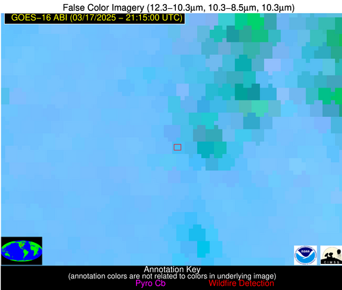
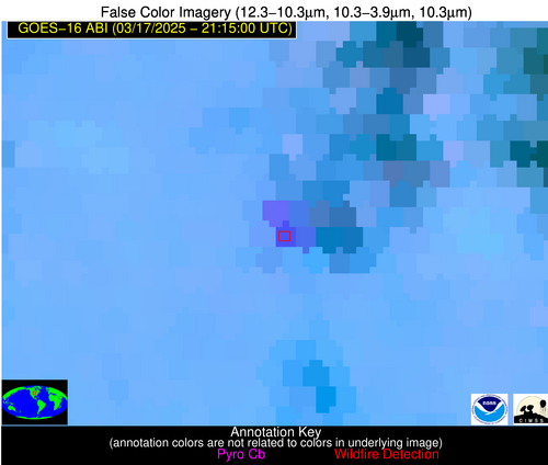
Possible Wildfire
| Basic Information | |
|---|---|
| State/Province(s) | IA |
| Country/Countries | United States |
| County/Locality(s) | Sac County, IA |
| NWS WFO | Des Moines IA |
| Identification Method | Enhanced Contextual (Clear) |
| Mean Object Date/Time | 2025-03-17 21:14:57UTC |
| Radiative Center (Lat, Lon): | 42.326946°, -95.257774° |
| Nearby Counties (meeting alert criteria): |
|
| Total Radiative Power Anomaly | n/a |
| Total Radiative Power | 48.89 MW |
| Map: | |
| Additional Information | |
| Alert Status | New Feature |
| Type of Event | Elevated SPC Risk and Red Flag Warning |
| Event Priority Ranking | 1 |
| Maximum Observed BT (3.9 um) | 310.36 K |
| Observed - Background BT (3.9 um) | 11.84 K |
| BT Anomaly (3.9 um) | 13.09 K |
| Maximum Observed - Clear RTM BT (3.9 um) | 23.17 K |
| Maximum Observed BTD (3.9-10/11/12 um) | 21.88 K |
| Observed - Background BTD (3.9-10/11/12 um) | 11.91 K |
| BTD Anomaly (3.9-10/11/12 um) | 13.07 K |
| Similar Pixel Count | 6 |
| BT Time Tendency (3.9 um) | 3.40 K |
| Image Interval | 1.00 minutes |
| Fraction of Surrounding LWIR Pixels that are Colder | 0.20 |
| Fraction of Surrounding Red Channel Pixels that are Brighter | 0.34 |
| Maximum Radiative Power | 48.89 MW |
| Maximum Radiative Power Uncertainty | 0.00 MW |
| Total Radiative Power Uncertainty | 0.00 MW |
| Mean Viewing Angle | 53.20° |
| Mean Solar Zenith Angle | 57.70° |
| Mean Glint Angle | 78.60° |
| Water Fraction | 0.00 |
| Total Pixel Area | 6.70 km2 |
| Latest Satellite Imagery: | |
| View all event imagery » | |
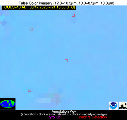
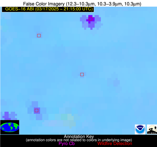
Possible Wildfire
| Basic Information | |
|---|---|
| State/Province(s) | OK |
| Country/Countries | United States |
| County/Locality(s) | Latimer County, OK |
| NWS WFO | Tulsa OK |
| Identification Method | Enhanced Contextual (Clear) |
| Mean Object Date/Time | 2025-03-17 21:14:59UTC |
| Radiative Center (Lat, Lon): | 34.837502°, -95.315002° |
| Nearby Counties (meeting alert criteria): |
|
| Total Radiative Power Anomaly | n/a |
| Total Radiative Power | 6.06 MW |
| Map: | |
| Additional Information | |
| Alert Status | New Feature |
| Type of Event | Elevated SPC Risk |
| Event Priority Ranking | 3 |
| Maximum Observed BT (3.9 um) | 301.57 K |
| Observed - Background BT (3.9 um) | 2.17 K |
| BT Anomaly (3.9 um) | 2.97 K |
| Maximum Observed - Clear RTM BT (3.9 um) | 11.93 K |
| Maximum Observed BTD (3.9-10/11/12 um) | 6.38 K |
| Observed - Background BTD (3.9-10/11/12 um) | 1.98 K |
| BTD Anomaly (3.9-10/11/12 um) | 4.02 K |
| Similar Pixel Count | 16 |
| BT Time Tendency (3.9 um) | 0.60 K |
| Image Interval | 1.00 minutes |
| Fraction of Surrounding LWIR Pixels that are Colder | 0.70 |
| Fraction of Surrounding Red Channel Pixels that are Brighter | 1.00 |
| Maximum Radiative Power | 6.06 MW |
| Maximum Radiative Power Uncertainty | 0.00 MW |
| Total Radiative Power Uncertainty | 0.00 MW |
| Mean Viewing Angle | 45.90° |
| Mean Solar Zenith Angle | 53.20° |
| Mean Glint Angle | 66.80° |
| Water Fraction | 0.00 |
| Total Pixel Area | 5.80 km2 |
| Latest Satellite Imagery: | |
| View all event imagery » | |


