10 Jan 2026: Notice to users: ongoing data center construction may unexpectedly interrupt NGFS product generation.
Wildfire Alert Report
| Date: | 2025-03-14 |
|---|---|
| Time: | 20:39:56 |
| Production Date and Time: | 2025-03-14 20:41:22 UTC |
| Primary Instrument: | GOES-18 ABI |
| Wmo Spacecraft Id: | 665 |
| Location/orbit: | GEO |
| L1 File: | OR_ABI-L1b-RadM2-M6C14_G18_s20250732039567_e20250732040026_c20250732040081.nc |
| L1 File(s) - Temporal | OR_ABI-L1b-RadM2-M6C14_G18_s20250732038567_e20250732039024_c20250732039083.nc |
| Number Of Thermal Anomaly Alerts: | 2 |
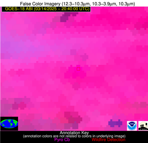
Possible Wildfire
| Basic Information | |
|---|---|
| State/Province(s) | OK |
| Country/Countries | United States |
| County/Locality(s) | Harper County, OK |
| NWS WFO | Norman OK |
| Identification Method | Enhanced Contextual (Cloud) |
| Mean Object Date/Time | 2025-03-14 20:40:01UTC |
| Radiative Center (Lat, Lon): | 36.792221°, -99.501945° |
| Nearby Counties (meeting alert criteria): |
|
| Total Radiative Power Anomaly | n/a |
| Total Radiative Power | 89.77 MW |
| Map: | |
| Additional Information | |
| Alert Status | New Feature |
| Type of Event | Critical SPC Risk and Red Flag Warning |
| Event Priority Ranking | 1 |
| Maximum Observed BT (3.9 um) | 310.54 K |
| Observed - Background BT (3.9 um) | 9.72 K |
| BT Anomaly (3.9 um) | 13.01 K |
| Maximum Observed - Clear RTM BT (3.9 um) | 23.85 K |
| Maximum Observed BTD (3.9-10/11/12 um) | 23.25 K |
| Observed - Background BTD (3.9-10/11/12 um) | 8.89 K |
| BTD Anomaly (3.9-10/11/12 um) | 12.52 K |
| Similar Pixel Count | 0 |
| BT Time Tendency (3.9 um) | 5.50 K |
| Image Interval | 1.00 minutes |
| Fraction of Surrounding LWIR Pixels that are Colder | 0.87 |
| Fraction of Surrounding Red Channel Pixels that are Brighter | 1.00 |
| Maximum Radiative Power | 48.44 MW |
| Maximum Radiative Power Uncertainty | 0.00 MW |
| Total Radiative Power Uncertainty | 0.00 MW |
| Mean Viewing Angle | 58.30° |
| Mean Solar Zenith Angle | 47.60° |
| Mean Glint Angle | 105.00° |
| Water Fraction | 0.00 |
| Total Pixel Area | 15.20 km2 |
| Latest Satellite Imagery: | |
| View all event imagery » | |
Possible Wildfire
| Basic Information | |
|---|---|
| State/Province(s) | TX |
| Country/Countries | United States |
| County/Locality(s) | Terry County, TX |
| NWS WFO | Lubbock TX |
| Identification Method | Enhanced Contextual (Cloud) |
| Mean Object Date/Time | 2025-03-14 20:40:01UTC |
| Radiative Center (Lat, Lon): | 33.279167°, -102.241112° |
| Nearby Counties (meeting alert criteria): |
|
| Total Radiative Power Anomaly | n/a |
| Total Radiative Power | 290.44 MW |
| Map: | |
| Additional Information | |
| Alert Status | New Feature |
| Type of Event | Extreme SPC Risk and Red Flag Warning |
| Event Priority Ranking | 1 |
| Maximum Observed BT (3.9 um) | 313.98 K |
| Observed - Background BT (3.9 um) | 10.16 K |
| BT Anomaly (3.9 um) | 10.57 K |
| Maximum Observed - Clear RTM BT (3.9 um) | 28.26 K |
| Maximum Observed BTD (3.9-10/11/12 um) | 31.36 K |
| Observed - Background BTD (3.9-10/11/12 um) | 9.61 K |
| BTD Anomaly (3.9-10/11/12 um) | 8.87 K |
| Similar Pixel Count | 0 |
| BT Time Tendency (3.9 um) | 6.50 K |
| Image Interval | 1.00 minutes |
| Fraction of Surrounding LWIR Pixels that are Colder | 0.69 |
| Fraction of Surrounding Red Channel Pixels that are Brighter | 1.00 |
| Maximum Radiative Power | 155.56 MW |
| Maximum Radiative Power Uncertainty | 0.00 MW |
| Total Radiative Power Uncertainty | 0.00 MW |
| Mean Viewing Angle | 53.90° |
| Mean Solar Zenith Angle | 43.50° |
| Mean Glint Angle | 96.50° |
| Water Fraction | 0.00 |
| Total Pixel Area | 13.60 km2 |
| Latest Satellite Imagery: | |
| View all event imagery » | |


