Wildfire Alert Report
| Date: | 2025-03-13 |
|---|---|
| Time: | 17:21:15 |
| Production Date and Time: | 2025-03-13 17:26:12 UTC |
| Primary Instrument: | GOES-16 ABI |
| Wmo Spacecraft Id: | 152 |
| Location/orbit: | GEO |
| L1 File: | OR_ABI-L1b-RadC-M6C14_G16_s20250721721155_e20250721723528_c20250721724014.nc |
| L1 File(s) - Temporal | OR_ABI-L1b-RadC-M6C14_G16_s20250721716155_e20250721718528_c20250721719025.nc |
| Number Of Thermal Anomaly Alerts: | 13 |
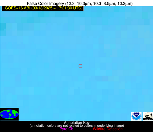
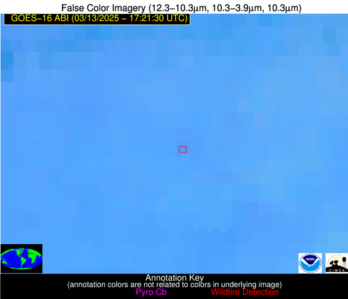
Possible Wildfire
| Basic Information | |
|---|---|
| State/Province(s) | PA |
| Country/Countries | United States |
| County/Locality(s) | Venango County, PA |
| NWS WFO | Pittsburgh PA |
| Identification Method | Enhanced Contextual (Clear) |
| Mean Object Date/Time | 2025-03-13 17:21:50UTC |
| Radiative Center (Lat, Lon): | 41.531666°, -79.511948° |
| Nearby Counties (meeting alert criteria): |
|
| Total Radiative Power Anomaly | n/a |
| Total Radiative Power | 4.78 MW |
| Map: | |
| Additional Information | |
| Alert Status | New Feature |
| Type of Event | Nominal Risk |
| Event Priority Ranking | 4 |
| Maximum Observed BT (3.9 um) | 302.67 K |
| Observed - Background BT (3.9 um) | 2.37 K |
| BT Anomaly (3.9 um) | 1.79 K |
| Maximum Observed - Clear RTM BT (3.9 um) | 15.98 K |
| Maximum Observed BTD (3.9-10/11/12 um) | 11.43 K |
| Observed - Background BTD (3.9-10/11/12 um) | 1.66 K |
| BTD Anomaly (3.9-10/11/12 um) | 3.02 K |
| Similar Pixel Count | 25 |
| BT Time Tendency (3.9 um) | 0.50 K |
| Image Interval | 5.00 minutes |
| Fraction of Surrounding LWIR Pixels that are Colder | 0.75 |
| Fraction of Surrounding Red Channel Pixels that are Brighter | 1.00 |
| Maximum Radiative Power | 4.78 MW |
| Maximum Radiative Power Uncertainty | 0.00 MW |
| Total Radiative Power Uncertainty | 0.00 MW |
| Mean Viewing Angle | 48.40° |
| Mean Solar Zenith Angle | 44.90° |
| Mean Glint Angle | 93.30° |
| Water Fraction | 0.00 |
| Total Pixel Area | 6.00 km2 |
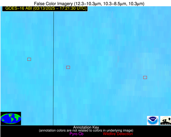
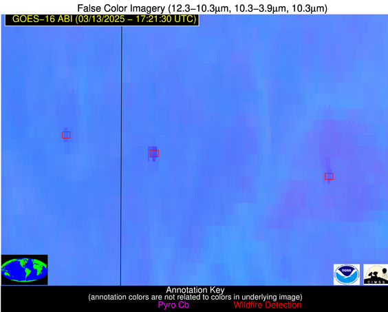
| Latest Satellite Imagery: | |
| View all event imagery » | |
Possible Wildfire
| Basic Information | |
|---|---|
| State/Province(s) | IL |
| Country/Countries | United States |
| County/Locality(s) | Iroquois County, IL |
| NWS WFO | Chicago IL |
| Identification Method | Enhanced Contextual (Clear) |
| Mean Object Date/Time | 2025-03-13 17:21:49UTC |
| Radiative Center (Lat, Lon): | 40.680000°, -87.822777° |
| Nearby Counties (meeting alert criteria): |
|
| Total Radiative Power Anomaly | n/a |
| Total Radiative Power | 19.30 MW |
| Map: | |
| Additional Information | |
| Alert Status | New Feature |
| Type of Event | Nominal Risk |
| Event Priority Ranking | 4 |
| Maximum Observed BT (3.9 um) | 312.39 K |
| Observed - Background BT (3.9 um) | 4.88 K |
| BT Anomaly (3.9 um) | 3.72 K |
| Maximum Observed - Clear RTM BT (3.9 um) | 22.06 K |
| Maximum Observed BTD (3.9-10/11/12 um) | 18.65 K |
| Observed - Background BTD (3.9-10/11/12 um) | 4.12 K |
| BTD Anomaly (3.9-10/11/12 um) | 7.93 K |
| Similar Pixel Count | 25 |
| BT Time Tendency (3.9 um) | 1.70 K |
| Image Interval | 5.00 minutes |
| Fraction of Surrounding LWIR Pixels that are Colder | 0.78 |
| Fraction of Surrounding Red Channel Pixels that are Brighter | 1.00 |
| Maximum Radiative Power | 19.30 MW |
| Maximum Radiative Power Uncertainty | 0.00 MW |
| Total Radiative Power Uncertainty | 0.00 MW |
| Mean Viewing Angle | 49.00° |
| Mean Solar Zenith Angle | 45.00° |
| Mean Glint Angle | 93.90° |
| Water Fraction | 0.00 |
| Total Pixel Area | 6.10 km2 |
| Latest Satellite Imagery: | |
| View all event imagery » | |
Possible Wildfire
| Basic Information | |
|---|---|
| State/Province(s) | IA |
| Country/Countries | United States |
| County/Locality(s) | Wayne County, IA |
| NWS WFO | Des Moines IA |
| Identification Method | Enhanced Contextual (Clear) |
| Mean Object Date/Time | 2025-03-13 17:21:49UTC |
| Radiative Center (Lat, Lon): | 40.823334°, -93.111115° |
| Nearby Counties (meeting alert criteria): |
|
| Total Radiative Power Anomaly | n/a |
| Total Radiative Power | 17.12 MW |
| Map: | |
| Additional Information | |
| Alert Status | New Feature |
| Type of Event | Nominal Risk |
| Event Priority Ranking | 4 |
| Maximum Observed BT (3.9 um) | 309.08 K |
| Observed - Background BT (3.9 um) | 3.71 K |
| BT Anomaly (3.9 um) | 3.98 K |
| Maximum Observed - Clear RTM BT (3.9 um) | 18.52 K |
| Maximum Observed BTD (3.9-10/11/12 um) | 14.96 K |
| Observed - Background BTD (3.9-10/11/12 um) | 3.88 K |
| BTD Anomaly (3.9-10/11/12 um) | 8.68 K |
| Similar Pixel Count | 22 |
| BT Time Tendency (3.9 um) | 3.30 K |
| Image Interval | 5.00 minutes |
| Fraction of Surrounding LWIR Pixels that are Colder | 0.44 |
| Fraction of Surrounding Red Channel Pixels that are Brighter | 1.00 |
| Maximum Radiative Power | 17.12 MW |
| Maximum Radiative Power Uncertainty | 0.00 MW |
| Total Radiative Power Uncertainty | 0.00 MW |
| Mean Viewing Angle | 50.90° |
| Mean Solar Zenith Angle | 46.40° |
| Mean Glint Angle | 97.10° |
| Water Fraction | 0.00 |
| Total Pixel Area | 6.30 km2 |
| Latest Satellite Imagery: | |
| View all event imagery » | |
Possible Wildfire
| Basic Information | |
|---|---|
| State/Province(s) | IN |
| Country/Countries | United States |
| County/Locality(s) | Carroll County, IN |
| NWS WFO | Indianapolis IN |
| Identification Method | Enhanced Contextual (Clear) |
| Mean Object Date/Time | 2025-03-13 17:21:49UTC |
| Radiative Center (Lat, Lon): | 40.588612°, -86.418053° |
| Nearby Counties (meeting alert criteria): |
|
| Total Radiative Power Anomaly | n/a |
| Total Radiative Power | 17.20 MW |
| Map: | |
| Additional Information | |
| Alert Status | New Feature |
| Type of Event | Nominal Risk |
| Event Priority Ranking | 4 |
| Maximum Observed BT (3.9 um) | 310.03 K |
| Observed - Background BT (3.9 um) | 4.93 K |
| BT Anomaly (3.9 um) | 4.18 K |
| Maximum Observed - Clear RTM BT (3.9 um) | 20.27 K |
| Maximum Observed BTD (3.9-10/11/12 um) | 19.63 K |
| Observed - Background BTD (3.9-10/11/12 um) | 5.31 K |
| BTD Anomaly (3.9-10/11/12 um) | 4.18 K |
| Similar Pixel Count | 25 |
| BT Time Tendency (3.9 um) | 3.70 K |
| Image Interval | 5.00 minutes |
| Fraction of Surrounding LWIR Pixels that are Colder | 0.30 |
| Fraction of Surrounding Red Channel Pixels that are Brighter | 0.94 |
| Maximum Radiative Power | 17.20 MW |
| Maximum Radiative Power Uncertainty | 0.00 MW |
| Total Radiative Power Uncertainty | 0.00 MW |
| Mean Viewing Angle | 48.50° |
| Mean Solar Zenith Angle | 44.70° |
| Mean Glint Angle | 93.10° |
| Water Fraction | 0.00 |
| Total Pixel Area | 6.00 km2 |
| Latest Satellite Imagery: | |
| View all event imagery » | |
Possible Wildfire
| Basic Information | |
|---|---|
| State/Province(s) | MO |
| Country/Countries | United States |
| County/Locality(s) | Howard County, MO |
| NWS WFO | Kansas City/Pleasant Hill MO |
| Identification Method | Enhanced Contextual (Cloud) |
| Mean Object Date/Time | 2025-03-13 17:21:49UTC |
| Radiative Center (Lat, Lon): | 39.006943°, -92.705002° |
| Nearby Counties (meeting alert criteria): |
|
| Total Radiative Power Anomaly | n/a |
| Total Radiative Power | 38.55 MW |
| Map: | |
| Additional Information | |
| Alert Status | New Feature |
| Type of Event | Nominal Risk |
| Event Priority Ranking | 4 |
| Maximum Observed BT (3.9 um) | 317.10 K |
| Observed - Background BT (3.9 um) | 9.58 K |
| BT Anomaly (3.9 um) | 7.84 K |
| Maximum Observed - Clear RTM BT (3.9 um) | 23.14 K |
| Maximum Observed BTD (3.9-10/11/12 um) | 19.63 K |
| Observed - Background BTD (3.9-10/11/12 um) | 8.20 K |
| BTD Anomaly (3.9-10/11/12 um) | 12.51 K |
| Similar Pixel Count | 0 |
| BT Time Tendency (3.9 um) | 7.50 K |
| Image Interval | 5.00 minutes |
| Fraction of Surrounding LWIR Pixels that are Colder | 0.95 |
| Fraction of Surrounding Red Channel Pixels that are Brighter | 0.99 |
| Maximum Radiative Power | 38.55 MW |
| Maximum Radiative Power Uncertainty | 0.00 MW |
| Total Radiative Power Uncertainty | 0.00 MW |
| Mean Viewing Angle | 48.90° |
| Mean Solar Zenith Angle | 44.50° |
| Mean Glint Angle | 93.30° |
| Water Fraction | 0.00 |
| Total Pixel Area | 6.10 km2 |
| Latest Satellite Imagery: | |
| View all event imagery » | |
Possible Wildfire
| Basic Information | |
|---|---|
| State/Province(s) | MO |
| Country/Countries | United States |
| County/Locality(s) | Phelps County, MO |
| NWS WFO | Springfield MO |
| Identification Method | Enhanced Contextual (Clear) |
| Mean Object Date/Time | 2025-03-13 17:21:49UTC |
| Radiative Center (Lat, Lon): | 37.865002°, -91.841942° |
| Nearby Counties (meeting alert criteria): |
|
| Total Radiative Power Anomaly | n/a |
| Total Radiative Power | 14.02 MW |
| Map: | |
| Additional Information | |
| Alert Status | New Feature |
| Type of Event | Nominal Risk |
| Event Priority Ranking | 4 |
| Maximum Observed BT (3.9 um) | 311.25 K |
| Observed - Background BT (3.9 um) | 3.52 K |
| BT Anomaly (3.9 um) | 9.37 K |
| Maximum Observed - Clear RTM BT (3.9 um) | 16.37 K |
| Maximum Observed BTD (3.9-10/11/12 um) | 14.70 K |
| Observed - Background BTD (3.9-10/11/12 um) | 3.50 K |
| BTD Anomaly (3.9-10/11/12 um) | 8.62 K |
| Similar Pixel Count | 25 |
| BT Time Tendency (3.9 um) | 2.50 K |
| Image Interval | 5.00 minutes |
| Fraction of Surrounding LWIR Pixels that are Colder | 0.46 |
| Fraction of Surrounding Red Channel Pixels that are Brighter | 1.00 |
| Maximum Radiative Power | 14.02 MW |
| Maximum Radiative Power Uncertainty | 0.00 MW |
| Total Radiative Power Uncertainty | 0.00 MW |
| Mean Viewing Angle | 47.40° |
| Mean Solar Zenith Angle | 43.20° |
| Mean Glint Angle | 90.50° |
| Water Fraction | 0.00 |
| Total Pixel Area | 5.90 km2 |
| Latest Satellite Imagery: | |
| View all event imagery » | |
Possible Wildfire
| Basic Information | |
|---|---|
| State/Province(s) | MO |
| Country/Countries | United States |
| County/Locality(s) | Dent County, MO |
| NWS WFO | Springfield MO |
| Identification Method | Enhanced Contextual (Clear) |
| Mean Object Date/Time | 2025-03-13 17:21:49UTC |
| Radiative Center (Lat, Lon): | 37.698334°, -91.544724° |
| Nearby Counties (meeting alert criteria): |
|
| Total Radiative Power Anomaly | n/a |
| Total Radiative Power | 13.87 MW |
| Map: | |
| Additional Information | |
| Alert Status | New Feature |
| Type of Event | Nominal Risk |
| Event Priority Ranking | 4 |
| Maximum Observed BT (3.9 um) | 310.81 K |
| Observed - Background BT (3.9 um) | 3.26 K |
| BT Anomaly (3.9 um) | 6.63 K |
| Maximum Observed - Clear RTM BT (3.9 um) | 17.05 K |
| Maximum Observed BTD (3.9-10/11/12 um) | 15.10 K |
| Observed - Background BTD (3.9-10/11/12 um) | 3.30 K |
| BTD Anomaly (3.9-10/11/12 um) | 9.24 K |
| Similar Pixel Count | 25 |
| BT Time Tendency (3.9 um) | 2.60 K |
| Image Interval | 5.00 minutes |
| Fraction of Surrounding LWIR Pixels that are Colder | 0.42 |
| Fraction of Surrounding Red Channel Pixels that are Brighter | 0.98 |
| Maximum Radiative Power | 13.87 MW |
| Maximum Radiative Power Uncertainty | 0.00 MW |
| Total Radiative Power Uncertainty | 0.00 MW |
| Mean Viewing Angle | 47.10° |
| Mean Solar Zenith Angle | 43.00° |
| Mean Glint Angle | 90.00° |
| Water Fraction | 0.00 |
| Total Pixel Area | 5.90 km2 |
| Latest Satellite Imagery: | |
| View all event imagery » | |
Possible Wildfire
| Basic Information | |
|---|---|
| State/Province(s) | SC |
| Country/Countries | United States |
| County/Locality(s) | Williamsburg County, SC |
| NWS WFO | Wilmington NC |
| Identification Method | Enhanced Contextual (Cloud) |
| Mean Object Date/Time | 2025-03-13 17:22:20UTC |
| Radiative Center (Lat, Lon): | 33.518055°, -79.815552° |
| Nearby Counties (meeting alert criteria): |
|
| Total Radiative Power Anomaly | n/a |
| Total Radiative Power | 34.92 MW |
| Map: | |
| Additional Information | |
| Alert Status | New Feature |
| Type of Event | Nominal Risk |
| Event Priority Ranking | 4 |
| Maximum Observed BT (3.9 um) | 312.25 K |
| Observed - Background BT (3.9 um) | 9.69 K |
| BT Anomaly (3.9 um) | 6.82 K |
| Maximum Observed - Clear RTM BT (3.9 um) | 18.70 K |
| Maximum Observed BTD (3.9-10/11/12 um) | 20.35 K |
| Observed - Background BTD (3.9-10/11/12 um) | 9.44 K |
| BTD Anomaly (3.9-10/11/12 um) | 8.05 K |
| Similar Pixel Count | 0 |
| BT Time Tendency (3.9 um) | 2.10 K |
| Image Interval | 5.00 minutes |
| Fraction of Surrounding LWIR Pixels that are Colder | 0.89 |
| Fraction of Surrounding Red Channel Pixels that are Brighter | 1.00 |
| Maximum Radiative Power | 34.92 MW |
| Maximum Radiative Power Uncertainty | 0.00 MW |
| Total Radiative Power Uncertainty | 0.00 MW |
| Mean Viewing Angle | 39.50° |
| Mean Solar Zenith Angle | 36.90° |
| Mean Glint Angle | 76.30° |
| Water Fraction | 0.00 |
| Total Pixel Area | 5.20 km2 |
| Latest Satellite Imagery: | |
| View all event imagery » | |
Possible Wildfire
| Basic Information | |
|---|---|
| State/Province(s) | SC |
| Country/Countries | United States |
| County/Locality(s) | Orangeburg County, SC |
| NWS WFO | Columbia SC |
| Identification Method | Enhanced Contextual (Clear) |
| Mean Object Date/Time | 2025-03-13 17:22:20UTC |
| Radiative Center (Lat, Lon): | 33.428333°, -80.504448° |
| Nearby Counties (meeting alert criteria): |
|
| Total Radiative Power Anomaly | n/a |
| Total Radiative Power | 35.71 MW |
| Map: | |
| Additional Information | |
| Alert Status | New Feature |
| Type of Event | Nominal Risk |
| Event Priority Ranking | 4 |
| Maximum Observed BT (3.9 um) | 308.44 K |
| Observed - Background BT (3.9 um) | 10.07 K |
| BT Anomaly (3.9 um) | 10.18 K |
| Maximum Observed - Clear RTM BT (3.9 um) | 15.45 K |
| Maximum Observed BTD (3.9-10/11/12 um) | 21.97 K |
| Observed - Background BTD (3.9-10/11/12 um) | 9.58 K |
| BTD Anomaly (3.9-10/11/12 um) | 8.08 K |
| Similar Pixel Count | 23 |
| BT Time Tendency (3.9 um) | -0.20 K |
| Image Interval | 5.00 minutes |
| Fraction of Surrounding LWIR Pixels that are Colder | 0.99 |
| Fraction of Surrounding Red Channel Pixels that are Brighter | 1.00 |
| Maximum Radiative Power | 35.71 MW |
| Maximum Radiative Power Uncertainty | 0.00 MW |
| Total Radiative Power Uncertainty | 0.00 MW |
| Mean Viewing Angle | 39.50° |
| Mean Solar Zenith Angle | 36.90° |
| Mean Glint Angle | 76.30° |
| Water Fraction | 0.00 |
| Total Pixel Area | 5.20 km2 |
| Latest Satellite Imagery: | |
| View all event imagery » | |
Possible Wildfire
| Basic Information | |
|---|---|
| State/Province(s) | AL |
| Country/Countries | United States |
| County/Locality(s) | Clarke County, AL |
| NWS WFO | Mobile AL |
| Identification Method | Enhanced Contextual (Cloud) |
| Mean Object Date/Time | 2025-03-13 17:22:19UTC |
| Radiative Center (Lat, Lon): | 31.861944°, -87.853889° |
| Nearby Counties (meeting alert criteria): |
|
| Total Radiative Power Anomaly | n/a |
| Total Radiative Power | 31.99 MW |
| Map: | |
| Additional Information | |
| Alert Status | New Feature |
| Type of Event | Nominal Risk |
| Event Priority Ranking | 4 |
| Maximum Observed BT (3.9 um) | 310.18 K |
| Observed - Background BT (3.9 um) | 7.11 K |
| BT Anomaly (3.9 um) | 10.19 K |
| Maximum Observed - Clear RTM BT (3.9 um) | 15.36 K |
| Maximum Observed BTD (3.9-10/11/12 um) | 23.91 K |
| Observed - Background BTD (3.9-10/11/12 um) | 7.57 K |
| BTD Anomaly (3.9-10/11/12 um) | 4.99 K |
| Similar Pixel Count | 0 |
| BT Time Tendency (3.9 um) | 6.50 K |
| Image Interval | 5.00 minutes |
| Fraction of Surrounding LWIR Pixels that are Colder | 0.32 |
| Fraction of Surrounding Red Channel Pixels that are Brighter | 0.41 |
| Maximum Radiative Power | 31.99 MW |
| Maximum Radiative Power Uncertainty | 0.00 MW |
| Total Radiative Power Uncertainty | 0.00 MW |
| Mean Viewing Angle | 39.70° |
| Mean Solar Zenith Angle | 36.50° |
| Mean Glint Angle | 76.10° |
| Water Fraction | 0.00 |
| Total Pixel Area | 5.20 km2 |
| Latest Satellite Imagery: | |
| View all event imagery » | |
Possible Wildfire
| Basic Information | |
|---|---|
| State/Province(s) | Nuevo León |
| Country/Countries | Mexico |
| County/Locality(s) | Marín, Nuevo León |
| NWS WFO | N/A |
| Identification Method | Enhanced Contextual (Clear) |
| Mean Object Date/Time | 2025-03-13 17:22:47UTC |
| Radiative Center (Lat, Lon): | 25.836111°, -99.985832° |
| Nearby Counties (meeting alert criteria): |
|
| Total Radiative Power Anomaly | n/a |
| Total Radiative Power | 25.76 MW |
| Map: | |
| Additional Information | |
| Alert Status | New Feature |
| Type of Event | Nominal Risk |
| Event Priority Ranking | 4 |
| Maximum Observed BT (3.9 um) | 322.87 K |
| Observed - Background BT (3.9 um) | 5.83 K |
| BT Anomaly (3.9 um) | 5.19 K |
| Maximum Observed - Clear RTM BT (3.9 um) | 10.68 K |
| Maximum Observed BTD (3.9-10/11/12 um) | 14.06 K |
| Observed - Background BTD (3.9-10/11/12 um) | 5.27 K |
| BTD Anomaly (3.9-10/11/12 um) | 9.61 K |
| Similar Pixel Count | 5 |
| BT Time Tendency (3.9 um) | 5.10 K |
| Image Interval | 5.00 minutes |
| Fraction of Surrounding LWIR Pixels that are Colder | 0.76 |
| Fraction of Surrounding Red Channel Pixels that are Brighter | 0.95 |
| Maximum Radiative Power | 25.76 MW |
| Maximum Radiative Power Uncertainty | 0.00 MW |
| Total Radiative Power Uncertainty | 0.00 MW |
| Mean Viewing Angle | 41.00° |
| Mean Solar Zenith Angle | 36.20° |
| Mean Glint Angle | 77.00° |
| Water Fraction | 0.00 |
| Total Pixel Area | 5.30 km2 |
| Latest Satellite Imagery: | |
| View all event imagery » | |
Possible Wildfire
| Basic Information | |
|---|---|
| State/Province(s) | Unknown |
| Country/Countries | Cuba |
| County/Locality(s) | Unknown, Unknown |
| NWS WFO | N/A |
| Identification Method | Enhanced Contextual (Cloud) |
| Mean Object Date/Time | 2025-03-13 17:23:20UTC |
| Radiative Center (Lat, Lon): | 21.792500°, -78.651665° |
| Nearby Counties (meeting alert criteria): |
|
| Total Radiative Power Anomaly | n/a |
| Total Radiative Power | 30.85 MW |
| Map: | |
| Additional Information | |
| Alert Status | New Feature |
| Type of Event | Nominal Risk |
| Event Priority Ranking | 4 |
| Maximum Observed BT (3.9 um) | 318.73 K |
| Observed - Background BT (3.9 um) | 6.35 K |
| BT Anomaly (3.9 um) | 3.69 K |
| Maximum Observed - Clear RTM BT (3.9 um) | 9.01 K |
| Maximum Observed BTD (3.9-10/11/12 um) | 29.14 K |
| Observed - Background BTD (3.9-10/11/12 um) | 6.19 K |
| BTD Anomaly (3.9-10/11/12 um) | 4.21 K |
| Similar Pixel Count | 0 |
| BT Time Tendency (3.9 um) | 3.90 K |
| Image Interval | 5.00 minutes |
| Fraction of Surrounding LWIR Pixels that are Colder | 0.49 |
| Fraction of Surrounding Red Channel Pixels that are Brighter | 0.34 |
| Maximum Radiative Power | 30.85 MW |
| Maximum Radiative Power Uncertainty | 0.00 MW |
| Total Radiative Power Uncertainty | 0.00 MW |
| Mean Viewing Angle | 25.90° |
| Mean Solar Zenith Angle | 25.20° |
| Mean Glint Angle | 51.00° |
| Water Fraction | 0.00 |
| Total Pixel Area | 4.40 km2 |
| Latest Satellite Imagery: | |
| View all event imagery » | |
Possible Wildfire
| Basic Information | |
|---|---|
| State/Province(s) | Veracruz de Ignacio de la Llave |
| Country/Countries | Mexico |
| County/Locality(s) | Pánuco, Veracruz de Ignacio de la Llave |
| NWS WFO | N/A |
| Identification Method | Enhanced Contextual (Clear) |
| Mean Object Date/Time | 2025-03-13 17:23:17UTC |
| Radiative Center (Lat, Lon): | 21.995556°, -98.335831° |
| Nearby Counties (meeting alert criteria): |
|
| Total Radiative Power Anomaly | n/a |
| Total Radiative Power | 13.14 MW |
| Map: | |
| Additional Information | |
| Alert Status | New Feature |
| Type of Event | Nominal Risk |
| Event Priority Ranking | 4 |
| Maximum Observed BT (3.9 um) | 315.73 K |
| Observed - Background BT (3.9 um) | 2.73 K |
| BT Anomaly (3.9 um) | 1.18 K |
| Maximum Observed - Clear RTM BT (3.9 um) | 10.06 K |
| Maximum Observed BTD (3.9-10/11/12 um) | 15.17 K |
| Observed - Background BTD (3.9-10/11/12 um) | 2.91 K |
| BTD Anomaly (3.9-10/11/12 um) | 2.28 K |
| Similar Pixel Count | 25 |
| BT Time Tendency (3.9 um) | 3.00 K |
| Image Interval | 5.00 minutes |
| Fraction of Surrounding LWIR Pixels that are Colder | 0.43 |
| Fraction of Surrounding Red Channel Pixels that are Brighter | 1.00 |
| Maximum Radiative Power | 13.14 MW |
| Maximum Radiative Power Uncertainty | 0.00 MW |
| Total Radiative Power Uncertainty | 0.00 MW |
| Mean Viewing Angle | 36.80° |
| Mean Solar Zenith Angle | 32.30° |
| Mean Glint Angle | 68.90° |
| Water Fraction | 0.00 |
| Total Pixel Area | 5.00 km2 |
| Latest Satellite Imagery: | |
| View all event imagery » | |
