Wildfire Alert Report
| Date: | 2025-03-12 |
|---|---|
| Time: | 17:46:15 |
| Production Date and Time: | 2025-03-12 17:53:23 UTC |
| Primary Instrument: | GOES-16 ABI |
| Wmo Spacecraft Id: | 152 |
| Location/orbit: | GEO |
| L1 File: | OR_ABI-L1b-RadC-M6C14_G16_s20250711746154_e20250711748527_c20250711749018.nc |
| L1 File(s) - Temporal | OR_ABI-L1b-RadC-M6C14_G16_s20250711741154_e20250711743527_c20250711744020.nc |
| Number Of Thermal Anomaly Alerts: | 25 |
Possible Wildfire
| Basic Information | |
|---|---|
| State/Province(s) | WI |
| Country/Countries | United States |
| County/Locality(s) | Dane County, WI |
| NWS WFO | Milwaukee/Sullivan WI |
| Identification Method | Enhanced Contextual (Clear) |
| Mean Object Date/Time | 2025-03-12 17:46:19UTC |
| Radiative Center (Lat, Lon): | 43.063332°, -89.282501° |
| Nearby Counties (meeting alert criteria): |
|
| Total Radiative Power Anomaly | n/a |
| Total Radiative Power | 22.44 MW |
| Map: | |
| Additional Information | |
| Alert Status | New Feature |
| Type of Event | Nominal Risk |
| Event Priority Ranking | 4 |
| Maximum Observed BT (3.9 um) | 298.40 K |
| Observed - Background BT (3.9 um) | 6.99 K |
| BT Anomaly (3.9 um) | 4.82 K |
| Maximum Observed - Clear RTM BT (3.9 um) | 12.98 K |
| Maximum Observed BTD (3.9-10/11/12 um) | 23.80 K |
| Observed - Background BTD (3.9-10/11/12 um) | 6.69 K |
| BTD Anomaly (3.9-10/11/12 um) | 5.22 K |
| Similar Pixel Count | 22 |
| BT Time Tendency (3.9 um) | 2.40 K |
| Image Interval | 5.00 minutes |
| Fraction of Surrounding LWIR Pixels that are Colder | 0.56 |
| Fraction of Surrounding Red Channel Pixels that are Brighter | 1.00 |
| Maximum Radiative Power | 22.44 MW |
| Maximum Radiative Power Uncertainty | 0.00 MW |
| Total Radiative Power Uncertainty | 0.00 MW |
| Mean Viewing Angle | 51.90° |
| Mean Solar Zenith Angle | 47.10° |
| Mean Glint Angle | 98.20° |
| Water Fraction | 0.00 |
| Total Pixel Area | 6.50 km2 |
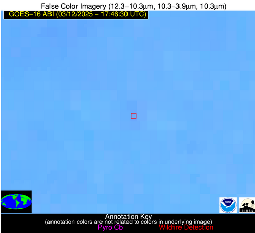
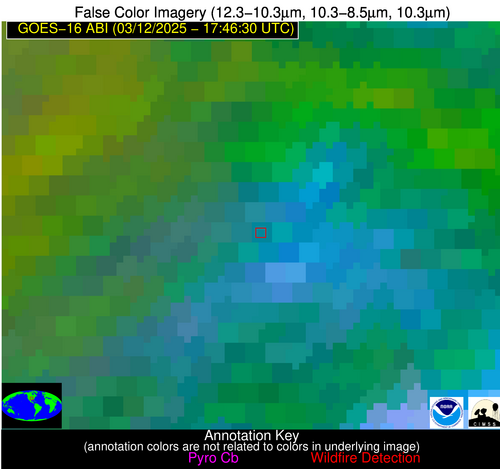
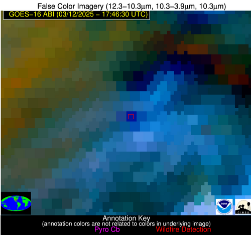
| Latest Satellite Imagery: | |
| View all event imagery » | |
Possible Wildfire
| Basic Information | |
|---|---|
| State/Province(s) | WI |
| Country/Countries | United States |
| County/Locality(s) | Green County, WI |
| NWS WFO | Milwaukee/Sullivan WI |
| Identification Method | Enhanced Contextual (Clear) |
| Mean Object Date/Time | 2025-03-12 17:46:49UTC |
| Radiative Center (Lat, Lon): | 42.580555°, -89.718330° |
| Nearby Counties (meeting alert criteria): |
|
| Total Radiative Power Anomaly | n/a |
| Total Radiative Power | 9.61 MW |
| Map: | |
| Additional Information | |
| Alert Status | New Feature |
| Type of Event | Nominal Risk |
| Event Priority Ranking | 4 |
| Maximum Observed BT (3.9 um) | 302.20 K |
| Observed - Background BT (3.9 um) | 2.42 K |
| BT Anomaly (3.9 um) | 1.96 K |
| Maximum Observed - Clear RTM BT (3.9 um) | 14.81 K |
| Maximum Observed BTD (3.9-10/11/12 um) | 14.67 K |
| Observed - Background BTD (3.9-10/11/12 um) | 2.60 K |
| BTD Anomaly (3.9-10/11/12 um) | 5.10 K |
| Similar Pixel Count | 25 |
| BT Time Tendency (3.9 um) | 2.70 K |
| Image Interval | 5.00 minutes |
| Fraction of Surrounding LWIR Pixels that are Colder | 0.48 |
| Fraction of Surrounding Red Channel Pixels that are Brighter | 1.00 |
| Maximum Radiative Power | 9.61 MW |
| Maximum Radiative Power Uncertainty | 0.00 MW |
| Total Radiative Power Uncertainty | 0.00 MW |
| Mean Viewing Angle | 51.50° |
| Mean Solar Zenith Angle | 46.60° |
| Mean Glint Angle | 97.30° |
| Water Fraction | 0.00 |
| Total Pixel Area | 6.40 km2 |
| Latest Satellite Imagery: | |
| View all event imagery » | |
Possible Wildfire
| Basic Information | |
|---|---|
| State/Province(s) | IL |
| Country/Countries | United States |
| County/Locality(s) | Whiteside County, IL |
| NWS WFO | Quad Cities IL |
| Identification Method | Enhanced Contextual (Clear) |
| Mean Object Date/Time | 2025-03-12 17:46:49UTC |
| Radiative Center (Lat, Lon): | 41.917500°, -89.672226° |
| Nearby Counties (meeting alert criteria): |
|
| Total Radiative Power Anomaly | n/a |
| Total Radiative Power | 7.48 MW |
| Map: | |
| Additional Information | |
| Alert Status | New Feature |
| Type of Event | Nominal Risk |
| Event Priority Ranking | 4 |
| Maximum Observed BT (3.9 um) | 302.47 K |
| Observed - Background BT (3.9 um) | 1.20 K |
| BT Anomaly (3.9 um) | 1.18 K |
| Maximum Observed - Clear RTM BT (3.9 um) | 14.41 K |
| Maximum Observed BTD (3.9-10/11/12 um) | 13.53 K |
| Observed - Background BTD (3.9-10/11/12 um) | 1.85 K |
| BTD Anomaly (3.9-10/11/12 um) | 3.66 K |
| Similar Pixel Count | 25 |
| BT Time Tendency (3.9 um) | 1.40 K |
| Image Interval | 5.00 minutes |
| Fraction of Surrounding LWIR Pixels that are Colder | 0.09 |
| Fraction of Surrounding Red Channel Pixels that are Brighter | 1.00 |
| Maximum Radiative Power | 7.48 MW |
| Maximum Radiative Power Uncertainty | 0.00 MW |
| Total Radiative Power Uncertainty | 0.00 MW |
| Mean Viewing Angle | 50.80° |
| Mean Solar Zenith Angle | 46.00° |
| Mean Glint Angle | 96.00° |
| Water Fraction | 0.00 |
| Total Pixel Area | 6.30 km2 |
| Latest Satellite Imagery: | |
| View all event imagery » | |
Possible Wildfire
| Basic Information | |
|---|---|
| State/Province(s) | MO |
| Country/Countries | United States |
| County/Locality(s) | Adair County, MO |
| NWS WFO | Kansas City/Pleasant Hill MO |
| Identification Method | Enhanced Contextual (Clear) |
| Mean Object Date/Time | 2025-03-12 17:46:49UTC |
| Radiative Center (Lat, Lon): | 40.258888°, -92.824722° |
| Nearby Counties (meeting alert criteria): |
|
| Total Radiative Power Anomaly | n/a |
| Total Radiative Power | 21.63 MW |
| Map: | |
| Additional Information | |
| Alert Status | New Feature |
| Type of Event | Nominal Risk |
| Event Priority Ranking | 4 |
| Maximum Observed BT (3.9 um) | 307.70 K |
| Observed - Background BT (3.9 um) | 3.26 K |
| BT Anomaly (3.9 um) | 3.29 K |
| Maximum Observed - Clear RTM BT (3.9 um) | 17.97 K |
| Maximum Observed BTD (3.9-10/11/12 um) | 13.02 K |
| Observed - Background BTD (3.9-10/11/12 um) | 3.14 K |
| BTD Anomaly (3.9-10/11/12 um) | 4.11 K |
| Similar Pixel Count | 25 |
| BT Time Tendency (3.9 um) | 2.50 K |
| Image Interval | 5.00 minutes |
| Fraction of Surrounding LWIR Pixels that are Colder | 0.51 |
| Fraction of Surrounding Red Channel Pixels that are Brighter | 0.94 |
| Maximum Radiative Power | 21.63 MW |
| Maximum Radiative Power Uncertainty | 0.00 MW |
| Total Radiative Power Uncertainty | 0.00 MW |
| Mean Viewing Angle | 50.20° |
| Mean Solar Zenith Angle | 44.80° |
| Mean Glint Angle | 94.10° |
| Water Fraction | 0.00 |
| Total Pixel Area | 12.50 km2 |
| Latest Satellite Imagery: | |
| View all event imagery » | |
Possible Wildfire
| Basic Information | |
|---|---|
| State/Province(s) | MO |
| Country/Countries | United States |
| County/Locality(s) | Audrain County, MO |
| NWS WFO | St Louis MO |
| Identification Method | Enhanced Contextual (Clear) |
| Mean Object Date/Time | 2025-03-12 17:46:49UTC |
| Radiative Center (Lat, Lon): | 39.210278°, -91.600281° |
| Nearby Counties (meeting alert criteria): |
|
| Total Radiative Power Anomaly | n/a |
| Total Radiative Power | 8.79 MW |
| Map: | |
| Additional Information | |
| Alert Status | New Feature |
| Type of Event | Nominal Risk |
| Event Priority Ranking | 4 |
| Maximum Observed BT (3.9 um) | 306.81 K |
| Observed - Background BT (3.9 um) | 1.73 K |
| BT Anomaly (3.9 um) | 2.59 K |
| Maximum Observed - Clear RTM BT (3.9 um) | 13.17 K |
| Maximum Observed BTD (3.9-10/11/12 um) | 12.65 K |
| Observed - Background BTD (3.9-10/11/12 um) | 2.54 K |
| BTD Anomaly (3.9-10/11/12 um) | 4.56 K |
| Similar Pixel Count | 25 |
| BT Time Tendency (3.9 um) | 1.30 K |
| Image Interval | 5.00 minutes |
| Fraction of Surrounding LWIR Pixels that are Colder | 0.09 |
| Fraction of Surrounding Red Channel Pixels that are Brighter | 1.00 |
| Maximum Radiative Power | 8.79 MW |
| Maximum Radiative Power Uncertainty | 0.00 MW |
| Total Radiative Power Uncertainty | 0.00 MW |
| Mean Viewing Angle | 48.70° |
| Mean Solar Zenith Angle | 43.50° |
| Mean Glint Angle | 91.40° |
| Water Fraction | 0.00 |
| Total Pixel Area | 6.10 km2 |
| Latest Satellite Imagery: | |
| View all event imagery » | |
Possible Wildfire
| Basic Information | |
|---|---|
| State/Province(s) | KS |
| Country/Countries | United States |
| County/Locality(s) | Johnson County, KS |
| NWS WFO | Kansas City/Pleasant Hill MO |
| Identification Method | Enhanced Contextual (Clear) |
| Mean Object Date/Time | 2025-03-12 17:46:48UTC |
| Radiative Center (Lat, Lon): | 38.904167°, -94.972504° |
| Nearby Counties (meeting alert criteria): |
|
| Total Radiative Power Anomaly | n/a |
| Total Radiative Power | 36.91 MW |
| Map: | |
| Additional Information | |
| Alert Status | New Feature |
| Type of Event | Nominal Risk |
| Event Priority Ranking | 4 |
| Maximum Observed BT (3.9 um) | 309.66 K |
| Observed - Background BT (3.9 um) | 4.07 K |
| BT Anomaly (3.9 um) | 5.42 K |
| Maximum Observed - Clear RTM BT (3.9 um) | 15.77 K |
| Maximum Observed BTD (3.9-10/11/12 um) | 13.21 K |
| Observed - Background BTD (3.9-10/11/12 um) | 4.16 K |
| BTD Anomaly (3.9-10/11/12 um) | 8.01 K |
| Similar Pixel Count | 12 |
| BT Time Tendency (3.9 um) | 4.60 K |
| Image Interval | 5.00 minutes |
| Fraction of Surrounding LWIR Pixels that are Colder | 0.47 |
| Fraction of Surrounding Red Channel Pixels that are Brighter | 1.00 |
| Maximum Radiative Power | 19.48 MW |
| Maximum Radiative Power Uncertainty | 0.00 MW |
| Total Radiative Power Uncertainty | 0.00 MW |
| Mean Viewing Angle | 49.70° |
| Mean Solar Zenith Angle | 43.80° |
| Mean Glint Angle | 92.70° |
| Water Fraction | 0.00 |
| Total Pixel Area | 12.40 km2 |
| Latest Satellite Imagery: | |
| View all event imagery » | |
Possible Wildfire
| Basic Information | |
|---|---|
| State/Province(s) | VA |
| Country/Countries | United States |
| County/Locality(s) | Campbell County, VA |
| NWS WFO | Blacksburg VA |
| Identification Method | Enhanced Contextual (Clear) |
| Mean Object Date/Time | 2025-03-12 17:46:50UTC |
| Radiative Center (Lat, Lon): | 37.163055°, -79.035004° |
| Nearby Counties (meeting alert criteria): |
|
| Total Radiative Power Anomaly | n/a |
| Total Radiative Power | 6.71 MW |
| Map: | |
| Additional Information | |
| Alert Status | New Feature |
| Type of Event | Nominal Risk |
| Event Priority Ranking | 4 |
| Maximum Observed BT (3.9 um) | 308.28 K |
| Observed - Background BT (3.9 um) | 2.35 K |
| BT Anomaly (3.9 um) | 2.64 K |
| Maximum Observed - Clear RTM BT (3.9 um) | 13.15 K |
| Maximum Observed BTD (3.9-10/11/12 um) | 9.26 K |
| Observed - Background BTD (3.9-10/11/12 um) | 1.94 K |
| BTD Anomaly (3.9-10/11/12 um) | 4.32 K |
| Similar Pixel Count | 25 |
| BT Time Tendency (3.9 um) | 1.50 K |
| Image Interval | 5.00 minutes |
| Fraction of Surrounding LWIR Pixels that are Colder | 0.79 |
| Fraction of Surrounding Red Channel Pixels that are Brighter | 0.71 |
| Maximum Radiative Power | 6.71 MW |
| Maximum Radiative Power Uncertainty | 0.00 MW |
| Total Radiative Power Uncertainty | 0.00 MW |
| Mean Viewing Angle | 43.50° |
| Mean Solar Zenith Angle | 41.20° |
| Mean Glint Angle | 83.90° |
| Water Fraction | 0.00 |
| Total Pixel Area | 5.50 km2 |
| Latest Satellite Imagery: | |
| View all event imagery » | |
Possible Wildfire
| Basic Information | |
|---|---|
| State/Province(s) | OK |
| Country/Countries | United States |
| County/Locality(s) | McIntosh County, OK |
| NWS WFO | Tulsa OK |
| Identification Method | Enhanced Contextual (Cloud) |
| Mean Object Date/Time | 2025-03-12 17:47:18UTC |
| Radiative Center (Lat, Lon): | 35.253613°, -95.843887° |
| Nearby Counties (meeting alert criteria): |
|
| Total Radiative Power Anomaly | n/a |
| Total Radiative Power | 59.35 MW |
| Map: | |
| Additional Information | |
| Alert Status | New Feature |
| Type of Event | Nominal Risk |
| Event Priority Ranking | 4 |
| Maximum Observed BT (3.9 um) | 301.20 K |
| Observed - Background BT (3.9 um) | 11.80 K |
| BT Anomaly (3.9 um) | 5.37 K |
| Maximum Observed - Clear RTM BT (3.9 um) | 6.70 K |
| Maximum Observed BTD (3.9-10/11/12 um) | 32.32 K |
| Observed - Background BTD (3.9-10/11/12 um) | 11.78 K |
| BTD Anomaly (3.9-10/11/12 um) | 5.91 K |
| Similar Pixel Count | 0 |
| BT Time Tendency (3.9 um) | -3.20 K |
| Image Interval | 5.00 minutes |
| Fraction of Surrounding LWIR Pixels that are Colder | 0.80 |
| Fraction of Surrounding Red Channel Pixels that are Brighter | 1.00 |
| Maximum Radiative Power | 59.35 MW |
| Maximum Radiative Power Uncertainty | 0.00 MW |
| Total Radiative Power Uncertainty | 0.00 MW |
| Mean Viewing Angle | 46.60° |
| Mean Solar Zenith Angle | 40.60° |
| Mean Glint Angle | 86.30° |
| Water Fraction | 0.00 |
| Total Pixel Area | 5.80 km2 |
| Latest Satellite Imagery: | |
| View all event imagery » | |
Possible Wildfire
| Basic Information | |
|---|---|
| State/Province(s) | SC |
| Country/Countries | United States |
| County/Locality(s) | Williamsburg County, SC |
| NWS WFO | Wilmington NC |
| Identification Method | Enhanced Contextual (Clear) |
| Mean Object Date/Time | 2025-03-12 17:47:20UTC |
| Radiative Center (Lat, Lon): | 33.469723°, -79.790001° |
| Nearby Counties (meeting alert criteria): |
|
| Total Radiative Power Anomaly | n/a |
| Total Radiative Power | 6.86 MW |
| Map: | |
| Additional Information | |
| Alert Status | New Feature |
| Type of Event | Nominal Risk |
| Event Priority Ranking | 4 |
| Maximum Observed BT (3.9 um) | 306.81 K |
| Observed - Background BT (3.9 um) | 3.35 K |
| BT Anomaly (3.9 um) | 2.24 K |
| Maximum Observed - Clear RTM BT (3.9 um) | 11.09 K |
| Maximum Observed BTD (3.9-10/11/12 um) | 8.03 K |
| Observed - Background BTD (3.9-10/11/12 um) | 2.46 K |
| BTD Anomaly (3.9-10/11/12 um) | 2.04 K |
| Similar Pixel Count | 18 |
| BT Time Tendency (3.9 um) | -0.10 K |
| Image Interval | 5.00 minutes |
| Fraction of Surrounding LWIR Pixels that are Colder | 0.95 |
| Fraction of Surrounding Red Channel Pixels that are Brighter | 1.00 |
| Maximum Radiative Power | 6.86 MW |
| Maximum Radiative Power Uncertainty | 0.00 MW |
| Total Radiative Power Uncertainty | 0.00 MW |
| Mean Viewing Angle | 39.40° |
| Mean Solar Zenith Angle | 37.50° |
| Mean Glint Angle | 76.10° |
| Water Fraction | 0.00 |
| Total Pixel Area | 5.20 km2 |
| Latest Satellite Imagery: | |
| View all event imagery » | |
Possible Wildfire
| Basic Information | |
|---|---|
| State/Province(s) | AL |
| Country/Countries | United States |
| County/Locality(s) | Randolph County, AL |
| NWS WFO | Birmingham AL |
| Identification Method | Enhanced Contextual (Clear) |
| Mean Object Date/Time | 2025-03-12 17:47:19UTC |
| Radiative Center (Lat, Lon): | 33.254444°, -85.385834° |
| Nearby Counties (meeting alert criteria): |
|
| Total Radiative Power Anomaly | n/a |
| Total Radiative Power | 16.48 MW |
| Map: | |
| Additional Information | |
| Alert Status | New Feature |
| Type of Event | Nominal Risk |
| Event Priority Ranking | 4 |
| Maximum Observed BT (3.9 um) | 308.89 K |
| Observed - Background BT (3.9 um) | 5.39 K |
| BT Anomaly (3.9 um) | 8.81 K |
| Maximum Observed - Clear RTM BT (3.9 um) | 16.53 K |
| Maximum Observed BTD (3.9-10/11/12 um) | 11.60 K |
| Observed - Background BTD (3.9-10/11/12 um) | 5.01 K |
| BTD Anomaly (3.9-10/11/12 um) | 15.53 K |
| Similar Pixel Count | 3 |
| BT Time Tendency (3.9 um) | 0.90 K |
| Image Interval | 5.00 minutes |
| Fraction of Surrounding LWIR Pixels that are Colder | 0.82 |
| Fraction of Surrounding Red Channel Pixels that are Brighter | 1.00 |
| Maximum Radiative Power | 16.48 MW |
| Maximum Radiative Power Uncertainty | 0.00 MW |
| Total Radiative Power Uncertainty | 0.00 MW |
| Mean Viewing Angle | 40.40° |
| Mean Solar Zenith Angle | 37.10° |
| Mean Glint Angle | 76.60° |
| Water Fraction | 0.00 |
| Total Pixel Area | 5.30 km2 |
| Latest Satellite Imagery: | |
| View all event imagery » | |
Possible Wildfire
| Basic Information | |
|---|---|
| State/Province(s) | AL |
| Country/Countries | United States |
| County/Locality(s) | Clay County, AL |
| NWS WFO | Birmingham AL |
| Identification Method | Enhanced Contextual (Clear) |
| Mean Object Date/Time | 2025-03-12 17:47:19UTC |
| Radiative Center (Lat, Lon): | 33.099167°, -86.001663° |
| Nearby Counties (meeting alert criteria): |
|
| Total Radiative Power Anomaly | n/a |
| Total Radiative Power | 8.48 MW |
| Map: | |
| Additional Information | |
| Alert Status | New Feature |
| Type of Event | Nominal Risk |
| Event Priority Ranking | 4 |
| Maximum Observed BT (3.9 um) | 306.67 K |
| Observed - Background BT (3.9 um) | 3.04 K |
| BT Anomaly (3.9 um) | 3.49 K |
| Maximum Observed - Clear RTM BT (3.9 um) | 14.28 K |
| Maximum Observed BTD (3.9-10/11/12 um) | 8.75 K |
| Observed - Background BTD (3.9-10/11/12 um) | 2.66 K |
| BTD Anomaly (3.9-10/11/12 um) | 6.15 K |
| Similar Pixel Count | 23 |
| BT Time Tendency (3.9 um) | 1.20 K |
| Image Interval | 5.00 minutes |
| Fraction of Surrounding LWIR Pixels that are Colder | 0.72 |
| Fraction of Surrounding Red Channel Pixels that are Brighter | 1.00 |
| Maximum Radiative Power | 8.48 MW |
| Maximum Radiative Power Uncertainty | 0.00 MW |
| Total Radiative Power Uncertainty | 0.00 MW |
| Mean Viewing Angle | 40.40° |
| Mean Solar Zenith Angle | 36.90° |
| Mean Glint Angle | 76.40° |
| Water Fraction | 0.00 |
| Total Pixel Area | 5.30 km2 |
| Latest Satellite Imagery: | |
| View all event imagery » | |
Possible Wildfire
| Basic Information | |
|---|---|
| State/Province(s) | AL |
| Country/Countries | United States |
| County/Locality(s) | Russell County, AL |
| NWS WFO | Birmingham AL |
| Identification Method | Enhanced Contextual (Clear) |
| Mean Object Date/Time | 2025-03-12 17:47:19UTC |
| Radiative Center (Lat, Lon): | 32.212776°, -85.401947° |
| Nearby Counties (meeting alert criteria): |
|
| Total Radiative Power Anomaly | n/a |
| Total Radiative Power | 23.25 MW |
| Map: | |
| Additional Information | |
| Alert Status | New Feature |
| Type of Event | Nominal Risk |
| Event Priority Ranking | 4 |
| Maximum Observed BT (3.9 um) | 309.08 K |
| Observed - Background BT (3.9 um) | 5.97 K |
| BT Anomaly (3.9 um) | 3.78 K |
| Maximum Observed - Clear RTM BT (3.9 um) | 14.85 K |
| Maximum Observed BTD (3.9-10/11/12 um) | 12.93 K |
| Observed - Background BTD (3.9-10/11/12 um) | 6.52 K |
| BTD Anomaly (3.9-10/11/12 um) | 4.69 K |
| Similar Pixel Count | 3 |
| BT Time Tendency (3.9 um) | 5.00 K |
| Image Interval | 5.00 minutes |
| Fraction of Surrounding LWIR Pixels that are Colder | 0.09 |
| Fraction of Surrounding Red Channel Pixels that are Brighter | 1.00 |
| Maximum Radiative Power | 23.25 MW |
| Maximum Radiative Power Uncertainty | 0.00 MW |
| Total Radiative Power Uncertainty | 0.00 MW |
| Mean Viewing Angle | 39.20° |
| Mean Solar Zenith Angle | 36.00° |
| Mean Glint Angle | 74.40° |
| Water Fraction | 0.00 |
| Total Pixel Area | 5.20 km2 |
| Latest Satellite Imagery: | |
| View all event imagery » | |
Possible Wildfire
| Basic Information | |
|---|---|
| State/Province(s) | GA |
| Country/Countries | United States |
| County/Locality(s) | Sumter County, GA |
| NWS WFO | Peachtree City GA |
| Identification Method | Enhanced Contextual (Clear) |
| Mean Object Date/Time | 2025-03-12 17:47:19UTC |
| Radiative Center (Lat, Lon): | 32.030834°, -84.370834° |
| Nearby Counties (meeting alert criteria): |
|
| Total Radiative Power Anomaly | n/a |
| Total Radiative Power | 44.01 MW |
| Map: | |
| Additional Information | |
| Alert Status | New Feature |
| Type of Event | Nominal Risk |
| Event Priority Ranking | 4 |
| Maximum Observed BT (3.9 um) | 309.33 K |
| Observed - Background BT (3.9 um) | 5.42 K |
| BT Anomaly (3.9 um) | 5.09 K |
| Maximum Observed - Clear RTM BT (3.9 um) | 15.26 K |
| Maximum Observed BTD (3.9-10/11/12 um) | 12.19 K |
| Observed - Background BTD (3.9-10/11/12 um) | 5.44 K |
| BTD Anomaly (3.9-10/11/12 um) | 9.22 K |
| Similar Pixel Count | 4 |
| BT Time Tendency (3.9 um) | 4.00 K |
| Image Interval | 5.00 minutes |
| Fraction of Surrounding LWIR Pixels that are Colder | 0.44 |
| Fraction of Surrounding Red Channel Pixels that are Brighter | 0.66 |
| Maximum Radiative Power | 18.62 MW |
| Maximum Radiative Power Uncertainty | 0.00 MW |
| Total Radiative Power Uncertainty | 0.00 MW |
| Mean Viewing Angle | 38.80° |
| Mean Solar Zenith Angle | 35.80° |
| Mean Glint Angle | 73.70° |
| Water Fraction | 0.00 |
| Total Pixel Area | 15.40 km2 |
| Latest Satellite Imagery: | |
| View all event imagery » | |
Possible Wildfire
| Basic Information | |
|---|---|
| State/Province(s) | GA |
| Country/Countries | United States |
| County/Locality(s) | Terrell County, GA |
| NWS WFO | Tallahassee FL |
| Identification Method | Enhanced Contextual (Clear) |
| Mean Object Date/Time | 2025-03-12 17:47:19UTC |
| Radiative Center (Lat, Lon): | 31.819723°, -84.323608° |
| Nearby Counties (meeting alert criteria): |
|
| Total Radiative Power Anomaly | n/a |
| Total Radiative Power | 21.21 MW |
| Map: | |
| Additional Information | |
| Alert Status | New Feature |
| Type of Event | Nominal Risk |
| Event Priority Ranking | 4 |
| Maximum Observed BT (3.9 um) | 310.81 K |
| Observed - Background BT (3.9 um) | 6.74 K |
| BT Anomaly (3.9 um) | 6.11 K |
| Maximum Observed - Clear RTM BT (3.9 um) | 16.75 K |
| Maximum Observed BTD (3.9-10/11/12 um) | 13.46 K |
| Observed - Background BTD (3.9-10/11/12 um) | 6.41 K |
| BTD Anomaly (3.9-10/11/12 um) | 10.17 K |
| Similar Pixel Count | 2 |
| BT Time Tendency (3.9 um) | 5.90 K |
| Image Interval | 5.00 minutes |
| Fraction of Surrounding LWIR Pixels that are Colder | 0.66 |
| Fraction of Surrounding Red Channel Pixels that are Brighter | 1.00 |
| Maximum Radiative Power | 21.21 MW |
| Maximum Radiative Power Uncertainty | 0.00 MW |
| Total Radiative Power Uncertainty | 0.00 MW |
| Mean Viewing Angle | 38.50° |
| Mean Solar Zenith Angle | 35.60° |
| Mean Glint Angle | 73.20° |
| Water Fraction | 0.00 |
| Total Pixel Area | 5.10 km2 |
| Latest Satellite Imagery: | |
| View all event imagery » | |
Possible Wildfire
| Basic Information | |
|---|---|
| State/Province(s) | AL |
| Country/Countries | United States |
| County/Locality(s) | Barbour County, AL |
| NWS WFO | Birmingham AL |
| Identification Method | Enhanced Contextual (Clear) |
| Mean Object Date/Time | 2025-03-12 17:47:19UTC |
| Radiative Center (Lat, Lon): | 31.628056°, -85.435837° |
| Nearby Counties (meeting alert criteria): |
|
| Total Radiative Power Anomaly | n/a |
| Total Radiative Power | 6.25 MW |
| Map: | |
| Additional Information | |
| Alert Status | New Feature |
| Type of Event | Nominal Risk |
| Event Priority Ranking | 4 |
| Maximum Observed BT (3.9 um) | 304.50 K |
| Observed - Background BT (3.9 um) | 1.70 K |
| BT Anomaly (3.9 um) | 2.31 K |
| Maximum Observed - Clear RTM BT (3.9 um) | 10.72 K |
| Maximum Observed BTD (3.9-10/11/12 um) | 8.14 K |
| Observed - Background BTD (3.9-10/11/12 um) | 1.91 K |
| BTD Anomaly (3.9-10/11/12 um) | 5.05 K |
| Similar Pixel Count | 24 |
| BT Time Tendency (3.9 um) | 1.50 K |
| Image Interval | 5.00 minutes |
| Fraction of Surrounding LWIR Pixels that are Colder | 0.31 |
| Fraction of Surrounding Red Channel Pixels that are Brighter | 1.00 |
| Maximum Radiative Power | 6.25 MW |
| Maximum Radiative Power Uncertainty | 0.00 MW |
| Total Radiative Power Uncertainty | 0.00 MW |
| Mean Viewing Angle | 38.60° |
| Mean Solar Zenith Angle | 35.40° |
| Mean Glint Angle | 73.20° |
| Water Fraction | 0.00 |
| Total Pixel Area | 5.10 km2 |
| Latest Satellite Imagery: | |
| View all event imagery » | |
Possible Wildfire
| Basic Information | |
|---|---|
| State/Province(s) | GA |
| Country/Countries | United States |
| County/Locality(s) | Colquitt County, GA |
| NWS WFO | Tallahassee FL |
| Identification Method | Enhanced Contextual (Clear) |
| Mean Object Date/Time | 2025-03-12 17:47:19UTC |
| Radiative Center (Lat, Lon): | 31.279444°, -83.973053° |
| Nearby Counties (meeting alert criteria): |
|
| Total Radiative Power Anomaly | n/a |
| Total Radiative Power | 5.22 MW |
| Map: | |
| Additional Information | |
| Alert Status | New Feature |
| Type of Event | Nominal Risk |
| Event Priority Ranking | 4 |
| Maximum Observed BT (3.9 um) | 304.97 K |
| Observed - Background BT (3.9 um) | 2.01 K |
| BT Anomaly (3.9 um) | 2.16 K |
| Maximum Observed - Clear RTM BT (3.9 um) | 10.72 K |
| Maximum Observed BTD (3.9-10/11/12 um) | 8.12 K |
| Observed - Background BTD (3.9-10/11/12 um) | 1.75 K |
| BTD Anomaly (3.9-10/11/12 um) | 2.89 K |
| Similar Pixel Count | 25 |
| BT Time Tendency (3.9 um) | 0.80 K |
| Image Interval | 5.00 minutes |
| Fraction of Surrounding LWIR Pixels that are Colder | 0.76 |
| Fraction of Surrounding Red Channel Pixels that are Brighter | 0.99 |
| Maximum Radiative Power | 5.22 MW |
| Maximum Radiative Power Uncertainty | 0.00 MW |
| Total Radiative Power Uncertainty | 0.00 MW |
| Mean Viewing Angle | 37.80° |
| Mean Solar Zenith Angle | 35.10° |
| Mean Glint Angle | 72.00° |
| Water Fraction | 0.00 |
| Total Pixel Area | 5.10 km2 |
| Latest Satellite Imagery: | |
| View all event imagery » | |
Possible Wildfire
| Basic Information | |
|---|---|
| State/Province(s) | GA |
| Country/Countries | United States |
| County/Locality(s) | Grady County, GA |
| NWS WFO | Tallahassee FL |
| Identification Method | Enhanced Contextual (Clear) |
| Mean Object Date/Time | 2025-03-12 17:47:19UTC |
| Radiative Center (Lat, Lon): | 30.797501°, -84.117500° |
| Nearby Counties (meeting alert criteria): |
|
| Total Radiative Power Anomaly | n/a |
| Total Radiative Power | 26.33 MW |
| Map: | |
| Additional Information | |
| Alert Status | New Feature |
| Type of Event | Nominal Risk |
| Event Priority Ranking | 4 |
| Maximum Observed BT (3.9 um) | 308.03 K |
| Observed - Background BT (3.9 um) | 4.36 K |
| BT Anomaly (3.9 um) | 2.24 K |
| Maximum Observed - Clear RTM BT (3.9 um) | 13.30 K |
| Maximum Observed BTD (3.9-10/11/12 um) | 11.33 K |
| Observed - Background BTD (3.9-10/11/12 um) | 4.54 K |
| BTD Anomaly (3.9-10/11/12 um) | 3.14 K |
| Similar Pixel Count | 5 |
| BT Time Tendency (3.9 um) | 2.90 K |
| Image Interval | 5.00 minutes |
| Fraction of Surrounding LWIR Pixels that are Colder | 0.46 |
| Fraction of Surrounding Red Channel Pixels that are Brighter | 1.00 |
| Maximum Radiative Power | 15.43 MW |
| Maximum Radiative Power Uncertainty | 0.00 MW |
| Total Radiative Power Uncertainty | 0.00 MW |
| Mean Viewing Angle | 37.30° |
| Mean Solar Zenith Angle | 34.60° |
| Mean Glint Angle | 71.00° |
| Water Fraction | 0.00 |
| Total Pixel Area | 10.10 km2 |
| Latest Satellite Imagery: | |
| View all event imagery » | |
Possible Wildfire
| Basic Information | |
|---|---|
| State/Province(s) | AL |
| Country/Countries | United States |
| County/Locality(s) | Baldwin County, AL |
| NWS WFO | Mobile AL |
| Identification Method | Enhanced Contextual (Clear) |
| Mean Object Date/Time | 2025-03-12 17:47:19UTC |
| Radiative Center (Lat, Lon): | 30.675278°, -87.596390° |
| Nearby Counties (meeting alert criteria): |
|
| Total Radiative Power Anomaly | n/a |
| Total Radiative Power | 3.97 MW |
| Map: | |
| Additional Information | |
| Alert Status | New Feature |
| Type of Event | Nominal Risk |
| Event Priority Ranking | 4 |
| Maximum Observed BT (3.9 um) | 303.20 K |
| Observed - Background BT (3.9 um) | 2.13 K |
| BT Anomaly (3.9 um) | 1.51 K |
| Maximum Observed - Clear RTM BT (3.9 um) | 9.50 K |
| Maximum Observed BTD (3.9-10/11/12 um) | 8.36 K |
| Observed - Background BTD (3.9-10/11/12 um) | 1.54 K |
| BTD Anomaly (3.9-10/11/12 um) | 1.71 K |
| Similar Pixel Count | 25 |
| BT Time Tendency (3.9 um) | 0.60 K |
| Image Interval | 5.00 minutes |
| Fraction of Surrounding LWIR Pixels that are Colder | 0.79 |
| Fraction of Surrounding Red Channel Pixels that are Brighter | 0.97 |
| Maximum Radiative Power | 3.97 MW |
| Maximum Radiative Power Uncertainty | 0.00 MW |
| Total Radiative Power Uncertainty | 0.00 MW |
| Mean Viewing Angle | 38.40° |
| Mean Solar Zenith Angle | 34.60° |
| Mean Glint Angle | 72.10° |
| Water Fraction | 0.00 |
| Total Pixel Area | 5.10 km2 |
| Latest Satellite Imagery: | |
| View all event imagery » | |
Possible Wildfire
| Basic Information | |
|---|---|
| State/Province(s) | FL |
| Country/Countries | United States |
| County/Locality(s) | Gadsden County, FL |
| NWS WFO | Tallahassee FL |
| Identification Method | Enhanced Contextual (Clear) |
| Mean Object Date/Time | 2025-03-12 17:47:19UTC |
| Radiative Center (Lat, Lon): | 30.618055°, -84.360558° |
| Nearby Counties (meeting alert criteria): |
|
| Total Radiative Power Anomaly | n/a |
| Total Radiative Power | 5.84 MW |
| Map: | |
| Additional Information | |
| Alert Status | New Feature |
| Type of Event | Nominal Risk |
| Event Priority Ranking | 4 |
| Maximum Observed BT (3.9 um) | 305.25 K |
| Observed - Background BT (3.9 um) | 2.13 K |
| BT Anomaly (3.9 um) | 1.24 K |
| Maximum Observed - Clear RTM BT (3.9 um) | 10.57 K |
| Maximum Observed BTD (3.9-10/11/12 um) | 8.12 K |
| Observed - Background BTD (3.9-10/11/12 um) | 1.94 K |
| BTD Anomaly (3.9-10/11/12 um) | 1.98 K |
| Similar Pixel Count | 25 |
| BT Time Tendency (3.9 um) | 1.00 K |
| Image Interval | 5.00 minutes |
| Fraction of Surrounding LWIR Pixels that are Colder | 0.63 |
| Fraction of Surrounding Red Channel Pixels that are Brighter | 1.00 |
| Maximum Radiative Power | 5.84 MW |
| Maximum Radiative Power Uncertainty | 0.00 MW |
| Total Radiative Power Uncertainty | 0.00 MW |
| Mean Viewing Angle | 37.20° |
| Mean Solar Zenith Angle | 34.40° |
| Mean Glint Angle | 70.70° |
| Water Fraction | 0.00 |
| Total Pixel Area | 5.00 km2 |
| Latest Satellite Imagery: | |
| View all event imagery » | |
Possible Wildfire
| Basic Information | |
|---|---|
| State/Province(s) | TX |
| Country/Countries | United States |
| County/Locality(s) | Tyler County, TX |
| NWS WFO | Lake Charles LA |
| Identification Method | Enhanced Contextual (Clear) |
| Mean Object Date/Time | 2025-03-12 17:47:18UTC |
| Radiative Center (Lat, Lon): | 30.750555°, -94.184723° |
| Nearby Counties (meeting alert criteria): |
|
| Total Radiative Power Anomaly | n/a |
| Total Radiative Power | 22.25 MW |
| Map: | |
| Additional Information | |
| Alert Status | New Feature |
| Type of Event | Nominal Risk, Known Incident: Rx Tyler 0912 (HIGH, tdiff=2.19438 days, Point) |
| Event Priority Ranking | 4 |
| Maximum Observed BT (3.9 um) | 308.19 K |
| Observed - Background BT (3.9 um) | 5.54 K |
| BT Anomaly (3.9 um) | 4.91 K |
| Maximum Observed - Clear RTM BT (3.9 um) | 12.89 K |
| Maximum Observed BTD (3.9-10/11/12 um) | 15.55 K |
| Observed - Background BTD (3.9-10/11/12 um) | 4.47 K |
| BTD Anomaly (3.9-10/11/12 um) | 2.65 K |
| Similar Pixel Count | 19 |
| BT Time Tendency (3.9 um) | 1.40 K |
| Image Interval | 5.00 minutes |
| Fraction of Surrounding LWIR Pixels that are Colder | 0.85 |
| Fraction of Surrounding Red Channel Pixels that are Brighter | 0.98 |
| Maximum Radiative Power | 22.25 MW |
| Maximum Radiative Power Uncertainty | 0.00 MW |
| Total Radiative Power Uncertainty | 0.00 MW |
| Mean Viewing Angle | 41.50° |
| Mean Solar Zenith Angle | 35.90° |
| Mean Glint Angle | 76.50° |
| Water Fraction | 0.00 |
| Total Pixel Area | 5.30 km2 |
| Latest Satellite Imagery: | |
| View all event imagery » | |
Possible Wildfire
| Basic Information | |
|---|---|
| State/Province(s) | FL |
| Country/Countries | United States |
| County/Locality(s) | Okaloosa County, FL |
| NWS WFO | Mobile AL |
| Identification Method | Enhanced Contextual (Clear) |
| Mean Object Date/Time | 2025-03-12 17:47:19UTC |
| Radiative Center (Lat, Lon): | 30.544167°, -86.754166° |
| Nearby Counties (meeting alert criteria): |
|
| Total Radiative Power Anomaly | n/a |
| Total Radiative Power | 24.82 MW |
| Map: | |
| Additional Information | |
| Alert Status | New Feature |
| Type of Event | Nominal Risk |
| Event Priority Ranking | 4 |
| Maximum Observed BT (3.9 um) | 312.67 K |
| Observed - Background BT (3.9 um) | 9.19 K |
| BT Anomaly (3.9 um) | 4.34 K |
| Maximum Observed - Clear RTM BT (3.9 um) | 19.21 K |
| Maximum Observed BTD (3.9-10/11/12 um) | 17.43 K |
| Observed - Background BTD (3.9-10/11/12 um) | 8.92 K |
| BTD Anomaly (3.9-10/11/12 um) | 6.14 K |
| Similar Pixel Count | 7 |
| BT Time Tendency (3.9 um) | 4.30 K |
| Image Interval | 5.00 minutes |
| Fraction of Surrounding LWIR Pixels that are Colder | 0.67 |
| Fraction of Surrounding Red Channel Pixels that are Brighter | 0.40 |
| Maximum Radiative Power | 24.82 MW |
| Maximum Radiative Power Uncertainty | 0.00 MW |
| Total Radiative Power Uncertainty | 0.00 MW |
| Mean Viewing Angle | 37.90° |
| Mean Solar Zenith Angle | 34.40° |
| Mean Glint Angle | 71.40° |
| Water Fraction | 0.00 |
| Total Pixel Area | 5.10 km2 |
| Latest Satellite Imagery: | |
| View all event imagery » | |
Possible Wildfire
| Basic Information | |
|---|---|
| State/Province(s) | FL |
| Country/Countries | United States |
| County/Locality(s) | Gilchrist County, FL |
| NWS WFO | Jacksonville FL |
| Identification Method | Enhanced Contextual (Clear) |
| Mean Object Date/Time | 2025-03-12 17:47:50UTC |
| Radiative Center (Lat, Lon): | 29.664167°, -82.784721° |
| Nearby Counties (meeting alert criteria): |
|
| Total Radiative Power Anomaly | n/a |
| Total Radiative Power | 15.57 MW |
| Map: | |
| Additional Information | |
| Alert Status | New Feature |
| Type of Event | Nominal Risk |
| Event Priority Ranking | 4 |
| Maximum Observed BT (3.9 um) | 309.76 K |
| Observed - Background BT (3.9 um) | 3.19 K |
| BT Anomaly (3.9 um) | 1.56 K |
| Maximum Observed - Clear RTM BT (3.9 um) | 13.56 K |
| Maximum Observed BTD (3.9-10/11/12 um) | 11.34 K |
| Observed - Background BTD (3.9-10/11/12 um) | 4.13 K |
| BTD Anomaly (3.9-10/11/12 um) | 3.79 K |
| Similar Pixel Count | 6 |
| BT Time Tendency (3.9 um) | 1.50 K |
| Image Interval | 5.00 minutes |
| Fraction of Surrounding LWIR Pixels that are Colder | 0.09 |
| Fraction of Surrounding Red Channel Pixels that are Brighter | 1.00 |
| Maximum Radiative Power | 15.57 MW |
| Maximum Radiative Power Uncertainty | 0.00 MW |
| Total Radiative Power Uncertainty | 0.00 MW |
| Mean Viewing Angle | 35.70° |
| Mean Solar Zenith Angle | 33.50° |
| Mean Glint Angle | 68.30° |
| Water Fraction | 0.00 |
| Total Pixel Area | 4.90 km2 |
| Latest Satellite Imagery: | |
| View all event imagery » | |
Possible Wildfire
| Basic Information | |
|---|---|
| State/Province(s) | FL |
| Country/Countries | United States |
| County/Locality(s) | Highlands County, FL |
| NWS WFO | Tampa Bay Ruskin FL |
| Identification Method | Enhanced Contextual (Clear) |
| Mean Object Date/Time | 2025-03-12 17:47:50UTC |
| Radiative Center (Lat, Lon): | 27.145555°, -81.231667° |
| Nearby Counties (meeting alert criteria): |
|
| Total Radiative Power Anomaly | n/a |
| Total Radiative Power | 8.55 MW |
| Map: | |
| Additional Information | |
| Alert Status | New Feature |
| Type of Event | Nominal Risk |
| Event Priority Ranking | 4 |
| Maximum Observed BT (3.9 um) | 312.20 K |
| Observed - Background BT (3.9 um) | 2.77 K |
| BT Anomaly (3.9 um) | 1.64 K |
| Maximum Observed - Clear RTM BT (3.9 um) | 10.33 K |
| Maximum Observed BTD (3.9-10/11/12 um) | 9.67 K |
| Observed - Background BTD (3.9-10/11/12 um) | 2.30 K |
| BTD Anomaly (3.9-10/11/12 um) | 3.24 K |
| Similar Pixel Count | 24 |
| BT Time Tendency (3.9 um) | 1.30 K |
| Image Interval | 5.00 minutes |
| Fraction of Surrounding LWIR Pixels that are Colder | 0.63 |
| Fraction of Surrounding Red Channel Pixels that are Brighter | 1.00 |
| Maximum Radiative Power | 8.55 MW |
| Maximum Radiative Power Uncertainty | 0.00 MW |
| Total Radiative Power Uncertainty | 0.00 MW |
| Mean Viewing Angle | 32.50° |
| Mean Solar Zenith Angle | 31.00° |
| Mean Glint Angle | 62.70° |
| Water Fraction | 0.00 |
| Total Pixel Area | 4.70 km2 |
| Latest Satellite Imagery: | |
| View all event imagery » | |
Possible Wildfire
| Basic Information | |
|---|---|
| State/Province(s) | Tamaulipas |
| Country/Countries | Mexico |
| County/Locality(s) | Matamoros, Tamaulipas |
| NWS WFO | N/A |
| Identification Method | Enhanced Contextual (Cloud) |
| Mean Object Date/Time | 2025-03-12 17:47:48UTC |
| Radiative Center (Lat, Lon): | 25.871944°, -97.639725° |
| Nearby Counties (meeting alert criteria): |
|
| Total Radiative Power Anomaly | n/a |
| Total Radiative Power | 70.59 MW |
| Map: | |
| Additional Information | |
| Alert Status | New Feature |
| Type of Event | Nominal Risk |
| Event Priority Ranking | 4 |
| Maximum Observed BT (3.9 um) | 322.56 K |
| Observed - Background BT (3.9 um) | 6.42 K |
| BT Anomaly (3.9 um) | 3.66 K |
| Maximum Observed - Clear RTM BT (3.9 um) | 16.19 K |
| Maximum Observed BTD (3.9-10/11/12 um) | 21.85 K |
| Observed - Background BTD (3.9-10/11/12 um) | 6.99 K |
| BTD Anomaly (3.9-10/11/12 um) | 8.09 K |
| Similar Pixel Count | 0 |
| BT Time Tendency (3.9 um) | 5.60 K |
| Image Interval | 5.00 minutes |
| Fraction of Surrounding LWIR Pixels that are Colder | 0.60 |
| Fraction of Surrounding Red Channel Pixels that are Brighter | 1.00 |
| Maximum Radiative Power | 37.33 MW |
| Maximum Radiative Power Uncertainty | 0.00 MW |
| Total Radiative Power Uncertainty | 0.00 MW |
| Mean Viewing Angle | 39.30° |
| Mean Solar Zenith Angle | 32.40° |
| Mean Glint Angle | 70.80° |
| Water Fraction | 0.00 |
| Total Pixel Area | 10.30 km2 |
| Latest Satellite Imagery: | |
| View all event imagery » | |
Possible Wildfire
| Basic Information | |
|---|---|
| State/Province(s) | Unknown |
| Country/Countries | Dominican Republic |
| County/Locality(s) | Unknown, Unknown |
| NWS WFO | N/A |
| Identification Method | Enhanced Contextual (Cloud) |
| Mean Object Date/Time | 2025-03-12 17:48:51UTC |
| Radiative Center (Lat, Lon): | 18.580278°, -68.985558° |
| Nearby Counties (meeting alert criteria): |
|
| Total Radiative Power Anomaly | n/a |
| Total Radiative Power | 79.20 MW |
| Map: | |
| Additional Information | |
| Alert Status | New Feature |
| Type of Event | Nominal Risk |
| Event Priority Ranking | 4 |
| Maximum Observed BT (3.9 um) | 321.32 K |
| Observed - Background BT (3.9 um) | 10.16 K |
| BT Anomaly (3.9 um) | 6.66 K |
| Maximum Observed - Clear RTM BT (3.9 um) | 24.32 K |
| Maximum Observed BTD (3.9-10/11/12 um) | 28.04 K |
| Observed - Background BTD (3.9-10/11/12 um) | 11.02 K |
| BTD Anomaly (3.9-10/11/12 um) | 6.00 K |
| Similar Pixel Count | 0 |
| BT Time Tendency (3.9 um) | 5.40 K |
| Image Interval | 5.00 minutes |
| Fraction of Surrounding LWIR Pixels that are Colder | 0.67 |
| Fraction of Surrounding Red Channel Pixels that are Brighter | 0.78 |
| Maximum Radiative Power | 40.18 MW |
| Maximum Radiative Power Uncertainty | 0.00 MW |
| Total Radiative Power Uncertainty | 0.00 MW |
| Mean Viewing Angle | 23.10° |
| Mean Solar Zenith Angle | 26.90° |
| Mean Glint Angle | 49.40° |
| Water Fraction | 0.00 |
| Total Pixel Area | 8.70 km2 |
| Latest Satellite Imagery: | |
| View all event imagery » | |
