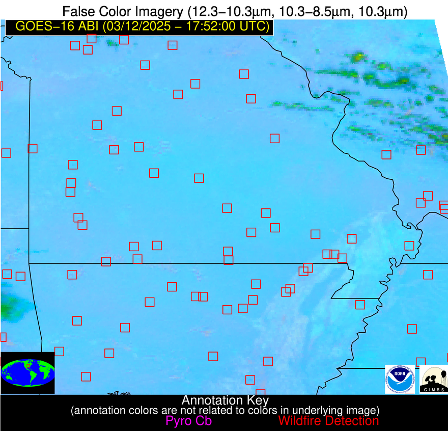
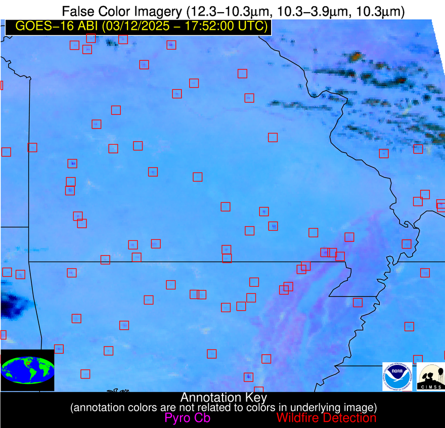
Wildfire Alert Report
| Date: | 2025-03-12 |
|---|---|
| Time: | 17:51:53 |
| Production Date and Time: | 2025-03-12 17:52:47 UTC |
| Primary Instrument: | GOES-16 ABI |
| Wmo Spacecraft Id: | 152 |
| Location/orbit: | GEO |
| L1 File: | OR_ABI-L1b-RadM2-M6C14_G16_s20250711751533_e20250711751590_c20250711752052.nc |
| L1 File(s) - Temporal | OR_ABI-L1b-RadM2-M6C14_G16_s20250711749533_e20250711749592_c20250711750051.nc |
| Number Of Thermal Anomaly Alerts: | 6 |
Possible Wildfire
| Basic Information | |
|---|---|
| State/Province(s) | MO |
| Country/Countries | United States |
| County/Locality(s) | Livingston County, MO |
| NWS WFO | Kansas City/Pleasant Hill MO |
| Identification Method | Enhanced Contextual (Clear) |
| Mean Object Date/Time | 2025-03-12 17:51:55UTC |
| Radiative Center (Lat, Lon): | 39.719166°, -93.737778° |
| Nearby Counties (meeting alert criteria): |
|
| Total Radiative Power Anomaly | n/a |
| Total Radiative Power | 13.07 MW |
| Map: | |
| Additional Information | |
| Alert Status | New Feature |
| Type of Event | Nominal Risk |
| Event Priority Ranking | 4 |
| Maximum Observed BT (3.9 um) | 308.44 K |
| Observed - Background BT (3.9 um) | 3.33 K |
| BT Anomaly (3.9 um) | 2.73 K |
| Maximum Observed - Clear RTM BT (3.9 um) | 16.45 K |
| Maximum Observed BTD (3.9-10/11/12 um) | 12.83 K |
| Observed - Background BTD (3.9-10/11/12 um) | 3.03 K |
| BTD Anomaly (3.9-10/11/12 um) | 2.90 K |
| Similar Pixel Count | 25 |
| BT Time Tendency (3.9 um) | 0.70 K |
| Image Interval | 2.00 minutes |
| Fraction of Surrounding LWIR Pixels that are Colder | 0.73 |
| Fraction of Surrounding Red Channel Pixels that are Brighter | 1.00 |
| Maximum Radiative Power | 13.07 MW |
| Maximum Radiative Power Uncertainty | 0.00 MW |
| Total Radiative Power Uncertainty | 0.00 MW |
| Mean Viewing Angle | 50.00° |
| Mean Solar Zenith Angle | 44.20° |
| Mean Glint Angle | 93.10° |
| Water Fraction | 0.00 |
| Total Pixel Area | 6.20 km2 |
| Latest Satellite Imagery: | |
| View all event imagery » | |
Possible Wildfire
| Basic Information | |
|---|---|
| State/Province(s) | MO |
| Country/Countries | United States |
| County/Locality(s) | Livingston County, MO |
| NWS WFO | Kansas City/Pleasant Hill MO |
| Identification Method | Enhanced Contextual (Clear) |
| Mean Object Date/Time | 2025-03-12 17:51:55UTC |
| Radiative Center (Lat, Lon): | 39.702499°, -93.283890° |
| Nearby Counties (meeting alert criteria): |
|
| Total Radiative Power Anomaly | n/a |
| Total Radiative Power | 17.88 MW |
| Map: | |
| Additional Information | |
| Alert Status | New Feature |
| Type of Event | Nominal Risk |
| Event Priority Ranking | 4 |
| Maximum Observed BT (3.9 um) | 308.19 K |
| Observed - Background BT (3.9 um) | 3.54 K |
| BT Anomaly (3.9 um) | 2.64 K |
| Maximum Observed - Clear RTM BT (3.9 um) | 15.45 K |
| Maximum Observed BTD (3.9-10/11/12 um) | 14.70 K |
| Observed - Background BTD (3.9-10/11/12 um) | 4.37 K |
| BTD Anomaly (3.9-10/11/12 um) | 3.94 K |
| Similar Pixel Count | 16 |
| BT Time Tendency (3.9 um) | 2.00 K |
| Image Interval | 2.00 minutes |
| Fraction of Surrounding LWIR Pixels that are Colder | 0.38 |
| Fraction of Surrounding Red Channel Pixels that are Brighter | 1.00 |
| Maximum Radiative Power | 17.88 MW |
| Maximum Radiative Power Uncertainty | 0.00 MW |
| Total Radiative Power Uncertainty | 0.00 MW |
| Mean Viewing Angle | 49.80° |
| Mean Solar Zenith Angle | 44.10° |
| Mean Glint Angle | 92.80° |
| Water Fraction | 0.00 |
| Total Pixel Area | 6.20 km2 |
| Latest Satellite Imagery: | |
| View all event imagery » | |
Possible Wildfire
| Basic Information | |
|---|---|
| State/Province(s) | MO |
| Country/Countries | United States |
| County/Locality(s) | Franklin County, MO |
| NWS WFO | St Louis MO |
| Identification Method | Enhanced Contextual (Clear) |
| Mean Object Date/Time | 2025-03-12 17:51:56UTC |
| Radiative Center (Lat, Lon): | 38.290279°, -91.171112° |
| Nearby Counties (meeting alert criteria): |
|
| Total Radiative Power Anomaly | n/a |
| Total Radiative Power | 5.54 MW |
| Map: | |
| Additional Information | |
| Alert Status | New Feature |
| Type of Event | Nominal Risk |
| Event Priority Ranking | 4 |
| Maximum Observed BT (3.9 um) | 308.60 K |
| Observed - Background BT (3.9 um) | 1.99 K |
| BT Anomaly (3.9 um) | 2.22 K |
| Maximum Observed - Clear RTM BT (3.9 um) | 14.07 K |
| Maximum Observed BTD (3.9-10/11/12 um) | 9.61 K |
| Observed - Background BTD (3.9-10/11/12 um) | 1.36 K |
| BTD Anomaly (3.9-10/11/12 um) | 4.65 K |
| Similar Pixel Count | 25 |
| BT Time Tendency (3.9 um) | 0.60 K |
| Image Interval | 2.00 minutes |
| Fraction of Surrounding LWIR Pixels that are Colder | 0.76 |
| Fraction of Surrounding Red Channel Pixels that are Brighter | 1.00 |
| Maximum Radiative Power | 5.54 MW |
| Maximum Radiative Power Uncertainty | 0.00 MW |
| Total Radiative Power Uncertainty | 0.00 MW |
| Mean Viewing Angle | 47.60° |
| Mean Solar Zenith Angle | 42.40° |
| Mean Glint Angle | 88.90° |
| Water Fraction | 0.00 |
| Total Pixel Area | 5.90 km2 |
| Latest Satellite Imagery: | |
| View all event imagery » | |
Possible Wildfire
| Basic Information | |
|---|---|
| State/Province(s) | IL |
| Country/Countries | United States |
| County/Locality(s) | Johnson County, IL |
| NWS WFO | Paducah KY |
| Identification Method | Enhanced Contextual (Clear) |
| Mean Object Date/Time | 2025-03-12 17:51:56UTC |
| Radiative Center (Lat, Lon): | 37.469444°, -89.023613° |
| Nearby Counties (meeting alert criteria): |
|
| Total Radiative Power Anomaly | n/a |
| Total Radiative Power | 10.07 MW |
| Map: | |
| Additional Information | |
| Alert Status | New Feature |
| Type of Event | Nominal Risk |
| Event Priority Ranking | 4 |
| Maximum Observed BT (3.9 um) | 306.97 K |
| Observed - Background BT (3.9 um) | 2.17 K |
| BT Anomaly (3.9 um) | 2.44 K |
| Maximum Observed - Clear RTM BT (3.9 um) | 14.96 K |
| Maximum Observed BTD (3.9-10/11/12 um) | 11.02 K |
| Observed - Background BTD (3.9-10/11/12 um) | 2.31 K |
| BTD Anomaly (3.9-10/11/12 um) | 4.81 K |
| Similar Pixel Count | 25 |
| BT Time Tendency (3.9 um) | 1.00 K |
| Image Interval | 2.00 minutes |
| Fraction of Surrounding LWIR Pixels that are Colder | 0.35 |
| Fraction of Surrounding Red Channel Pixels that are Brighter | 0.98 |
| Maximum Radiative Power | 10.07 MW |
| Maximum Radiative Power Uncertainty | 0.00 MW |
| Total Radiative Power Uncertainty | 0.00 MW |
| Mean Viewing Angle | 46.00° |
| Mean Solar Zenith Angle | 41.40° |
| Mean Glint Angle | 86.30° |
| Water Fraction | 0.00 |
| Total Pixel Area | 5.80 km2 |
| Latest Satellite Imagery: | |
| View all event imagery » | |
Possible Wildfire
| Basic Information | |
|---|---|
| State/Province(s) | MO |
| Country/Countries | United States |
| County/Locality(s) | Lawrence County, MO |
| NWS WFO | Springfield MO |
| Identification Method | Enhanced Contextual (Clear) |
| Mean Object Date/Time | 2025-03-12 17:51:55UTC |
| Radiative Center (Lat, Lon): | 37.051945°, -93.864998° |
| Nearby Counties (meeting alert criteria): |
|
| Total Radiative Power Anomaly | n/a |
| Total Radiative Power | 9.54 MW |
| Map: | |
| Additional Information | |
| Alert Status | New Feature |
| Type of Event | Nominal Risk |
| Event Priority Ranking | 4 |
| Maximum Observed BT (3.9 um) | 308.19 K |
| Observed - Background BT (3.9 um) | 2.45 K |
| BT Anomaly (3.9 um) | 2.48 K |
| Maximum Observed - Clear RTM BT (3.9 um) | 14.62 K |
| Maximum Observed BTD (3.9-10/11/12 um) | 11.37 K |
| Observed - Background BTD (3.9-10/11/12 um) | 2.57 K |
| BTD Anomaly (3.9-10/11/12 um) | 3.04 K |
| Similar Pixel Count | 25 |
| BT Time Tendency (3.9 um) | 0.50 K |
| Image Interval | 2.00 minutes |
| Fraction of Surrounding LWIR Pixels that are Colder | 0.37 |
| Fraction of Surrounding Red Channel Pixels that are Brighter | 1.00 |
| Maximum Radiative Power | 9.54 MW |
| Maximum Radiative Power Uncertainty | 0.00 MW |
| Total Radiative Power Uncertainty | 0.00 MW |
| Mean Viewing Angle | 47.40° |
| Mean Solar Zenith Angle | 41.60° |
| Mean Glint Angle | 87.90° |
| Water Fraction | 0.00 |
| Total Pixel Area | 5.90 km2 |
| Latest Satellite Imagery: | |
| View all event imagery » | |
Possible Wildfire
| Basic Information | |
|---|---|
| State/Province(s) | OK |
| Country/Countries | United States |
| County/Locality(s) | Le Flore County, OK |
| NWS WFO | Tulsa OK |
| Identification Method | Enhanced Contextual (Clear) |
| Mean Object Date/Time | 2025-03-12 17:51:55UTC |
| Radiative Center (Lat, Lon): | 34.864723°, -94.676666° |
| Nearby Counties (meeting alert criteria): |
|
| Total Radiative Power Anomaly | n/a |
| Total Radiative Power | 6.40 MW |
| Map: | |
| Additional Information | |
| Alert Status | New Feature |
| Type of Event | Nominal Risk |
| Event Priority Ranking | 4 |
| Maximum Observed BT (3.9 um) | 305.64 K |
| Observed - Background BT (3.9 um) | 3.01 K |
| BT Anomaly (3.9 um) | 1.94 K |
| Maximum Observed - Clear RTM BT (3.9 um) | 10.99 K |
| Maximum Observed BTD (3.9-10/11/12 um) | 9.77 K |
| Observed - Background BTD (3.9-10/11/12 um) | 2.39 K |
| BTD Anomaly (3.9-10/11/12 um) | 2.78 K |
| Similar Pixel Count | 23 |
| BT Time Tendency (3.9 um) | 2.00 K |
| Image Interval | 2.00 minutes |
| Fraction of Surrounding LWIR Pixels that are Colder | 0.74 |
| Fraction of Surrounding Red Channel Pixels that are Brighter | 1.00 |
| Maximum Radiative Power | 6.40 MW |
| Maximum Radiative Power Uncertainty | 0.00 MW |
| Total Radiative Power Uncertainty | 0.00 MW |
| Mean Viewing Angle | 45.70° |
| Mean Solar Zenith Angle | 39.60° |
| Mean Glint Angle | 84.10° |
| Water Fraction | 0.00 |
| Total Pixel Area | 5.70 km2 |
| Latest Satellite Imagery: | |
| View all event imagery » | |


