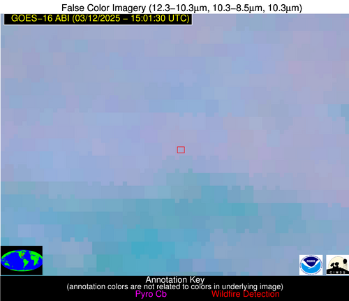
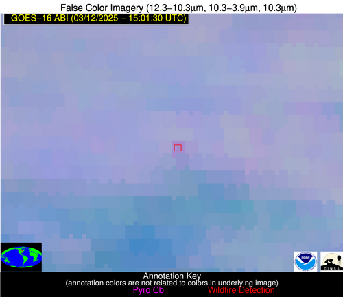
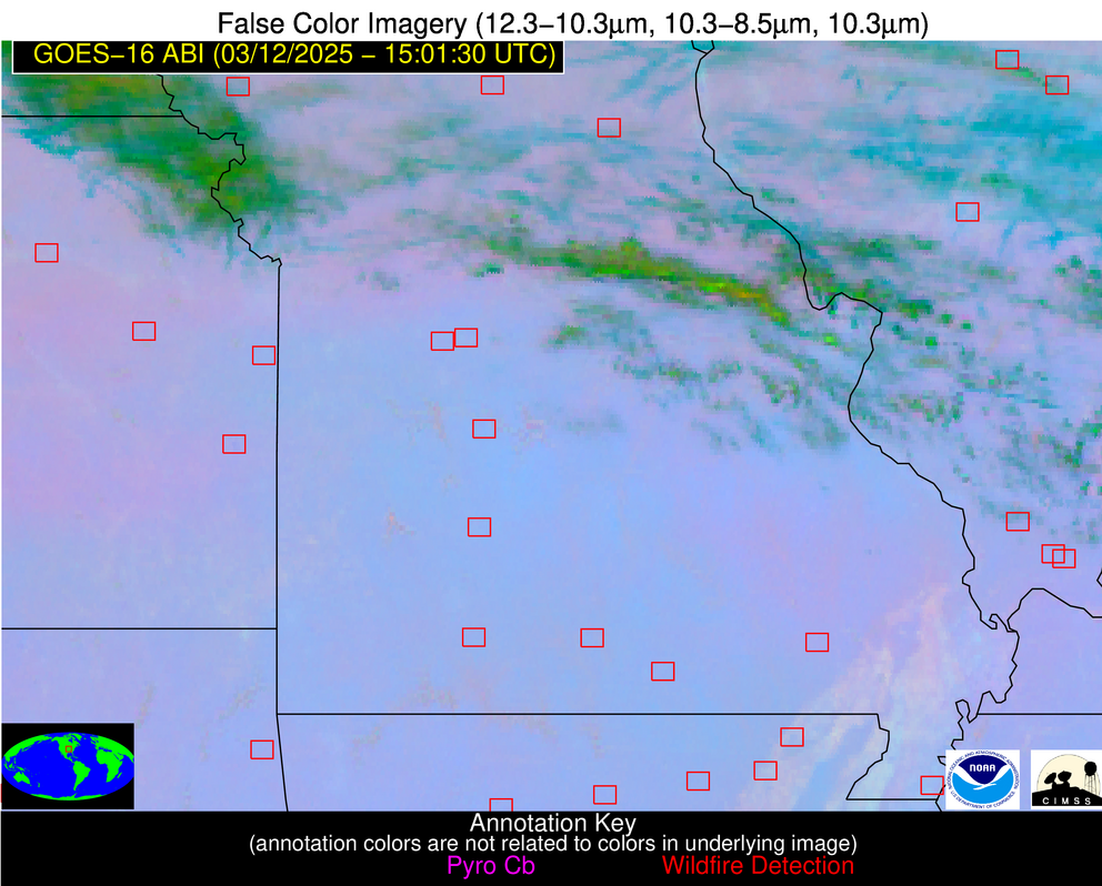
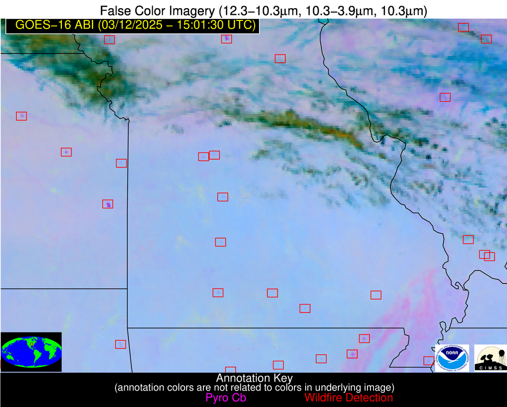
Wildfire Alert Report
| Date: | 2025-03-12 |
|---|---|
| Time: | 15:01:15 |
| Production Date and Time: | 2025-03-12 15:05:57 UTC |
| Primary Instrument: | GOES-16 ABI |
| Wmo Spacecraft Id: | 152 |
| Location/orbit: | GEO |
| L1 File: | OR_ABI-L1b-RadC-M6C14_G16_s20250711501154_e20250711503527_c20250711504021.nc |
| L1 File(s) - Temporal | OR_ABI-L1b-RadC-M6C14_G16_s20250711456154_e20250711458527_c20250711459018.nc |
| Number Of Thermal Anomaly Alerts: | 18 |
Possible Wildfire
| Basic Information | |
|---|---|
| State/Province(s) | IL |
| Country/Countries | United States |
| County/Locality(s) | Warren County, IL |
| NWS WFO | Quad Cities IL |
| Identification Method | Enhanced Contextual (Clear) |
| Mean Object Date/Time | 2025-03-12 15:01:49UTC |
| Radiative Center (Lat, Lon): | 40.814445°, -90.457222° |
| Nearby Counties (meeting alert criteria): |
|
| Total Radiative Power Anomaly | n/a |
| Total Radiative Power | 7.80 MW |
| Map: | |
| Additional Information | |
| Alert Status | New Feature |
| Type of Event | Nominal Risk |
| Event Priority Ranking | 4 |
| Maximum Observed BT (3.9 um) | 294.58 K |
| Observed - Background BT (3.9 um) | 2.81 K |
| BT Anomaly (3.9 um) | 2.66 K |
| Maximum Observed - Clear RTM BT (3.9 um) | 12.87 K |
| Maximum Observed BTD (3.9-10/11/12 um) | 11.61 K |
| Observed - Background BTD (3.9-10/11/12 um) | 2.81 K |
| BTD Anomaly (3.9-10/11/12 um) | 4.01 K |
| Similar Pixel Count | 23 |
| BT Time Tendency (3.9 um) | 1.40 K |
| Image Interval | 5.00 minutes |
| Fraction of Surrounding LWIR Pixels that are Colder | 0.62 |
| Fraction of Surrounding Red Channel Pixels that are Brighter | 1.00 |
| Maximum Radiative Power | 7.80 MW |
| Maximum Radiative Power Uncertainty | 0.00 MW |
| Total Radiative Power Uncertainty | 0.00 MW |
| Mean Viewing Angle | 49.90° |
| Mean Solar Zenith Angle | 62.20° |
| Mean Glint Angle | 105.20° |
| Water Fraction | 0.00 |
| Total Pixel Area | 6.20 km2 |
| Latest Satellite Imagery: | |
| View all event imagery » | |
Possible Wildfire
| Basic Information | |
|---|---|
| State/Province(s) | MO |
| Country/Countries | United States |
| County/Locality(s) | Nodaway County, MO |
| NWS WFO | Kansas City/Pleasant Hill MO |
| Identification Method | Enhanced Contextual (Cloud) |
| Mean Object Date/Time | 2025-03-12 15:01:48UTC |
| Radiative Center (Lat, Lon): | 40.174446°, -94.904724° |
| Nearby Counties (meeting alert criteria): |
|
| Total Radiative Power Anomaly | n/a |
| Total Radiative Power | 17.72 MW |
| Map: | |
| Additional Information | |
| Alert Status | New Feature |
| Type of Event | Nominal Risk |
| Event Priority Ranking | 4 |
| Maximum Observed BT (3.9 um) | 294.73 K |
| Observed - Background BT (3.9 um) | 6.70 K |
| BT Anomaly (3.9 um) | 6.05 K |
| Maximum Observed - Clear RTM BT (3.9 um) | 10.45 K |
| Maximum Observed BTD (3.9-10/11/12 um) | 15.40 K |
| Observed - Background BTD (3.9-10/11/12 um) | 6.54 K |
| BTD Anomaly (3.9-10/11/12 um) | 5.97 K |
| Similar Pixel Count | 0 |
| BT Time Tendency (3.9 um) | 6.40 K |
| Image Interval | 5.00 minutes |
| Fraction of Surrounding LWIR Pixels that are Colder | 0.61 |
| Fraction of Surrounding Red Channel Pixels that are Brighter | 0.99 |
| Maximum Radiative Power | 17.72 MW |
| Maximum Radiative Power Uncertainty | 0.00 MW |
| Total Radiative Power Uncertainty | 0.00 MW |
| Mean Viewing Angle | 50.90° |
| Mean Solar Zenith Angle | 64.80° |
| Mean Glint Angle | 109.30° |
| Water Fraction | 0.00 |
| Total Pixel Area | 6.30 km2 |
| Latest Satellite Imagery: | |
| View all event imagery » | |
Possible Wildfire
| Basic Information | |
|---|---|
| State/Province(s) | KS |
| Country/Countries | United States |
| County/Locality(s) | Pottawatomie County, KS |
| NWS WFO | Topeka KS |
| Identification Method | Enhanced Contextual (Clear) |
| Mean Object Date/Time | 2025-03-12 15:01:48UTC |
| Radiative Center (Lat, Lon): | 39.200554°, -96.327499° |
| Nearby Counties (meeting alert criteria): |
|
| Total Radiative Power Anomaly | n/a |
| Total Radiative Power | 37.64 MW |
| Map: | |
| Additional Information | |
| Alert Status | New Feature |
| Type of Event | Nominal Risk |
| Event Priority Ranking | 4 |
| Maximum Observed BT (3.9 um) | 298.31 K |
| Observed - Background BT (3.9 um) | 7.49 K |
| BT Anomaly (3.9 um) | 8.05 K |
| Maximum Observed - Clear RTM BT (3.9 um) | 11.44 K |
| Maximum Observed BTD (3.9-10/11/12 um) | 13.60 K |
| Observed - Background BTD (3.9-10/11/12 um) | 7.88 K |
| BTD Anomaly (3.9-10/11/12 um) | 19.19 K |
| Similar Pixel Count | 4 |
| BT Time Tendency (3.9 um) | 8.60 K |
| Image Interval | 5.00 minutes |
| Fraction of Surrounding LWIR Pixels that are Colder | 0.30 |
| Fraction of Surrounding Red Channel Pixels that are Brighter | 1.00 |
| Maximum Radiative Power | 21.93 MW |
| Maximum Radiative Power Uncertainty | 0.00 MW |
| Total Radiative Power Uncertainty | 0.00 MW |
| Mean Viewing Angle | 50.60° |
| Mean Solar Zenith Angle | 65.30° |
| Mean Glint Angle | 109.80° |
| Water Fraction | 0.00 |
| Total Pixel Area | 12.60 km2 |
| Latest Satellite Imagery: | |
| View all event imagery » | |
Possible Wildfire
| Basic Information | |
|---|---|
| State/Province(s) | MO |
| Country/Countries | United States |
| County/Locality(s) | Pettis County, MO |
| NWS WFO | Kansas City/Pleasant Hill MO |
| Identification Method | Enhanced Contextual (Clear) |
| Mean Object Date/Time | 2025-03-12 15:01:48UTC |
| Radiative Center (Lat, Lon): | 38.683613°, -93.384720° |
| Nearby Counties (meeting alert criteria): |
|
| Total Radiative Power Anomaly | n/a |
| Total Radiative Power | 9.23 MW |
| Map: | |
| Additional Information | |
| Alert Status | New Feature |
| Type of Event | Nominal Risk |
| Event Priority Ranking | 4 |
| Maximum Observed BT (3.9 um) | 297.63 K |
| Observed - Background BT (3.9 um) | 3.27 K |
| BT Anomaly (3.9 um) | 5.44 K |
| Maximum Observed - Clear RTM BT (3.9 um) | 9.86 K |
| Maximum Observed BTD (3.9-10/11/12 um) | 9.04 K |
| Observed - Background BTD (3.9-10/11/12 um) | 3.18 K |
| BTD Anomaly (3.9-10/11/12 um) | 8.43 K |
| Similar Pixel Count | 7 |
| BT Time Tendency (3.9 um) | 3.20 K |
| Image Interval | 5.00 minutes |
| Fraction of Surrounding LWIR Pixels that are Colder | 0.59 |
| Fraction of Surrounding Red Channel Pixels that are Brighter | 1.00 |
| Maximum Radiative Power | 9.23 MW |
| Maximum Radiative Power Uncertainty | 0.00 MW |
| Total Radiative Power Uncertainty | 0.00 MW |
| Mean Viewing Angle | 48.80° |
| Mean Solar Zenith Angle | 63.00° |
| Mean Glint Angle | 105.60° |
| Water Fraction | 0.00 |
| Total Pixel Area | 6.10 km2 |
| Latest Satellite Imagery: | |
| View all event imagery » | |
Possible Wildfire
| Basic Information | |
|---|---|
| State/Province(s) | KS |
| Country/Countries | United States |
| County/Locality(s) | Miami County, KS |
| NWS WFO | Kansas City/Pleasant Hill MO |
| Identification Method | Enhanced Contextual (Clear) |
| Mean Object Date/Time | 2025-03-12 15:01:48UTC |
| Radiative Center (Lat, Lon): | 38.600277°, -94.713058° |
| Nearby Counties (meeting alert criteria): |
|
| Total Radiative Power Anomaly | n/a |
| Total Radiative Power | 12.15 MW |
| Map: | |
| Additional Information | |
| Alert Status | New Feature |
| Type of Event | Nominal Risk |
| Event Priority Ranking | 4 |
| Maximum Observed BT (3.9 um) | 296.36 K |
| Observed - Background BT (3.9 um) | 3.21 K |
| BT Anomaly (3.9 um) | 5.29 K |
| Maximum Observed - Clear RTM BT (3.9 um) | 9.31 K |
| Maximum Observed BTD (3.9-10/11/12 um) | 8.33 K |
| Observed - Background BTD (3.9-10/11/12 um) | 2.75 K |
| BTD Anomaly (3.9-10/11/12 um) | 9.46 K |
| Similar Pixel Count | 18 |
| BT Time Tendency (3.9 um) | 2.80 K |
| Image Interval | 5.00 minutes |
| Fraction of Surrounding LWIR Pixels that are Colder | 0.88 |
| Fraction of Surrounding Red Channel Pixels that are Brighter | 1.00 |
| Maximum Radiative Power | 12.15 MW |
| Maximum Radiative Power Uncertainty | 0.00 MW |
| Total Radiative Power Uncertainty | 0.00 MW |
| Mean Viewing Angle | 49.30° |
| Mean Solar Zenith Angle | 63.90° |
| Mean Glint Angle | 107.10° |
| Water Fraction | 0.00 |
| Total Pixel Area | 12.30 km2 |
| Latest Satellite Imagery: | |
| View all event imagery » | |
Possible Wildfire
| Basic Information | |
|---|---|
| State/Province(s) | MO |
| Country/Countries | United States |
| County/Locality(s) | Dallas County, MO |
| NWS WFO | Springfield MO |
| Identification Method | Enhanced Contextual (Clear) |
| Mean Object Date/Time | 2025-03-12 15:01:48UTC |
| Radiative Center (Lat, Lon): | 37.594723°, -93.110275° |
| Nearby Counties (meeting alert criteria): |
|
| Total Radiative Power Anomaly | n/a |
| Total Radiative Power | 11.68 MW |
| Map: | |
| Additional Information | |
| Alert Status | New Feature |
| Type of Event | Nominal Risk |
| Event Priority Ranking | 4 |
| Maximum Observed BT (3.9 um) | 297.12 K |
| Observed - Background BT (3.9 um) | 2.29 K |
| BT Anomaly (3.9 um) | 22.95 K |
| Maximum Observed - Clear RTM BT (3.9 um) | 10.14 K |
| Maximum Observed BTD (3.9-10/11/12 um) | 7.62 K |
| Observed - Background BTD (3.9-10/11/12 um) | 2.37 K |
| BTD Anomaly (3.9-10/11/12 um) | 14.46 K |
| Similar Pixel Count | 23 |
| BT Time Tendency (3.9 um) | 1.70 K |
| Image Interval | 5.00 minutes |
| Fraction of Surrounding LWIR Pixels that are Colder | 0.39 |
| Fraction of Surrounding Red Channel Pixels that are Brighter | 1.00 |
| Maximum Radiative Power | 6.30 MW |
| Maximum Radiative Power Uncertainty | 0.00 MW |
| Total Radiative Power Uncertainty | 0.00 MW |
| Mean Viewing Angle | 47.60° |
| Mean Solar Zenith Angle | 62.30° |
| Mean Glint Angle | 103.90° |
| Water Fraction | 0.00 |
| Total Pixel Area | 11.90 km2 |
| Latest Satellite Imagery: | |
| View all event imagery » | |
Possible Wildfire
| Basic Information | |
|---|---|
| State/Province(s) | IL |
| Country/Countries | United States |
| County/Locality(s) | Johnson County, IL |
| NWS WFO | Paducah KY |
| Identification Method | Enhanced Contextual (Clear) |
| Mean Object Date/Time | 2025-03-12 15:01:49UTC |
| Radiative Center (Lat, Lon): | 37.410278°, -88.764442° |
| Nearby Counties (meeting alert criteria): |
|
| Total Radiative Power Anomaly | n/a |
| Total Radiative Power | 7.07 MW |
| Map: | |
| Additional Information | |
| Alert Status | New Feature |
| Type of Event | Nominal Risk |
| Event Priority Ranking | 4 |
| Maximum Observed BT (3.9 um) | 296.60 K |
| Observed - Background BT (3.9 um) | 2.66 K |
| BT Anomaly (3.9 um) | 2.71 K |
| Maximum Observed - Clear RTM BT (3.9 um) | 10.41 K |
| Maximum Observed BTD (3.9-10/11/12 um) | 7.88 K |
| Observed - Background BTD (3.9-10/11/12 um) | 2.65 K |
| BTD Anomaly (3.9-10/11/12 um) | 5.81 K |
| Similar Pixel Count | 13 |
| BT Time Tendency (3.9 um) | 2.40 K |
| Image Interval | 5.00 minutes |
| Fraction of Surrounding LWIR Pixels that are Colder | 0.44 |
| Fraction of Surrounding Red Channel Pixels that are Brighter | 1.00 |
| Maximum Radiative Power | 7.07 MW |
| Maximum Radiative Power Uncertainty | 0.00 MW |
| Total Radiative Power Uncertainty | 0.00 MW |
| Mean Viewing Angle | 45.80° |
| Mean Solar Zenith Angle | 59.30° |
| Mean Glint Angle | 98.60° |
| Water Fraction | 0.00 |
| Total Pixel Area | 5.70 km2 |
| Latest Satellite Imagery: | |
| View all event imagery » | |
Possible Wildfire
| Basic Information | |
|---|---|
| State/Province(s) | MO |
| Country/Countries | United States |
| County/Locality(s) | Howell County, MO |
| NWS WFO | Springfield MO |
| Identification Method | Enhanced Contextual (Clear) |
| Mean Object Date/Time | 2025-03-12 15:01:49UTC |
| Radiative Center (Lat, Lon): | 36.750000°, -91.746109° |
| Nearby Counties (meeting alert criteria): |
|
| Total Radiative Power Anomaly | n/a |
| Total Radiative Power | 5.87 MW |
| Map: | |
| Additional Information | |
| Alert Status | New Feature |
| Type of Event | Nominal Risk |
| Event Priority Ranking | 4 |
| Maximum Observed BT (3.9 um) | 296.79 K |
| Observed - Background BT (3.9 um) | 2.35 K |
| BT Anomaly (3.9 um) | 6.06 K |
| Maximum Observed - Clear RTM BT (3.9 um) | 10.45 K |
| Maximum Observed BTD (3.9-10/11/12 um) | 7.62 K |
| Observed - Background BTD (3.9-10/11/12 um) | 2.26 K |
| BTD Anomaly (3.9-10/11/12 um) | 8.91 K |
| Similar Pixel Count | 25 |
| BT Time Tendency (3.9 um) | 2.00 K |
| Image Interval | 5.00 minutes |
| Fraction of Surrounding LWIR Pixels that are Colder | 0.56 |
| Fraction of Surrounding Red Channel Pixels that are Brighter | 1.00 |
| Maximum Radiative Power | 5.87 MW |
| Maximum Radiative Power Uncertainty | 0.00 MW |
| Total Radiative Power Uncertainty | 0.00 MW |
| Mean Viewing Angle | 46.30° |
| Mean Solar Zenith Angle | 60.90° |
| Mean Glint Angle | 101.10° |
| Water Fraction | 0.00 |
| Total Pixel Area | 5.80 km2 |
| Latest Satellite Imagery: | |
| View all event imagery » | |
Possible Wildfire
| Basic Information | |
|---|---|
| State/Province(s) | NC |
| Country/Countries | United States |
| County/Locality(s) | Forsyth County, NC |
| NWS WFO | Raleigh NC |
| Identification Method | Enhanced Contextual (Clear) |
| Mean Object Date/Time | 2025-03-12 15:01:50UTC |
| Radiative Center (Lat, Lon): | 36.253334°, -80.074722° |
| Nearby Counties (meeting alert criteria): |
|
| Total Radiative Power Anomaly | n/a |
| Total Radiative Power | 10.60 MW |
| Map: | |
| Additional Information | |
| Alert Status | New Feature |
| Type of Event | Nominal Risk |
| Event Priority Ranking | 4 |
| Maximum Observed BT (3.9 um) | 300.88 K |
| Observed - Background BT (3.9 um) | 2.53 K |
| BT Anomaly (3.9 um) | 2.39 K |
| Maximum Observed - Clear RTM BT (3.9 um) | 14.00 K |
| Maximum Observed BTD (3.9-10/11/12 um) | 8.78 K |
| Observed - Background BTD (3.9-10/11/12 um) | 3.60 K |
| BTD Anomaly (3.9-10/11/12 um) | 6.31 K |
| Similar Pixel Count | 1 |
| BT Time Tendency (3.9 um) | 3.30 K |
| Image Interval | 5.00 minutes |
| Fraction of Surrounding LWIR Pixels that are Colder | 0.08 |
| Fraction of Surrounding Red Channel Pixels that are Brighter | 1.00 |
| Maximum Radiative Power | 10.60 MW |
| Maximum Radiative Power Uncertainty | 0.00 MW |
| Total Radiative Power Uncertainty | 0.00 MW |
| Mean Viewing Angle | 42.60° |
| Mean Solar Zenith Angle | 53.00° |
| Mean Glint Angle | 88.00° |
| Water Fraction | 0.00 |
| Total Pixel Area | 5.40 km2 |
| Latest Satellite Imagery: | |
| View all event imagery » | |
Possible Wildfire
| Basic Information | |
|---|---|
| State/Province(s) | AR |
| Country/Countries | United States |
| County/Locality(s) | Randolph County, AR |
| NWS WFO | Little Rock AR |
| Identification Method | Enhanced Contextual (Clear) |
| Mean Object Date/Time | 2025-03-12 15:01:49UTC |
| Radiative Center (Lat, Lon): | 36.168888°, -90.983612° |
| Nearby Counties (meeting alert criteria): |
|
| Total Radiative Power Anomaly | n/a |
| Total Radiative Power | 42.53 MW |
| Map: | |
| Additional Information | |
| Alert Status | New Feature |
| Type of Event | Nominal Risk |
| Event Priority Ranking | 4 |
| Maximum Observed BT (3.9 um) | 302.59 K |
| Observed - Background BT (3.9 um) | 8.72 K |
| BT Anomaly (3.9 um) | 7.90 K |
| Maximum Observed - Clear RTM BT (3.9 um) | 15.65 K |
| Maximum Observed BTD (3.9-10/11/12 um) | 15.88 K |
| Observed - Background BTD (3.9-10/11/12 um) | 9.06 K |
| BTD Anomaly (3.9-10/11/12 um) | 6.01 K |
| Similar Pixel Count | 4 |
| BT Time Tendency (3.9 um) | 7.00 K |
| Image Interval | 5.00 minutes |
| Fraction of Surrounding LWIR Pixels that are Colder | 0.37 |
| Fraction of Surrounding Red Channel Pixels that are Brighter | 0.54 |
| Maximum Radiative Power | 25.01 MW |
| Maximum Radiative Power Uncertainty | 0.00 MW |
| Total Radiative Power Uncertainty | 0.00 MW |
| Mean Viewing Angle | 45.40° |
| Mean Solar Zenith Angle | 60.10° |
| Mean Glint Angle | 99.40° |
| Water Fraction | 0.00 |
| Total Pixel Area | 11.40 km2 |
| Latest Satellite Imagery: | |
| View all event imagery » | |
Possible Wildfire
| Basic Information | |
|---|---|
| State/Province(s) | NC |
| Country/Countries | United States |
| County/Locality(s) | Transylvania County, NC |
| NWS WFO | Greenville-Spartanburg SC |
| Identification Method | Enhanced Contextual (Clear) |
| Mean Object Date/Time | 2025-03-12 15:02:20UTC |
| Radiative Center (Lat, Lon): | 35.132500°, -82.916115° |
| Nearby Counties (meeting alert criteria): |
|
| Total Radiative Power Anomaly | n/a |
| Total Radiative Power | 7.95 MW |
| Map: | |
| Additional Information | |
| Alert Status | New Feature |
| Type of Event | Nominal Risk |
| Event Priority Ranking | 4 |
| Maximum Observed BT (3.9 um) | 297.67 K |
| Observed - Background BT (3.9 um) | 3.64 K |
| BT Anomaly (3.9 um) | 2.85 K |
| Maximum Observed - Clear RTM BT (3.9 um) | 12.18 K |
| Maximum Observed BTD (3.9-10/11/12 um) | 7.37 K |
| Observed - Background BTD (3.9-10/11/12 um) | 3.27 K |
| BTD Anomaly (3.9-10/11/12 um) | 8.62 K |
| Similar Pixel Count | 2 |
| BT Time Tendency (3.9 um) | 3.10 K |
| Image Interval | 5.00 minutes |
| Fraction of Surrounding LWIR Pixels that are Colder | 0.60 |
| Fraction of Surrounding Red Channel Pixels that are Brighter | 1.00 |
| Maximum Radiative Power | 7.95 MW |
| Maximum Radiative Power Uncertainty | 0.00 MW |
| Total Radiative Power Uncertainty | 0.00 MW |
| Mean Viewing Angle | 41.80° |
| Mean Solar Zenith Angle | 54.10° |
| Mean Glint Angle | 88.90° |
| Water Fraction | 0.00 |
| Total Pixel Area | 5.40 km2 |
| Latest Satellite Imagery: | |
| View all event imagery » | |
Possible Wildfire
| Basic Information | |
|---|---|
| State/Province(s) | GA |
| Country/Countries | United States |
| County/Locality(s) | Paulding County, GA |
| NWS WFO | Peachtree City GA |
| Identification Method | Enhanced Contextual (Clear) |
| Mean Object Date/Time | 2025-03-12 15:02:19UTC |
| Radiative Center (Lat, Lon): | 33.993610°, -84.939445° |
| Nearby Counties (meeting alert criteria): |
|
| Total Radiative Power Anomaly | n/a |
| Total Radiative Power | 7.98 MW |
| Map: | |
| Additional Information | |
| Alert Status | New Feature |
| Type of Event | Nominal Risk |
| Event Priority Ranking | 4 |
| Maximum Observed BT (3.9 um) | 298.26 K |
| Observed - Background BT (3.9 um) | 3.56 K |
| BT Anomaly (3.9 um) | 4.88 K |
| Maximum Observed - Clear RTM BT (3.9 um) | 11.55 K |
| Maximum Observed BTD (3.9-10/11/12 um) | 7.63 K |
| Observed - Background BTD (3.9-10/11/12 um) | 3.23 K |
| BTD Anomaly (3.9-10/11/12 um) | 7.71 K |
| Similar Pixel Count | 3 |
| BT Time Tendency (3.9 um) | 2.00 K |
| Image Interval | 5.00 minutes |
| Fraction of Surrounding LWIR Pixels that are Colder | 0.69 |
| Fraction of Surrounding Red Channel Pixels that are Brighter | 1.00 |
| Maximum Radiative Power | 7.98 MW |
| Maximum Radiative Power Uncertainty | 0.00 MW |
| Total Radiative Power Uncertainty | 0.00 MW |
| Mean Viewing Angle | 41.00° |
| Mean Solar Zenith Angle | 54.80° |
| Mean Glint Angle | 89.30° |
| Water Fraction | 0.00 |
| Total Pixel Area | 5.30 km2 |
| Latest Satellite Imagery: | |
| View all event imagery » | |
Possible Wildfire
| Basic Information | |
|---|---|
| State/Province(s) | AL |
| Country/Countries | United States |
| County/Locality(s) | Tuscaloosa County, AL |
| NWS WFO | Birmingham AL |
| Identification Method | Enhanced Contextual (Clear) |
| Mean Object Date/Time | 2025-03-12 15:02:19UTC |
| Radiative Center (Lat, Lon): | 33.393612°, -87.470001° |
| Nearby Counties (meeting alert criteria): |
|
| Total Radiative Power Anomaly | n/a |
| Total Radiative Power | 8.29 MW |
| Map: | |
| Additional Information | |
| Alert Status | New Feature |
| Type of Event | Nominal Risk |
| Event Priority Ranking | 4 |
| Maximum Observed BT (3.9 um) | 294.98 K |
| Observed - Background BT (3.9 um) | 3.43 K |
| BT Anomaly (3.9 um) | 3.49 K |
| Maximum Observed - Clear RTM BT (3.9 um) | 8.47 K |
| Maximum Observed BTD (3.9-10/11/12 um) | 6.86 K |
| Observed - Background BTD (3.9-10/11/12 um) | 3.57 K |
| BTD Anomaly (3.9-10/11/12 um) | 6.04 K |
| Similar Pixel Count | 1 |
| BT Time Tendency (3.9 um) | 1.00 K |
| Image Interval | 5.00 minutes |
| Fraction of Surrounding LWIR Pixels that are Colder | 0.38 |
| Fraction of Surrounding Red Channel Pixels that are Brighter | 1.00 |
| Maximum Radiative Power | 8.29 MW |
| Maximum Radiative Power Uncertainty | 0.00 MW |
| Total Radiative Power Uncertainty | 0.00 MW |
| Mean Viewing Angle | 41.20° |
| Mean Solar Zenith Angle | 56.20° |
| Mean Glint Angle | 91.30° |
| Water Fraction | 0.00 |
| Total Pixel Area | 5.30 km2 |
| Latest Satellite Imagery: | |
| View all event imagery » | |
Possible Wildfire
| Basic Information | |
|---|---|
| State/Province(s) | AL |
| Country/Countries | United States |
| County/Locality(s) | Autauga County, AL |
| NWS WFO | Birmingham AL |
| Identification Method | Enhanced Contextual (Clear) |
| Mean Object Date/Time | 2025-03-12 15:02:19UTC |
| Radiative Center (Lat, Lon): | 32.588055°, -86.562500° |
| Nearby Counties (meeting alert criteria): |
|
| Total Radiative Power Anomaly | n/a |
| Total Radiative Power | 4.53 MW |
| Map: | |
| Additional Information | |
| Alert Status | New Feature |
| Type of Event | Nominal Risk |
| Event Priority Ranking | 4 |
| Maximum Observed BT (3.9 um) | 295.68 K |
| Observed - Background BT (3.9 um) | 2.26 K |
| BT Anomaly (3.9 um) | 2.35 K |
| Maximum Observed - Clear RTM BT (3.9 um) | 9.16 K |
| Maximum Observed BTD (3.9-10/11/12 um) | 5.86 K |
| Observed - Background BTD (3.9-10/11/12 um) | 2.01 K |
| BTD Anomaly (3.9-10/11/12 um) | 4.81 K |
| Similar Pixel Count | 14 |
| BT Time Tendency (3.9 um) | 1.50 K |
| Image Interval | 5.00 minutes |
| Fraction of Surrounding LWIR Pixels that are Colder | 0.74 |
| Fraction of Surrounding Red Channel Pixels that are Brighter | 1.00 |
| Maximum Radiative Power | 4.53 MW |
| Maximum Radiative Power Uncertainty | 0.00 MW |
| Total Radiative Power Uncertainty | 0.00 MW |
| Mean Viewing Angle | 40.00° |
| Mean Solar Zenith Angle | 55.10° |
| Mean Glint Angle | 89.10° |
| Water Fraction | 0.00 |
| Total Pixel Area | 5.20 km2 |
| Latest Satellite Imagery: | |
| View all event imagery » | |
Possible Wildfire
| Basic Information | |
|---|---|
| State/Province(s) | GA |
| Country/Countries | United States |
| County/Locality(s) | Grady County, GA |
| NWS WFO | Tallahassee FL |
| Identification Method | Enhanced Contextual (Clear) |
| Mean Object Date/Time | 2025-03-12 15:02:19UTC |
| Radiative Center (Lat, Lon): | 30.684166°, -84.192497° |
| Nearby Counties (meeting alert criteria): |
|
| Total Radiative Power Anomaly | n/a |
| Total Radiative Power | 5.30 MW |
| Map: | |
| Additional Information | |
| Alert Status | New Feature |
| Type of Event | Nominal Risk |
| Event Priority Ranking | 4 |
| Maximum Observed BT (3.9 um) | 296.69 K |
| Observed - Background BT (3.9 um) | 2.68 K |
| BT Anomaly (3.9 um) | 3.86 K |
| Maximum Observed - Clear RTM BT (3.9 um) | 9.39 K |
| Maximum Observed BTD (3.9-10/11/12 um) | 5.78 K |
| Observed - Background BTD (3.9-10/11/12 um) | 2.59 K |
| BTD Anomaly (3.9-10/11/12 um) | 8.64 K |
| Similar Pixel Count | 3 |
| BT Time Tendency (3.9 um) | 1.80 K |
| Image Interval | 5.00 minutes |
| Fraction of Surrounding LWIR Pixels that are Colder | 0.56 |
| Fraction of Surrounding Red Channel Pixels that are Brighter | 1.00 |
| Maximum Radiative Power | 5.30 MW |
| Maximum Radiative Power Uncertainty | 0.00 MW |
| Total Radiative Power Uncertainty | 0.00 MW |
| Mean Viewing Angle | 37.20° |
| Mean Solar Zenith Angle | 52.40° |
| Mean Glint Angle | 83.40° |
| Water Fraction | 0.00 |
| Total Pixel Area | 5.00 km2 |
| Latest Satellite Imagery: | |
| View all event imagery » | |
Possible Wildfire
| Basic Information | |
|---|---|
| State/Province(s) | FL |
| Country/Countries | United States |
| County/Locality(s) | Hardee County, FL |
| NWS WFO | Tampa Bay Ruskin FL |
| Identification Method | Enhanced Contextual (Clear) |
| Mean Object Date/Time | 2025-03-12 15:02:50UTC |
| Radiative Center (Lat, Lon): | 27.478611°, -81.861389° |
| Nearby Counties (meeting alert criteria): |
|
| Total Radiative Power Anomaly | n/a |
| Total Radiative Power | 15.97 MW |
| Map: | |
| Additional Information | |
| Alert Status | New Feature |
| Type of Event | Nominal Risk |
| Event Priority Ranking | 4 |
| Maximum Observed BT (3.9 um) | 303.88 K |
| Observed - Background BT (3.9 um) | 4.23 K |
| BT Anomaly (3.9 um) | 3.94 K |
| Maximum Observed - Clear RTM BT (3.9 um) | 10.30 K |
| Maximum Observed BTD (3.9-10/11/12 um) | 7.92 K |
| Observed - Background BTD (3.9-10/11/12 um) | 3.18 K |
| BTD Anomaly (3.9-10/11/12 um) | 5.56 K |
| Similar Pixel Count | 12 |
| BT Time Tendency (3.9 um) | 3.60 K |
| Image Interval | 5.00 minutes |
| Fraction of Surrounding LWIR Pixels that are Colder | 0.37 |
| Fraction of Surrounding Red Channel Pixels that are Brighter | 1.00 |
| Maximum Radiative Power | 8.55 MW |
| Maximum Radiative Power Uncertainty | 0.00 MW |
| Total Radiative Power Uncertainty | 0.00 MW |
| Mean Viewing Angle | 33.10° |
| Mean Solar Zenith Angle | 48.90° |
| Mean Glint Angle | 75.70° |
| Water Fraction | 0.00 |
| Total Pixel Area | 9.50 km2 |
| Latest Satellite Imagery: | |
| View all event imagery » | |
Possible Wildfire
| Basic Information | |
|---|---|
| State/Province(s) | Unknown |
| Country/Countries | Cuba |
| County/Locality(s) | Unknown, Unknown |
| NWS WFO | N/A |
| Identification Method | Enhanced Contextual (Clear) |
| Mean Object Date/Time | 2025-03-12 15:03:20UTC |
| Radiative Center (Lat, Lon): | 22.358889°, -81.193336° |
| Nearby Counties (meeting alert criteria): |
|
| Total Radiative Power Anomaly | n/a |
| Total Radiative Power | 8.90 MW |
| Map: | |
| Additional Information | |
| Alert Status | New Feature |
| Type of Event | Nominal Risk |
| Event Priority Ranking | 4 |
| Maximum Observed BT (3.9 um) | 302.59 K |
| Observed - Background BT (3.9 um) | 2.77 K |
| BT Anomaly (3.9 um) | 2.19 K |
| Maximum Observed - Clear RTM BT (3.9 um) | 3.82 K |
| Maximum Observed BTD (3.9-10/11/12 um) | 9.22 K |
| Observed - Background BTD (3.9-10/11/12 um) | 2.98 K |
| BTD Anomaly (3.9-10/11/12 um) | 2.56 K |
| Similar Pixel Count | 7 |
| BT Time Tendency (3.9 um) | 1.50 K |
| Image Interval | 5.00 minutes |
| Fraction of Surrounding LWIR Pixels that are Colder | 0.34 |
| Fraction of Surrounding Red Channel Pixels that are Brighter | 0.99 |
| Maximum Radiative Power | 8.90 MW |
| Maximum Radiative Power Uncertainty | 0.00 MW |
| Total Radiative Power Uncertainty | 0.00 MW |
| Mean Viewing Angle | 27.10° |
| Mean Solar Zenith Angle | 45.70° |
| Mean Glint Angle | 67.10° |
| Water Fraction | 0.00 |
| Total Pixel Area | 4.50 km2 |
| Latest Satellite Imagery: | |
| View all event imagery » | |
Possible Wildfire
| Basic Information | |
|---|---|
| State/Province(s) | Unknown |
| Country/Countries | Cuba |
| County/Locality(s) | Unknown, Unknown |
| NWS WFO | N/A |
| Identification Method | Enhanced Contextual (Cloud) |
| Mean Object Date/Time | 2025-03-12 15:03:20UTC |
| Radiative Center (Lat, Lon): | 21.080833°, -78.179726° |
| Nearby Counties (meeting alert criteria): |
|
| Total Radiative Power Anomaly | n/a |
| Total Radiative Power | 19.13 MW |
| Map: | |
| Additional Information | |
| Alert Status | New Feature |
| Type of Event | Nominal Risk |
| Event Priority Ranking | 4 |
| Maximum Observed BT (3.9 um) | 313.31 K |
| Observed - Background BT (3.9 um) | 7.37 K |
| BT Anomaly (3.9 um) | 3.60 K |
| Maximum Observed - Clear RTM BT (3.9 um) | 12.46 K |
| Maximum Observed BTD (3.9-10/11/12 um) | 18.13 K |
| Observed - Background BTD (3.9-10/11/12 um) | 6.85 K |
| BTD Anomaly (3.9-10/11/12 um) | 5.24 K |
| Similar Pixel Count | 0 |
| BT Time Tendency (3.9 um) | 3.60 K |
| Image Interval | 5.00 minutes |
| Fraction of Surrounding LWIR Pixels that are Colder | 0.74 |
| Fraction of Surrounding Red Channel Pixels that are Brighter | 1.00 |
| Maximum Radiative Power | 19.13 MW |
| Maximum Radiative Power Uncertainty | 0.00 MW |
| Total Radiative Power Uncertainty | 0.00 MW |
| Mean Viewing Angle | 25.00° |
| Mean Solar Zenith Angle | 42.60° |
| Mean Glint Angle | 61.00° |
| Water Fraction | 0.00 |
| Total Pixel Area | 4.40 km2 |
| Latest Satellite Imagery: | |
| View all event imagery » | |
