Wildfire Alert Report
| Date: | 2025-03-12 |
|---|---|
| Time: | 13:46:15 |
| Production Date and Time: | 2025-03-12 13:50:59 UTC |
| Primary Instrument: | GOES-16 ABI |
| Wmo Spacecraft Id: | 152 |
| Location/orbit: | GEO |
| L1 File: | OR_ABI-L1b-RadC-M6C14_G16_s20250711346154_e20250711348527_c20250711349018.nc |
| L1 File(s) - Temporal | OR_ABI-L1b-RadC-M6C14_G16_s20250711341154_e20250711343527_c20250711344038.nc |
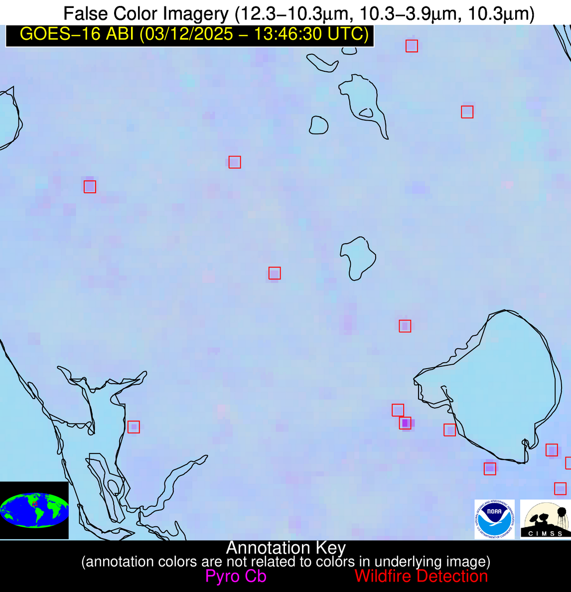
| Number Of Thermal Anomaly Alerts: | 8 |
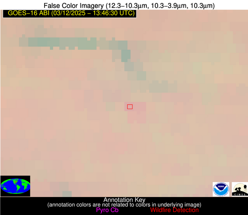
Possible Wildfire
| Basic Information | |
|---|---|
| State/Province(s) | IL |
| Country/Countries | United States |
| County/Locality(s) | Knox County, IL |
| NWS WFO | Lincoln IL |
| Identification Method | Enhanced Contextual (Clear) |
| Mean Object Date/Time | 2025-03-12 13:46:49UTC |
| Radiative Center (Lat, Lon): | 40.865276°, -90.313614° |
| Nearby Counties (meeting alert criteria): |
|
| Total Radiative Power Anomaly | n/a |
| Total Radiative Power | 3.82 MW |
| Map: | |
| Additional Information | |
| Alert Status | New Feature |
| Type of Event | Nominal Risk |
| Event Priority Ranking | 4 |
| Maximum Observed BT (3.9 um) | 282.64 K |
| Observed - Background BT (3.9 um) | 2.43 K |
| BT Anomaly (3.9 um) | 4.93 K |
| Maximum Observed - Clear RTM BT (3.9 um) | 4.52 K |
| Maximum Observed BTD (3.9-10/11/12 um) | 5.76 K |
| Observed - Background BTD (3.9-10/11/12 um) | 2.11 K |
| BTD Anomaly (3.9-10/11/12 um) | 4.19 K |
| Similar Pixel Count | 11 |
| BT Time Tendency (3.9 um) | 2.70 K |
| Image Interval | 5.00 minutes |
| Fraction of Surrounding LWIR Pixels that are Colder | 0.59 |
| Fraction of Surrounding Red Channel Pixels that are Brighter | 1.00 |
| Maximum Radiative Power | 3.82 MW |
| Maximum Radiative Power Uncertainty | 0.00 MW |
| Total Radiative Power Uncertainty | 0.00 MW |
| Mean Viewing Angle | 49.90° |
| Mean Solar Zenith Angle | 74.90° |
| Mean Glint Angle | 108.60° |
| Water Fraction | 0.00 |
| Total Pixel Area | 6.20 km2 |
| Latest Satellite Imagery: | |
| View all event imagery » | |
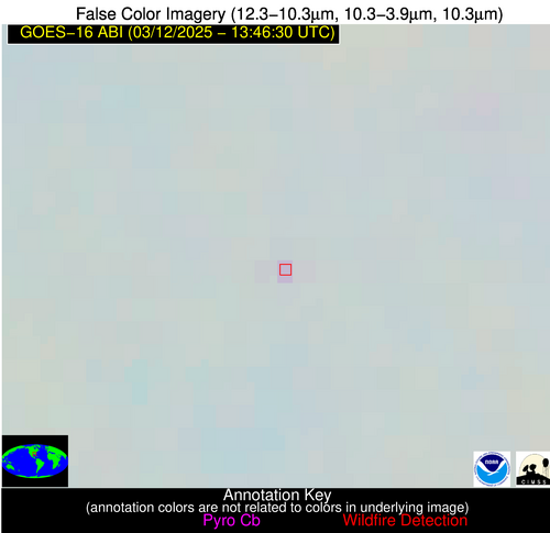
Possible Wildfire
| Basic Information | |
|---|---|
| State/Province(s) | IN |
| Country/Countries | United States |
| County/Locality(s) | Parke County, IN |
| NWS WFO | Indianapolis IN |
| Identification Method | Enhanced Contextual (Clear) |
| Mean Object Date/Time | 2025-03-12 13:46:49UTC |
| Radiative Center (Lat, Lon): | 39.806667°, -87.023613° |
| Nearby Counties (meeting alert criteria): |
|
| Total Radiative Power Anomaly | n/a |
| Total Radiative Power | 6.33 MW |
| Map: | |
| Additional Information | |
| Alert Status | New Feature |
| Type of Event | Nominal Risk |
| Event Priority Ranking | 4 |
| Maximum Observed BT (3.9 um) | 286.83 K |
| Observed - Background BT (3.9 um) | 3.39 K |
| BT Anomaly (3.9 um) | 7.67 K |
| Maximum Observed - Clear RTM BT (3.9 um) | 5.54 K |
| Maximum Observed BTD (3.9-10/11/12 um) | 6.87 K |
| Observed - Background BTD (3.9-10/11/12 um) | 3.00 K |
| BTD Anomaly (3.9-10/11/12 um) | 5.03 K |
| Similar Pixel Count | 6 |
| BT Time Tendency (3.9 um) | 2.30 K |
| Image Interval | 5.00 minutes |
| Fraction of Surrounding LWIR Pixels that are Colder | 0.75 |
| Fraction of Surrounding Red Channel Pixels that are Brighter | 0.95 |
| Maximum Radiative Power | 6.33 MW |
| Maximum Radiative Power Uncertainty | 0.00 MW |
| Total Radiative Power Uncertainty | 0.00 MW |
| Mean Viewing Angle | 47.90° |
| Mean Solar Zenith Angle | 72.20° |
| Mean Glint Angle | 103.80° |
| Water Fraction | 0.00 |
| Total Pixel Area | 6.00 km2 |
| Latest Satellite Imagery: | |
| View all event imagery » | |
Possible Wildfire
| Basic Information | |
|---|---|
| State/Province(s) | SC |
| Country/Countries | United States |
| County/Locality(s) | Colleton County, SC |
| NWS WFO | Charleston SC |
| Identification Method | Enhanced Contextual (Clear) |
| Mean Object Date/Time | 2025-03-12 13:47:20UTC |
| Radiative Center (Lat, Lon): | 32.881390°, -80.754448° |
| Nearby Counties (meeting alert criteria): |
|
| Total Radiative Power Anomaly | n/a |
| Total Radiative Power | 6.28 MW |
| Map: | |
| Additional Information | |
| Alert Status | New Feature |
| Type of Event | Nominal Risk |
| Event Priority Ranking | 4 |
| Maximum Observed BT (3.9 um) | 291.04 K |
| Observed - Background BT (3.9 um) | 3.95 K |
| BT Anomaly (3.9 um) | 8.31 K |
| Maximum Observed - Clear RTM BT (3.9 um) | 5.78 K |
| Maximum Observed BTD (3.9-10/11/12 um) | 4.93 K |
| Observed - Background BTD (3.9-10/11/12 um) | 3.53 K |
| BTD Anomaly (3.9-10/11/12 um) | 13.16 K |
| Similar Pixel Count | 2 |
| BT Time Tendency (3.9 um) | 3.10 K |
| Image Interval | 5.00 minutes |
| Fraction of Surrounding LWIR Pixels that are Colder | 0.85 |
| Fraction of Surrounding Red Channel Pixels that are Brighter | 1.00 |
| Maximum Radiative Power | 6.28 MW |
| Maximum Radiative Power Uncertainty | 0.00 MW |
| Total Radiative Power Uncertainty | 0.00 MW |
| Mean Viewing Angle | 38.90° |
| Mean Solar Zenith Angle | 64.90° |
| Mean Glint Angle | 88.80° |
| Water Fraction | 0.00 |
| Total Pixel Area | 5.10 km2 |
| Latest Satellite Imagery: | |
| View all event imagery » | |
Possible Wildfire
| Basic Information | |
|---|---|
| State/Province(s) | AL |
| Country/Countries | United States |
| County/Locality(s) | Dallas County, AL |
| NWS WFO | Birmingham AL |
| Identification Method | Enhanced Contextual (Clear) |
| Mean Object Date/Time | 2025-03-12 13:47:19UTC |
| Radiative Center (Lat, Lon): | 32.248055°, -87.236115° |
| Nearby Counties (meeting alert criteria): |
|
| Total Radiative Power Anomaly | n/a |
| Total Radiative Power | 6.17 MW |
| Map: | |
| Additional Information | |
| Alert Status | New Feature |
| Type of Event | Nominal Risk |
| Event Priority Ranking | 4 |
| Maximum Observed BT (3.9 um) | 289.05 K |
| Observed - Background BT (3.9 um) | 3.72 K |
| BT Anomaly (3.9 um) | 8.29 K |
| Maximum Observed - Clear RTM BT (3.9 um) | 5.35 K |
| Maximum Observed BTD (3.9-10/11/12 um) | 4.96 K |
| Observed - Background BTD (3.9-10/11/12 um) | 3.64 K |
| BTD Anomaly (3.9-10/11/12 um) | 22.64 K |
| Similar Pixel Count | 1 |
| BT Time Tendency (3.9 um) | 2.10 K |
| Image Interval | 5.00 minutes |
| Fraction of Surrounding LWIR Pixels that are Colder | 0.51 |
| Fraction of Surrounding Red Channel Pixels that are Brighter | 1.00 |
| Maximum Radiative Power | 6.17 MW |
| Maximum Radiative Power Uncertainty | 0.00 MW |
| Total Radiative Power Uncertainty | 0.00 MW |
| Mean Viewing Angle | 39.90° |
| Mean Solar Zenith Angle | 69.80° |
| Mean Glint Angle | 97.00° |
| Water Fraction | 0.00 |
| Total Pixel Area | 5.20 km2 |
| Latest Satellite Imagery: | |
| View all event imagery » | |
Possible Wildfire
| Basic Information | |
|---|---|
| State/Province(s) | FL |
| Country/Countries | United States |
| County/Locality(s) | Osceola County, FL |
| NWS WFO | Melbourne FL |
| Identification Method | Enhanced Contextual (Clear) |
| Mean Object Date/Time | 2025-03-12 13:47:50UTC |
| Radiative Center (Lat, Lon): | 27.864166°, -80.922501° |
| Nearby Counties (meeting alert criteria): |
|
| Total Radiative Power Anomaly | n/a |
| Total Radiative Power | 11.42 MW |
| Map: | |
| Additional Information | |
| Alert Status | New Feature |
| Type of Event | Nominal Risk |
| Event Priority Ranking | 4 |
| Maximum Observed BT (3.9 um) | 294.11 K |
| Observed - Background BT (3.9 um) | 2.99 K |
| BT Anomaly (3.9 um) | 4.02 K |
| Maximum Observed - Clear RTM BT (3.9 um) | 7.39 K |
| Maximum Observed BTD (3.9-10/11/12 um) | 4.49 K |
| Observed - Background BTD (3.9-10/11/12 um) | 2.57 K |
| BTD Anomaly (3.9-10/11/12 um) | 7.68 K |
| Similar Pixel Count | 4 |
| BT Time Tendency (3.9 um) | 2.40 K |
| Image Interval | 5.00 minutes |
| Fraction of Surrounding LWIR Pixels that are Colder | 0.76 |
| Fraction of Surrounding Red Channel Pixels that are Brighter | 1.00 |
| Maximum Radiative Power | 11.42 MW |
| Maximum Radiative Power Uncertainty | 0.00 MW |
| Total Radiative Power Uncertainty | 0.00 MW |
| Mean Viewing Angle | 33.30° |
| Mean Solar Zenith Angle | 63.20° |
| Mean Glint Angle | 83.40° |
| Water Fraction | 0.00 |
| Total Pixel Area | 14.40 km2 |
| Latest Satellite Imagery: | |
| View all event imagery » | |
Possible Wildfire
| Basic Information | |
|---|---|
| State/Province(s) | FL |
| Country/Countries | United States |
| County/Locality(s) | Manatee County, FL |
| NWS WFO | Tampa Bay Ruskin FL |
| Identification Method | Enhanced Contextual (Clear) |
| Mean Object Date/Time | 2025-03-12 13:47:50UTC |
| Radiative Center (Lat, Lon): | 27.612778°, -82.165558° |
| Nearby Counties (meeting alert criteria): |
|
| Total Radiative Power Anomaly | n/a |
| Total Radiative Power | 20.74 MW |
| Map: | |
| Additional Information | |
| Alert Status | New Feature |
| Type of Event | Nominal Risk |
| Event Priority Ranking | 4 |
| Maximum Observed BT (3.9 um) | 298.66 K |
| Observed - Background BT (3.9 um) | 6.06 K |
| BT Anomaly (3.9 um) | 6.11 K |
| Maximum Observed - Clear RTM BT (3.9 um) | 10.33 K |
| Maximum Observed BTD (3.9-10/11/12 um) | 8.14 K |
| Observed - Background BTD (3.9-10/11/12 um) | 5.32 K |
| BTD Anomaly (3.9-10/11/12 um) | 7.64 K |
| Similar Pixel Count | 2 |
| BT Time Tendency (3.9 um) | 4.50 K |
| Image Interval | 5.00 minutes |
| Fraction of Surrounding LWIR Pixels that are Colder | 0.93 |
| Fraction of Surrounding Red Channel Pixels that are Brighter | 1.00 |
| Maximum Radiative Power | 10.57 MW |
| Maximum Radiative Power Uncertainty | 0.00 MW |
| Total Radiative Power Uncertainty | 0.00 MW |
| Mean Viewing Angle | 33.30° |
| Mean Solar Zenith Angle | 64.10° |
| Mean Glint Angle | 85.00° |
| Water Fraction | 0.00 |
| Total Pixel Area | 9.60 km2 |
| Latest Satellite Imagery: | |
| View all event imagery » | |
Possible Wildfire
| Basic Information | |
|---|---|
| State/Province(s) | FL |
| Country/Countries | United States |
| County/Locality(s) | Glades County, FL |
| NWS WFO | Miami FL |
| Identification Method | Enhanced Contextual (Clear) |
| Mean Object Date/Time | 2025-03-12 13:47:50UTC |
| Radiative Center (Lat, Lon): | 27.144722°, -81.127502° |
| Nearby Counties (meeting alert criteria): |
|
| Total Radiative Power Anomaly | n/a |
| Total Radiative Power | 12.67 MW |
| Map: | |
| Additional Information | |
| Alert Status | New Feature |
| Type of Event | Nominal Risk |
| Event Priority Ranking | 4 |
| Maximum Observed BT (3.9 um) | 297.35 K |
| Observed - Background BT (3.9 um) | 5.74 K |
| BT Anomaly (3.9 um) | 9.67 K |
| Maximum Observed - Clear RTM BT (3.9 um) | 9.91 K |
| Maximum Observed BTD (3.9-10/11/12 um) | 8.41 K |
| Observed - Background BTD (3.9-10/11/12 um) | 6.28 K |
| BTD Anomaly (3.9-10/11/12 um) | 19.44 K |
| Similar Pixel Count | 1 |
| BT Time Tendency (3.9 um) | 6.10 K |
| Image Interval | 5.00 minutes |
| Fraction of Surrounding LWIR Pixels that are Colder | 0.11 |
| Fraction of Surrounding Red Channel Pixels that are Brighter | 1.00 |
| Maximum Radiative Power | 12.67 MW |
| Maximum Radiative Power Uncertainty | 0.00 MW |
| Total Radiative Power Uncertainty | 0.00 MW |
| Mean Viewing Angle | 32.50° |
| Mean Solar Zenith Angle | 63.10° |
| Mean Glint Angle | 82.90° |
| Water Fraction | 0.00 |
| Total Pixel Area | 4.70 km2 |
| Latest Satellite Imagery: | |
| View all event imagery » | |
Possible Wildfire
| Basic Information | |
|---|---|
| State/Province(s) | FL |
| Country/Countries | United States |
| County/Locality(s) | Palm Beach County, FL |
| NWS WFO | Miami FL |
| Identification Method | Enhanced Contextual (Clear) |
| Mean Object Date/Time | 2025-03-12 13:47:50UTC |
| Radiative Center (Lat, Lon): | 26.665277°, -80.847778° |
| Nearby Counties (meeting alert criteria): |
|
| Total Radiative Power Anomaly | n/a |
| Total Radiative Power | 36.40 MW |
| Map: | |
| Additional Information | |
| Alert Status | New Feature |
| Type of Event | Nominal Risk |
| Event Priority Ranking | 4 |
| Maximum Observed BT (3.9 um) | 305.18 K |
| Observed - Background BT (3.9 um) | 10.26 K |
| BT Anomaly (3.9 um) | 7.43 K |
| Maximum Observed - Clear RTM BT (3.9 um) | 15.72 K |
| Maximum Observed BTD (3.9-10/11/12 um) | 12.70 K |
| Observed - Background BTD (3.9-10/11/12 um) | 9.53 K |
| BTD Anomaly (3.9-10/11/12 um) | 17.06 K |
| Similar Pixel Count | 2 |
| BT Time Tendency (3.9 um) | 8.00 K |
| Image Interval | 5.00 minutes |
| Fraction of Surrounding LWIR Pixels that are Colder | 0.80 |
| Fraction of Surrounding Red Channel Pixels that are Brighter | 1.00 |
| Maximum Radiative Power | 36.40 MW |
| Maximum Radiative Power Uncertainty | 0.00 MW |
| Total Radiative Power Uncertainty | 0.00 MW |
| Mean Viewing Angle | 31.90° |
| Mean Solar Zenith Angle | 62.70° |
| Mean Glint Angle | 82.00° |
| Water Fraction | 0.00 |
| Total Pixel Area | 9.40 km2 |
| Latest Satellite Imagery: | |
| View all event imagery » | |


