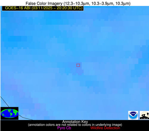
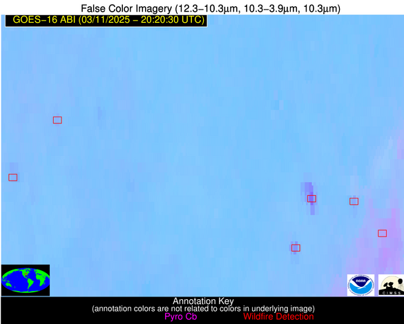
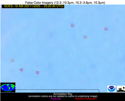
Wildfire Alert Report
| Date: | 2025-03-11 |
|---|---|
| Time: | 20:20:26 |
| Production Date and Time: | 2025-03-11 20:21:08 UTC |
| Primary Instrument: | GOES-16 ABI |
| Wmo Spacecraft Id: | 152 |
| Location/orbit: | GEO |
| L1 File: | OR_ABI-L1b-RadM1-M6C14_G16_s20250702020261_e20250702020319_c20250702020373.nc |
| L1 File(s) - Temporal | OR_ABI-L1b-RadM1-M6C14_G16_s20250702017232_e20250702017290_c20250702017352.nc |
| Number Of Thermal Anomaly Alerts: | 5 |
Possible Wildfire
| Basic Information | |
|---|---|
| State/Province(s) | IL |
| Country/Countries | United States |
| County/Locality(s) | Pike County, IL |
| NWS WFO | St Louis MO |
| Identification Method | Enhanced Contextual (Clear) |
| Mean Object Date/Time | 2025-03-11 20:20:29UTC |
| Radiative Center (Lat, Lon): | 39.782501°, -90.905556° |
| Nearby Counties (meeting alert criteria): |
|
| Total Radiative Power Anomaly | n/a |
| Total Radiative Power | 8.92 MW |
| Map: | |
| Additional Information | |
| Alert Status | New Feature |
| Type of Event | Nominal Risk |
| Event Priority Ranking | 4 |
| Maximum Observed BT (3.9 um) | 303.65 K |
| Observed - Background BT (3.9 um) | 2.57 K |
| BT Anomaly (3.9 um) | 2.33 K |
| Maximum Observed - Clear RTM BT (3.9 um) | 15.03 K |
| Maximum Observed BTD (3.9-10/11/12 um) | 11.17 K |
| Observed - Background BTD (3.9-10/11/12 um) | 2.68 K |
| BTD Anomaly (3.9-10/11/12 um) | 4.68 K |
| Similar Pixel Count | 25 |
| BT Time Tendency (3.9 um) | 3.30 K |
| Image Interval | 3.00 minutes |
| Fraction of Surrounding LWIR Pixels that are Colder | 0.49 |
| Fraction of Surrounding Red Channel Pixels that are Brighter | 1.00 |
| Maximum Radiative Power | 8.92 MW |
| Maximum Radiative Power Uncertainty | 0.00 MW |
| Total Radiative Power Uncertainty | 0.00 MW |
| Mean Viewing Angle | 49.00° |
| Mean Solar Zenith Angle | 52.70° |
| Mean Glint Angle | 81.90° |
| Water Fraction | 0.00 |
| Total Pixel Area | 6.10 km2 |
| Latest Satellite Imagery: | |
| View all event imagery » | |
Possible Wildfire
| Basic Information | |
|---|---|
| State/Province(s) | MO |
| Country/Countries | United States |
| County/Locality(s) | Texas County, MO |
| NWS WFO | Springfield MO |
| Identification Method | Enhanced Contextual (Clear) |
| Mean Object Date/Time | 2025-03-11 20:20:29UTC |
| Radiative Center (Lat, Lon): | 37.119167°, -92.068054° |
| Nearby Counties (meeting alert criteria): |
|
| Total Radiative Power Anomaly | n/a |
| Total Radiative Power | 7.23 MW |
| Map: | |
| Additional Information | |
| Alert Status | New Feature |
| Type of Event | Nominal Risk |
| Event Priority Ranking | 4 |
| Maximum Observed BT (3.9 um) | 306.06 K |
| Observed - Background BT (3.9 um) | 1.86 K |
| BT Anomaly (3.9 um) | 3.71 K |
| Maximum Observed - Clear RTM BT (3.9 um) | 16.67 K |
| Maximum Observed BTD (3.9-10/11/12 um) | 6.95 K |
| Observed - Background BTD (3.9-10/11/12 um) | 1.95 K |
| BTD Anomaly (3.9-10/11/12 um) | 6.85 K |
| Similar Pixel Count | 25 |
| BT Time Tendency (3.9 um) | 0.50 K |
| Image Interval | 3.00 minutes |
| Fraction of Surrounding LWIR Pixels that are Colder | 0.44 |
| Fraction of Surrounding Red Channel Pixels that are Brighter | 1.00 |
| Maximum Radiative Power | 7.23 MW |
| Maximum Radiative Power Uncertainty | 0.00 MW |
| Total Radiative Power Uncertainty | 0.00 MW |
| Mean Viewing Angle | 46.80° |
| Mean Solar Zenith Angle | 50.10° |
| Mean Glint Angle | 76.80° |
| Water Fraction | 0.00 |
| Total Pixel Area | 5.80 km2 |
| Latest Satellite Imagery: | |
| View all event imagery » | |
Possible Wildfire
| Basic Information | |
|---|---|
| State/Province(s) | MO |
| Country/Countries | United States |
| County/Locality(s) | Butler County, MO |
| NWS WFO | Paducah KY |
| Identification Method | Enhanced Contextual (Clear) |
| Mean Object Date/Time | 2025-03-11 20:20:29UTC |
| Radiative Center (Lat, Lon): | 36.912777°, -90.326111° |
| Nearby Counties (meeting alert criteria): |
|
| Total Radiative Power Anomaly | n/a |
| Total Radiative Power | 10.72 MW |
| Map: | |
| Additional Information | |
| Alert Status | New Feature |
| Type of Event | Nominal Risk |
| Event Priority Ranking | 4 |
| Maximum Observed BT (3.9 um) | 304.46 K |
| Observed - Background BT (3.9 um) | 2.62 K |
| BT Anomaly (3.9 um) | 2.47 K |
| Maximum Observed - Clear RTM BT (3.9 um) | 14.49 K |
| Maximum Observed BTD (3.9-10/11/12 um) | 8.32 K |
| Observed - Background BTD (3.9-10/11/12 um) | 2.80 K |
| BTD Anomaly (3.9-10/11/12 um) | 2.54 K |
| Similar Pixel Count | 4 |
| BT Time Tendency (3.9 um) | 1.60 K |
| Image Interval | 3.00 minutes |
| Fraction of Surrounding LWIR Pixels that are Colder | 0.43 |
| Fraction of Surrounding Red Channel Pixels that are Brighter | 1.00 |
| Maximum Radiative Power | 10.72 MW |
| Maximum Radiative Power Uncertainty | 0.00 MW |
| Total Radiative Power Uncertainty | 0.00 MW |
| Mean Viewing Angle | 45.90° |
| Mean Solar Zenith Angle | 50.90° |
| Mean Glint Angle | 77.00° |
| Water Fraction | 0.00 |
| Total Pixel Area | 5.70 km2 |
| Latest Satellite Imagery: | |
| View all event imagery » | |
Possible Wildfire
| Basic Information | |
|---|---|
| State/Province(s) | MS |
| Country/Countries | United States |
| County/Locality(s) | Covington County, MS |
| NWS WFO | Jackson MS |
| Identification Method | Enhanced Contextual (Clear) |
| Mean Object Date/Time | 2025-03-11 20:20:32UTC |
| Radiative Center (Lat, Lon): | 31.645555°, -89.636391° |
| Nearby Counties (meeting alert criteria): |
|
| Total Radiative Power Anomaly | n/a |
| Total Radiative Power | 12.50 MW |
| Map: | |
| Additional Information | |
| Alert Status | New Feature |
| Type of Event | Nominal Risk |
| Event Priority Ranking | 4 |
| Maximum Observed BT (3.9 um) | 304.25 K |
| Observed - Background BT (3.9 um) | 4.47 K |
| BT Anomaly (3.9 um) | 10.23 K |
| Maximum Observed - Clear RTM BT (3.9 um) | 14.26 K |
| Maximum Observed BTD (3.9-10/11/12 um) | 7.92 K |
| Observed - Background BTD (3.9-10/11/12 um) | 4.33 K |
| BTD Anomaly (3.9-10/11/12 um) | 17.20 K |
| Similar Pixel Count | 2 |
| BT Time Tendency (3.9 um) | 3.50 K |
| Image Interval | 3.00 minutes |
| Fraction of Surrounding LWIR Pixels that are Colder | 0.69 |
| Fraction of Surrounding Red Channel Pixels that are Brighter | 1.00 |
| Maximum Radiative Power | 12.50 MW |
| Maximum Radiative Power Uncertainty | 0.00 MW |
| Total Radiative Power Uncertainty | 0.00 MW |
| Mean Viewing Angle | 40.20° |
| Mean Solar Zenith Angle | 47.50° |
| Mean Glint Angle | 67.80° |
| Water Fraction | 0.00 |
| Total Pixel Area | 5.20 km2 |
| Latest Satellite Imagery: | |
| View all event imagery » | |
Possible Wildfire
| Basic Information | |
|---|---|
| State/Province(s) | MS |
| Country/Countries | United States |
| County/Locality(s) | Amite County, MS |
| NWS WFO | New Orleans LA |
| Identification Method | Enhanced Contextual (Clear) |
| Mean Object Date/Time | 2025-03-11 20:20:32UTC |
| Radiative Center (Lat, Lon): | 31.211666°, -90.879997° |
| Nearby Counties (meeting alert criteria): |
|
| Total Radiative Power Anomaly | n/a |
| Total Radiative Power | 19.02 MW |
| Map: | |
| Additional Information | |
| Alert Status | New Feature |
| Type of Event | Nominal Risk |
| Event Priority Ranking | 4 |
| Maximum Observed BT (3.9 um) | 305.85 K |
| Observed - Background BT (3.9 um) | 6.43 K |
| BT Anomaly (3.9 um) | 11.53 K |
| Maximum Observed - Clear RTM BT (3.9 um) | 16.23 K |
| Maximum Observed BTD (3.9-10/11/12 um) | 9.95 K |
| Observed - Background BTD (3.9-10/11/12 um) | 6.46 K |
| BTD Anomaly (3.9-10/11/12 um) | 19.52 K |
| Similar Pixel Count | 1 |
| BT Time Tendency (3.9 um) | 6.10 K |
| Image Interval | 3.00 minutes |
| Fraction of Surrounding LWIR Pixels that are Colder | 0.42 |
| Fraction of Surrounding Red Channel Pixels that are Brighter | 1.00 |
| Maximum Radiative Power | 19.02 MW |
| Maximum Radiative Power Uncertainty | 0.00 MW |
| Total Radiative Power Uncertainty | 0.00 MW |
| Mean Viewing Angle | 40.30° |
| Mean Solar Zenith Angle | 46.50° |
| Mean Glint Angle | 66.40° |
| Water Fraction | 0.00 |
| Total Pixel Area | 5.20 km2 |
| Latest Satellite Imagery: | |
| View all event imagery » | |


