Wildfire Alert Report
| Date: | 2025-03-11 |
|---|---|
| Time: | 19:33:23 |
| Production Date and Time: | 2025-03-11 19:34:16 UTC |
| Primary Instrument: | GOES-16 ABI |
| Wmo Spacecraft Id: | 152 |
| Location/orbit: | GEO |
| L1 File: | OR_ABI-L1b-RadM1-M6C14_G16_s20250701933232_e20250701933290_c20250701933352.nc |
| L1 File(s) - Temporal | OR_ABI-L1b-RadM1-M6C14_G16_s20250701931232_e20250701931290_c20250701931349.nc |
| Number Of Thermal Anomaly Alerts: | 6 |
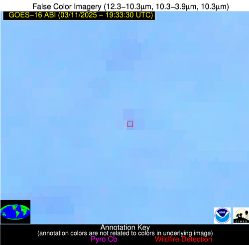
Possible Wildfire
| Basic Information | |
|---|---|
| State/Province(s) | KS |
| Country/Countries | United States |
| County/Locality(s) | Wilson County, KS |
| NWS WFO | Wichita KS |
| Identification Method | Enhanced Contextual (Clear) |
| Mean Object Date/Time | 2025-03-11 19:33:25UTC |
| Radiative Center (Lat, Lon): | 37.480835°, -95.618889° |
| Nearby Counties (meeting alert criteria): |
|
| Total Radiative Power Anomaly | n/a |
| Total Radiative Power | 6.92 MW |
| Map: | |
| Additional Information | |
| Alert Status | New Feature |
| Type of Event | Nominal Risk |
| Event Priority Ranking | 4 |
| Maximum Observed BT (3.9 um) | 306.77 K |
| Observed - Background BT (3.9 um) | 2.18 K |
| BT Anomaly (3.9 um) | 2.76 K |
| Maximum Observed - Clear RTM BT (3.9 um) | 15.31 K |
| Maximum Observed BTD (3.9-10/11/12 um) | 8.21 K |
| Observed - Background BTD (3.9-10/11/12 um) | 1.94 K |
| BTD Anomaly (3.9-10/11/12 um) | 4.18 K |
| Similar Pixel Count | 25 |
| BT Time Tendency (3.9 um) | 1.20 K |
| Image Interval | 2.00 minutes |
| Fraction of Surrounding LWIR Pixels that are Colder | 0.61 |
| Fraction of Surrounding Red Channel Pixels that are Brighter | 1.00 |
| Maximum Radiative Power | 6.92 MW |
| Maximum Radiative Power Uncertainty | 0.00 MW |
| Total Radiative Power Uncertainty | 0.00 MW |
| Mean Viewing Angle | 48.70° |
| Mean Solar Zenith Angle | 44.00° |
| Mean Glint Angle | 80.50° |
| Water Fraction | 0.00 |
| Total Pixel Area | 6.10 km2 |
| Latest Satellite Imagery: | |
| View all event imagery » | |
Possible Wildfire
| Basic Information | |
|---|---|
| State/Province(s) | OK |
| Country/Countries | United States |
| County/Locality(s) | Kingfisher County, OK |
| NWS WFO | Norman OK |
| Identification Method | Enhanced Contextual (Clear) |
| Mean Object Date/Time | 2025-03-11 19:33:27UTC |
| Radiative Center (Lat, Lon): | 35.957222°, -97.817780° |
| Nearby Counties (meeting alert criteria): |
|
| Total Radiative Power Anomaly | n/a |
| Total Radiative Power | 9.38 MW |
| Map: | |
| Additional Information | |
| Alert Status | New Feature |
| Type of Event | Nominal Risk |
| Event Priority Ranking | 4 |
| Maximum Observed BT (3.9 um) | 309.97 K |
| Observed - Background BT (3.9 um) | 2.67 K |
| BT Anomaly (3.9 um) | 3.14 K |
| Maximum Observed - Clear RTM BT (3.9 um) | 17.82 K |
| Maximum Observed BTD (3.9-10/11/12 um) | 8.72 K |
| Observed - Background BTD (3.9-10/11/12 um) | 2.14 K |
| BTD Anomaly (3.9-10/11/12 um) | 4.20 K |
| Similar Pixel Count | 25 |
| BT Time Tendency (3.9 um) | 0.70 K |
| Image Interval | 2.00 minutes |
| Fraction of Surrounding LWIR Pixels that are Colder | 0.79 |
| Fraction of Surrounding Red Channel Pixels that are Brighter | 1.00 |
| Maximum Radiative Power | 9.38 MW |
| Maximum Radiative Power Uncertainty | 0.00 MW |
| Total Radiative Power Uncertainty | 0.00 MW |
| Mean Viewing Angle | 48.30° |
| Mean Solar Zenith Angle | 41.90° |
| Mean Glint Angle | 78.00° |
| Water Fraction | 0.00 |
| Total Pixel Area | 6.00 km2 |
| Latest Satellite Imagery: | |
| View all event imagery » | |
Possible Wildfire
| Basic Information | |
|---|---|
| State/Province(s) | AR |
| Country/Countries | United States |
| County/Locality(s) | Poinsett County, AR |
| NWS WFO | Memphis TN |
| Identification Method | Enhanced Contextual (Clear) |
| Mean Object Date/Time | 2025-03-11 19:33:29UTC |
| Radiative Center (Lat, Lon): | 35.513332°, -90.900002° |
| Nearby Counties (meeting alert criteria): |
|
| Total Radiative Power Anomaly | n/a |
| Total Radiative Power | 10.74 MW |
| Map: | |
| Additional Information | |
| Alert Status | New Feature |
| Type of Event | Nominal Risk |
| Event Priority Ranking | 4 |
| Maximum Observed BT (3.9 um) | 304.90 K |
| Observed - Background BT (3.9 um) | 2.85 K |
| BT Anomaly (3.9 um) | 1.86 K |
| Maximum Observed - Clear RTM BT (3.9 um) | 13.93 K |
| Maximum Observed BTD (3.9-10/11/12 um) | 11.22 K |
| Observed - Background BTD (3.9-10/11/12 um) | 3.48 K |
| BTD Anomaly (3.9-10/11/12 um) | 3.33 K |
| Similar Pixel Count | 11 |
| BT Time Tendency (3.9 um) | 2.30 K |
| Image Interval | 2.00 minutes |
| Fraction of Surrounding LWIR Pixels that are Colder | 0.25 |
| Fraction of Surrounding Red Channel Pixels that are Brighter | 0.87 |
| Maximum Radiative Power | 10.74 MW |
| Maximum Radiative Power Uncertainty | 0.00 MW |
| Total Radiative Power Uncertainty | 0.00 MW |
| Mean Viewing Angle | 44.70° |
| Mean Solar Zenith Angle | 43.80° |
| Mean Glint Angle | 76.50° |
| Water Fraction | 0.00 |
| Total Pixel Area | 5.60 km2 |
| Latest Satellite Imagery: | |
| View all event imagery » | |
Possible Wildfire
| Basic Information | |
|---|---|
| State/Province(s) | OK |
| Country/Countries | United States |
| County/Locality(s) | Pittsburg County, OK |
| NWS WFO | Tulsa OK |
| Identification Method | Enhanced Contextual (Clear) |
| Mean Object Date/Time | 2025-03-11 19:33:28UTC |
| Radiative Center (Lat, Lon): | 35.198891°, -95.701111° |
| Nearby Counties (meeting alert criteria): |
|
| Total Radiative Power Anomaly | n/a |
| Total Radiative Power | 26.10 MW |
| Map: | |
| Additional Information | |
| Alert Status | New Feature |
| Type of Event | Nominal Risk |
| Event Priority Ranking | 4 |
| Maximum Observed BT (3.9 um) | 306.57 K |
| Observed - Background BT (3.9 um) | 3.07 K |
| BT Anomaly (3.9 um) | 2.62 K |
| Maximum Observed - Clear RTM BT (3.9 um) | 13.61 K |
| Maximum Observed BTD (3.9-10/11/12 um) | 9.16 K |
| Observed - Background BTD (3.9-10/11/12 um) | 4.06 K |
| BTD Anomaly (3.9-10/11/12 um) | 8.60 K |
| Similar Pixel Count | 4 |
| BT Time Tendency (3.9 um) | 3.40 K |
| Image Interval | 2.00 minutes |
| Fraction of Surrounding LWIR Pixels that are Colder | 0.32 |
| Fraction of Surrounding Red Channel Pixels that are Brighter | 1.00 |
| Maximum Radiative Power | 14.94 MW |
| Maximum Radiative Power Uncertainty | 0.00 MW |
| Total Radiative Power Uncertainty | 0.00 MW |
| Mean Viewing Angle | 46.50° |
| Mean Solar Zenith Angle | 41.80° |
| Mean Glint Angle | 76.10° |
| Water Fraction | 0.00 |
| Total Pixel Area | 11.60 km2 |
| Latest Satellite Imagery: | |
| View all event imagery » | |
Possible Wildfire
| Basic Information | |
|---|---|
| State/Province(s) | MS |
| Country/Countries | United States |
| County/Locality(s) | Marshall County, MS |
| NWS WFO | Memphis TN |
| Identification Method | Enhanced Contextual (Clear) |
| Mean Object Date/Time | 2025-03-11 19:33:29UTC |
| Radiative Center (Lat, Lon): | 34.686668°, -89.706108° |
| Nearby Counties (meeting alert criteria): |
|
| Total Radiative Power Anomaly | n/a |
| Total Radiative Power | 11.10 MW |
| Map: | |
| Additional Information | |
| Alert Status | New Feature |
| Type of Event | Nominal Risk |
| Event Priority Ranking | 4 |
| Maximum Observed BT (3.9 um) | 305.99 K |
| Observed - Background BT (3.9 um) | 3.93 K |
| BT Anomaly (3.9 um) | 5.39 K |
| Maximum Observed - Clear RTM BT (3.9 um) | 15.82 K |
| Maximum Observed BTD (3.9-10/11/12 um) | 8.64 K |
| Observed - Background BTD (3.9-10/11/12 um) | 3.51 K |
| BTD Anomaly (3.9-10/11/12 um) | 10.13 K |
| Similar Pixel Count | 3 |
| BT Time Tendency (3.9 um) | 0.80 K |
| Image Interval | 2.00 minutes |
| Fraction of Surrounding LWIR Pixels that are Colder | 0.88 |
| Fraction of Surrounding Red Channel Pixels that are Brighter | 1.00 |
| Maximum Radiative Power | 11.10 MW |
| Maximum Radiative Power Uncertainty | 0.00 MW |
| Total Radiative Power Uncertainty | 0.00 MW |
| Mean Viewing Angle | 43.40° |
| Mean Solar Zenith Angle | 43.60° |
| Mean Glint Angle | 75.00° |
| Water Fraction | 0.00 |
| Total Pixel Area | 5.50 km2 |
| Latest Satellite Imagery: | |
| View all event imagery » | |
Possible Wildfire
| Basic Information | |
|---|---|
| State/Province(s) | MS |
| Country/Countries | United States |
| County/Locality(s) | Jones County, MS |
| NWS WFO | Jackson MS |
| Identification Method | Enhanced Contextual (Clear) |
| Mean Object Date/Time | 2025-03-11 19:33:29UTC |
| Radiative Center (Lat, Lon): | 31.517221°, -89.133888° |
| Nearby Counties (meeting alert criteria): |
|
| Total Radiative Power Anomaly | n/a |
| Total Radiative Power | 9.88 MW |
| Map: | |
| Additional Information | |
| Alert Status | New Feature |
| Type of Event | Nominal Risk |
| Event Priority Ranking | 4 |
| Maximum Observed BT (3.9 um) | 303.99 K |
| Observed - Background BT (3.9 um) | 2.79 K |
| BT Anomaly (3.9 um) | 2.72 K |
| Maximum Observed - Clear RTM BT (3.9 um) | 12.64 K |
| Maximum Observed BTD (3.9-10/11/12 um) | 7.38 K |
| Observed - Background BTD (3.9-10/11/12 um) | 3.19 K |
| BTD Anomaly (3.9-10/11/12 um) | 5.93 K |
| Similar Pixel Count | 3 |
| BT Time Tendency (3.9 um) | 2.30 K |
| Image Interval | 2.00 minutes |
| Fraction of Surrounding LWIR Pixels that are Colder | 0.22 |
| Fraction of Surrounding Red Channel Pixels that are Brighter | 1.00 |
| Maximum Radiative Power | 9.88 MW |
| Maximum Radiative Power Uncertainty | 0.00 MW |
| Total Radiative Power Uncertainty | 0.00 MW |
| Mean Viewing Angle | 39.90° |
| Mean Solar Zenith Angle | 41.20° |
| Mean Glint Angle | 68.80° |
| Water Fraction | 0.00 |
| Total Pixel Area | 5.20 km2 |
| Latest Satellite Imagery: | |
| View all event imagery » | |
