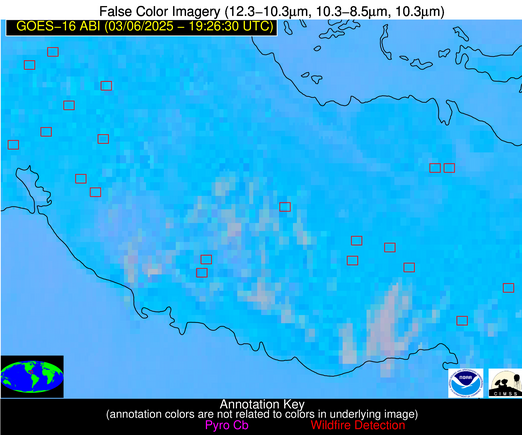
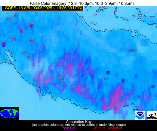
Wildfire Alert Report
| Date: | 2025-03-06 |
|---|---|
| Time: | 19:26:17 |
| Production Date and Time: | 2025-03-06 19:31:08 UTC |
| Primary Instrument: | GOES-16 ABI |
| Wmo Spacecraft Id: | 152 |
| Location/orbit: | GEO |
| L1 File: | OR_ABI-L1b-RadC-M6C14_G16_s20250651926172_e20250651928544_c20250651929030.nc |
| L1 File(s) - Temporal | OR_ABI-L1b-RadC-M6C14_G16_s20250651921172_e20250651923544_c20250651924039.nc |
| Number Of Thermal Anomaly Alerts: | 8 |
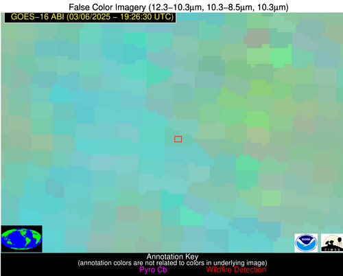
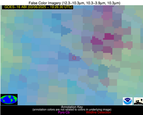
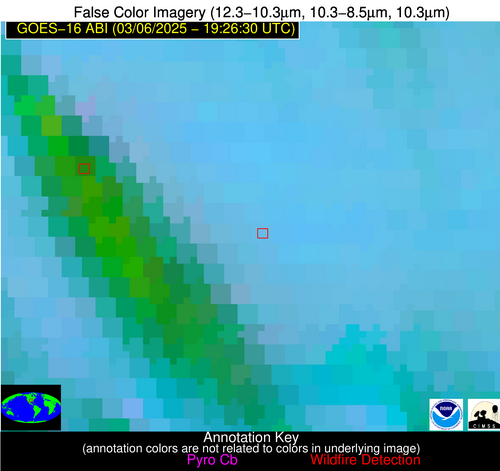
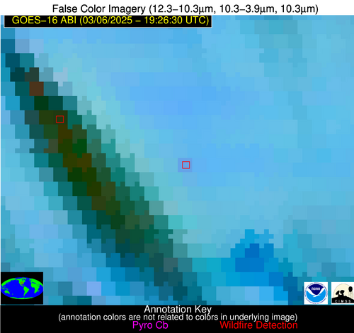
Possible Wildfire
| Basic Information | |
|---|---|
| State/Province(s) | WA |
| Country/Countries | United States |
| County/Locality(s) | Okanogan County, WA |
| NWS WFO | Spokane WA |
| Identification Method | Enhanced Contextual (Clear) |
| Mean Object Date/Time | 2025-03-06 19:26:19UTC |
| Radiative Center (Lat, Lon): | 48.429165°, -119.402496° |
| Nearby Counties (meeting alert criteria): |
|
| Total Radiative Power Anomaly | n/a |
| Total Radiative Power | 31.32 MW |
| Map: | |
| Additional Information | |
| Alert Status | New Feature |
| Type of Event | Nominal Risk |
| Event Priority Ranking | 4 |
| Maximum Observed BT (3.9 um) | 291.21 K |
| Observed - Background BT (3.9 um) | 7.56 K |
| BT Anomaly (3.9 um) | 2.68 K |
| Maximum Observed - Clear RTM BT (3.9 um) | 15.57 K |
| Maximum Observed BTD (3.9-10/11/12 um) | 15.31 K |
| Observed - Background BTD (3.9-10/11/12 um) | 7.91 K |
| BTD Anomaly (3.9-10/11/12 um) | 4.16 K |
| Similar Pixel Count | 10 |
| BT Time Tendency (3.9 um) | 1.10 K |
| Image Interval | 5.00 minutes |
| Fraction of Surrounding LWIR Pixels that are Colder | 0.45 |
| Fraction of Surrounding Red Channel Pixels that are Brighter | 0.56 |
| Maximum Radiative Power | 31.32 MW |
| Maximum Radiative Power Uncertainty | 0.00 MW |
| Total Radiative Power Uncertainty | 0.00 MW |
| Mean Viewing Angle | 70.30° |
| Mean Solar Zenith Angle | 55.40° |
| Mean Glint Angle | 114.00° |
| Water Fraction | 0.00 |
| Total Pixel Area | 11.90 km2 |
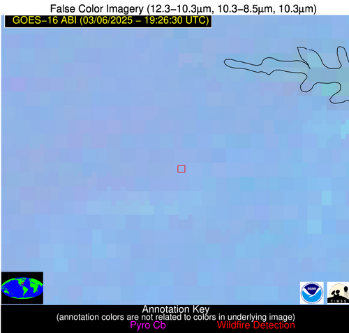
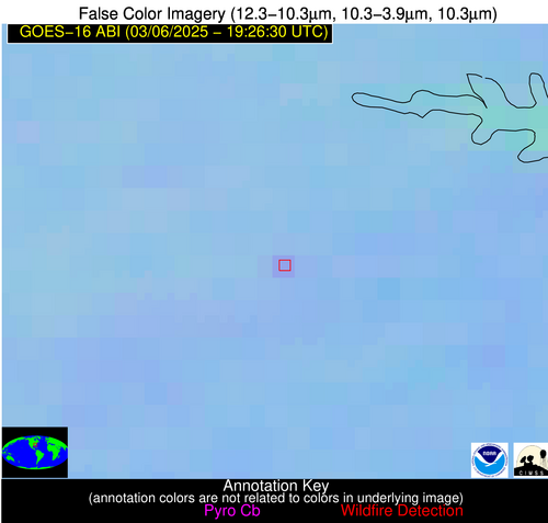
| Latest Satellite Imagery: | |
| View all event imagery » | |
Possible Wildfire
| Basic Information | |
|---|---|
| State/Province(s) | AR |
| Country/Countries | United States |
| County/Locality(s) | Lawrence County, AR |
| NWS WFO | Little Rock AR |
| Identification Method | Enhanced Contextual (Clear) |
| Mean Object Date/Time | 2025-03-06 19:27:21UTC |
| Radiative Center (Lat, Lon): | 36.094166°, -91.014442° |
| Nearby Counties (meeting alert criteria): |
|
| Total Radiative Power Anomaly | n/a |
| Total Radiative Power | 9.83 MW |
| Map: | |
| Additional Information | |
| Alert Status | New Feature |
| Type of Event | Nominal Risk |
| Event Priority Ranking | 4 |
| Maximum Observed BT (3.9 um) | 298.71 K |
| Observed - Background BT (3.9 um) | 5.46 K |
| BT Anomaly (3.9 um) | 5.65 K |
| Maximum Observed - Clear RTM BT (3.9 um) | 16.72 K |
| Maximum Observed BTD (3.9-10/11/12 um) | 11.83 K |
| Observed - Background BTD (3.9-10/11/12 um) | 4.54 K |
| BTD Anomaly (3.9-10/11/12 um) | 5.89 K |
| Similar Pixel Count | 15 |
| BT Time Tendency (3.9 um) | 3.20 K |
| Image Interval | 5.00 minutes |
| Fraction of Surrounding LWIR Pixels that are Colder | 0.99 |
| Fraction of Surrounding Red Channel Pixels that are Brighter | 1.00 |
| Maximum Radiative Power | 9.83 MW |
| Maximum Radiative Power Uncertainty | 0.00 MW |
| Total Radiative Power Uncertainty | 0.00 MW |
| Mean Viewing Angle | 45.30° |
| Mean Solar Zenith Angle | 45.30° |
| Mean Glint Angle | 80.00° |
| Water Fraction | 0.00 |
| Total Pixel Area | 5.70 km2 |
| Latest Satellite Imagery: | |
| View all event imagery » | |
Possible Wildfire
| Basic Information | |
|---|---|
| State/Province(s) | AR |
| Country/Countries | United States |
| County/Locality(s) | Scott County, AR |
| NWS WFO | Little Rock AR |
| Identification Method | Enhanced Contextual (Clear) |
| Mean Object Date/Time | 2025-03-06 19:27:20UTC |
| Radiative Center (Lat, Lon): | 34.794167°, -94.087502° |
| Nearby Counties (meeting alert criteria): |
|
| Total Radiative Power Anomaly | n/a |
| Total Radiative Power | 9.50 MW |
| Map: | |
| Additional Information | |
| Alert Status | New Feature |
| Type of Event | Nominal Risk |
| Event Priority Ranking | 4 |
| Maximum Observed BT (3.9 um) | 296.36 K |
| Observed - Background BT (3.9 um) | 3.25 K |
| BT Anomaly (3.9 um) | 1.55 K |
| Maximum Observed - Clear RTM BT (3.9 um) | 12.13 K |
| Maximum Observed BTD (3.9-10/11/12 um) | 9.95 K |
| Observed - Background BTD (3.9-10/11/12 um) | 3.35 K |
| BTD Anomaly (3.9-10/11/12 um) | 3.70 K |
| Similar Pixel Count | 12 |
| BT Time Tendency (3.9 um) | 0.40 K |
| Image Interval | 5.00 minutes |
| Fraction of Surrounding LWIR Pixels that are Colder | 0.70 |
| Fraction of Surrounding Red Channel Pixels that are Brighter | 1.00 |
| Maximum Radiative Power | 9.50 MW |
| Maximum Radiative Power Uncertainty | 0.00 MW |
| Total Radiative Power Uncertainty | 0.00 MW |
| Mean Viewing Angle | 45.40° |
| Mean Solar Zenith Angle | 43.20° |
| Mean Glint Angle | 77.60° |
| Water Fraction | 0.00 |
| Total Pixel Area | 5.70 km2 |
| Latest Satellite Imagery: | |
| View all event imagery » | |
Possible Wildfire
| Basic Information | |
|---|---|
| State/Province(s) | SC |
| Country/Countries | United States |
| County/Locality(s) | Saluda County, SC |
| NWS WFO | Columbia SC |
| Identification Method | Enhanced Contextual (Clear) |
| Mean Object Date/Time | 2025-03-06 19:27:22UTC |
| Radiative Center (Lat, Lon): | 33.897221°, -81.624443° |
| Nearby Counties (meeting alert criteria): |
|
| Total Radiative Power Anomaly | n/a |
| Total Radiative Power | 6.71 MW |
| Map: | |
| Additional Information | |
| Alert Status | New Feature |
| Type of Event | Nominal Risk |
| Event Priority Ranking | 4 |
| Maximum Observed BT (3.9 um) | 296.60 K |
| Observed - Background BT (3.9 um) | 4.07 K |
| BT Anomaly (3.9 um) | 3.95 K |
| Maximum Observed - Clear RTM BT (3.9 um) | 13.14 K |
| Maximum Observed BTD (3.9-10/11/12 um) | 8.83 K |
| Observed - Background BTD (3.9-10/11/12 um) | 3.63 K |
| BTD Anomaly (3.9-10/11/12 um) | 6.82 K |
| Similar Pixel Count | 9 |
| BT Time Tendency (3.9 um) | 1.10 K |
| Image Interval | 5.00 minutes |
| Fraction of Surrounding LWIR Pixels that are Colder | 0.76 |
| Fraction of Surrounding Red Channel Pixels that are Brighter | 0.98 |
| Maximum Radiative Power | 6.71 MW |
| Maximum Radiative Power Uncertainty | 0.00 MW |
| Total Radiative Power Uncertainty | 0.00 MW |
| Mean Viewing Angle | 40.20° |
| Mean Solar Zenith Angle | 47.50° |
| Mean Glint Angle | 78.10° |
| Water Fraction | 0.00 |
| Total Pixel Area | 5.20 km2 |
| Latest Satellite Imagery: | |
| View all event imagery » | |
Possible Wildfire
| Basic Information | |
|---|---|
| State/Province(s) | MS |
| Country/Countries | United States |
| County/Locality(s) | Kemper County, MS |
| NWS WFO | Jackson MS |
| Identification Method | Enhanced Contextual (Clear) |
| Mean Object Date/Time | 2025-03-06 19:27:21UTC |
| Radiative Center (Lat, Lon): | 32.919724°, -88.724724° |
| Nearby Counties (meeting alert criteria): |
|
| Total Radiative Power Anomaly | n/a |
| Total Radiative Power | 7.14 MW |
| Map: | |
| Additional Information | |
| Alert Status | New Feature |
| Type of Event | Nominal Risk |
| Event Priority Ranking | 4 |
| Maximum Observed BT (3.9 um) | 294.93 K |
| Observed - Background BT (3.9 um) | 2.74 K |
| BT Anomaly (3.9 um) | 3.03 K |
| Maximum Observed - Clear RTM BT (3.9 um) | 12.02 K |
| Maximum Observed BTD (3.9-10/11/12 um) | 8.19 K |
| Observed - Background BTD (3.9-10/11/12 um) | 3.05 K |
| BTD Anomaly (3.9-10/11/12 um) | 5.14 K |
| Similar Pixel Count | 5 |
| BT Time Tendency (3.9 um) | 1.90 K |
| Image Interval | 5.00 minutes |
| Fraction of Surrounding LWIR Pixels that are Colder | 0.31 |
| Fraction of Surrounding Red Channel Pixels that are Brighter | 1.00 |
| Maximum Radiative Power | 7.14 MW |
| Maximum Radiative Power Uncertainty | 0.00 MW |
| Total Radiative Power Uncertainty | 0.00 MW |
| Mean Viewing Angle | 41.20° |
| Mean Solar Zenith Angle | 43.40° |
| Mean Glint Angle | 73.90° |
| Water Fraction | 0.00 |
| Total Pixel Area | 5.30 km2 |
| Latest Satellite Imagery: | |
| View all event imagery » | |
Possible Wildfire
| Basic Information | |
|---|---|
| State/Province(s) | GA |
| Country/Countries | United States |
| County/Locality(s) | Mitchell County, GA |
| NWS WFO | Tallahassee FL |
| Identification Method | Enhanced Contextual (Clear) |
| Mean Object Date/Time | 2025-03-06 19:27:21UTC |
| Radiative Center (Lat, Lon): | 31.147223°, -84.377502° |
| Nearby Counties (meeting alert criteria): |
|
| Total Radiative Power Anomaly | n/a |
| Total Radiative Power | 7.70 MW |
| Map: | |
| Additional Information | |
| Alert Status | New Feature |
| Type of Event | Nominal Risk |
| Event Priority Ranking | 4 |
| Maximum Observed BT (3.9 um) | 302.67 K |
| Observed - Background BT (3.9 um) | 4.26 K |
| BT Anomaly (3.9 um) | 2.86 K |
| Maximum Observed - Clear RTM BT (3.9 um) | 16.39 K |
| Maximum Observed BTD (3.9-10/11/12 um) | 11.40 K |
| Observed - Background BTD (3.9-10/11/12 um) | 3.78 K |
| BTD Anomaly (3.9-10/11/12 um) | 3.64 K |
| Similar Pixel Count | 23 |
| BT Time Tendency (3.9 um) | 0.70 K |
| Image Interval | 5.00 minutes |
| Fraction of Surrounding LWIR Pixels that are Colder | 0.76 |
| Fraction of Surrounding Red Channel Pixels that are Brighter | 0.61 |
| Maximum Radiative Power | 7.70 MW |
| Maximum Radiative Power Uncertainty | 0.00 MW |
| Total Radiative Power Uncertainty | 0.00 MW |
| Mean Viewing Angle | 37.80° |
| Mean Solar Zenith Angle | 43.90° |
| Mean Glint Angle | 71.60° |
| Water Fraction | 0.00 |
| Total Pixel Area | 5.10 km2 |
| Latest Satellite Imagery: | |
| View all event imagery » | |
Possible Wildfire
| Basic Information | |
|---|---|
| State/Province(s) | Unknown |
| Country/Countries | Cuba |
| County/Locality(s) | Unknown, Unknown |
| NWS WFO | N/A |
| Identification Method | Enhanced Contextual (Clear) |
| Mean Object Date/Time | 2025-03-06 19:28:22UTC |
| Radiative Center (Lat, Lon): | 22.373056°, -80.317497° |
| Nearby Counties (meeting alert criteria): |
|
| Total Radiative Power Anomaly | n/a |
| Total Radiative Power | 36.72 MW |
| Map: | |
| Additional Information | |
| Alert Status | New Feature |
| Type of Event | Nominal Risk |
| Event Priority Ranking | 4 |
| Maximum Observed BT (3.9 um) | 321.17 K |
| Observed - Background BT (3.9 um) | 9.52 K |
| BT Anomaly (3.9 um) | 5.65 K |
| Maximum Observed - Clear RTM BT (3.9 um) | 19.03 K |
| Maximum Observed BTD (3.9-10/11/12 um) | 22.02 K |
| Observed - Background BTD (3.9-10/11/12 um) | 9.06 K |
| BTD Anomaly (3.9-10/11/12 um) | 6.98 K |
| Similar Pixel Count | 8 |
| BT Time Tendency (3.9 um) | 7.50 K |
| Image Interval | 5.00 minutes |
| Fraction of Surrounding LWIR Pixels that are Colder | 0.80 |
| Fraction of Surrounding Red Channel Pixels that are Brighter | 0.73 |
| Maximum Radiative Power | 36.72 MW |
| Maximum Radiative Power Uncertainty | 0.00 MW |
| Total Radiative Power Uncertainty | 0.00 MW |
| Mean Viewing Angle | 26.90° |
| Mean Solar Zenith Angle | 39.80° |
| Mean Glint Angle | 57.10° |
| Water Fraction | 0.00 |
| Total Pixel Area | 4.50 km2 |
| Latest Satellite Imagery: | |
| View all event imagery » | |
Possible Wildfire
| Basic Information | |
|---|---|
| State/Province(s) | Unknown |
| Country/Countries | Cuba |
| County/Locality(s) | Unknown, Unknown |
| NWS WFO | N/A |
| Identification Method | Enhanced Contextual (Clear) |
| Mean Object Date/Time | 2025-03-06 19:28:22UTC |
| Radiative Center (Lat, Lon): | 21.711111°, -78.669167° |
| Nearby Counties (meeting alert criteria): |
|
| Total Radiative Power Anomaly | n/a |
| Total Radiative Power | 42.29 MW |
| Map: | |
| Additional Information | |
| Alert Status | New Feature |
| Type of Event | Nominal Risk |
| Event Priority Ranking | 4 |
| Maximum Observed BT (3.9 um) | 320.93 K |
| Observed - Background BT (3.9 um) | 11.42 K |
| BT Anomaly (3.9 um) | 5.28 K |
| Maximum Observed - Clear RTM BT (3.9 um) | 20.44 K |
| Maximum Observed BTD (3.9-10/11/12 um) | 24.32 K |
| Observed - Background BTD (3.9-10/11/12 um) | 11.01 K |
| BTD Anomaly (3.9-10/11/12 um) | 6.18 K |
| Similar Pixel Count | 5 |
| BT Time Tendency (3.9 um) | 7.20 K |
| Image Interval | 5.00 minutes |
| Fraction of Surrounding LWIR Pixels that are Colder | 0.84 |
| Fraction of Surrounding Red Channel Pixels that are Brighter | 0.61 |
| Maximum Radiative Power | 42.29 MW |
| Maximum Radiative Power Uncertainty | 0.00 MW |
| Total Radiative Power Uncertainty | 0.00 MW |
| Mean Viewing Angle | 25.80° |
| Mean Solar Zenith Angle | 40.50° |
| Mean Glint Angle | 57.30° |
| Water Fraction | 0.00 |
| Total Pixel Area | 4.40 km2 |
| Latest Satellite Imagery: | |
| View all event imagery » | |
