Wildfire Alert Report
| Date: | 2025-03-03 |
|---|---|
| Time: | 20:21:17 |
| Production Date and Time: | 2025-03-03 20:26:21 UTC |
| Primary Instrument: | GOES-16 ABI |
| Wmo Spacecraft Id: | 152 |
| Location/orbit: | GEO |
| L1 File: | OR_ABI-L1b-RadC-M6C14_G16_s20250622021170_e20250622023543_c20250622024037.nc |
| L1 File(s) - Temporal | OR_ABI-L1b-RadC-M6C14_G16_s20250622016170_e20250622018543_c20250622019033.nc |
| Number Of Thermal Anomaly Alerts: | 12 |
Possible Wildfire
| Basic Information | |
|---|---|
| State/Province(s) | WI |
| Country/Countries | United States |
| County/Locality(s) | Dane County, WI |
| NWS WFO | Milwaukee/Sullivan WI |
| Identification Method | Enhanced Contextual (Clear) |
| Mean Object Date/Time | 2025-03-03 20:21:51UTC |
| Radiative Center (Lat, Lon): | 42.869167°, -89.635834° |
| Nearby Counties (meeting alert criteria): |
|
| Total Radiative Power Anomaly | n/a |
| Total Radiative Power | 8.35 MW |
| Map: | |
| Additional Information | |
| Alert Status | New Feature |
| Type of Event | Nominal Risk |
| Event Priority Ranking | 4 |
| Maximum Observed BT (3.9 um) | 290.63 K |
| Observed - Background BT (3.9 um) | 3.24 K |
| BT Anomaly (3.9 um) | 3.45 K |
| Maximum Observed - Clear RTM BT (3.9 um) | 17.85 K |
| Maximum Observed BTD (3.9-10/11/12 um) | 11.65 K |
| Observed - Background BTD (3.9-10/11/12 um) | 3.04 K |
| BTD Anomaly (3.9-10/11/12 um) | 3.97 K |
| Similar Pixel Count | 21 |
| BT Time Tendency (3.9 um) | 0.90 K |
| Image Interval | 5.00 minutes |
| Fraction of Surrounding LWIR Pixels that are Colder | 0.65 |
| Fraction of Surrounding Red Channel Pixels that are Brighter | 1.00 |
| Maximum Radiative Power | 8.35 MW |
| Maximum Radiative Power Uncertainty | 0.00 MW |
| Total Radiative Power Uncertainty | 0.00 MW |
| Mean Viewing Angle | 51.80° |
| Mean Solar Zenith Angle | 58.20° |
| Mean Glint Angle | 90.70° |
| Water Fraction | 0.00 |
| Total Pixel Area | 6.50 km2 |
| Latest Satellite Imagery: | |
| View all event imagery » | |
Possible Wildfire
| Basic Information | |
|---|---|
| State/Province(s) | IL |
| Country/Countries | United States |
| County/Locality(s) | Peoria County, IL |
| NWS WFO | Lincoln IL |
| Identification Method | Enhanced Contextual (Clear) |
| Mean Object Date/Time | 2025-03-03 20:21:51UTC |
| Radiative Center (Lat, Lon): | 40.793610°, -89.796944° |
| Nearby Counties (meeting alert criteria): |
|
| Total Radiative Power Anomaly | n/a |
| Total Radiative Power | 5.83 MW |
| Map: | |
| Additional Information | |
| Alert Status | New Feature |
| Type of Event | Nominal Risk |
| Event Priority Ranking | 4 |
| Maximum Observed BT (3.9 um) | 294.98 K |
| Observed - Background BT (3.9 um) | 2.28 K |
| BT Anomaly (3.9 um) | 2.58 K |
| Maximum Observed - Clear RTM BT (3.9 um) | 15.79 K |
| Maximum Observed BTD (3.9-10/11/12 um) | 11.26 K |
| Observed - Background BTD (3.9-10/11/12 um) | 2.46 K |
| BTD Anomaly (3.9-10/11/12 um) | 2.84 K |
| Similar Pixel Count | 17 |
| BT Time Tendency (3.9 um) | 2.80 K |
| Image Interval | 5.00 minutes |
| Fraction of Surrounding LWIR Pixels that are Colder | 0.40 |
| Fraction of Surrounding Red Channel Pixels that are Brighter | 1.00 |
| Maximum Radiative Power | 5.83 MW |
| Maximum Radiative Power Uncertainty | 0.00 MW |
| Total Radiative Power Uncertainty | 0.00 MW |
| Mean Viewing Angle | 49.70° |
| Mean Solar Zenith Angle | 56.60° |
| Mean Glint Angle | 87.00° |
| Water Fraction | 0.00 |
| Total Pixel Area | 6.20 km2 |
| Latest Satellite Imagery: | |
| View all event imagery » | |
Possible Wildfire
| Basic Information | |
|---|---|
| State/Province(s) | IL |
| Country/Countries | United States |
| County/Locality(s) | Vermilion County, IL |
| NWS WFO | Lincoln IL |
| Identification Method | Enhanced Contextual (Clear) |
| Mean Object Date/Time | 2025-03-03 20:21:51UTC |
| Radiative Center (Lat, Lon): | 39.938332°, -87.888885° |
| Nearby Counties (meeting alert criteria): |
|
| Total Radiative Power Anomaly | n/a |
| Total Radiative Power | 4.99 MW |
| Map: | |
| Additional Information | |
| Alert Status | New Feature |
| Type of Event | Nominal Risk |
| Event Priority Ranking | 4 |
| Maximum Observed BT (3.9 um) | 294.78 K |
| Observed - Background BT (3.9 um) | 2.07 K |
| BT Anomaly (3.9 um) | 2.20 K |
| Maximum Observed - Clear RTM BT (3.9 um) | 16.52 K |
| Maximum Observed BTD (3.9-10/11/12 um) | 12.22 K |
| Observed - Background BTD (3.9-10/11/12 um) | 2.02 K |
| BTD Anomaly (3.9-10/11/12 um) | 4.24 K |
| Similar Pixel Count | 25 |
| BT Time Tendency (3.9 um) | 1.60 K |
| Image Interval | 5.00 minutes |
| Fraction of Surrounding LWIR Pixels that are Colder | 0.50 |
| Fraction of Surrounding Red Channel Pixels that are Brighter | 1.00 |
| Maximum Radiative Power | 4.99 MW |
| Maximum Radiative Power Uncertainty | 0.00 MW |
| Total Radiative Power Uncertainty | 0.00 MW |
| Mean Viewing Angle | 48.30° |
| Mean Solar Zenith Angle | 56.90° |
| Mean Glint Angle | 86.30° |
| Water Fraction | 0.00 |
| Total Pixel Area | 6.00 km2 |
| Latest Satellite Imagery: | |
| View all event imagery » | |
Possible Wildfire
| Basic Information | |
|---|---|
| State/Province(s) | TN |
| Country/Countries | United States |
| County/Locality(s) | Rutherford County, TN |
| NWS WFO | Nashville TN |
| Identification Method | Enhanced Contextual (Clear) |
| Mean Object Date/Time | 2025-03-03 20:22:21UTC |
| Radiative Center (Lat, Lon): | 35.703335°, -86.648331° |
| Nearby Counties (meeting alert criteria): |
|
| Total Radiative Power Anomaly | n/a |
| Total Radiative Power | 5.04 MW |
| Map: | |
| Additional Information | |
| Alert Status | New Feature |
| Type of Event | Nominal Risk |
| Event Priority Ranking | 4 |
| Maximum Observed BT (3.9 um) | 297.07 K |
| Observed - Background BT (3.9 um) | 1.92 K |
| BT Anomaly (3.9 um) | 2.45 K |
| Maximum Observed - Clear RTM BT (3.9 um) | 15.45 K |
| Maximum Observed BTD (3.9-10/11/12 um) | 8.39 K |
| Observed - Background BTD (3.9-10/11/12 um) | 1.99 K |
| BTD Anomaly (3.9-10/11/12 um) | 6.45 K |
| Similar Pixel Count | 25 |
| BT Time Tendency (3.9 um) | 1.00 K |
| Image Interval | 5.00 minutes |
| Fraction of Surrounding LWIR Pixels that are Colder | 0.43 |
| Fraction of Surrounding Red Channel Pixels that are Brighter | 1.00 |
| Maximum Radiative Power | 5.04 MW |
| Maximum Radiative Power Uncertainty | 0.00 MW |
| Total Radiative Power Uncertainty | 0.00 MW |
| Mean Viewing Angle | 43.40° |
| Mean Solar Zenith Angle | 54.50° |
| Mean Glint Angle | 79.60° |
| Water Fraction | 0.00 |
| Total Pixel Area | 5.50 km2 |
| Latest Satellite Imagery: | |
| View all event imagery » | |
Possible Wildfire
| Basic Information | |
|---|---|
| State/Province(s) | NC |
| Country/Countries | United States |
| County/Locality(s) | Duplin County, NC |
| NWS WFO | Newport/Morehead City NC |
| Identification Method | Enhanced Contextual (Clear) |
| Mean Object Date/Time | 2025-03-03 20:22:22UTC |
| Radiative Center (Lat, Lon): | 34.940277°, -77.810837° |
| Nearby Counties (meeting alert criteria): |
|
| Total Radiative Power Anomaly | n/a |
| Total Radiative Power | 5.45 MW |
| Map: | |
| Additional Information | |
| Alert Status | New Feature |
| Type of Event | Nominal Risk |
| Event Priority Ranking | 4 |
| Maximum Observed BT (3.9 um) | 294.37 K |
| Observed - Background BT (3.9 um) | 2.72 K |
| BT Anomaly (3.9 um) | 2.63 K |
| Maximum Observed - Clear RTM BT (3.9 um) | 12.64 K |
| Maximum Observed BTD (3.9-10/11/12 um) | 7.90 K |
| Observed - Background BTD (3.9-10/11/12 um) | 2.74 K |
| BTD Anomaly (3.9-10/11/12 um) | 5.65 K |
| Similar Pixel Count | 15 |
| BT Time Tendency (3.9 um) | 1.60 K |
| Image Interval | 5.00 minutes |
| Fraction of Surrounding LWIR Pixels that are Colder | 0.44 |
| Fraction of Surrounding Red Channel Pixels that are Brighter | 1.00 |
| Maximum Radiative Power | 5.45 MW |
| Maximum Radiative Power Uncertainty | 0.00 MW |
| Total Radiative Power Uncertainty | 0.00 MW |
| Mean Viewing Angle | 40.90° |
| Mean Solar Zenith Angle | 59.50° |
| Mean Glint Angle | 84.90° |
| Water Fraction | 0.00 |
| Total Pixel Area | 5.30 km2 |
| Latest Satellite Imagery: | |
| View all event imagery » | |
Possible Wildfire
| Basic Information | |
|---|---|
| State/Province(s) | MS |
| Country/Countries | United States |
| County/Locality(s) | Union County, MS |
| NWS WFO | Memphis TN |
| Identification Method | Enhanced Contextual (Clear) |
| Mean Object Date/Time | 2025-03-03 20:22:21UTC |
| Radiative Center (Lat, Lon): | 34.444168°, -88.851387° |
| Nearby Counties (meeting alert criteria): |
|
| Total Radiative Power Anomaly | n/a |
| Total Radiative Power | 10.69 MW |
| Map: | |
| Additional Information | |
| Alert Status | New Feature |
| Type of Event | Nominal Risk |
| Event Priority Ranking | 4 |
| Maximum Observed BT (3.9 um) | 300.21 K |
| Observed - Background BT (3.9 um) | 4.22 K |
| BT Anomaly (3.9 um) | 3.25 K |
| Maximum Observed - Clear RTM BT (3.9 um) | 15.20 K |
| Maximum Observed BTD (3.9-10/11/12 um) | 11.24 K |
| Observed - Background BTD (3.9-10/11/12 um) | 3.97 K |
| BTD Anomaly (3.9-10/11/12 um) | 5.88 K |
| Similar Pixel Count | 10 |
| BT Time Tendency (3.9 um) | 1.60 K |
| Image Interval | 5.00 minutes |
| Fraction of Surrounding LWIR Pixels that are Colder | 0.70 |
| Fraction of Surrounding Red Channel Pixels that are Brighter | 1.00 |
| Maximum Radiative Power | 10.69 MW |
| Maximum Radiative Power Uncertainty | 0.00 MW |
| Total Radiative Power Uncertainty | 0.00 MW |
| Mean Viewing Angle | 42.80° |
| Mean Solar Zenith Angle | 52.30° |
| Mean Glint Angle | 76.20° |
| Water Fraction | 0.00 |
| Total Pixel Area | 5.50 km2 |
| Latest Satellite Imagery: | |
| View all event imagery » | |
Possible Wildfire
| Basic Information | |
|---|---|
| State/Province(s) | GA |
| Country/Countries | United States |
| County/Locality(s) | Long County, GA |
| NWS WFO | Charleston SC |
| Identification Method | Enhanced Contextual (Cloud) |
| Mean Object Date/Time | 2025-03-03 20:22:22UTC |
| Radiative Center (Lat, Lon): | 31.879723°, -81.826111° |
| Nearby Counties (meeting alert criteria): |
|
| Total Radiative Power Anomaly | n/a |
| Total Radiative Power | 172.56 MW |
| Map: | |
| Additional Information | |
| Alert Status | New Feature |
| Type of Event | Nominal Risk |
| Event Priority Ranking | 4 |
| Maximum Observed BT (3.9 um) | 300.05 K |
| Observed - Background BT (3.9 um) | 25.61 K |
| BT Anomaly (3.9 um) | 15.88 K |
| Maximum Observed - Clear RTM BT (3.9 um) | 14.25 K |
| Maximum Observed BTD (3.9-10/11/12 um) | 41.23 K |
| Observed - Background BTD (3.9-10/11/12 um) | 25.47 K |
| BTD Anomaly (3.9-10/11/12 um) | 10.59 K |
| Similar Pixel Count | 0 |
| BT Time Tendency (3.9 um) | 21.10 K |
| Image Interval | 5.00 minutes |
| Fraction of Surrounding LWIR Pixels that are Colder | 0.55 |
| Fraction of Surrounding Red Channel Pixels that are Brighter | 0.44 |
| Maximum Radiative Power | 172.56 MW |
| Maximum Radiative Power Uncertainty | 0.00 MW |
| Total Radiative Power Uncertainty | 0.00 MW |
| Mean Viewing Angle | 38.00° |
| Mean Solar Zenith Angle | 55.00° |
| Mean Glint Angle | 76.50° |
| Water Fraction | 0.00 |
| Total Pixel Area | 10.10 km2 |
| Latest Satellite Imagery: | |
| View all event imagery » | |
Possible Wildfire
| Basic Information | |
|---|---|
| State/Province(s) | Tamaulipas |
| Country/Countries | Mexico |
| County/Locality(s) | Padilla, Tamaulipas |
| NWS WFO | N/A |
| Identification Method | Enhanced Contextual (Clear) |
| Mean Object Date/Time | 2025-03-03 20:23:19UTC |
| Radiative Center (Lat, Lon): | 24.030277°, -98.809723° |
| Nearby Counties (meeting alert criteria): |
|
| Total Radiative Power Anomaly | n/a |
| Total Radiative Power | 40.47 MW |
| Map: | |
| Additional Information | |
| Alert Status | New Feature |
| Type of Event | Nominal Risk |
| Event Priority Ranking | 4 |
| Maximum Observed BT (3.9 um) | 317.05 K |
| Observed - Background BT (3.9 um) | 8.00 K |
| BT Anomaly (3.9 um) | 3.83 K |
| Maximum Observed - Clear RTM BT (3.9 um) | 11.02 K |
| Maximum Observed BTD (3.9-10/11/12 um) | 21.21 K |
| Observed - Background BTD (3.9-10/11/12 um) | 8.09 K |
| BTD Anomaly (3.9-10/11/12 um) | 4.01 K |
| Similar Pixel Count | 6 |
| BT Time Tendency (3.9 um) | 6.20 K |
| Image Interval | 5.00 minutes |
| Fraction of Surrounding LWIR Pixels that are Colder | 0.66 |
| Fraction of Surrounding Red Channel Pixels that are Brighter | 0.99 |
| Maximum Radiative Power | 40.47 MW |
| Maximum Radiative Power Uncertainty | 0.00 MW |
| Total Radiative Power Uncertainty | 0.00 MW |
| Mean Viewing Angle | 38.80° |
| Mean Solar Zenith Angle | 38.80° |
| Mean Glint Angle | 54.40° |
| Water Fraction | 0.00 |
| Total Pixel Area | 5.10 km2 |
| Latest Satellite Imagery: | |
| View all event imagery » | |
Possible Wildfire
| Basic Information | |
|---|---|
| State/Province(s) | Unknown |
| Country/Countries | Cuba |
| County/Locality(s) | Unknown, Unknown |
| NWS WFO | N/A |
| Identification Method | Enhanced Contextual (Clear) |
| Mean Object Date/Time | 2025-03-03 20:23:22UTC |
| Radiative Center (Lat, Lon): | 22.719999°, -79.934723° |
| Nearby Counties (meeting alert criteria): |
|
| Total Radiative Power Anomaly | n/a |
| Total Radiative Power | 26.19 MW |
| Map: | |
| Additional Information | |
| Alert Status | New Feature |
| Type of Event | Nominal Risk |
| Event Priority Ranking | 4 |
| Maximum Observed BT (3.9 um) | 311.19 K |
| Observed - Background BT (3.9 um) | 8.80 K |
| BT Anomaly (3.9 um) | 5.74 K |
| Maximum Observed - Clear RTM BT (3.9 um) | 10.99 K |
| Maximum Observed BTD (3.9-10/11/12 um) | 17.73 K |
| Observed - Background BTD (3.9-10/11/12 um) | 8.80 K |
| BTD Anomaly (3.9-10/11/12 um) | 6.09 K |
| Similar Pixel Count | 1 |
| BT Time Tendency (3.9 um) | 4.90 K |
| Image Interval | 5.00 minutes |
| Fraction of Surrounding LWIR Pixels that are Colder | 0.50 |
| Fraction of Surrounding Red Channel Pixels that are Brighter | 0.62 |
| Maximum Radiative Power | 26.19 MW |
| Maximum Radiative Power Uncertainty | 0.00 MW |
| Total Radiative Power Uncertainty | 0.00 MW |
| Mean Viewing Angle | 27.20° |
| Mean Solar Zenith Angle | 51.10° |
| Mean Glint Angle | 63.70° |
| Water Fraction | 0.00 |
| Total Pixel Area | 4.50 km2 |
| Latest Satellite Imagery: | |
| View all event imagery » | |
Possible Wildfire
| Basic Information | |
|---|---|
| State/Province(s) | Unknown |
| Country/Countries | Cuba |
| County/Locality(s) | Unknown, Unknown |
| NWS WFO | N/A |
| Identification Method | Enhanced Contextual (Clear) |
| Mean Object Date/Time | 2025-03-03 20:23:22UTC |
| Radiative Center (Lat, Lon): | 22.459723°, -80.979164° |
| Nearby Counties (meeting alert criteria): |
|
| Total Radiative Power Anomaly | n/a |
| Total Radiative Power | 107.80 MW |
| Map: | |
| Additional Information | |
| Alert Status | New Feature |
| Type of Event | Nominal Risk |
| Event Priority Ranking | 4 |
| Maximum Observed BT (3.9 um) | 313.39 K |
| Observed - Background BT (3.9 um) | 10.07 K |
| BT Anomaly (3.9 um) | 5.42 K |
| Maximum Observed - Clear RTM BT (3.9 um) | 10.77 K |
| Maximum Observed BTD (3.9-10/11/12 um) | 21.84 K |
| Observed - Background BTD (3.9-10/11/12 um) | 10.06 K |
| BTD Anomaly (3.9-10/11/12 um) | 4.32 K |
| Similar Pixel Count | 12 |
| BT Time Tendency (3.9 um) | 5.30 K |
| Image Interval | 5.00 minutes |
| Fraction of Surrounding LWIR Pixels that are Colder | 0.65 |
| Fraction of Surrounding Red Channel Pixels that are Brighter | 0.85 |
| Maximum Radiative Power | 56.23 MW |
| Maximum Radiative Power Uncertainty | 0.00 MW |
| Total Radiative Power Uncertainty | 0.00 MW |
| Mean Viewing Angle | 27.20° |
| Mean Solar Zenith Angle | 50.20° |
| Mean Glint Angle | 62.00° |
| Water Fraction | 0.00 |
| Total Pixel Area | 9.00 km2 |
| Latest Satellite Imagery: | |
| View all event imagery » | |
Possible Wildfire
| Basic Information | |
|---|---|
| State/Province(s) | Unknown |
| Country/Countries | Cuba |
| County/Locality(s) | Unknown, Unknown |
| NWS WFO | N/A |
| Identification Method | Enhanced Contextual (Clear) |
| Mean Object Date/Time | 2025-03-03 20:23:22UTC |
| Radiative Center (Lat, Lon): | 21.771111°, -78.434166° |
| Nearby Counties (meeting alert criteria): |
|
| Total Radiative Power Anomaly | n/a |
| Total Radiative Power | 10.08 MW |
| Map: | |
| Additional Information | |
| Alert Status | New Feature |
| Type of Event | Nominal Risk |
| Event Priority Ranking | 4 |
| Maximum Observed BT (3.9 um) | 307.11 K |
| Observed - Background BT (3.9 um) | 1.99 K |
| BT Anomaly (3.9 um) | 1.23 K |
| Maximum Observed - Clear RTM BT (3.9 um) | 5.72 K |
| Maximum Observed BTD (3.9-10/11/12 um) | 13.99 K |
| Observed - Background BTD (3.9-10/11/12 um) | 2.32 K |
| BTD Anomaly (3.9-10/11/12 um) | 1.83 K |
| Similar Pixel Count | 25 |
| BT Time Tendency (3.9 um) | 1.70 K |
| Image Interval | 5.00 minutes |
| Fraction of Surrounding LWIR Pixels that are Colder | 0.63 |
| Fraction of Surrounding Red Channel Pixels that are Brighter | 1.00 |
| Maximum Radiative Power | 10.08 MW |
| Maximum Radiative Power Uncertainty | 0.00 MW |
| Total Radiative Power Uncertainty | 0.00 MW |
| Mean Viewing Angle | 25.90° |
| Mean Solar Zenith Angle | 51.90° |
| Mean Glint Angle | 64.20° |
| Water Fraction | 0.00 |
| Total Pixel Area | 4.40 km2 |
| Latest Satellite Imagery: | |
| View all event imagery » | |
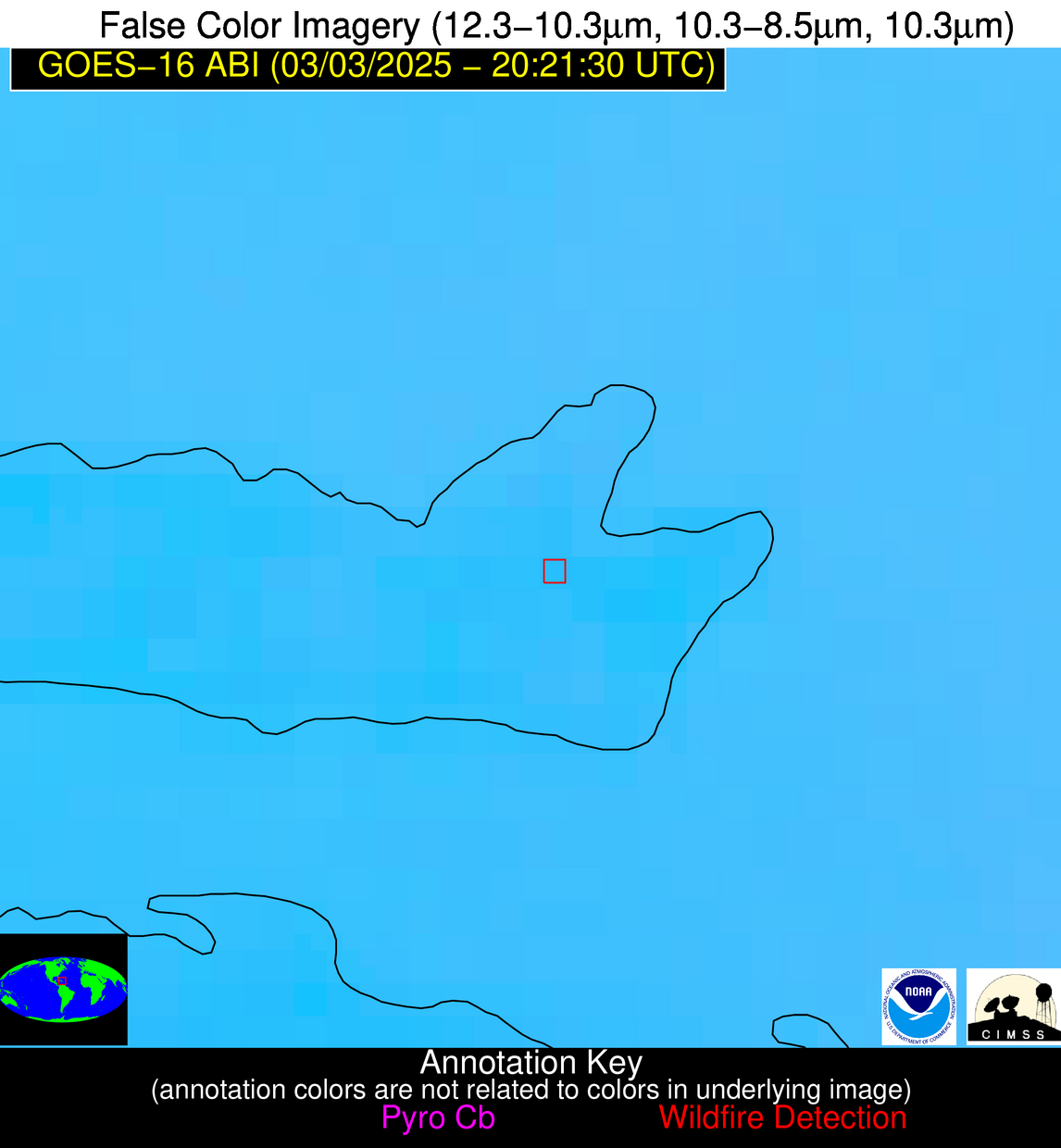
Possible Wildfire
| Basic Information | |
|---|---|
| State/Province(s) | Unknown |
| Country/Countries | Dominican Republic |
| County/Locality(s) | Unknown, Unknown |
| NWS WFO | N/A |
| Identification Method | Enhanced Contextual (Clear) |
| Mean Object Date/Time | 2025-03-03 20:23:53UTC |
| Radiative Center (Lat, Lon): | 19.270834°, -69.267220° |
| Nearby Counties (meeting alert criteria): |
|
| Total Radiative Power Anomaly | n/a |
| Total Radiative Power | 6.41 MW |
| Map: | |
| Additional Information | |
| Alert Status | New Feature |
| Type of Event | Nominal Risk |
| Event Priority Ranking | 4 |
| Maximum Observed BT (3.9 um) | 303.69 K |
| Observed - Background BT (3.9 um) | 4.83 K |
| BT Anomaly (3.9 um) | 3.67 K |
| Maximum Observed - Clear RTM BT (3.9 um) | 6.09 K |
| Maximum Observed BTD (3.9-10/11/12 um) | 9.54 K |
| Observed - Background BTD (3.9-10/11/12 um) | 4.18 K |
| BTD Anomaly (3.9-10/11/12 um) | 4.20 K |
| Similar Pixel Count | 19 |
| BT Time Tendency (3.9 um) | 0.30 K |
| Image Interval | 5.00 minutes |
| Fraction of Surrounding LWIR Pixels that are Colder | 0.90 |
| Fraction of Surrounding Red Channel Pixels that are Brighter | 1.00 |
| Maximum Radiative Power | 6.41 MW |
| Maximum Radiative Power Uncertainty | 0.00 MW |
| Total Radiative Power Uncertainty | 0.00 MW |
| Mean Viewing Angle | 23.70° |
| Mean Solar Zenith Angle | 58.60° |
| Mean Glint Angle | 74.90° |
| Water Fraction | 0.00 |
| Total Pixel Area | 4.40 km2 |
| Latest Satellite Imagery: | |
| View all event imagery » | |
