Wildfire Alert Report
| Date: | 2025-03-01 |
|---|---|
| Time: | 22:26:17 |
| Production Date and Time: | 2025-03-01 22:34:49 UTC |
| Primary Instrument: | GOES-16 ABI |
| Wmo Spacecraft Id: | 152 |
| Location/orbit: | GEO |
| L1 File: | OR_ABI-L1b-RadC-M6C14_G16_s20250602226176_e20250602228549_c20250602229033.nc |
| L1 File(s) - Temporal | OR_ABI-L1b-RadC-M6C14_G16_s20250602221176_e20250602223549_c20250602224036.nc |
| Number Of Thermal Anomaly Alerts: | 10 |
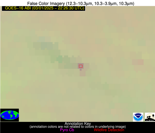
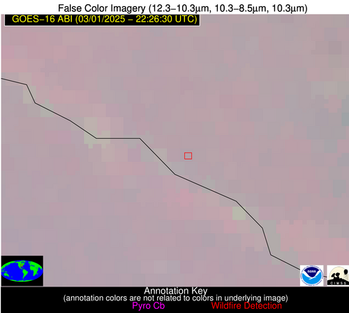
Possible Wildfire
| Basic Information | |
|---|---|
| State/Province(s) | IA |
| Country/Countries | United States |
| County/Locality(s) | Wapello County, IA |
| NWS WFO | Des Moines IA |
| Identification Method | Enhanced Contextual (Clear) |
| Mean Object Date/Time | 2025-03-01 22:26:51UTC |
| Radiative Center (Lat, Lon): | 40.904446°, -92.255554° |
| Nearby Counties (meeting alert criteria): |
|
| Total Radiative Power Anomaly | n/a |
| Total Radiative Power | 7.64 MW |
| Map: | |
| Additional Information | |
| Alert Status | New Feature |
| Type of Event | Nominal Risk |
| Event Priority Ranking | 4 |
| Maximum Observed BT (3.9 um) | 280.56 K |
| Observed - Background BT (3.9 um) | 4.43 K |
| BT Anomaly (3.9 um) | 9.94 K |
| Maximum Observed - Clear RTM BT (3.9 um) | 11.09 K |
| Maximum Observed BTD (3.9-10/11/12 um) | 9.99 K |
| Observed - Background BTD (3.9-10/11/12 um) | 6.21 K |
| BTD Anomaly (3.9-10/11/12 um) | 14.85 K |
| Similar Pixel Count | 1 |
| BT Time Tendency (3.9 um) | 0.10 K |
| Image Interval | 5.00 minutes |
| Fraction of Surrounding LWIR Pixels that are Colder | 0.01 |
| Fraction of Surrounding Red Channel Pixels that are Brighter | 0.98 |
| Maximum Radiative Power | 7.64 MW |
| Maximum Radiative Power Uncertainty | 0.00 MW |
| Total Radiative Power Uncertainty | 0.00 MW |
| Mean Viewing Angle | 50.70° |
| Mean Solar Zenith Angle | 74.40° |
| Mean Glint Angle | 80.60° |
| Water Fraction | 0.00 |
| Total Pixel Area | 6.30 km2 |
| Latest Satellite Imagery: | |
| View all event imagery » | |
Possible Wildfire
| Basic Information | |
|---|---|
| State/Province(s) | IL |
| Country/Countries | United States |
| County/Locality(s) | Randolph County, IL |
| NWS WFO | St Louis MO |
| Identification Method | Enhanced Contextual (Clear) |
| Mean Object Date/Time | 2025-03-01 22:26:51UTC |
| Radiative Center (Lat, Lon): | 37.934444°, -89.824722° |
| Nearby Counties (meeting alert criteria): |
|
| Total Radiative Power Anomaly | n/a |
| Total Radiative Power | 10.12 MW |
| Map: | |
| Additional Information | |
| Alert Status | New Feature |
| Type of Event | Nominal Risk |
| Event Priority Ranking | 4 |
| Maximum Observed BT (3.9 um) | 282.64 K |
| Observed - Background BT (3.9 um) | 3.59 K |
| BT Anomaly (3.9 um) | 8.57 K |
| Maximum Observed - Clear RTM BT (3.9 um) | 9.83 K |
| Maximum Observed BTD (3.9-10/11/12 um) | 6.66 K |
| Observed - Background BTD (3.9-10/11/12 um) | 3.83 K |
| BTD Anomaly (3.9-10/11/12 um) | 13.46 K |
| Similar Pixel Count | 2 |
| BT Time Tendency (3.9 um) | 3.40 K |
| Image Interval | 5.00 minutes |
| Fraction of Surrounding LWIR Pixels that are Colder | 0.31 |
| Fraction of Surrounding Red Channel Pixels that are Brighter | 1.00 |
| Maximum Radiative Power | 10.12 MW |
| Maximum Radiative Power Uncertainty | 0.00 MW |
| Total Radiative Power Uncertainty | 0.00 MW |
| Mean Viewing Angle | 46.80° |
| Mean Solar Zenith Angle | 74.80° |
| Mean Glint Angle | 79.80° |
| Water Fraction | 0.00 |
| Total Pixel Area | 11.70 km2 |
| Latest Satellite Imagery: | |
| View all event imagery » | |
Possible Wildfire
| Basic Information | |
|---|---|
| State/Province(s) | OK |
| Country/Countries | United States |
| County/Locality(s) | Ottawa County, OK |
| NWS WFO | Tulsa OK |
| Identification Method | Enhanced Contextual (Cloud) |
| Mean Object Date/Time | 2025-03-01 22:26:50UTC |
| Radiative Center (Lat, Lon): | 36.805279°, -94.808334° |
| Nearby Counties (meeting alert criteria): |
|
| Total Radiative Power Anomaly | n/a |
| Total Radiative Power | 49.23 MW |
| Map: | |
| Additional Information | |
| Alert Status | New Feature |
| Type of Event | Nominal Risk |
| Event Priority Ranking | 4 |
| Maximum Observed BT (3.9 um) | 284.11 K |
| Observed - Background BT (3.9 um) | 13.96 K |
| BT Anomaly (3.9 um) | 5.87 K |
| Maximum Observed - Clear RTM BT (3.9 um) | 5.49 K |
| Maximum Observed BTD (3.9-10/11/12 um) | 29.51 K |
| Observed - Background BTD (3.9-10/11/12 um) | 13.66 K |
| BTD Anomaly (3.9-10/11/12 um) | 6.42 K |
| Similar Pixel Count | 0 |
| BT Time Tendency (3.9 um) | 16.70 K |
| Image Interval | 5.00 minutes |
| Fraction of Surrounding LWIR Pixels that are Colder | 0.79 |
| Fraction of Surrounding Red Channel Pixels that are Brighter | 0.93 |
| Maximum Radiative Power | 49.23 MW |
| Maximum Radiative Power Uncertainty | 0.00 MW |
| Total Radiative Power Uncertainty | 0.00 MW |
| Mean Viewing Angle | 47.70° |
| Mean Solar Zenith Angle | 70.80° |
| Mean Glint Angle | 74.10° |
| Water Fraction | 0.00 |
| Total Pixel Area | 5.90 km2 |
| Latest Satellite Imagery: | |
| View all event imagery » | |
Possible Wildfire
| Basic Information | |
|---|---|
| State/Province(s) | OK |
| Country/Countries | United States |
| County/Locality(s) | Major County, OK |
| NWS WFO | Norman OK |
| Identification Method | Enhanced Contextual (Clear) |
| Mean Object Date/Time | 2025-03-01 22:27:20UTC |
| Radiative Center (Lat, Lon): | 36.186668°, -98.474724° |
| Nearby Counties (meeting alert criteria): |
|
| Total Radiative Power Anomaly | n/a |
| Total Radiative Power | 5.91 MW |
| Map: | |
| Additional Information | |
| Alert Status | New Feature |
| Type of Event | Nominal Risk |
| Event Priority Ranking | 4 |
| Maximum Observed BT (3.9 um) | 295.43 K |
| Observed - Background BT (3.9 um) | 2.46 K |
| BT Anomaly (3.9 um) | 3.47 K |
| Maximum Observed - Clear RTM BT (3.9 um) | 12.53 K |
| Maximum Observed BTD (3.9-10/11/12 um) | 6.72 K |
| Observed - Background BTD (3.9-10/11/12 um) | 2.31 K |
| BTD Anomaly (3.9-10/11/12 um) | 8.22 K |
| Similar Pixel Count | 13 |
| BT Time Tendency (3.9 um) | 0.60 K |
| Image Interval | 5.00 minutes |
| Fraction of Surrounding LWIR Pixels that are Colder | 0.63 |
| Fraction of Surrounding Red Channel Pixels that are Brighter | 1.00 |
| Maximum Radiative Power | 5.91 MW |
| Maximum Radiative Power Uncertainty | 0.00 MW |
| Total Radiative Power Uncertainty | 0.00 MW |
| Mean Viewing Angle | 48.90° |
| Mean Solar Zenith Angle | 67.90° |
| Mean Glint Angle | 70.40° |
| Water Fraction | 0.00 |
| Total Pixel Area | 6.10 km2 |
| Latest Satellite Imagery: | |
| View all event imagery » | |
Possible Wildfire
| Basic Information | |
|---|---|
| State/Province(s) | OK |
| Country/Countries | United States |
| County/Locality(s) | Lincoln County, OK |
| NWS WFO | Norman OK |
| Identification Method | Enhanced Contextual (Clear) |
| Mean Object Date/Time | 2025-03-01 22:27:20UTC |
| Radiative Center (Lat, Lon): | 35.615833°, -96.824165° |
| Nearby Counties (meeting alert criteria): |
|
| Total Radiative Power Anomaly | n/a |
| Total Radiative Power | 12.47 MW |
| Map: | |
| Additional Information | |
| Alert Status | New Feature |
| Type of Event | Nominal Risk |
| Event Priority Ranking | 4 |
| Maximum Observed BT (3.9 um) | 296.50 K |
| Observed - Background BT (3.9 um) | 4.98 K |
| BT Anomaly (3.9 um) | 49.83 K |
| Maximum Observed - Clear RTM BT (3.9 um) | 12.53 K |
| Maximum Observed BTD (3.9-10/11/12 um) | 8.77 K |
| Observed - Background BTD (3.9-10/11/12 um) | 4.89 K |
| BTD Anomaly (3.9-10/11/12 um) | 27.07 K |
| Similar Pixel Count | 2 |
| BT Time Tendency (3.9 um) | 3.80 K |
| Image Interval | 5.00 minutes |
| Fraction of Surrounding LWIR Pixels that are Colder | 0.67 |
| Fraction of Surrounding Red Channel Pixels that are Brighter | 1.00 |
| Maximum Radiative Power | 12.47 MW |
| Maximum Radiative Power Uncertainty | 0.00 MW |
| Total Radiative Power Uncertainty | 0.00 MW |
| Mean Viewing Angle | 47.50° |
| Mean Solar Zenith Angle | 68.80° |
| Mean Glint Angle | 71.00° |
| Water Fraction | 0.00 |
| Total Pixel Area | 5.90 km2 |
| Latest Satellite Imagery: | |
| View all event imagery » | |
Possible Wildfire
| Basic Information | |
|---|---|
| State/Province(s) | MS |
| Country/Countries | United States |
| County/Locality(s) | Tallahatchie County, MS |
| NWS WFO | Memphis TN |
| Identification Method | Enhanced Contextual (Clear) |
| Mean Object Date/Time | 2025-03-01 22:27:21UTC |
| Radiative Center (Lat, Lon): | 34.039444°, -90.162498° |
| Nearby Counties (meeting alert criteria): |
|
| Total Radiative Power Anomaly | n/a |
| Total Radiative Power | 8.16 MW |
| Map: | |
| Additional Information | |
| Alert Status | New Feature |
| Type of Event | Elevated SPC Risk and Red Flag Warning |
| Event Priority Ranking | 1 |
| Maximum Observed BT (3.9 um) | 291.21 K |
| Observed - Background BT (3.9 um) | 3.50 K |
| BT Anomaly (3.9 um) | 4.00 K |
| Maximum Observed - Clear RTM BT (3.9 um) | 9.41 K |
| Maximum Observed BTD (3.9-10/11/12 um) | 9.06 K |
| Observed - Background BTD (3.9-10/11/12 um) | 4.44 K |
| BTD Anomaly (3.9-10/11/12 um) | 7.90 K |
| Similar Pixel Count | 2 |
| BT Time Tendency (3.9 um) | 1.50 K |
| Image Interval | 5.00 minutes |
| Fraction of Surrounding LWIR Pixels that are Colder | 0.12 |
| Fraction of Surrounding Red Channel Pixels that are Brighter | 1.00 |
| Maximum Radiative Power | 8.16 MW |
| Maximum Radiative Power Uncertainty | 0.00 MW |
| Total Radiative Power Uncertainty | 0.00 MW |
| Mean Viewing Angle | 42.90° |
| Mean Solar Zenith Angle | 73.10° |
| Mean Glint Angle | 75.60° |
| Water Fraction | 0.00 |
| Total Pixel Area | 5.50 km2 |
| Latest Satellite Imagery: | |
| View all event imagery » | |
Possible Wildfire
| Basic Information | |
|---|---|
| State/Province(s) | GA |
| Country/Countries | United States |
| County/Locality(s) | Oconee County, GA |
| NWS WFO | Peachtree City GA |
| Identification Method | Enhanced Contextual (Clear) |
| Mean Object Date/Time | 2025-03-01 22:27:21UTC |
| Radiative Center (Lat, Lon): | 33.728333°, -83.444725° |
| Nearby Counties (meeting alert criteria): |
|
| Total Radiative Power Anomaly | n/a |
| Total Radiative Power | 30.30 MW |
| Map: | |
| Additional Information | |
| Alert Status | New Feature |
| Type of Event | Elevated SPC Risk and Red Flag Warning |
| Event Priority Ranking | 1 |
| Maximum Observed BT (3.9 um) | 301.24 K |
| Observed - Background BT (3.9 um) | 12.81 K |
| BT Anomaly (3.9 um) | 15.82 K |
| Maximum Observed - Clear RTM BT (3.9 um) | 16.84 K |
| Maximum Observed BTD (3.9-10/11/12 um) | 16.54 K |
| Observed - Background BTD (3.9-10/11/12 um) | 12.79 K |
| BTD Anomaly (3.9-10/11/12 um) | 15.30 K |
| Similar Pixel Count | 4 |
| BT Time Tendency (3.9 um) | 3.70 K |
| Image Interval | 5.00 minutes |
| Fraction of Surrounding LWIR Pixels that are Colder | 0.70 |
| Fraction of Surrounding Red Channel Pixels that are Brighter | 1.00 |
| Maximum Radiative Power | 30.30 MW |
| Maximum Radiative Power Uncertainty | 0.00 MW |
| Total Radiative Power Uncertainty | 0.00 MW |
| Mean Viewing Angle | 40.40° |
| Mean Solar Zenith Angle | 78.20° |
| Mean Glint Angle | 83.20° |
| Water Fraction | 0.00 |
| Total Pixel Area | 5.30 km2 |
| Latest Satellite Imagery: | |
| View all event imagery » | |
Possible Wildfire
| Basic Information | |
|---|---|
| State/Province(s) | MS |
| Country/Countries | United States |
| County/Locality(s) | Lowndes County, MS |
| NWS WFO | Jackson MS |
| Identification Method | Enhanced Contextual (Clear) |
| Mean Object Date/Time | 2025-03-01 22:27:21UTC |
| Radiative Center (Lat, Lon): | 33.391109°, -88.394997° |
| Nearby Counties (meeting alert criteria): |
|
| Total Radiative Power Anomaly | n/a |
| Total Radiative Power | 13.46 MW |
| Map: | |
| Additional Information | |
| Alert Status | New Feature |
| Type of Event | Nominal Risk |
| Event Priority Ranking | 4 |
| Maximum Observed BT (3.9 um) | 294.93 K |
| Observed - Background BT (3.9 um) | 5.89 K |
| BT Anomaly (3.9 um) | 11.29 K |
| Maximum Observed - Clear RTM BT (3.9 um) | 12.23 K |
| Maximum Observed BTD (3.9-10/11/12 um) | 11.01 K |
| Observed - Background BTD (3.9-10/11/12 um) | 6.94 K |
| BTD Anomaly (3.9-10/11/12 um) | 7.11 K |
| Similar Pixel Count | 2 |
| BT Time Tendency (3.9 um) | 2.50 K |
| Image Interval | 5.00 minutes |
| Fraction of Surrounding LWIR Pixels that are Colder | 0.34 |
| Fraction of Surrounding Red Channel Pixels that are Brighter | 0.99 |
| Maximum Radiative Power | 13.46 MW |
| Maximum Radiative Power Uncertainty | 0.00 MW |
| Total Radiative Power Uncertainty | 0.00 MW |
| Mean Viewing Angle | 41.50° |
| Mean Solar Zenith Angle | 74.20° |
| Mean Glint Angle | 76.90° |
| Water Fraction | 0.00 |
| Total Pixel Area | 5.30 km2 |
| Latest Satellite Imagery: | |
| View all event imagery » | |
Possible Wildfire
| Basic Information | |
|---|---|
| State/Province(s) | MS |
| Country/Countries | United States |
| County/Locality(s) | Attala County, MS |
| NWS WFO | Jackson MS |
| Identification Method | Enhanced Contextual (Clear) |
| Mean Object Date/Time | 2025-03-01 22:27:21UTC |
| Radiative Center (Lat, Lon): | 32.938057°, -89.469170° |
| Nearby Counties (meeting alert criteria): |
|
| Total Radiative Power Anomaly | n/a |
| Total Radiative Power | 9.64 MW |
| Map: | |
| Additional Information | |
| Alert Status | New Feature |
| Type of Event | Nominal Risk |
| Event Priority Ranking | 4 |
| Maximum Observed BT (3.9 um) | 293.96 K |
| Observed - Background BT (3.9 um) | 4.79 K |
| BT Anomaly (3.9 um) | 13.80 K |
| Maximum Observed - Clear RTM BT (3.9 um) | 10.67 K |
| Maximum Observed BTD (3.9-10/11/12 um) | 7.15 K |
| Observed - Background BTD (3.9-10/11/12 um) | 4.69 K |
| BTD Anomaly (3.9-10/11/12 um) | 25.23 K |
| Similar Pixel Count | 1 |
| BT Time Tendency (3.9 um) | 0.60 K |
| Image Interval | 5.00 minutes |
| Fraction of Surrounding LWIR Pixels that are Colder | 0.61 |
| Fraction of Surrounding Red Channel Pixels that are Brighter | 1.00 |
| Maximum Radiative Power | 9.64 MW |
| Maximum Radiative Power Uncertainty | 0.00 MW |
| Total Radiative Power Uncertainty | 0.00 MW |
| Mean Viewing Angle | 41.50° |
| Mean Solar Zenith Angle | 73.20° |
| Mean Glint Angle | 75.20° |
| Water Fraction | 0.00 |
| Total Pixel Area | 5.30 km2 |
| Latest Satellite Imagery: | |
| View all event imagery » | |
Possible Wildfire
| Basic Information | |
|---|---|
| State/Province(s) | TX |
| Country/Countries | United States |
| County/Locality(s) | Cherokee County, TX |
| NWS WFO | Shreveport LA |
| Identification Method | Enhanced Contextual (Clear) |
| Mean Object Date/Time | 2025-03-01 22:27:20UTC |
| Radiative Center (Lat, Lon): | 31.682777°, -95.059723° |
| Nearby Counties (meeting alert criteria): |
|
| Total Radiative Power Anomaly | n/a |
| Total Radiative Power | 5.82 MW |
| Map: | |
| Additional Information | |
| Alert Status | New Feature |
| Type of Event | Nominal Risk |
| Event Priority Ranking | 4 |
| Maximum Observed BT (3.9 um) | 298.53 K |
| Observed - Background BT (3.9 um) | 2.17 K |
| BT Anomaly (3.9 um) | 7.67 K |
| Maximum Observed - Clear RTM BT (3.9 um) | 10.30 K |
| Maximum Observed BTD (3.9-10/11/12 um) | 6.11 K |
| Observed - Background BTD (3.9-10/11/12 um) | 2.13 K |
| BTD Anomaly (3.9-10/11/12 um) | 7.83 K |
| Similar Pixel Count | 15 |
| BT Time Tendency (3.9 um) | 0.50 K |
| Image Interval | 5.00 minutes |
| Fraction of Surrounding LWIR Pixels that are Colder | 0.55 |
| Fraction of Surrounding Red Channel Pixels that are Brighter | 1.00 |
| Maximum Radiative Power | 5.82 MW |
| Maximum Radiative Power Uncertainty | 0.00 MW |
| Total Radiative Power Uncertainty | 0.00 MW |
| Mean Viewing Angle | 42.90° |
| Mean Solar Zenith Angle | 68.40° |
| Mean Glint Angle | 67.90° |
| Water Fraction | 0.00 |
| Total Pixel Area | 5.50 km2 |
| Latest Satellite Imagery: | |
| View all event imagery » | |


