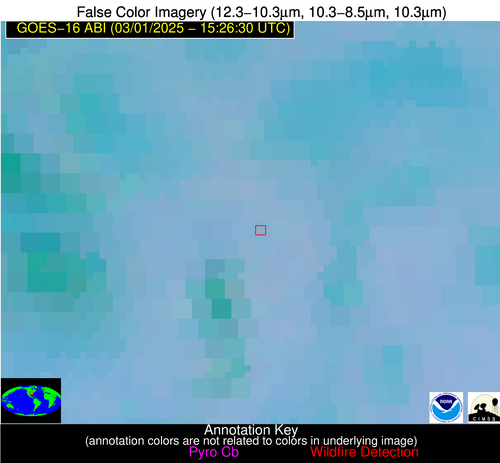
Please consider accessing NGFS detections and satellite imagery through the NOAA/NESDIS Wildland Fire Data Portal: https://fire.data.nesdis.noaa.gov/map/
Wildfire Notification Report
| Date: | 2025-03-01 |
|---|---|
| Time: | 15:26:17 |
| Production Date and Time: | 2025-03-01 15:30:59 UTC |
| Primary Instrument: | GOES-16 ABI |
| Wmo Spacecraft Id: | 152 |
| Location/orbit: | GEO |
| L1 File: | OR_ABI-L1b-RadC-M6C14_G16_s20250601526176_e20250601528549_c20250601529019.nc |
| L1 File(s) - Temporal | OR_ABI-L1b-RadC-M6C14_G16_s20250601521176_e20250601523549_c20250601524017.nc |
| Number Of Thermal Anomaly Notifications: | 9 |
Possible Wildfire
| Basic Information | |
|---|---|
| State/Province(s) | KS |
| Country/Countries | United States |
| County/Locality(s) | Dickinson County, KS |
| NWS WFO | Topeka KS |
| Identification Method | Enhanced Contextual (Cloud) |
| Mean Object Date/Time | 2025-03-01 15:26:50UTC |
| Radiative Center (Lat, Lon): | 38.816387°, -97.366386° |
| Nearby Counties (meeting notification criteria): |
|
| Total Radiative Power Anomaly | n/a |
| Total Radiative Power | 24.43 MW |
| Map: | |
| Additional Information | |
| Notification Status | New Feature |
| Type of Event | Nominal Risk |
| Event Priority Ranking | 4 |
| Maximum Observed BT (3.9 um) | 287.96 K |
| Observed - Background BT (3.9 um) | 8.49 K |
| BT Anomaly (3.9 um) | 9.99 K |
| Maximum Observed - Clear RTM BT (3.9 um) | 9.31 K |
| Maximum Observed BTD (3.9-10/11/12 um) | 22.37 K |
| Observed - Background BTD (3.9-10/11/12 um) | 8.79 K |
| BTD Anomaly (3.9-10/11/12 um) | 7.35 K |
| Similar Pixel Count | 0 |
| BT Time Tendency (3.9 um) | 8.40 K |
| Image Interval | 5.00 minutes |
| Fraction of Surrounding LWIR Pixels that are Colder | 0.34 |
| Fraction of Surrounding Red Channel Pixels that are Brighter | 1.00 |
| Maximum Radiative Power | 24.43 MW |
| Maximum Radiative Power Uncertainty | 0.00 MW |
| Total Radiative Power Uncertainty | 0.00 MW |
| Mean Viewing Angle | 50.80° |
| Mean Solar Zenith Angle | 65.20° |
| Mean Glint Angle | 112.60° |
| Water Fraction | 0.00 |
| Total Pixel Area | 6.30 km2 |
| Latest Satellite Imagery: | |
| View all event imagery » | |
Possible Wildfire
| Basic Information | |
|---|---|
| State/Province(s) | AR |
| Country/Countries | United States |
| County/Locality(s) | Izard County, AR |
| NWS WFO | Little Rock AR |
| Identification Method | Enhanced Contextual (Clear) |
| Mean Object Date/Time | 2025-03-01 15:26:51UTC |
| Radiative Center (Lat, Lon): | 36.224724°, -92.006386° |
| Nearby Counties (meeting notification criteria): |
|
| Total Radiative Power Anomaly | n/a |
| Total Radiative Power | 8.30 MW |
| Map: | |
| Additional Information | |
| Notification Status | New Feature |
| Type of Event | Nominal Risk |
| Event Priority Ranking | 4 |
| Maximum Observed BT (3.9 um) | 292.62 K |
| Observed - Background BT (3.9 um) | 3.61 K |
| BT Anomaly (3.9 um) | 4.79 K |
| Maximum Observed - Clear RTM BT (3.9 um) | 12.49 K |
| Maximum Observed BTD (3.9-10/11/12 um) | 10.09 K |
| Observed - Background BTD (3.9-10/11/12 um) | 2.94 K |
| BTD Anomaly (3.9-10/11/12 um) | 3.15 K |
| Similar Pixel Count | 8 |
| BT Time Tendency (3.9 um) | 3.70 K |
| Image Interval | 5.00 minutes |
| Fraction of Surrounding LWIR Pixels that are Colder | 0.77 |
| Fraction of Surrounding Red Channel Pixels that are Brighter | 1.00 |
| Maximum Radiative Power | 8.30 MW |
| Maximum Radiative Power Uncertainty | 0.00 MW |
| Total Radiative Power Uncertainty | 0.00 MW |
| Mean Viewing Angle | 45.90° |
| Mean Solar Zenith Angle | 60.20° |
| Mean Glint Angle | 102.70° |
| Water Fraction | 0.00 |
| Total Pixel Area | 5.70 km2 |
| Latest Satellite Imagery: | |
| View all event imagery » | |
Possible Wildfire
| Basic Information | |
|---|---|
| State/Province(s) | NC |
| Country/Countries | United States |
| County/Locality(s) | Greene County, NC |
| NWS WFO | Newport/Morehead City NC |
| Identification Method | Enhanced Contextual (Clear) |
| Mean Object Date/Time | 2025-03-01 15:27:22UTC |
| Radiative Center (Lat, Lon): | 35.435276°, -77.761948° |
| Nearby Counties (meeting notification criteria): |
|
| Total Radiative Power Anomaly | n/a |
| Total Radiative Power | 4.68 MW |
| Map: | |
| Additional Information | |
| Notification Status | New Feature |
| Type of Event | Elevated SPC Risk and Red Flag Warning |
| Event Priority Ranking | 1 |
| Maximum Observed BT (3.9 um) | 297.76 K |
| Observed - Background BT (3.9 um) | 1.44 K |
| BT Anomaly (3.9 um) | 1.31 K |
| Maximum Observed - Clear RTM BT (3.9 um) | 12.14 K |
| Maximum Observed BTD (3.9-10/11/12 um) | 9.11 K |
| Observed - Background BTD (3.9-10/11/12 um) | 1.68 K |
| BTD Anomaly (3.9-10/11/12 um) | 3.37 K |
| Similar Pixel Count | 25 |
| BT Time Tendency (3.9 um) | 2.30 K |
| Image Interval | 5.00 minutes |
| Fraction of Surrounding LWIR Pixels that are Colder | 0.56 |
| Fraction of Surrounding Red Channel Pixels that are Brighter | 1.00 |
| Maximum Radiative Power | 4.68 MW |
| Maximum Radiative Power Uncertainty | 0.00 MW |
| Total Radiative Power Uncertainty | 0.00 MW |
| Mean Viewing Angle | 41.40° |
| Mean Solar Zenith Angle | 51.50° |
| Mean Glint Angle | 87.90° |
| Water Fraction | 0.00 |
| Total Pixel Area | 5.30 km2 |
| Latest Satellite Imagery: | |
| View all event imagery » | |
Possible Wildfire
| Basic Information | |
|---|---|
| State/Province(s) | OK |
| Country/Countries | United States |
| County/Locality(s) | Caddo County, OK |
| NWS WFO | Norman OK |
| Identification Method | Enhanced Contextual (Clear) |
| Mean Object Date/Time | 2025-03-01 15:27:20UTC |
| Radiative Center (Lat, Lon): | 35.223057°, -98.255836° |
| Nearby Counties (meeting notification criteria): |
|
| Total Radiative Power Anomaly | n/a |
| Total Radiative Power | 30.04 MW |
| Map: | |
| Additional Information | |
| Notification Status | New Feature |
| Type of Event | Nominal Risk |
| Event Priority Ranking | 4 |
| Maximum Observed BT (3.9 um) | 299.66 K |
| Observed - Background BT (3.9 um) | 5.75 K |
| BT Anomaly (3.9 um) | 6.10 K |
| Maximum Observed - Clear RTM BT (3.9 um) | 13.96 K |
| Maximum Observed BTD (3.9-10/11/12 um) | 12.53 K |
| Observed - Background BTD (3.9-10/11/12 um) | 5.46 K |
| BTD Anomaly (3.9-10/11/12 um) | 9.09 K |
| Similar Pixel Count | 2 |
| BT Time Tendency (3.9 um) | 6.10 K |
| Image Interval | 5.00 minutes |
| Fraction of Surrounding LWIR Pixels that are Colder | 0.72 |
| Fraction of Surrounding Red Channel Pixels that are Brighter | 1.00 |
| Maximum Radiative Power | 15.14 MW |
| Maximum Radiative Power Uncertainty | 0.00 MW |
| Total Radiative Power Uncertainty | 0.00 MW |
| Mean Viewing Angle | 47.90° |
| Mean Solar Zenith Angle | 63.80° |
| Mean Glint Angle | 109.00° |
| Water Fraction | 0.00 |
| Total Pixel Area | 11.90 km2 |
| Latest Satellite Imagery: | |
| View all event imagery » | |
Possible Wildfire
| Basic Information | |
|---|---|
| State/Province(s) | SC |
| Country/Countries | United States |
| County/Locality(s) | Kershaw County, SC |
| NWS WFO | Columbia SC |
| Identification Method | Enhanced Contextual (Clear) |
| Mean Object Date/Time | 2025-03-01 15:27:22UTC |
| Radiative Center (Lat, Lon): | 34.397499°, -80.668610° |
| Nearby Counties (meeting notification criteria): |
|
| Total Radiative Power Anomaly | n/a |
| Total Radiative Power | 9.98 MW |
| Map: | |
| Additional Information | |
| Notification Status | New Feature |
| Type of Event | Elevated SPC Risk and Red Flag Warning |
| Event Priority Ranking | 1 |
| Maximum Observed BT (3.9 um) | 297.53 K |
| Observed - Background BT (3.9 um) | 2.70 K |
| BT Anomaly (3.9 um) | 2.60 K |
| Maximum Observed - Clear RTM BT (3.9 um) | 10.03 K |
| Maximum Observed BTD (3.9-10/11/12 um) | 7.88 K |
| Observed - Background BTD (3.9-10/11/12 um) | 2.28 K |
| BTD Anomaly (3.9-10/11/12 um) | 3.31 K |
| Similar Pixel Count | 9 |
| BT Time Tendency (3.9 um) | 0.70 K |
| Image Interval | 5.00 minutes |
| Fraction of Surrounding LWIR Pixels that are Colder | 0.69 |
| Fraction of Surrounding Red Channel Pixels that are Brighter | 1.00 |
| Maximum Radiative Power | 9.98 MW |
| Maximum Radiative Power Uncertainty | 0.00 MW |
| Total Radiative Power Uncertainty | 0.00 MW |
| Mean Viewing Angle | 40.60° |
| Mean Solar Zenith Angle | 52.20° |
| Mean Glint Angle | 88.20° |
| Water Fraction | 0.00 |
| Total Pixel Area | 10.50 km2 |
| Latest Satellite Imagery: | |
| View all event imagery » | |
Possible Wildfire
| Basic Information | |
|---|---|
| State/Province(s) | MS |
| Country/Countries | United States |
| County/Locality(s) | Montgomery County, MS |
| NWS WFO | Jackson MS |
| Identification Method | Enhanced Contextual (Clear) |
| Mean Object Date/Time | 2025-03-01 15:27:21UTC |
| Radiative Center (Lat, Lon): | 33.518890°, -89.701111° |
| Nearby Counties (meeting notification criteria): |
|
| Total Radiative Power Anomaly | n/a |
| Total Radiative Power | 3.87 MW |
| Map: | |
| Additional Information | |
| Notification Status | New Feature |
| Type of Event | Nominal Risk |
| Event Priority Ranking | 4 |
| Maximum Observed BT (3.9 um) | 294.63 K |
| Observed - Background BT (3.9 um) | 2.42 K |
| BT Anomaly (3.9 um) | 3.77 K |
| Maximum Observed - Clear RTM BT (3.9 um) | 10.04 K |
| Maximum Observed BTD (3.9-10/11/12 um) | 7.09 K |
| Observed - Background BTD (3.9-10/11/12 um) | 2.05 K |
| BTD Anomaly (3.9-10/11/12 um) | 4.56 K |
| Similar Pixel Count | 23 |
| BT Time Tendency (3.9 um) | 0.90 K |
| Image Interval | 5.00 minutes |
| Fraction of Surrounding LWIR Pixels that are Colder | 0.88 |
| Fraction of Surrounding Red Channel Pixels that are Brighter | 1.00 |
| Maximum Radiative Power | 3.87 MW |
| Maximum Radiative Power Uncertainty | 0.00 MW |
| Total Radiative Power Uncertainty | 0.00 MW |
| Mean Viewing Angle | 42.20° |
| Mean Solar Zenith Angle | 57.10° |
| Mean Glint Angle | 95.90° |
| Water Fraction | 0.00 |
| Total Pixel Area | 5.40 km2 |
| Latest Satellite Imagery: | |
| View all event imagery » | |
Possible Wildfire
| Basic Information | |
|---|---|
| State/Province(s) | MS |
| Country/Countries | United States |
| County/Locality(s) | Noxubee County, MS |
| NWS WFO | Jackson MS |
| Identification Method | Enhanced Contextual (Clear) |
| Mean Object Date/Time | 2025-03-01 15:27:21UTC |
| Radiative Center (Lat, Lon): | 33.256943°, -88.810837° |
| Nearby Counties (meeting notification criteria): |
|
| Total Radiative Power Anomaly | n/a |
| Total Radiative Power | 6.79 MW |
| Map: | |
| Additional Information | |
| Notification Status | New Feature |
| Type of Event | Nominal Risk |
| Event Priority Ranking | 4 |
| Maximum Observed BT (3.9 um) | 295.63 K |
| Observed - Background BT (3.9 um) | 3.12 K |
| BT Anomaly (3.9 um) | 3.33 K |
| Maximum Observed - Clear RTM BT (3.9 um) | 10.21 K |
| Maximum Observed BTD (3.9-10/11/12 um) | 7.70 K |
| Observed - Background BTD (3.9-10/11/12 um) | 3.12 K |
| BTD Anomaly (3.9-10/11/12 um) | 4.48 K |
| Similar Pixel Count | 5 |
| BT Time Tendency (3.9 um) | 1.00 K |
| Image Interval | 5.00 minutes |
| Fraction of Surrounding LWIR Pixels that are Colder | 0.48 |
| Fraction of Surrounding Red Channel Pixels that are Brighter | 0.91 |
| Maximum Radiative Power | 6.79 MW |
| Maximum Radiative Power Uncertainty | 0.00 MW |
| Total Radiative Power Uncertainty | 0.00 MW |
| Mean Viewing Angle | 41.60° |
| Mean Solar Zenith Angle | 56.30° |
| Mean Glint Angle | 94.50° |
| Water Fraction | 0.00 |
| Total Pixel Area | 5.30 km2 |
| Latest Satellite Imagery: | |
| View all event imagery » | |
Possible Wildfire
| Basic Information | |
|---|---|
| State/Province(s) | AL |
| Country/Countries | United States |
| County/Locality(s) | Bullock County, AL |
| NWS WFO | Birmingham AL |
| Identification Method | Enhanced Contextual (Clear) |
| Mean Object Date/Time | 2025-03-01 15:27:21UTC |
| Radiative Center (Lat, Lon): | 32.190277°, -85.466110° |
| Nearby Counties (meeting notification criteria): |
|
| Total Radiative Power Anomaly | n/a |
| Total Radiative Power | 12.02 MW |
| Map: | |
| Additional Information | |
| Notification Status | New Feature |
| Type of Event | Elevated SPC Risk |
| Event Priority Ranking | 3 |
| Maximum Observed BT (3.9 um) | 300.13 K |
| Observed - Background BT (3.9 um) | 5.34 K |
| BT Anomaly (3.9 um) | 6.72 K |
| Maximum Observed - Clear RTM BT (3.9 um) | 12.97 K |
| Maximum Observed BTD (3.9-10/11/12 um) | 9.34 K |
| Observed - Background BTD (3.9-10/11/12 um) | 4.94 K |
| BTD Anomaly (3.9-10/11/12 um) | 18.73 K |
| Similar Pixel Count | 1 |
| BT Time Tendency (3.9 um) | 5.30 K |
| Image Interval | 5.00 minutes |
| Fraction of Surrounding LWIR Pixels that are Colder | 0.63 |
| Fraction of Surrounding Red Channel Pixels that are Brighter | 1.00 |
| Maximum Radiative Power | 12.02 MW |
| Maximum Radiative Power Uncertainty | 0.00 MW |
| Total Radiative Power Uncertainty | 0.00 MW |
| Mean Viewing Angle | 39.30° |
| Mean Solar Zenith Angle | 53.50° |
| Mean Glint Angle | 89.10° |
| Water Fraction | 0.00 |
| Total Pixel Area | 5.20 km2 |
| Latest Satellite Imagery: | |
| View all event imagery » | |
Possible Wildfire
| Basic Information | |
|---|---|
| State/Province(s) | LA |
| Country/Countries | United States |
| County/Locality(s) | Grant Parish, LA |
| NWS WFO | Shreveport LA |
| Identification Method | Enhanced Contextual (Clear) |
| Mean Object Date/Time | 2025-03-01 15:27:20UTC |
| Radiative Center (Lat, Lon): | 31.517221°, -92.681664° |
| Nearby Counties (meeting notification criteria): |
|
| Total Radiative Power Anomaly | n/a |
| Total Radiative Power | 9.80 MW |
| Map: | |
| Additional Information | |
| Notification Status | New Feature |
| Type of Event | Nominal Risk |
| Event Priority Ranking | 4 |
| Maximum Observed BT (3.9 um) | 296.93 K |
| Observed - Background BT (3.9 um) | 4.64 K |
| BT Anomaly (3.9 um) | 8.32 K |
| Maximum Observed - Clear RTM BT (3.9 um) | 9.08 K |
| Maximum Observed BTD (3.9-10/11/12 um) | 8.08 K |
| Observed - Background BTD (3.9-10/11/12 um) | 4.09 K |
| BTD Anomaly (3.9-10/11/12 um) | 9.59 K |
| Similar Pixel Count | 2 |
| BT Time Tendency (3.9 um) | 3.10 K |
| Image Interval | 5.00 minutes |
| Fraction of Surrounding LWIR Pixels that are Colder | 0.89 |
| Fraction of Surrounding Red Channel Pixels that are Brighter | 0.93 |
| Maximum Radiative Power | 9.80 MW |
| Maximum Radiative Power Uncertainty | 0.00 MW |
| Total Radiative Power Uncertainty | 0.00 MW |
| Mean Viewing Angle | 41.50° |
| Mean Solar Zenith Angle | 57.90° |
| Mean Glint Angle | 96.60° |
| Water Fraction | 0.00 |
| Total Pixel Area | 5.30 km2 |
| Latest Satellite Imagery: | |
| View all event imagery » | |


