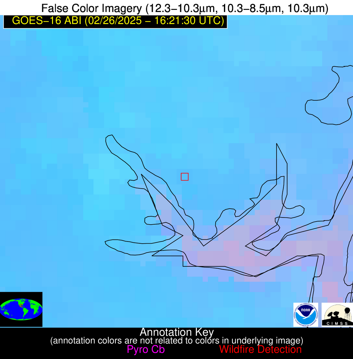
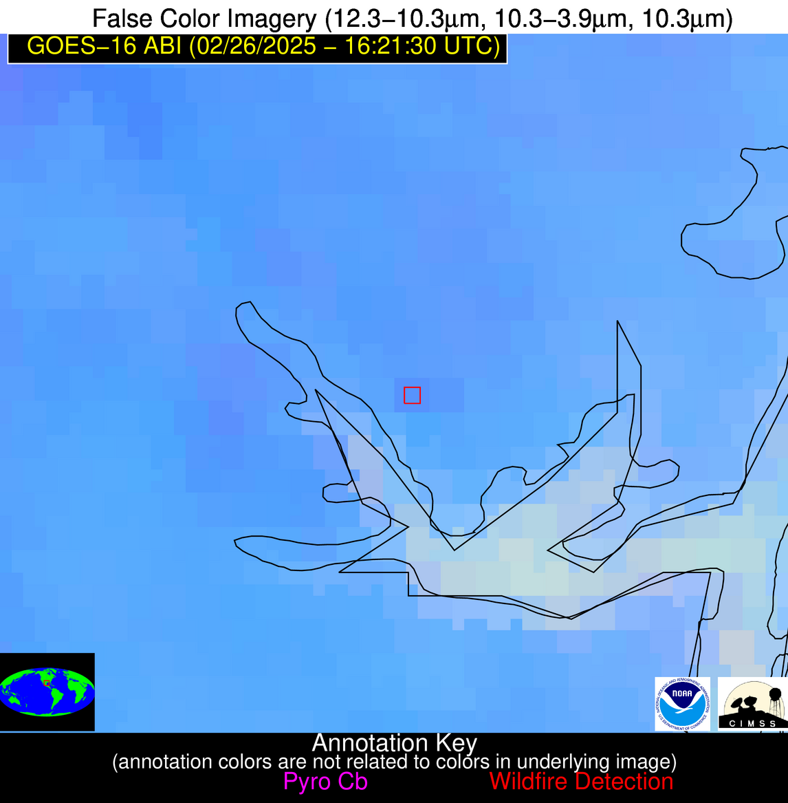
Wildfire Alert Report
| Date: | 2025-02-26 |
|---|---|
| Time: | 16:21:17 |
| Production Date and Time: | 2025-02-26 16:25:59 UTC |
| Primary Instrument: | GOES-16 ABI |
| Wmo Spacecraft Id: | 152 |
| Location/orbit: | GEO |
| L1 File: | OR_ABI-L1b-RadC-M6C14_G16_s20250571621174_e20250571623547_c20250571624022.nc |
| L1 File(s) - Temporal | OR_ABI-L1b-RadC-M6C14_G16_s20250571616174_e20250571618547_c20250571619012.nc |
| Number Of Thermal Anomaly Alerts: | 25 |
Possible Wildfire
| Basic Information | |
|---|---|
| State/Province(s) | MD |
| Country/Countries | United States |
| County/Locality(s) | Caroline County, MD |
| NWS WFO | Mount Holly NJ |
| Identification Method | Enhanced Contextual (Clear) |
| Mean Object Date/Time | 2025-02-26 16:21:52UTC |
| Radiative Center (Lat, Lon): | 38.958611°, -75.930557° |
| Nearby Counties (meeting alert criteria): |
|
| Total Radiative Power Anomaly | n/a |
| Total Radiative Power | 9.86 MW |
| Map: | |
| Additional Information | |
| Alert Status | New Feature |
| Type of Event | Nominal Risk |
| Event Priority Ranking | 4 |
| Maximum Observed BT (3.9 um) | 301.77 K |
| Observed - Background BT (3.9 um) | 3.03 K |
| BT Anomaly (3.9 um) | 3.13 K |
| Maximum Observed - Clear RTM BT (3.9 um) | 17.98 K |
| Maximum Observed BTD (3.9-10/11/12 um) | 12.50 K |
| Observed - Background BTD (3.9-10/11/12 um) | 3.30 K |
| BTD Anomaly (3.9-10/11/12 um) | 7.25 K |
| Similar Pixel Count | 25 |
| BT Time Tendency (3.9 um) | 2.80 K |
| Image Interval | 5.00 minutes |
| Fraction of Surrounding LWIR Pixels that are Colder | 0.25 |
| Fraction of Surrounding Red Channel Pixels that are Brighter | 1.00 |
| Maximum Radiative Power | 9.86 MW |
| Maximum Radiative Power Uncertainty | 0.00 MW |
| Total Radiative Power Uncertainty | 0.00 MW |
| Mean Viewing Angle | 45.30° |
| Mean Solar Zenith Angle | 49.80° |
| Mean Glint Angle | 93.70° |
| Water Fraction | 0.00 |
| Total Pixel Area | 5.70 km2 |
| Latest Satellite Imagery: | |
| View all event imagery » | |
Possible Wildfire
| Basic Information | |
|---|---|
| State/Province(s) | SC |
| Country/Countries | United States |
| County/Locality(s) | Spartanburg County, SC |
| NWS WFO | Greenville-Spartanburg SC |
| Identification Method | Enhanced Contextual (Clear) |
| Mean Object Date/Time | 2025-02-26 16:22:22UTC |
| Radiative Center (Lat, Lon): | 34.878334°, -82.013885° |
| Nearby Counties (meeting alert criteria): |
|
| Total Radiative Power Anomaly | n/a |
| Total Radiative Power | 4.95 MW |
| Map: | |
| Additional Information | |
| Alert Status | New Feature |
| Type of Event | Nominal Risk |
| Event Priority Ranking | 4 |
| Maximum Observed BT (3.9 um) | 304.25 K |
| Observed - Background BT (3.9 um) | 1.94 K |
| BT Anomaly (3.9 um) | 1.36 K |
| Maximum Observed - Clear RTM BT (3.9 um) | 16.37 K |
| Maximum Observed BTD (3.9-10/11/12 um) | 9.72 K |
| Observed - Background BTD (3.9-10/11/12 um) | 1.76 K |
| BTD Anomaly (3.9-10/11/12 um) | 2.45 K |
| Similar Pixel Count | 25 |
| BT Time Tendency (3.9 um) | 0.90 K |
| Image Interval | 5.00 minutes |
| Fraction of Surrounding LWIR Pixels that are Colder | 0.61 |
| Fraction of Surrounding Red Channel Pixels that are Brighter | 0.91 |
| Maximum Radiative Power | 4.95 MW |
| Maximum Radiative Power Uncertainty | 0.00 MW |
| Total Radiative Power Uncertainty | 0.00 MW |
| Mean Viewing Angle | 41.40° |
| Mean Solar Zenith Angle | 47.90° |
| Mean Glint Angle | 88.20° |
| Water Fraction | 0.00 |
| Total Pixel Area | 5.30 km2 |
| Latest Satellite Imagery: | |
| View all event imagery » | |
Possible Wildfire
| Basic Information | |
|---|---|
| State/Province(s) | NC |
| Country/Countries | United States |
| County/Locality(s) | Duplin County, NC |
| NWS WFO | Newport/Morehead City NC |
| Identification Method | Enhanced Contextual (Clear) |
| Mean Object Date/Time | 2025-02-26 16:22:22UTC |
| Radiative Center (Lat, Lon): | 34.843613°, -78.148613° |
| Nearby Counties (meeting alert criteria): |
|
| Total Radiative Power Anomaly | n/a |
| Total Radiative Power | 5.02 MW |
| Map: | |
| Additional Information | |
| Alert Status | New Feature |
| Type of Event | Nominal Risk |
| Event Priority Ranking | 4 |
| Maximum Observed BT (3.9 um) | 302.63 K |
| Observed - Background BT (3.9 um) | 1.96 K |
| BT Anomaly (3.9 um) | 1.93 K |
| Maximum Observed - Clear RTM BT (3.9 um) | 13.94 K |
| Maximum Observed BTD (3.9-10/11/12 um) | 8.73 K |
| Observed - Background BTD (3.9-10/11/12 um) | 1.70 K |
| BTD Anomaly (3.9-10/11/12 um) | 2.14 K |
| Similar Pixel Count | 25 |
| BT Time Tendency (3.9 um) | 1.60 K |
| Image Interval | 5.00 minutes |
| Fraction of Surrounding LWIR Pixels that are Colder | 0.69 |
| Fraction of Surrounding Red Channel Pixels that are Brighter | 1.00 |
| Maximum Radiative Power | 5.02 MW |
| Maximum Radiative Power Uncertainty | 0.00 MW |
| Total Radiative Power Uncertainty | 0.00 MW |
| Mean Viewing Angle | 40.80° |
| Mean Solar Zenith Angle | 46.50° |
| Mean Glint Angle | 86.10° |
| Water Fraction | 0.00 |
| Total Pixel Area | 5.30 km2 |
| Latest Satellite Imagery: | |
| View all event imagery » | |
Possible Wildfire
| Basic Information | |
|---|---|
| State/Province(s) | SC |
| Country/Countries | United States |
| County/Locality(s) | Spartanburg County, SC |
| NWS WFO | Greenville-Spartanburg SC |
| Identification Method | Enhanced Contextual (Clear) |
| Mean Object Date/Time | 2025-02-26 16:22:22UTC |
| Radiative Center (Lat, Lon): | 34.802223°, -81.845833° |
| Nearby Counties (meeting alert criteria): |
|
| Total Radiative Power Anomaly | n/a |
| Total Radiative Power | 4.82 MW |
| Map: | |
| Additional Information | |
| Alert Status | New Feature |
| Type of Event | Nominal Risk |
| Event Priority Ranking | 4 |
| Maximum Observed BT (3.9 um) | 302.67 K |
| Observed - Background BT (3.9 um) | 1.69 K |
| BT Anomaly (3.9 um) | 1.12 K |
| Maximum Observed - Clear RTM BT (3.9 um) | 14.58 K |
| Maximum Observed BTD (3.9-10/11/12 um) | 8.89 K |
| Observed - Background BTD (3.9-10/11/12 um) | 1.64 K |
| BTD Anomaly (3.9-10/11/12 um) | 2.02 K |
| Similar Pixel Count | 25 |
| BT Time Tendency (3.9 um) | 0.90 K |
| Image Interval | 5.00 minutes |
| Fraction of Surrounding LWIR Pixels that are Colder | 0.63 |
| Fraction of Surrounding Red Channel Pixels that are Brighter | 1.00 |
| Maximum Radiative Power | 4.82 MW |
| Maximum Radiative Power Uncertainty | 0.00 MW |
| Total Radiative Power Uncertainty | 0.00 MW |
| Mean Viewing Angle | 41.20° |
| Mean Solar Zenith Angle | 47.70° |
| Mean Glint Angle | 88.00° |
| Water Fraction | 0.00 |
| Total Pixel Area | 5.30 km2 |
| Latest Satellite Imagery: | |
| View all event imagery » | |
Possible Wildfire
| Basic Information | |
|---|---|
| State/Province(s) | MS |
| Country/Countries | United States |
| County/Locality(s) | Tallahatchie County, MS |
| NWS WFO | Memphis TN |
| Identification Method | Enhanced Contextual (Clear) |
| Mean Object Date/Time | 2025-02-26 16:22:21UTC |
| Radiative Center (Lat, Lon): | 34.014999°, -90.157219° |
| Nearby Counties (meeting alert criteria): |
|
| Total Radiative Power Anomaly | n/a |
| Total Radiative Power | 13.63 MW |
| Map: | |
| Additional Information | |
| Alert Status | New Feature |
| Type of Event | Nominal Risk |
| Event Priority Ranking | 4 |
| Maximum Observed BT (3.9 um) | 302.16 K |
| Observed - Background BT (3.9 um) | 3.26 K |
| BT Anomaly (3.9 um) | 3.11 K |
| Maximum Observed - Clear RTM BT (3.9 um) | 14.07 K |
| Maximum Observed BTD (3.9-10/11/12 um) | 12.12 K |
| Observed - Background BTD (3.9-10/11/12 um) | 4.31 K |
| BTD Anomaly (3.9-10/11/12 um) | 5.83 K |
| Similar Pixel Count | 4 |
| BT Time Tendency (3.9 um) | 3.70 K |
| Image Interval | 5.00 minutes |
| Fraction of Surrounding LWIR Pixels that are Colder | 0.09 |
| Fraction of Surrounding Red Channel Pixels that are Brighter | 0.97 |
| Maximum Radiative Power | 13.63 MW |
| Maximum Radiative Power Uncertainty | 0.00 MW |
| Total Radiative Power Uncertainty | 0.00 MW |
| Mean Viewing Angle | 42.90° |
| Mean Solar Zenith Angle | 50.70° |
| Mean Glint Angle | 93.00° |
| Water Fraction | 0.00 |
| Total Pixel Area | 5.50 km2 |
| Latest Satellite Imagery: | |
| View all event imagery » | |
Possible Wildfire
| Basic Information | |
|---|---|
| State/Province(s) | GA |
| Country/Countries | United States |
| County/Locality(s) | Coweta County, GA |
| NWS WFO | Peachtree City GA |
| Identification Method | Enhanced Contextual (Clear) |
| Mean Object Date/Time | 2025-02-26 16:22:21UTC |
| Radiative Center (Lat, Lon): | 33.266388°, -84.660004° |
| Nearby Counties (meeting alert criteria): |
|
| Total Radiative Power Anomaly | n/a |
| Total Radiative Power | 4.95 MW |
| Map: | |
| Additional Information | |
| Alert Status | New Feature |
| Type of Event | Nominal Risk |
| Event Priority Ranking | 4 |
| Maximum Observed BT (3.9 um) | 303.28 K |
| Observed - Background BT (3.9 um) | 2.11 K |
| BT Anomaly (3.9 um) | 1.74 K |
| Maximum Observed - Clear RTM BT (3.9 um) | 12.81 K |
| Maximum Observed BTD (3.9-10/11/12 um) | 9.06 K |
| Observed - Background BTD (3.9-10/11/12 um) | 1.93 K |
| BTD Anomaly (3.9-10/11/12 um) | 2.68 K |
| Similar Pixel Count | 25 |
| BT Time Tendency (3.9 um) | 1.00 K |
| Image Interval | 5.00 minutes |
| Fraction of Surrounding LWIR Pixels that are Colder | 0.64 |
| Fraction of Surrounding Red Channel Pixels that are Brighter | 1.00 |
| Maximum Radiative Power | 4.95 MW |
| Maximum Radiative Power Uncertainty | 0.00 MW |
| Total Radiative Power Uncertainty | 0.00 MW |
| Mean Viewing Angle | 40.20° |
| Mean Solar Zenith Angle | 47.50° |
| Mean Glint Angle | 86.90° |
| Water Fraction | 0.00 |
| Total Pixel Area | 5.20 km2 |
| Latest Satellite Imagery: | |
| View all event imagery » | |
Possible Wildfire
| Basic Information | |
|---|---|
| State/Province(s) | TX |
| Country/Countries | United States |
| County/Locality(s) | Bowie County, TX |
| NWS WFO | Shreveport LA |
| Identification Method | Enhanced Contextual (Clear) |
| Mean Object Date/Time | 2025-02-26 16:22:20UTC |
| Radiative Center (Lat, Lon): | 33.389446°, -94.288612° |
| Nearby Counties (meeting alert criteria): |
|
| Total Radiative Power Anomaly | n/a |
| Total Radiative Power | 6.35 MW |
| Map: | |
| Additional Information | |
| Alert Status | New Feature |
| Type of Event | Nominal Risk |
| Event Priority Ranking | 4 |
| Maximum Observed BT (3.9 um) | 298.13 K |
| Observed - Background BT (3.9 um) | 2.66 K |
| BT Anomaly (3.9 um) | 1.59 K |
| Maximum Observed - Clear RTM BT (3.9 um) | 9.53 K |
| Maximum Observed BTD (3.9-10/11/12 um) | 9.87 K |
| Observed - Background BTD (3.9-10/11/12 um) | 2.30 K |
| BTD Anomaly (3.9-10/11/12 um) | 2.06 K |
| Similar Pixel Count | 22 |
| BT Time Tendency (3.9 um) | 1.90 K |
| Image Interval | 5.00 minutes |
| Fraction of Surrounding LWIR Pixels that are Colder | 0.67 |
| Fraction of Surrounding Red Channel Pixels that are Brighter | 1.00 |
| Maximum Radiative Power | 6.35 MW |
| Maximum Radiative Power Uncertainty | 0.00 MW |
| Total Radiative Power Uncertainty | 0.00 MW |
| Mean Viewing Angle | 44.10° |
| Mean Solar Zenith Angle | 52.40° |
| Mean Glint Angle | 96.10° |
| Water Fraction | 0.00 |
| Total Pixel Area | 5.60 km2 |
| Latest Satellite Imagery: | |
| View all event imagery » | |
Possible Wildfire
| Basic Information | |
|---|---|
| State/Province(s) | GA |
| Country/Countries | United States |
| County/Locality(s) | Washington County, GA |
| NWS WFO | Peachtree City GA |
| Identification Method | Enhanced Contextual (Clear) |
| Mean Object Date/Time | 2025-02-26 16:22:22UTC |
| Radiative Center (Lat, Lon): | 33.026943°, -83.027779° |
| Nearby Counties (meeting alert criteria): |
|
| Total Radiative Power Anomaly | n/a |
| Total Radiative Power | 7.10 MW |
| Map: | |
| Additional Information | |
| Alert Status | New Feature |
| Type of Event | Nominal Risk |
| Event Priority Ranking | 4 |
| Maximum Observed BT (3.9 um) | 303.58 K |
| Observed - Background BT (3.9 um) | 3.37 K |
| BT Anomaly (3.9 um) | 4.06 K |
| Maximum Observed - Clear RTM BT (3.9 um) | 13.05 K |
| Maximum Observed BTD (3.9-10/11/12 um) | 9.64 K |
| Observed - Background BTD (3.9-10/11/12 um) | 2.99 K |
| BTD Anomaly (3.9-10/11/12 um) | 8.52 K |
| Similar Pixel Count | 16 |
| BT Time Tendency (3.9 um) | 0.50 K |
| Image Interval | 5.00 minutes |
| Fraction of Surrounding LWIR Pixels that are Colder | 0.90 |
| Fraction of Surrounding Red Channel Pixels that are Brighter | 1.00 |
| Maximum Radiative Power | 7.10 MW |
| Maximum Radiative Power Uncertainty | 0.00 MW |
| Total Radiative Power Uncertainty | 0.00 MW |
| Mean Viewing Angle | 39.50° |
| Mean Solar Zenith Angle | 46.60° |
| Mean Glint Angle | 85.20° |
| Water Fraction | 0.00 |
| Total Pixel Area | 5.20 km2 |
| Latest Satellite Imagery: | |
| View all event imagery » | |
Possible Wildfire
| Basic Information | |
|---|---|
| State/Province(s) | GA |
| Country/Countries | United States |
| County/Locality(s) | Burke County, GA |
| NWS WFO | Columbia SC |
| Identification Method | Enhanced Contextual (Clear) |
| Mean Object Date/Time | 2025-02-26 16:22:22UTC |
| Radiative Center (Lat, Lon): | 33.010555°, -81.703056° |
| Nearby Counties (meeting alert criteria): |
|
| Total Radiative Power Anomaly | n/a |
| Total Radiative Power | 24.33 MW |
| Map: | |
| Additional Information | |
| Alert Status | New Feature |
| Type of Event | Nominal Risk |
| Event Priority Ranking | 4 |
| Maximum Observed BT (3.9 um) | 309.14 K |
| Observed - Background BT (3.9 um) | 6.34 K |
| BT Anomaly (3.9 um) | 3.81 K |
| Maximum Observed - Clear RTM BT (3.9 um) | 17.64 K |
| Maximum Observed BTD (3.9-10/11/12 um) | 12.28 K |
| Observed - Background BTD (3.9-10/11/12 um) | 4.93 K |
| BTD Anomaly (3.9-10/11/12 um) | 4.65 K |
| Similar Pixel Count | 11 |
| BT Time Tendency (3.9 um) | 3.90 K |
| Image Interval | 5.00 minutes |
| Fraction of Surrounding LWIR Pixels that are Colder | 0.97 |
| Fraction of Surrounding Red Channel Pixels that are Brighter | 0.37 |
| Maximum Radiative Power | 13.91 MW |
| Maximum Radiative Power Uncertainty | 0.00 MW |
| Total Radiative Power Uncertainty | 0.00 MW |
| Mean Viewing Angle | 39.20° |
| Mean Solar Zenith Angle | 46.10° |
| Mean Glint Angle | 84.30° |
| Water Fraction | 0.00 |
| Total Pixel Area | 10.30 km2 |
| Latest Satellite Imagery: | |
| View all event imagery » | |
Possible Wildfire
| Basic Information | |
|---|---|
| State/Province(s) | AL |
| Country/Countries | United States |
| County/Locality(s) | Coosa County, AL |
| NWS WFO | Birmingham AL |
| Identification Method | Enhanced Contextual (Clear) |
| Mean Object Date/Time | 2025-02-26 16:22:21UTC |
| Radiative Center (Lat, Lon): | 32.868610°, -86.355003° |
| Nearby Counties (meeting alert criteria): |
|
| Total Radiative Power Anomaly | n/a |
| Total Radiative Power | 7.07 MW |
| Map: | |
| Additional Information | |
| Alert Status | New Feature |
| Type of Event | Nominal Risk |
| Event Priority Ranking | 4 |
| Maximum Observed BT (3.9 um) | 301.73 K |
| Observed - Background BT (3.9 um) | 1.55 K |
| BT Anomaly (3.9 um) | 1.25 K |
| Maximum Observed - Clear RTM BT (3.9 um) | 11.66 K |
| Maximum Observed BTD (3.9-10/11/12 um) | 9.53 K |
| Observed - Background BTD (3.9-10/11/12 um) | 2.06 K |
| BTD Anomaly (3.9-10/11/12 um) | 4.39 K |
| Similar Pixel Count | 24 |
| BT Time Tendency (3.9 um) | 1.50 K |
| Image Interval | 5.00 minutes |
| Fraction of Surrounding LWIR Pixels that are Colder | 0.23 |
| Fraction of Surrounding Red Channel Pixels that are Brighter | 1.00 |
| Maximum Radiative Power | 7.07 MW |
| Maximum Radiative Power Uncertainty | 0.00 MW |
| Total Radiative Power Uncertainty | 0.00 MW |
| Mean Viewing Angle | 40.30° |
| Mean Solar Zenith Angle | 47.90° |
| Mean Glint Angle | 87.50° |
| Water Fraction | 0.00 |
| Total Pixel Area | 5.20 km2 |
| Latest Satellite Imagery: | |
| View all event imagery » | |
Possible Wildfire
| Basic Information | |
|---|---|
| State/Province(s) | GA |
| Country/Countries | United States |
| County/Locality(s) | Johnson County, GA |
| NWS WFO | Peachtree City GA |
| Identification Method | Enhanced Contextual (Clear) |
| Mean Object Date/Time | 2025-02-26 16:22:22UTC |
| Radiative Center (Lat, Lon): | 32.546944°, -82.598053° |
| Nearby Counties (meeting alert criteria): |
|
| Total Radiative Power Anomaly | n/a |
| Total Radiative Power | 4.10 MW |
| Map: | |
| Additional Information | |
| Alert Status | New Feature |
| Type of Event | Nominal Risk |
| Event Priority Ranking | 4 |
| Maximum Observed BT (3.9 um) | 304.57 K |
| Observed - Background BT (3.9 um) | 2.28 K |
| BT Anomaly (3.9 um) | 3.00 K |
| Maximum Observed - Clear RTM BT (3.9 um) | 12.81 K |
| Maximum Observed BTD (3.9-10/11/12 um) | 8.71 K |
| Observed - Background BTD (3.9-10/11/12 um) | 1.44 K |
| BTD Anomaly (3.9-10/11/12 um) | 3.91 K |
| Similar Pixel Count | 25 |
| BT Time Tendency (3.9 um) | 0.80 K |
| Image Interval | 5.00 minutes |
| Fraction of Surrounding LWIR Pixels that are Colder | 0.94 |
| Fraction of Surrounding Red Channel Pixels that are Brighter | 0.85 |
| Maximum Radiative Power | 4.10 MW |
| Maximum Radiative Power Uncertainty | 0.00 MW |
| Total Radiative Power Uncertainty | 0.00 MW |
| Mean Viewing Angle | 38.90° |
| Mean Solar Zenith Angle | 46.00° |
| Mean Glint Angle | 84.00° |
| Water Fraction | 0.00 |
| Total Pixel Area | 5.10 km2 |
| Latest Satellite Imagery: | |
| View all event imagery » | |
Possible Wildfire
| Basic Information | |
|---|---|
| State/Province(s) | GA |
| Country/Countries | United States |
| County/Locality(s) | Marion County, GA |
| NWS WFO | Peachtree City GA |
| Identification Method | Enhanced Contextual (Clear) |
| Mean Object Date/Time | 2025-02-26 16:22:21UTC |
| Radiative Center (Lat, Lon): | 32.431110°, -84.419441° |
| Nearby Counties (meeting alert criteria): |
|
| Total Radiative Power Anomaly | n/a |
| Total Radiative Power | 7.62 MW |
| Map: | |
| Additional Information | |
| Alert Status | New Feature |
| Type of Event | Nominal Risk |
| Event Priority Ranking | 4 |
| Maximum Observed BT (3.9 um) | 306.02 K |
| Observed - Background BT (3.9 um) | 3.80 K |
| BT Anomaly (3.9 um) | 2.97 K |
| Maximum Observed - Clear RTM BT (3.9 um) | 14.72 K |
| Maximum Observed BTD (3.9-10/11/12 um) | 9.51 K |
| Observed - Background BTD (3.9-10/11/12 um) | 2.78 K |
| BTD Anomaly (3.9-10/11/12 um) | 6.00 K |
| Similar Pixel Count | 24 |
| BT Time Tendency (3.9 um) | 1.30 K |
| Image Interval | 5.00 minutes |
| Fraction of Surrounding LWIR Pixels that are Colder | 0.81 |
| Fraction of Surrounding Red Channel Pixels that are Brighter | 1.00 |
| Maximum Radiative Power | 7.62 MW |
| Maximum Radiative Power Uncertainty | 0.00 MW |
| Total Radiative Power Uncertainty | 0.00 MW |
| Mean Viewing Angle | 39.20° |
| Mean Solar Zenith Angle | 46.70° |
| Mean Glint Angle | 85.10° |
| Water Fraction | 0.00 |
| Total Pixel Area | 5.20 km2 |
| Latest Satellite Imagery: | |
| View all event imagery » | |
Possible Wildfire
| Basic Information | |
|---|---|
| State/Province(s) | AL |
| Country/Countries | United States |
| County/Locality(s) | Sumter County, AL |
| NWS WFO | Birmingham AL |
| Identification Method | Enhanced Contextual (Clear) |
| Mean Object Date/Time | 2025-02-26 16:22:21UTC |
| Radiative Center (Lat, Lon): | 32.435833°, -88.293335° |
| Nearby Counties (meeting alert criteria): |
|
| Total Radiative Power Anomaly | n/a |
| Total Radiative Power | 6.09 MW |
| Map: | |
| Additional Information | |
| Alert Status | New Feature |
| Type of Event | Nominal Risk |
| Event Priority Ranking | 4 |
| Maximum Observed BT (3.9 um) | 300.67 K |
| Observed - Background BT (3.9 um) | 2.79 K |
| BT Anomaly (3.9 um) | 3.68 K |
| Maximum Observed - Clear RTM BT (3.9 um) | 10.53 K |
| Maximum Observed BTD (3.9-10/11/12 um) | 8.06 K |
| Observed - Background BTD (3.9-10/11/12 um) | 2.28 K |
| BTD Anomaly (3.9-10/11/12 um) | 4.58 K |
| Similar Pixel Count | 24 |
| BT Time Tendency (3.9 um) | 1.30 K |
| Image Interval | 5.00 minutes |
| Fraction of Surrounding LWIR Pixels that are Colder | 0.85 |
| Fraction of Surrounding Red Channel Pixels that are Brighter | 1.00 |
| Maximum Radiative Power | 6.09 MW |
| Maximum Radiative Power Uncertainty | 0.00 MW |
| Total Radiative Power Uncertainty | 0.00 MW |
| Mean Viewing Angle | 40.50° |
| Mean Solar Zenith Angle | 48.50° |
| Mean Glint Angle | 88.40° |
| Water Fraction | 0.00 |
| Total Pixel Area | 5.30 km2 |
| Latest Satellite Imagery: | |
| View all event imagery » | |
Possible Wildfire
| Basic Information | |
|---|---|
| State/Province(s) | GA |
| Country/Countries | United States |
| County/Locality(s) | Bulloch County, GA |
| NWS WFO | Charleston SC |
| Identification Method | Enhanced Contextual (Clear) |
| Mean Object Date/Time | 2025-02-26 16:22:22UTC |
| Radiative Center (Lat, Lon): | 32.302776°, -81.929726° |
| Nearby Counties (meeting alert criteria): |
|
| Total Radiative Power Anomaly | n/a |
| Total Radiative Power | 17.39 MW |
| Map: | |
| Additional Information | |
| Alert Status | New Feature |
| Type of Event | Nominal Risk |
| Event Priority Ranking | 4 |
| Maximum Observed BT (3.9 um) | 307.41 K |
| Observed - Background BT (3.9 um) | 4.19 K |
| BT Anomaly (3.9 um) | 3.33 K |
| Maximum Observed - Clear RTM BT (3.9 um) | 15.49 K |
| Maximum Observed BTD (3.9-10/11/12 um) | 10.86 K |
| Observed - Background BTD (3.9-10/11/12 um) | 3.44 K |
| BTD Anomaly (3.9-10/11/12 um) | 4.67 K |
| Similar Pixel Count | 21 |
| BT Time Tendency (3.9 um) | 1.70 K |
| Image Interval | 5.00 minutes |
| Fraction of Surrounding LWIR Pixels that are Colder | 0.86 |
| Fraction of Surrounding Red Channel Pixels that are Brighter | 0.74 |
| Maximum Radiative Power | 9.59 MW |
| Maximum Radiative Power Uncertainty | 0.00 MW |
| Total Radiative Power Uncertainty | 0.00 MW |
| Mean Viewing Angle | 38.50° |
| Mean Solar Zenith Angle | 45.60° |
| Mean Glint Angle | 83.10° |
| Water Fraction | 0.00 |
| Total Pixel Area | 10.20 km2 |
| Latest Satellite Imagery: | |
| View all event imagery » | |
Possible Wildfire
| Basic Information | |
|---|---|
| State/Province(s) | GA |
| Country/Countries | United States |
| County/Locality(s) | Bryan County, GA |
| NWS WFO | Charleston SC |
| Identification Method | Enhanced Contextual (Clear) |
| Mean Object Date/Time | 2025-02-26 16:22:22UTC |
| Radiative Center (Lat, Lon): | 32.136391°, -81.737778° |
| Nearby Counties (meeting alert criteria): |
|
| Total Radiative Power Anomaly | n/a |
| Total Radiative Power | 10.06 MW |
| Map: | |
| Additional Information | |
| Alert Status | New Feature |
| Type of Event | Nominal Risk |
| Event Priority Ranking | 4 |
| Maximum Observed BT (3.9 um) | 304.28 K |
| Observed - Background BT (3.9 um) | 2.96 K |
| BT Anomaly (3.9 um) | 1.70 K |
| Maximum Observed - Clear RTM BT (3.9 um) | 12.34 K |
| Maximum Observed BTD (3.9-10/11/12 um) | 9.66 K |
| Observed - Background BTD (3.9-10/11/12 um) | 3.27 K |
| BTD Anomaly (3.9-10/11/12 um) | 3.54 K |
| Similar Pixel Count | 2 |
| BT Time Tendency (3.9 um) | 2.80 K |
| Image Interval | 5.00 minutes |
| Fraction of Surrounding LWIR Pixels that are Colder | 0.40 |
| Fraction of Surrounding Red Channel Pixels that are Brighter | 1.00 |
| Maximum Radiative Power | 10.06 MW |
| Maximum Radiative Power Uncertainty | 0.00 MW |
| Total Radiative Power Uncertainty | 0.00 MW |
| Mean Viewing Angle | 38.20° |
| Mean Solar Zenith Angle | 45.30° |
| Mean Glint Angle | 82.60° |
| Water Fraction | 0.00 |
| Total Pixel Area | 5.10 km2 |
| Latest Satellite Imagery: | |
| View all event imagery » | |
Possible Wildfire
| Basic Information | |
|---|---|
| State/Province(s) | GA |
| Country/Countries | United States |
| County/Locality(s) | Dooly County, GA |
| NWS WFO | Peachtree City GA |
| Identification Method | Enhanced Contextual (Clear) |
| Mean Object Date/Time | 2025-02-26 16:22:21UTC |
| Radiative Center (Lat, Lon): | 32.093613°, -83.865280° |
| Nearby Counties (meeting alert criteria): |
|
| Total Radiative Power Anomaly | n/a |
| Total Radiative Power | 10.97 MW |
| Map: | |
| Additional Information | |
| Alert Status | New Feature |
| Type of Event | Nominal Risk |
| Event Priority Ranking | 4 |
| Maximum Observed BT (3.9 um) | 304.97 K |
| Observed - Background BT (3.9 um) | 2.75 K |
| BT Anomaly (3.9 um) | 1.98 K |
| Maximum Observed - Clear RTM BT (3.9 um) | 13.46 K |
| Maximum Observed BTD (3.9-10/11/12 um) | 10.91 K |
| Observed - Background BTD (3.9-10/11/12 um) | 3.33 K |
| BTD Anomaly (3.9-10/11/12 um) | 4.87 K |
| Similar Pixel Count | 21 |
| BT Time Tendency (3.9 um) | 3.50 K |
| Image Interval | 5.00 minutes |
| Fraction of Surrounding LWIR Pixels that are Colder | 0.17 |
| Fraction of Surrounding Red Channel Pixels that are Brighter | 0.96 |
| Maximum Radiative Power | 10.97 MW |
| Maximum Radiative Power Uncertainty | 0.00 MW |
| Total Radiative Power Uncertainty | 0.00 MW |
| Mean Viewing Angle | 38.70° |
| Mean Solar Zenith Angle | 46.20° |
| Mean Glint Angle | 84.00° |
| Water Fraction | 0.00 |
| Total Pixel Area | 5.10 km2 |
| Latest Satellite Imagery: | |
| View all event imagery » | |
Possible Wildfire
| Basic Information | |
|---|---|
| State/Province(s) | AL |
| Country/Countries | United States |
| County/Locality(s) | Henry County, AL |
| NWS WFO | Tallahassee FL |
| Identification Method | Enhanced Contextual (Clear) |
| Mean Object Date/Time | 2025-02-26 16:22:21UTC |
| Radiative Center (Lat, Lon): | 31.623888°, -85.190002° |
| Nearby Counties (meeting alert criteria): |
|
| Total Radiative Power Anomaly | n/a |
| Total Radiative Power | 8.91 MW |
| Map: | |
| Additional Information | |
| Alert Status | New Feature |
| Type of Event | Nominal Risk |
| Event Priority Ranking | 4 |
| Maximum Observed BT (3.9 um) | 304.21 K |
| Observed - Background BT (3.9 um) | 3.21 K |
| BT Anomaly (3.9 um) | 3.08 K |
| Maximum Observed - Clear RTM BT (3.9 um) | 12.36 K |
| Maximum Observed BTD (3.9-10/11/12 um) | 10.12 K |
| Observed - Background BTD (3.9-10/11/12 um) | 3.02 K |
| BTD Anomaly (3.9-10/11/12 um) | 5.36 K |
| Similar Pixel Count | 21 |
| BT Time Tendency (3.9 um) | 3.50 K |
| Image Interval | 5.00 minutes |
| Fraction of Surrounding LWIR Pixels that are Colder | 0.63 |
| Fraction of Surrounding Red Channel Pixels that are Brighter | 0.92 |
| Maximum Radiative Power | 8.91 MW |
| Maximum Radiative Power Uncertainty | 0.00 MW |
| Total Radiative Power Uncertainty | 0.00 MW |
| Mean Viewing Angle | 38.60° |
| Mean Solar Zenith Angle | 46.40° |
| Mean Glint Angle | 84.20° |
| Water Fraction | 0.00 |
| Total Pixel Area | 5.10 km2 |
| Latest Satellite Imagery: | |
| View all event imagery » | |
Possible Wildfire
| Basic Information | |
|---|---|
| State/Province(s) | GA |
| Country/Countries | United States |
| County/Locality(s) | Dougherty County, GA |
| NWS WFO | Tallahassee FL |
| Identification Method | Enhanced Contextual (Clear) |
| Mean Object Date/Time | 2025-02-26 16:22:21UTC |
| Radiative Center (Lat, Lon): | 31.587500°, -84.362778° |
| Nearby Counties (meeting alert criteria): |
|
| Total Radiative Power Anomaly | n/a |
| Total Radiative Power | 6.65 MW |
| Map: | |
| Additional Information | |
| Alert Status | New Feature |
| Type of Event | Nominal Risk |
| Event Priority Ranking | 4 |
| Maximum Observed BT (3.9 um) | 305.22 K |
| Observed - Background BT (3.9 um) | 3.14 K |
| BT Anomaly (3.9 um) | 2.31 K |
| Maximum Observed - Clear RTM BT (3.9 um) | 12.02 K |
| Maximum Observed BTD (3.9-10/11/12 um) | 9.69 K |
| Observed - Background BTD (3.9-10/11/12 um) | 2.42 K |
| BTD Anomaly (3.9-10/11/12 um) | 4.16 K |
| Similar Pixel Count | 25 |
| BT Time Tendency (3.9 um) | 2.90 K |
| Image Interval | 5.00 minutes |
| Fraction of Surrounding LWIR Pixels that are Colder | 0.80 |
| Fraction of Surrounding Red Channel Pixels that are Brighter | 1.00 |
| Maximum Radiative Power | 6.65 MW |
| Maximum Radiative Power Uncertainty | 0.00 MW |
| Total Radiative Power Uncertainty | 0.00 MW |
| Mean Viewing Angle | 38.30° |
| Mean Solar Zenith Angle | 45.90° |
| Mean Glint Angle | 83.40° |
| Water Fraction | 0.00 |
| Total Pixel Area | 5.10 km2 |
| Latest Satellite Imagery: | |
| View all event imagery » | |
Possible Wildfire
| Basic Information | |
|---|---|
| State/Province(s) | GA |
| Country/Countries | United States |
| County/Locality(s) | Early County, GA |
| NWS WFO | Tallahassee FL |
| Identification Method | Enhanced Contextual (Clear) |
| Mean Object Date/Time | 2025-02-26 16:22:21UTC |
| Radiative Center (Lat, Lon): | 31.362499°, -84.823608° |
| Nearby Counties (meeting alert criteria): |
|
| Total Radiative Power Anomaly | n/a |
| Total Radiative Power | 7.00 MW |
| Map: | |
| Additional Information | |
| Alert Status | New Feature |
| Type of Event | Nominal Risk |
| Event Priority Ranking | 4 |
| Maximum Observed BT (3.9 um) | 304.36 K |
| Observed - Background BT (3.9 um) | 1.76 K |
| BT Anomaly (3.9 um) | 1.69 K |
| Maximum Observed - Clear RTM BT (3.9 um) | 11.80 K |
| Maximum Observed BTD (3.9-10/11/12 um) | 10.08 K |
| Observed - Background BTD (3.9-10/11/12 um) | 2.01 K |
| BTD Anomaly (3.9-10/11/12 um) | 2.95 K |
| Similar Pixel Count | 22 |
| BT Time Tendency (3.9 um) | 2.50 K |
| Image Interval | 5.00 minutes |
| Fraction of Surrounding LWIR Pixels that are Colder | 0.31 |
| Fraction of Surrounding Red Channel Pixels that are Brighter | 1.00 |
| Maximum Radiative Power | 7.00 MW |
| Maximum Radiative Power Uncertainty | 0.00 MW |
| Total Radiative Power Uncertainty | 0.00 MW |
| Mean Viewing Angle | 38.20° |
| Mean Solar Zenith Angle | 46.00° |
| Mean Glint Angle | 83.40° |
| Water Fraction | 0.00 |
| Total Pixel Area | 5.10 km2 |
| Latest Satellite Imagery: | |
| View all event imagery » | |
Possible Wildfire
| Basic Information | |
|---|---|
| State/Province(s) | GA |
| Country/Countries | United States |
| County/Locality(s) | Mitchell County, GA |
| NWS WFO | Tallahassee FL |
| Identification Method | Enhanced Contextual (Clear) |
| Mean Object Date/Time | 2025-02-26 16:22:21UTC |
| Radiative Center (Lat, Lon): | 31.280834°, -84.061668° |
| Nearby Counties (meeting alert criteria): |
|
| Total Radiative Power Anomaly | n/a |
| Total Radiative Power | 4.08 MW |
| Map: | |
| Additional Information | |
| Alert Status | New Feature |
| Type of Event | Nominal Risk |
| Event Priority Ranking | 4 |
| Maximum Observed BT (3.9 um) | 303.69 K |
| Observed - Background BT (3.9 um) | 1.54 K |
| BT Anomaly (3.9 um) | 1.73 K |
| Maximum Observed - Clear RTM BT (3.9 um) | 10.04 K |
| Maximum Observed BTD (3.9-10/11/12 um) | 8.51 K |
| Observed - Background BTD (3.9-10/11/12 um) | 1.36 K |
| BTD Anomaly (3.9-10/11/12 um) | 2.78 K |
| Similar Pixel Count | 25 |
| BT Time Tendency (3.9 um) | 1.60 K |
| Image Interval | 5.00 minutes |
| Fraction of Surrounding LWIR Pixels that are Colder | 0.71 |
| Fraction of Surrounding Red Channel Pixels that are Brighter | 1.00 |
| Maximum Radiative Power | 4.08 MW |
| Maximum Radiative Power Uncertainty | 0.00 MW |
| Total Radiative Power Uncertainty | 0.00 MW |
| Mean Viewing Angle | 37.90° |
| Mean Solar Zenith Angle | 45.60° |
| Mean Glint Angle | 82.60° |
| Water Fraction | 0.00 |
| Total Pixel Area | 5.10 km2 |
| Latest Satellite Imagery: | |
| View all event imagery » | |
Possible Wildfire
| Basic Information | |
|---|---|
| State/Province(s) | GA |
| Country/Countries | United States |
| County/Locality(s) | Brantley County, GA |
| NWS WFO | Jacksonville FL |
| Identification Method | Enhanced Contextual (Clear) |
| Mean Object Date/Time | 2025-02-26 16:22:22UTC |
| Radiative Center (Lat, Lon): | 31.251667°, -81.794441° |
| Nearby Counties (meeting alert criteria): |
|
| Total Radiative Power Anomaly | n/a |
| Total Radiative Power | 13.27 MW |
| Map: | |
| Additional Information | |
| Alert Status | New Feature |
| Type of Event | Nominal Risk |
| Event Priority Ranking | 4 |
| Maximum Observed BT (3.9 um) | 303.20 K |
| Observed - Background BT (3.9 um) | 3.46 K |
| BT Anomaly (3.9 um) | 4.93 K |
| Maximum Observed - Clear RTM BT (3.9 um) | 11.16 K |
| Maximum Observed BTD (3.9-10/11/12 um) | 8.58 K |
| Observed - Background BTD (3.9-10/11/12 um) | 2.88 K |
| BTD Anomaly (3.9-10/11/12 um) | 7.24 K |
| Similar Pixel Count | 19 |
| BT Time Tendency (3.9 um) | 2.90 K |
| Image Interval | 5.00 minutes |
| Fraction of Surrounding LWIR Pixels that are Colder | 0.87 |
| Fraction of Surrounding Red Channel Pixels that are Brighter | 1.00 |
| Maximum Radiative Power | 6.76 MW |
| Maximum Radiative Power Uncertainty | 0.00 MW |
| Total Radiative Power Uncertainty | 0.00 MW |
| Mean Viewing Angle | 37.30° |
| Mean Solar Zenith Angle | 44.60° |
| Mean Glint Angle | 80.90° |
| Water Fraction | 0.00 |
| Total Pixel Area | 10.10 km2 |
| Latest Satellite Imagery: | |
| View all event imagery » | |
Possible Wildfire
| Basic Information | |
|---|---|
| State/Province(s) | FL |
| Country/Countries | United States |
| County/Locality(s) | Leon County, FL |
| NWS WFO | Tallahassee FL |
| Identification Method | Enhanced Contextual (Clear) |
| Mean Object Date/Time | 2025-02-26 16:22:21UTC |
| Radiative Center (Lat, Lon): | 30.294722°, -84.127502° |
| Nearby Counties (meeting alert criteria): |
|
| Total Radiative Power Anomaly | n/a |
| Total Radiative Power | 17.64 MW |
| Map: | |
| Additional Information | |
| Alert Status | New Feature |
| Type of Event | Nominal Risk |
| Event Priority Ranking | 4 |
| Maximum Observed BT (3.9 um) | 303.20 K |
| Observed - Background BT (3.9 um) | 3.41 K |
| BT Anomaly (3.9 um) | 1.79 K |
| Maximum Observed - Clear RTM BT (3.9 um) | 10.29 K |
| Maximum Observed BTD (3.9-10/11/12 um) | 8.96 K |
| Observed - Background BTD (3.9-10/11/12 um) | 3.41 K |
| BTD Anomaly (3.9-10/11/12 um) | 3.76 K |
| Similar Pixel Count | 8 |
| BT Time Tendency (3.9 um) | 1.80 K |
| Image Interval | 5.00 minutes |
| Fraction of Surrounding LWIR Pixels that are Colder | 0.53 |
| Fraction of Surrounding Red Channel Pixels that are Brighter | 1.00 |
| Maximum Radiative Power | 9.74 MW |
| Maximum Radiative Power Uncertainty | 0.00 MW |
| Total Radiative Power Uncertainty | 0.00 MW |
| Mean Viewing Angle | 36.80° |
| Mean Solar Zenith Angle | 44.80° |
| Mean Glint Angle | 80.80° |
| Water Fraction | 0.00 |
| Total Pixel Area | 10.00 km2 |
| Latest Satellite Imagery: | |
| View all event imagery » | |
Possible Wildfire
| Basic Information | |
|---|---|
| State/Province(s) | FL |
| Country/Countries | United States |
| County/Locality(s) | Gilchrist County, FL |
| NWS WFO | Jacksonville FL |
| Identification Method | Enhanced Contextual (Clear) |
| Mean Object Date/Time | 2025-02-26 16:22:52UTC |
| Radiative Center (Lat, Lon): | 29.732779°, -82.834167° |
| Nearby Counties (meeting alert criteria): |
|
| Total Radiative Power Anomaly | n/a |
| Total Radiative Power | 6.43 MW |
| Map: | |
| Additional Information | |
| Alert Status | New Feature |
| Type of Event | Nominal Risk |
| Event Priority Ranking | 4 |
| Maximum Observed BT (3.9 um) | 307.60 K |
| Observed - Background BT (3.9 um) | 3.33 K |
| BT Anomaly (3.9 um) | 1.72 K |
| Maximum Observed - Clear RTM BT (3.9 um) | 13.28 K |
| Maximum Observed BTD (3.9-10/11/12 um) | 10.01 K |
| Observed - Background BTD (3.9-10/11/12 um) | 2.69 K |
| BTD Anomaly (3.9-10/11/12 um) | 2.70 K |
| Similar Pixel Count | 15 |
| BT Time Tendency (3.9 um) | 2.60 K |
| Image Interval | 5.00 minutes |
| Fraction of Surrounding LWIR Pixels that are Colder | 0.73 |
| Fraction of Surrounding Red Channel Pixels that are Brighter | 0.97 |
| Maximum Radiative Power | 6.43 MW |
| Maximum Radiative Power Uncertainty | 0.00 MW |
| Total Radiative Power Uncertainty | 0.00 MW |
| Mean Viewing Angle | 35.80° |
| Mean Solar Zenith Angle | 43.70° |
| Mean Glint Angle | 78.70° |
| Water Fraction | 0.00 |
| Total Pixel Area | 4.90 km2 |
| Latest Satellite Imagery: | |
| View all event imagery » | |
Possible Wildfire
| Basic Information | |
|---|---|
| State/Province(s) | FL |
| Country/Countries | United States |
| County/Locality(s) | Hardee County, FL |
| NWS WFO | Tampa Bay Ruskin FL |
| Identification Method | Enhanced Contextual (Clear) |
| Mean Object Date/Time | 2025-02-26 16:22:52UTC |
| Radiative Center (Lat, Lon): | 27.366667°, -81.601944° |
| Nearby Counties (meeting alert criteria): |
|
| Total Radiative Power Anomaly | n/a |
| Total Radiative Power | 22.88 MW |
| Map: | |
| Additional Information | |
| Alert Status | New Feature |
| Type of Event | Nominal Risk |
| Event Priority Ranking | 4 |
| Maximum Observed BT (3.9 um) | 308.92 K |
| Observed - Background BT (3.9 um) | 3.89 K |
| BT Anomaly (3.9 um) | 3.49 K |
| Maximum Observed - Clear RTM BT (3.9 um) | 14.27 K |
| Maximum Observed BTD (3.9-10/11/12 um) | 13.67 K |
| Observed - Background BTD (3.9-10/11/12 um) | 3.81 K |
| BTD Anomaly (3.9-10/11/12 um) | 6.75 K |
| Similar Pixel Count | 25 |
| BT Time Tendency (3.9 um) | 1.10 K |
| Image Interval | 5.00 minutes |
| Fraction of Surrounding LWIR Pixels that are Colder | 0.51 |
| Fraction of Surrounding Red Channel Pixels that are Brighter | 0.99 |
| Maximum Radiative Power | 11.97 MW |
| Maximum Radiative Power Uncertainty | 0.00 MW |
| Total Radiative Power Uncertainty | 0.00 MW |
| Mean Viewing Angle | 32.90° |
| Mean Solar Zenith Angle | 41.10° |
| Mean Glint Angle | 73.10° |
| Water Fraction | 0.00 |
| Total Pixel Area | 9.50 km2 |
| Latest Satellite Imagery: | |
| View all event imagery » | |
Possible Wildfire
| Basic Information | |
|---|---|
| State/Province(s) | TX |
| Country/Countries | United States |
| County/Locality(s) | Kleberg County, TX |
| NWS WFO | Corpus Christi TX |
| Identification Method | Enhanced Contextual (Clear) |
| Mean Object Date/Time | 2025-02-26 16:22:50UTC |
| Radiative Center (Lat, Lon): | 27.395555°, -97.647224° |
| Nearby Counties (meeting alert criteria): |
|
| Total Radiative Power Anomaly | n/a |
| Total Radiative Power | 8.75 MW |
| Map: | |
| Additional Information | |
| Alert Status | New Feature |
| Type of Event | Nominal Risk |
| Event Priority Ranking | 4 |
| Maximum Observed BT (3.9 um) | 308.25 K |
| Observed - Background BT (3.9 um) | 2.12 K |
| BT Anomaly (3.9 um) | 1.02 K |
| Maximum Observed - Clear RTM BT (3.9 um) | 11.30 K |
| Maximum Observed BTD (3.9-10/11/12 um) | 12.57 K |
| Observed - Background BTD (3.9-10/11/12 um) | 2.35 K |
| BTD Anomaly (3.9-10/11/12 um) | 1.85 K |
| Similar Pixel Count | 22 |
| BT Time Tendency (3.9 um) | 2.20 K |
| Image Interval | 5.00 minutes |
| Fraction of Surrounding LWIR Pixels that are Colder | 0.50 |
| Fraction of Surrounding Red Channel Pixels that are Brighter | 0.94 |
| Maximum Radiative Power | 8.75 MW |
| Maximum Radiative Power Uncertainty | 0.00 MW |
| Total Radiative Power Uncertainty | 0.00 MW |
| Mean Viewing Angle | 40.70° |
| Mean Solar Zenith Angle | 50.20° |
| Mean Glint Angle | 90.70° |
| Water Fraction | 0.00 |
| Total Pixel Area | 5.30 km2 |
| Latest Satellite Imagery: | |
| View all event imagery » | |
