Wildfire Alert Report
| Date: | 2025-02-25 |
|---|---|
| Time: | 21:56:17 |
| Production Date and Time: | 2025-02-25 22:03:02 UTC |
| Primary Instrument: | GOES-16 ABI |
| Wmo Spacecraft Id: | 152 |
| Location/orbit: | GEO |
| L1 File: | OR_ABI-L1b-RadC-M6C14_G16_s20250562156174_e20250562158547_c20250562159035.nc |
| L1 File(s) - Temporal | OR_ABI-L1b-RadC-M6C14_G16_s20250562151174_e20250562153547_c20250562154031.nc |
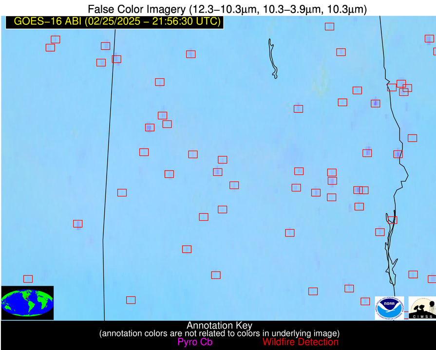
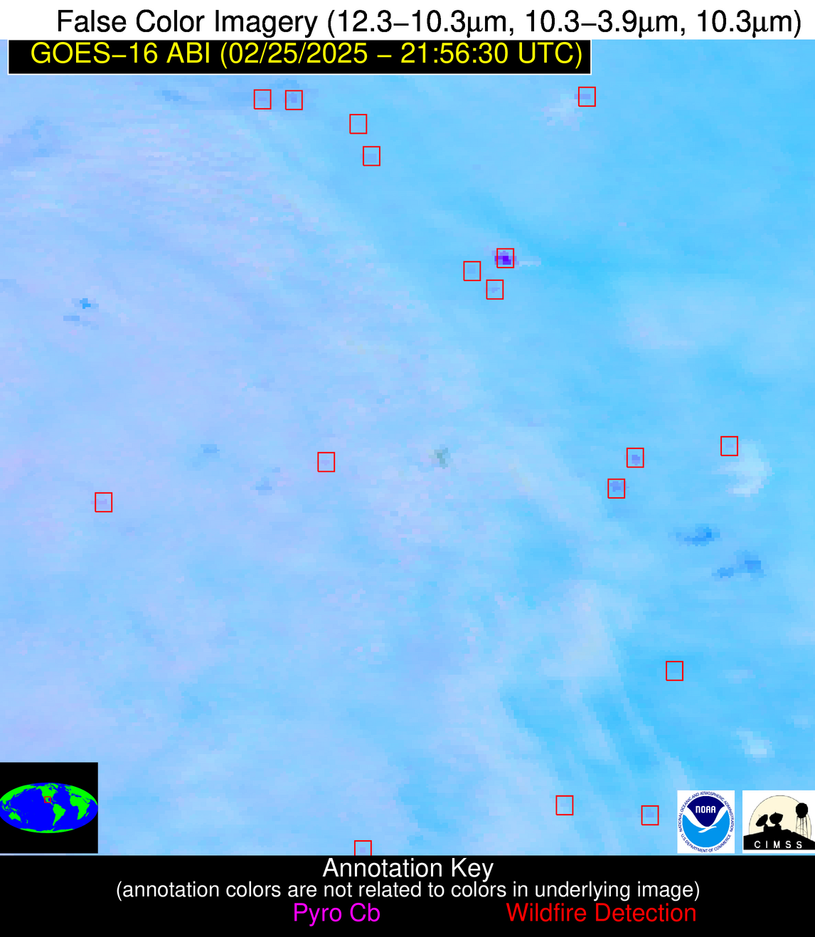
| Number Of Thermal Anomaly Alerts: | 15 |
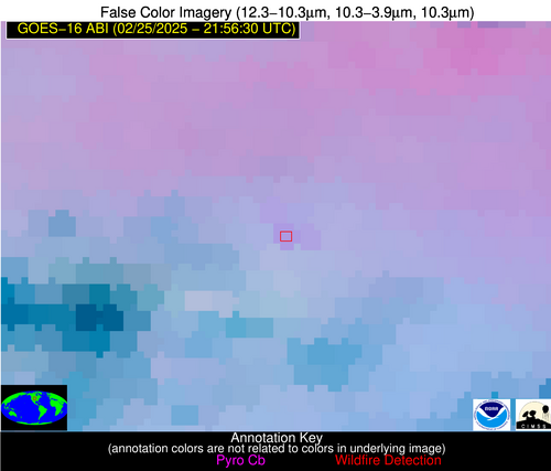
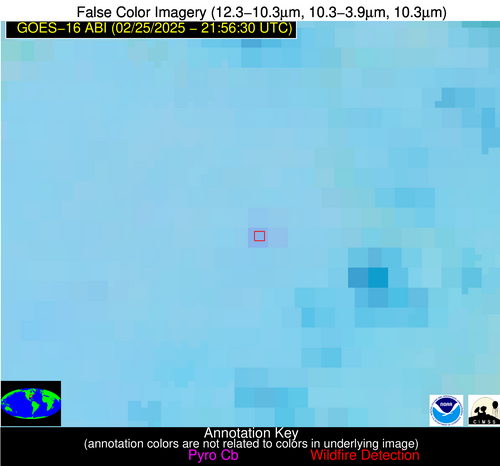
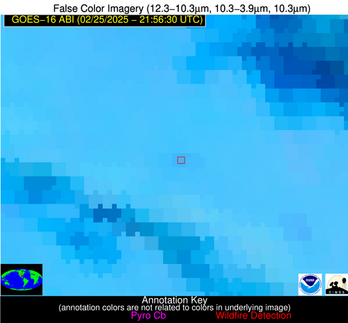
Possible Wildfire
| Basic Information | |
|---|---|
| State/Province(s) | IA |
| Country/Countries | United States |
| County/Locality(s) | Cherokee County, IA |
| NWS WFO | Sioux Falls SD |
| Identification Method | Enhanced Contextual (Clear) |
| Mean Object Date/Time | 2025-02-25 21:56:50UTC |
| Radiative Center (Lat, Lon): | 42.629444°, -95.544441° |
| Nearby Counties (meeting alert criteria): |
|
| Total Radiative Power Anomaly | n/a |
| Total Radiative Power | 7.59 MW |
| Map: | |
| Additional Information | |
| Alert Status | New Feature |
| Type of Event | Nominal Risk |
| Event Priority Ranking | 4 |
| Maximum Observed BT (3.9 um) | 290.33 K |
| Observed - Background BT (3.9 um) | 3.20 K |
| BT Anomaly (3.9 um) | 6.15 K |
| Maximum Observed - Clear RTM BT (3.9 um) | 10.46 K |
| Maximum Observed BTD (3.9-10/11/12 um) | 8.56 K |
| Observed - Background BTD (3.9-10/11/12 um) | 3.21 K |
| BTD Anomaly (3.9-10/11/12 um) | 10.61 K |
| Similar Pixel Count | 14 |
| BT Time Tendency (3.9 um) | 1.20 K |
| Image Interval | 5.00 minutes |
| Fraction of Surrounding LWIR Pixels that are Colder | 0.57 |
| Fraction of Surrounding Red Channel Pixels that are Brighter | 0.98 |
| Maximum Radiative Power | 7.59 MW |
| Maximum Radiative Power Uncertainty | 0.00 MW |
| Total Radiative Power Uncertainty | 0.00 MW |
| Mean Viewing Angle | 53.60° |
| Mean Solar Zenith Angle | 69.30° |
| Mean Glint Angle | 83.40° |
| Water Fraction | 0.00 |
| Total Pixel Area | 6.70 km2 |
| Latest Satellite Imagery: | |
| View all event imagery » | |
Possible Wildfire
| Basic Information | |
|---|---|
| State/Province(s) | NE |
| Country/Countries | United States |
| County/Locality(s) | Hooker County, NE |
| NWS WFO | North Platte NE |
| Identification Method | Enhanced Contextual (Clear) |
| Mean Object Date/Time | 2025-02-25 21:56:50UTC |
| Radiative Center (Lat, Lon): | 41.830555°, -101.057777° |
| Nearby Counties (meeting alert criteria): |
|
| Total Radiative Power Anomaly | n/a |
| Total Radiative Power | 6.98 MW |
| Map: | |
| Additional Information | |
| Alert Status | New Feature |
| Type of Event | Elevated SPC Risk and Red Flag Warning |
| Event Priority Ranking | 1 |
| Maximum Observed BT (3.9 um) | 296.36 K |
| Observed - Background BT (3.9 um) | 3.45 K |
| BT Anomaly (3.9 um) | 3.81 K |
| Maximum Observed - Clear RTM BT (3.9 um) | 14.91 K |
| Maximum Observed BTD (3.9-10/11/12 um) | 9.52 K |
| Observed - Background BTD (3.9-10/11/12 um) | 2.21 K |
| BTD Anomaly (3.9-10/11/12 um) | 2.00 K |
| Similar Pixel Count | 15 |
| BT Time Tendency (3.9 um) | 2.10 K |
| Image Interval | 5.00 minutes |
| Fraction of Surrounding LWIR Pixels that are Colder | 0.93 |
| Fraction of Surrounding Red Channel Pixels that are Brighter | 1.00 |
| Maximum Radiative Power | 6.98 MW |
| Maximum Radiative Power Uncertainty | 0.00 MW |
| Total Radiative Power Uncertainty | 0.00 MW |
| Mean Viewing Angle | 55.30° |
| Mean Solar Zenith Angle | 65.60° |
| Mean Glint Angle | 79.80° |
| Water Fraction | 0.00 |
| Total Pixel Area | 7.00 km2 |
| Latest Satellite Imagery: | |
| View all event imagery » | |
Possible Wildfire
| Basic Information | |
|---|---|
| State/Province(s) | TN |
| Country/Countries | United States |
| County/Locality(s) | Monroe County, TN |
| NWS WFO | Morristown TN |
| Identification Method | Enhanced Contextual (Clear) |
| Mean Object Date/Time | 2025-02-25 21:57:21UTC |
| Radiative Center (Lat, Lon): | 35.557777°, -84.342224° |
| Nearby Counties (meeting alert criteria): |
|
| Total Radiative Power Anomaly | n/a |
| Total Radiative Power | 8.17 MW |
| Map: | |
| Additional Information | |
| Alert Status | New Feature |
| Type of Event | Nominal Risk |
| Event Priority Ranking | 4 |
| Maximum Observed BT (3.9 um) | 294.63 K |
| Observed - Background BT (3.9 um) | 3.82 K |
| BT Anomaly (3.9 um) | 9.85 K |
| Maximum Observed - Clear RTM BT (3.9 um) | 12.52 K |
| Maximum Observed BTD (3.9-10/11/12 um) | 6.77 K |
| Observed - Background BTD (3.9-10/11/12 um) | 3.49 K |
| BTD Anomaly (3.9-10/11/12 um) | 6.06 K |
| Similar Pixel Count | 2 |
| BT Time Tendency (3.9 um) | 0.50 K |
| Image Interval | 5.00 minutes |
| Fraction of Surrounding LWIR Pixels that are Colder | 0.72 |
| Fraction of Surrounding Red Channel Pixels that are Brighter | 1.00 |
| Maximum Radiative Power | 8.17 MW |
| Maximum Radiative Power Uncertainty | 0.00 MW |
| Total Radiative Power Uncertainty | 0.00 MW |
| Mean Viewing Angle | 42.60° |
| Mean Solar Zenith Angle | 73.30° |
| Mean Glint Angle | 84.10° |
| Water Fraction | 0.00 |
| Total Pixel Area | 5.40 km2 |
| Latest Satellite Imagery: | |
| View all event imagery » | |
Possible Wildfire
| Basic Information | |
|---|---|
| State/Province(s) | OK |
| Country/Countries | United States |
| County/Locality(s) | Okmulgee County, OK |
| NWS WFO | Tulsa OK |
| Identification Method | Enhanced Contextual (Clear) |
| Mean Object Date/Time | 2025-02-25 21:57:20UTC |
| Radiative Center (Lat, Lon): | 35.803890°, -95.840836° |
| Nearby Counties (meeting alert criteria): |
|
| Total Radiative Power Anomaly | n/a |
| Total Radiative Power | 5.97 MW |
| Map: | |
| Additional Information | |
| Alert Status | New Feature |
| Type of Event | Nominal Risk |
| Event Priority Ranking | 4 |
| Maximum Observed BT (3.9 um) | 299.79 K |
| Observed - Background BT (3.9 um) | 2.89 K |
| BT Anomaly (3.9 um) | 2.59 K |
| Maximum Observed - Clear RTM BT (3.9 um) | 12.66 K |
| Maximum Observed BTD (3.9-10/11/12 um) | 8.23 K |
| Observed - Background BTD (3.9-10/11/12 um) | 2.10 K |
| BTD Anomaly (3.9-10/11/12 um) | 3.09 K |
| Similar Pixel Count | 25 |
| BT Time Tendency (3.9 um) | 1.10 K |
| Image Interval | 5.00 minutes |
| Fraction of Surrounding LWIR Pixels that are Colder | 0.90 |
| Fraction of Surrounding Red Channel Pixels that are Brighter | 1.00 |
| Maximum Radiative Power | 5.97 MW |
| Maximum Radiative Power Uncertainty | 0.00 MW |
| Total Radiative Power Uncertainty | 0.00 MW |
| Mean Viewing Angle | 47.20° |
| Mean Solar Zenith Angle | 65.30° |
| Mean Glint Angle | 74.20° |
| Water Fraction | 0.00 |
| Total Pixel Area | 5.90 km2 |
| Latest Satellite Imagery: | |
| View all event imagery » | |
Possible Wildfire
| Basic Information | |
|---|---|
| State/Province(s) | MS |
| Country/Countries | United States |
| County/Locality(s) | Kemper County, MS |
| NWS WFO | Jackson MS |
| Identification Method | Enhanced Contextual (Clear) |
| Mean Object Date/Time | 2025-02-25 21:57:21UTC |
| Radiative Center (Lat, Lon): | 32.891109°, -88.489166° |
| Nearby Counties (meeting alert criteria): |
|
| Total Radiative Power Anomaly | n/a |
| Total Radiative Power | 7.31 MW |
| Map: | |
| Additional Information | |
| Alert Status | New Feature |
| Type of Event | Nominal Risk |
| Event Priority Ranking | 4 |
| Maximum Observed BT (3.9 um) | 297.44 K |
| Observed - Background BT (3.9 um) | 3.28 K |
| BT Anomaly (3.9 um) | 5.39 K |
| Maximum Observed - Clear RTM BT (3.9 um) | 11.52 K |
| Maximum Observed BTD (3.9-10/11/12 um) | 5.52 K |
| Observed - Background BTD (3.9-10/11/12 um) | 2.98 K |
| BTD Anomaly (3.9-10/11/12 um) | 5.71 K |
| Similar Pixel Count | 3 |
| BT Time Tendency (3.9 um) | 0.90 K |
| Image Interval | 5.00 minutes |
| Fraction of Surrounding LWIR Pixels that are Colder | 0.94 |
| Fraction of Surrounding Red Channel Pixels that are Brighter | 1.00 |
| Maximum Radiative Power | 7.31 MW |
| Maximum Radiative Power Uncertainty | 0.00 MW |
| Total Radiative Power Uncertainty | 0.00 MW |
| Mean Viewing Angle | 41.10° |
| Mean Solar Zenith Angle | 69.00° |
| Mean Glint Angle | 76.70° |
| Water Fraction | 0.00 |
| Total Pixel Area | 5.30 km2 |
| Latest Satellite Imagery: | |
| View all event imagery » | |
Possible Wildfire
| Basic Information | |
|---|---|
| State/Province(s) | AL |
| Country/Countries | United States |
| County/Locality(s) | Dallas County, AL |
| NWS WFO | Birmingham AL |
| Identification Method | Enhanced Contextual (Clear) |
| Mean Object Date/Time | 2025-02-25 21:57:21UTC |
| Radiative Center (Lat, Lon): | 32.194443°, -86.933052° |
| Nearby Counties (meeting alert criteria): |
|
| Total Radiative Power Anomaly | n/a |
| Total Radiative Power | 6.35 MW |
| Map: | |
| Additional Information | |
| Alert Status | New Feature |
| Type of Event | Nominal Risk |
| Event Priority Ranking | 4 |
| Maximum Observed BT (3.9 um) | 295.97 K |
| Observed - Background BT (3.9 um) | 2.45 K |
| BT Anomaly (3.9 um) | 5.61 K |
| Maximum Observed - Clear RTM BT (3.9 um) | 9.90 K |
| Maximum Observed BTD (3.9-10/11/12 um) | 5.22 K |
| Observed - Background BTD (3.9-10/11/12 um) | 2.92 K |
| BTD Anomaly (3.9-10/11/12 um) | 8.44 K |
| Similar Pixel Count | 2 |
| BT Time Tendency (3.9 um) | 1.70 K |
| Image Interval | 5.00 minutes |
| Fraction of Surrounding LWIR Pixels that are Colder | 0.06 |
| Fraction of Surrounding Red Channel Pixels that are Brighter | 1.00 |
| Maximum Radiative Power | 6.35 MW |
| Maximum Radiative Power Uncertainty | 0.00 MW |
| Total Radiative Power Uncertainty | 0.00 MW |
| Mean Viewing Angle | 39.80° |
| Mean Solar Zenith Angle | 69.90° |
| Mean Glint Angle | 77.50° |
| Water Fraction | 0.00 |
| Total Pixel Area | 5.20 km2 |
| Latest Satellite Imagery: | |
| View all event imagery » | |
Possible Wildfire
| Basic Information | |
|---|---|
| State/Province(s) | GA |
| Country/Countries | United States |
| County/Locality(s) | Randolph County, GA |
| NWS WFO | Tallahassee FL |
| Identification Method | Enhanced Contextual (Clear) |
| Mean Object Date/Time | 2025-02-25 21:57:21UTC |
| Radiative Center (Lat, Lon): | 31.687778°, -84.841667° |
| Nearby Counties (meeting alert criteria): |
|
| Total Radiative Power Anomaly | n/a |
| Total Radiative Power | 6.07 MW |
| Map: | |
| Additional Information | |
| Alert Status | New Feature |
| Type of Event | Nominal Risk |
| Event Priority Ranking | 4 |
| Maximum Observed BT (3.9 um) | 296.55 K |
| Observed - Background BT (3.9 um) | 2.87 K |
| BT Anomaly (3.9 um) | 6.40 K |
| Maximum Observed - Clear RTM BT (3.9 um) | 8.48 K |
| Maximum Observed BTD (3.9-10/11/12 um) | 5.09 K |
| Observed - Background BTD (3.9-10/11/12 um) | 2.56 K |
| BTD Anomaly (3.9-10/11/12 um) | 11.49 K |
| Similar Pixel Count | 1 |
| BT Time Tendency (3.9 um) | 1.70 K |
| Image Interval | 5.00 minutes |
| Fraction of Surrounding LWIR Pixels that are Colder | 0.84 |
| Fraction of Surrounding Red Channel Pixels that are Brighter | 1.00 |
| Maximum Radiative Power | 6.07 MW |
| Maximum Radiative Power Uncertainty | 0.00 MW |
| Total Radiative Power Uncertainty | 0.00 MW |
| Mean Viewing Angle | 38.50° |
| Mean Solar Zenith Angle | 71.30° |
| Mean Glint Angle | 79.40° |
| Water Fraction | 0.00 |
| Total Pixel Area | 5.10 km2 |
| Latest Satellite Imagery: | |
| View all event imagery » | |
Possible Wildfire
| Basic Information | |
|---|---|
| State/Province(s) | MS |
| Country/Countries | United States |
| County/Locality(s) | Jones County, MS |
| NWS WFO | Jackson MS |
| Identification Method | Enhanced Contextual (Clear) |
| Mean Object Date/Time | 2025-02-25 21:57:21UTC |
| Radiative Center (Lat, Lon): | 31.662222°, -89.342781° |
| Nearby Counties (meeting alert criteria): |
|
| Total Radiative Power Anomaly | n/a |
| Total Radiative Power | 5.31 MW |
| Map: | |
| Additional Information | |
| Alert Status | New Feature |
| Type of Event | Nominal Risk |
| Event Priority Ranking | 4 |
| Maximum Observed BT (3.9 um) | 295.87 K |
| Observed - Background BT (3.9 um) | 2.56 K |
| BT Anomaly (3.9 um) | 8.07 K |
| Maximum Observed - Clear RTM BT (3.9 um) | 9.57 K |
| Maximum Observed BTD (3.9-10/11/12 um) | 5.22 K |
| Observed - Background BTD (3.9-10/11/12 um) | 2.40 K |
| BTD Anomaly (3.9-10/11/12 um) | 12.50 K |
| Similar Pixel Count | 2 |
| BT Time Tendency (3.9 um) | 0.90 K |
| Image Interval | 5.00 minutes |
| Fraction of Surrounding LWIR Pixels that are Colder | 0.76 |
| Fraction of Surrounding Red Channel Pixels that are Brighter | 1.00 |
| Maximum Radiative Power | 5.31 MW |
| Maximum Radiative Power Uncertainty | 0.00 MW |
| Total Radiative Power Uncertainty | 0.00 MW |
| Mean Viewing Angle | 40.10° |
| Mean Solar Zenith Angle | 67.80° |
| Mean Glint Angle | 74.30° |
| Water Fraction | 0.00 |
| Total Pixel Area | 5.20 km2 |
| Latest Satellite Imagery: | |
| View all event imagery » | |
Possible Wildfire
| Basic Information | |
|---|---|
| State/Province(s) | TX |
| Country/Countries | United States |
| County/Locality(s) | Jackson County, TX |
| NWS WFO | Houston/Galveston TX |
| Identification Method | Enhanced Contextual (Cloud) |
| Mean Object Date/Time | 2025-02-25 21:57:50UTC |
| Radiative Center (Lat, Lon): | 28.866667°, -96.432503° |
| Nearby Counties (meeting alert criteria): |
|
| Total Radiative Power Anomaly | n/a |
| Total Radiative Power | 48.01 MW |
| Map: | |
| Additional Information | |
| Alert Status | New Feature |
| Type of Event | Nominal Risk |
| Event Priority Ranking | 4 |
| Maximum Observed BT (3.9 um) | 313.09 K |
| Observed - Background BT (3.9 um) | 14.59 K |
| BT Anomaly (3.9 um) | 10.95 K |
| Maximum Observed - Clear RTM BT (3.9 um) | 23.44 K |
| Maximum Observed BTD (3.9-10/11/12 um) | 19.50 K |
| Observed - Background BTD (3.9-10/11/12 um) | 14.29 K |
| BTD Anomaly (3.9-10/11/12 um) | 21.08 K |
| Similar Pixel Count | 0 |
| BT Time Tendency (3.9 um) | 13.80 K |
| Image Interval | 5.00 minutes |
| Fraction of Surrounding LWIR Pixels that are Colder | 0.68 |
| Fraction of Surrounding Red Channel Pixels that are Brighter | 1.00 |
| Maximum Radiative Power | 48.01 MW |
| Maximum Radiative Power Uncertainty | 0.00 MW |
| Total Radiative Power Uncertainty | 0.00 MW |
| Mean Viewing Angle | 41.20° |
| Mean Solar Zenith Angle | 61.10° |
| Mean Glint Angle | 63.90° |
| Water Fraction | 0.00 |
| Total Pixel Area | 5.30 km2 |
| Latest Satellite Imagery: | |
| View all event imagery » | |
Possible Wildfire
| Basic Information | |
|---|---|
| State/Province(s) | TX |
| Country/Countries | United States |
| County/Locality(s) | Victoria County, TX |
| NWS WFO | Corpus Christi TX |
| Identification Method | Enhanced Contextual (Clear) |
| Mean Object Date/Time | 2025-02-25 21:57:50UTC |
| Radiative Center (Lat, Lon): | 28.617777°, -97.049164° |
| Nearby Counties (meeting alert criteria): |
|
| Total Radiative Power Anomaly | n/a |
| Total Radiative Power | 13.40 MW |
| Map: | |
| Additional Information | |
| Alert Status | New Feature |
| Type of Event | Nominal Risk |
| Event Priority Ranking | 4 |
| Maximum Observed BT (3.9 um) | 301.73 K |
| Observed - Background BT (3.9 um) | 2.98 K |
| BT Anomaly (3.9 um) | 2.24 K |
| Maximum Observed - Clear RTM BT (3.9 um) | 10.84 K |
| Maximum Observed BTD (3.9-10/11/12 um) | 7.23 K |
| Observed - Background BTD (3.9-10/11/12 um) | 2.68 K |
| BTD Anomaly (3.9-10/11/12 um) | 5.16 K |
| Similar Pixel Count | 11 |
| BT Time Tendency (3.9 um) | 0.40 K |
| Image Interval | 5.00 minutes |
| Fraction of Surrounding LWIR Pixels that are Colder | 0.63 |
| Fraction of Surrounding Red Channel Pixels that are Brighter | 1.00 |
| Maximum Radiative Power | 6.80 MW |
| Maximum Radiative Power Uncertainty | 0.00 MW |
| Total Radiative Power Uncertainty | 0.00 MW |
| Mean Viewing Angle | 41.40° |
| Mean Solar Zenith Angle | 60.50° |
| Mean Glint Angle | 63.00° |
| Water Fraction | 0.00 |
| Total Pixel Area | 10.70 km2 |
| Latest Satellite Imagery: | |
| View all event imagery » | |
Possible Wildfire
| Basic Information | |
|---|---|
| State/Province(s) | Nuevo León |
| Country/Countries | Mexico |
| County/Locality(s) | China, Nuevo León |
| NWS WFO | N/A |
| Identification Method | Enhanced Contextual (Clear) |
| Mean Object Date/Time | 2025-02-25 21:57:49UTC |
| Radiative Center (Lat, Lon): | 25.705555°, -99.246391° |
| Nearby Counties (meeting alert criteria): |
|
| Total Radiative Power Anomaly | n/a |
| Total Radiative Power | 37.64 MW |
| Map: | |
| Additional Information | |
| Alert Status | New Feature |
| Type of Event | Nominal Risk |
| Event Priority Ranking | 4 |
| Maximum Observed BT (3.9 um) | 313.01 K |
| Observed - Background BT (3.9 um) | 4.61 K |
| BT Anomaly (3.9 um) | 6.34 K |
| Maximum Observed - Clear RTM BT (3.9 um) | 13.69 K |
| Maximum Observed BTD (3.9-10/11/12 um) | 8.95 K |
| Observed - Background BTD (3.9-10/11/12 um) | 4.71 K |
| BTD Anomaly (3.9-10/11/12 um) | 13.30 K |
| Similar Pixel Count | 2 |
| BT Time Tendency (3.9 um) | 3.10 K |
| Image Interval | 5.00 minutes |
| Fraction of Surrounding LWIR Pixels that are Colder | 0.49 |
| Fraction of Surrounding Red Channel Pixels that are Brighter | 0.44 |
| Maximum Radiative Power | 19.20 MW |
| Maximum Radiative Power Uncertainty | 0.00 MW |
| Total Radiative Power Uncertainty | 0.00 MW |
| Mean Viewing Angle | 40.40° |
| Mean Solar Zenith Angle | 57.30° |
| Mean Glint Angle | 57.00° |
| Water Fraction | 0.00 |
| Total Pixel Area | 10.50 km2 |
| Latest Satellite Imagery: | |
| View all event imagery » | |
Possible Wildfire
| Basic Information | |
|---|---|
| State/Province(s) | Tamaulipas |
| Country/Countries | Mexico |
| County/Locality(s) | Padilla, Tamaulipas |
| NWS WFO | N/A |
| Identification Method | Enhanced Contextual (Clear) |
| Mean Object Date/Time | 2025-02-25 21:58:19UTC |
| Radiative Center (Lat, Lon): | 24.051390°, -98.814720° |
| Nearby Counties (meeting alert criteria): |
|
| Total Radiative Power Anomaly | n/a |
| Total Radiative Power | 5.94 MW |
| Map: | |
| Additional Information | |
| Alert Status | New Feature |
| Type of Event | Nominal Risk |
| Event Priority Ranking | 4 |
| Maximum Observed BT (3.9 um) | 308.86 K |
| Observed - Background BT (3.9 um) | 1.98 K |
| BT Anomaly (3.9 um) | 1.50 K |
| Maximum Observed - Clear RTM BT (3.9 um) | 7.12 K |
| Maximum Observed BTD (3.9-10/11/12 um) | 5.86 K |
| Observed - Background BTD (3.9-10/11/12 um) | 1.86 K |
| BTD Anomaly (3.9-10/11/12 um) | 5.79 K |
| Similar Pixel Count | 14 |
| BT Time Tendency (3.9 um) | 1.40 K |
| Image Interval | 5.00 minutes |
| Fraction of Surrounding LWIR Pixels that are Colder | 0.37 |
| Fraction of Surrounding Red Channel Pixels that are Brighter | 1.00 |
| Maximum Radiative Power | 5.94 MW |
| Maximum Radiative Power Uncertainty | 0.00 MW |
| Total Radiative Power Uncertainty | 0.00 MW |
| Mean Viewing Angle | 38.80° |
| Mean Solar Zenith Angle | 56.80° |
| Mean Glint Angle | 54.80° |
| Water Fraction | 0.00 |
| Total Pixel Area | 5.10 km2 |
| Latest Satellite Imagery: | |
| View all event imagery » | |
Possible Wildfire
| Basic Information | |
|---|---|
| State/Province(s) | San Luis Potosí |
| Country/Countries | Mexico |
| County/Locality(s) | Cedral, San Luis Potosí |
| NWS WFO | N/A |
| Identification Method | Enhanced Contextual (Clear) |
| Mean Object Date/Time | 2025-02-25 21:58:19UTC |
| Radiative Center (Lat, Lon): | 23.785278°, -100.712502° |
| Nearby Counties (meeting alert criteria): |
|
| Total Radiative Power Anomaly | n/a |
| Total Radiative Power | 28.03 MW |
| Map: | |
| Additional Information | |
| Alert Status | New Feature |
| Type of Event | Nominal Risk |
| Event Priority Ranking | 4 |
| Maximum Observed BT (3.9 um) | 314.65 K |
| Observed - Background BT (3.9 um) | 3.47 K |
| BT Anomaly (3.9 um) | 2.94 K |
| Maximum Observed - Clear RTM BT (3.9 um) | 14.49 K |
| Maximum Observed BTD (3.9-10/11/12 um) | 7.55 K |
| Observed - Background BTD (3.9-10/11/12 um) | 3.93 K |
| BTD Anomaly (3.9-10/11/12 um) | 9.82 K |
| Similar Pixel Count | 4 |
| BT Time Tendency (3.9 um) | 1.40 K |
| Image Interval | 5.00 minutes |
| Fraction of Surrounding LWIR Pixels that are Colder | 0.41 |
| Fraction of Surrounding Red Channel Pixels that are Brighter | 0.95 |
| Maximum Radiative Power | 14.64 MW |
| Maximum Radiative Power Uncertainty | 0.00 MW |
| Total Radiative Power Uncertainty | 0.00 MW |
| Mean Viewing Angle | 40.10° |
| Mean Solar Zenith Angle | 55.20° |
| Mean Glint Angle | 53.00° |
| Water Fraction | 0.00 |
| Total Pixel Area | 10.50 km2 |
| Latest Satellite Imagery: | |
| View all event imagery » | |
Possible Wildfire
| Basic Information | |
|---|---|
| State/Province(s) | Unknown |
| Country/Countries | Cuba |
| County/Locality(s) | Unknown, Unknown |
| NWS WFO | N/A |
| Identification Method | Enhanced Contextual (Clear) |
| Mean Object Date/Time | 2025-02-25 21:58:22UTC |
| Radiative Center (Lat, Lon): | 22.582777°, -80.985558° |
| Nearby Counties (meeting alert criteria): |
|
| Total Radiative Power Anomaly | n/a |
| Total Radiative Power | 7.89 MW |
| Map: | |
| Additional Information | |
| Alert Status | New Feature |
| Type of Event | Nominal Risk |
| Event Priority Ranking | 4 |
| Maximum Observed BT (3.9 um) | 301.20 K |
| Observed - Background BT (3.9 um) | 3.59 K |
| BT Anomaly (3.9 um) | 4.84 K |
| Maximum Observed - Clear RTM BT (3.9 um) | 6.38 K |
| Maximum Observed BTD (3.9-10/11/12 um) | 7.46 K |
| Observed - Background BTD (3.9-10/11/12 um) | 3.28 K |
| BTD Anomaly (3.9-10/11/12 um) | 5.20 K |
| Similar Pixel Count | 7 |
| BT Time Tendency (3.9 um) | 2.30 K |
| Image Interval | 5.00 minutes |
| Fraction of Surrounding LWIR Pixels that are Colder | 0.69 |
| Fraction of Surrounding Red Channel Pixels that are Brighter | 1.00 |
| Maximum Radiative Power | 7.89 MW |
| Maximum Radiative Power Uncertainty | 0.00 MW |
| Total Radiative Power Uncertainty | 0.00 MW |
| Mean Viewing Angle | 27.40° |
| Mean Solar Zenith Angle | 71.10° |
| Mean Glint Angle | 75.30° |
| Water Fraction | 0.00 |
| Total Pixel Area | 4.50 km2 |
| Latest Satellite Imagery: | |
| View all event imagery » | |
Possible Wildfire
| Basic Information | |
|---|---|
| State/Province(s) | San Luis Potosí |
| Country/Countries | Mexico |
| County/Locality(s) | El Naranjo, San Luis Potosí |
| NWS WFO | N/A |
| Identification Method | Enhanced Contextual (Clear) |
| Mean Object Date/Time | 2025-02-25 21:58:19UTC |
| Radiative Center (Lat, Lon): | 22.350555°, -99.314163° |
| Nearby Counties (meeting alert criteria): |
|
| Total Radiative Power Anomaly | n/a |
| Total Radiative Power | 4.67 MW |
| Map: | |
| Additional Information | |
| Alert Status | New Feature |
| Type of Event | Nominal Risk |
| Event Priority Ranking | 4 |
| Maximum Observed BT (3.9 um) | 304.06 K |
| Observed - Background BT (3.9 um) | 4.07 K |
| BT Anomaly (3.9 um) | 1.95 K |
| Maximum Observed - Clear RTM BT (3.9 um) | 3.99 K |
| Maximum Observed BTD (3.9-10/11/12 um) | 4.57 K |
| Observed - Background BTD (3.9-10/11/12 um) | 1.68 K |
| BTD Anomaly (3.9-10/11/12 um) | 2.87 K |
| Similar Pixel Count | 14 |
| BT Time Tendency (3.9 um) | 0.70 K |
| Image Interval | 5.00 minutes |
| Fraction of Surrounding LWIR Pixels that are Colder | 0.50 |
| Fraction of Surrounding Red Channel Pixels that are Brighter | 1.00 |
| Maximum Radiative Power | 4.67 MW |
| Maximum Radiative Power Uncertainty | 0.00 MW |
| Total Radiative Power Uncertainty | 0.00 MW |
| Mean Viewing Angle | 37.90° |
| Mean Solar Zenith Angle | 55.50° |
| Mean Glint Angle | 51.80° |
| Water Fraction | 0.00 |
| Total Pixel Area | 5.10 km2 |
| Latest Satellite Imagery: | |
| View all event imagery » | |


