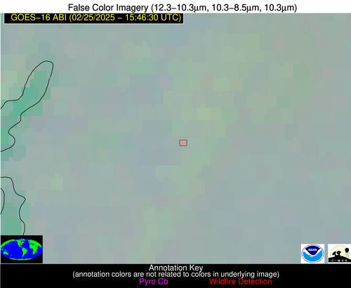
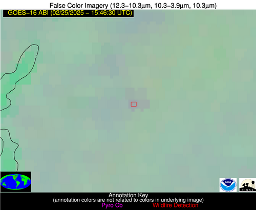
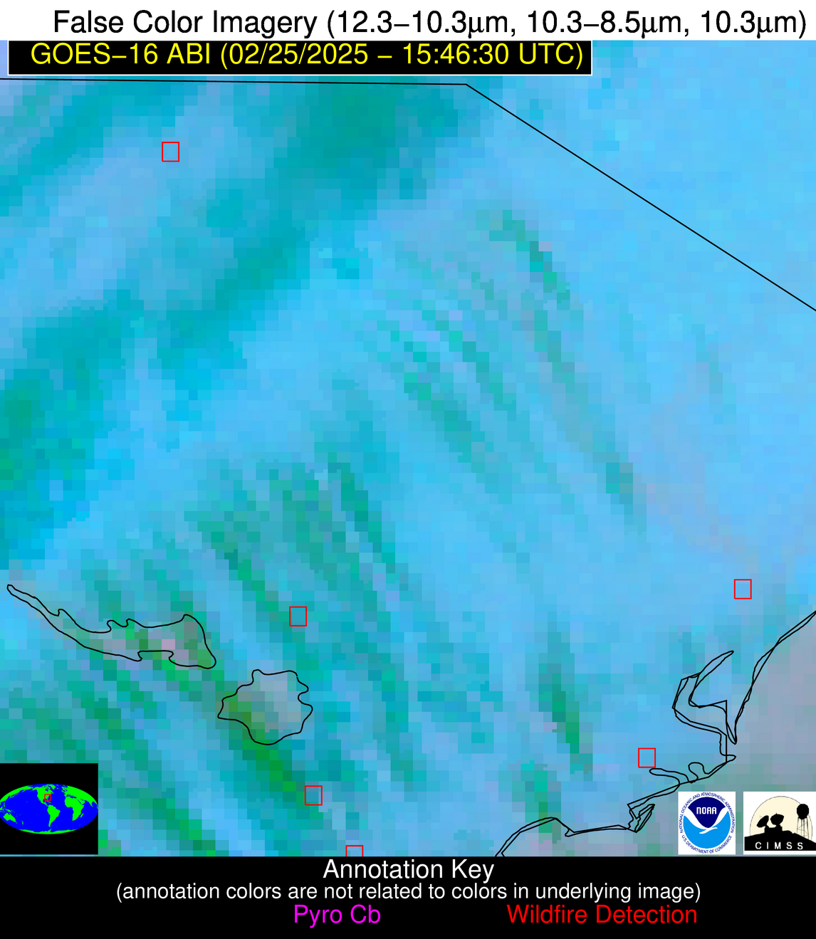
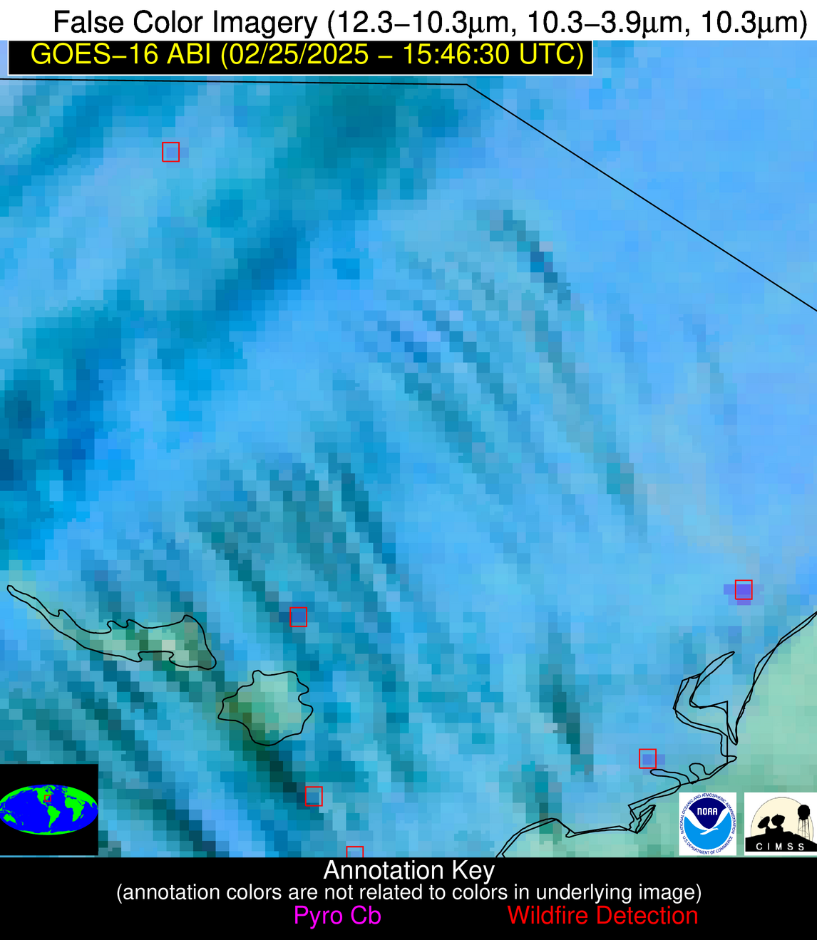
Wildfire Alert Report
| Date: | 2025-02-25 |
|---|---|
| Time: | 15:46:17 |
| Production Date and Time: | 2025-02-25 15:50:55 UTC |
| Primary Instrument: | GOES-16 ABI |
| Wmo Spacecraft Id: | 152 |
| Location/orbit: | GEO |
| L1 File: | OR_ABI-L1b-RadC-M6C14_G16_s20250561546174_e20250561548547_c20250561549001.nc |
| L1 File(s) - Temporal | OR_ABI-L1b-RadC-M6C14_G16_s20250561541174_e20250561543547_c20250561544013.nc |
| Number Of Thermal Anomaly Alerts: | 13 |
Possible Wildfire
| Basic Information | |
|---|---|
| State/Province(s) | WI |
| Country/Countries | United States |
| County/Locality(s) | Adams County, WI |
| NWS WFO | La Crosse WI |
| Identification Method | Enhanced Contextual (Clear) |
| Mean Object Date/Time | 2025-02-25 15:46:21UTC |
| Radiative Center (Lat, Lon): | 44.085556°, -89.622223° |
| Nearby Counties (meeting alert criteria): |
|
| Total Radiative Power Anomaly | n/a |
| Total Radiative Power | 5.15 MW |
| Map: | |
| Additional Information | |
| Alert Status | New Feature |
| Type of Event | Nominal Risk |
| Event Priority Ranking | 4 |
| Maximum Observed BT (3.9 um) | 283.81 K |
| Observed - Background BT (3.9 um) | 3.42 K |
| BT Anomaly (3.9 um) | 3.54 K |
| Maximum Observed - Clear RTM BT (3.9 um) | 9.07 K |
| Maximum Observed BTD (3.9-10/11/12 um) | 7.94 K |
| Observed - Background BTD (3.9-10/11/12 um) | 2.87 K |
| BTD Anomaly (3.9-10/11/12 um) | 5.42 K |
| Similar Pixel Count | 13 |
| BT Time Tendency (3.9 um) | 0.80 K |
| Image Interval | 5.00 minutes |
| Fraction of Surrounding LWIR Pixels that are Colder | 0.77 |
| Fraction of Surrounding Red Channel Pixels that are Brighter | 0.96 |
| Maximum Radiative Power | 5.15 MW |
| Maximum Radiative Power Uncertainty | 0.00 MW |
| Total Radiative Power Uncertainty | 0.00 MW |
| Mean Viewing Angle | 53.10° |
| Mean Solar Zenith Angle | 62.90° |
| Mean Glint Angle | 113.10° |
| Water Fraction | 0.00 |
| Total Pixel Area | 6.70 km2 |
| Latest Satellite Imagery: | |
| View all event imagery » | |
Possible Wildfire
| Basic Information | |
|---|---|
| State/Province(s) | SC |
| Country/Countries | United States |
| County/Locality(s) | Chesterfield County, SC |
| NWS WFO | Columbia SC |
| Identification Method | Enhanced Contextual (Clear) |
| Mean Object Date/Time | 2025-02-25 15:47:22UTC |
| Radiative Center (Lat, Lon): | 34.637779°, -80.231667° |
| Nearby Counties (meeting alert criteria): |
|
| Total Radiative Power Anomaly | n/a |
| Total Radiative Power | 9.74 MW |
| Map: | |
| Additional Information | |
| Alert Status | New Feature |
| Type of Event | Nominal Risk, Known Incident: 0301-0308-0309 CRR RX (HIGH, tdiff=0.08463 days, Point) |
| Event Priority Ranking | 4 |
| Maximum Observed BT (3.9 um) | 297.90 K |
| Observed - Background BT (3.9 um) | 4.07 K |
| BT Anomaly (3.9 um) | 3.90 K |
| Maximum Observed - Clear RTM BT (3.9 um) | 11.24 K |
| Maximum Observed BTD (3.9-10/11/12 um) | 12.19 K |
| Observed - Background BTD (3.9-10/11/12 um) | 3.81 K |
| BTD Anomaly (3.9-10/11/12 um) | 3.79 K |
| Similar Pixel Count | 16 |
| BT Time Tendency (3.9 um) | 3.10 K |
| Image Interval | 5.00 minutes |
| Fraction of Surrounding LWIR Pixels that are Colder | 0.78 |
| Fraction of Surrounding Red Channel Pixels that are Brighter | 1.00 |
| Maximum Radiative Power | 9.74 MW |
| Maximum Radiative Power Uncertainty | 0.00 MW |
| Total Radiative Power Uncertainty | 0.00 MW |
| Mean Viewing Angle | 40.80° |
| Mean Solar Zenith Angle | 51.00° |
| Mean Glint Angle | 88.70° |
| Water Fraction | 0.00 |
| Total Pixel Area | 5.30 km2 |
| Latest Satellite Imagery: | |
| View all event imagery » | |
Possible Wildfire
| Basic Information | |
|---|---|
| State/Province(s) | OK |
| Country/Countries | United States |
| County/Locality(s) | Atoka County, OK |
| NWS WFO | Norman OK |
| Identification Method | Enhanced Contextual (Clear) |
| Mean Object Date/Time | 2025-02-25 15:47:20UTC |
| Radiative Center (Lat, Lon): | 34.379166°, -96.223610° |
| Nearby Counties (meeting alert criteria): |
|
| Total Radiative Power Anomaly | n/a |
| Total Radiative Power | 3.95 MW |
| Map: | |
| Additional Information | |
| Alert Status | New Feature |
| Type of Event | Nominal Risk |
| Event Priority Ranking | 4 |
| Maximum Observed BT (3.9 um) | 295.23 K |
| Observed - Background BT (3.9 um) | 2.14 K |
| BT Anomaly (3.9 um) | 3.92 K |
| Maximum Observed - Clear RTM BT (3.9 um) | 8.38 K |
| Maximum Observed BTD (3.9-10/11/12 um) | 8.20 K |
| Observed - Background BTD (3.9-10/11/12 um) | 1.61 K |
| BTD Anomaly (3.9-10/11/12 um) | 5.86 K |
| Similar Pixel Count | 25 |
| BT Time Tendency (3.9 um) | 0.80 K |
| Image Interval | 5.00 minutes |
| Fraction of Surrounding LWIR Pixels that are Colder | 0.96 |
| Fraction of Surrounding Red Channel Pixels that are Brighter | 1.00 |
| Maximum Radiative Power | 3.95 MW |
| Maximum Radiative Power Uncertainty | 0.00 MW |
| Total Radiative Power Uncertainty | 0.00 MW |
| Mean Viewing Angle | 46.10° |
| Mean Solar Zenith Angle | 59.80° |
| Mean Glint Angle | 104.30° |
| Water Fraction | 0.00 |
| Total Pixel Area | 5.80 km2 |
| Latest Satellite Imagery: | |
| View all event imagery » | |
Possible Wildfire
| Basic Information | |
|---|---|
| State/Province(s) | AL |
| Country/Countries | United States |
| County/Locality(s) | Etowah County, AL |
| NWS WFO | Birmingham AL |
| Identification Method | Enhanced Contextual (Clear) |
| Mean Object Date/Time | 2025-02-25 15:47:21UTC |
| Radiative Center (Lat, Lon): | 33.985832°, -85.766388° |
| Nearby Counties (meeting alert criteria): |
|
| Total Radiative Power Anomaly | n/a |
| Total Radiative Power | 14.06 MW |
| Map: | |
| Additional Information | |
| Alert Status | New Feature |
| Type of Event | Nominal Risk |
| Event Priority Ranking | 4 |
| Maximum Observed BT (3.9 um) | 297.63 K |
| Observed - Background BT (3.9 um) | 2.93 K |
| BT Anomaly (3.9 um) | 4.98 K |
| Maximum Observed - Clear RTM BT (3.9 um) | 12.47 K |
| Maximum Observed BTD (3.9-10/11/12 um) | 8.85 K |
| Observed - Background BTD (3.9-10/11/12 um) | 3.00 K |
| BTD Anomaly (3.9-10/11/12 um) | 8.50 K |
| Similar Pixel Count | 7 |
| BT Time Tendency (3.9 um) | 3.70 K |
| Image Interval | 5.00 minutes |
| Fraction of Surrounding LWIR Pixels that are Colder | 0.41 |
| Fraction of Surrounding Red Channel Pixels that are Brighter | 1.00 |
| Maximum Radiative Power | 7.41 MW |
| Maximum Radiative Power Uncertainty | 0.00 MW |
| Total Radiative Power Uncertainty | 0.00 MW |
| Mean Viewing Angle | 41.30° |
| Mean Solar Zenith Angle | 53.30° |
| Mean Glint Angle | 92.20° |
| Water Fraction | 0.00 |
| Total Pixel Area | 10.60 km2 |
| Latest Satellite Imagery: | |
| View all event imagery » | |
Possible Wildfire
| Basic Information | |
|---|---|
| State/Province(s) | SC |
| Country/Countries | United States |
| County/Locality(s) | Williamsburg County, SC |
| NWS WFO | Wilmington NC |
| Identification Method | Enhanced Contextual (Clear) |
| Mean Object Date/Time | 2025-02-25 15:47:22UTC |
| Radiative Center (Lat, Lon): | 33.519722°, -79.995003° |
| Nearby Counties (meeting alert criteria): |
|
| Total Radiative Power Anomaly | n/a |
| Total Radiative Power | 16.97 MW |
| Map: | |
| Additional Information | |
| Alert Status | New Feature |
| Type of Event | Nominal Risk |
| Event Priority Ranking | 4 |
| Maximum Observed BT (3.9 um) | 296.12 K |
| Observed - Background BT (3.9 um) | 6.50 K |
| BT Anomaly (3.9 um) | 4.35 K |
| Maximum Observed - Clear RTM BT (3.9 um) | 8.62 K |
| Maximum Observed BTD (3.9-10/11/12 um) | 19.35 K |
| Observed - Background BTD (3.9-10/11/12 um) | 6.52 K |
| BTD Anomaly (3.9-10/11/12 um) | 4.06 K |
| Similar Pixel Count | 13 |
| BT Time Tendency (3.9 um) | 2.00 K |
| Image Interval | 5.00 minutes |
| Fraction of Surrounding LWIR Pixels that are Colder | 0.46 |
| Fraction of Surrounding Red Channel Pixels that are Brighter | 0.88 |
| Maximum Radiative Power | 16.97 MW |
| Maximum Radiative Power Uncertainty | 0.00 MW |
| Total Radiative Power Uncertainty | 0.00 MW |
| Mean Viewing Angle | 39.50° |
| Mean Solar Zenith Angle | 49.90° |
| Mean Glint Angle | 86.40° |
| Water Fraction | 0.00 |
| Total Pixel Area | 5.20 km2 |
| Latest Satellite Imagery: | |
| View all event imagery » | |
Possible Wildfire
| Basic Information | |
|---|---|
| State/Province(s) | SC |
| Country/Countries | United States |
| County/Locality(s) | Georgetown County, SC |
| NWS WFO | Wilmington NC |
| Identification Method | Enhanced Contextual (Clear) |
| Mean Object Date/Time | 2025-02-25 15:47:22UTC |
| Radiative Center (Lat, Lon): | 33.179165°, -79.347504° |
| Nearby Counties (meeting alert criteria): |
|
| Total Radiative Power Anomaly | n/a |
| Total Radiative Power | 27.54 MW |
| Map: | |
| Additional Information | |
| Alert Status | New Feature |
| Type of Event | Nominal Risk |
| Event Priority Ranking | 4 |
| Maximum Observed BT (3.9 um) | 299.58 K |
| Observed - Background BT (3.9 um) | 7.83 K |
| BT Anomaly (3.9 um) | 4.15 K |
| Maximum Observed - Clear RTM BT (3.9 um) | 11.60 K |
| Maximum Observed BTD (3.9-10/11/12 um) | 15.21 K |
| Observed - Background BTD (3.9-10/11/12 um) | 7.96 K |
| BTD Anomaly (3.9-10/11/12 um) | 6.56 K |
| Similar Pixel Count | 3 |
| BT Time Tendency (3.9 um) | 6.40 K |
| Image Interval | 5.00 minutes |
| Fraction of Surrounding LWIR Pixels that are Colder | 0.75 |
| Fraction of Surrounding Red Channel Pixels that are Brighter | 0.99 |
| Maximum Radiative Power | 27.54 MW |
| Maximum Radiative Power Uncertainty | 0.00 MW |
| Total Radiative Power Uncertainty | 0.00 MW |
| Mean Viewing Angle | 39.00° |
| Mean Solar Zenith Angle | 49.30° |
| Mean Glint Angle | 85.30° |
| Water Fraction | 0.00 |
| Total Pixel Area | 10.30 km2 |
| Latest Satellite Imagery: | |
| View all event imagery » | |
Possible Wildfire
| Basic Information | |
|---|---|
| State/Province(s) | GA |
| Country/Countries | United States |
| County/Locality(s) | Upson County, GA |
| NWS WFO | Peachtree City GA |
| Identification Method | Enhanced Contextual (Clear) |
| Mean Object Date/Time | 2025-02-25 15:47:21UTC |
| Radiative Center (Lat, Lon): | 32.953056°, -84.484169° |
| Nearby Counties (meeting alert criteria): |
|
| Total Radiative Power Anomaly | n/a |
| Total Radiative Power | 16.67 MW |
| Map: | |
| Additional Information | |
| Alert Status | New Feature |
| Type of Event | Nominal Risk |
| Event Priority Ranking | 4 |
| Maximum Observed BT (3.9 um) | 299.66 K |
| Observed - Background BT (3.9 um) | 4.08 K |
| BT Anomaly (3.9 um) | 4.67 K |
| Maximum Observed - Clear RTM BT (3.9 um) | 13.43 K |
| Maximum Observed BTD (3.9-10/11/12 um) | 9.71 K |
| Observed - Background BTD (3.9-10/11/12 um) | 4.08 K |
| BTD Anomaly (3.9-10/11/12 um) | 9.93 K |
| Similar Pixel Count | 4 |
| BT Time Tendency (3.9 um) | 2.60 K |
| Image Interval | 5.00 minutes |
| Fraction of Surrounding LWIR Pixels that are Colder | 0.48 |
| Fraction of Surrounding Red Channel Pixels that are Brighter | 1.00 |
| Maximum Radiative Power | 16.67 MW |
| Maximum Radiative Power Uncertainty | 0.00 MW |
| Total Radiative Power Uncertainty | 0.00 MW |
| Mean Viewing Angle | 39.80° |
| Mean Solar Zenith Angle | 51.80° |
| Mean Glint Angle | 89.20° |
| Water Fraction | 0.00 |
| Total Pixel Area | 10.40 km2 |
| Latest Satellite Imagery: | |
| View all event imagery » | |
Possible Wildfire
| Basic Information | |
|---|---|
| State/Province(s) | GA |
| Country/Countries | United States |
| County/Locality(s) | Monroe County, GA |
| NWS WFO | Peachtree City GA |
| Identification Method | Enhanced Contextual (Clear) |
| Mean Object Date/Time | 2025-02-25 15:47:21UTC |
| Radiative Center (Lat, Lon): | 32.923889°, -84.119446° |
| Nearby Counties (meeting alert criteria): |
|
| Total Radiative Power Anomaly | n/a |
| Total Radiative Power | 6.34 MW |
| Map: | |
| Additional Information | |
| Alert Status | New Feature |
| Type of Event | Nominal Risk |
| Event Priority Ranking | 4 |
| Maximum Observed BT (3.9 um) | 298.62 K |
| Observed - Background BT (3.9 um) | 2.91 K |
| BT Anomaly (3.9 um) | 3.95 K |
| Maximum Observed - Clear RTM BT (3.9 um) | 11.53 K |
| Maximum Observed BTD (3.9-10/11/12 um) | 8.28 K |
| Observed - Background BTD (3.9-10/11/12 um) | 2.41 K |
| BTD Anomaly (3.9-10/11/12 um) | 6.22 K |
| Similar Pixel Count | 25 |
| BT Time Tendency (3.9 um) | 1.80 K |
| Image Interval | 5.00 minutes |
| Fraction of Surrounding LWIR Pixels that are Colder | 0.83 |
| Fraction of Surrounding Red Channel Pixels that are Brighter | 1.00 |
| Maximum Radiative Power | 6.34 MW |
| Maximum Radiative Power Uncertainty | 0.00 MW |
| Total Radiative Power Uncertainty | 0.00 MW |
| Mean Viewing Angle | 39.70° |
| Mean Solar Zenith Angle | 51.60° |
| Mean Glint Angle | 88.80° |
| Water Fraction | 0.00 |
| Total Pixel Area | 5.20 km2 |
| Latest Satellite Imagery: | |
| View all event imagery » | |
Possible Wildfire
| Basic Information | |
|---|---|
| State/Province(s) | AL |
| Country/Countries | United States |
| County/Locality(s) | Marengo County, AL |
| NWS WFO | Birmingham AL |
| Identification Method | Enhanced Contextual (Clear) |
| Mean Object Date/Time | 2025-02-25 15:47:21UTC |
| Radiative Center (Lat, Lon): | 32.373611°, -87.597778° |
| Nearby Counties (meeting alert criteria): |
|
| Total Radiative Power Anomaly | n/a |
| Total Radiative Power | 4.87 MW |
| Map: | |
| Additional Information | |
| Alert Status | New Feature |
| Type of Event | Nominal Risk |
| Event Priority Ranking | 4 |
| Maximum Observed BT (3.9 um) | 296.88 K |
| Observed - Background BT (3.9 um) | 2.59 K |
| BT Anomaly (3.9 um) | 3.04 K |
| Maximum Observed - Clear RTM BT (3.9 um) | 10.03 K |
| Maximum Observed BTD (3.9-10/11/12 um) | 7.65 K |
| Observed - Background BTD (3.9-10/11/12 um) | 2.31 K |
| BTD Anomaly (3.9-10/11/12 um) | 5.25 K |
| Similar Pixel Count | 20 |
| BT Time Tendency (3.9 um) | 2.60 K |
| Image Interval | 5.00 minutes |
| Fraction of Surrounding LWIR Pixels that are Colder | 0.71 |
| Fraction of Surrounding Red Channel Pixels that are Brighter | 1.00 |
| Maximum Radiative Power | 4.87 MW |
| Maximum Radiative Power Uncertainty | 0.00 MW |
| Total Radiative Power Uncertainty | 0.00 MW |
| Mean Viewing Angle | 40.20° |
| Mean Solar Zenith Angle | 53.10° |
| Mean Glint Angle | 91.20° |
| Water Fraction | 0.00 |
| Total Pixel Area | 5.20 km2 |
| Latest Satellite Imagery: | |
| View all event imagery » | |
Possible Wildfire
| Basic Information | |
|---|---|
| State/Province(s) | AL |
| Country/Countries | United States |
| County/Locality(s) | Russell County, AL |
| NWS WFO | Birmingham AL |
| Identification Method | Enhanced Contextual (Clear) |
| Mean Object Date/Time | 2025-02-25 15:47:21UTC |
| Radiative Center (Lat, Lon): | 32.113609°, -85.119446° |
| Nearby Counties (meeting alert criteria): |
|
| Total Radiative Power Anomaly | n/a |
| Total Radiative Power | 22.47 MW |
| Map: | |
| Additional Information | |
| Alert Status | New Feature |
| Type of Event | Nominal Risk |
| Event Priority Ranking | 4 |
| Maximum Observed BT (3.9 um) | 302.86 K |
| Observed - Background BT (3.9 um) | 8.66 K |
| BT Anomaly (3.9 um) | 8.99 K |
| Maximum Observed - Clear RTM BT (3.9 um) | 15.68 K |
| Maximum Observed BTD (3.9-10/11/12 um) | 14.83 K |
| Observed - Background BTD (3.9-10/11/12 um) | 8.73 K |
| BTD Anomaly (3.9-10/11/12 um) | 17.23 K |
| Similar Pixel Count | 1 |
| BT Time Tendency (3.9 um) | 8.70 K |
| Image Interval | 5.00 minutes |
| Fraction of Surrounding LWIR Pixels that are Colder | 0.47 |
| Fraction of Surrounding Red Channel Pixels that are Brighter | 1.00 |
| Maximum Radiative Power | 22.47 MW |
| Maximum Radiative Power Uncertainty | 0.00 MW |
| Total Radiative Power Uncertainty | 0.00 MW |
| Mean Viewing Angle | 39.10° |
| Mean Solar Zenith Angle | 51.50° |
| Mean Glint Angle | 88.30° |
| Water Fraction | 0.00 |
| Total Pixel Area | 5.20 km2 |
| Latest Satellite Imagery: | |
| View all event imagery » | |
Possible Wildfire
| Basic Information | |
|---|---|
| State/Province(s) | MS |
| Country/Countries | United States |
| County/Locality(s) | Clarke County, MS |
| NWS WFO | Jackson MS |
| Identification Method | Enhanced Contextual (Clear) |
| Mean Object Date/Time | 2025-02-25 15:47:21UTC |
| Radiative Center (Lat, Lon): | 31.908056°, -88.862503° |
| Nearby Counties (meeting alert criteria): |
|
| Total Radiative Power Anomaly | n/a |
| Total Radiative Power | 2.24 MW |
| Map: | |
| Additional Information | |
| Alert Status | New Feature |
| Type of Event | Nominal Risk |
| Event Priority Ranking | 4 |
| Maximum Observed BT (3.9 um) | 293.69 K |
| Observed - Background BT (3.9 um) | 1.79 K |
| BT Anomaly (3.9 um) | 2.60 K |
| Maximum Observed - Clear RTM BT (3.9 um) | 6.39 K |
| Maximum Observed BTD (3.9-10/11/12 um) | 6.16 K |
| Observed - Background BTD (3.9-10/11/12 um) | 1.40 K |
| BTD Anomaly (3.9-10/11/12 um) | 3.19 K |
| Similar Pixel Count | 24 |
| BT Time Tendency (3.9 um) | 1.00 K |
| Image Interval | 5.00 minutes |
| Fraction of Surrounding LWIR Pixels that are Colder | 0.87 |
| Fraction of Surrounding Red Channel Pixels that are Brighter | 1.00 |
| Maximum Radiative Power | 2.24 MW |
| Maximum Radiative Power Uncertainty | 0.00 MW |
| Total Radiative Power Uncertainty | 0.00 MW |
| Mean Viewing Angle | 40.20° |
| Mean Solar Zenith Angle | 53.60° |
| Mean Glint Angle | 91.80° |
| Water Fraction | 0.00 |
| Total Pixel Area | 5.20 km2 |
| Latest Satellite Imagery: | |
| View all event imagery » | |
Possible Wildfire
| Basic Information | |
|---|---|
| State/Province(s) | TX |
| Country/Countries | United States |
| County/Locality(s) | Bosque County, TX |
| NWS WFO | Fort Worth TX |
| Identification Method | Enhanced Contextual (Clear) |
| Mean Object Date/Time | 2025-02-25 15:47:20UTC |
| Radiative Center (Lat, Lon): | 32.060001°, -97.812500° |
| Nearby Counties (meeting alert criteria): |
|
| Total Radiative Power Anomaly | n/a |
| Total Radiative Power | 6.86 MW |
| Map: | |
| Additional Information | |
| Alert Status | New Feature |
| Type of Event | Nominal Risk |
| Event Priority Ranking | 4 |
| Maximum Observed BT (3.9 um) | 298.71 K |
| Observed - Background BT (3.9 um) | 3.13 K |
| BT Anomaly (3.9 um) | 4.12 K |
| Maximum Observed - Clear RTM BT (3.9 um) | 8.52 K |
| Maximum Observed BTD (3.9-10/11/12 um) | 8.34 K |
| Observed - Background BTD (3.9-10/11/12 um) | 2.65 K |
| BTD Anomaly (3.9-10/11/12 um) | 6.87 K |
| Similar Pixel Count | 24 |
| BT Time Tendency (3.9 um) | 2.50 K |
| Image Interval | 5.00 minutes |
| Fraction of Surrounding LWIR Pixels that are Colder | 0.81 |
| Fraction of Surrounding Red Channel Pixels that are Brighter | 1.00 |
| Maximum Radiative Power | 6.86 MW |
| Maximum Radiative Power Uncertainty | 0.00 MW |
| Total Radiative Power Uncertainty | 0.00 MW |
| Mean Viewing Angle | 44.80° |
| Mean Solar Zenith Angle | 59.40° |
| Mean Glint Angle | 103.00° |
| Water Fraction | 0.00 |
| Total Pixel Area | 5.60 km2 |
| Latest Satellite Imagery: | |
| View all event imagery » | |
Possible Wildfire
| Basic Information | |
|---|---|
| State/Province(s) | GA |
| Country/Countries | United States |
| County/Locality(s) | Brooks County, GA |
| NWS WFO | Tallahassee FL |
| Identification Method | Enhanced Contextual (Clear) |
| Mean Object Date/Time | 2025-02-25 15:47:21UTC |
| Radiative Center (Lat, Lon): | 30.721390°, -83.605003° |
| Nearby Counties (meeting alert criteria): |
|
| Total Radiative Power Anomaly | n/a |
| Total Radiative Power | 6.57 MW |
| Map: | |
| Additional Information | |
| Alert Status | New Feature |
| Type of Event | Nominal Risk |
| Event Priority Ranking | 4 |
| Maximum Observed BT (3.9 um) | 298.31 K |
| Observed - Background BT (3.9 um) | 2.76 K |
| BT Anomaly (3.9 um) | 4.78 K |
| Maximum Observed - Clear RTM BT (3.9 um) | 9.78 K |
| Maximum Observed BTD (3.9-10/11/12 um) | 9.69 K |
| Observed - Background BTD (3.9-10/11/12 um) | 2.68 K |
| BTD Anomaly (3.9-10/11/12 um) | 5.58 K |
| Similar Pixel Count | 19 |
| BT Time Tendency (3.9 um) | 3.00 K |
| Image Interval | 5.00 minutes |
| Fraction of Surrounding LWIR Pixels that are Colder | 0.49 |
| Fraction of Surrounding Red Channel Pixels that are Brighter | 1.00 |
| Maximum Radiative Power | 6.57 MW |
| Maximum Radiative Power Uncertainty | 0.00 MW |
| Total Radiative Power Uncertainty | 0.00 MW |
| Mean Viewing Angle | 37.10° |
| Mean Solar Zenith Angle | 49.60° |
| Mean Glint Angle | 84.30° |
| Water Fraction | 0.00 |
| Total Pixel Area | 5.00 km2 |
| Latest Satellite Imagery: | |
| View all event imagery » | |
