10 Jan 2026: Notice to users: ongoing data center construction may unexpectedly interrupt NGFS product generation.
Wildfire Alert Report
| Date: | 2025-02-20 |
|---|---|
| Time: | 19:41:17 |
| Production Date and Time: | 2025-02-20 19:45:58 UTC |
| Primary Instrument: | GOES-18 ABI |
| Wmo Spacecraft Id: | 665 |
| Location/orbit: | GEO |
| L1 File: | OR_ABI-L1b-RadC-M6C14_G18_s20250511941175_e20250511943548_c20250511944034.nc |
| L1 File(s) - Temporal | OR_ABI-L1b-RadC-M6C14_G18_s20250511936175_e20250511938548_c20250511939030.nc |
| Number Of Thermal Anomaly Alerts: | 2 |
Possible Wildfire
| Basic Information | |
|---|---|
| State/Province(s) | MT |
| Country/Countries | United States |
| County/Locality(s) | Fergus County, MT |
| NWS WFO | Great Falls MT |
| Identification Method | Enhanced Contextual (Cloud) |
| Mean Object Date/Time | 2025-02-20 19:41:24UTC |
| Radiative Center (Lat, Lon): | 47.270000°, -109.467781° |
| Nearby Counties (meeting alert criteria): |
|
| Total Radiative Power Anomaly | n/a |
| Total Radiative Power | 55.23 MW |
| Map: | |
| Additional Information | |
| Alert Status | New Feature |
| Type of Event | Nominal Risk |
| Event Priority Ranking | 4 |
| Maximum Observed BT (3.9 um) | 294.46 K |
| Observed - Background BT (3.9 um) | 21.09 K |
| BT Anomaly (3.9 um) | 9.08 K |
| Maximum Observed - Clear RTM BT (3.9 um) | 24.81 K |
| Maximum Observed BTD (3.9-10/11/12 um) | 25.14 K |
| Observed - Background BTD (3.9-10/11/12 um) | 19.66 K |
| BTD Anomaly (3.9-10/11/12 um) | 9.02 K |
| Similar Pixel Count | 0 |
| BT Time Tendency (3.9 um) | 2.20 K |
| Image Interval | 5.00 minutes |
| Fraction of Surrounding LWIR Pixels that are Colder | 0.97 |
| Fraction of Surrounding Red Channel Pixels that are Brighter | 0.98 |
| Maximum Radiative Power | 55.23 MW |
| Maximum Radiative Power Uncertainty | 0.00 MW |
| Total Radiative Power Uncertainty | 0.00 MW |
| Mean Viewing Angle | 61.00° |
| Mean Solar Zenith Angle | 58.60° |
| Mean Glint Angle | 112.10° |
| Water Fraction | 0.00 |
| Total Pixel Area | 8.20 km2 |
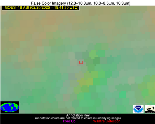
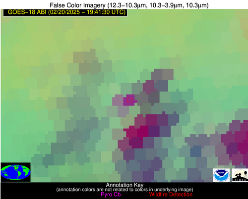
| Latest Satellite Imagery: | |
| View all event imagery » | |
Possible Wildfire
| Basic Information | |
|---|---|
| State/Province(s) | CA |
| Country/Countries | United States |
| County/Locality(s) | Shasta County, CA |
| NWS WFO | Sacramento CA |
| Identification Method | Enhanced Contextual (Clear) |
| Mean Object Date/Time | 2025-02-20 19:41:53UTC |
| Radiative Center (Lat, Lon): | 40.841946°, -122.322220° |
| Nearby Counties (meeting alert criteria): |
|
| Total Radiative Power Anomaly | n/a |
| Total Radiative Power | 7.86 MW |
| Map: | |
| Additional Information | |
| Alert Status | New Feature |
| Type of Event | Nominal Risk |
| Event Priority Ranking | 4 |
| Maximum Observed BT (3.9 um) | 291.30 K |
| Observed - Background BT (3.9 um) | 3.93 K |
| BT Anomaly (3.9 um) | 2.21 K |
| Maximum Observed - Clear RTM BT (3.9 um) | 12.48 K |
| Maximum Observed BTD (3.9-10/11/12 um) | 10.97 K |
| Observed - Background BTD (3.9-10/11/12 um) | 4.06 K |
| BTD Anomaly (3.9-10/11/12 um) | 3.51 K |
| Similar Pixel Count | 8 |
| BT Time Tendency (3.9 um) | 1.10 K |
| Image Interval | 5.00 minutes |
| Fraction of Surrounding LWIR Pixels that are Colder | 0.52 |
| Fraction of Surrounding Red Channel Pixels that are Brighter | 1.00 |
| Maximum Radiative Power | 7.86 MW |
| Maximum Radiative Power Uncertainty | 0.00 MW |
| Total Radiative Power Uncertainty | 0.00 MW |
| Mean Viewing Angle | 49.80° |
| Mean Solar Zenith Angle | 53.00° |
| Mean Glint Angle | 96.50° |
| Water Fraction | 0.00 |
| Total Pixel Area | 6.20 km2 |
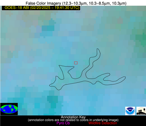
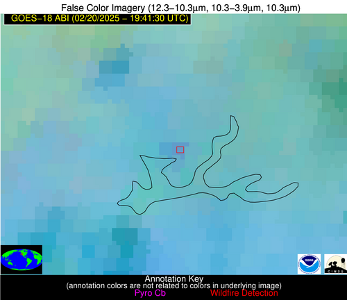
| Latest Satellite Imagery: | |
| View all event imagery » | |


