Wildfire Alert Report
| Date: | 2025-01-29 |
|---|---|
| Time: | 16:52:55 |
| Production Date and Time: | 2025-01-29 16:53:36 UTC |
| Primary Instrument: | GOES-16 ABI |
| Wmo Spacecraft Id: | 152 |
| Location/orbit: | GEO |
| L1 File: | OR_ABI-L1b-RadM2-M6C14_G16_s20250291652553_e20250291653010_c20250291653067.nc |
| L1 File(s) - Temporal | OR_ABI-L1b-RadM2-M6C14_G16_s20250291651553_e20250291652010_c20250291652062.nc |
| Number Of Thermal Anomaly Alerts: | 2 |
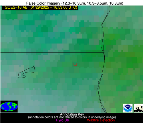
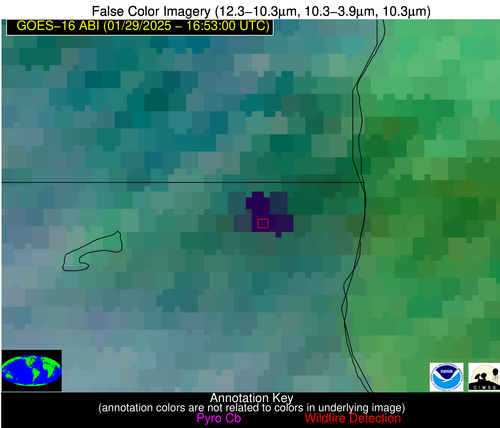
Possible Wildfire
| Basic Information | |
|---|---|
| State/Province(s) | IL |
| Country/Countries | United States |
| County/Locality(s) | Lake County, IL |
| NWS WFO | Chicago IL |
| Identification Method | Enhanced Contextual (Clear) |
| Mean Object Date/Time | 2025-01-29 16:52:57UTC |
| Radiative Center (Lat, Lon): | 42.440556°, -87.942497° |
| Nearby Counties (meeting alert criteria): |
|
| Total Radiative Power Anomaly | n/a |
| Total Radiative Power | 145.67 MW |
| Map: | |
| Additional Information | |
| Alert Status | New Feature |
| Type of Event | Nominal Risk |
| Event Priority Ranking | 4 |
| Maximum Observed BT (3.9 um) | 301.28 K |
| Observed - Background BT (3.9 um) | 29.57 K |
| BT Anomaly (3.9 um) | 8.60 K |
| Maximum Observed - Clear RTM BT (3.9 um) | 26.73 K |
| Maximum Observed BTD (3.9-10/11/12 um) | 45.80 K |
| Observed - Background BTD (3.9-10/11/12 um) | 29.80 K |
| BTD Anomaly (3.9-10/11/12 um) | 8.53 K |
| Similar Pixel Count | 3 |
| BT Time Tendency (3.9 um) | 12.00 K |
| Image Interval | 1.00 minutes |
| Fraction of Surrounding LWIR Pixels that are Colder | 0.19 |
| Fraction of Surrounding Red Channel Pixels that are Brighter | 0.88 |
| Maximum Radiative Power | 95.96 MW |
| Maximum Radiative Power Uncertainty | 0.00 MW |
| Total Radiative Power Uncertainty | 0.00 MW |
| Mean Viewing Angle | 51.00° |
| Mean Solar Zenith Angle | 62.60° |
| Mean Glint Angle | 113.60° |
| Water Fraction | 0.00 |
| Total Pixel Area | 12.70 km2 |
| Latest Satellite Imagery: | |
| View all event imagery » | |
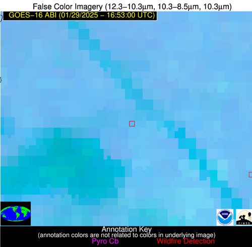
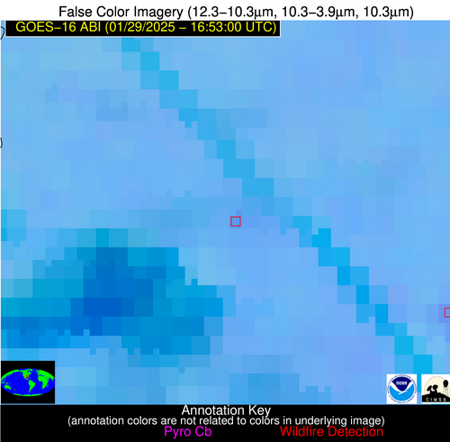
Possible Wildfire
| Basic Information | |
|---|---|
| State/Province(s) | GA |
| Country/Countries | United States |
| County/Locality(s) | Early County, GA |
| NWS WFO | Tallahassee FL |
| Identification Method | Enhanced Contextual (Clear) |
| Mean Object Date/Time | 2025-01-29 16:53:00UTC |
| Radiative Center (Lat, Lon): | 31.430834°, -84.743332° |
| Nearby Counties (meeting alert criteria): |
|
| Total Radiative Power Anomaly | n/a |
| Total Radiative Power | 7.47 MW |
| Map: | |
| Additional Information | |
| Alert Status | New Feature |
| Type of Event | Nominal Risk |
| Event Priority Ranking | 4 |
| Maximum Observed BT (3.9 um) | 299.19 K |
| Observed - Background BT (3.9 um) | 3.06 K |
| BT Anomaly (3.9 um) | 3.56 K |
| Maximum Observed - Clear RTM BT (3.9 um) | 10.66 K |
| Maximum Observed BTD (3.9-10/11/12 um) | 11.69 K |
| Observed - Background BTD (3.9-10/11/12 um) | 3.69 K |
| BTD Anomaly (3.9-10/11/12 um) | 4.15 K |
| Similar Pixel Count | 21 |
| BT Time Tendency (3.9 um) | 2.90 K |
| Image Interval | 1.00 minutes |
| Fraction of Surrounding LWIR Pixels that are Colder | 0.38 |
| Fraction of Surrounding Red Channel Pixels that are Brighter | 1.00 |
| Maximum Radiative Power | 7.47 MW |
| Maximum Radiative Power Uncertainty | 0.00 MW |
| Total Radiative Power Uncertainty | 0.00 MW |
| Mean Viewing Angle | 38.20° |
| Mean Solar Zenith Angle | 51.40° |
| Mean Glint Angle | 89.60° |
| Water Fraction | 0.00 |
| Total Pixel Area | 5.10 km2 |
| Latest Satellite Imagery: | |
| View all event imagery » | |


