Wildfire Alert Report
| Date: | 2025-01-07 |
|---|---|
| Time: | 17:46:17 |
| Production Date and Time: | 2025-01-07 17:50:59 UTC |
| Primary Instrument: | GOES-16 ABI |
| Wmo Spacecraft Id: | 152 |
| Location/orbit: | GEO |
| L1 File: | OR_ABI-L1b-RadC-M6C14_G16_s20250071746170_e20250071748543_c20250071749041.nc |
| L1 File(s) - Temporal | OR_ABI-L1b-RadC-M6C14_G16_s20250071741170_e20250071743543_c20250071744054.nc |
| Number Of Thermal Anomaly Alerts: | 7 |
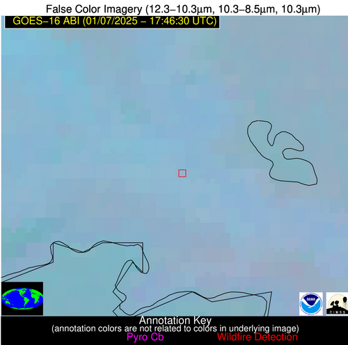
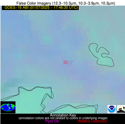
Possible Wildfire
| Basic Information | |
|---|---|
| State/Province(s) | MT |
| Country/Countries | USA |
| County/Locality(s) | Fergus County, MT |
| NWS WFO | Great Falls MT |
| Identification Method | Enhanced Contextual (Cloud) |
| Mean Object Date/Time | 2025-01-07 17:46:19UTC |
| Radiative Center (Lat, Lon): | 46.790000°, -109.150000° |
| Nearby Counties (meeting alert criteria): |
|
| Total Radiative Power Anomaly | n/a |
| Total Radiative Power | 75.03 MW |
| Map: | |
| Additional Information | |
| Alert Status | New Feature |
| Type of Event | Nominal Risk, Known Incident: KAHN COULEE RX (HIGH, tdiff=0.81987 days, POINT) |
| Event Priority Ranking | 4 |
| Maximum Observed BT (3.9 um) | 298.08 K |
| Observed - Background BT (3.9 um) | 28.42 K |
| BT Anomaly (3.9 um) | 8.67 K |
| Maximum Observed - Clear RTM BT (3.9 um) | 33.03 K |
| Maximum Observed BTD (3.9-10/11/12 um) | 32.73 K |
| Observed - Background BTD (3.9-10/11/12 um) | 28.23 K |
| BTD Anomaly (3.9-10/11/12 um) | 8.31 K |
| Similar Pixel Count | 0 |
| BT Time Tendency (3.9 um) | 2.50 K |
| Image Interval | 5.00 minutes |
| Fraction of Surrounding LWIR Pixels that are Colder | 0.68 |
| Fraction of Surrounding Red Channel Pixels that are Brighter | 0.90 |
| Maximum Radiative Power | 75.03 MW |
| Maximum Radiative Power Uncertainty | 0.00 MW |
| Total Radiative Power Uncertainty | 0.00 MW |
| Mean Viewing Angle | 63.60° |
| Mean Solar Zenith Angle | 72.40° |
| Mean Glint Angle | 132.10° |
| Water Fraction | 0.00 |
| Total Pixel Area | 13.00 km2 |
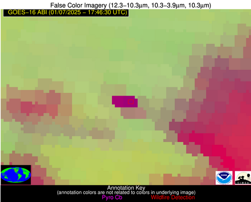
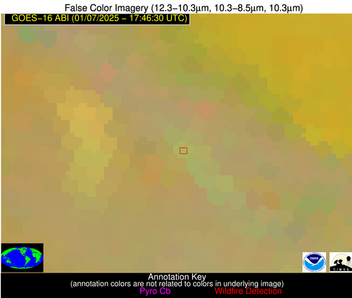
| Latest Satellite Imagery: | |
| View all event imagery » | |
Possible Wildfire
| Basic Information | |
|---|---|
| State/Province(s) | WY |
| Country/Countries | USA |
| County/Locality(s) | Sublette County, WY |
| NWS WFO | Riverton WY |
| Identification Method | Enhanced Contextual (Cloud) |
| Mean Object Date/Time | 2025-01-07 17:46:49UTC |
| Radiative Center (Lat, Lon): | 42.620000°, -109.360000° |
| Nearby Counties (meeting alert criteria): |
|
| Total Radiative Power Anomaly | n/a |
| Total Radiative Power | 30.78 MW |
| Map: | |
| Additional Information | |
| Alert Status | New Feature |
| Type of Event | Nominal Risk |
| Event Priority Ranking | 4 |
| Maximum Observed BT (3.9 um) | 285.51 K |
| Observed - Background BT (3.9 um) | 15.21 K |
| BT Anomaly (3.9 um) | 3.61 K |
| Maximum Observed - Clear RTM BT (3.9 um) | 25.48 K |
| Maximum Observed BTD (3.9-10/11/12 um) | 24.26 K |
| Observed - Background BTD (3.9-10/11/12 um) | 15.41 K |
| BTD Anomaly (3.9-10/11/12 um) | 3.39 K |
| Similar Pixel Count | 0 |
| BT Time Tendency (3.9 um) | 2.30 K |
| Image Interval | 5.00 minutes |
| Fraction of Surrounding LWIR Pixels that are Colder | 0.52 |
| Fraction of Surrounding Red Channel Pixels that are Brighter | 0.85 |
| Maximum Radiative Power | 30.78 MW |
| Maximum Radiative Power Uncertainty | 0.00 MW |
| Total Radiative Power Uncertainty | 0.00 MW |
| Mean Viewing Angle | 60.40° |
| Mean Solar Zenith Angle | 68.60° |
| Mean Glint Angle | 125.20° |
| Water Fraction | 0.00 |
| Total Pixel Area | 11.30 km2 |
| Latest Satellite Imagery: | |
| View all event imagery » | |
Possible Wildfire
| Basic Information | |
|---|---|
| State/Province(s) | GA |
| Country/Countries | USA |
| County/Locality(s) | Burke County, GA |
| NWS WFO | Columbia SC |
| Identification Method | Enhanced Contextual (Clear) |
| Mean Object Date/Time | 2025-01-07 17:47:22UTC |
| Radiative Center (Lat, Lon): | 33.110000°, -81.800000° |
| Nearby Counties (meeting alert criteria): |
|
| Total Radiative Power Anomaly | n/a |
| Total Radiative Power | 6.52 MW |
| Map: | |
| Additional Information | |
| Alert Status | New Feature |
| Type of Event | Nominal Risk |
| Event Priority Ranking | 4 |
| Maximum Observed BT (3.9 um) | 291.44 K |
| Observed - Background BT (3.9 um) | 4.40 K |
| BT Anomaly (3.9 um) | 2.94 K |
| Maximum Observed - Clear RTM BT (3.9 um) | 11.15 K |
| Maximum Observed BTD (3.9-10/11/12 um) | 9.43 K |
| Observed - Background BTD (3.9-10/11/12 um) | 3.90 K |
| BTD Anomaly (3.9-10/11/12 um) | 4.44 K |
| Similar Pixel Count | 13 |
| BT Time Tendency (3.9 um) | 2.40 K |
| Image Interval | 5.00 minutes |
| Fraction of Surrounding LWIR Pixels that are Colder | 0.75 |
| Fraction of Surrounding Red Channel Pixels that are Brighter | 1.00 |
| Maximum Radiative Power | 6.52 MW |
| Maximum Radiative Power Uncertainty | 0.00 MW |
| Total Radiative Power Uncertainty | 0.00 MW |
| Mean Viewing Angle | 39.30° |
| Mean Solar Zenith Angle | 55.40° |
| Mean Glint Angle | 93.70° |
| Water Fraction | 0.00 |
| Total Pixel Area | 5.60 km2 |
| Latest Satellite Imagery: | |
| View all event imagery » | |
Possible Wildfire
| Basic Information | |
|---|---|
| State/Province(s) | GA |
| Country/Countries | USA |
| County/Locality(s) | Liberty County, GA |
| NWS WFO | Charleston SC |
| Identification Method | Enhanced Contextual (Clear) |
| Mean Object Date/Time | 2025-01-07 17:47:22UTC |
| Radiative Center (Lat, Lon): | 32.070000°, -81.690000° |
| Nearby Counties (meeting alert criteria): |
|
| Total Radiative Power Anomaly | n/a |
| Total Radiative Power | 9.00 MW |
| Map: | |
| Additional Information | |
| Alert Status | New Feature |
| Type of Event | Nominal Risk |
| Event Priority Ranking | 4 |
| Maximum Observed BT (3.9 um) | 290.39 K |
| Observed - Background BT (3.9 um) | 4.00 K |
| BT Anomaly (3.9 um) | 3.24 K |
| Maximum Observed - Clear RTM BT (3.9 um) | 9.17 K |
| Maximum Observed BTD (3.9-10/11/12 um) | 9.35 K |
| Observed - Background BTD (3.9-10/11/12 um) | 4.59 K |
| BTD Anomaly (3.9-10/11/12 um) | 5.70 K |
| Similar Pixel Count | 4 |
| BT Time Tendency (3.9 um) | 4.30 K |
| Image Interval | 5.00 minutes |
| Fraction of Surrounding LWIR Pixels that are Colder | 0.14 |
| Fraction of Surrounding Red Channel Pixels that are Brighter | 1.00 |
| Maximum Radiative Power | 9.00 MW |
| Maximum Radiative Power Uncertainty | 0.00 MW |
| Total Radiative Power Uncertainty | 0.00 MW |
| Mean Viewing Angle | 38.20° |
| Mean Solar Zenith Angle | 54.40° |
| Mean Glint Angle | 91.40° |
| Water Fraction | 0.00 |
| Total Pixel Area | 5.50 km2 |
| Latest Satellite Imagery: | |
| View all event imagery » | |
Possible Wildfire
| Basic Information | |
|---|---|
| State/Province(s) | GA |
| Country/Countries | USA |
| County/Locality(s) | Coffee County, GA |
| NWS WFO | Jacksonville FL |
| Identification Method | Enhanced Contextual (Clear) |
| Mean Object Date/Time | 2025-01-07 17:47:22UTC |
| Radiative Center (Lat, Lon): | 31.610000°, -82.860000° |
| Nearby Counties (meeting alert criteria): |
|
| Total Radiative Power Anomaly | n/a |
| Total Radiative Power | 5.53 MW |
| Map: | |
| Additional Information | |
| Alert Status | New Feature |
| Type of Event | Nominal Risk |
| Event Priority Ranking | 4 |
| Maximum Observed BT (3.9 um) | 293.53 K |
| Observed - Background BT (3.9 um) | 3.48 K |
| BT Anomaly (3.9 um) | 2.25 K |
| Maximum Observed - Clear RTM BT (3.9 um) | 11.94 K |
| Maximum Observed BTD (3.9-10/11/12 um) | 10.33 K |
| Observed - Background BTD (3.9-10/11/12 um) | 3.21 K |
| BTD Anomaly (3.9-10/11/12 um) | 3.56 K |
| Similar Pixel Count | 22 |
| BT Time Tendency (3.9 um) | 1.10 K |
| Image Interval | 5.00 minutes |
| Fraction of Surrounding LWIR Pixels that are Colder | 0.58 |
| Fraction of Surrounding Red Channel Pixels that are Brighter | 0.98 |
| Maximum Radiative Power | 5.53 MW |
| Maximum Radiative Power Uncertainty | 0.00 MW |
| Total Radiative Power Uncertainty | 0.00 MW |
| Mean Viewing Angle | 37.90° |
| Mean Solar Zenith Angle | 53.90° |
| Mean Glint Angle | 90.60° |
| Water Fraction | 0.00 |
| Total Pixel Area | 5.50 km2 |
| Latest Satellite Imagery: | |
| View all event imagery » | |
Possible Wildfire
| Basic Information | |
|---|---|
| State/Province(s) | LA |
| Country/Countries | USA |
| County/Locality(s) | Iberia Parish, LA |
| NWS WFO | Lake Charles LA |
| Identification Method | Enhanced Contextual (Clear) |
| Mean Object Date/Time | 2025-01-07 17:47:50UTC |
| Radiative Center (Lat, Lon): | 29.950000°, -91.770000° |
| Nearby Counties (meeting alert criteria): |
|
| Total Radiative Power Anomaly | n/a |
| Total Radiative Power | 3.93 MW |
| Map: | |
| Additional Information | |
| Alert Status | New Feature |
| Type of Event | Nominal Risk |
| Event Priority Ranking | 4 |
| Maximum Observed BT (3.9 um) | 292.51 K |
| Observed - Background BT (3.9 um) | 3.62 K |
| BT Anomaly (3.9 um) | 1.96 K |
| Maximum Observed - Clear RTM BT (3.9 um) | 12.15 K |
| Maximum Observed BTD (3.9-10/11/12 um) | 9.74 K |
| Observed - Background BTD (3.9-10/11/12 um) | 2.76 K |
| BTD Anomaly (3.9-10/11/12 um) | 2.65 K |
| Similar Pixel Count | 25 |
| BT Time Tendency (3.9 um) | 1.40 K |
| Image Interval | 5.00 minutes |
| Fraction of Surrounding LWIR Pixels that are Colder | 0.82 |
| Fraction of Surrounding Red Channel Pixels that are Brighter | 0.96 |
| Maximum Radiative Power | 3.93 MW |
| Maximum Radiative Power Uncertainty | 0.00 MW |
| Total Radiative Power Uncertainty | 0.00 MW |
| Mean Viewing Angle | 39.50° |
| Mean Solar Zenith Angle | 52.60° |
| Mean Glint Angle | 89.80° |
| Water Fraction | 0.00 |
| Total Pixel Area | 5.70 km2 |
| Latest Satellite Imagery: | |
| View all event imagery » | |
Possible Wildfire
| Basic Information | |
|---|---|
| State/Province(s) | Chihuahua |
| Country/Countries | Mexico |
| County/Locality(s) | Meoqui, Chihuahua |
| NWS WFO | N/A |
| Identification Method | Enhanced Contextual (Clear) |
| Mean Object Date/Time | 2025-01-07 17:47:49UTC |
| Radiative Center (Lat, Lon): | 28.460000°, -105.550000° |
| Nearby Counties (meeting alert criteria): |
|
| Total Radiative Power Anomaly | n/a |
| Total Radiative Power | 18.82 MW |
| Map: | |
| Additional Information | |
| Alert Status | New Feature |
| Type of Event | Nominal Risk |
| Event Priority Ranking | 4 |
| Maximum Observed BT (3.9 um) | 307.21 K |
| Observed - Background BT (3.9 um) | 3.56 K |
| BT Anomaly (3.9 um) | 2.48 K |
| Maximum Observed - Clear RTM BT (3.9 um) | 12.26 K |
| Maximum Observed BTD (3.9-10/11/12 um) | 14.63 K |
| Observed - Background BTD (3.9-10/11/12 um) | 3.96 K |
| BTD Anomaly (3.9-10/11/12 um) | 3.55 K |
| Similar Pixel Count | 22 |
| BT Time Tendency (3.9 um) | 3.90 K |
| Image Interval | 5.00 minutes |
| Fraction of Surrounding LWIR Pixels that are Colder | 0.34 |
| Fraction of Surrounding Red Channel Pixels that are Brighter | 0.94 |
| Maximum Radiative Power | 18.82 MW |
| Maximum Radiative Power Uncertainty | 0.00 MW |
| Total Radiative Power Uncertainty | 0.00 MW |
| Mean Viewing Angle | 47.20° |
| Mean Solar Zenith Angle | 54.40° |
| Mean Glint Angle | 97.80° |
| Water Fraction | 0.00 |
| Total Pixel Area | 7.00 km2 |
| Latest Satellite Imagery: | |
| View all event imagery » | |

