Feb 18 2026: Due to heavy traffic, please consider accessing NGFS detections and satellite imagery through the NOAA/NESDIS Wildland Fire Data Portal: https://fire.data.nesdis.noaa.gov/map/
Wildfire Alert Report
| Date: | 2024-12-21 |
|---|---|
| Time: | 16:06:17 |
| Production Date and Time: | 2024-12-21 16:10:58 UTC |
| Primary Instrument: | GOES-16 ABI |
| Wmo Spacecraft Id: | 152 |
| Location/orbit: | GEO |
| L1 File: | OR_ABI-L1b-RadC-M6C14_G16_s20243561606176_e20243561608548_c20243561609046.nc |
| L1 File(s) - Temporal | OR_ABI-L1b-RadC-M6C14_G16_s20243561601176_e20243561603549_c20243561604016.nc |
| Number Of Thermal Anomaly Alerts: | 5 |
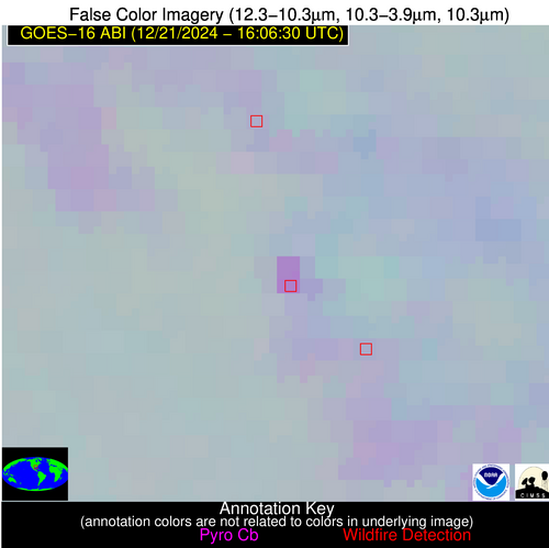
Possible Wildfire
| Basic Information | |
|---|---|
| State/Province(s) | IA |
| Country/Countries | USA |
| County/Locality(s) | Davis County, IA |
| NWS WFO | Des Moines IA |
| Identification Method | Enhanced Contextual (Clear) |
| Mean Object Date/Time | 2024-12-21 16:06:51UTC |
| Radiative Center (Lat, Lon): | 40.850000°, -92.180000° |
| Nearby Counties (meeting alert criteria): |
|
| Total Radiative Power Anomaly | n/a |
| Total Radiative Power | 14.90 MW |
| Map: | |
| Additional Information | |
| Alert Status | New Feature |
| Type of Event | Nominal Risk |
| Event Priority Ranking | 4 |
| Maximum Observed BT (3.9 um) | 285.72 K |
| Observed - Background BT (3.9 um) | 7.87 K |
| BT Anomaly (3.9 um) | 9.82 K |
| Maximum Observed - Clear RTM BT (3.9 um) | 14.52 K |
| Maximum Observed BTD (3.9-10/11/12 um) | 15.92 K |
| Observed - Background BTD (3.9-10/11/12 um) | 8.41 K |
| BTD Anomaly (3.9-10/11/12 um) | 15.24 K |
| Similar Pixel Count | 1 |
| BT Time Tendency (3.9 um) | 2.00 K |
| Image Interval | 5.00 minutes |
| Fraction of Surrounding LWIR Pixels that are Colder | 0.07 |
| Fraction of Surrounding Red Channel Pixels that are Brighter | 1.00 |
| Maximum Radiative Power | 14.90 MW |
| Maximum Radiative Power Uncertainty | 0.00 MW |
| Total Radiative Power Uncertainty | 0.00 MW |
| Mean Viewing Angle | 50.60° |
| Mean Solar Zenith Angle | 70.10° |
| Mean Glint Angle | 120.50° |
| Water Fraction | 0.00 |
| Total Pixel Area | 7.30 km2 |
| Latest Satellite Imagery: | |
| View all event imagery » | |
Possible Wildfire
| Basic Information | |
|---|---|
| State/Province(s) | MO |
| Country/Countries | USA |
| County/Locality(s) | Jackson County, MO |
| NWS WFO | Kansas City/Pleasant Hill MO |
| Identification Method | Enhanced Contextual (Clear) |
| Mean Object Date/Time | 2024-12-21 16:06:50UTC |
| Radiative Center (Lat, Lon): | 39.100000°, -94.480000° |
| Nearby Counties (meeting alert criteria): |
|
| Total Radiative Power Anomaly | n/a |
| Total Radiative Power | 12.44 MW |
| Map: | |
| Additional Information | |
| Alert Status | New Feature |
| Type of Event | Likely an Urban Source |
| Event Priority Ranking | 5 |
| Maximum Observed BT (3.9 um) | 285.86 K |
| Observed - Background BT (3.9 um) | 7.23 K |
| BT Anomaly (3.9 um) | 10.25 K |
| Maximum Observed - Clear RTM BT (3.9 um) | 14.35 K |
| Maximum Observed BTD (3.9-10/11/12 um) | 13.83 K |
| Observed - Background BTD (3.9-10/11/12 um) | 7.19 K |
| BTD Anomaly (3.9-10/11/12 um) | 13.02 K |
| Similar Pixel Count | 1 |
| BT Time Tendency (3.9 um) | -1.00 K |
| Image Interval | 5.00 minutes |
| Fraction of Surrounding LWIR Pixels that are Colder | 0.56 |
| Fraction of Surrounding Red Channel Pixels that are Brighter | 0.38 |
| Maximum Radiative Power | 12.44 MW |
| Maximum Radiative Power Uncertainty | 0.00 MW |
| Total Radiative Power Uncertainty | 0.00 MW |
| Mean Viewing Angle | 49.70° |
| Mean Solar Zenith Angle | 69.50° |
| Mean Glint Angle | 119.20° |
| Water Fraction | 0.00 |
| Total Pixel Area | 7.20 km2 |
| Latest Satellite Imagery: | |
| View all event imagery » | |
Possible Wildfire
| Basic Information | |
|---|---|
| State/Province(s) | AL |
| Country/Countries | USA |
| County/Locality(s) | Chilton County, AL |
| NWS WFO | Birmingham AL |
| Identification Method | Enhanced Contextual (Clear) |
| Mean Object Date/Time | 2024-12-21 16:07:21UTC |
| Radiative Center (Lat, Lon): | 32.740000°, -86.880000° |
| Nearby Counties (meeting alert criteria): |
|
| Total Radiative Power Anomaly | n/a |
| Total Radiative Power | 1.71 MW |
| Map: | |
| Additional Information | |
| Alert Status | New Feature |
| Type of Event | Nominal Risk |
| Event Priority Ranking | 4 |
| Maximum Observed BT (3.9 um) | 285.79 K |
| Observed - Background BT (3.9 um) | 2.18 K |
| BT Anomaly (3.9 um) | 2.53 K |
| Maximum Observed - Clear RTM BT (3.9 um) | 8.18 K |
| Maximum Observed BTD (3.9-10/11/12 um) | 6.04 K |
| Observed - Background BTD (3.9-10/11/12 um) | 1.48 K |
| BTD Anomaly (3.9-10/11/12 um) | 3.02 K |
| Similar Pixel Count | 24 |
| BT Time Tendency (3.9 um) | 1.20 K |
| Image Interval | 5.00 minutes |
| Fraction of Surrounding LWIR Pixels that are Colder | 0.94 |
| Fraction of Surrounding Red Channel Pixels that are Brighter | 1.00 |
| Maximum Radiative Power | 1.71 MW |
| Maximum Radiative Power Uncertainty | 0.00 MW |
| Total Radiative Power Uncertainty | 0.00 MW |
| Mean Viewing Angle | 40.30° |
| Mean Solar Zenith Angle | 60.90° |
| Mean Glint Angle | 101.10° |
| Water Fraction | 0.00 |
| Total Pixel Area | 5.70 km2 |
| Latest Satellite Imagery: | |
| View all event imagery » | |
Possible Wildfire
| Basic Information | |
|---|---|
| State/Province(s) | TX |
| Country/Countries | USA |
| County/Locality(s) | Palo Pinto County, TX |
| NWS WFO | Fort Worth TX |
| Identification Method | Enhanced Contextual (Clear) |
| Mean Object Date/Time | 2024-12-21 16:07:20UTC |
| Radiative Center (Lat, Lon): | 32.760000°, -98.130000° |
| Nearby Counties (meeting alert criteria): |
|
| Total Radiative Power Anomaly | n/a |
| Total Radiative Power | 10.97 MW |
| Map: | |
| Additional Information | |
| Alert Status | New Feature |
| Type of Event | Nominal Risk |
| Event Priority Ranking | 4 |
| Maximum Observed BT (3.9 um) | 290.03 K |
| Observed - Background BT (3.9 um) | 4.61 K |
| BT Anomaly (3.9 um) | 4.26 K |
| Maximum Observed - Clear RTM BT (3.9 um) | 8.30 K |
| Maximum Observed BTD (3.9-10/11/12 um) | 10.38 K |
| Observed - Background BTD (3.9-10/11/12 um) | 5.01 K |
| BTD Anomaly (3.9-10/11/12 um) | 7.21 K |
| Similar Pixel Count | 1 |
| BT Time Tendency (3.9 um) | 1.60 K |
| Image Interval | 5.00 minutes |
| Fraction of Surrounding LWIR Pixels that are Colder | 0.19 |
| Fraction of Surrounding Red Channel Pixels that are Brighter | 1.00 |
| Maximum Radiative Power | 10.97 MW |
| Maximum Radiative Power Uncertainty | 0.00 MW |
| Total Radiative Power Uncertainty | 0.00 MW |
| Mean Viewing Angle | 45.60° |
| Mean Solar Zenith Angle | 65.80° |
| Mean Glint Angle | 111.50° |
| Water Fraction | 0.00 |
| Total Pixel Area | 6.60 km2 |
| Latest Satellite Imagery: | |
| View all event imagery » | |
Possible Wildfire
| Basic Information | |
|---|---|
| State/Province(s) | LA |
| Country/Countries | USA |
| County/Locality(s) | West Baton Rouge Parish, LA |
| NWS WFO | New Orleans LA |
| Identification Method | Enhanced Contextual (Clear) |
| Mean Object Date/Time | 2024-12-21 16:07:20UTC |
| Radiative Center (Lat, Lon): | 30.330000°, -91.270000° |
| Nearby Counties (meeting alert criteria): |
|
| Total Radiative Power Anomaly | n/a |
| Total Radiative Power | 26.48 MW |
| Map: | |
| Additional Information | |
| Alert Status | New Feature |
| Type of Event | Nonmetal-mineral |
| Event Priority Ranking | 5 |
| Maximum Observed BT (3.9 um) | 295.43 K |
| Observed - Background BT (3.9 um) | 8.68 K |
| BT Anomaly (3.9 um) | 4.97 K |
| Maximum Observed - Clear RTM BT (3.9 um) | 15.15 K |
| Maximum Observed BTD (3.9-10/11/12 um) | 12.97 K |
| Observed - Background BTD (3.9-10/11/12 um) | 7.50 K |
| BTD Anomaly (3.9-10/11/12 um) | 7.63 K |
| Similar Pixel Count | 3 |
| BT Time Tendency (3.9 um) | 5.00 K |
| Image Interval | 5.00 minutes |
| Fraction of Surrounding LWIR Pixels that are Colder | 0.89 |
| Fraction of Surrounding Red Channel Pixels that are Brighter | 0.61 |
| Maximum Radiative Power | 13.83 MW |
| Maximum Radiative Power Uncertainty | 0.00 MW |
| Total Radiative Power Uncertainty | 0.00 MW |
| Mean Viewing Angle | 39.70° |
| Mean Solar Zenith Angle | 60.60° |
| Mean Glint Angle | 100.30° |
| Water Fraction | 0.00 |
| Total Pixel Area | 11.40 km2 |
| Latest Satellite Imagery: | |
| View all event imagery » | |
