Jan 2026: Due to an ongoing data center cooling system construction project, NGFS data outages may occur with little or no notice.
Wildfire Alert Report
| Date: | 2024-12-20 |
|---|---|
| Time: | 17:06:17 |
| Production Date and Time: | 2024-12-20 17:10:53 UTC |
| Primary Instrument: | GOES-16 ABI |
| Wmo Spacecraft Id: | 152 |
| Location/orbit: | GEO |
| L1 File: | OR_ABI-L1b-RadC-M6C14_G16_s20243551706175_e20243551708548_c20243551709023.nc |
| L1 File(s) - Temporal | OR_ABI-L1b-RadC-M6C14_G16_s20243551701175_e20243551703548_c20243551704040.nc |
| Number Of Thermal Anomaly Alerts: | 11 |
Possible Wildfire
| Basic Information | |
|---|---|
| State/Province(s) | OK |
| Country/Countries | USA |
| County/Locality(s) | McIntosh County, OK |
| NWS WFO | Tulsa OK |
| Identification Method | Enhanced Contextual (Clear) |
| Mean Object Date/Time | 2024-12-20 17:07:20UTC |
| Radiative Center (Lat, Lon): | 35.380000°, -95.780000° |
| Nearby Counties (meeting alert criteria): |
|
| Total Radiative Power Anomaly | n/a |
| Total Radiative Power | 9.87 MW |
| Map: | |
| Additional Information | |
| Alert Status | New Feature |
| Type of Event | Nominal Risk |
| Event Priority Ranking | 4 |
| Maximum Observed BT (3.9 um) | 290.63 K |
| Observed - Background BT (3.9 um) | 5.98 K |
| BT Anomaly (3.9 um) | 4.46 K |
| Maximum Observed - Clear RTM BT (3.9 um) | 13.49 K |
| Maximum Observed BTD (3.9-10/11/12 um) | 12.11 K |
| Observed - Background BTD (3.9-10/11/12 um) | 5.65 K |
| BTD Anomaly (3.9-10/11/12 um) | 5.12 K |
| Similar Pixel Count | 3 |
| BT Time Tendency (3.9 um) | 4.10 K |
| Image Interval | 5.00 minutes |
| Fraction of Surrounding LWIR Pixels that are Colder | 0.78 |
| Fraction of Surrounding Red Channel Pixels that are Brighter | 1.00 |
| Maximum Radiative Power | 9.87 MW |
| Maximum Radiative Power Uncertainty | 0.00 MW |
| Total Radiative Power Uncertainty | 0.00 MW |
| Mean Viewing Angle | 46.80° |
| Mean Solar Zenith Angle | 61.40° |
| Mean Glint Angle | 107.00° |
| Water Fraction | 0.00 |
| Total Pixel Area | 6.70 km2 |
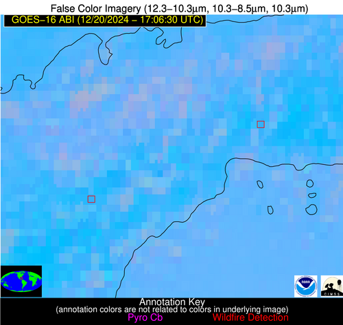
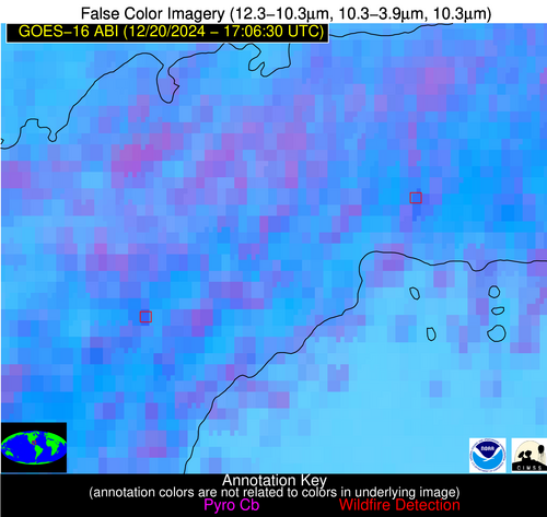
| Latest Satellite Imagery: | |
| View all event imagery » | |
Possible Wildfire
| Basic Information | |
|---|---|
| State/Province(s) | AL |
| Country/Countries | USA |
| County/Locality(s) | Autauga County, AL |
| NWS WFO | Birmingham AL |
| Identification Method | Enhanced Contextual (Clear) |
| Mean Object Date/Time | 2024-12-20 17:07:21UTC |
| Radiative Center (Lat, Lon): | 32.550000°, -86.900000° |
| Nearby Counties (meeting alert criteria): |
|
| Total Radiative Power Anomaly | n/a |
| Total Radiative Power | 3.08 MW |
| Map: | |
| Additional Information | |
| Alert Status | New Feature |
| Type of Event | Nominal Risk |
| Event Priority Ranking | 4 |
| Maximum Observed BT (3.9 um) | 292.62 K |
| Observed - Background BT (3.9 um) | 2.04 K |
| BT Anomaly (3.9 um) | 1.85 K |
| Maximum Observed - Clear RTM BT (3.9 um) | 8.65 K |
| Maximum Observed BTD (3.9-10/11/12 um) | 6.14 K |
| Observed - Background BTD (3.9-10/11/12 um) | 1.76 K |
| BTD Anomaly (3.9-10/11/12 um) | 3.32 K |
| Similar Pixel Count | 17 |
| BT Time Tendency (3.9 um) | 1.20 K |
| Image Interval | 5.00 minutes |
| Fraction of Surrounding LWIR Pixels that are Colder | 0.68 |
| Fraction of Surrounding Red Channel Pixels that are Brighter | 1.00 |
| Maximum Radiative Power | 3.08 MW |
| Maximum Radiative Power Uncertainty | 0.00 MW |
| Total Radiative Power Uncertainty | 0.00 MW |
| Mean Viewing Angle | 40.10° |
| Mean Solar Zenith Angle | 56.70° |
| Mean Glint Angle | 96.30° |
| Water Fraction | 0.00 |
| Total Pixel Area | 5.70 km2 |
| Latest Satellite Imagery: | |
| View all event imagery » | |
Possible Wildfire
| Basic Information | |
|---|---|
| State/Province(s) | GA |
| Country/Countries | USA |
| County/Locality(s) | Bulloch County, GA |
| NWS WFO | Charleston SC |
| Identification Method | Enhanced Contextual (Clear) |
| Mean Object Date/Time | 2024-12-20 17:07:22UTC |
| Radiative Center (Lat, Lon): | 32.250000°, -81.440000° |
| Nearby Counties (meeting alert criteria): |
|
| Total Radiative Power Anomaly | n/a |
| Total Radiative Power | 5.42 MW |
| Map: | |
| Additional Information | |
| Alert Status | New Feature |
| Type of Event | Nominal Risk |
| Event Priority Ranking | 4 |
| Maximum Observed BT (3.9 um) | 295.08 K |
| Observed - Background BT (3.9 um) | 2.42 K |
| BT Anomaly (3.9 um) | 2.22 K |
| Maximum Observed - Clear RTM BT (3.9 um) | 8.52 K |
| Maximum Observed BTD (3.9-10/11/12 um) | 6.63 K |
| Observed - Background BTD (3.9-10/11/12 um) | 2.53 K |
| BTD Anomaly (3.9-10/11/12 um) | 4.02 K |
| Similar Pixel Count | 6 |
| BT Time Tendency (3.9 um) | 0.50 K |
| Image Interval | 5.00 minutes |
| Fraction of Surrounding LWIR Pixels that are Colder | 0.43 |
| Fraction of Surrounding Red Channel Pixels that are Brighter | 1.00 |
| Maximum Radiative Power | 5.42 MW |
| Maximum Radiative Power Uncertainty | 0.00 MW |
| Total Radiative Power Uncertainty | 0.00 MW |
| Mean Viewing Angle | 38.30° |
| Mean Solar Zenith Angle | 55.80° |
| Mean Glint Angle | 93.90° |
| Water Fraction | 0.00 |
| Total Pixel Area | 5.50 km2 |
| Latest Satellite Imagery: | |
| View all event imagery » | |
Possible Wildfire
| Basic Information | |
|---|---|
| State/Province(s) | AL |
| Country/Countries | USA |
| County/Locality(s) | Monroe County, AL |
| NWS WFO | Mobile AL |
| Identification Method | Enhanced Contextual (Clear) |
| Mean Object Date/Time | 2024-12-20 17:07:21UTC |
| Radiative Center (Lat, Lon): | 31.520000°, -87.260000° |
| Nearby Counties (meeting alert criteria): |
|
| Total Radiative Power Anomaly | n/a |
| Total Radiative Power | 14.43 MW |
| Map: | |
| Additional Information | |
| Alert Status | New Feature |
| Type of Event | Nominal Risk |
| Event Priority Ranking | 4 |
| Maximum Observed BT (3.9 um) | 294.11 K |
| Observed - Background BT (3.9 um) | 3.39 K |
| BT Anomaly (3.9 um) | 3.38 K |
| Maximum Observed - Clear RTM BT (3.9 um) | 8.87 K |
| Maximum Observed BTD (3.9-10/11/12 um) | 7.74 K |
| Observed - Background BTD (3.9-10/11/12 um) | 3.71 K |
| BTD Anomaly (3.9-10/11/12 um) | 6.68 K |
| Similar Pixel Count | 4 |
| BT Time Tendency (3.9 um) | 0.80 K |
| Image Interval | 5.00 minutes |
| Fraction of Surrounding LWIR Pixels that are Colder | 0.49 |
| Fraction of Surrounding Red Channel Pixels that are Brighter | 1.00 |
| Maximum Radiative Power | 7.43 MW |
| Maximum Radiative Power Uncertainty | 0.00 MW |
| Total Radiative Power Uncertainty | 0.00 MW |
| Mean Viewing Angle | 39.10° |
| Mean Solar Zenith Angle | 55.80° |
| Mean Glint Angle | 94.30° |
| Water Fraction | 0.00 |
| Total Pixel Area | 11.20 km2 |
| Latest Satellite Imagery: | |
| View all event imagery » | |
Possible Wildfire
| Basic Information | |
|---|---|
| State/Province(s) | GA |
| Country/Countries | USA |
| County/Locality(s) | Colquitt County, GA |
| NWS WFO | Tallahassee FL |
| Identification Method | Enhanced Contextual (Clear) |
| Mean Object Date/Time | 2024-12-20 17:07:21UTC |
| Radiative Center (Lat, Lon): | 31.110000°, -83.670000° |
| Nearby Counties (meeting alert criteria): |
|
| Total Radiative Power Anomaly | n/a |
| Total Radiative Power | 27.00 MW |
| Map: | |
| Additional Information | |
| Alert Status | New Feature |
| Type of Event | Nominal Risk |
| Event Priority Ranking | 4 |
| Maximum Observed BT (3.9 um) | 300.84 K |
| Observed - Background BT (3.9 um) | 7.22 K |
| BT Anomaly (3.9 um) | 6.83 K |
| Maximum Observed - Clear RTM BT (3.9 um) | 14.78 K |
| Maximum Observed BTD (3.9-10/11/12 um) | 12.06 K |
| Observed - Background BTD (3.9-10/11/12 um) | 6.77 K |
| BTD Anomaly (3.9-10/11/12 um) | 10.68 K |
| Similar Pixel Count | 3 |
| BT Time Tendency (3.9 um) | 5.70 K |
| Image Interval | 5.00 minutes |
| Fraction of Surrounding LWIR Pixels that are Colder | 0.83 |
| Fraction of Surrounding Red Channel Pixels that are Brighter | 0.47 |
| Maximum Radiative Power | 14.94 MW |
| Maximum Radiative Power Uncertainty | 0.00 MW |
| Total Radiative Power Uncertainty | 0.00 MW |
| Mean Viewing Angle | 37.60° |
| Mean Solar Zenith Angle | 54.90° |
| Mean Glint Angle | 92.10° |
| Water Fraction | 0.00 |
| Total Pixel Area | 10.90 km2 |
| Latest Satellite Imagery: | |
| View all event imagery » | |
Possible Wildfire
| Basic Information | |
|---|---|
| State/Province(s) | LA |
| Country/Countries | USA |
| County/Locality(s) | Iberville Parish, LA |
| NWS WFO | New Orleans LA |
| Identification Method | Enhanced Contextual (Clear) |
| Mean Object Date/Time | 2024-12-20 17:07:20UTC |
| Radiative Center (Lat, Lon): | 30.440000°, -91.460000° |
| Nearby Counties (meeting alert criteria): |
|
| Total Radiative Power Anomaly | n/a |
| Total Radiative Power | 29.20 MW |
| Map: | |
| Additional Information | |
| Alert Status | New Feature |
| Type of Event | Nominal Risk |
| Event Priority Ranking | 4 |
| Maximum Observed BT (3.9 um) | 301.49 K |
| Observed - Background BT (3.9 um) | 8.02 K |
| BT Anomaly (3.9 um) | 4.72 K |
| Maximum Observed - Clear RTM BT (3.9 um) | 14.66 K |
| Maximum Observed BTD (3.9-10/11/12 um) | 11.83 K |
| Observed - Background BTD (3.9-10/11/12 um) | 7.07 K |
| BTD Anomaly (3.9-10/11/12 um) | 7.55 K |
| Similar Pixel Count | 3 |
| BT Time Tendency (3.9 um) | 5.90 K |
| Image Interval | 5.00 minutes |
| Fraction of Surrounding LWIR Pixels that are Colder | 0.81 |
| Fraction of Surrounding Red Channel Pixels that are Brighter | 0.50 |
| Maximum Radiative Power | 14.63 MW |
| Maximum Radiative Power Uncertainty | 0.00 MW |
| Total Radiative Power Uncertainty | 0.00 MW |
| Mean Viewing Angle | 39.80° |
| Mean Solar Zenith Angle | 55.50° |
| Mean Glint Angle | 94.50° |
| Water Fraction | 0.00 |
| Total Pixel Area | 11.50 km2 |
| Latest Satellite Imagery: | |
| View all event imagery » | |
Possible Wildfire
| Basic Information | |
|---|---|
| State/Province(s) | LA |
| Country/Countries | USA |
| County/Locality(s) | St. Mary Parish, LA |
| NWS WFO | Lake Charles LA |
| Identification Method | Enhanced Contextual (Clear) |
| Mean Object Date/Time | 2024-12-20 17:07:50UTC |
| Radiative Center (Lat, Lon): | 29.850000°, -91.540000° |
| Nearby Counties (meeting alert criteria): |
|
| Total Radiative Power Anomaly | n/a |
| Total Radiative Power | 8.31 MW |
| Map: | |
| Additional Information | |
| Alert Status | New Feature |
| Type of Event | Nominal Risk |
| Event Priority Ranking | 4 |
| Maximum Observed BT (3.9 um) | 300.42 K |
| Observed - Background BT (3.9 um) | 6.21 K |
| BT Anomaly (3.9 um) | 3.02 K |
| Maximum Observed - Clear RTM BT (3.9 um) | 13.77 K |
| Maximum Observed BTD (3.9-10/11/12 um) | 9.86 K |
| Observed - Background BTD (3.9-10/11/12 um) | 4.78 K |
| BTD Anomaly (3.9-10/11/12 um) | 4.02 K |
| Similar Pixel Count | 9 |
| BT Time Tendency (3.9 um) | 1.00 K |
| Image Interval | 5.00 minutes |
| Fraction of Surrounding LWIR Pixels that are Colder | 0.93 |
| Fraction of Surrounding Red Channel Pixels that are Brighter | 0.68 |
| Maximum Radiative Power | 8.31 MW |
| Maximum Radiative Power Uncertainty | 0.00 MW |
| Total Radiative Power Uncertainty | 0.00 MW |
| Mean Viewing Angle | 39.30° |
| Mean Solar Zenith Angle | 55.00° |
| Mean Glint Angle | 93.40° |
| Water Fraction | 0.00 |
| Total Pixel Area | 5.70 km2 |
| Latest Satellite Imagery: | |
| View all event imagery » | |
Possible Wildfire
| Basic Information | |
|---|---|
| State/Province(s) | FL |
| Country/Countries | USA |
| County/Locality(s) | Marion County, FL |
| NWS WFO | Jacksonville FL |
| Identification Method | Enhanced Contextual (Clear) |
| Mean Object Date/Time | 2024-12-20 17:07:52UTC |
| Radiative Center (Lat, Lon): | 29.010000°, -82.300000° |
| Nearby Counties (meeting alert criteria): |
|
| Total Radiative Power Anomaly | n/a |
| Total Radiative Power | 35.77 MW |
| Map: | |
| Additional Information | |
| Alert Status | New Feature |
| Type of Event | Nominal Risk |
| Event Priority Ranking | 4 |
| Maximum Observed BT (3.9 um) | 308.64 K |
| Observed - Background BT (3.9 um) | 11.23 K |
| BT Anomaly (3.9 um) | 6.99 K |
| Maximum Observed - Clear RTM BT (3.9 um) | 17.05 K |
| Maximum Observed BTD (3.9-10/11/12 um) | 19.92 K |
| Observed - Background BTD (3.9-10/11/12 um) | 11.34 K |
| BTD Anomaly (3.9-10/11/12 um) | 5.70 K |
| Similar Pixel Count | 2 |
| BT Time Tendency (3.9 um) | 5.20 K |
| Image Interval | 5.00 minutes |
| Fraction of Surrounding LWIR Pixels that are Colder | 0.43 |
| Fraction of Surrounding Red Channel Pixels that are Brighter | 0.51 |
| Maximum Radiative Power | 35.77 MW |
| Maximum Radiative Power Uncertainty | 0.00 MW |
| Total Radiative Power Uncertainty | 0.00 MW |
| Mean Viewing Angle | 34.90° |
| Mean Solar Zenith Angle | 52.60° |
| Mean Glint Angle | 87.20° |
| Water Fraction | 0.00 |
| Total Pixel Area | 5.20 km2 |
| Latest Satellite Imagery: | |
| View all event imagery » | |
Possible Wildfire
| Basic Information | |
|---|---|
| State/Province(s) | FL |
| Country/Countries | USA |
| County/Locality(s) | Hendry County, FL |
| NWS WFO | Miami FL |
| Identification Method | Enhanced Contextual (Cloud) |
| Mean Object Date/Time | 2024-12-20 17:07:52UTC |
| Radiative Center (Lat, Lon): | 26.730000°, -81.020000° |
| Nearby Counties (meeting alert criteria): |
|
| Total Radiative Power Anomaly | n/a |
| Total Radiative Power | 54.58 MW |
| Map: | |
| Additional Information | |
| Alert Status | New Feature |
| Type of Event | Nominal Risk |
| Event Priority Ranking | 4 |
| Maximum Observed BT (3.9 um) | 312.90 K |
| Observed - Background BT (3.9 um) | 11.18 K |
| BT Anomaly (3.9 um) | 4.33 K |
| Maximum Observed - Clear RTM BT (3.9 um) | 17.02 K |
| Maximum Observed BTD (3.9-10/11/12 um) | 23.24 K |
| Observed - Background BTD (3.9-10/11/12 um) | 10.44 K |
| BTD Anomaly (3.9-10/11/12 um) | 3.45 K |
| Similar Pixel Count | 0 |
| BT Time Tendency (3.9 um) | 8.10 K |
| Image Interval | 5.00 minutes |
| Fraction of Surrounding LWIR Pixels that are Colder | 0.89 |
| Fraction of Surrounding Red Channel Pixels that are Brighter | 0.73 |
| Maximum Radiative Power | 54.58 MW |
| Maximum Radiative Power Uncertainty | 0.00 MW |
| Total Radiative Power Uncertainty | 0.00 MW |
| Mean Viewing Angle | 32.00° |
| Mean Solar Zenith Angle | 50.30° |
| Mean Glint Angle | 82.10° |
| Water Fraction | 0.00 |
| Total Pixel Area | 5.00 km2 |
| Latest Satellite Imagery: | |
| View all event imagery » | |
Possible Wildfire
| Basic Information | |
|---|---|
| State/Province(s) | Unknown |
| Country/Countries | Cuba |
| County/Locality(s) | Cuba |
| NWS WFO | N/A |
| Identification Method | Enhanced Contextual (Clear) |
| Mean Object Date/Time | 2024-12-20 17:08:21UTC |
| Radiative Center (Lat, Lon): | 22.780000°, -82.680000° |
| Nearby Counties (meeting alert criteria): |
|
| Total Radiative Power Anomaly | n/a |
| Total Radiative Power | 33.57 MW |
| Map: | |
| Additional Information | |
| Alert Status | New Feature |
| Type of Event | Nominal Risk |
| Event Priority Ranking | 4 |
| Maximum Observed BT (3.9 um) | 311.31 K |
| Observed - Background BT (3.9 um) | 8.00 K |
| BT Anomaly (3.9 um) | 3.04 K |
| Maximum Observed - Clear RTM BT (3.9 um) | 17.05 K |
| Maximum Observed BTD (3.9-10/11/12 um) | 18.42 K |
| Observed - Background BTD (3.9-10/11/12 um) | 7.45 K |
| BTD Anomaly (3.9-10/11/12 um) | 3.24 K |
| Similar Pixel Count | 20 |
| BT Time Tendency (3.9 um) | 2.60 K |
| Image Interval | 5.00 minutes |
| Fraction of Surrounding LWIR Pixels that are Colder | 0.75 |
| Fraction of Surrounding Red Channel Pixels that are Brighter | 0.88 |
| Maximum Radiative Power | 33.57 MW |
| Maximum Radiative Power Uncertainty | 0.00 MW |
| Total Radiative Power Uncertainty | 0.00 MW |
| Mean Viewing Angle | 28.10° |
| Mean Solar Zenith Angle | 46.50° |
| Mean Glint Angle | 74.10° |
| Water Fraction | 0.00 |
| Total Pixel Area | 9.50 km2 |
| Latest Satellite Imagery: | |
| View all event imagery » | |
Possible Wildfire
| Basic Information | |
|---|---|
| State/Province(s) | Unknown |
| Country/Countries | Cuba |
| County/Locality(s) | Cuba |
| NWS WFO | N/A |
| Identification Method | Enhanced Contextual (Clear) |
| Mean Object Date/Time | 2024-12-20 17:08:21UTC |
| Radiative Center (Lat, Lon): | 22.600000°, -83.210000° |
| Nearby Counties (meeting alert criteria): |
|
| Total Radiative Power Anomaly | n/a |
| Total Radiative Power | 20.25 MW |
| Map: | |
| Additional Information | |
| Alert Status | New Feature |
| Type of Event | Nominal Risk |
| Event Priority Ranking | 4 |
| Maximum Observed BT (3.9 um) | 311.19 K |
| Observed - Background BT (3.9 um) | 7.55 K |
| BT Anomaly (3.9 um) | 4.41 K |
| Maximum Observed - Clear RTM BT (3.9 um) | 16.55 K |
| Maximum Observed BTD (3.9-10/11/12 um) | 19.63 K |
| Observed - Background BTD (3.9-10/11/12 um) | 7.58 K |
| BTD Anomaly (3.9-10/11/12 um) | 4.12 K |
| Similar Pixel Count | 15 |
| BT Time Tendency (3.9 um) | 3.50 K |
| Image Interval | 5.00 minutes |
| Fraction of Surrounding LWIR Pixels that are Colder | 0.61 |
| Fraction of Surrounding Red Channel Pixels that are Brighter | 0.77 |
| Maximum Radiative Power | 20.25 MW |
| Maximum Radiative Power Uncertainty | 0.00 MW |
| Total Radiative Power Uncertainty | 0.00 MW |
| Mean Viewing Angle | 28.10° |
| Mean Solar Zenith Angle | 46.40° |
| Mean Glint Angle | 74.00° |
| Water Fraction | 0.00 |
| Total Pixel Area | 4.70 km2 |
| Latest Satellite Imagery: | |
| View all event imagery » | |
