Wildfire Alert Report
| Date: | 2024-11-15 |
|---|---|
| Time: | 21:01:17 |
| Production Date and Time: | 2024-11-15 21:05:54 UTC |
| Primary Instrument: | GOES-18 ABI |
| Wmo Spacecraft Id: | 665 |
| Location/orbit: | GEO |
| L1 File: | OR_ABI-L1b-RadC-M6C14_G18_s20243202101177_e20243202103550_c20243202104019.nc |
| L1 File(s) - Temporal | OR_ABI-L1b-RadC-M6C14_G18_s20243202056177_e20243202058550_c20243202059034.nc |
| Number Of Thermal Anomaly Alerts: | 2 |
Possible Wildfire
| Basic Information | |
|---|---|
| State/Province(s) | OR |
| Country/Countries | USA |
| County/Locality(s) | Coos County, OR |
| NWS WFO | Medford OR |
| Identification Method | Enhanced Contextual (Cloud) |
| Mean Object Date/Time | 2024-11-15 21:01:22UTC |
| Radiative Center (Lat, Lon): | 43.200000°, -123.950000° |
| Nearby Counties (meeting alert criteria): |
|
| Total Radiative Power Anomaly | n/a |
| Total Radiative Power | 32.26 MW |
| Map: | |
| Additional Information | |
| Alert Status | New Feature |
| Type of Event | Nominal Risk |
| Event Priority Ranking | 4 |
| Maximum Observed BT (3.9 um) | 300.06 K |
| Observed - Background BT (3.9 um) | 12.51 K |
| BT Anomaly (3.9 um) | 7.82 K |
| Maximum Observed - Clear RTM BT (3.9 um) | 24.39 K |
| Maximum Observed BTD (3.9-10/11/12 um) | 25.41 K |
| Observed - Background BTD (3.9-10/11/12 um) | 13.25 K |
| BTD Anomaly (3.9-10/11/12 um) | 5.38 K |
| Similar Pixel Count | 0 |
| BT Time Tendency (3.9 um) | 4.90 K |
| Image Interval | 5.00 minutes |
| Fraction of Surrounding LWIR Pixels that are Colder | 0.57 |
| Fraction of Surrounding Red Channel Pixels that are Brighter | 0.62 |
| Maximum Radiative Power | 32.26 MW |
| Maximum Radiative Power Uncertainty | 0.00 MW |
| Total Radiative Power Uncertainty | 0.00 MW |
| Mean Viewing Angle | 51.80° |
| Mean Solar Zenith Angle | 63.20° |
| Mean Glint Angle | 115.00° |
| Water Fraction | 0.00 |
| Total Pixel Area | 7.40 km2 |
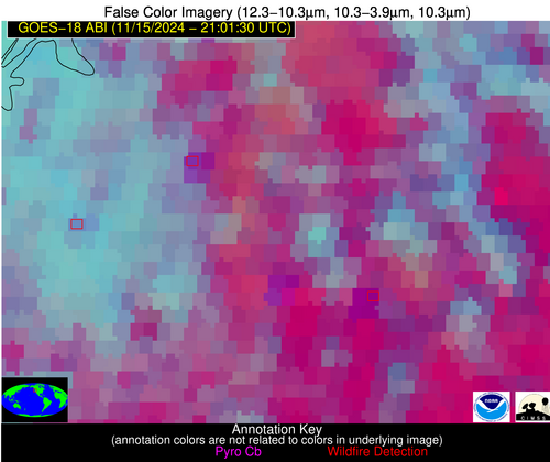
| Latest Satellite Imagery: | |
| View all event imagery » | |
Possible Wildfire
| Basic Information | |
|---|---|
| State/Province(s) | OR |
| Country/Countries | USA |
| County/Locality(s) | Douglas County, OR |
| NWS WFO | Medford OR |
| Identification Method | Enhanced Contextual (Cloud) |
| Mean Object Date/Time | 2024-11-15 21:01:22UTC |
| Radiative Center (Lat, Lon): | 42.940000°, -123.610000° |
| Nearby Counties (meeting alert criteria): |
|
| Total Radiative Power Anomaly | n/a |
| Total Radiative Power | 126.19 MW |
| Map: | |
| Additional Information | |
| Alert Status | New Feature |
| Type of Event | Nominal Risk |
| Event Priority Ranking | 4 |
| Maximum Observed BT (3.9 um) | 306.68 K |
| Observed - Background BT (3.9 um) | 15.35 K |
| BT Anomaly (3.9 um) | 5.83 K |
| Maximum Observed - Clear RTM BT (3.9 um) | 31.96 K |
| Maximum Observed BTD (3.9-10/11/12 um) | 38.09 K |
| Observed - Background BTD (3.9-10/11/12 um) | 15.18 K |
| BTD Anomaly (3.9-10/11/12 um) | 4.71 K |
| Similar Pixel Count | 0 |
| BT Time Tendency (3.9 um) | 13.70 K |
| Image Interval | 5.00 minutes |
| Fraction of Surrounding LWIR Pixels that are Colder | 0.55 |
| Fraction of Surrounding Red Channel Pixels that are Brighter | 0.79 |
| Maximum Radiative Power | 82.06 MW |
| Maximum Radiative Power Uncertainty | 0.00 MW |
| Total Radiative Power Uncertainty | 0.00 MW |
| Mean Viewing Angle | 51.60° |
| Mean Solar Zenith Angle | 63.10° |
| Mean Glint Angle | 114.60° |
| Water Fraction | 0.00 |
| Total Pixel Area | 14.80 km2 |
| Latest Satellite Imagery: | |
| View all event imagery » | |


