Wildfire Alert Report
| Date: | 2024-11-08 |
|---|---|
| Time: | 00:36:17 |
| Production Date and Time: | 2024-11-08 00:40:40 UTC |
| Primary Instrument: | GOES-16 ABI |
| Wmo Spacecraft Id: | 152 |
| Location/orbit: | GEO |
| L1 File: | OR_ABI-L1b-RadC-M6C14_G16_s20243130036175_e20243130038548_c20243130039014.nc |
| L1 File(s) - Temporal | OR_ABI-L1b-RadC-M6C14_G16_s20243130031175_e20243130033548_c20243130034048.nc |
| Number Of Thermal Anomaly Alerts: | 3 |
Possible Wildfire
| Basic Information | |
|---|---|
| State/Province(s) | ND |
| Country/Countries | USA |
| County/Locality(s) | Ward County, ND |
| NWS WFO | Bismarck ND |
| Identification Method | Enhanced Contextual (Clear) |
| Mean Object Date/Time | 2024-11-08 00:36:20UTC |
| Radiative Center (Lat, Lon): | 48.030000°, -101.860000° |
| Nearby Counties (meeting alert criteria): |
|
| Total Radiative Power Anomaly | n/a |
| Total Radiative Power | 6.18 MW |
| Map: | |
| Additional Information | |
| Alert Status | New Feature |
| Type of Event | Nominal Risk |
| Event Priority Ranking | 4 |
| Maximum Observed BT (3.9 um) | 276.52 K |
| Observed - Background BT (3.9 um) | 4.19 K |
| BT Anomaly (3.9 um) | 6.37 K |
| Maximum Observed - Clear RTM BT (3.9 um) | 1.37 K |
| Maximum Observed BTD (3.9-10/11/12 um) | 2.26 K |
| Observed - Background BTD (3.9-10/11/12 um) | 3.53 K |
| BTD Anomaly (3.9-10/11/12 um) | 16.07 K |
| Similar Pixel Count | 1 |
| BT Time Tendency (3.9 um) | 3.00 K |
| Image Interval | 5.00 minutes |
| Fraction of Surrounding LWIR Pixels that are Colder | 0.85 |
| Fraction of Surrounding Red Channel Pixels that are Brighter | 1.00 |
| Maximum Radiative Power | 6.18 MW |
| Maximum Radiative Power Uncertainty | 0.00 MW |
| Total Radiative Power Uncertainty | 0.00 MW |
| Mean Viewing Angle | 61.30° |
| Mean Solar Zenith Angle | 103.10° |
| Mean Glint Angle | 76.50° |
| Water Fraction | 0.00 |
| Total Pixel Area | 11.00 km2 |
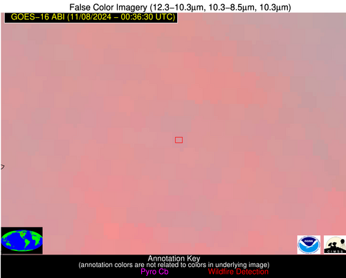
| Latest Satellite Imagery: | |
| View all event imagery » | |
Possible Wildfire
| Basic Information | |
|---|---|
| State/Province(s) | ID |
| Country/Countries | USA |
| County/Locality(s) | Kootenai County, ID |
| NWS WFO | Spokane WA |
| Identification Method | Enhanced Contextual (Clear) |
| Mean Object Date/Time | 2024-11-08 00:36:19UTC |
| Radiative Center (Lat, Lon): | 47.900000°, -116.910000° |
| Nearby Counties (meeting alert criteria): |
|
| Total Radiative Power Anomaly | n/a |
| Total Radiative Power | 7.66 MW |
| Map: | |
| Additional Information | |
| Alert Status | New Feature |
| Type of Event | Nominal Risk |
| Event Priority Ranking | 4 |
| Maximum Observed BT (3.9 um) | 276.21 K |
| Observed - Background BT (3.9 um) | 3.33 K |
| BT Anomaly (3.9 um) | 4.61 K |
| Maximum Observed - Clear RTM BT (3.9 um) | 3.96 K |
| Maximum Observed BTD (3.9-10/11/12 um) | 3.61 K |
| Observed - Background BTD (3.9-10/11/12 um) | 3.23 K |
| BTD Anomaly (3.9-10/11/12 um) | 9.26 K |
| Similar Pixel Count | 1 |
| BT Time Tendency (3.9 um) | 0.10 K |
| Image Interval | 5.00 minutes |
| Fraction of Surrounding LWIR Pixels that are Colder | 0.63 |
| Fraction of Surrounding Red Channel Pixels that are Brighter | 1.00 |
| Maximum Radiative Power | 7.66 MW |
| Maximum Radiative Power Uncertainty | 0.00 MW |
| Total Radiative Power Uncertainty | 0.00 MW |
| Mean Viewing Angle | 68.50° |
| Mean Solar Zenith Angle | 93.40° |
| Mean Glint Angle | 64.60° |
| Water Fraction | 0.00 |
| Total Pixel Area | 18.50 km2 |
| Latest Satellite Imagery: | |
| View all event imagery » | |
Possible Wildfire
| Basic Information | |
|---|---|
| State/Province(s) | OR |
| Country/Countries | USA |
| County/Locality(s) | Polk County, OR |
| NWS WFO | Portland OR |
| Identification Method | Enhanced Contextual (Clear) |
| Mean Object Date/Time | 2024-11-08 00:36:48UTC |
| Radiative Center (Lat, Lon): | 44.750000°, -123.570000° |
| Nearby Counties (meeting alert criteria): |
|
| Total Radiative Power Anomaly | n/a |
| Total Radiative Power | 51.02 MW |
| Map: | |
| Additional Information | |
| Alert Status | New Feature |
| Type of Event | Nominal Risk |
| Event Priority Ranking | 4 |
| Maximum Observed BT (3.9 um) | 287.30 K |
| Observed - Background BT (3.9 um) | 7.02 K |
| BT Anomaly (3.9 um) | 5.98 K |
| Maximum Observed - Clear RTM BT (3.9 um) | 7.82 K |
| Maximum Observed BTD (3.9-10/11/12 um) | 8.11 K |
| Observed - Background BTD (3.9-10/11/12 um) | 6.66 K |
| BTD Anomaly (3.9-10/11/12 um) | 5.49 K |
| Similar Pixel Count | 2 |
| BT Time Tendency (3.9 um) | 0.90 K |
| Image Interval | 5.00 minutes |
| Fraction of Surrounding LWIR Pixels that are Colder | 0.81 |
| Fraction of Surrounding Red Channel Pixels that are Brighter | 0.92 |
| Maximum Radiative Power | 31.21 MW |
| Maximum Radiative Power Uncertainty | 0.00 MW |
| Total Radiative Power Uncertainty | 0.00 MW |
| Mean Viewing Angle | 70.60° |
| Mean Solar Zenith Angle | 87.90° |
| Mean Glint Angle | 59.30° |
| Water Fraction | 0.00 |
| Total Pixel Area | 46.00 km2 |
| Latest Satellite Imagery: | |
| View all event imagery » | |


