Please consider accessing NGFS detections and satellite imagery through the NOAA/NESDIS Wildland Fire Data Portal: https://fire.data.nesdis.noaa.gov/map/
Wildfire Notification Report
| Date: | 2024-10-30 |
|---|---|
| Time: | 19:51:17 |
| Production Date and Time: | 2024-10-30 19:56:08 UTC |
| Primary Instrument: | GOES-16 ABI |
| Wmo Spacecraft Id: | 152 |
| Location/orbit: | GEO |
| L1 File: | OR_ABI-L1b-RadC-M6C14_G16_s20243041951171_e20243041953544_c20243041954029.nc |
| L1 File(s) - Temporal | OR_ABI-L1b-RadC-M6C14_G16_s20243041946171_e20243041948544_c20243041949024.nc |
| Number Of Thermal Anomaly Alerts: | 8 |
Possible Wildfire
| Basic Information | |
|---|---|
| State/Province(s) | Saskatchewan |
| Country/Countries | Canada |
| County/Locality(s) | Division No. 13, Saskatchewan |
| NWS WFO | N/A |
| Identification Method | Enhanced Contextual (Clear) |
| Mean Object Date/Time | 2024-10-30 19:51:20UTC |
| Radiative Center (Lat, Lon): | 52.040000°, -109.790000° |
| Nearby Counties (meeting alert criteria): |
|
| Total Radiative Power Anomaly | n/a |
| Total Radiative Power | 34.85 MW |
| Map: | |
| Additional Information | |
| Alert Status | New Feature |
| Type of Event | Nominal Risk |
| Event Priority Ranking | 4 |
| Maximum Observed BT (3.9 um) | 290.51 K |
| Observed - Background BT (3.9 um) | 4.40 K |
| BT Anomaly (3.9 um) | 6.89 K |
| Maximum Observed - Clear RTM BT (3.9 um) | 15.59 K |
| Maximum Observed BTD (3.9-10/11/12 um) | 11.71 K |
| Observed - Background BTD (3.9-10/11/12 um) | 4.40 K |
| BTD Anomaly (3.9-10/11/12 um) | 9.39 K |
| Similar Pixel Count | 8 |
| BT Time Tendency (3.9 um) | 3.50 K |
| Image Interval | 5.00 minutes |
| Fraction of Surrounding LWIR Pixels that are Colder | 0.41 |
| Fraction of Surrounding Red Channel Pixels that are Brighter | 0.96 |
| Maximum Radiative Power | 18.30 MW |
| Maximum Radiative Power Uncertainty | 0.00 MW |
| Total Radiative Power Uncertainty | 0.00 MW |
| Mean Viewing Angle | 68.10° |
| Mean Solar Zenith Angle | 66.80° |
| Mean Glint Angle | 110.70° |
| Water Fraction | 0.00 |
| Total Pixel Area | 33.10 km2 |
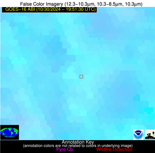
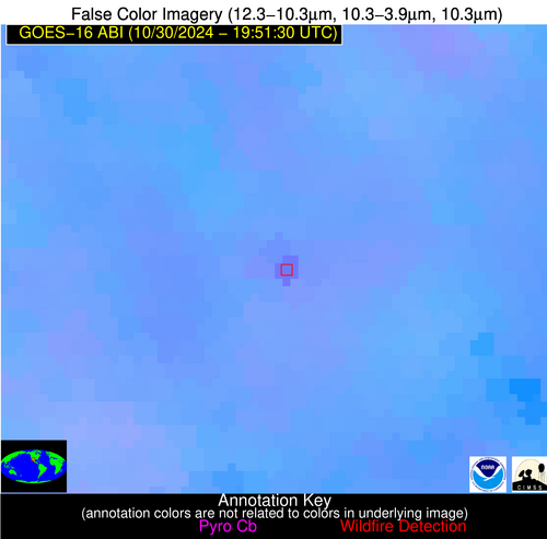
| Latest Satellite Imagery: | |
| View all event imagery » | |
Possible Wildfire
| Basic Information | |
|---|---|
| State/Province(s) | Saskatchewan |
| Country/Countries | Canada |
| County/Locality(s) | Division No. 1, Saskatchewan |
| NWS WFO | N/A |
| Identification Method | Enhanced Contextual (Clear) |
| Mean Object Date/Time | 2024-10-30 19:51:20UTC |
| Radiative Center (Lat, Lon): | 49.540000°, -102.520000° |
| Nearby Counties (meeting alert criteria): |
|
| Total Radiative Power Anomaly | n/a |
| Total Radiative Power | 26.36 MW |
| Map: | |
| Additional Information | |
| Alert Status | New Feature |
| Type of Event | Nominal Risk |
| Event Priority Ranking | 4 |
| Maximum Observed BT (3.9 um) | 294.27 K |
| Observed - Background BT (3.9 um) | 7.79 K |
| BT Anomaly (3.9 um) | 6.62 K |
| Maximum Observed - Clear RTM BT (3.9 um) | 18.02 K |
| Maximum Observed BTD (3.9-10/11/12 um) | 14.20 K |
| Observed - Background BTD (3.9-10/11/12 um) | 7.66 K |
| BTD Anomaly (3.9-10/11/12 um) | 10.74 K |
| Similar Pixel Count | 3 |
| BT Time Tendency (3.9 um) | 4.80 K |
| Image Interval | 5.00 minutes |
| Fraction of Surrounding LWIR Pixels that are Colder | 0.62 |
| Fraction of Surrounding Red Channel Pixels that are Brighter | 0.82 |
| Maximum Radiative Power | 26.36 MW |
| Maximum Radiative Power Uncertainty | 0.00 MW |
| Total Radiative Power Uncertainty | 0.00 MW |
| Mean Viewing Angle | 62.90° |
| Mean Solar Zenith Angle | 65.70° |
| Mean Glint Angle | 106.20° |
| Water Fraction | 0.00 |
| Total Pixel Area | 11.80 km2 |
| Latest Satellite Imagery: | |
| View all event imagery » | |
Possible Wildfire
| Basic Information | |
|---|---|
| State/Province(s) | Manitoba |
| Country/Countries | Canada |
| County/Locality(s) | Division No. 5, Manitoba |
| NWS WFO | N/A |
| Identification Method | Enhanced Contextual (Cloud) |
| Mean Object Date/Time | 2024-10-30 19:51:20UTC |
| Radiative Center (Lat, Lon): | 49.190000°, -100.780000° |
| Nearby Counties (meeting alert criteria): |
|
| Total Radiative Power Anomaly | n/a |
| Total Radiative Power | 38.91 MW |
| Map: | |
| Additional Information | |
| Alert Status | New Feature |
| Type of Event | Nominal Risk |
| Event Priority Ranking | 4 |
| Maximum Observed BT (3.9 um) | 298.44 K |
| Observed - Background BT (3.9 um) | 10.90 K |
| BT Anomaly (3.9 um) | 9.14 K |
| Maximum Observed - Clear RTM BT (3.9 um) | 21.27 K |
| Maximum Observed BTD (3.9-10/11/12 um) | 17.57 K |
| Observed - Background BTD (3.9-10/11/12 um) | 10.70 K |
| BTD Anomaly (3.9-10/11/12 um) | 16.08 K |
| Similar Pixel Count | 0 |
| BT Time Tendency (3.9 um) | 8.40 K |
| Image Interval | 5.00 minutes |
| Fraction of Surrounding LWIR Pixels that are Colder | 0.70 |
| Fraction of Surrounding Red Channel Pixels that are Brighter | 0.92 |
| Maximum Radiative Power | 38.91 MW |
| Maximum Radiative Power Uncertainty | 0.00 MW |
| Total Radiative Power Uncertainty | 0.00 MW |
| Mean Viewing Angle | 61.90° |
| Mean Solar Zenith Angle | 65.80° |
| Mean Glint Angle | 105.60° |
| Water Fraction | 0.00 |
| Total Pixel Area | 11.20 km2 |
| Latest Satellite Imagery: | |
| View all event imagery » | |
Possible Wildfire
| Basic Information | |
|---|---|
| State/Province(s) | ND |
| Country/Countries | USA |
| County/Locality(s) | Pierce County, ND |
| NWS WFO | Bismarck ND |
| Identification Method | Enhanced Contextual (Clear) |
| Mean Object Date/Time | 2024-10-30 19:51:20UTC |
| Radiative Center (Lat, Lon): | 48.470000°, -99.710000° |
| Nearby Counties (meeting alert criteria): |
|
| Total Radiative Power Anomaly | n/a |
| Total Radiative Power | 22.56 MW |
| Map: | |
| Additional Information | |
| Alert Status | New Feature |
| Type of Event | Nominal Risk |
| Event Priority Ranking | 4 |
| Maximum Observed BT (3.9 um) | 292.84 K |
| Observed - Background BT (3.9 um) | 5.18 K |
| BT Anomaly (3.9 um) | 3.87 K |
| Maximum Observed - Clear RTM BT (3.9 um) | 14.02 K |
| Maximum Observed BTD (3.9-10/11/12 um) | 10.76 K |
| Observed - Background BTD (3.9-10/11/12 um) | 4.45 K |
| BTD Anomaly (3.9-10/11/12 um) | 8.28 K |
| Similar Pixel Count | 9 |
| BT Time Tendency (3.9 um) | 3.80 K |
| Image Interval | 5.00 minutes |
| Fraction of Surrounding LWIR Pixels that are Colder | 0.75 |
| Fraction of Surrounding Red Channel Pixels that are Brighter | 1.00 |
| Maximum Radiative Power | 12.85 MW |
| Maximum Radiative Power Uncertainty | 0.00 MW |
| Total Radiative Power Uncertainty | 0.00 MW |
| Mean Viewing Angle | 60.80° |
| Mean Solar Zenith Angle | 65.50° |
| Mean Glint Angle | 104.50° |
| Water Fraction | 0.00 |
| Total Pixel Area | 21.20 km2 |
| Latest Satellite Imagery: | |
| View all event imagery » | |
Possible Wildfire
| Basic Information | |
|---|---|
| State/Province(s) | ND |
| Country/Countries | USA |
| County/Locality(s) | Nelson County, ND |
| NWS WFO | Grand Forks ND |
| Identification Method | Enhanced Contextual (Cloud) |
| Mean Object Date/Time | 2024-10-30 19:51:20UTC |
| Radiative Center (Lat, Lon): | 48.080000°, -98.220000° |
| Nearby Counties (meeting alert criteria): |
|
| Total Radiative Power Anomaly | n/a |
| Total Radiative Power | 33.74 MW |
| Map: | |
| Additional Information | |
| Alert Status | New Feature |
| Type of Event | Nominal Risk |
| Event Priority Ranking | 4 |
| Maximum Observed BT (3.9 um) | 297.76 K |
| Observed - Background BT (3.9 um) | 11.35 K |
| BT Anomaly (3.9 um) | 13.21 K |
| Maximum Observed - Clear RTM BT (3.9 um) | 19.26 K |
| Maximum Observed BTD (3.9-10/11/12 um) | 16.55 K |
| Observed - Background BTD (3.9-10/11/12 um) | 10.37 K |
| BTD Anomaly (3.9-10/11/12 um) | 28.56 K |
| Similar Pixel Count | 0 |
| BT Time Tendency (3.9 um) | 9.40 K |
| Image Interval | 5.00 minutes |
| Fraction of Surrounding LWIR Pixels that are Colder | 0.94 |
| Fraction of Surrounding Red Channel Pixels that are Brighter | 1.00 |
| Maximum Radiative Power | 33.74 MW |
| Maximum Radiative Power Uncertainty | 0.00 MW |
| Total Radiative Power Uncertainty | 0.00 MW |
| Mean Viewing Angle | 59.90° |
| Mean Solar Zenith Angle | 65.50° |
| Mean Glint Angle | 104.00° |
| Water Fraction | 0.00 |
| Total Pixel Area | 10.10 km2 |
| Latest Satellite Imagery: | |
| View all event imagery » | |
Possible Wildfire
| Basic Information | |
|---|---|
| State/Province(s) | AL |
| Country/Countries | USA |
| County/Locality(s) | Covington County, AL |
| NWS WFO | Mobile AL |
| Identification Method | Enhanced Contextual (Clear) |
| Mean Object Date/Time | 2024-10-30 19:52:21UTC |
| Radiative Center (Lat, Lon): | 31.350000°, -86.580000° |
| Nearby Counties (meeting alert criteria): |
|
| Total Radiative Power Anomaly | n/a |
| Total Radiative Power | 13.34 MW |
| Map: | |
| Additional Information | |
| Alert Status | New Feature |
| Type of Event | Nominal Risk |
| Event Priority Ranking | 4 |
| Maximum Observed BT (3.9 um) | 305.54 K |
| Observed - Background BT (3.9 um) | 5.43 K |
| BT Anomaly (3.9 um) | 5.78 K |
| Maximum Observed - Clear RTM BT (3.9 um) | 8.31 K |
| Maximum Observed BTD (3.9-10/11/12 um) | 13.34 K |
| Observed - Background BTD (3.9-10/11/12 um) | 4.61 K |
| BTD Anomaly (3.9-10/11/12 um) | 4.48 K |
| Similar Pixel Count | 16 |
| BT Time Tendency (3.9 um) | 1.60 K |
| Image Interval | 5.00 minutes |
| Fraction of Surrounding LWIR Pixels that are Colder | 0.90 |
| Fraction of Surrounding Red Channel Pixels that are Brighter | 0.98 |
| Maximum Radiative Power | 13.34 MW |
| Maximum Radiative Power Uncertainty | 0.00 MW |
| Total Radiative Power Uncertainty | 0.00 MW |
| Mean Viewing Angle | 38.70° |
| Mean Solar Zenith Angle | 56.60° |
| Mean Glint Angle | 78.70° |
| Water Fraction | 0.00 |
| Total Pixel Area | 5.60 km2 |
| Latest Satellite Imagery: | |
| View all event imagery » | |
Possible Wildfire
| Basic Information | |
|---|---|
| State/Province(s) | LA |
| Country/Countries | USA |
| County/Locality(s) | St. Landry Parish, LA |
| NWS WFO | Lake Charles LA |
| Identification Method | Enhanced Contextual (Clear) |
| Mean Object Date/Time | 2024-10-30 19:52:20UTC |
| Radiative Center (Lat, Lon): | 30.780000°, -91.870000° |
| Nearby Counties (meeting alert criteria): |
|
| Total Radiative Power Anomaly | n/a |
| Total Radiative Power | 3.63 MW |
| Map: | |
| Additional Information | |
| Alert Status | New Feature |
| Type of Event | Nominal Risk |
| Event Priority Ranking | 4 |
| Maximum Observed BT (3.9 um) | 305.25 K |
| Observed - Background BT (3.9 um) | 2.83 K |
| BT Anomaly (3.9 um) | 1.95 K |
| Maximum Observed - Clear RTM BT (3.9 um) | 6.10 K |
| Maximum Observed BTD (3.9-10/11/12 um) | 17.39 K |
| Observed - Background BTD (3.9-10/11/12 um) | 3.32 K |
| BTD Anomaly (3.9-10/11/12 um) | 2.59 K |
| Similar Pixel Count | 25 |
| BT Time Tendency (3.9 um) | 1.20 K |
| Image Interval | 5.00 minutes |
| Fraction of Surrounding LWIR Pixels that are Colder | 0.54 |
| Fraction of Surrounding Red Channel Pixels that are Brighter | 0.81 |
| Maximum Radiative Power | 3.63 MW |
| Maximum Radiative Power Uncertainty | 0.00 MW |
| Total Radiative Power Uncertainty | 0.00 MW |
| Mean Viewing Angle | 40.40° |
| Mean Solar Zenith Angle | 53.20° |
| Mean Glint Angle | 75.00° |
| Water Fraction | 0.00 |
| Total Pixel Area | 5.80 km2 |
| Latest Satellite Imagery: | |
| View all event imagery » | |
Possible Wildfire
| Basic Information | |
|---|---|
| State/Province(s) | Chihuahua |
| Country/Countries | Mexico |
| County/Locality(s) | Nuevo Casas Grandes, Chihuahua |
| NWS WFO | N/A |
| Identification Method | Enhanced Contextual (Clear) |
| Mean Object Date/Time | 2024-10-30 19:52:49UTC |
| Radiative Center (Lat, Lon): | 30.640000°, -107.840000° |
| Nearby Counties (meeting alert criteria): |
|
| Total Radiative Power Anomaly | n/a |
| Total Radiative Power | 30.54 MW |
| Map: | |
| Additional Information | |
| Alert Status | New Feature |
| Type of Event | Nominal Risk |
| Event Priority Ranking | 4 |
| Maximum Observed BT (3.9 um) | 316.83 K |
| Observed - Background BT (3.9 um) | 5.11 K |
| BT Anomaly (3.9 um) | 3.06 K |
| Maximum Observed - Clear RTM BT (3.9 um) | 23.00 K |
| Maximum Observed BTD (3.9-10/11/12 um) | 15.55 K |
| Observed - Background BTD (3.9-10/11/12 um) | 5.68 K |
| BTD Anomaly (3.9-10/11/12 um) | 7.03 K |
| Similar Pixel Count | 8 |
| BT Time Tendency (3.9 um) | 3.60 K |
| Image Interval | 5.00 minutes |
| Fraction of Surrounding LWIR Pixels that are Colder | 0.31 |
| Fraction of Surrounding Red Channel Pixels that are Brighter | 0.79 |
| Maximum Radiative Power | 30.54 MW |
| Maximum Radiative Power Uncertainty | 0.00 MW |
| Total Radiative Power Uncertainty | 0.00 MW |
| Mean Viewing Angle | 50.50° |
| Mean Solar Zenith Angle | 46.60° |
| Mean Glint Angle | 75.50° |
| Water Fraction | 0.00 |
| Total Pixel Area | 7.70 km2 |
| Latest Satellite Imagery: | |
| View all event imagery » | |
