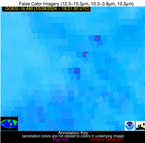
Wildfire Alert Report
| Date: | 2024-10-28 |
|---|---|
| Time: | 19:21:17 |
| Production Date and Time: | 2024-10-28 19:25:55 UTC |
| Primary Instrument: | GOES-16 ABI |
| Wmo Spacecraft Id: | 152 |
| Location/orbit: | GEO |
| L1 File: | OR_ABI-L1b-RadC-M6C14_G16_s20243021921170_e20243021923543_c20243021924001.nc |
| L1 File(s) - Temporal | OR_ABI-L1b-RadC-M6C14_G16_s20243021916170_e20243021918543_c20243021919019.nc |
| Number Of Thermal Anomaly Alerts: | 10 |
Possible Wildfire
| Basic Information | |
|---|---|
| State/Province(s) | Manitoba |
| Country/Countries | Canada |
| County/Locality(s) | Division No. 15, Manitoba |
| NWS WFO | N/A |
| Identification Method | Enhanced Contextual (Clear) |
| Mean Object Date/Time | 2024-10-28 19:21:20UTC |
| Radiative Center (Lat, Lon): | 50.320000°, -100.930000° |
| Nearby Counties (meeting alert criteria): |
|
| Total Radiative Power Anomaly | n/a |
| Total Radiative Power | 31.65 MW |
| Map: | |
| Additional Information | |
| Alert Status | New Feature |
| Type of Event | Nominal Risk |
| Event Priority Ranking | 4 |
| Maximum Observed BT (3.9 um) | 299.66 K |
| Observed - Background BT (3.9 um) | 7.80 K |
| BT Anomaly (3.9 um) | 10.30 K |
| Maximum Observed - Clear RTM BT (3.9 um) | 16.70 K |
| Maximum Observed BTD (3.9-10/11/12 um) | 15.30 K |
| Observed - Background BTD (3.9-10/11/12 um) | 7.59 K |
| BTD Anomaly (3.9-10/11/12 um) | 11.51 K |
| Similar Pixel Count | 6 |
| BT Time Tendency (3.9 um) | 7.00 K |
| Image Interval | 5.00 minutes |
| Fraction of Surrounding LWIR Pixels that are Colder | 0.69 |
| Fraction of Surrounding Red Channel Pixels that are Brighter | 0.80 |
| Maximum Radiative Power | 31.65 MW |
| Maximum Radiative Power Uncertainty | 0.00 MW |
| Total Radiative Power Uncertainty | 0.00 MW |
| Mean Viewing Angle | 63.00° |
| Mean Solar Zenith Angle | 64.70° |
| Mean Glint Angle | 111.10° |
| Water Fraction | 0.00 |
| Total Pixel Area | 11.70 km2 |
| Latest Satellite Imagery: | |
| View all event imagery » | |
Possible Wildfire
| Basic Information | |
|---|---|
| State/Province(s) | Saskatchewan |
| Country/Countries | Canada |
| County/Locality(s) | Division No. 5, Saskatchewan |
| NWS WFO | N/A |
| Identification Method | Enhanced Contextual (Clear) |
| Mean Object Date/Time | 2024-10-28 19:21:20UTC |
| Radiative Center (Lat, Lon): | 50.050000°, -102.730000° |
| Nearby Counties (meeting alert criteria): |
|
| Total Radiative Power Anomaly | n/a |
| Total Radiative Power | 18.05 MW |
| Map: | |
| Additional Information | |
| Alert Status | New Feature |
| Type of Event | Nominal Risk |
| Event Priority Ranking | 4 |
| Maximum Observed BT (3.9 um) | 295.23 K |
| Observed - Background BT (3.9 um) | 5.09 K |
| BT Anomaly (3.9 um) | 2.95 K |
| Maximum Observed - Clear RTM BT (3.9 um) | 12.92 K |
| Maximum Observed BTD (3.9-10/11/12 um) | 12.19 K |
| Observed - Background BTD (3.9-10/11/12 um) | 4.80 K |
| BTD Anomaly (3.9-10/11/12 um) | 4.62 K |
| Similar Pixel Count | 5 |
| BT Time Tendency (3.9 um) | 2.20 K |
| Image Interval | 5.00 minutes |
| Fraction of Surrounding LWIR Pixels that are Colder | 0.48 |
| Fraction of Surrounding Red Channel Pixels that are Brighter | 0.69 |
| Maximum Radiative Power | 18.05 MW |
| Maximum Radiative Power Uncertainty | 0.00 MW |
| Total Radiative Power Uncertainty | 0.00 MW |
| Mean Viewing Angle | 63.40° |
| Mean Solar Zenith Angle | 64.20° |
| Mean Glint Angle | 110.80° |
| Water Fraction | 0.00 |
| Total Pixel Area | 12.10 km2 |
| Latest Satellite Imagery: | |
| View all event imagery » | |
Possible Wildfire
| Basic Information | |
|---|---|
| State/Province(s) | Manitoba |
| Country/Countries | Canada |
| County/Locality(s) | Division No. 3, Manitoba |
| NWS WFO | N/A |
| Identification Method | Enhanced Contextual (Clear) |
| Mean Object Date/Time | 2024-10-28 19:21:20UTC |
| Radiative Center (Lat, Lon): | 49.360000°, -97.190000° |
| Nearby Counties (meeting alert criteria): |
|
| Total Radiative Power Anomaly | n/a |
| Total Radiative Power | 34.84 MW |
| Map: | |
| Additional Information | |
| Alert Status | New Feature |
| Type of Event | Nominal Risk |
| Event Priority Ranking | 4 |
| Maximum Observed BT (3.9 um) | 297.44 K |
| Observed - Background BT (3.9 um) | 4.44 K |
| BT Anomaly (3.9 um) | 7.48 K |
| Maximum Observed - Clear RTM BT (3.9 um) | 12.48 K |
| Maximum Observed BTD (3.9-10/11/12 um) | 11.17 K |
| Observed - Background BTD (3.9-10/11/12 um) | 4.62 K |
| BTD Anomaly (3.9-10/11/12 um) | 13.53 K |
| Similar Pixel Count | 4 |
| BT Time Tendency (3.9 um) | 2.60 K |
| Image Interval | 5.00 minutes |
| Fraction of Surrounding LWIR Pixels that are Colder | 0.45 |
| Fraction of Surrounding Red Channel Pixels that are Brighter | 0.70 |
| Maximum Radiative Power | 17.56 MW |
| Maximum Radiative Power Uncertainty | 0.00 MW |
| Total Radiative Power Uncertainty | 0.00 MW |
| Mean Viewing Angle | 60.70° |
| Mean Solar Zenith Angle | 64.50° |
| Mean Glint Angle | 109.20° |
| Water Fraction | 0.00 |
| Total Pixel Area | 20.70 km2 |
| Latest Satellite Imagery: | |
| View all event imagery » | |
Possible Wildfire
| Basic Information | |
|---|---|
| State/Province(s) | ND |
| Country/Countries | USA |
| County/Locality(s) | Rolette County, ND |
| NWS WFO | Bismarck ND |
| Identification Method | Enhanced Contextual (Clear) |
| Mean Object Date/Time | 2024-10-28 19:21:20UTC |
| Radiative Center (Lat, Lon): | 48.700000°, -99.650000° |
| Nearby Counties (meeting alert criteria): |
|
| Total Radiative Power Anomaly | n/a |
| Total Radiative Power | 58.52 MW |
| Map: | |
| Additional Information | |
| Alert Status | New Feature |
| Type of Event | Nominal Risk |
| Event Priority Ranking | 4 |
| Maximum Observed BT (3.9 um) | 301.16 K |
| Observed - Background BT (3.9 um) | 6.52 K |
| BT Anomaly (3.9 um) | 4.62 K |
| Maximum Observed - Clear RTM BT (3.9 um) | 15.46 K |
| Maximum Observed BTD (3.9-10/11/12 um) | 12.65 K |
| Observed - Background BTD (3.9-10/11/12 um) | 5.64 K |
| BTD Anomaly (3.9-10/11/12 um) | 7.80 K |
| Similar Pixel Count | 4 |
| BT Time Tendency (3.9 um) | 4.90 K |
| Image Interval | 5.00 minutes |
| Fraction of Surrounding LWIR Pixels that are Colder | 0.86 |
| Fraction of Surrounding Red Channel Pixels that are Brighter | 0.87 |
| Maximum Radiative Power | 22.32 MW |
| Maximum Radiative Power Uncertainty | 0.00 MW |
| Total Radiative Power Uncertainty | 0.00 MW |
| Mean Viewing Angle | 61.00° |
| Mean Solar Zenith Angle | 63.40° |
| Mean Glint Angle | 108.20° |
| Water Fraction | 0.00 |
| Total Pixel Area | 32.00 km2 |
| Latest Satellite Imagery: | |
| View all event imagery » | |
Possible Wildfire
| Basic Information | |
|---|---|
| State/Province(s) | OR |
| Country/Countries | USA |
| County/Locality(s) | Clatsop County, OR |
| NWS WFO | Portland OR |
| Identification Method | Enhanced Contextual (Clear) |
| Mean Object Date/Time | 2024-10-28 19:21:18UTC |
| Radiative Center (Lat, Lon): | 45.890000°, -123.920000° |
| Nearby Counties (meeting alert criteria): |
|
| Total Radiative Power Anomaly | n/a |
| Total Radiative Power | 49.21 MW |
| Map: | |
| Additional Information | |
| Alert Status | New Feature |
| Type of Event | Nominal Risk |
| Event Priority Ranking | 4 |
| Maximum Observed BT (3.9 um) | 292.01 K |
| Observed - Background BT (3.9 um) | 11.64 K |
| BT Anomaly (3.9 um) | 4.69 K |
| Maximum Observed - Clear RTM BT (3.9 um) | 15.86 K |
| Maximum Observed BTD (3.9-10/11/12 um) | 19.22 K |
| Observed - Background BTD (3.9-10/11/12 um) | 11.00 K |
| BTD Anomaly (3.9-10/11/12 um) | 4.02 K |
| Similar Pixel Count | 2 |
| BT Time Tendency (3.9 um) | 7.70 K |
| Image Interval | 5.00 minutes |
| Fraction of Surrounding LWIR Pixels that are Colder | 0.81 |
| Fraction of Surrounding Red Channel Pixels that are Brighter | 0.88 |
| Maximum Radiative Power | 49.21 MW |
| Maximum Radiative Power Uncertainty | 0.00 MW |
| Total Radiative Power Uncertainty | 0.00 MW |
| Mean Viewing Angle | 71.40° |
| Mean Solar Zenith Angle | 59.80° |
| Mean Glint Angle | 113.40° |
| Water Fraction | 0.00 |
| Total Pixel Area | 24.70 km2 |
| Latest Satellite Imagery: | |
| View all event imagery » | |
Possible Wildfire
| Basic Information | |
|---|---|
| State/Province(s) | OK |
| Country/Countries | USA |
| County/Locality(s) | Stephens County, OK |
| NWS WFO | Norman OK |
| Identification Method | Enhanced Contextual (Clear) |
| Mean Object Date/Time | 2024-10-28 19:22:20UTC |
| Radiative Center (Lat, Lon): | 34.420000°, -97.980000° |
| Nearby Counties (meeting alert criteria): |
|
| Total Radiative Power Anomaly | n/a |
| Total Radiative Power | 41.48 MW |
| Map: | |
| Additional Information | |
| Alert Status | New Feature |
| Type of Event | Elevated SPC Risk |
| Event Priority Ranking | 3 |
| Maximum Observed BT (3.9 um) | 314.73 K |
| Observed - Background BT (3.9 um) | 5.74 K |
| BT Anomaly (3.9 um) | 5.89 K |
| Maximum Observed - Clear RTM BT (3.9 um) | 12.94 K |
| Maximum Observed BTD (3.9-10/11/12 um) | 14.80 K |
| Observed - Background BTD (3.9-10/11/12 um) | 5.25 K |
| BTD Anomaly (3.9-10/11/12 um) | 9.99 K |
| Similar Pixel Count | 8 |
| BT Time Tendency (3.9 um) | 4.70 K |
| Image Interval | 5.00 minutes |
| Fraction of Surrounding LWIR Pixels that are Colder | 0.82 |
| Fraction of Surrounding Red Channel Pixels that are Brighter | 1.00 |
| Maximum Radiative Power | 23.77 MW |
| Maximum Radiative Power Uncertainty | 0.00 MW |
| Total Radiative Power Uncertainty | 0.00 MW |
| Mean Viewing Angle | 47.00° |
| Mean Solar Zenith Angle | 50.20° |
| Mean Glint Angle | 82.20° |
| Water Fraction | 0.00 |
| Total Pixel Area | 13.60 km2 |
| Latest Satellite Imagery: | |
| View all event imagery » | |
Possible Wildfire
| Basic Information | |
|---|---|
| State/Province(s) | MS |
| Country/Countries | USA |
| County/Locality(s) | Montgomery County, MS |
| NWS WFO | Jackson MS |
| Identification Method | Enhanced Contextual (Cloud) |
| Mean Object Date/Time | 2024-10-28 19:22:21UTC |
| Radiative Center (Lat, Lon): | 33.660000°, -89.660000° |
| Nearby Counties (meeting alert criteria): |
|
| Total Radiative Power Anomaly | n/a |
| Total Radiative Power | 34.07 MW |
| Map: | |
| Additional Information | |
| Alert Status | New Feature |
| Type of Event | Nominal Risk |
| Event Priority Ranking | 4 |
| Maximum Observed BT (3.9 um) | 311.91 K |
| Observed - Background BT (3.9 um) | 10.08 K |
| BT Anomaly (3.9 um) | 9.97 K |
| Maximum Observed - Clear RTM BT (3.9 um) | 13.87 K |
| Maximum Observed BTD (3.9-10/11/12 um) | 17.98 K |
| Observed - Background BTD (3.9-10/11/12 um) | 9.40 K |
| BTD Anomaly (3.9-10/11/12 um) | 12.27 K |
| Similar Pixel Count | 0 |
| BT Time Tendency (3.9 um) | 7.10 K |
| Image Interval | 5.00 minutes |
| Fraction of Surrounding LWIR Pixels that are Colder | 0.87 |
| Fraction of Surrounding Red Channel Pixels that are Brighter | 1.00 |
| Maximum Radiative Power | 34.07 MW |
| Maximum Radiative Power Uncertainty | 0.00 MW |
| Total Radiative Power Uncertainty | 0.00 MW |
| Mean Viewing Angle | 42.30° |
| Mean Solar Zenith Angle | 52.50° |
| Mean Glint Angle | 81.40° |
| Water Fraction | 0.00 |
| Total Pixel Area | 6.00 km2 |
| Latest Satellite Imagery: | |
| View all event imagery » | |
Possible Wildfire
| Basic Information | |
|---|---|
| State/Province(s) | LA |
| Country/Countries | USA |
| County/Locality(s) | Avoyelles Parish, LA |
| NWS WFO | Lake Charles LA |
| Identification Method | Enhanced Contextual (Clear) |
| Mean Object Date/Time | 2024-10-28 19:22:20UTC |
| Radiative Center (Lat, Lon): | 30.850000°, -92.210000° |
| Nearby Counties (meeting alert criteria): |
|
| Total Radiative Power Anomaly | n/a |
| Total Radiative Power | 39.91 MW |
| Map: | |
| Additional Information | |
| Alert Status | New Feature |
| Type of Event | Nominal Risk |
| Event Priority Ranking | 4 |
| Maximum Observed BT (3.9 um) | 318.41 K |
| Observed - Background BT (3.9 um) | 11.05 K |
| BT Anomaly (3.9 um) | 4.77 K |
| Maximum Observed - Clear RTM BT (3.9 um) | 18.27 K |
| Maximum Observed BTD (3.9-10/11/12 um) | 20.02 K |
| Observed - Background BTD (3.9-10/11/12 um) | 9.64 K |
| BTD Anomaly (3.9-10/11/12 um) | 4.69 K |
| Similar Pixel Count | 3 |
| BT Time Tendency (3.9 um) | 6.50 K |
| Image Interval | 5.00 minutes |
| Fraction of Surrounding LWIR Pixels that are Colder | 0.98 |
| Fraction of Surrounding Red Channel Pixels that are Brighter | 0.71 |
| Maximum Radiative Power | 39.91 MW |
| Maximum Radiative Power Uncertainty | 0.00 MW |
| Total Radiative Power Uncertainty | 0.00 MW |
| Mean Viewing Angle | 40.60° |
| Mean Solar Zenith Angle | 49.00° |
| Mean Glint Angle | 75.40° |
| Water Fraction | 0.00 |
| Total Pixel Area | 5.80 km2 |
| Latest Satellite Imagery: | |
| View all event imagery » | |
Possible Wildfire
| Basic Information | |
|---|---|
| State/Province(s) | FL |
| Country/Countries | USA |
| County/Locality(s) | Columbia County, FL |
| NWS WFO | Jacksonville FL |
| Identification Method | Enhanced Contextual (Clear) |
| Mean Object Date/Time | 2024-10-28 19:22:22UTC |
| Radiative Center (Lat, Lon): | 30.230000°, -82.640000° |
| Nearby Counties (meeting alert criteria): |
|
| Total Radiative Power Anomaly | n/a |
| Total Radiative Power | 9.17 MW |
| Map: | |
| Additional Information | |
| Alert Status | New Feature |
| Type of Event | Nominal Risk |
| Event Priority Ranking | 4 |
| Maximum Observed BT (3.9 um) | 301.81 K |
| Observed - Background BT (3.9 um) | 3.33 K |
| BT Anomaly (3.9 um) | 2.41 K |
| Maximum Observed - Clear RTM BT (3.9 um) | 5.24 K |
| Maximum Observed BTD (3.9-10/11/12 um) | 10.35 K |
| Observed - Background BTD (3.9-10/11/12 um) | 3.25 K |
| BTD Anomaly (3.9-10/11/12 um) | 3.87 K |
| Similar Pixel Count | 12 |
| BT Time Tendency (3.9 um) | 1.40 K |
| Image Interval | 5.00 minutes |
| Fraction of Surrounding LWIR Pixels that are Colder | 0.58 |
| Fraction of Surrounding Red Channel Pixels that are Brighter | 1.00 |
| Maximum Radiative Power | 9.17 MW |
| Maximum Radiative Power Uncertainty | 0.00 MW |
| Total Radiative Power Uncertainty | 0.00 MW |
| Mean Viewing Angle | 36.30° |
| Mean Solar Zenith Angle | 53.20° |
| Mean Glint Angle | 78.10° |
| Water Fraction | 0.00 |
| Total Pixel Area | 5.30 km2 |
| Latest Satellite Imagery: | |
| View all event imagery » | |
Possible Wildfire
| Basic Information | |
|---|---|
| State/Province(s) | TX |
| Country/Countries | USA |
| County/Locality(s) | Colorado County, TX |
| NWS WFO | Houston/Galveston TX |
| Identification Method | Enhanced Contextual (Clear) |
| Mean Object Date/Time | 2024-10-28 19:22:50UTC |
| Radiative Center (Lat, Lon): | 29.430000°, -96.530000° |
| Nearby Counties (meeting alert criteria): |
|
| Total Radiative Power Anomaly | n/a |
| Total Radiative Power | 43.14 MW |
| Map: | |
| Additional Information | |
| Alert Status | New Feature |
| Type of Event | Nominal Risk |
| Event Priority Ranking | 4 |
| Maximum Observed BT (3.9 um) | 313.50 K |
| Observed - Background BT (3.9 um) | 6.89 K |
| BT Anomaly (3.9 um) | 3.75 K |
| Maximum Observed - Clear RTM BT (3.9 um) | 9.98 K |
| Maximum Observed BTD (3.9-10/11/12 um) | 18.63 K |
| Observed - Background BTD (3.9-10/11/12 um) | 6.14 K |
| BTD Anomaly (3.9-10/11/12 um) | 4.42 K |
| Similar Pixel Count | 17 |
| BT Time Tendency (3.9 um) | 3.60 K |
| Image Interval | 5.00 minutes |
| Fraction of Surrounding LWIR Pixels that are Colder | 0.89 |
| Fraction of Surrounding Red Channel Pixels that are Brighter | 0.93 |
| Maximum Radiative Power | 25.50 MW |
| Maximum Radiative Power Uncertainty | 0.00 MW |
| Total Radiative Power Uncertainty | 0.00 MW |
| Mean Viewing Angle | 41.70° |
| Mean Solar Zenith Angle | 46.10° |
| Mean Glint Angle | 72.50° |
| Water Fraction | 0.00 |
| Total Pixel Area | 12.00 km2 |
| Latest Satellite Imagery: | |
| View all event imagery » | |
