Wildfire Alert Report
| Date: | 2024-10-18 |
|---|---|
| Time: | 17:56:17 |
| Production Date and Time: | 2024-10-18 18:01:00 UTC |
| Primary Instrument: | GOES-16 ABI |
| Wmo Spacecraft Id: | 152 |
| Location/orbit: | GEO |
| L1 File: | OR_ABI-L1b-RadC-M6C14_G16_s20242921756172_e20242921758545_c20242921759007.nc |
| L1 File(s) - Temporal | OR_ABI-L1b-RadC-M6C14_G16_s20242921751172_e20242921753545_c20242921754036.nc |
| Number Of Thermal Anomaly Alerts: | 5 |
Possible Wildfire
| Basic Information | |
|---|---|
| State/Province(s) | IL |
| Country/Countries | USA |
| County/Locality(s) | Lake County, IL |
| NWS WFO | Chicago IL |
| Identification Method | Enhanced Contextual (Clear) |
| Mean Object Date/Time | 2024-10-18 17:56:51UTC |
| Radiative Center (Lat, Lon): | 42.360000°, -88.030000° |
| Nearby Counties (meeting alert criteria): |
|
| Total Radiative Power Anomaly | n/a |
| Total Radiative Power | 17.77 MW |
| Map: | |
| Additional Information | |
| Alert Status | New Feature |
| Type of Event | Nominal Risk |
| Event Priority Ranking | 4 |
| Maximum Observed BT (3.9 um) | 300.05 K |
| Observed - Background BT (3.9 um) | 3.23 K |
| BT Anomaly (3.9 um) | 3.19 K |
| Maximum Observed - Clear RTM BT (3.9 um) | 10.12 K |
| Maximum Observed BTD (3.9-10/11/12 um) | 9.11 K |
| Observed - Background BTD (3.9-10/11/12 um) | 2.88 K |
| BTD Anomaly (3.9-10/11/12 um) | 6.17 K |
| Similar Pixel Count | 15 |
| BT Time Tendency (3.9 um) | 1.00 K |
| Image Interval | 5.00 minutes |
| Fraction of Surrounding LWIR Pixels that are Colder | 0.78 |
| Fraction of Surrounding Red Channel Pixels that are Brighter | 1.00 |
| Maximum Radiative Power | 9.63 MW |
| Maximum Radiative Power Uncertainty | 0.00 MW |
| Total Radiative Power Uncertainty | 0.00 MW |
| Mean Viewing Angle | 50.90° |
| Mean Solar Zenith Angle | 52.40° |
| Mean Glint Angle | 100.00° |
| Water Fraction | 0.00 |
| Total Pixel Area | 14.50 km2 |
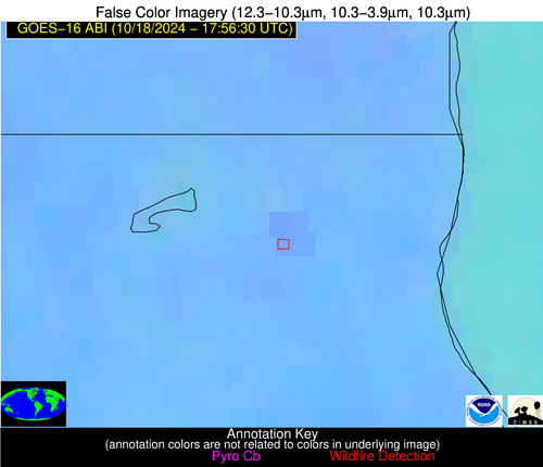
| Latest Satellite Imagery: | |
| View all event imagery » | |
Possible Wildfire
| Basic Information | |
|---|---|
| State/Province(s) | TN |
| Country/Countries | USA |
| County/Locality(s) | Marion County, TN |
| NWS WFO | Morristown TN |
| Identification Method | Enhanced Contextual (Clear) |
| Mean Object Date/Time | 2024-10-18 17:57:21UTC |
| Radiative Center (Lat, Lon): | 35.080000°, -85.580000° |
| Nearby Counties (meeting alert criteria): |
|
| Total Radiative Power Anomaly | n/a |
| Total Radiative Power | 10.96 MW |
| Map: | |
| Additional Information | |
| Alert Status | New Feature |
| Type of Event | Nominal Risk |
| Event Priority Ranking | 4 |
| Maximum Observed BT (3.9 um) | 302.32 K |
| Observed - Background BT (3.9 um) | 5.16 K |
| BT Anomaly (3.9 um) | 3.68 K |
| Maximum Observed - Clear RTM BT (3.9 um) | 12.73 K |
| Maximum Observed BTD (3.9-10/11/12 um) | 9.43 K |
| Observed - Background BTD (3.9-10/11/12 um) | 4.12 K |
| BTD Anomaly (3.9-10/11/12 um) | 7.54 K |
| Similar Pixel Count | 5 |
| BT Time Tendency (3.9 um) | 0.60 K |
| Image Interval | 5.00 minutes |
| Fraction of Surrounding LWIR Pixels that are Colder | 0.93 |
| Fraction of Surrounding Red Channel Pixels that are Brighter | 1.00 |
| Maximum Radiative Power | 10.96 MW |
| Maximum Radiative Power Uncertainty | 0.00 MW |
| Total Radiative Power Uncertainty | 0.00 MW |
| Mean Viewing Angle | 42.40° |
| Mean Solar Zenith Angle | 45.40° |
| Mean Glint Angle | 84.70° |
| Water Fraction | 0.00 |
| Total Pixel Area | 5.90 km2 |
| Latest Satellite Imagery: | |
| View all event imagery » | |
Possible Wildfire
| Basic Information | |
|---|---|
| State/Province(s) | MS |
| Country/Countries | USA |
| County/Locality(s) | Marshall County, MS |
| NWS WFO | Memphis TN |
| Identification Method | Enhanced Contextual (Clear) |
| Mean Object Date/Time | 2024-10-18 17:57:21UTC |
| Radiative Center (Lat, Lon): | 34.650000°, -89.320000° |
| Nearby Counties (meeting alert criteria): |
|
| Total Radiative Power Anomaly | n/a |
| Total Radiative Power | 9.78 MW |
| Map: | |
| Additional Information | |
| Alert Status | New Feature |
| Type of Event | Nominal Risk |
| Event Priority Ranking | 4 |
| Maximum Observed BT (3.9 um) | 301.24 K |
| Observed - Background BT (3.9 um) | 3.68 K |
| BT Anomaly (3.9 um) | 3.10 K |
| Maximum Observed - Clear RTM BT (3.9 um) | 8.60 K |
| Maximum Observed BTD (3.9-10/11/12 um) | 6.83 K |
| Observed - Background BTD (3.9-10/11/12 um) | 2.36 K |
| BTD Anomaly (3.9-10/11/12 um) | 4.46 K |
| Similar Pixel Count | 4 |
| BT Time Tendency (3.9 um) | -0.10 K |
| Image Interval | 5.00 minutes |
| Fraction of Surrounding LWIR Pixels that are Colder | 0.99 |
| Fraction of Surrounding Red Channel Pixels that are Brighter | 0.58 |
| Maximum Radiative Power | 5.18 MW |
| Maximum Radiative Power Uncertainty | 0.00 MW |
| Total Radiative Power Uncertainty | 0.00 MW |
| Mean Viewing Angle | 43.20° |
| Mean Solar Zenith Angle | 44.60° |
| Mean Glint Angle | 84.40° |
| Water Fraction | 0.00 |
| Total Pixel Area | 12.20 km2 |
| Latest Satellite Imagery: | |
| View all event imagery » | |
Possible Wildfire
| Basic Information | |
|---|---|
| State/Province(s) | LA |
| Country/Countries | USA |
| County/Locality(s) | Iberville Parish, LA |
| NWS WFO | New Orleans LA |
| Identification Method | Enhanced Contextual (Clear) |
| Mean Object Date/Time | 2024-10-18 17:57:20UTC |
| Radiative Center (Lat, Lon): | 30.370000°, -91.420000° |
| Nearby Counties (meeting alert criteria): |
|
| Total Radiative Power Anomaly | n/a |
| Total Radiative Power | 45.65 MW |
| Map: | |
| Additional Information | |
| Alert Status | New Feature |
| Type of Event | Nominal Risk |
| Event Priority Ranking | 4 |
| Maximum Observed BT (3.9 um) | 314.67 K |
| Observed - Background BT (3.9 um) | 13.37 K |
| BT Anomaly (3.9 um) | 3.50 K |
| Maximum Observed - Clear RTM BT (3.9 um) | 19.19 K |
| Maximum Observed BTD (3.9-10/11/12 um) | 22.04 K |
| Observed - Background BTD (3.9-10/11/12 um) | 12.89 K |
| BTD Anomaly (3.9-10/11/12 um) | 4.63 K |
| Similar Pixel Count | 1 |
| BT Time Tendency (3.9 um) | 9.60 K |
| Image Interval | 5.00 minutes |
| Fraction of Surrounding LWIR Pixels that are Colder | 0.68 |
| Fraction of Surrounding Red Channel Pixels that are Brighter | 0.52 |
| Maximum Radiative Power | 45.65 MW |
| Maximum Radiative Power Uncertainty | 0.00 MW |
| Total Radiative Power Uncertainty | 0.00 MW |
| Mean Viewing Angle | 39.80° |
| Mean Solar Zenith Angle | 40.20° |
| Mean Glint Angle | 76.30° |
| Water Fraction | 0.00 |
| Total Pixel Area | 5.70 km2 |
| Latest Satellite Imagery: | |
| View all event imagery » | |
Possible Wildfire
| Basic Information | |
|---|---|
| State/Province(s) | Unknown |
| Country/Countries | Saint Kitts and Nevis |
| County/Locality(s) | Saint Kitts and Nevis |
| NWS WFO | N/A |
| Identification Method | Enhanced Contextual (Clear) |
| Mean Object Date/Time | 2024-10-18 17:58:54UTC |
| Radiative Center (Lat, Lon): | 17.300000°, -62.720000° |
| Nearby Counties (meeting alert criteria): |
|
| Total Radiative Power Anomaly | n/a |
| Total Radiative Power | 33.60 MW |
| Map: | |
| Additional Information | |
| Alert Status | New Feature |
| Type of Event | Likely a Solar Farm |
| Event Priority Ranking | 4 |
| Maximum Observed BT (3.9 um) | 311.68 K |
| Observed - Background BT (3.9 um) | 10.92 K |
| BT Anomaly (3.9 um) | 12.61 K |
| Maximum Observed - Clear RTM BT (3.9 um) | 11.96 K |
| Maximum Observed BTD (3.9-10/11/12 um) | 19.97 K |
| Observed - Background BTD (3.9-10/11/12 um) | 10.08 K |
| BTD Anomaly (3.9-10/11/12 um) | 8.38 K |
| Similar Pixel Count | 18 |
| BT Time Tendency (3.9 um) | 1.00 K |
| Image Interval | 5.00 minutes |
| Fraction of Surrounding LWIR Pixels that are Colder | 1.00 |
| Fraction of Surrounding Red Channel Pixels that are Brighter | 0.61 |
| Maximum Radiative Power | 33.60 MW |
| Maximum Radiative Power Uncertainty | 0.00 MW |
| Total Radiative Power Uncertainty | 0.00 MW |
| Mean Viewing Angle | 25.00° |
| Mean Solar Zenith Angle | 40.30° |
| Mean Glint Angle | 64.80° |
| Water Fraction | 0.00 |
| Total Pixel Area | 4.60 km2 |
| Latest Satellite Imagery: | |
| View all event imagery » | |

